190 résultats
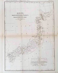
1878210211Philadelphia.: American Institute of Mining Engineers. Sherman & Co. printers. 1878. Large folding map of Japan showing "some of the more important Mining Districts Coal Fields etc." small fold split without loss tables 67pp. Covers a little scuffed and discoloured overall in very good condition. Scarce offprint separately paginated of a paper included in Volume V of the Transactions of the American Institute of Mining Engineers. The author Henry S. Munroe had been retained by the Japanese Government as Assistant Geologist and Mining Engineer with the Geological Survey of Yesso for the Hokkaidō Colonization Agency. His work laid the foundations for the future coal mining industry in Hokkaido. The report contains two lengthy tables relating to coal production and quality. . American Institute of Mining Engineers. Sherman & Co., printers. unknown
185275654Buffalo:: Jewett Thomas & Co. 1852. First edition. original gilt-lettered cloth. Tear to the folding map neatly repaired on verso with Japanese tissue; slight use and fading to the cloth; very attractive. 12mo. Illustrated with maps and numerous engravings from original sketches including a folding map of the "Northern Route U. S. Mail Line.Steamers.New York and Rochester.and Routes from Albany to Niagara Falls Buffalo and Montreal" with inset view of Niagara Falls. Jewett, Thomas & Co., hardcover
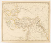
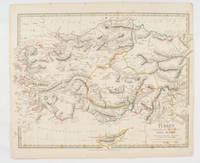
1840174957London.: Charles Knight & Co. circa1840s. Lithographed map with original outline hand-colour 31.9 x 39.1 cm small marginal tears neatly repaired with archival material but no loss small surface abrasion affecting the border at the foot edgewear and browning inked pagination in an early hand but in very good condition. A handsome map with fine topographical engraving also showing the borders with Hungary Russia and Persia. . Charles Knight & Co. unknown
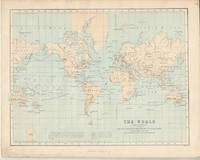
1874174897London.: Virtue & Co. circa1874. Printed colour map 18.4 x 24.1 cm edge wear marginal spotting and on the verso but the map in very good condition. Unusual map showing time differences east and west of Greenwich before the atomic clock and well before satellites! The explanatory text notes aso that: "The space comprehended between the meridiens of 120 & 160 E. is repeated in order to show the relative position of England to Australia both eastward and westward." . Virtue & Co. unknown
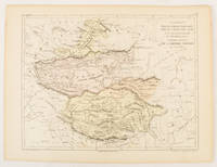
1856175109Paris.: Gustave Barba Editeur. 1856. Lithographed map with original hand colour central fold 24.2 x 31.5 cm marginal toning plate number in manuscript in very good condition. Finely engraved Dufour map of Central Asia prepared for his "Atlas Populaire" showing East Turkestan Petite Boukharie and Kalmykia Dzoungarie Mongolia and Tibet. . Gustave Barba Editeur. unknown
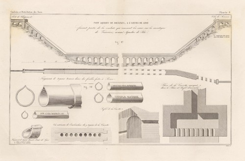
186510891Paris, Dunod, 1865 ; 2 tomes : texte in-4 et atlas in-folio ; demi-chagrin rouge à coins, dos à nerfs très décoré à froid et doré, titre doré, roulette décorative dorée sur les plats (reliure de l'époque) ; XV, (1 bl.), 496 pp. ; atlas de 47 planches doubles représentant plusieurs centaines de figures.
1830175250London.: Society for the Diffusion of Useful Knowledge. Baldwin & Cradock. 1830. Engraved map wth outline hand colour 29.7 x 42 cm relief shown in hachures key to abbreviations including "Ancient Ruins" the west and east extremities attactively engraved to burst through the border original folds map with occasional spotting more pronounced at the lower corner edges a little ragged small chip to the inner margin no loss to the map manuscript pagination in the lower corner but in good condition. . Society for the Diffusion of Useful Knowledge. Baldwin & Cradock. unknown
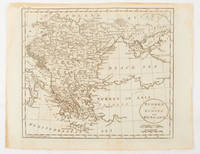
1816175252Philadelphia.: Carey Mathew and Warner Benjamin. 1816. Engraved map 19 x 22.3 cm original folds some offsetting to the map marginal browning and staining small archival repairs to the outer margin but in good condition. Fine map Plate 19 prepared for Carey and Benjamin's "General Atlas.". . (Carey, Mathew and Warner, Benjamin). unknown
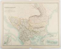
1893177055Edinburgh & London.: W. & A. K. Johnston. 1893. Engraved map with original outline hand-colour 44 x 57.4 cm map two inset maps of the Bosphorus and Crete; central fold corners chipped with loss lower edge with several small marginal tears neatly repaired head and foot clipped at the fold with loss to the margin but the map in very good condition. Detailed and finely engraved map also showing submarine telegraph lines and relief by hachures. Re-issue of the map first published in 1863 for "Keith Johnston's Royal Atlas of Modern Geography". . W. & A. K. Johnston unknown
187524088Chicago: Beach Barnard & . Legal and mmercial Printers 1875. 35 1 blank pp. Original printed wrappers light dust and wear disbound four punch holes in blank left margin. Last few pages include charts trimmed a bit closely a few digits lost at edge of each line of one chart. Good. offered with ----TO THE HONORABLE THE JUDGE OF SAID COURT IN CHANCERY SITTING: THE RECEIVER IN THE ABOVE ENTITLED CAUSE RESPECTFULLY REPORTS TO THE COURT THE RECEIPTS AND DISBURSEMENTS ON ACCOUNT OF THE PROPERTY IN HIS CHARGE FROM APRIL 30TH 1877 THE DATE OF HIS LAST REPORT TO AUGUST 31ST 1877. 16pp. Caption title as issued disbound punch holes in blank inner margin. Light edge chipping and dusting. Good. offered with -----IN THE UNITED STATES SUPREME COURT OCTOBER TERM A.D. 1881. THE CHICAGO DANVILLE & VINCENNES RAILROAD COMPANY AND JAMES W. ELWELL APPELLANTS V. WM. R. FOSDICK AND JAMES D. FISH TRUSTEES APPELLEES. APPEALS FROM THE CIRCUIT COURT OF THE UNITED STATES NORTHERN DISTRICT OF ILLINOIS. PETITIONS FOR RE-HEARING AND SUGGESTIONS IN SUPPORT THEREOF. LAWRENCE CAMPBELL & LAWRENCE COUNSEL FOR PETITIONERS. Beach Barnard & . Legal Printers. 1882. 73 1 blank pp. Original printed front wrapper lightly age toned small hole in blank margin old ink inscription at head disbound four punch holes in left margin. Light vertical crease else Very Good. offered with ----- APPEALS FROM THE CIRCUIT COURT OF THE UNITED STATES NORTHERN DISTRICT OF ILLINOIS. SUGGESTIONS TO SUPPORT PETITION FOR RE-HEARING. HENRY CRAWFORD SOLICITOR. Beach Barnard & . Legal Printers. 1882. 38pp. Original printed front wrapper bottom corner chipped ink inscription at head disbound four punch holes in left margin. Text lightly age toned small chip to bottom corner of last page. Very Good. The suit originated in March 1875 on the issue of the Road's nonpayment of bond interest. Fosdick and Fish sued the Chicago Danville & Vincennes Railroad. Beach, Barnard & ., Legal and mmercial Printers unknown books
1846WRCAM17477New Braunfels 1846. Printed indenture 10 1/2 x 8 1/2 inches executed in ink. Some old folds light soiling. "55" written in red pencil in top blank margin. Very good. Printed indenture executed in ink and signed in full by John O. Meusebach as Trustee of the German Emigration and Rail-Road Company drawing on the banking firm of H. Flersheim in Frankfurt for the sum of $3000 to be deposited to the account of the Company dated December 12. Meusebach a highly educated and civilized man came to Texas from Germany in 1845 to succeed Prince Carl of Solms-Braunfels as commissioner-general of the Verein zum Shutze Deutscher Einwanderer in Texas in the course of which he assumed Texas citizenship oversaw the affairs of the colonists and accomplished the 1847 treaty with the Comanche chiefs which made colonization possible. This document coming from the period of his service to the Verein no doubt represents a draft for funds to further the establishment of the colony the cities of New Braunfels and Fredericksburg and the attempted settlement of the financial horror show which Prince Carl left behind. A superb piece signed by one of the major figures of early Texas colonization. unknown books
183910927Le Mans, Imprimerie Monnoyer, 1839 ; in-8, broché ; 48 pp., couverture beige décorée d'ornements typographiques de style romantique.
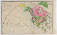
1877159812Kyoto.: 村上勘兵衛 文部省刊行. Murakami Kanbē; Monbushō kankō. Meiji 10 1877. Colour woodblock map of North and Central America. From the Journal of World Geography 萬國地誌略 published in 1877. Printed area measures 33.5 x 21cm a good copy with occasional soiling. . 村上勘兵衛, 文部省刊行. [Murakami Kanbē; Monbushō kanko& unknown
1819162103Tokyo.: Tōseisha. Showa 18 1943. Folding colour map of Australia 54.2 x 76.4cm. Some foxing particularly along folds and upper right margins a few repaired tears and small holes at folds.With original sleeve. The 15th map in the Standard Maps of Greater East Asia series of 20 maps. Shows the natural resources such as sheep gold pearl diary regions opals etc. Tasmania appears as an inset in the bottom right corner. Text in Japanese. . Tōseisha. unknown
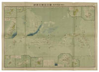
1819155215統正社 Tōseisha . Showa 18 1943. Colour folded map 54. x 76.5cm. Pinholes at corners light even browning good copy. This Japanese map of Micronesia shows the Mariana Islands Eastern and Western Caroline Islands Marshall Islands and Gilbert Islands. The separate maps around the edge are clockwise from the upper right corner: Jaluit Atoll Guam Island Rota Island Saipan Island Palau Islands Yap Island Hall Islands Pohnpei Island Truk Islands and Kusaie Island. . 統正社 [Tōseisha ]. unknown