SPEED, JohnBiblio.com
1 009 résultats
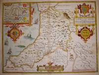
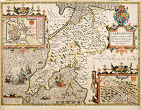
162764225London. c.1627. John Speed 1552-1629 is arguably the most famous name in early English cartography. In 1610 he published his wonderful and historic atlas 'The Theatre of Great Britain'. In 1627 he published another edition entitled 'A Prospect of The Most Famous Parts of The World' published in London by John Sudbury and George Humble. Speed based his maps on the earlier works done by Christopher Saxton and John Norden. His maps have always been keenly sought after as include many decorative features. Examples include: compass roses cherubs coats of arms mannerist style decoration prominent town plans stylish calligraphy and well defined regional physical features. John Speed's maps proved so popular that they were issued for many years after his death. This decorative and attractive example is of the Welsh county of Caernarvonshire. Size: 420 x 525 mm. Copperplate engraving with later hand colour. Fair to good condition. Repair to lower centrefold. Margins slim and 'chipped'. unknown
16239847London George Humble 1623. Copper engraving image 38 x 50.5 cm sheet size 41.5 x 53 cm fine original hand colour blank verso. An unusual example: the map was coloured trimmed to the edge of the printed image and mounted on thick paper in the 17th century perhaps as part of a special commission from a wealthy patron. Typically surviving Speed maps have been extracted from atlases and have descriptive text on the verso. However some examples were sold as loose sheets without any text on the back sometimes the text was supplied as side panels on either side of the map and occasionally these were bound into atlases when supplies of a particular map had run out and these broadsheets were the only copies to hand. It is also possible that an entire atlas was created in this fashion. John Speed 1552-1629 is unquestionably the most significant English map-maker of the seventeenth-century. A brief note from Granger's Bibliographical History of England 1779 contains most of the information we have about Speed's life: "John Speed who was bred a Tailor was by the generosity of Sir Fulk Grevil his patron set free from a manual employment and enabled to pursue his studies to which he was strongly inclined by the bent of his genius. The fruits of them were his Theatre of Great Britain containing an entire set of maps of the counties drawn by himself his History of Great Britain richly adorned with seals coins & medals from the Cotton collection; and his Genealogies of Scripture first bound up with the Bible in 1611 which was the first edition of the present English translation. His maps were very justly esteemed & his History of Great Britain was in its kind incomparably more complete than all the histories of his predecessors put together ." The first edition of Speed's "Theatre" was published in 1612. It was the first atlas of the British Isles and the first attempt made by an Englishman to match the achievements of the great continental publishing houses - although much of the engraving of the copper plates was performed in Amsterdam by Jodocus Hondius. Speed was an antiquary and intended that his atlas should be read in conjunction with his history of Britain. He managed to include a great deal of historical detail on his 'modern' county maps and the inset town plans some surveyed by himself together comprise the first collection of town plans of the British Isles all in all making the Theatre a highly decorative as well as a useful volume. It was a great success and there were editions printed throughout the seventeenth-century. Map unknown
192423501Reilly & Lee Chicago 1924. HARDBACK NODustJacket 1924 EARLY Edition VG/VG- NOJAckeT SOLD AS-IS Dark Olive Green & Black Decorated cloth Light SOIL Rub Wear & Tiny Chips Extremities InteRioR nice Tight Light FOXinG & Water Stain Last Page Near Hinge 208 pgs Cover spine sunned & small Tears Along Spine edge & extremities Small Round Stain Back Cover Small 8vo. This copy is solid but the extremities are worn and sunned it lacks the frontispiece plate and there is a gift inscription on the front endpaper. . OUT OF PRINT. Hard Cover. Reilly & Lee Chicago hardcover
164623413London: William Humble 1646. Other. In excellent condition. 386 by 513mm 15¼ by 20¼ inches. 386 by 513mm 15¼ by 20¼ inches. Copper engraving uncolored as published. William Humble unknown
75869<p>London John Sudbury & George Humble nd. Large Map. Approx 20 x 16 inches engraved area. Hand coloured. Mounted. Double-sided with list of hundreds and Description of the County on reverse. Framed. In very good condition. Lovely colouring. Centre crease. Double glazed Frame. Some masking tape reinforcement to bottom of map. Glass may need to be removed for transit/posting if sent abroad.</p> London, John Sudbury & George Humble nd
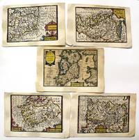
1632M11092London: Petrus Kaerius caelavit George Humble c.1632 . Very Good. Notes: A set of 5 miniature maps of Ireland and its counties.<br>Pieter van den Keere Latin: Petrus Kaerius 1571 – c. 1646 was a Flemish engraver publisher and globe maker who worked for the most part of his career in England and the Dutch Republic.<br><br>Miniature Speeds<br>A series of 44 plates for the British Isles from about 1599 took a long time to publish. They were based on Christopher Saxton Ortelius and Giovanni Battista Boazio respectively for England and Wales Scotland and Ireland. They appeared in 1617 in a Latin edition of the Britannia of William Camden by Willem Blaeu. Later these plates came to William Humble or George Humble according to Royal Geographical Society fellow Carl Moreland and David Bannister—map dealer—in "Antique Maps" who issued them with some modification and expansion in 1627 as a miniature version of the atlas of John Speed. Thereby van den Keere's works came by the name "Miniature Speeds".<br> Size : 85x123 mm 3.35x4.84 Inches Coloring: Original Hand Coloring Category: Maps Europe Ireland; Petrus Kaerius caelavit [George Humble] unknown
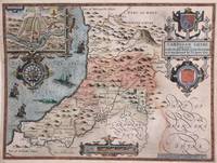
1616M8778London: John Sudbury & George Humble 1616. Good a few marginal tears restored margins reinforced with acid free tissue. . Notes: StolenBeautiful map of Cardigan Shyre in Wales drawn by John Speed and engraved by Jodocus Hondius showing its mountains major rivers forests and towns. Decorative inset shows plan of town of Cardigan. <br><br><br>John Speed 1552 –1629 was an English cartographer and historian. He is known as England's most famous Stuart period mapmaker. His maps of English counties are often found framed in homes throughout the United Kingdom.For a series of maps Speed partnered with Dutch engraver Jodocus Hondius. <br><br> Size : 383x510 mm 15.08x20.08 Inches Coloring: Original Hand Coloring Category: Maps Europe United Kingdom Wales; John Sudbury & George Humble unknown
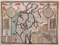
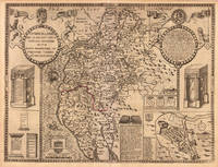
1616M8779London: John Sudbury & George Humble 1616. Good a few marginal tears upper left corner replaced not affecting the image. Reinforced with acid free tissue paper on the back of the margins. . Notes: StolenBeautiful map of Cumberland northern England showing mountains rivers and major towns with an inset of Carlisle armorials and a vignette of a battle scene.<br><br>John Speed 1552 –1629 was an English cartographer and historian. He is known as England's most famous Stuart period mapmaker. His maps of English counties are often found framed in homes throughout the United Kingdom.For a series of maps Speed partnered with Dutch engraver Jodocus Hondius. <br><br> Size : 384x507 mm 15.12x19.96 Inches Coloring: Original Hand Coloring Category: Maps Europe United Kingdom England; John Sudbury & George Humble unknown
88321Published Bassett & Chiswell. Ca 1676. Engraved map Uncoloured. With printed description of the County of Dorset on back. Ivory Mount Size 64cm x 52cm. Map size 52cm x 39cm In very good condition. Neat Centre fold. -- Map of Dorset from 1662 with town plan of Dorchester and coats of arms. From John Speed’s ‘Theatre of the Empire of Britain’ originally engraved by Jodocus Hondius with a brief description and history of Dorset with list of Divisions and Hundreds on the back. Published Bassett & Chiswell. Ca 1676 unknown
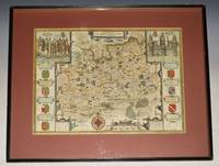
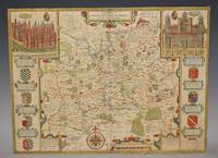
93175John Sudbury & George Humble 1627. Nice later hand-colouring. An attractive and decorative map with inset views of the palaces of Richmond and Nonsuch both royal Tudor residences which were demolished by the end of the seventeenth century. Nonsuch was given by Charles II to Barbara Countess of Castlemaine who then tore it apart to pay gambling debts; Richmond was sold by Parliament after the execution of Charles I. In very good condition. Some slight on centre fold. Map a little darkened. Wooden fame has a few little nicks. Large double sided map engraved surface 20.5 x 15.5 inches. Gold tinted black hardwood Frame with glass front with a light maroon mount. Frame Size 24.5 x 22.5 inches. The maps by John Speed are "the best known and most popular of all English county maps" Tooley. John Sudbury & George Humble 1627 unknown
1971mon0000459675Angus and Robertson 1971T. paperback. Good. in x in x in. Ex-library book usual marking. Clean copy in good condition. Angus and Robertson paperback
180949236London William Nicholson 1809. 8vo. Contemp. hcalf but spine lacks boards loose. In: "A Journal of Natural Philosophy Chemistry and the Arts. By William Nicholson." Vol. XXII. - VIII3848 pp. a. 10 engraved plates. Youngs paper: pp. 104-124. Small stamps to verso of titlepage. Internally fine and clean. <br/><br/><em>First appearance together with the paper in the "Transactions of the Royal Society at the same time of this famous paper containing Young's implicit discovery of the Joukowski equation for solids 100 years before it appeared under the name of Joukowski 1847-1921 the well-known pioneer in the theory of aerodynamics. </em> hardcover
164623396London: William Humble 1646. Other. In excellent condition. 384 by 508mm 15 by 20 inches. 384 by 508mm 15 by 20 inches. Copper engraving uncolored as published. William Humble unknown
164623408London: William Humble 1646. Other. In excellent condition. 381 by 505mm 15 by 20 inches. 381 by 505mm 15 by 20 inches. Copper engraving uncolored as published. William Humble unknown
16765494London Thomas Bassett &: Richard Chiswell 1676. Copper engraving 38.5 x 51.2 cms recent hand colour English text to verso. John Speed 1552-1629 is unquestionably the most significant English map-maker of the seventeenth-century. A brief note from Granger's Bibliographical History of England 1779 contains most of the information we have about Speed's life: "John Speed who was bred a Tailor was by the generosity of Sir Fulk Grevil his patron set free from a manual employment and enabled to pursue his studies to which he was strongly inclined by the bent of his genius. The fruits of them were his Theatre of Great Britain containing an entire set of maps of the counties drawn by himself his History of Great Britain richly adorned with seals coins & medals from the Cotton collection; and his Genealogies of Scripture first bound up with the Bible in 1611 which was the first edition of the present English translation. His maps were very justly esteemed & his History of Great Britain was in its kind incomparably more complete than all the histories of his predecessors put together ." The first edition of Speed's "Theatre" was published in 1612. It was the first atlas of the British Isles and the first attempt made by an Englishman to match the achievements of the great continental publishing houses - although much of the engraving of the copper plates was performed in Amsterdam by Jodocus Hondius. Speed was an antiquary and intended that his atlas should be read in conjunction with his history of Britain. He managed to include a great deal of historical detail on his 'modern' county maps and the inset town plans some surveyed by himself together comprise the first collection of town plans of the British Isles all in all making the Theatre a highly decorative as well as a useful volume. It was a great success and there were editions printed throughout the seventeenth-century. Map Richard Chiswell unknown
87950Bassett & Chiswell 1676. Lg. map engr.surface ca 51 cm x 37 cm. English text on verso. A nice example of this decorative County map by John Speed. Includes inset of Breknoke with the coat of arms for James Butler Earle of Breknoke and three other coasts of arms plus and early battle scene. FRAMED in double Glazed Hogarth Frame. Strong impression with the detail in the engraving clear and black. Overall in very good condition. Imprint on left- hand corner giving publishers: “Performed by John Speede. And are to be solde by Thomas Bassett in Fleetstreet and Richard Chiswell in St Pauls Churchyard”. The maps by J.Speed are "the best known and most popular of all English county maps" Tooley. Despite competition from maps of the English counties by Blaeu and Jansson Speed’ maps were “bestsellers”. A beautifully coloured map of the historic county of Brecknockshire with an inset map of the city of Brecon. Bassett & Chiswell, 1676 unknown
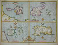
161011341London: John Sudbury and George Humble 1610. No binding. Good. THE FIRST REASONABLY ACCURATE MAP OF JERSEY. 385 x 510 mm. with recent outline and wash colour in good condition. The first published state of a quartered map by John Speed displaying the tidal Holy Island Lindisfarne reachable on foot at low tide and the Farne Islands both off the coast of Northumberland. On the right side are the two main Channel Islands of Guernsey and Jersey. This is the first reasonably accurate map of Jersey to be printed. The parish boundaries are marked along with the various waterways each indicating housing along their courses. In addition three windmills are displayed. Guernsey displays no real improvement over that of Gerard Mercator published in 1595 but it does now display its proximity to Jersey. Sark now displays buildings and one windmill which had only recently been built by Hellier de Carteret in 1571. He was the first Seigneur of the island. It was famously decapitated by the Nazis in the Second World War. John Speed 1552-1629 is the best known and among collectors the most popular British cartographer. He was like his father a tailor by trade with a passion for history. On joining the Society of Antiquaries he took his first steps towards the compilation of the atlas that has placed him among the cartographic immortals.In 1611 he produced the 'History of Great Britain' and his atlas the 'Theatre of the Empire of Great Britain' was published to accompany it. The 'Theatre .' was the first atlas of the British Isles ever produced containing sixty-seven maps which in addition to the counties of England and Wales also included general maps of the Heptarchy England in Anglo-Saxon times Great Britain and Ireland England Wales Scotland and the Provinces of Ireland together with maps of the Isles of Wight and Man and the Channel Islands. Preparation for the atlas took several years and the maps are all engraved by Jodocus Hondius in Amsterdam. This example was printed in 1627 the last edition to be published before the death of Speed. Provenance: private Jersey collection. Shirley T.SPE-1e; Skelton 1966; Skelton 1970 7 & 16. John Sudbury and George Humble unknown
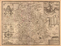
1610022406London: John Spede Speed John Sudbury Georg George Humble 1610. First Edition . Single Folded Sheet. Near Fine/No Jacket. Image 20 1/2' x 15". 1610 date in both the title block and the printing information block. Original two page map from Speed's atlas in a very strong impression. Very attractive later color coastal water outlines blue with brown along land coastlines inset maps of Bangor and Caernarvon in light blue and orange borders in red shields in red all details nicely colored. Near fine print and coloring strong no tears or repairs very slight dust/soiling in small area in margins adjacent to center fold. Nicely framed with double glaze displaying the atlas pages 123 and 124 on the reverse. <br/> <br/> John Spede (Speed), John Sudbury, Georg (George) Humble unknown
164623417London: William Humble 1646. Other. In excellent condition. 382 by 506mm 15 by 20 inches. 382 by 506mm 15 by 20 inches. Copper engraving uncolored as published. William Humble unknown
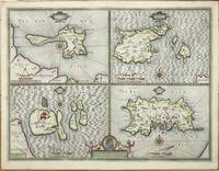
16765122London: Basset & Chiswell 1676. Copper engraving 38.5 x 51 cms modern hand-colour four maps on one sheet English text to verso. Islands around the British coast were often grouped in various cominations by early mapmakers. John Speed 1552-1629 is unquestionably the most significant English map-maker of the seventeenth-century. A brief note from Grangers Bibliographical History of England 1779 contains most of the information we have about Speeds life: John Speed who was bred a Tailor was by the generosity of Sir Fulk Grevil his patron set free from a manual employment and enabled to pursue his studies to which he was strongly inclined by the bent of his genius. The fruits of them were his Theatre of Great Britain containing an entire set of maps of the counties drawn by himself his History of Great Britain richly adorned with seals coins & medals from the Cotton collection; and his Genealogies of Scripture first bound up with the Bible in 1611 which was the first edition of the present English translation. His maps were very justly esteemed & his History of Great Britain was in its kind incomparably more complete than all the histories of his predecessors put together The first edition of Speeds Theatre was published in 1612. It was the first atlas of the British Isles and the first attempt made by an Englishman to match the achievements of the great continental publishing houses although much of the engraving of the copper plates was performed in Amsterdam by Jodocus Hondius. Speed was an antiquary and intended that his atlas should be read in conjunction with his history of Britain. He managed to include a great deal of historical detail on his modern county maps and the inset town plans some surveyed by himself together comprise the first collection of town plans of the British Isles all in all making the Theatre a highly decorative as well as a useful volume. It was a great success and there were editions printed throughout the seventeenth-century. Map Basset & Chiswell unknown
16765645London: Basset & Chiswell 1676. Copper engraving 39 x 51.5 cms recent hand-colour inset of Cardigan very minor staining on the right-hand side of the map English text on verso. John Speed 1552-1629 is unquestionably the most significant English map-maker of the seventeenth-century. A brief note from Granger's Bibliographical History of England 1779 contains most of the information we have about Speed's life: "John Speed who was bred a Tailor was by the generosity of Sir Fulk Grevil his patron set free from a manual employment and enabled to pursue his studies to which he was strongly inclined by the bent of his genius. The fruits of them were his Theatre of Great Britain containing an entire set of maps of the counties drawn by himself his History of Great Britain richly adorned with seals coins & medals from the Cotton collection; and his Genealogies of Scripture first bound up with the Bible in 1611 which was the first edition of the present English translation. His maps were very justly esteemed & his History of Great Britain was in its kind incomparably more complete than all the histories of his predecessors put together ." The first edition of Speed's "Theatre" was published in 1612. It was the first atlas of the British Isles and the first attempt made by an Englishman to match the achievements of the great continental publishing houses - although much of the engraving of the copper plates was performed in Amsterdam by Jodocus Hondius. Speed was an antiquary and intended that his atlas should be read in conjunction with his history of Britain. He managed to include a great deal of historical detail on his 'modern' county maps and the inset town plans some surveyed by himself together comprise the first collection of town plans of the British Isles all in all making the Theatre a highly decorative as well as a useful volume. It was a great success and there were editions printed throughout the seventeenth-century. Map Basset & Chiswell unknown
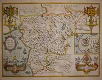
16765646London: Basset & Chiswell 1676. Copper engraving 39 x 51.5 cms recent hand-colour inset town-plan of Harlech light waterstaining to the upper part of the map English text on verso. John Speed 1552-1629 is unquestionably the most significant English map-maker of the seventeenth-century. A brief note from Granger's Bibliographical History of England 1779 contains most of the information we have about Speed's life: "John Speed who was bred a Tailor was by the generosity of Sir Fulk Grevil his patron set free from a manual employment and enabled to pursue his studies to which he was strongly inclined by the bent of his genius. The fruits of them were his Theatre of Great Britain containing an entire set of maps of the counties drawn by himself his History of Great Britain richly adorned with seals coins & medals from the Cotton collection; and his Genealogies of Scripture first bound up with the Bible in 1611 which was the first edition of the present English translation. His maps were very justly esteemed & his History of Great Britain was in its kind incomparably more complete than all the histories of his predecessors put together ." The first edition of Speed's "Theatre" was published in 1612. It was the first atlas of the British Isles and the first attempt made by an Englishman to match the achievements of the great continental publishing houses - although much of the engraving of the copper plates was performed in Amsterdam by Jodocus Hondius. Speed was an antiquary and intended that his atlas should be read in conjunction with his history of Britain. He managed to include a great deal of historical detail on his 'modern' county maps and the inset town plans some surveyed by himself together comprise the first collection of town plans of the British Isles all in all making the Theatre a highly decorative as well as a useful volume. It was a great success and there were editions printed throughout the seventeenth-century. Map Basset & Chiswell unknown
164623400London: William Humble 1646. Other. In excellent condition. 386 by 512mm 15¼ by 20¼ inches. 386 by 512mm 15¼ by 20¼ inches. Copper engraving uncolored as published. William Humble unknown
191219949Chicago: The Reilly and Britton Co. Near Fine with no dust jacket. 1912. First Edition; First Printing. Hardcover. Just perhaps the faintest hint of fading to the spine and 3 small light spots at the bottom of the front cover. Owner's name in pencil on the fep. Not chipped bumped or rubbed. It doesn't get much better. ; Small 8vo 7½" - 8" tall; 313ads pages . The Reilly and Britton Co. hardcover
87965Published by Bassett and Chiswell -The Theatre of the Empire of Great Britaine described by John Norden. 1676. Engraved map with later hand colouring. Map size 52cm x 39cm. In good condition. Some slight darkening around edges and centre fold. Professional repair ends of folds. Map has been laid down onto hard Card. Unframed. With heraldic shields and insets of Richmond and Nonsuch Palace. Published by Bassett and Chiswell -The Theatre of the Empire of Great Britaine, described by John Norden. 1676 unknown