Speed, JohnBiblio.com
1 009 résultats
164623399London: William Humble 1646. Other. In excellent condition. 393 by 520mm 15½ by 20½ inches. 393 by 520mm 15½ by 20½ inches. Copper engraving uncolored as published. William Humble unknown
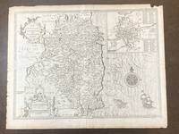
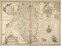
1676100280To be sold by Robert Chiswell in St. Paul's Churchyard and Thomas Basset in Fleetstreet 1676. Map. Very Good. Uncolored map of County Leinster 15 in. x 20.25 in. sheet is 17 in. x 22 in. with inset map 6 in. x 7 in. of Dublin with a 69-point key. The map is backed by pages 141/142 of an atlas presentation. Title and legend are decorated with two ornate cartouches a decorative compass rose and a full-masted sailing ship and sea-monster that cruise the Irish Sea. <br /> <br /> Map is dated 1610. The English text on the verso and the 3-line imprint Chiswell and Bassett below the distance scale indicate it is from the 1676 publication of Speed's "Theatre of the Empire of Great Britaine." On the map's backside page 141 describes the geography people and history of the County. Page 142 provides an alphabetized list all the towns and villages included on the map. <br /> <br /> Light tanning; rubbing and short closed tears along right and edges. Faint vertical fold line at center and faint horizontal fold line eight inches above bottom. One inch chip in margin at upper right corner. John Speed 1552-1629 began his career as a tailor with deep interests in history theology and cartography. The patronage of Sir Fulke Greville Lord Brooke 1554-1628 allowed him to give up his trade and dedicate himself to these interests. In terms of cartography he is especially known for an ambitious project to publish a series of maps of English counties called Theatre of the Empire of Great Britaine first published in 1611. Designed along the lines of Ortelius' Theatrum orbis terrarum Speed's Theatre was groundbreaking: it provided some of the first detailed maps of the Irish provinces as well as town plans for seventy-three English towns. Univ of Missouri Special Collections. To be sold by Robert Chiswell in St. Paul's Churchyard and Thomas Basset in Fleetstreet unknown
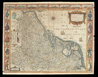
167621920<p>London: Are to be sold by Thomas Bassett in Fleet Street and Richard Chiswell in St. Pauls Churchyard 1676. 420 by 540mm. 16.5 by 21.25 inches. Speed's map of 'Low Germanie' Double-page engraved map with hand-colour. A map of 'Low Germanie' the modern-day Netherlands from the 1676 edition of the first atlas compiled and published by an Englishman Speed's 'Prospect'. A decorative border along the top of the map depicts views of major cities among them Amsterdam and Utrecht. Along each side of the map are illustrated figures in regional costume. Accompanying text in English 'The Description of Belgia' is printed on the reverse. John Speed 1552-1629 was the outstanding cartographer of his age. By trade a merchant tailor but by proclivity a historian it was the patronage of Sir Fulke Greville poet and statesman that allowed him to pursue this interest in earnest. His 'Theatre of Great Britain' first published in 1611 or 1612 was the first large-scale printed atlas of the British Isles. The 'Prospect of the Most Famous Parts of the World' from which the present work is drawn appeared in 1627 bound with the 'Theatre' and is the first world atlas compiled by an Englishman to be published in England. Engraved in Amsterdam many of the maps are anglicized versions of works by Dutch makers in distinctive carte-à-figure style featuring borders with figures in local costume and city views. This map is from the 1676 edition of the 'Prospect' published by Thomas Bassett and Richard Chiswell. While not as rare as the earlier publications this edition is perhaps the most important given that it is the first to include the nine new maps: among them Virginia and Maryland Barbados and Russia. It is also the last time that the 'Prospect' was printed as an atlas. Shirley Atlases T.SPE-2f.</p> Are to be sold by Thomas Bassett in Fleet Street and Richard Chiswell in St. Pauls Churchyard,
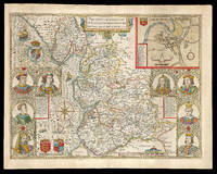
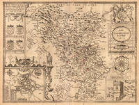
167621977<p>London: And are to be solde by Thomas Bassett in Fleet Street and Ric: Chiswell in St. Pauls Churchyard 1676. 390 by 510mm. 15.25 by 20 inches. Speed's map of Lancashire Double-page engraved map with hand-colour minor wear to edges. A map of Lancashire from the 1676 edition of the first large-scale atlas of the British Isles Speed's 'Theatre'. In the top right-hand corner is an inset town-plan of Lancaster probably the first printed plan of Lancaster. On the left-hand side are portraits of monarchs from the house of Lancaster including Henry IV and on the right of monarchs from the house of York including Richard III. On the verso of the map is printed 'Hundreds in Cheshire' and a description of 'The County Palatine of Chester'. John Speed 1552-1629 was the outstanding cartographer of his age. By trade a merchant tailor but by proclivity a historian it was the patronage of Sir Fulke Greville poet and statesman that allowed him to pursue this interest in earnest. His 'Theatre of Great Britain' from which the present work is drawn was first published in 1611 or 1612 and is 'the earliest English attempt at atlas-production on a grand scale' Skelton. Drawing heavily on the work of Saxton and Norden little of Speed's cartography is original he acknowledges 'I have put my sickle into other mens corne' instead it is his blend of cartography and history incorporating town-plans vignettes and genealogy that makes Speed an innovator. This map is from the 1676 edition of the 'Theatre' published by Thomas Bassett and Richard Chiswell. Chubb CIV; Shirley Atlases T.Spe-1j; Skelton 92; Whitaker 123.</p> And are to be solde by Thomas Bassett in Fleet Street, and Ric: Chiswell in St. Pauls Churchyard,
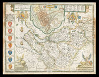
167621981<p>London: And are to be sold by Thomas Bassett in Fleet Street and Richard Chiswell in St. Pauls Churchyard 1676. 385 by 510mm. 15.25 by 20 inches. Speed's Map of Cheshire Double-page engraved map with hand-colour some discolouration to margins and to left and right of image. A map of Cheshire from the 1676 edition of the first large-scale atlas of the British Isles Speed's 'Theatre'. In the top-centre of the map is an inset town-plan of Chester with four coin medallions possibly showing: Julius Caesar the emperor Vespasian the emperor Domitian and the 20th Legion which was among those to invade Britain with Claudius in 43CE. Along the left-hand side of the map are depicted the arms of the Earls of Chester since the Norman Conquest among them 'Ranulph Blundeuill' and 'Ranulph Gernones'. John Speed 1552-1629 was the outstanding cartographer of his age. By trade a merchant tailor but by proclivity a historian it was the patronage of Sir Fulke Greville poet and statesman that allowed him to pursue this interest in earnest. His 'Theatre of Great Britain' from which the present work is drawn was first published in 1611 or 1612 and is 'the earliest English attempt at atlas-production on a grand scale' Skelton. Drawing heavily on the work of Saxton and Norden little of Speed's cartography is original he acknowledges 'I have put my sickle into other mens corne' instead it is his blend of cartography and history incorporating town-plans vignettes and genealogy that makes Speed an innovator. This map is from the 1676 edition of the 'Theatre' published by Thomas Bassett and Richard Chiswell. Interestingly this map lacks the text in English that is usually printed on the verso. Chubb CIV; Shirley Atlases T.Spe-1j; Skelton 92.</p> And are to be sold by Thomas Bassett in Fleet Street, and Richard Chiswell in St. Pauls Churchyard,
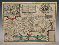
86954<p>Described by Iohn Norden. Augmented by I. Speede And are to be solde by G. Humble. Cum Privilegio 1627. Nice later hand-colouring. An attractive and decorative map with inset town plan of Chichester crests and elaborate coat of arms vignettes of galleons and sea-monsters there is a Civil War battle probably a skirmish at Haywards Heath and a representation of William the Conqueror's fleet arriving at Pevensey. In very good condition. Some slight darkening around edges and centre fold. Professional repair lower margin. Unframed. Large double sided map engraved surface 20.5 x 16 inches. The maps by John Speed are "the best known and most popular of all English county maps" Tooley. This is a very famous map engraved by Jodocus Hondius in 1610 and first published the following year in Speed's atlas 'The Theatre of the Empire of Great Britain'.</p> Described by Iohn Norden. Augmented by I. Speede, And are to be solde by G. Humble. Cum Privilegio 1627
164623409London: William Humble 1646. Other. In excellent condition. 383 by 507mm 15 by 20 inches. Copper engraving uncolored as published. William Humble unknown
164623430London: William Humble 1646. Other. In excellent condition. 384 by 512mm 15 by 20¼ inches. 384 by 512mm 15 by 20¼ inches. Copper engraving hand colored in outline and wash. William Humble unknown
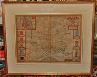
78599London Fleet Street Thomas Bassett 1676. Framed size approx 28 x 23 inches. Engraved surfaces approx 20 x 15 ins. Double-glazed in gold wood frame with ivory mount behind glass. Front and Back. In very good condition. Some darkening/tanning to paper vertical centre crease. Some slight fading to print in some areas. Lovely bright crisp colouring. Very small tear to top l/h corner. Centre fold and edges darkened on rear side. Else a beautiful clean example. Original engraved map with hand colouring. Coloured letterpiece on rear side. London, Fleet Street, Thomas Bassett, 1676 unknown
1650LL4281George Humble 1650. PAGINATION: 12 155-402 395-799 1pp. 800-828ff. 829-921 49pp. ~Original dark brown calf boards faint remains of double gilt fillets and blind roll framing boards. Rebacked in near-matching calf with raised bands and gilt numerals to spine and early brown gilt spine label laid down. Minor loss to base spine with loss of replacement bottom headband. Cracking starting to top spine over rear hinge c. 7cm but hinges still holding firm. Wear to top and bottom board edges with discreet fairly early repairs to board corners. Top edges darkened other edges speckled red. Single splash mark to fore-edges. Large folio 35.5 x 29.5cm. Replacement laid paper endpapers with cracking just starting at gutters. Two older armorial bookplates laid down to inside front board: one of Julius Bertram of Sishes End Hertfordshire either Julius Bertram 1866-1944 Liberal politician or his father of the same name and one older bookplate with minor loss with boar passant. Owner's signature of Elizabeth Pryor in old hand to replacement blank front endpage. Trimmed remains of lettering in old hand to top dedication page. Title page from the 1627 edition ESTC S124203 bound in with imprint 'Imprinted at London: Anno Cum Privilegio 1627. Are to be sold by George Humble at the Whit horse in Popes-head Alley'. However this is the 1650 third edition ESTC S121978 not the 1627 second edition. T.p. substitution is indicated by the fact that pattern of minor worm damage to t.p. does not match that to frontis and dedication page. This and the slightly smaller size of the t.p. in comparison to other sheets as well as sigs pagination 49 rather than 47 unnumbered pp. to rear and presence of the 1629 frontis. port. engraving by Samuel Savery indicate that this is the 1650 Humble edn with the 1627 t.p. bound in other possible edns do not have matching pagination or signatures. We have included a printout of the 1650 t.p. from an online edition showing near-identical t.p. engraved by the notable Dutch cartographer and engraver Jodocus Hondius after a design by Speed. Some black smut marks to pp. 860-61 and 900-01 none more than c. 8cm obscuring text slightly. Slight dampstaining to bottom outer corner final 10ff. Very minor worm damage extending from rear of vol. to p. 725 two holes to margin with one pinprick hole only affecting text. Minor worm damage extending down from single hole in top edges mildly affecting pp. from title page to p.384. At no point does this amount to more than c. 4 pin-holes slightly affecting text near top page. Illustrated throughout with in-text illustrations decorated initials headpieces and tailpieces all the work of the engraver Christopher Switzer. John Speed 1551/2-1629 historian and cartographer. Speed produced his History of Great Britain as a continuation of its companion atlas volume The Theatre of the Empire of Great Britaine pagination continuous from companion vol. but this vol. is complete in itself. Both were the result of 'industrious research and reading' ODNB with the encouragement and assistance of the foremost antiquarians of the time including William Camden and Sir Robert Cotton. This product of early Stuart optimism and nation-building first published in 1611 and creating 'Great Britaine' for the 'most potent monarch Iames' the first king of both Scotland and England is in this 1650 edition republished just before the end of the civil war that was to see the Stuart monarchy expelled from Britain for a decade. Handsome edn in original boards. ~Robust packaging. Overseas orders trackable on request. Used books are exempt from USA tariffs. 3rd edn. Hardback. Hardback. Good. c. 1000pp. George Humble Hardcover
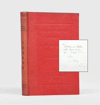
1933175841Beijing: Kwang Yuen Press 1933. First edition first printing presentation copy inscribed by the author on the front free endpaper "To Cobbles and Dulcie with best wishes for a Happy Xmas from Charles. 1933 Peking" opposite a gelatin silver photograph of the author. The recipients were Charles and Dulcie Hope Danby 1879-1958; 1889-1981. Hope Danby was a prolific writer on Chinese history and archaeology. She was a friend of the controversial scholar-collector Edmund Backhouse and wrote his entry for the Dictionary of National Biography. Her husband worked as an insurance agent. Based like the Danbys in Beijing the author 1884-1972 was the city's most senior customs service official. He entered the service in 1903 at the junior level of Fourth Assistant. On his retirement in 1935 he had served for 13 years at the senior grades of deputy commissioner and then acting commissioner. In 1969 he published his autobiographical Chinese Tribute which recounts his colourful experiences of working for the service. Alongside his professional work Williams had a scholarly interest in Chinese history and culture. He is most well-known for Outlines of Chinese Symbolism and Art Motives: An Alphabetical Compendium of Antique Legends and Beliefs as Reflected in the Manners and Customs of the Chinese 1931. This manual describes the country's animal agricultural textile and mineral exports and is also intended to assist scholarly research of flora and fauna. Octavo. Half-tone frontispiece showing Shanghai customs house. Original red cloth spine lettered in gilt in English and Chinese front cover panelled and lettered in English and Chinese in blind. Spine sunned staining on rear board a few leaves dog-eared: a very good copy. hardcover
1998032509Collector Grade Publications 1998. Hardcover. Fine. Fine clean hard cover first edition with fine dust jacket. Size: 8vo - over 7¾" - 9¾" Tall; Oblong Collector Grade Publications hardcover
192123510Reilly & Lee Chicago 1921. HARDBACK NODustJacket F-/VG NOJACKET SOLD AS-IS 1921 1st Edition Original Publishers Blue Lined Cloth lettered In Black Front & Back Nice condition with Spotting & FoXing on Spine Cover altho Title is Bright Interior Nice Tight Clean light FoX Wear 223 pgs .B/W Glossy Frontispiece of Josie & Mary Louise by Harry W. Armstrong . First Edition. Hard Cover. Reilly & Lee Chicago hardcover
1680mon0000023721London: for R. Scot T. Baffet 1680. LATER EDITION. Small 4to. 54pp.i disbound recto of title-page repaired illustrated with two engravings one of which is a title-page vignette foredge of title-page chipped not affecting image or text. The poem celebrates a brawl in the Wood Street Compter or debtors' prison. The title-page vignette a copperplate illustrates a brawl; the other plate a full-page woodcut shows a scene at the gate of the prison. The date of the first edition of this work is uncertain but circa 1628 is guessed.rnWing S4896; Lowndes 2164; Grolier Whither to Prior 771. London: for R. Scot, T. Baffet, unknown
163253668London: Printed by John Dawson for George Humble 1632. Third Edition revised and enlarged. Hardcover. Good-. Folio. 22 1042pp. 1043-1086 leaves 1087-1237 85pp. Contemporary calf backed in brown buckram manuscript lettering in white at spine. Frontispiece portrait engraving of John Speed by S. Savery mounted. Title page with publisher's device and double frame. Decorative and historiated head- and endpieces and initials. Revised enlarged and newly corrected with sundry descents of the Saxon Kings their marriages and arms. All pages framed in black with marginalia. A catalog of the religious houses colleges etc. in England Wales Scotland and Ireland. Illustrated with numerous woodcuts and genealogical tables throughout including coins coats of arms crests royal seals etc.<br /> <br /> Covers scuffed and worn at edges. Inked name on inside front cover; hinges reinforced with cream cloth tape. Frontispiece mounted and reinfored on verso at edges slightly ragged at gutter not affecting portrait or text. Few repairs with small pieces of tape in margins not affecting text. Last leaf of index reinforced with paper strip along fore-edge on front lettering slightly obscured on verso. Block lightly age-toned. Binding in overall fair interior in good engraving and woodcuts in very good condition.<br /> <br /> Third edition a variant of the 1631 edition published as a continuation of the author's Theatre of Great Britaine both works being listed in the table of contents. The foliated section ff. 1043-1086 contain A Catalogue of the Religious Houses Colleges and Hospitals Sometimes in England and Wales running title. ESTC S997. Printed by John Dawson for George Humble hardcover
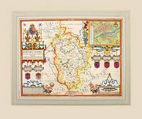
162757319Theatre of the Empire of Great Britain published by Bassett and Chiswell. c.1627. Speed's map of Bedfordshire embelished with four strapwork cartouches surrounding the town plan of Bedford the coats of arms of the Earls and Dukes of Bedford the title commentary and the scale. First published in 1611 today the work of John Speed is regarded highly by map collectors historians and artists due to the intricate nature and artistic beauty of the maps. Copper engraving. Fine condition. Mounted size: 71.5 x 60 cm Hand coloured. Size: 50 x 38.5 cm. 19½ x 15 inches unknown
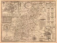
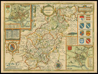
162711770London: Performed by Iohn Speede and are to be sold by George Humble in ye Popes head alley 1627. 380 by 510mm. 15 by 20 inches. Engraved map with hand colouring. A beautifully coloured map of Northamptonshire with inset maps of Northampton and Peterborough and a vignette with text of the Battle of Edgecote Moor where Richard Neville Duke of Warwick defeated Edward IV during the Wars of the Roses. John Speed 1552-1629 was the outstanding cartographer of his age. His 'Theatre of Great Britain' was the first atlas of the British Isles: Speed prepared the maps himself about two years before they were published. His maps and books dominated the seventeenth-century English market. The present map is taken from the 1627 English edition published by George Humble. Chubb XXV. Performed by Iohn Speede and are to be sold by George Humble in ye Popes head alley, unknown
1997032510Collector Grade Publications 1997. Hardcover. Fine. Fine clean hard cover first edition with near fine dust jacket. Size: 8vo - over 7¾" - 9¾" Tall; Oblong Collector Grade Publications hardcover
191824648Reilly and Lee Company CHICAGO 1918. HBDJ 1918. Early Edition Hardcover. Book Condition: Very Good -. Dust Jacket Condition: FAIR AS-IS FADED. Light sunning to extremities cloth at head and tail of spine dust soil to block edges DJ with Campfire Girls series advertisement on rear panel FOX SOIL end with camp fire girls in Old Kentucky shows some wear with chipping at head and tail of spine and cornertips 3 1/2" closed tear at hinge of front flap some dust soil and sunning 255 pgsNO ADS in Back. Small 8vo with the DJ listing 5 titles on the rear flap ends with Mary Louise Adopts a Soldier. Full bound blue Decorated cloth with navy titles on front board and spine Cvr Light Wear. Some sunning to cloth at head and tail of spine light dust soil to block edges booksellers' stickers on front and rear pastedowns. DJ Shows significant wear with Tiny & Small Chips Extremities Edges Yet Titles in Blue & Faded Orange & Illustration INTACTInner flap DJ tiny chipping along all edges 1/2" chipped from head and tail of Darkened Spine DJ affects Titles & Publ sOmewhat some sunning and dust soil. Back DJ Soil Fox & Edge Chipping Yet Titles INTACT End with Camp Fire Girls at Hurricane Island Interior tight crisp and relatively clean FOX & WEAR. B/W Frontispiece by Alice Carsey of 5 Girls with FlagLike Dresses on Carry Banner Says Liberty Girls of Dorfield on Streets . Front Inner Flap DJ Taped Detached Priceclipped Blank Endpaper Small Stickers rub wear .This book was written to show what important tasks girls can/may accomplish when spurred on by patriotism. Mary wanted to do her Bit. so she organized Liberty Girls Formed Liberty Shop which in their capable Hands became one busiest spots in Dorfield. Sent thousands of useful presents to gallant soldiers of Uncle Sam. Mary busy Stomping out German Propaganda in city. etc. Hard Cover. Reilly and Lee Company CHICAGO hardcover
49671London: Tho. Bassett and Richard Chiswell. 1676. Original engraved map 38 x 51 cm. Uncoloured. Inset of Dubline. Good impression very light tanning to centre-fold minor crease at margin of lower right corner. London: Tho. Bassett and Richard Chiswell. [1676] unknown
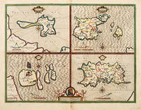
164663961London. c.1646. An excellent map by John Speed of the English Islands of: Farne and Holy Island off the Northumbrian coast; and the Channel Islands of Jersey and Guernsey. Each quatered map has a compass rose dividers and a mileage scale. Size: 430 x 550 mm. Copperplate engraving. Hand coloured. Good condition. Some minor staining to the centrefold and surrounding area. unknown
1610247261Sudbury & Humble 1610. Map. Engraving with hand coloring. Image measures 15 x 20".<br/> <br/> This wonderfully decorated map depicts the island of Anglesey off the northwest coast of Wales. The island is centered on the map and labeled with towns rovers as well pictorial mountains and trees. A strapwork title cartouche features the coat of arms of England flanked by a lion and a unicorn. Below two elegant ships sail the beautifully patterned ocean surrounding an elaborate and colorful compass rose. In the lower left corner of the map showing part of Wales is an ornamental scale topped with strapwork cherubs a peacock and the country's coat of arms. A similar border frames the inset of Beaumaris in the upper right of the map which shows a plan of the port city labeled according to a key including its famous castle. The map appeared in Speed's atlas "The Theatre of the Empire of Great Britaine." It is in good condition with but margins are cropped. Expert repair to right corners. <br> <br> John Speed 1552-1629 is widely considered to be the most famous English cartographer of the 17th century. His atlas "The Theatre of the Empire of Great Britaine" contained the first set of individual county maps of England and Wales as well as significant town plans that are in many cases the first visual records of their subjects. This map of Anglesey is a beautiful example of his work.<br/> <br/> Sudbury & Humble unknown
164623403London: William Humble 1646. Other. In excellent condition. 384 by 514mm 15 by 20¼ inches. 384 by 514mm 15 by 20¼ inches. Copper engraving uncolored as published. William Humble unknown
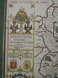
16767838Published by Thomas Bassett and Richard Chiswell Theatre of the Empire of Great Britain atlas 1676. no binding. copper engraved and hand coloured map from 'The Theatre of the Empire of Great Britaine' 386 x 516 mmelaborate cartouche with compass rose below inset bird's eye plan of Shrewsbury smaller inset with description of 'a great and bloody battaill was fought . Anno 1403 Battle of Shrewsbury .' with a small pictorial rendering of same; showing forests hills rivers including River Severne churches parkland; includes Part of Denbigh Shire Montgomery Shire Staffordshire etc; verso shows Hundreds in Shropshire and The Description of Shropshire Chapter XXXVII tight margins an attractive antique map suitable for mounting/framing. This is an original antique map. We do not sell reproductions or facsimiles Published by Thomas Bassett and Richard Chiswell, Theatre of the Empire of Great Britain atlas unknown
167633174Bassett and Chiswell 1676. This map is from John Speed's The Theater of the Empire of Great Britaine with the english text on the back. Presenting well uniform toning later hand-coloring. Border strengthened at the back with acid free tape. 545 by 435mm 21½ by 17¼ inches. Bassett and Chiswell unknown