Speed, JohnBiblio.com
1 203 résultats
162623758London: G. Humble 1626. Other. In excellent condition. 382 by 508mm 15 by 20 inches. 382 by 508mm 15 by 20 inches. Copper engraving hand colored in outline and wash. Original antique copper engraving hand colored in outline and wash. John Speed 1551 or 1552 28 July 1629 was an English cartographer and historian. He is alongside Christopher Saxton one of the best known English mapmakers of the early modern period.Speed was born in the Cheshire village of Farndon and went into his father Samuel Speed's tailoring later in life.While working in London Speed was a tailor and member of a corresponding guild and came to the attention of "learned" individuals. These individuals included Sir Fulke Greville who subsequently made him an allowance to enable him to devote his whole attention to research. By 1598 he had enough patronage to leave his manual labour job and "engage in full-time scholarship". As a reward for his earlier efforts Queen Elizabeth granted Speed the use of a room in the Custom House. Speed was by this point as "tailor turned scholar" who had a highly developed "pictorial sense".In 1575 Speed married a woman named Susanna Draper in London later having children with her. These children definitely included a son named John Speed later a "learned" man with a doctorate and an unknown number of others since chroniclers and historians cannot agree on how many children they raised. Regardless there is no doubt that the Speed family was relatively well-off.By 1595 Speed published a map of biblical Canaan in 1598 he presented his maps to Queen Elizabeth and in 16111612 he published maps of Great Britain with his son perhaps assisting Speed in surveys of English towns.At age 77 or 78 in August 1629 Speed died. He was buried alongside his wife in London's St Giles-without-Cripplegate church on Fore Street. Later on a memorial to John Speed was also erected behind the altar of the church. According to the church's website "His was one of the few memorials in the church that survived the bombing" of London during The Blitz of 19401941 . The website also notes that "the cast for the niche in which the bust is placed was provided by the Merchant Taylors' Company of which John Speed was a member". His memorial brass has ended up on display in the Burrell Collection near Glasgow. Wikipedia G. Humble unknown
164623415London: William Humble 1646. Other. In excellent condition. 386 by 510mm 15¼ by 20 inches. 386 by 510mm 15¼ by 20 inches. Copper engraving uncolored as published. William Humble unknown
164623411London: William Humble 1646. Other. In excellent condition. 380 by 507mm 15 by 20 inches. 380 by 507mm 15 by 20 inches. Copper engraving uncolored as published. William Humble unknown
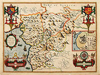
162764226London. c.1627. John Speed 1552-1629 is arguably the most famous name in early English cartography. In 1610 he published his wonderful and historic atlas 'The Theatre of Great Britain'. In 1627 he published another edition entitled 'A Prospect of The Most Famous Parts of The World' published in London by John Sudbury and George Humble. Speed based his maps on the earlier works done by Christopher Saxton and John Norden. His maps have always been keenly sought after as include many decorative features. Examples include: compass roses cherubs coats of arms mannerist style decoration prominent town plans calligraphy and well defined regional physical features. John Speed's maps proved so popular that they were issued for many years after his death. This example is of the Welsh county of Merionethshire. Size:420 x 545 mm. Copperplate engraving with later hand colour. Fair condition. Map has had repairs to lower centrefold and margin. General toning. unknown
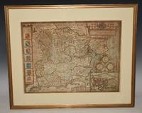
89165Described by Iohn Norden. Augmented by I. Speede And are to be solde by G. Humble. Cum Privilegio. 1610/1625. Large double sided map engraved surface 20 x 15 inches. Framed with mount. Frame Size 26 x 22 inches. In very good condition. Some darkening around the top and corners the darkening has left some lighter stripes. Two rubbed holes at bottom corners with missing text neatly re-written at left corner. One small minor tear to right hand edge on borner and bottom edge by scale at inset of Colchester. With vertical centre fold. Nice later hand-colouring. An attractive and decorative map with inset town plan of Colchester crests and elaborate coat of arms. The maps by John Speed are "the best known and most popular of all English county maps" Tooley. Described by Iohn Norden. Augmented by I. Speede, And are to be solde by G. Humble. Cum Privilegio. 1610/1625 unknown
2011__0199533903Oxford Univ Pr 2011. Hardcover. New. new edition. 576 pages. 11.25x9.00x1.25 inches. Oxford Univ Pr hardcover
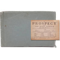
166821680London: Printed for Roger Rea 1668. Third edition. This was first published in 1631. Maps removed they were printed with the text. lacking A2 &7 B5 C2 &8 D5 E2 &8 F5 G2 &7 H5 I2 &8 K4 L1 & 6 M3 &7 and N4 &8. 1 vols. Oblong 24mo 6 1/2 x 4 inches. Later green wrappers some browning of text lacking 21 leaves else a very good copy. Third edition. This was first published in 1631. Maps removed they were printed with the text. lacking A2 &7 B5 C2 &8 D5 E2 &8 F5 G2 &7 H5 I2 &8 K4 L1 & 6 M3 &7 and N4 &8. 1 vols. Oblong 24mo 6 1/2 x 4 inches. The section on America the D gathering is lacking the first and final leaves but the comments on Virginia are present "on the East it has Mare del Nort on the North Norumbega Florida on the South and Westward the bound are not yet set.The North parts are most inhabited by our men and it is therefore called New England." Florida is "'a Pleasant Region.discovered by our English under Sebastian Cubbot 1497 but left for the Spaniard to possess.and after him the French but neither in quiet. For they warred upon each other till they left neither of them men enough to hold it". Sabin 89228n Printed for Roger Rea unknown
166821680London: Printed for Roger Rea 1668. Third edition. This was first published in 1631. Maps removed they were printed with the text. lacking A2 &7 B5 C2 &8 D5 E2 &8 F5 G2 &7 H5 I2 &8 K4 L1 & 6 M3 &7 and N4 &8. 1 vols. Oblong 24mo 6 1/2 x 4 inches. Later green wrappers some browning of text lacking 21 leaves else a very good copy. Third edition. This was first published in 1631. Maps removed they were printed with the text. lacking A2 &7 B5 C2 &8 D5 E2 &8 F5 G2 &7 H5 I2 &8 K4 L1 & 6 M3 &7 and N4 &8. 1 vols. Oblong 24mo 6 1/2 x 4 inches. The section on America the D gathering is lacking the first and final leaves but the comments on Virginia are present "on the East it has Mare del Nort on the North Norumbega Florida on the South and Westward the bound are not yet set.The North parts are most inhabited by our men and it is therefore called New England." Florida is "'a Pleasant Region.discovered by our English under Sebastian Cubbot 1497 but left for the Spaniard to possess.and after him the French but neither in quiet. For they warred upon each other till they left neither of them men enough to hold it". Sabin 89228n Printed for Roger Rea unknown books
1977758894Harvard University Press 1977-1993. Hardcover no dust jacket. Ex-Libris with usual library matter and stamps to head edge. Otherwise the set is in very good condition. Sound bindings clean and crisp pages with normal shelf wear. From Trinity Episcopal School for Ministry. Volume 6 2 volumes is published by Medieval and Renaissance Text and Studies but maintainces style uniformity with the first 5 volumes. Heavy item will require additional shipping fees. Harvard University Press hardcover
1693JC11390London: T. Basset R. Chiswell M. Wotton G. Conyers and J. Walford 1693. Paperback. Good. Disbound; 12mo; pp. 27 1 blank with large copperplate engraving on title-page. Title-page backed along the fore-edge and extending beyond the body of the text which is trimmed close frequently eliminating marginal notes. A scarce edition of this enormously popular and oft-reprinted verse attack on the Puritans first published in 1647. Wing S4898. <br/><br/> T. Basset, R. Chiswell, M. Wotton, G. Conyers, and J. Walford paperback books
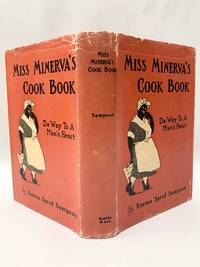
1931140938484New York: Reilly & Lee 1931. First Edition. Near Fine/Good. First edition. 280 pp. Red ribbed cloth with black lettering. Near Fine with former owner's name on front free endpaper in Good unclipped dust jacket with panels held together on verso by archival mending tissue worn and a little chipped along edge horizontal tear in spine panel. 323 recipes in African-American dialect: green ham Sunday Night jellied salad pigs in the orchard stuffed peach salad hurry-up apple pie etc. Reilly & Lee unknown books
193148889Chicago: Reilly & Lee Co 1931. First Edition. Hardcover. Fine/very good. 280p octavo illustrated. Front fly leaf expertly repaired as this book was printed with a binding flaw. Other wise a fine crisp copy in a very good dust jacket. <br/><br/> Reilly & Lee Co hardcover
171312789London: Henry Overton Bassett & Chiswell 1713. Copper-engraved map with full modern colour very large marings in very good condition except for a stain at the bottom edge well away from the image. A highly decorative map of Denbighshire by one of the greatest English cartographers<br/> <br/>Denbighshire in Wales clearly a mountainous region was surveyed by Christopher Saxton which was Speed's source for this map. William Smith Pursuivant at the College of Arms was the apparent source for the coats of arms: one of which is that of Robert Dudley Earl of Leicester Queen Elizabeth's favorite. In the town plan of Denbigh in the upper right corner is a circular inset displaying what appears to be a castle. It is actually an unfinished and indeed never finished church that Leicester had tried to have built in Denbigh. Apparently his unpopularity was part of the reason the church was never completed. The map is decorated with a sea monster a classical god on horseback and a ship. Henry Overton's edition of this map includes the few roads that snaked their way through the county.<br/> <br/>cf. Hawkyard and Nicolson The Counties of Britain A Tudor Atlas by John Speed p. 73-76; Skelton The County Atlases of the British Isles 1579-1850 Map Collector's Circle part 1 #7 Speed and part 4 #92 & 121. Henry Overton, Bassett & Chiswell unknown books
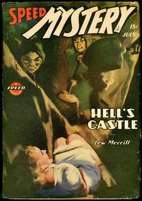
194430838Springfield MA: Trojan Pubications Inc. 1944. Lower edge trimmed. A fine copy. 30838. Octavo single issue cover by Hugh Jospeh Ward pictorial wrappers. Pulp magazine. This magazine started its incarnation as SPICY MYSTERY STORIES. Most of the fiction writers are house pseudonyms. Reference: Cook Mystery Detective and Espionage Magazines pp. 518-521. Trojan Pubications, Inc. unknown
171312789London: Henry Overton Bassett & Chiswell 1713. Copper-engraved map with full modern colour very large marings in very good condition except for a stain at the bottom edge well away from the image. A highly decorative map of Denbighshire by one of the greatest English cartographers<br/> <br/> Denbighshire in Wales clearly a mountainous region was surveyed by Christopher Saxton which was Speed's source for this map. William Smith Pursuivant at the College of Arms was the apparent source for the coats of arms: one of which is that of Robert Dudley Earl of Leicester Queen Elizabeth's favorite. In the town plan of Denbigh in the upper right corner is a circular inset displaying what appears to be a castle. It is actually an unfinished and indeed never finished church that Leicester had tried to have built in Denbigh. Apparently his unpopularity was part of the reason the church was never completed. The map is decorated with a sea monster a classical god on horseback and a ship. Henry Overton's edition of this map includes the few roads that snaked their way through the county.<br/> <br/> cf. Hawkyard and Nicolson The Counties of Britain A Tudor Atlas by John Speed p. 73-76; Skelton The County Atlases of the British Isles 1579-1850 Map Collector's Circle part 1 #7 Speed and part 4 #92 & 121. Henry Overton, Bassett & Chiswell unknown
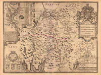
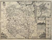
1610330332John Sudbury & George Humble 1610. unbound. Map. Original engraving. Image measures 15" x 20".<br/> <br/> Beautiful early map of Herefordshire with inset plan of the city of Hereford.The region central England is known for cider and beer production. Topography castles and churches are represented pictorially. Insets include an image and explanation of a famous 1461 battle during the War of the Roses a group of coats of arms and two images of a mapmaker at work. Verso has information and history on the county and a census of towns and "hundreds" smaller municipalities within the county. Map is in good condition despite a few scattered stains. Chips to margins not affecting the image. There is a small repari near the original fold line. <br> <br> John Speed 1552-1629 born in Cheshire and a tailor by profession until he was 50 is widely considered to be the most famous English cartographer of the 17th century. He is noted for placing England in the mainstream of map publishing an industry which was at the time dominated by the Dutch. His atlas "The Theatre of the Empire of Great Britaine" contained the first set of individual county maps of England and Wales as well as significant town plans that are in many cases the first visual records of their subjects.<br/> <br/> John Sudbury & George Humble unknown
1931mon0003676787Peiping: Customs College Press 1931. Hardcover. Very Good. . A beautiful copy with 200 illustrations many in color SIGNED by the author on the title page. Williams was a British scholar who lived much of his life in China. A comprehensive book on Chinese culture it is alphabetically arranged and covers symbolism legends manners and customs. Blue cloth cover shows minor wear and rubbing pages are lightly tanned and clean. Peiping: Customs College Press hardcover
Sm. 4to., First [and Sole?] Edition, F2 torn at fore-margin with some loss of text, some light age-staining; disbound, sewed as issued, uncut, a fresh, crisp copy. With the publisher's advertisement leaf at end. The work is dedicated by Henry Smith to Pollard himself. James Ley (1618-1665), third Earl of Marlborough and naval captain, was grandson of his namesake, the first Earl and notable barrister. By 1643 he had become a Royalist commander and two years later established a colony at Santa Cruz in the West Indies. He then commanded the East Indies squadron that received Bombay from the Portuguese in 1661, and was nominated Governor of Jamaica in 1664. Ley's 'pious letter' is dated 24 April 1665. It concludes with the phrase 'So prays old James, near the coast of Holland' [at sea during the Second Anglo-Dutch War]. A marginal note in a neat contemporary hand states (correctly) 'the ship he was in, Old James, was his own name'. He died soon after [13 June 1665] aboard the same vessel. The Battle of Lowestoft, fought on 13 June 1665 between the English fleet under James Duke of York and the United Provinces [Dutch] fleet under Jacob van Wassenaer, remains the worst naval defeat in Dutch history. The author was killed in the 68-gun 'Old James' stationed in the Centre Division of the Duke of York's Red Squadron. Smith's compilation is nothing if not wide ranging. The other 'learned and honourable persons' include (of the UK) Arundel, Bacon, Bancroft, Charles I, Compton, Coventry, Donne, Egerton, Hatton, Howard, Leicester, Mason, Peito, Pembroke, Raleigh, Selden, Thomas Smith, Somerset, Stafford, Usher, Walsingham, Wolsey, Wotton; (and others) Aristotle, Caracciolus, Charles V, Chrysostom, Gondamar, Grotius, de Haro, Heinsius, Ignatius, Irenaeus, Junius, Justin Martyr, Mazarin, Origen, Plato, Polycarp, Richlieu, Salmasius, Seneca, Socrates, Solomon, Tertullian. Significantly, the publisher's advertisement leaf announces 'An excellent Preservative against Plague…2s. 6d. Per Paper, sealed', together with 'Medela Pestilentiae…an exact Method for curing that Epidemical Distemper' and 'Reflections on the Weekly Bills of Mortality for the Cities of London and Westminster'. EXTREMELY SCARCE.
47512248-nnew. unknown
1891009292London and New York: Longmans Green & Co. 1891. Book. Very Good. Hardcover. Limited and Numbered First Edition. Tall 8vo. # 15 of 150 copies printed. Original quarter white parchment over grey paper covered boards five raised bands and title at spine printed in blue Very Good spine browned and with two small stains joints starting to open yet still holding well corners rubbed end pages toned prior owner gift inscription in pencil front end page. The poem "In Helena's Garden" by Richard Watson Gilder pasted onto recto of 2nd front end page laid in at rear the poem "O Music" by Harriet Prescott Spofford from a contemporary magazine. Longmans, Green & Co. Hardcover
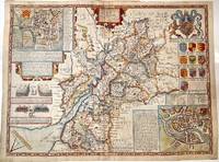
1627M11352London 1627. Very Good central fold reinforced. Notes: Detailed and decorative county map of Gloucestershire with inset plans of Bristol and Gloucester also with two battle vignettes and 10 Royal coat of arms.<br>English text on verso. Size : 388x510 mm 15.28x20.08 Inches Coloring: Hand Colored Category: Maps Europe United Kingdom England Counties; unknown
76833Speed / George Humble ca1610-1614. Original Engraved Hand Coloured Double-Sided Map. Mounted and framed in double glazed gold frame glass front and back. Map size 20 x 15 inches. Total size 26 x 21 inches. In very good condition. Vertical crease to centre. A very clean and bright example. Beautifully hand coloured with description and list of Towns to verso. Speed / George Humble ca1610-1614 unknown
16518591London Printed by R.W. for Giles Calvert . 1651. 1651 4to. 8 31 1 p. Lacking A2 and A3 from the prelims. Unbound with the spine strengthened with a paper strip. Some signs of use with good margins clear of the sidenotes. Scarce with no copy in the British Library or Bodleian. London Printed by R.W. for Giles Calvert ... unknown
9638156like new. unknown
9638156-nnew. unknown