SPEED, JOHN:Biblio.com
1 203 résultats
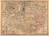
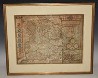
89165Described by Iohn Norden. Augmented by I. Speede And are to be solde by G. Humble. Cum Privilegio. 1610/1625. Large double sided map engraved surface 20 x 15 inches. Framed with mount. Frame Size 26 x 22 inches. In very good condition. Some darkening around the top and corners the darkening has left some lighter stripes. Two rubbed holes at bottom corners with missing text neatly re-written at left corner. One small minor tear to right hand edge on borner and bottom edge by scale at inset of Colchester. With vertical centre fold. Nice later hand-colouring. An attractive and decorative map with inset town plan of Colchester crests and elaborate coat of arms. The maps by John Speed are "the best known and most popular of all English county maps" Tooley. Described by Iohn Norden. Augmented by I. Speede, And are to be solde by G. Humble. Cum Privilegio. 1610/1625 unknown
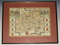
93175John Sudbury & George Humble 1627. Nice later hand-colouring. An attractive and decorative map with inset views of the palaces of Richmond and Nonsuch both royal Tudor residences which were demolished by the end of the seventeenth century. Nonsuch was given by Charles II to Barbara Countess of Castlemaine who then tore it apart to pay gambling debts; Richmond was sold by Parliament after the execution of Charles I. In very good condition. Some slight on centre fold. Map a little darkened. Wooden fame has a few little nicks. Large double sided map engraved surface 20.5 x 15.5 inches. Gold tinted black hardwood Frame with glass front with a light maroon mount. Frame Size 24.5 x 22.5 inches. The maps by John Speed are "the best known and most popular of all English county maps" Tooley. John Sudbury & George Humble 1627 unknown
162764885London. 1627. A handsome early Sudbury and Humble edition of John Speed's map of Oxfordshire in colour. Towns and cities are highlighted in red decorative college arms and the supposed years of their foundation are found on either side of the map. A detailed inset map of the city of Oxford is in the upper right corner with a separate key with 28 listed city landmarks. The arms of the earl of Oxford to the right. Two academic university figures are seen standing with a pair of compass dividers either side of a striking globe representing the scale of miles. A strapwork border design and the royal coat of arms complete this map wonderfully well. Size: 395 x 535 mm. Copperplate engraving with later hand colouring. Fair condition. Some old repairs to lower central fold. Slight discolouration to the central fold. unknown
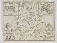
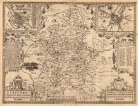
52744London: Performed by Johan Speed. Solde by Bassett.and Chiswell.Now Sold by Hen: Overton at the White Horse without Newgate. c.1720. 41x 51 cm. Uncoloured double-page map. Insets of Oukham & Stanford. Additional light fold creases mid right and mid lower half. London: Performed by Johan Speed. Solde by Bassett..and Chiswell...Now Sold by Hen: Overton at the White Horse without Newgate. unknown
164623413London: William Humble 1646. Other. In excellent condition. 386 by 513mm 15¼ by 20¼ inches. 386 by 513mm 15¼ by 20¼ inches. Copper engraving uncolored as published. William Humble unknown
15-5100New York: Speed & Dodd Mead 1883. 8vo. Single Page Very Good with small tear minor creasing rubbing edge wear & some stains. New York: Speed & Dodd Mead, 1883. unknown
164623404London: William Humble 1646. Other. In excellent condition. 378 by 507mm 15 by 20 inches. 378 by 507mm 15 by 20 inches. Copper engraving uncolored as published. William Humble unknown
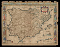
162621921<p>London: Are to be sold by Thomas Bassett in Fleet Street & Richard Chiswell in St. Pauls Churchyard 1626 but 1676. 415 by 540mm. 16.25 by 21.25 inches. Speed's map of Spain Double-page engraved map with hand-colour some wear to edges. A map of Spain from the 1676 edition of the first atlas compiled and published by an Englishman Speed's 'Prospect'. A decorative border along the top illustrates views of major cities including Granada and Barcelona and along each side there are depictions of figures in regional costume. The Balearics appear marked as the 'Pyne Ilands'. Accompanying text in English 'The Description of Spain' is printed on the reverse. John Speed 1552-1629 was the outstanding cartographer of his age. By trade a merchant tailor but by proclivity a historian it was the patronage of Sir Fulke Greville poet and statesman that allowed him to pursue this interest in earnest. His 'Theatre of Great Britain' first published in 1611 or 1612 was the first large-scale printed atlas of the British Isles. The 'Prospect of the Most Famous Parts of the World' from which the present work is drawn appeared in 1627 bound with the 'Theatre' and is the first world atlas compiled by an Englishman to be published in England. Engraved in Amsterdam many of the maps are anglicized versions of works by Dutch makers in distinctive carte-à-figure style featuring borders with figures in local costume and city views. This map is from the 1676 edition of the 'Prospect' published by Thomas Bassett and Richard Chiswell. While not as rare as the earlier publications this edition is perhaps the most important given that it is the first to include the nine new maps: among them Virginia and Maryland Barbados and Russia. It is also the last time that the 'Prospect' was printed as an atlas. Shirley Atlases T.SPE-2f.</p> Are to be sold by Thomas Bassett in Fleet Street & Richard Chiswell in St. Pauls Churchyard,
164623400London: William Humble 1646. Other. In excellent condition. 386 by 512mm 15¼ by 20¼ inches. 386 by 512mm 15¼ by 20¼ inches. Copper engraving uncolored as published. William Humble unknown
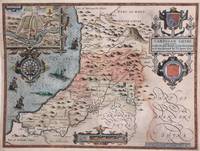
1616M8778London: John Sudbury & George Humble 1616. Good a few marginal tears restored margins reinforced with acid free tissue. . Notes: StolenBeautiful map of Cardigan Shyre in Wales drawn by John Speed and engraved by Jodocus Hondius showing its mountains major rivers forests and towns. Decorative inset shows plan of town of Cardigan. <br><br><br>John Speed 1552 –1629 was an English cartographer and historian. He is known as England's most famous Stuart period mapmaker. His maps of English counties are often found framed in homes throughout the United Kingdom.For a series of maps Speed partnered with Dutch engraver Jodocus Hondius. <br><br> Size : 383x510 mm 15.08x20.08 Inches Coloring: Original Hand Coloring Category: Maps Europe United Kingdom Wales; John Sudbury & George Humble unknown
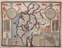
1616M8779London: John Sudbury & George Humble 1616. Good a few marginal tears upper left corner replaced not affecting the image. Reinforced with acid free tissue paper on the back of the margins. . Notes: StolenBeautiful map of Cumberland northern England showing mountains rivers and major towns with an inset of Carlisle armorials and a vignette of a battle scene.<br><br>John Speed 1552 –1629 was an English cartographer and historian. He is known as England's most famous Stuart period mapmaker. His maps of English counties are often found framed in homes throughout the United Kingdom.For a series of maps Speed partnered with Dutch engraver Jodocus Hondius. <br><br> Size : 384x507 mm 15.12x19.96 Inches Coloring: Original Hand Coloring Category: Maps Europe United Kingdom England; John Sudbury & George Humble unknown
167653206The Theatre of the Empire of Great Britain. T Bassett & R Chiswell. 1676. A very attractive map of Suffolk with inset of Ipswich enclosed in an elegant border. On the right of this is a pictorial reference to Bodicia Queen of the Iceni who occupied the area today known as East Anglia. On the left stands a Roman General. Numerous coats of arms of the Dukes and Earles of Suffolk and Clare adorn either side. At the bottom left a cherub holds dividers over the scale on the right a cupid holds a wind rose. Copper engraving. Fine condition good margins but some slight offsetting. Mounted size: 72 x 60 cm. Hand coloured. Size: 51 x 38 cm. 20 x 15 inches. unknown
1289334951.Gpaperback. Good. Access codes and supplements are not guaranteed with used items. May be an ex-library book. paperback
1680mon0000023721London: for R. Scot T. Baffet 1680. LATER EDITION. Small 4to. 54pp.i disbound recto of title-page repaired illustrated with two engravings one of which is a title-page vignette foredge of title-page chipped not affecting image or text. The poem celebrates a brawl in the Wood Street Compter or debtors' prison. The title-page vignette a copperplate illustrates a brawl; the other plate a full-page woodcut shows a scene at the gate of the prison. The date of the first edition of this work is uncertain but circa 1628 is guessed.rnWing S4896; Lowndes 2164; Grolier Whither to Prior 771. London: for R. Scot, T. Baffet, unknown
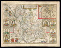
167621977<p>London: And are to be solde by Thomas Bassett in Fleet Street and Ric: Chiswell in St. Pauls Churchyard 1676. 390 by 510mm. 15.25 by 20 inches. Speed's map of Lancashire Double-page engraved map with hand-colour minor wear to edges. A map of Lancashire from the 1676 edition of the first large-scale atlas of the British Isles Speed's 'Theatre'. In the top right-hand corner is an inset town-plan of Lancaster probably the first printed plan of Lancaster. On the left-hand side are portraits of monarchs from the house of Lancaster including Henry IV and on the right of monarchs from the house of York including Richard III. On the verso of the map is printed 'Hundreds in Cheshire' and a description of 'The County Palatine of Chester'. John Speed 1552-1629 was the outstanding cartographer of his age. By trade a merchant tailor but by proclivity a historian it was the patronage of Sir Fulke Greville poet and statesman that allowed him to pursue this interest in earnest. His 'Theatre of Great Britain' from which the present work is drawn was first published in 1611 or 1612 and is 'the earliest English attempt at atlas-production on a grand scale' Skelton. Drawing heavily on the work of Saxton and Norden little of Speed's cartography is original he acknowledges 'I have put my sickle into other mens corne' instead it is his blend of cartography and history incorporating town-plans vignettes and genealogy that makes Speed an innovator. This map is from the 1676 edition of the 'Theatre' published by Thomas Bassett and Richard Chiswell. Chubb CIV; Shirley Atlases T.Spe-1j; Skelton 92; Whitaker 123.</p> And are to be solde by Thomas Bassett in Fleet Street, and Ric: Chiswell in St. Pauls Churchyard,
164623430London: William Humble 1646. Other. In excellent condition. 384 by 512mm 15 by 20¼ inches. 384 by 512mm 15 by 20¼ inches. Copper engraving hand colored in outline and wash. William Humble unknown
164623411London: William Humble 1646. Other. In excellent condition. 380 by 507mm 15 by 20 inches. 380 by 507mm 15 by 20 inches. Copper engraving uncolored as published. William Humble unknown
164623401London: William Humble 1646. Other. In excellent condition. 385 by 510mm 15¼ by 20 inches. 385 by 510mm 15¼ by 20 inches. Copper engraving uncolored as published. William Humble unknown
49671London: Tho. Bassett and Richard Chiswell. 1676. Original engraved map 38 x 51 cm. Uncoloured. Inset of Dubline. Good impression very light tanning to centre-fold minor crease at margin of lower right corner. London: Tho. Bassett and Richard Chiswell. [1676] unknown
1992109244Pavilion Books 1992-01-01. Hardcover. New. 11x9x0. Brand new gift quality hardcover in jacket oversized and overweight. B75 Please email for photos. Pavilion Books hardcover
1989Q-0500251045Thames & Hudson 1989. hardcover. New. In shrink wrap. Looks like an interesting title! Thames & Hudson hardcover
16651780London: to be sold by Roger Rea the Elder and younger at the Golden Crosse in Cornhill against the Exchange 1665. 410 by 550mm. 16.25 by 21.75 inches. Double-page engraved map upper left and right margins skilfully repaired margins reinforced with japan paper. The map bears the imprint of Roger Rea the Elder and Younger. The Reas had purchased the rights to Speed's work from William Garrett in 1659 who had previously purchased them from the widow of William Humble in the same year. Skelton suggests that the father and son intended a new edition of the atlas for the Restoration of 1660. However the atlas would appear not to have been published until 1665. This is borne out by an advertisement in the Term Catalogue by the subsequent owners of the plates Thomas Bassett and Richard Chiswell in 1675: "Mr John Speed's. Geography of the Kingdoms of England Scotland and Ireland. together with his Prospect. all in one entire Volume hath been for seven Years past out of Print the greatest part of an Impression then newly Printed being destroyed by the late dreadful Fire 1666". This is borne out by the rarity of the Rea edition of the atlas. There is evidence that they planned an edition of 1666 as there are impressions of Sussex Buckingham and Derby with Rea's imprint which bear that date. Rea would later sell the plates to Bassett and Chiswell who would publish a new edition in 1676. to be sold by Roger Rea the Elder and younger at the Golden Crosse in Cornhill against the Exchange, unknown
16651788London: to be sold by Roger Rea the Elder ad younger at the Golden Crosse in Cornhill against the Exchange. 1665. 410 by 550mm. 16.25 by 21.75 inches. Double-page engraved map fine contemporary outline hand colour upper left and right margins skilfully repaired margins reinforced with japan paper. The map bears the imprint of Roger Rea the Elder and Younger. The Reas had purchased the rights to Speed's work form William Garrett in 1659 who had previously purchased them from the widow of William Humble in the same year. Skelton suggests that the father and son intended a new edition of the atlas for the Restoration of 1660. However the atlas would appear not to have been published until 1665. This is borne out by an advertisement in the Term Catalogue by the subsequent owners of the plates Thomas Bassett and Richard Chiswell in 1675: "Mr John Speed's. Geography of the Kingdoms of England Scotland and Ireland. together with his Prospect. all in one entire Volume hath been for seven Years past out of Print the greatest part of an Impression then newly Printed being destroyed by the late dreadful Fire 1666". This is borne out by the rarity of the Rea edition of the atlas. There is evidence that they planned an edition of 1666 as there are impressions of Sussex Buckingham and Derby with Rea's imprint which bear that date. Rea would later sell the plates to Bassett and Chiswell who would publish a new edition in 1676. to be sold by Roger Rea the Elder ad younger at the Golden Crosse in Cornhill against the Exchange. unknown
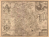
161221264London: Sudbury & Humble 1612. Insets of the Plan of Radnor Wales with a coat of arms compass rose/scale of miles and title in decorative cartouche. From the atlas "The Theatre of the Empire of Great Britaine". Skelton R. A. County 7. Restoration in margins otherwise very good. Copper engraving with original color re-touched. 20 x 15" plus ample margins. Sudbury & Humble unknown
1989132425England: Thames And Hudson 1989. Hardcover. Fine/Fine. First American edition. Fine in fine dustwrapper. A beautiful copy clean like new many detailed maps. Thames And Hudson hardcover