1 204 résultats
2008x-0822343134Duke Univ Pr 2008. Paperback. New. 377 pages. 9.00x6.00x0.75 inches. Duke Univ Pr paperback
2082402113505950Hotta Koseikan Main Store N.A. Soft Cover. Fine. Volume: 1 Hotta Koseikan Main Store paperback
160 pages. A valuable and informative guide for everyone who plays the game - and those who want to! Examines every aspect of play. Clearly explains: fundamentals of the game; basic use of the crosse; various offensive and defensive techniques - complete with detailed illustrations; the importance of face-off technique; skillful goal tending; how to improve your speed. Field lacrosse for women. Average wear. Single hole punched in top corner of each cover. Sticker residue on front cover. Unmarked. Book
2011Q-1404870466Picture Window Books 2011-08-01. Paperback. New. In shrink wrap. Looks like an interesting title! Picture Window Books paperback
1515846512.Glibrary. Good. Access codes and supplements are not guaranteed with used items. May be an ex-library book. unknown
164623415London: William Humble 1646. Other. In excellent condition. 386 by 510mm 15¼ by 20 inches. 386 by 510mm 15¼ by 20 inches. Copper engraving uncolored as published. William Humble unknown
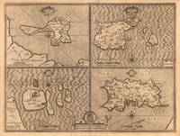
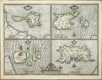
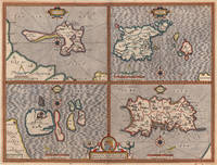
161011341London: John Sudbury and George Humble 1610. No binding. Good. THE FIRST REASONABLY ACCURATE MAP OF JERSEY. 385 x 510 mm. with recent outline and wash colour in good condition. The first published state of a quartered map by John Speed displaying the tidal Holy Island Lindisfarne reachable on foot at low tide and the Farne Islands both off the coast of Northumberland. On the right side are the two main Channel Islands of Guernsey and Jersey. This is the first reasonably accurate map of Jersey to be printed. The parish boundaries are marked along with the various waterways each indicating housing along their courses. In addition three windmills are displayed. Guernsey displays no real improvement over that of Gerard Mercator published in 1595 but it does now display its proximity to Jersey. Sark now displays buildings and one windmill which had only recently been built by Hellier de Carteret in 1571. He was the first Seigneur of the island. It was famously decapitated by the Nazis in the Second World War. John Speed 1552-1629 is the best known and among collectors the most popular British cartographer. He was like his father a tailor by trade with a passion for history. On joining the Society of Antiquaries he took his first steps towards the compilation of the atlas that has placed him among the cartographic immortals.In 1611 he produced the 'History of Great Britain' and his atlas the 'Theatre of the Empire of Great Britain' was published to accompany it. The 'Theatre .' was the first atlas of the British Isles ever produced containing sixty-seven maps which in addition to the counties of England and Wales also included general maps of the Heptarchy England in Anglo-Saxon times Great Britain and Ireland England Wales Scotland and the Provinces of Ireland together with maps of the Isles of Wight and Man and the Channel Islands. Preparation for the atlas took several years and the maps are all engraved by Jodocus Hondius in Amsterdam. This example was printed in 1627 the last edition to be published before the death of Speed. Provenance: private Jersey collection. Shirley T.SPE-1e; Skelton 1966; Skelton 1970 7 & 16. John Sudbury and George Humble unknown
162623758London: G. Humble 1626. Other. In excellent condition. 382 by 508mm 15 by 20 inches. 382 by 508mm 15 by 20 inches. Copper engraving hand colored in outline and wash. Original antique copper engraving hand colored in outline and wash. John Speed 1551 or 1552 28 July 1629 was an English cartographer and historian. He is alongside Christopher Saxton one of the best known English mapmakers of the early modern period.Speed was born in the Cheshire village of Farndon and went into his father Samuel Speed's tailoring later in life.While working in London Speed was a tailor and member of a corresponding guild and came to the attention of "learned" individuals. These individuals included Sir Fulke Greville who subsequently made him an allowance to enable him to devote his whole attention to research. By 1598 he had enough patronage to leave his manual labour job and "engage in full-time scholarship". As a reward for his earlier efforts Queen Elizabeth granted Speed the use of a room in the Custom House. Speed was by this point as "tailor turned scholar" who had a highly developed "pictorial sense".In 1575 Speed married a woman named Susanna Draper in London later having children with her. These children definitely included a son named John Speed later a "learned" man with a doctorate and an unknown number of others since chroniclers and historians cannot agree on how many children they raised. Regardless there is no doubt that the Speed family was relatively well-off.By 1595 Speed published a map of biblical Canaan in 1598 he presented his maps to Queen Elizabeth and in 16111612 he published maps of Great Britain with his son perhaps assisting Speed in surveys of English towns.At age 77 or 78 in August 1629 Speed died. He was buried alongside his wife in London's St Giles-without-Cripplegate church on Fore Street. Later on a memorial to John Speed was also erected behind the altar of the church. According to the church's website "His was one of the few memorials in the church that survived the bombing" of London during The Blitz of 19401941 . The website also notes that "the cast for the niche in which the bust is placed was provided by the Merchant Taylors' Company of which John Speed was a member". His memorial brass has ended up on display in the Burrell Collection near Glasgow. Wikipedia G. Humble unknown
194839752Couverture souple. Broché. 128 pages.
5259Paris, Presses Universitaires de France Coll. Que sais-je? n° 88, Le Point des connaissances actuelles, 1942 – in-12, 128 pp. – broché, illustrations n. et b. (figures)
19071187551907 A Paris, H. Dunod et E. Pinat, Editeurs - 1907 - Fort in-4, demi chagrin brun, dos à 5 nerfs avec titre et nom de l'auteur en doré - 800 p. - Riche iconographie in texte en N&B
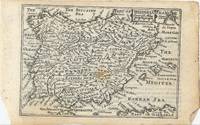
62151London: William Humble 1646. Original copper-engraved miniature map of Spain and Portugal 8.6 x 12.4 cm. Uncoloured. English text on verso. Small brown spot to centre of image. Some slight show through text otherwise in good condition. [London: William Humble, 1646]. unknown
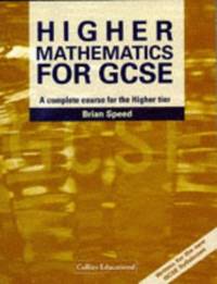
0007256833.Gpaperback. Good. Access codes and supplements are not guaranteed with used items. May be an ex-library book. paperback
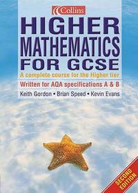
0007215649.Gpaperback. Good. Access codes and supplements are not guaranteed with used items. May be an ex-library book. paperback
GOR001147033Paperback. Very Good. paperback
0007115105.Gpaperback. Good. Access codes and supplements are not guaranteed with used items. May be an ex-library book. paperback
0007215754.Gpaperback. Good. Access codes and supplements are not guaranteed with used items. May be an ex-library book. paperback
197710381California, Society of Photo-Optical Instrumentation Engineers / SPIE (Proceedings, 94), 1977. August 1976, San Diego VIII, 152 S. (28 cm) Großformat, Paperback / kartoniert
2023__0727766910ICE Publishing 2023. Hardcover. New. 296 pages. 9.33x6.30x0.83 inches. ICE Publishing hardcover
2023__0727766899ICE Publishing 2023. Hardcover. New. 272 pages. 9.21x6.34x0.87 inches. ICE Publishing hardcover
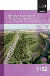
A9780727765789Hardback. New. This volume of High Speed Two: Infrastructure Design and Construction from the HS2 Project contains a collection of papers submitted to HS2 Ltd's Technical Papers Competition. Papers in this second volume cover digital engineering environment and heritage. hardcover
A9780727765765Hardback. New. This volume of High Speed Two: Infrastructure Design and Construction from the HS2 Project contains a collection of papers submitted to HS2 Ltd's Technical Papers Competition. Papers in this first volume cover design engineering and architecture. hardcover
2021__0727766376Thomas Telford Ltd 2021. Paperback. New. pck edition. 896 pages. 9.22x6.15x9.21 inches. Thomas Telford Ltd paperback
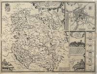
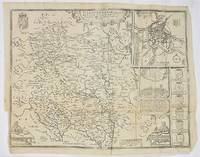
1610330332John Sudbury & George Humble 1610. unbound. Map. Original engraving. Image measures 15" x 20".<br/> <br/> Beautiful early map of Herefordshire with inset plan of the city of Hereford.The region central England is known for cider and beer production. Topography castles and churches are represented pictorially. Insets include an image and explanation of a famous 1461 battle during the War of the Roses a group of coats of arms and two images of a mapmaker at work. Verso has information and history on the county and a census of towns and "hundreds" smaller municipalities within the county. Map is in good condition despite a few scattered stains. Chips to margins not affecting the image. There is a small repari near the original fold line. <br> <br> John Speed 1552-1629 born in Cheshire and a tailor by profession until he was 50 is widely considered to be the most famous English cartographer of the 17th century. He is noted for placing England in the mainstream of map publishing an industry which was at the time dominated by the Dutch. His atlas "The Theatre of the Empire of Great Britaine" contained the first set of individual county maps of England and Wales as well as significant town plans that are in many cases the first visual records of their subjects.<br/> <br/> John Sudbury & George Humble unknown
52742London: Performed by John Speed and are to be Sold by Henry Overton at the White Horse without Newgate. c.1720. 41x 51 cm. Uncoloured double-page map. Insets of a plan of the town of Hereford arms of the nobility and battle of Mortimer's Cross. Some creases Additional light fold creases mid right and mid lower half. London: Performed by John Speed and are to be Sold by Henry Overton at the White Horse without Newgate. [c.1720] unknown