Museum of Practical GeologyBiblio.com
288 résultats
0282752498.Gpaperback. Good. Access codes and supplements are not guaranteed with used items. May be an ex-library book. paperback
1330187970.Gpaperback. Good. Access codes and supplements are not guaranteed with used items. May be an ex-library book. paperback
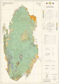
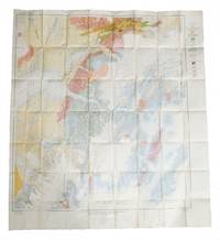
654351980. Original large colour-printed map of Qatar 104 x 74 cm. Topography based on 1:100000 scale series 1980 compiled and drawn by Hunting Surveys Limited for the Ministry of Public Works Qatar. Compiled and cartography by Hunting Geology and Geophysics Limited. In very good condition. Showing the maturation of Qatar's Oil and Gas Industries This is an extremely rare 1980 large-format bilingual geological map of Qatar produced by Hunting Geology and Geophysics for the Qatari government. Issued nearly a decade after independence the map played an important role in the country's continued development of its oil and gas industries the wealth from which was successfully leveraged to support wider social and economic development. The map covers the Qatari Peninsula its nearby islands including the Hawar Islands belonging to Bahrain and reclaimed coastal land using colour-shading to indicate a variety of sands gravels clay and stone as explained in the bilingual legends present at right which also indicate geological era. Roads carriageways highways tracks settlements oil wells pipelines waterways including wadis and other features including some maritime features sand banks reefs are recorded as explained in a legend at right. The level of detail is so extraordinary that even power lines and fences are noted. Additional information is also explained at right such as the local grid employed and a reliability diagram based on the surveys that form the basis of the map's data. Qatar's Oil Industry Takes Off The early history of Qatar's oil industry began in the 1920s and 1930s when the small sparsely populated British protectorate first attracted the interest of international oil companies exploring the Persian Gulf. In 1932 the Anglo-Persian Oil Company obtained the first oil concession in Qatar through a subsidiary the Iraq Petroleum Company. Initial exploration efforts included geological surveys and test drilling reflecting British hopes that Qatar might yield oil reserves comparable to those already found in neighbouring Bahrain and Saudi Arabia. The first promising discovery came in 1939 at the Dukhan field on Qatar's western coast. However development was delayed by the outbreak of the Second World War which diverted resources and prevented large-scale extraction. Oil production in Qatar truly began after the war. In 1947 - 1948 the Dukhan field was finally brought into production with the first export shipment departing in December 1949. Revenues from oil began to replace traditional industries like pearling fishing and small-scale trade. Through the 1950s the Qatar Petroleum Company then an operating arm of the concession-holding consortium expanded infrastructure at Dukhan and the growing port of Umm Said Mesaieed which became the centre of refining and export operations. The influx of oil revenue initiated an era of modernisation. Beginning in the 1950s the ruling al-Thani family used oil income to fund public works schools healthcare and roads gradually transforming Qatar from a relatively poor Gulf sheikhdom into a state with rapidly improving infrastructure and services. This map was when Qatar's oil industry entered a period of rapid growth. The discovery and development of new offshore reserves were especially significant during this period including the Bul Hanine field located southeast of the Qatari peninsula. Discovered in 1970 and brought into production in 1972 Bul Hanine became a key contributor to Qatar's output during the 1970s reflecting the country's shift toward offshore exploration that would later define much of its energy sector. Qatar also steadily increased its role in managing the sector especially after independence. In the early 1970s the government negotiated increased participation in concessionary operations aligning with a broader regional trend across the Gulf and the wider Arab world. In 1974 Qatar achieved a majority state share in the Qatar Petroleum Company's operations reflecting the global momentum of resource nationalisation. Oil exports from fields such as Bul Hanine strengthened the young state's financial position enabling even further investments in education housing infrastructure and early industrialisation projects driven by the leadership of Emir Khalifa bin Hamad r. 1972 - 1995. This era also set the stage for the eventual development of Qatar's massive natural gas resources especially the North Field the largest natural gas field in the world which would propel the country into a new phase of energy leadership even as geopolitical incidents the 1973 Oil Embargo the Iranian Revolution and Iran-Iraq War caused turmoil in the oil and gas industries. Publication History and Census This map was compiled and drawn by the firm Hunting Geology and Geophysics in the late 1970s based on their own surveys and those of Seltrust Engineering Limited which prepared an equally rare explanatory booklet for the map OCLC and was published in 1980. In a sense the map can be seen as a successor to a 1970 geological map of Qatar previously sold by us which Hunting had a role in developing with the same title and dimensions as the present map similar involvement of the Qatari government in this case the Industrial Development Technical Centre and equivalent types of data reflected. However the present map is based on later surveys and benefits from a decade of additional technological advances making it a rather unique work rather than a second edition. In any event the present map is very scarce noted only among the holdings of the Library of Congress and with no known market history. Cartographer Hunting Geology and Geophysics Ltd. 1952 - 1987 was a British surveying firm that specialized in cutting-edge methods of mapping especially aeromagnetic surveys and focused on discovering potential reserves of natural resources especially fossil fuels. It was part of the larger Hunting group originally founded in 1874 as a shipping company by Charles Hunting and later moving into aircraft surveying and petroleum. Companies within the Hunting group frequently merged with each other and with outside acquisitions leading to frequent name changes; in this case Hunting Aerosurveys founded 1944 merged with Hunting Geophysics founded 1952 to form Hunting Surveys in 1960. In 1965 a public company was formed called Hunting Associated Industries Ltd. which included Hunting Surveys Holdings Ltd. but not a new entity Hunting Geology and Geophysics Ltd. which remained part of the privately-owned Hunting Group. In 1987 Hunting Geology and Geophysics Ltd. was closed down in a consolidation process that saw the public company now Hunting plc buy out the Hunting Group though the Hunting family retains a significant share of the company's stock and one of its members remains Chairman of the Board. Hunting Geophysics and later Hunting Geology and Geophysics Ltd. made pioneering surveys of Great Britain itself along with several countries in Central Africa seeking uranium and other minerals the Philippines Ethiopia and especially countries in the Middle East where the company conducted critically important surveys that helped to develop the lucrative oil industries of the United Arab Emirates Qatar and Kuwait among others. OCLC 35277935 1980. unknown
1887111111114632Providence Franklin Society 1887. Hardcover. Good. Providence Franklin Society; Providence 1887. Hardcover. A Good brown cloth binding with gilt lettering on front board and spine some handling/scuffing to boards rubbing along board edges crimping to spine edges ink name stamp front pastedown age toning to pages cracked front hinge few pages with some pencil markings small abrasions to board corners mild spine lean rubbing along joints without Dust wrapper. A good copy. 8vooctavo or approx. 6 x 9 inches. 130pp. indexed. We pack securely and ship daily with delivery confirmation on every book. The picture on the listing page is of the actual book for sale. Additional Scans are available for any item please inquire. Providence Franklin Society hardcover
0332368815.Gpaperback. Good. Access codes and supplements are not guaranteed with used items. May be an ex-library book. paperback
0332702154.Ghardcover. Good. Access codes and supplements are not guaranteed with used items. May be an ex-library book. hardcover
1974005195Sao Paulo Brasil: Associacao Brasileira de Geologia de Engenharia 1974. Hardcover. Very Good/No Jacket. 4to - over 9¾" - 12" tall. 3vol.set; vols.1&2 paginated by theme&chapter;vol.3-340pgs.; weighs apprx.7lbs.; HB brwn.w/blk.; ex-lib cards&stamps ft.pastedwns.&title pgs.; vol.1:sml.chip bttm.spine; covers rubbed; hinges loose-bk.hinge cracked&torn; cleantight pgs. vol.2:covers rubbed/severe wear bk.edges; cleantight pgs. vol.3:covers&edges rubbed w/cleantight pgs. Volume 1: Themes I-IV; Teaching & training; Siesmic phenomena; Urban & country planning; and Classification of natural materials of construction. Volume 2: Themes V-VII; Mass movements; Dam foundations; and Underground construction. Volume 3: Acknowledgments & discussions. illus. diagrams graphs&charts <br/> <br/> Associacao Brasileira de Geologia de Engenharia hardcover
1334495122.Gpaperback. Good. Access codes and supplements are not guaranteed with used items. May be an ex-library book. paperback
12366821502Paperback. GOOD. Hardcover ©1873 D. Appleton & Co. 11th edition Vol 1 only Green Boards Front hinge weak Stain on bottom of spineTight binding Unmarked text paperback
1330448243.Gpaperback. Good. Access codes and supplements are not guaranteed with used items. May be an ex-library book. paperback
1528165799.Ghardcover. Good. Access codes and supplements are not guaranteed with used items. May be an ex-library book. hardcover
0548832668.Gpaperback. Good. Access codes and supplements are not guaranteed with used items. May be an ex-library book. paperback
2008DADAX0548832668Kessinger Publishing 2008-01-10. paperback. New. 8.25x1.36x11.00. Buy with confidence. Excellent Customer Service & Return policy. Kessinger Publishing paperback
133448791X.Gpaperback. Good. Access codes and supplements are not guaranteed with used items. May be an ex-library book. paperback
ria9781789245349_inpPaperback / softback. New. New Book; Fast Shipping from UK; Not signed; Not First Edition; A new textbook showing beginners how to use the free programming language R for fundamental biostatistical analysis graphical display and experimental design. The book takes a simple step-by-step approach to give a good grounding in t paperback
41637917like new. unknown
41637917-nnew. unknown
526001940. 3 original colour maps each c. 110 x 110 cm 40 x 45 inches folding to 20 x 12.5 cm. Natural fold creases generally very fresh and clean. Shows anchorage Big delta Blying Sound Circle fairbanks Gulkana Healy Kantishna River Kenai Livengood Mount Hayes Mount McKinley Seldovia Seward Talkeetna Talketna Mountains Tanan Tyonek Valdez etc. 1940 unknown
THPU-75425Hardcover. NEW. US Standard Edition. We will ship same day or next day with trackable delivery method. Expedited Shipping Available. We don't entertain INTERNATIONAL orders ATM. 30-day money-back guarantee. hardcover
191112648Seattle 1911. 13.25 x 8.75" stitched plain grey wrappers 22 leaves illustrated with pasted in photographic magazine clippings; title page 15 typed text pages 12 page diary two pages of poetry and one page of statistics four illustration pages one page with a newspaper clipping one blank. A typescript account of an all-girls trip taken by the students of Professor Henry Landes at the University of Washington. Called the "Traveling School of Geology" this five week excursion to Victoria Island and to Northwest and Southwest Washington State consisted of ten girls and five staff members including "Madame Oakley" a chaperone and Landes Dean of Science and founding member of the University's geology department each individual is listed on the title page. This vivid playful account is mostly about adventures and hijinks rather than science with descriptions of clothing food and flirtations "studying heology instead of geology" throughout as well as lively accounts of mountain climbing camping local color and the participants. The group first toured Victoria Island and the San Juan Islands before visited the Cascades including an ascent of Pinnacle Peak and the climbing of glaciers on Mt. Rainier. The close bonds of the women comes through quite strongly with their silly nicknames "Madame Moraine" "Bonnie Boulder" etc used throughout and the long poem at the end describing the various subsets of five within the ten students "There were five who wore knickers and five who wore skirts and five who on the mountain always wore shirts." <br /> <br /> The confident carefree personalities of the girls are apparent for instance when one girl climbs onto an oil can to give a speech on a wharf in coastal Washington or when the girls spontaneously jump into the water to swim much to the chagrin of Professor Landes:<br /> <br /> "On the wharf due to 'Germany's' oratorical ability she was hastily lifted to the top of an oil can in order that she might give us an example of her 'ladies and gentleman'. During this flowery outburst our eminent fishologist 'Middy' employed her leisure time chasing 'Uneeda' with a rat-fish and 'Boots' made a doll-baby of kelp.It was about this time that 'Uneeda' replied to 'Madam' that she was studying heology and not geology. Was it this reply that caused Mr. Gilliam to offer to furnish her specimens of tear drop rocks at La Conner" July 11 1911<br /> <br /> "The 'Call of the Wild' was so strong that they could resist it no longer. Away they went into the water!.They were seagulls. They could scarcely be distinguished from their untamed relatives as they shrieked to each other while paddling around in the water.The Professor finally succeeded in coaxing them out of the water by promising them a launch-ride to Tikeland." August 1 1911<br /> <br /> Of particular interest are the passages describing the group as they hiked trails climbed mountains and crossed glaciers:<br /> <br /> "Another plunge into the forest for seven miles down grade and camp was near. 'Uneeda' began to lag so 'Bonnie' gave her a fifth egg which revived her. 'Dude' begged to be left by the wayside to die but Prof. Landes called her attention to a hickory stick and no more complaint was heard. Dinner served at 7:00 p.m. and all unconscious by 9:00 after a feast of cherries brought in by 'Boots'." July 8 1911<br /> <br /> "At 8:30 A.M. started for Pinnacle Peak to get what was to many of the party their first experience in mountain climbing. Antitalus in her No. 8 boots several skirtless among them modest Dakota and all with hideously painted faces carrying lunches and gay bandannas tied to their belts.Prof Landes determined to take everyone to the summit. After constant help from the patient professor Tailus gave a shout of victory from the top and considered herself quite a heroine.That night 'Uneeda' still held her own at dinner. Ate in relays and won an eating contest with 'Milwaukee'. For a part of the day a man joined our party and of course the 'Dude' monopolized him." July 19 1911<br /> <br /> A page of statistics at the end notes that the group traveled 1749 miles in total of which 184.5 was on foot. A vivid playful account of an early outdoor education expedition for women. In good condition with printed title label that was once on cover missing chipping to edges of wraps stain to lower corner of front wrap. paperback
185071486London: The Society for Promoting Christian Knowledge 1850. Small 8vo. xii 305 pp. Hand coloured folding map frontis and chart at rear with wood engravings throughout. Cloth with blind stamped decoration to boards and gilt lettering to spine. Wear and bumping to extremities particularly at spine which has darkened. Light marking to binding. Folding pages have wear to fore-edges. Pencil ownership mark to ffep otherwise quite clean internally. . Good. Publisher's Cloth. 1850. The Society for Promoting Christian Knowledge 1850 hardcover
Z1-B-004-00781Bibliolife. Used - Like New. Used - Like New. Book is new and unread but may have minor shelf wear. Ships from UK in 48 hours or less usually same day. Your purchase helps support Sri Lankan Children's Charity 'The Rainbow Centre'. 100% money back guarantee. We are a world class secondhand bookstore based in Hertfordshire United Kingdom and specialize in high quality textbooks across an enormous variety of subjects. We aim to provide a vast range of textbooks rare and collectible books at a great price. Our donations to The Rainbow Centre have helped provide an education and a safe haven to hundreds of children who live in appalling conditions. We provide a 100% money back guarantee and are dedicated to providing our customers with the highest standards of service in the bookselling industry. Bibliolife unknown
1016758510.Ghardcover. Good. Access codes and supplements are not guaranteed with used items. May be an ex-library book. hardcover
185842300London Taylor and Francis 1858. 4to. No wrappers as extracted from "Philosophical Transactions" Vol. 148 - Part II pp. 703-786 and 3 lithographed plates. Map of Etna - Craters and Lava of 1852 & 1853 - Fossil leaves from Etna 23 textillustrations. <br/><br/><em>Firs printing of this importent investigation of the processes involved in the creation of volcanoes. Lyell had been convinced in his study of Madeira and the Canaries that the evidence on which Leopold von Buch had founded his his theory of craters of elevation 1825 was completely fallacious. Lyell "found that Etna had neither a linear axis nor a single center of upheaval. Instead he found two earlier centers of eruption in the Val del Bove. From each center the beds of lava sloped away in all directions but beds of lava arising from Etna's modern center of eruption had flowed over and buried those from the earlier centers. Lyell considered this to be decisive evidence against the crater-of-elevationn theory because "although one cone of eruption may envelope and bury another cone of eruption it is impossible for a cone of upheaval to mantle round and overwhelm another cone of upheaval so as to reduce the whole mass to one conical mountain.". He concluded that the conical form of Etna as of all volcanoes was entirely the result of the long-continued process of volcanic eruption."DSB.Charles Lyell 1797-1875 probably accomplished more in the advancement of geological knowledge than any other one man. The world-wide influence of his treatises and textbooks established the principle of uniformitarianism. </em> unknown
186942834London Taylor & Francis 1869 Large 4to. Without wrappers. Extracted from "Philosophical Transactions of the Royal Society of London.". 1868. Vol. 158. Pp. 333-345 a. 3 fine lithographed plates. <br/><br/><em>First appearance of this paper in which Phillips summarizes his importen work on the moons surface."In 1852 John Phillips brought maturee geological experience to his own personal observations of the physiocal features ofthe surface of the moon using first the great telescope belonging to the Earl of Rosse.The drawings of surfaces of the moon were to be made under a set of standard conditions of representation and on a uniform scale.By 1853 he was recording his observations photographically on collodion palets and employing his great artuistic skill in accurate and detailled drawings.In a summary of his findings published in 1868 the paper offered Phillips drew vivid analogies between many of the features seen on the surfaceof the moon and those known to him intimately by observation and measurement on the earth."DSB X p. 584. </em> unknown