1 748 résultats
2012Q-1904872441Can of Worms Kids Press 2012-10-03. Hardcover. New. In shrink wrap. Looks like an interesting title! Can of Worms Kids Press hardcover
1008NMQ42ADHardcover. Very Good. An encyclopedia of geography. Philadelphia: Lee and Blanchard 1845. Vol. 1 only of three vols. Full leather. 331 woodcuts in this volume maps other illus. Foxing throughout though pages and binding still VG. Some scuffs to leather gilt tooled binding. Gilt dentelles at all four corners. Spine is remarkably bright and ornate with only a touch of external chipping and no loss at head or tail of spine. An encyclopedia of geography: Comprising a complete description of the earth physical statistical civil and political. hardcover
1560656867.Gschool. Good. Access codes and supplements are not guaranteed with used items. May be an ex-library book. unknown
60409 ½ inches 24 cm. diameter; 21 inches 53 cm. total height. Single pedestal globe with horizon ring armature & meridian all of wood wear and staining on meridian at point where fits into stand some chipping at extremities else fine; globe with vibrant original color and clear sharp patina; some abrasion & losses mostly in lower and upper extremities; overall very good plus condition.<br /><br />An attractive very capably executed table or desk globe in the distinctive style of the Delamarche firm <i>"the most successful French entrepreneurs in maps and globes"</i> Dekker/ van der Krogt. This was an original work by the son Felix who succeeded his father in the management of the firm in 1817. The globe is geographically up-to-date notably in the South Pacific and Alaska with information from then recent Russian voyages such as Krusenstern's. Related to this at the time the globe appeared and reflected on it Europeans were beginning to differentiate between various regions of the Pacific. These were based on a better understanding of cultural and other differences between the peoples of various areas encountered on these recent voyages. For example in 1831 the French explorer Dumont d'Urville proposed the use of the terms "Micronesia" and "Melanesia" for various parts of the Pacific as distinguished from Polynesia. Printed dashed lines on this globe labeled "Division Oceanique" roughly approximate the three eventually accepted divisions of what is referred to as the South Pacific though the regions are not named on the globe. Delamarche also clearly identifies on the globe the more traditional divisions of the Pacific between "Grand Ocean Boreal" "Grand Ocean Equinoxial" and "Grand Ocean Austral."<br /><br />The Delamarche firm was the first to successfully reach a fairly sizable general market of globe buyers. It accomplished this by reducing the cost of constructing globe stands and other parts while maintaining a high level of quality in the maps of their globes which are cleanly and attractively engraved. Traditional brass meridians were replaced by wooden ones and the horizon rings and armatures supporting the rings were greatly simplified and made from either wood or stiff board. Also the firm generally used simpler single-pedestal stands rather than four-legged designs. Yet as this well-preserved example demonstrates Delamarche's design and materials proved to be very durable.<br /><br />Charles-Francois Delamarche 1740-1817 the founder of the family firm was the successor of the great map and globe-making family the Robert De Vaugondys as is cited in the title of this globe. Delamarche in fact seemed to have cornered the globe market in France by also incorporating the stocks of Jean Fortin and Jean Lattre. Delamarche's son Felix took over the firm upon his father's death and managed it until 1848 when Gosselin succeeded him. The firm continued well into the latter 19th century under yet another Delamarche descendent.<br /><br />Dekker/ Van der Krogt <i>Globes from the Western World</i> pp. 63 74; Dekker E. <i>Globes at Greenwich</i> pp. 321-25; Suarez T. <i>Early Mapping of the Pacific</i> p. 25.
1390364151.Gpaperback. Good. Access codes and supplements are not guaranteed with used items. May be an ex-library book. paperback
19322083002116206553Teito Publishing Co. Ltd. Geography Bureau Ministry of Internal Affairs 1932. Soft Cover. Fine. The book is in fine condition. Teito Publishing Co., Ltd. Geography Bureau, Ministry of Internal Affairs paperback
19282083002116201210Teikoku Shoin Geography Professor Association 1928. Soft Cover. Fine. The book is in fine condition. Teikoku Shoin Geography Professor Association paperback
20022111902160304757Shinano Mainichi Shimbun 2002. Soft Cover. Fine. Number of pages: 311 pages Size: A5 size Shinano Mainichi Shimbun paperback
19832092902140311671Daimeido 1983. Soft Cover. Fine. Number of books: 1 Daimeido paperback
19912111902156203579Not Available 1991. Soft Cover. Fine. The book is in fine condition. Not Available paperback
0366909290.Gpaperback. Good. Access codes and supplements are not guaranteed with used items. May be an ex-library book. paperback
198523513Københaven: Gjellerup & Gad 1985. Book. Good. Hardcover. Third Edition. 8vo - over 7¾" - 9¾" tall. 427 pages. Danish language throughout. Suhr's college of home economics school. Gjellerup & Gad Hardcover
2003SBS-9780754632870ASHGATE 2003. Hardcover. New. ASHGATE hardcover
2003SBS-9780754632870ASHGATE 2003. Hardcover. New. ASHGATE hardcover
0364493682.Ghardcover. Good. Access codes and supplements are not guaranteed with used items. May be an ex-library book. hardcover
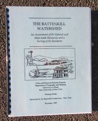
19871337<p>State University of New York at Albany Department of Geography and Planning.~<em>The Battenkill Watershed: An Assessment of Its Natural and Man-made Resources and a Survey of Its Residents</em>.~ Albany NY: the Department 1987 first edition.~ Softcover light blue laminated covers with black lettering and illustration black plastic comb binding sponsored by the Battenkill Conservancy-New York contains "a wealth of information about the existing conditions and emerging issues important to the Battenkill watershed's human and natural environment" numerous GIS color maps graphs charts and black and white photos appendices survey bibliography glossary list of references 148 pages. A nice Battenkill item.~ Near Fine condition inside and out.</p> State University of New York at Albany Department of Geography and Planning paperback
24321723like new. unknown
1610022406London: John Spede Speed John Sudbury Georg George Humble 1610. First Edition . Single Folded Sheet. Near Fine/No Jacket. Image 20 1/2' x 15". 1610 date in both the title block and the printing information block. Original two page map from Speed's atlas in a very strong impression. Very attractive later color coastal water outlines blue with brown along land coastlines inset maps of Bangor and Caernarvon in light blue and orange borders in red shields in red all details nicely colored. Near fine print and coloring strong no tears or repairs very slight dust/soiling in small area in margins adjacent to center fold. Nicely framed with double glaze displaying the atlas pages 123 and 124 on the reverse. <br/> <br/> John Spede (Speed), John Sudbury, Georg (George) Humble unknown
19242090502128300733Not Available 1924. Soft Cover. Fine. The book is in fine condition. Not Available paperback
232930885X.Gpaperback. Good. Access codes and supplements are not guaranteed with used items. May be an ex-library book. paperback
1396575782.Ghardcover. Good. Access codes and supplements are not guaranteed with used items. May be an ex-library book. hardcover
1391541766.Gpaperback. Good. Access codes and supplements are not guaranteed with used items. May be an ex-library book. paperback
0259024597.Gpaperback. Good. Access codes and supplements are not guaranteed with used items. May be an ex-library book. paperback
3563771324.Gpaperback. Good. Access codes and supplements are not guaranteed with used items. May be an ex-library book. paperback