122 315 résultats
16424830DB3 Bände. Franckfurt am Mayn, Wolffgang Hoffmanns Buchdruckerey, 1642–1759. Folio. 1.: Kupfertitel, Titel, (36) Bl. (Porträts), 1185 S., (51) S. (Register), 2 gefaltete Kupfer (Weltkarte), 329 Kupfer im Text; 2.: Kupfertitel, Titel, (2) Bl., 1272 S., (68) Bl. (Register, 57 gefaltete Kupfer; 3.: Titelkupfer, Titel, (2) Bl., 1328 S., (57) Bl. (Register), 45 gefaltete Kupfer. Leder- und Halblederbände.
17997152CB2 Bände (inkl. Tafeln und Karten). Leipzig, Gottfried Martini, 1799–1801. 4°. XXXII, 516 S.; XXIV, 526 S. Mit 52 meist gef. (davon 23 koloriert) Kupfertafeln und 3 Kupferkarten (alt montiert auf einem Blatt, dieses lose). Lederbände der Zeit mit reicher Rücken- und Deckelvergoldung (nicht uniform).
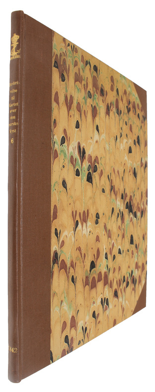
183553813Christiania, Chr. Gröndahl, 1835-64. 4to. Indbundet i 6 senere hshirtbd. (Hefte 6 afvigende indbundet) med rygforgyldning, alle med det originale blå blanke foromslag. Stempel på titelbladene. Velbevarede eksemplarer.
Christiania, Chr. Gröndahl, 1835-64. 4to. Indbundet i 6 senere hshirtbd. (Hefte 6 afvigende indbundet) med rygforgyldning, alle med det originale blå blanke foromslag. Stempel på titelbladene. Velbevarede eksemplarer.
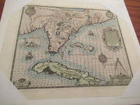
1592026339Frankfurt am Main 1591 1592. Original Antique Map . Single Sheet. Near Fine. Laid Paper. Size: Image And Border Approximately 17 7/8 Inches X 1M.5 Inches 45.2 Cm X 36.75 Cm. Debry Printed His Voyage To Virginia In 1590 As Part I Of His Works But Burden Mapping Of North America Provides No Record That A 1592 Printing Exists. This Map Has No Center Fold But Contemporary Engravings Exist Of The Offices Of The Great 17Th Century Cartographic Publishers With Row Upon Row Of Flat Drawers For Storage Of Single Maps; It Would Be Unreasonable To Believe That None Of These Unbound Maps Survived. This Appears To Be One Of Them Although The Consensus Of Modern Dealers Is That No Unfolded Large Map First Published In A Book Can Exist. Although We Have Been Unable To Locate A 1592 German Edition Of Debry We Believe This Is A Map As Issued In The 1592 German Edition Of De Bry Which Was First Published In 1591 And Subsequently Reprinted In 1592 And 1594 And In The Seventeenth Century. Small Cartouche At Lower Left Monogram With Text "Caesavece Matis. Privilegio Mdxcii" In The Plate Added After Original 1591 Printing. This Is An Unfolded Sheet Which Was Never Bound In A Book; A Strong Impression Without Damage And With Old Light Partial Coloring. Once Quite Aged Then Professionally Cleaned De-Acidified And Mounted Loosely With Archival Materials By A Museum-Experienced Conservator In About 2000. Scarce. And Now 430 Years Later It's Depicting A Hangout For Orangutans. <br/> <br/> unknown
1783340504W. Strahan, J.F. And C Rivington, A. Hamilton etc., London 1786, 1779,1781 + 1783. mehr als 1000 Seiten je Band mit Titelkupfer in Band 1 und mit 145 (von 146) teils gefalteten Kupferstich-Tafeln sowie 78seitigem Index im Tafelband, (more than 1000 pages per volume with title copper in volume 1 and 145 (of 146) partly folded plates (copperplate engravings) and with 78-page index extensive index in the plate volume), 2° (40 x 24 cm), Originalganzledereinbände der Zeit mit Rückentitel, fachmänisch restauriert, Papier ganz vereinzelt leicht braunfleckig, Innendeckel mit Exlibris, insgesamt sehr gute Exemplare mit sauberen Tafeln, (Original all-leather bindings of the period with spine title, professionally restored, paper with occasional slight brown spots, overall very good copies with clean plates),
1 vol. in-4 reliure de l'époque demi-veau vert à petits coins, dos à 4 nerfs plats orné, dos portant l'indication erronée "W. Beattie", Hippolyte Souverain, Paris, 1835, 2 ff., VIII-372 pp. Exceptionnel exemplaire, bien complet des 89 planches indiquées en table (dont la carte dépliante du Lac des Quatre Cantons, et la grande carte routière dépliante de la Suisse par Keller), et des 2 ff. de partition, mais surtout enrichi à l'époque de très nombreux documents, cartes et gravures anciennes, dont plusieurs aquatintes en couleurs, la carte du Mont-Blanc par Picquet, la belle lithographie coloriée du Rigi, de nombreux gravures en couleurs de costumes traditionnels, etc. (voir détail complet ci-après, ou sur demande). Bon état (des rouss. et petits frott., qq. petits accrocs ou défauts signalés aux planches, le relieur a confondu Alexandre Martine et William Beattie, tous deux auteurs d'une "Suisse Pittoresque", à moins qu'il ne s'agisse d'un remboitage lég. postérieur) pour cet exemplaire unique. Détail des planches et documents supplémentaires : - General-Carte der Scwheiz, bey Orell Fussli, 1829 (carte dépliante en couleurs) - Der Canton Zurich 1822 (carte dépliante en couleurs, Orell, Fussli) - Zurich (costumes du canton de Zurich, lithographie rehaussée en couleurs format 10,5 x 14 cm, contrecollé sur support) - Der Canton Bern (carte dépliante en couleurs, Orell, Fussli) - Berne (costumes du canton, lithographie rehaussée en couleurs format 10,5 x 14 cm, contrecollé sur support) - Vue du Château et de la ville de Berthoud (format 9,5 x 7,5 cm contrecollé sur support) - Vue de Neuhaus (format 9,5 x 7,5 cm contrecollé sur support) - Femme de la Vallée de Lauterbrunne (lithographie rehaussée en couleurs numérotée "28") - 2 vues du glacier de Grindelwald ( chacune format 9,5 x 7,5 cm contrecollé sur support) - 2 vues de la Scheideck et Lauterbrounen (chacune format 9,5 x 7,5 cm contrecollé sur support) - Paysage de la Wengen-Alp (aquatinte format 16,5 x 12 cm rehaussée en couleur) - Vue du Wellhorn et Wetterhorn (aquatinte format 15,5 x 11,5 cm rehaussée en couleur) - Chute d'eau près le glacier de Rosenlau (format 9,5 x 7,5 cm contrecollé sur support) - Les bains de la Rosenlau (aquatinte format 16,5 x 11,5 cm rehaussée en couleur, avec mq.) - Der Giesbach am Brienzersee (lithographie dépliante par Labhart et Werner) - Vue du Pont de Zollbrücksur l'Aar (lithographie dépliante de Engelmann, par Villeneuve) - Lucerne (costumes du canton, lithographie rehaussée en couleurs format 10,5 x 14 cm, contrecollé sur support) - Souvenir du Rigi ; Sehnsucht nach dem Rigi, par Hanar (lithographie avec belle vue rehaussée en couleur au recto et partition au verso, format global circa 31 x 48 cm) - L'Auberge du Rigi-Staffel (gravure dessinée par Corrodi, gravée par Weber) - L'Auberge du Rigi-Koulm (gravure dessinée par Corrodi, gravée par Weber) - Chapelle de N. D. de Neiges sur le Righi (format 9,5 x 7,5 cm contrecollé sur support) - Vue de la chapelle de Guillaume Tell (gravure dessinée par Corrodi, gravée par Weber) - Grutli (gravure dessinée par Corrodi, gravée par Weber) - Brunnen (gravure dessinée par Corrodi, gravée par Weber) - Le Lac de Lowertz vers les Mythen (aquatinte format 16,5 x 11,5 cm rehaussée en couleur) - Schwyz (costumes du canton, lithographie rehaussée en couleurs format 10,5 x 14 cm, contrecollé sur support) - Lac de Lowert et Goldau (Lith. de Kaeppelin, par Drulin d'après Dubois, format 11 x 11 cm contrecollé sur support) - La Chapelle de Guillaumetell (gravure dessinée par Fuessli, gravée par Bentz) - Die Cantone Schwyz und Zug (carte dépliante en couleurs, Orell, Fussli) - Zug (costumes du canton, lithographie rehaussée en couleurs format 10,5 x 14 cm, contrecollé sur support) - Zoug (gravure dessinée par Corrodi, gravée par Bodmer) - Der Canton Freyburg (carte dépliante en couleurs, Orell, Fussli) - Gravure de Charles Duc de Bourgogne [Charles Le Téméraire ] (gravure format 21 x 15 contrecollée sur papier fort, Chez Iollain [Jollain ] Paris, s.d. ] - Femme en Costume de Cérémonie (Canton de Fribourg) (lithographie rehaussée en couleurs numérotée "59") - Vue de Morat (lithographie dépliante de Villain dessinée par Pingret - Der Canton Aargau 1822 (carte dépliante en couleurs, Orell, Fussli) - Baden (Lith. de Kaeppelin, par Drulin d'après Dubois, format 11 x 10,5 cm contrecollé sur support) - Femme de la Campagne (Canton d'Argovie) (lithographie rehaussée en couleurs numérotée "63") - Nion (lac de Genève) (lithographie par J. du Bois format 11 x 12,5 cm contrecollée sur papier fort) - Plan de la ville et des environs de Lausanne capitale du Canton de Vaud 1824 (carte dépliante lithographiée, chez Amédée Batard - fort accroc) - La Tour à mon Repos et Mon Repos (2 lithographies contrecollées, par Dubois, lith de Spengler) - Prison pénitentière et Le Signal (2 lith. contrecollées, par Dubois) - Le Château de la Tour du Peil et Mortreux (par Dubois, lith. de Kocher et de Lemercier) - Port d'Ouchy (aquatinte rehaussée en couleurs format 16 x 11 cm) - Neuchatel (lithographie rehaussée en couleurs format 10 x 14 cm) - Plan de Genève publié par Briquet et Dubois (grand plan dépliant en couleurs, lithographié par Kocher et Décor) - Maison où est né Jean-Jacques Rousseau à Genève (vue lith. rehaussée en couleurs format 9,5 x 8 cm, contrecollée sur papier fort) - Château de Ferney-Voltaire à Genève, Chez Manega Frères (vue lith. rehaussée en couleurs format 9 x 9 cm, contrecollée sur papier fort. Au dessous : Intérieur de la chambre de Voltaire à Fernex) - Inscription existante à la vieille route de la Grotte : Carolus Emmanuel II (placard format 29 x 42 cm à la gloire des ducs de Savoie et rois de Sardaigne, évoquant le creusement de la route vers Chambéry) - Mont-Blanc et Alpes adjacentes (grande carte dépliante gravée par Picquet, format 41 x 55 cm) - Eaux Thermales et Minérales de Saint-Gervais, en Savoie, entre Genève et Chamonix. Prospectus (2 feuillets sur papier vert, 1830, chez Routin, Bottero et Alesio, Chambéry) - La Mer de Glace vue du Montaviert (lith. format 10 x 11 cm contrecollée sur papier fort) - On joint, sur f. volant : Grotte du Giesbach (gravure rehaussée en couleurs format 12 x 17 cm) Français
186666425Graz, Selbstverlag von Carl Reichert, 1863-1866. Qu.-4°. Mit 3 (1 farb. u. 2 goldgedr.) chromolithogr. Titelblättern u. 282 (3 gefalt.; statt 294) meist getönten lithogr. Tafeln. 8 Bll., 57 S; 2 Bll., 58 S; 60 S.; 12 S., Mod. Ldr.-Bde. a. 4 Bünden m. blindgepr. Rücken- u. Deckeltiteln in Pp.-Schuber.
1916187677Gotha, Perthes, 1855-1916. 4°. M. zahlr. Taf. u. mehr. Textktn. Meist zwischengeb.: Geogr. Literaturbericht u. Geogr. Monatsbericht. Hldr., OLwd., Hlwd. u. Pp. Einbde. meist berieben, einige stockfl. Einige Rücken angerissen bzw. (fast) lose. Seiten teils etwas stockfl., wenige etwas gewellt durch Lagerung. Teils m. St. a. Vors., Tit., einigen Seiten bzw. Ktn. Einige Seiten u. Ktn. m. kl. Anrissen. Einige Ktn liegen lose bei. Fehlt. Bd. 2 Taf. 11.
16631442Nürnberg, Paul Fürst, 1663. 3 Bll., 314 S., 3 Bll. (Register). 1 Kupfertitel, 64 Kupfertafeln mit 165 (statt 171) Abbildungen, 1 gefalt. Stammtafel. 4°. HLdr. um 1800 mit Rückenschild bestoßen und beschabt). [7 Warenabbildungen]
Paris, l'Auteur & Desnos (vol. I), Chec l'Auteur (vol. 2-3), 1761-62. Folio. (34x28,5 cm.). 3 cont. hcalf. Backs worn, tears to spine ends, hinges weakening, corners bumped. Vol.I: 57 double-folio leaves, all engraved including engraved ornamental title in rococo-style (leaves numb. 1-57). - Vol. II: 70 double-folio leaves, all engraved including double-page engraved title (different from the title in vol. 1) + Table des Matieres. - Vol. III: 60 double-folio leaves, all engraved including double-page engraved title (the same as in vol. II) + Table des Matieres (numb. 71-130). With in all 119 handcoloured engraved maps and astronomical plates. Further 68 other plates with tables, text etc. All maps and illustrations having engraved text on both sides. On good thick paper. A few brownspots, some dampstains mainly marginal, 2 plates with small tears, no loss.
159045982[Likely Antwerp or Amsterdam, circa 1590]. Woodcut ovoid roundel (60 x 75 mm), contemporarily trimmed to just outside neatline and contemporarily mounted to a larger sheet of paper (in excellent condition).
in-4 oblungo, titolo inciso, pp. (4), 75, leg. coeva cart. Con una vignetta al tit., altra in fine e 12 suggestive vedute f.t. (6 disegnate da L. Hess e 6 dal Meyer stesso, che tutte le incise finemente in rame): Am Zuger See, Tells-Kapelle, Altorf, Airolo, Calonico, Quartino, Molinetto, Tresa, Ponte Tresa, Villa Pliniana, Via Mala, Wallenstatter-See. Prima edizione di questa dettagliata relazione illustrata del viaggio nella Svizzera italiana. L'autore (1759-1832) fu noto ritrattista e paesaggista esatto e fine. Esempl. perfetto.. Lonchamp 2058 (Bibliogr. génér. Suisse) e 538 (Estampes e livres à grav. Suisse). Barth 18181..
186253158Paris, Arthus-Bertrand, [1862]. Large folio (ca. 64 x 49 cm). Title-page with etched, coloured and pasted vignette plan of the Church of the Holy Sepulchre, 4 pp., and 14 lithographs by Albert Adam, Charles Claude Bachelier, Hubert Clerget, Charles Fichot, and Jules Gaildrau after F.-E. Pâris (12 printed in colour). Stored loosely, as issued, in original paper wrapper with title and modern brown half cloth portfolio with white cloth ties and giltstamped title lable pasted to upper cover.
In 4° (mm 190X155) Pagg. (8), 365 [ma 371], (25 di indice). Frontespizio in rosso e nero con marca editoriale, testo inquadrato da doppia bordura silografica, 67 incisioni in legno nel testo molte vedute e piante di città alla maniera di Braun and Hogenberg: Constantinopoli, Gerusalemme, Londra, Ginevra, Vienna, Parigi, Anversa, Brussell, Roma (a piena pagina), e molte altre città europee. Vi sono inoltre le descrizioni di Florida, Nova Francia, Nova Spagna, Nova Galicia, Yucatan, Cuba, Brasile, Perù etc. Pergamena parlante del XVII secolo con unghie rimontata, timbrino a secco al piatto anteriore e data incisa in oro, titolo manoscritto al dorso. Tagli blu. Bell’esemplare che presenta alcune pagine arrossate. Adams R 694; Sabin 73000 contains descriptions of Florida, New-France, New-Spain, Nova Galicia, Yucatan, Cuba, Brazil, Peru, etc."; Alden 595; Bachmann 14;Muller 1376.<BR><BR>
187547717Shanghai, London, American Presbyterian Mission Press, Trübner, 1875. 8vo. (2), II, (1), (1 blank), 130 pp. With numerous Chinese characters in text and 3 wood engraved illustrations in text. Contemporary blind- and gold-blocked cloth.
1620546Amsterdam, Hondius, 1621 (Am Ende: Elzevier für Hondius, 1620). 6 Bll., 1075 (recte 1065) S., 1 Kupfertitel mit 57 kleinen Kupferstichkarten im Text und 1 Textholzschnitt. 4°. Blindgeprägtes Schweinsleder der Zeit (stark bestoßen, beschabt und etw. verzogen, Schließbänder fehlen). [5 Warenabbildungen]
185252816Wiesbaden, C. W. Kreidel, [1852]. Small oblong folio (298 x 228 mm). Suite of 10 steel-engraved views, all finely hand-coloured and heightened with gum arabic, tipped to thick brown leaves with printed decorative borders and captions. Original decorated red cloth, gilt.
In-8 gr. (mm. 251x193), 2 volumi: 1 di testo in p. pelle bazana coeva (restaur. per abrasioni), cornice dorata ai piatti, fregi e tit. oro su tassello al dorso, dentelles dorate ai risg., tagli marmorizzati, pp. XII,232. Nell’opera: “Un précis historique des principales révolutions que cette isle a essuyées depuis ses temps connus jusqu’à sa dernière guerre avec les Génois (1761) - Portrait des Corses, leurs moeurs, coutumes, gouvernement, ecc. - Climat, productions et commerce - Description particulière et routier des cotes - Description géographique de la Corse par provinces, avec le détail des pièves et villages qu’elles contiennent”. - 1 Atlante (mm. 293x223), mz. pelle mod. con angoli, stile Settecento, decoraz. e tit oro su tassello al dorso, contenente: 1 tavola di Indice delle carte (a doppia pag.), entro pregevole cornice decorata - 1 carta generale dell’isola divisa in province e 37 carte geografiche e piante (la 6 e la 30 hanno un bis) di cui 4 sono a 1 pagina, 2 più volte ripieg., le restanti a doppia pagina. "Edizione originale", estremamente rara se completa di testo e Atlante. Cfr. Starace “Bibliografia della Corsica”, 189 e 190: “Opera importante”. Solo qualche piccola macchia nel t. altrimenti fresco esempalre, ben conservato.
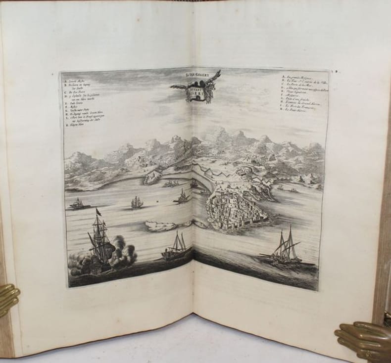
23479Amsterdam, Wolfgang, Waesberge, Boom et van Someren, 1686. In-folio, un frontispice, (3)ff., 534 pp., (11)ff. , illustré de 13 cartes dépliantes dont 1 carte générale de l'Afrique, de 30 planches dépliantes hors-texte, ainsi que de 55 figures in-texte. Petite mouillure marginale au frontispice et à une planche dépliante, minime déchirure à une pliure centrale de la carte générale, à une pliure d'une planche dépliante et en marge de la page 141 ; p.173-176 mal numérotées 175-178. Intérieur très frais. Petit cachet en marge des 3 premiers feuillets "Ernest Kyroux". Veau brun de l'époque, joli ornement à froid sur les plats composé d'un double filet d'encadrement avec fleurons en écoinçons entourant au centre un rectangle peint en noir. Tache au second plat, dos refait au 19ème.
14 volumi in-4, di circa 400 pp. caduno, legature coeve in piena pergamena flessibile, titoli manoscritti ai dorsi. Frontespizi impressi in rosso e nero, con armi araldiche dei nobili dedicatari (diverse per ogni tomo) incise in rame al centro del foglio. Medesimo antiporta allegorico inciso a p.pagina a ogni volume. La più completa edizione, molto aumentata rispetto alla prima (Parma 1690-94 in 4 vol.), di questa diffusa storia universale di tutti i regni e popoli del mondo, dalle origini all'inizio del 18.mo secolo, delle antiche civiltà greche, egizie, dell'Asia Minore, ottomane, europee, della repubblica, monarchia e Impero Romani, della Cina e dell'India, delle varie religioni e fedi, storia e vita dei Papi. Le Americhe non sono comprese nell'opera. Antonio Foresti, padre gesuita, fu l'autore del testo dei primi quattro volumi, altri studiosi, tra i quali Apostolo Zeno, svilupparono e completarono l'opera dopo la sua scomparsa. Vasta opera storica, importante e rara, non citata da molte bibliografie. Esemplare assai raro, completo, ben conservato nella sua prima legatura.. Catalogo Vinciana del '600, n.579 (descrive la seconda ediz. 1711-1718). Be Backer-Sommervogel III, 884..
181859221London, Edward Wallis, [1818]. Hand-coloured copper engraving mounted on canvas in 12 segments (620 x 470 mm). With accompanying pamphlet: 8vo. 20 pp. Contemporary plain brown wrappers. All housed in original marbled box with coloured and mounted illustration on the front.
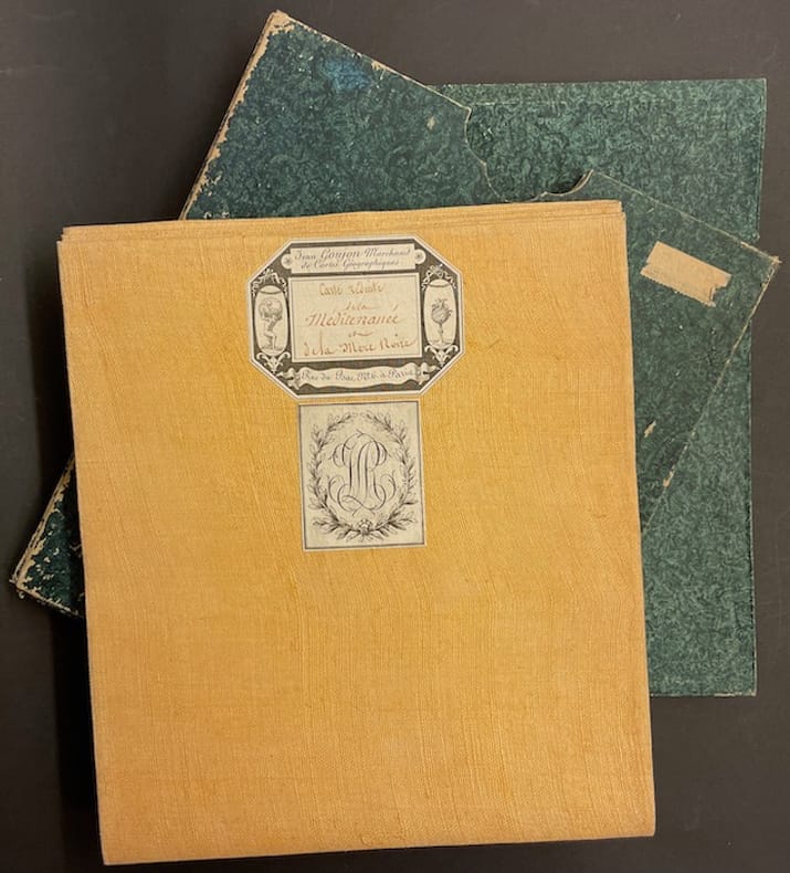
41926A Paris, chez J. S. Gravier, 1808. 82,5 X 195 cm sous étui cartonné d'époque.
176356939Kiøbenhavn, Godiche,1763-81. 4to. Bind 1-6 indbundet i 6 samtidige, ensartede hellæderbind i flammet kalv. Ophøjede bind på rygge. Rig rygforgyldning. Forgyldte tome- og titelfelter. Bind VII afvigende i samtidigt hldrbd. med rig rygforgyldning. Ryg lidt slidt og forreste fals itu. Med alle 296 kobberstukne plancher, kort, prospekter, grundtegninger m.v. (heraf 17 foldekort, incl. det Generelle Danmarkskort 1763). Enkelte kort og plancher med nogle rifter og forstærkninger på bagsiden. Eksemplaret har tilhørt litteraturhistorikeren Carl S. Petersen og bærer hans navn på alle friblade. Udmærket komplet eksemplar på trykpapir.
In-8 gr. (mm. 248x188), 4 volumi, elegante legatura in p. pelle bazana coeva (picc. spacchi alle cerniere), dorso a cordoni con ricche decorazioni e tit. oro su due tasselli, sottili cornici dorate ai piatti, tagli marmorizzati, pp. (4),IV,XVI,(2),XXXII,388; (8),536; (8),394,(2); (4),VIII,367; illustrati f.t., come da Indice, da 52 tavole inc. in rame di cui 30 carte geografiche, più volte ripieg., e 22 magnifiche tavole (anche a doppia pag.) che raffigurano usi e costumi degli indigeni, paesaggi, flora e fauna, scene storiche, tutte molto ben conservate. L’opera, tradotta dall’inglese, è così suddivisa: 1° vol. “Relation d’un voyage fait autour du monde, dans les années 1764, 1765 et 1766, par le Commodore Byron, Commandant le vaisseau du Roi le ‘Dauphin’ (segue) Voyage.. dans les années 1766, 1767, 1768 et 1769, par Philippe Carteret, Ecuyer, Commandant du ‘Swallow Sloup’ de Sa Majesté Britannique” - 2° vol. “Voyage.. dans les années 1766, 1767 et 1768, par Samuel Wallis, Commandant le vaisseau du Roi ‘le Dauphin’ (segue) Voyage.. dans les années 1769, 1770 et 1771, par le Lieutenant Jacques Cook, Commandant le vaisseau du Roi ‘l’Endeavour’” - 3° et 4° volumi “continuation et fin du ‘Voyage du Capitaine Cook”. "Prima edizione della versione francese". Cfr. The Hill Collection of Pacific Voyages (2004),782, per la prima ediz. inglese del 1773: “Important collection chronicling English maritime expeditions. John Byron visited the Tuamoto Islands and Nikunau in what would later be called the Gilbert Islands. Captain Wallis discovered the volcanic island of Tahiti and Morea.. Captain Carteret discovered Pitcairn Island and some remote atolls in the South Seas. The first voyage under the not-yet-famous Captain Cook’s command was primarly of a scientific nature. The expedition was to sail to Tahiti in order to observe the transit of Venus across the disk of the sun, to determine the earth’s distance from the sun, and also to carry on the geographical discovery that John Byron had started. Entering the Pacific around Cape Horn, Cook reached Tahiti in 1769 and carried out the necessary astronomical observations.. Leaving Tahiti in July, Cook discovered, named and charted the Society Islands, and then, heading southwest, explored New Zealand. Cook then headed towards Australia and discovered and charted the eastern coast for 2.000 miles, naming the area New South Wales. He nearly lost his ship on the Great Barrier Reef. Both Australia and New Zealand were annexed by Britain as a result of this voyage, which began in 1768 and ended in 1771. Cook’s discoveries won him prominence, promotion, and the opportunity to sail again. They also ensured J. Hawkesworth’s position in maritime literary history, as the official chronicler of Cook’s first voyage”. Pagine ingiallite per la qualità della carta, altrimenti esemplare ben conservato.