1 748 résultats
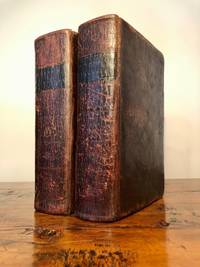
1850019528London and New York: The London Printing and Publishing Company - Limited 1850. First Edition Thus . Half Leather. Good. 11 1/8" Tall. 3 Colored Maps 22 Colored Plates 30 Uncolored Plates. Two Volumes Three Quarter Leather. Volume 1: 944 Pp With 30 Uncolored Plates And One Colored Map "Mexico California And Texas: The Newly Discovered Gold Districts". Volume Ii: 784 Pp With Two Colored Maps Of Canada And 22 Colored Plates All With Yellow Borders And Nice Original Color Throughout. The Map Of Mexico And California Tipped In But Neatly Loosened And Detached Without Intention And Usually Not Present Has Nicely Detailed Illustrations Of The Ruins At Uxmal Yucatan Mexican Peasantry And Gold Washing And Outlines The Gold Districts Of The U S And Mexico In Yellow. No Date Of Publication Indicated But Presumably 1850. Bindings Poor Three Of Four Boards Detached Spines Perished Boards Very Worn And Frayed Deserving Of An Expensive Rebind. Contents Near Fine Clean Maps Perfectly Preserved. Volume I With Additional Illustrated Title Page Showing Penn's Treaty Painted By Benjamin West And Here Engraved By J. Rogers. This Greatly Enlarged Fourth Edition With The Colored California Gold Map Is Uncommon About 7 Holdings Shown In Worldcat; It Is Not Listed In Carl Wheat's "The Maps Of The California Gold Region 1848 - 1857" Nor In The Addendum To The 1997 Martino Reprint Of That Book. <br/> <br/> The London Printing and Publishing Company - Limited hardcover
ria9781138553002_inpMultiple-component retail product. New. New Book; Fast Shipping from UK; Not signed; Not First Edition; The SEND Code of Practice 2015 reinforced the requirement that all teachers must meet the needs of all learners. This set of books provides practical tried and tested strategies and resources that will support teachers in making less unknown
2010SBS-9780754678892ASHGATE 2010. Hardcover. New. ASHGATE hardcover
2010SBS-9780754678892ASHGATE 2010. Hardcover. New. ASHGATE hardcover
2010SBS-9780754678670ASHGATE 2010. Hardcover. New. ASHGATE hardcover
2010SBS-9780754678670ASHGATE 2010. Hardcover. New. ASHGATE hardcover
19672092902140700069Japan Association for the Study of Literature 1967. Soft Cover. Fine. Size: A5 Number of books: 10 Japan Association for the Study of Literature paperback
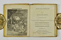
42115London: Printed and Sold by John Marshall 1800. 24mo 93 x 76 mm 68pp. engraved frontispiece and numerous circular woodcuts throughout original publishers yellow boards slit to spine original circular pink printed label to upper boards label on lower chipped away. Originally issued by Marshall in the series The Juvenile or Childs Library which consisted of 19 volumes each devoted to a separate subject i.e. Geography Natural History Arithmetic History Poetry Grammar etc. Osborne I p.177; Welsh Miniature Books 4817. London: Printed and Sold by John Marshall, [1800] hardcover
19852081502111902478China Map Publishing Company 1985. Soft Cover. Fine. Size: B4 hardcover book China Map Publishing Company paperback
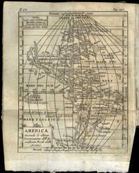
175169769Venezia 1751. 8vo. Samtidig helpergamentbind. 24 442 2 s. Med 19 foldede kobberstukne kart. Appresso Francesco Pitteri Italiensk. <br/><br/><em>På Amerika-kartet er California gjengitt som øy ! Noen eselører materien noe brunplettet bindet med slitasjer i ryggen. </em> unknown
18107540Edinburgh: William Anderson of Stirling 1810. Revised edition. Leatherbound. Good. J. Menzies; T. Clerk engraved maps. 8vo. Pp. xii 952; 830. Frontis. fold-out map each volume. Illustrated with 30 additional engraved fold-out maps. Volumes uniformly bound in contemporary full polished calf gilt titles stamped in black morocco lettering pieces on the spine with gilt rules decorations and volume numbers. Previous owner ink signature "D. B. McNab" on each front free endpaper and ink manuscript index to plates tipped in. T. Kitchin engraving of armillary sphere mounted to front pastedown of vol. 1 and 1841 data table of Scotland's railways and canals to Vol. 2 FFEP. Corners bumped spines with crackling light scuffs and scars to covers leaf edges toned and light foxing throughout top edges soiled all maps intact albeit some with small chips and creases bindings tight. "A compilation where those who read the Newspapers might at once find some account of any particular town or fortress." The casual armchair traveler is also well-served with vivid descriptions. This revision of the 1807 edition has better maps. The Chronological Table leaves off in November 1809 with events of the Napoleonic Wars. <p>Sample of a brief entry: "Oregan or River of the West a river of North America which falls into the ocean in lon. 122.30.W and lat. 43.17.30.N." Though the mythical river had yet to be supplanted by the real Columbia in the listings it appears on the updated map of North America. William Anderson of Stirling unknown
2009SBS-9780754649779ASHGATE 2009. Hardcover. New. ASHGATE hardcover
2009SBS-9780754649779ASHGATE 2009. Hardcover. New. ASHGATE hardcover
34988Quebec.Printed for the Society. 1911-1930. Soft cover. sm4to 26cm being 101 continuousissues the original printed wraps are frayed or chipping along the spinecap on some but over all are in very good condition a rare and importantgeographical periodical. cnds. Quebec.Printed for the Society. 1911-1930 unknown
19912111902156203579Not Available 1991. Soft Cover. Fine. The book is in fine condition. Not Available paperback
2003SBS-9780754632870ASHGATE 2003. Hardcover. New. ASHGATE hardcover
2003SBS-9780754632870ASHGATE 2003. Hardcover. New. ASHGATE hardcover
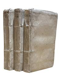
17399338Venice: Appresso Gio: Battista Recurti 1739. Third edition. 3 vols 8vos continuously paginated: 15 408; 409-816; 817-1365pp. plus 3pp publisher's ads. In Italian. Title in vol 1 in red and black. Index. Original thin parchment boards with hand lettered spines. A few leaves in Vol.1 browned and with tide mark to edges boards lightly soiled else a clean set. <br /> <br /> Originally published in 1722 this geographical treatise on the known world went through at least 4 editions through 1769 and was immensely popular. Chiusole 1679-1755 was a well-known historian mathematician and geographer who published several works which added to the Italian knowledge base of the time this geographical work being the most prominent. This text contains a short section on America in vol. III. An attractive set in original binding. <br /> <br /> European Americana 739/66. Appresso Gio: Battista Recurti unknown
18611012614to leather spine and corners with speckled boards maps colored in outline 23 pp. index. Top board almost separated joint split spine and edges are rather worn small piece missing at the top of spine preliminary page loose large folding map has split at the center; maps generally bright and clean. This atlas contains 22 maps that are colored in outline. Includes a nice map of Palestine and a folding map of some of the exploits of Alexander the Great. The atlas also contains an index that provides the latitude and longitude of the places named on the maps. H.G. Bohn,
1861005672Liverpool New York: Charles Magnus & Co. 1861. First Edition Thus . No Binding. Very Good . 28" x 24. Early Civil War Era Display Map Hand Colored Title "Union Military Map" At Top In Red White And Blue And Incorporating The 19" X 14.5" Complete Map Of The Rail Roads At Center Hand Colored With Other Three Maps Below Along With Hand Colored Figures Of Columbia And Justice And A Very Detailed Engraving Of The Capitol With The City Of Washington In The Background. Mounted On Board. The Map Of Rail Roads Has A Copyright Date Hand Corrected In The Printing Plate To 1859; The Map As A Whole Has A Copyright Date At Bottom Hand Corrected In The Plate To 1861. Another Version Probably Later Includes Additional Figures Of Uniformed Soldiers At Both Sides Of The Rail Road Map. In A Simple Yet Solid Black Frame With Uv-Resistant Glass. No Folds Or Tears. Scarce. <br/> <br/> Charles Magnus & Co. unknown
19032111902160200764Kobayashi Jiro 1903. Soft Cover. Fine. Volume: 1 Kobayashi Jiro paperback
19722092902137500425Fukui Prefecture Topography Conference 1972. Soft Cover. Fine. Size: A5 size Number of books: 1 book Fukui Prefecture Topography Conference paperback
ria9781138161023_inpHardcover. New. New Book; Fast Shipping from UK; Not signed; Not First Edition; Provides an introduction to contemporary debates in feminist geography - exploring the diversity and difference which go to make up feminist geography in the 1990s. Introduces key analytical concepts examines the history of the subdisc hardcover
2002mon0000143581Capstone Press 2002-09-01. Library Binding. Good. 0.3386 in x 8.9409 in x 6.0000 in. Capstone Press unknown
1806300804Glasgow: Niven Napier and Khull 1806. hardcover. very good-. Illustrated with some engraved portrait plates and 4 folding maps. 3 volumes. iv 480; iv 476; iv 479 pages. 8vo contemporary full brown calf with red labels; well-rubbed but sound. Glasgow: Niven Napier and Khull 1806. Some crude repairs to folding plates and significant foxing throughout still a very good- copy of this uncommon title.<br/> <br/> Niven, Napier and Khull unknown