COLLECTIFLivre Rare Book
122 314 résultats
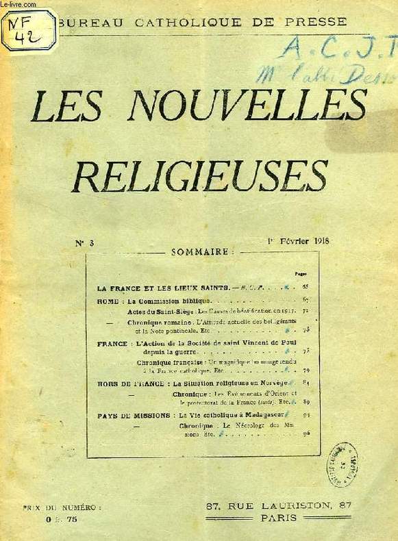
1928RO40189818Bureau Catholique de Presse, Paris. 1918-1928. In-4. Broché. Etat d'usage, Plats abîmés, Dos abîmé, Intérieur acceptable. 223 numéros d'env. 30 pages chacun. Numéros manquants: 1918: n° 1-2; 1920: n° 2, 9-11, 14, 17-18, 20; 1921: n° 1-6, 8, 10-18, 20-21, 24; 1922: n° 1; 1924: n° 7, 14; 1928: n° 17-21. Texte sur 2 colonnes. Etiquettes de code, annotations et tampons de bibliothèque sur les 1ers plats. Couvertures parfois très abîmées et détachées.. . . . Classification Dewey : 270-Histoire et géographie de l'Eglise
Bureau Catholique de Presse, Paris. 1918-1928. In-4 Carré. Broché. Etat d'usage. Plats abîmés. Dos abîmé. Intérieur acceptable. 223 numéros d'env. 30 pages chacun. Numéros manquants: 1918: n° 1-2; 1920: n° 2, 9-11, 14, 17-18, 20; 1921: n° 1-6, 8, 10-18, 20-21, 24; 1922: n° 1; 1924: n° 7, 14; 1928: n° 17-21. Texte sur 2 colonnes. Etiquettes de code, annotations et tampons de bibliothèque sur les 1ers plats. Couvertures parfois très abîmées et détachées. Du n° 3, 1re année, fév. 1918, au n° 16, 11e année, oct. 1928. 23 numéros pour 1918 (avec 1 de Tables). 25 numéros pour 1919 (avec 1 de Tables). 16 numéros pour 1920 (avec 1 de Tables). 6 numéros pour 1921 (avec 1 de Tables). 24 numéros pour 1922 (avec 1 de Tables). 24 numéros pour 1923. 22 numéros pour 1924. 24 numéros pour 1925. 22 numéros pour 1926. 21 numéros pour 1927. 16 numéros pour 1928. Sommaire du n° 3, fév. 1918: La France et les Lieux Saints. Rome: La Commission biblique; Actes du Saint-Siège, Les causes de béatification 1917; Chronique romaine, L'attitude actuelle des belligérants et la Note pontif. France: L'action de la Société Saint Vincent de Paul depuis la guerre; Chronique: Un magnifique hommage rendu à la France catholique. La situation religieuse en Norvège; Les événements d'Orient et le protectorat de la France (suite). Pays de missions: La vie catholique à Madagascar; Le nécrologe des missions, etc. Sommaire du n° 16, oct. 1928: La liturgie de la mort dans l'ordre de saint Dominique (fin), Fr. M.D. Chauvin o.p. Rome, Actes du Saint-Siège. Mgr Suhard. A propos du divorce. L'Eglise catholique en Roumanie. Allemagne, mariages mixtes et divorces. Syrie: La population scolaire de l'Univ. catholique de Beyrouth. Palestine: La YMCA à Jérusalem. Hindoustan: Les fiançailles chez les Khondes. Chine: La béatification des catholiques chinois tués par les Boxers. Amérique: baie d'Hudson: Au milieu des Esquimaux. Les missions d'Océanie...
140086aafConstanz, Pechtische Steindruckerei, o.J. kl. in-8vo, 24 Bl. (jedes Blatt enthält eine lithographische Ill. mit Ortsangabe ohne weiteren Text)., Hs: Paul Schinz 1882 auf Vorsatz / Exlibris Peter E. Obergfell, Original-Pappband, Rücken wurde mal geklebt, mit Schuber, in gutem Zustand.,
18654288Innsbruck, Wagner, 1865. 144 S., 3 Bll. (Inhalt, Abkürzungen, Anzeigen). 5 (teils mehrfach gefalt., teils farbige) lithograph. Tafeln und 1 mehrfach gefalt. farb. lithograph. Karte. 8°. OPp. (etw. bestoßen, Gebrssprn.).
Very Good Turkish, Ottoman (1500-1928) Original map. Oblong atlas folio. (57 x 77 cm). In Ottoman script. Folded. Stains on the upper side. Slightly chipped margins. Filistin haritasi. Scale: 1/250.000. Erkilet was an officer of the Ottoman Army and the general of the Turkish Army. In fall 1941 he, along with General Ali Fuad Erden, visited the occupied territories in Ukraine (including Crimea) on the invitation of Gerd von Rundstedt. From there he and other Turkish officers flew to Rastenburg to meet Hitler in person. In 1943 he published his essays on that trip under the title "What I Saw on the Eastern Front". Being a staunch Turanist, he was briefly detained for Panturkic activities in 1948 together with some other prominent Turanists.
Very Good Turkish, Ottoman (1500-1928) Lithographed Edition. First and Only Edition of this first Turkish book exclusively related to America. This very rare work (both in scarce institutional holdings and market rarity) is the first book in Turkish to describe the discovery and conquest of America. Thus, it is an important and early source on America in the Islamic world. "The first treatise [in Turkish] dedicated exclusively to America" (Strauss). It is printed in a format that is specific to the early printing period of the Ottoman Empire and is written in a tâliq script and has the appearance of a manuscript. It has neither a preface nor a proper title. The heading (serlevha) on the first page which is placed in a decorative floral design reads: "First chapter: On the Islands Discovered by the Venetian and Genoese seafarers, and, secondly, on the discovery of America by Christopher Columbus". It also contains the mandatory praise of the ruler, i.e., Sultan Abdülmecid, and indicates that it was "translated and transferred from some selected writings (ba'z-i evrâk-i müntahabe)". The dramatic events of the discovery and of the different conquests by the Spaniards are vividly described in plain and simple language. Though it is not free from clichés adopted from Western sources, the darker aspects of the European expansion are not omitted. Particular interest is devoted to the fauna and flora of the American continent. The modern territorial divisions of the American continent, and briefly, its political history, are dealt with in a special chapter at the end of the book. This chapter comprises information about both North and South America from the Polar Regions (Arazi-i kutbiyye) and "Russian America" (Amerika-i Rusiyye) to the Banda Oriental (Banda) or the Cisplatine Republic (Çisplatin) and the Province of Patagonia (Patakonya Eyaleti). It takes into account the latest developments. The last event referred to is General Soulouque's takeover in Haiti. "[.] ?in Santa Domingo (Sen Domeng), i.e., the island of Haiti, a general from the Negro people appeared in the Frankish year of 1847 and beat the Spaniards and the French. Assuming the title of 'king', he is known today as Faustin I." (p. 54). In fact, General Soulouque (Emperor of Hayti, (1782-1867)) had assumed the title of 'Emperor' in 1849. His reign lasted until 1859. (Source: Nineteenth-Century Ottoman Americana by Johann Strauss). Original wrappers. Occasionally slight stains on some pages and chipped on front cover, otherwise a very good copy. Roy. 8vo. (23 x 16 cm). In Ottoman script (Turkish with Arabic letters). 56 p. Litho. Only two copies in OCLC: (University of California, Los Angeles & Library of Congress, Karl Süssheim Collection, no. 1717.): 948879228.; TBTK 4412 / 5557.; Özege 1591 / 22639.
18832110502150906360Masaaki Yuki Ironworks 1883. Soft Cover. Fine. Number of books: 1 Masaaki Yuki Ironworks paperback
1971134623Wien, 1884-1971. 4°. M. zahlr. Ktn. u. Abb. Hldr., Lwd., Lwd. u. OBr. Einige Einbde. teils beschabt u. stockfl. Wenige Bind. gelockert. Teils m. Rsign. sowie St. u. Sign. a. Tit. Jeweils zusammengeb.: 50-51 (50 auch einzeln); 63-64; 65-67. Fehlt: Jg. 32 Tit., Taf. 10 + 20; 51 H. 5-6; 55 H. 5-6; 105 H. 1-2.
in-8, pp. (32, le ultime 2 bb.), 136, (24), attraente leg. coeva in p. vitello bruno con bordura a filetti e fregi ovale in oro sui piatti, dorso a nervi decorato in oro, tagli dor. Stemma di Gerusalemme silogr. al tit., iniziali silogr. Nelle pagine prelim. lunga dedica dell'a. ad Ernesto, arcivescovo di Colonia e vari componimenti poetici in lode dell'autore e dell'opera. Seconda edizione in latino (la prima apparve 1585) di quest'opera assai rara che in 270 paragrafi descrive dettagliatamente le porte, le strade e gli edifici principali della Città Santa, con particolare riguardo al Tempio, ed i luoghi vicini così come dovevano essere al tempo di Gesù Cristo; contiene inoltre brevi cenni storici sulla vita, passione e morte di Cristo e di vari santi. In fine sono elencate 36 fonti utilizzate dall'autore. Chr. Adrichem, latinizzato in Andrichomius (Delft 1533 - Colonia 1585) dedicò la propria vita allo studio della Terra Santa, componendo anche altre importanti opere, tra cui il ''Theatrum Terrae Sanctae''. (Esempl. con vari lavori marginali di tarlo che toccano il testo in alcuni fogli).. Adams A-189. Index Aureliensis 100.711. Enclop. Treccani, I, 557..
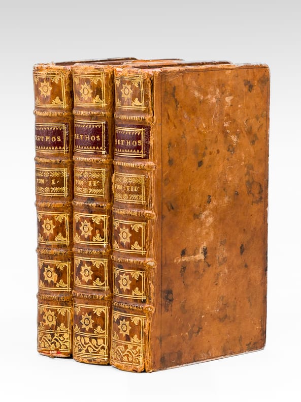
1731693623 vol. in-12 reliure de l'époque plein veau marbré brun, dos à 5 nerfs orné, Chez Jacques Guérin, Paris, 1731, I : 2 ff., XVIII-426-XII pp. et 1 f. n. ch. avec une carte dépliante ; II : 2 ff., pp. [428]-562 et 1 f. blanc, 322 pp. et 1 f. n. ch. avec une carte dépliante ; III : 2 ff., pp. [323]-842, 3 ff. n. ch.
Dédiée et Présentée à Monsieur le Duc de Lauzun, Colonel Propriétaire des Volontaires Etrangers, Gouverneur du Sénégal, Chevalier de l'Ordre Royal et Militaire de Saint Louis, 1 carte entoilée format 29,5 x 66 cm rehaussée en couleurs à l'aquarelle, Chez l'Auteur, rue et Collège des Cholets, près la Nouvelle Eglise de Ste Geneviève, 1779 Un long texte de "Description de la Côte Occidentale de la Guinée Septentrionale et du Cours des Fleuves du Sénégal et de la Gambie" encadre la carte, qui propose notamment le détail d'une "Vue de l'Isle de Gorée", le "Plan du Fort St Louis", le "Plan de James-Fort", le "Plan du Fort Saint Joseph" et la "Carte de l'Entrée de la Rivière du Sénégal". Le texte commence par une évocation des Normands qui "formèrent des Etablissements sur les Côtes occidentales de l'Afrique dès l'an 1364, il subsiste un traité d'association de commerce sur ces Côtes du mois de Septembre 1863 entre les Négocians de Dieppe et ceux de Rouen", cela pour introduire, sans la citer nommément,la "Compagnie normande" qui établira des comptoirs "au Sénégal, à Rufisque et sur la Gambie", depuis le "Cap Cantin jusqu'au Cap Blanc". Les Anglais s'en emparent en 1758 jusqu'à la capitulation du Fort du Sénégal au Duc de Lauzun le 28 janvier 1779 [Lauzun se distinguera deux ans plus tard en 1781 lors de la victoire de Yorktown). Il évoque la Guinée Septentrionale renferme les "Royaumes d'Ovale ou de Brae, des Foulles ou Siratiques, celui de Galam le long du Sénégal d'Orient en Occident, celui de Bambouc qui est rempli de riches Mines d'Or, mais les Princes et les Peuples qui y vivent n'y souffrent point d'Etrangers, il n'y a que les Marchands Mandingues et Sousos qui [ ... ] y conservent quelques relations". "Les Jaloffes et les Felouppes sont les principaux peuples qui habitent les environs de la Gambie [... ]". Le texte insiste sur la richesse du sol et sur la culture des épices qu'il doit être possible d'y établir : "L'Or, les Gommes, le Coton, l'Indigo, les Cuirs, la Cire, les Plumes d'Autruche, les Dents d'Eléphants, la Civette, l'Ambre gris et la Traite des Nègres ne seroient plus alors les seuls objets qui nous fixeroient sur ces parages : le Canellier, les Gérofliers et tous les autres Arbustes dont les Isles d'Amboine, de Ternate et Tidot abondent y réussiraient...". Suit l'exposé historique de la découverte de la côte et de l'établissement des forts. Bon état (qq. petites traces d'usage, étiquette manuscrite au verso : "Carte du Sénégal, de l'Isle de Gorée et Plans des Forts St Louis, St Joseph et James Fort"). A long text of "Description of the West Coast of Northern Guinea and the Course of the Rivers of Senegal and Gambia" frames the map, which offers in particular the detail of a "View of the Isle of Gorée", the " Plan of Fort St Louis", the "Plan of James-Fort", the "Plan of Fort Saint Joseph" and the "Map of the Entrance to the Senegal River". The text begins with an evocation of the Normans who "formed Establishments on the Western Coasts of Africa from the year 1364, there remains a treaty of trade association on these Coasts of September 1863 between the Negotiators of Dieppe and those of Rouen", this to introduce, without mentioning it by name, the "Compagnie normande" which will establish counters "in Senegal, Rufisque and Gambia", from "Cap Cantin to Cap Blanc". The English seized it in 1758 until the capitulation of the Fort of Senegal to the Duke of Lauzun on January 28, 1779 [Lauzun will distinguish himself two years later in 1781 during the victory of Yorktown). It evokes Northern Guinea containing the "Kingdoms of Ovale or Brae, Foulles or Siratiques, that of Galam along the Senegal from the East to the West, that of Bambouc which is filled with rich Gold Mines, but the Princes and the Peoples who live there do not suffer from Foreigners, there are only the Mandinka and Sousos Merchants who [ ... ] keep some relations there". "The Jaloffes and the Felouppes are the principal peoples who inhabit the environs of The Gambia [...]". The text insists on the richness of the soil and on the cultivation of spices that it must be possible to establish there: "Gold, Gums, Cotton, Indigo, Leather, Wax, Feathers of Ostrich, Elephant's Teeth, Civet, Ambergris and Traite des Nègres would no longer be the only objects that would fix us on these parts: the Canellier, the Gérofliers and all the other Shrubs including the Isles of Amboyna , de Ternate and Tidot abound would succeed...". This is followed by the historical account of the discovery of the coast and the establishment of the forts. Good condition (some small traces of use, handwritten label on the back: "Map of Senegal, Isle of Gorée and Plans of Forts St Louis, St Joseph and James Fort"). Français
141296aafGlarus, Schmid und Zürich, Orell Füssli, 1872-1878, gr. in-4to, Bd. 1 (1871) bis 2 (1872) und 4 (1873) 5 & 6 (1874). + FORTSETZUNG: Neue Alpenpost. Special-Organ für Alpenkunde, Touristik, Balneologie, Hotellerie etc. Redigiert von J.E. Grob und J.J. Binder. Bd. 3 (1876) bis 7 (1878). Insges.: 10 Jrg. in 8 Bände, uneinheitliche meist Hlwd., etwas abgegriffen.
138883aafBerne, Lithographie & Verlag von J. Frch Wagner, 1836, Qu.-8vo. Titelblatt und ‘Zeichen-Erklärung’ auf Innenumschlag aufgezogen + 72 lith. Detailkarten, nummeriert 1 bis 27, 27 1/2, 28-47, und 49-72, so vollständig, Exlibris Peter E. Obergfell, H.-Pergament, Buntpapier auf den Deckeln berieben, Titelschildchen auf dem Rücken.
138973aafBerne, Lithographie & Verlag von J. Frch Wagner, 1836, Qu.-8vo. Titelblatt und ‘Zeichen-Erklärung’ auf Innenumschlag aufgezogen + 72 lith. Detailkarten, nummeriert 1 bis 27, 27 1/2, 28-47, und 49-72, so vollständig, Halbleder, Buntpapier auf den Deckeln berieben, Titelschildchen auf dem Rücken.
106140Guelverbyti (Wolfenbüttel), Impendis Viudae Conradi Bunonis, Typis Caspari Johannis Bismarci 1686, 215x170mm, frontispice gravé sur cuivre - titre imprimé en deux couleurs - 13 ff. + 607 pages + 50 ff. (Index) + 16 ff. (Index posterior), collation effectuée: 1 planche, 4 tables dont 2 dépliantes et 42 cartes dépliantes dont une détachée et une autre avec une déchirure (sans atteinte d’illustrations). Reliure parchemin de l’époque avec noms de possesseurs du XVIIIe siècle sur les plats.
18502744DBca. 1850. Folio. Roter Maroquineinband mit Rücken- und Deckelvergoldung.
187057582ABBerlin, Lithographische Anstalt von Leopold Kraatz., (Ca. 1870). 14x21 cm. Blattgrösse 22,5x33,5 cm. Handschriftlicher Titel und 12 lithographierte Ansichten auf Japanpapier. In losen Blättern. [3 Warenabbildungen]
187057582ABBerlin, Lithographische Anstalt von Leopold Kraatz. (Ca. 1870). 14x21 cm. Blattgrösse 22,5x33,5 cm. Handschriftlicher Titel und 12 lithographierte Ansichten auf Japanpapier. In losen Blättern.
17534079DB2 Bände. Koopenhagen. Franz Christian Mumme. 1753-54 1.: 367 S. mit 16 Kupferstichen, 2.: 536 S. mit 14 Kupferstichen. Kalbslederband mit Rückenvergoldung und geprägtem Rückenschild. Mit marmorierten Vorsätzen. Berieben und bestossen.
168429632ABFranckfurt, Johann David Zunner, [1684]. 1 gestochener Titel, 2 gestochene Portraits, 110 (von 113) Kupfertafeln, (4 Bl.), 138 S., (5 Bl. Register). Pappband der Zeit (Kanten stärker bestoßen, oberes Kapital fixiert). 1. Band (von 5).
Cartella edit. in tela (dorso e patelle interne rifatti) contenente 33 (su 34) carte geografiche telate, per lo più a colori, relative all’"Italia Centrale" e così composto (come da Indice):<br> - mm. 400 x 580 <br> Provincie di: Ancona - Arezzo - Ascoli Piceno - Bologna - Civitavecchia - Comarca di Roma - Prov. di Ferrara - Circondario di Fermo - Prov. di Firenze - Forlì - Delegaz. di Frosinone - Prov. di Grosseto - Livorno e Pisa - Lucca e Massa Carrara - Macerata - Rep. di San Marino - Circ. di Orvieto - Circ. di Perugia e Foligno - Prov. di Ravenna - Circ. di Rieti - Prov. di Rovigo e Ferrara - Siena - Circ. di Spoleto e Terni - Prov. di Urbino e Pesaro - Deleg. di Velletri - di Viterbo.<br> - mm. 585 x 730 <br> Provincie di: Parma e Piacenza - Reggio nell’Emilia e Modena - Toscane - Toscane: Orografiche e idrografia.<br> - mm. 585 x 800 <br> Carte corografiche di: Reggio d’Emilia, Modena, Bologna, Ravenna, Forlì e parte limitrofe di Firenze e Ferrara - Provincia di Roma.<br> - mm. 1135 x 975 <br> Nuova carta topografica della Campagna di Roma Antica e Moderna.<br> "Manca" la carta dell’Italia Centrale. Esempl. ben conservato.
Supplemento mensili illustrati del Secolo - Collana Le cento città d'Italia. Anno XXVII-XXVIII-XXIV-XXIX-XXX-XXXI - Gennaio/Dicembre 1892-1896 - Serie VI/Serie X - Disp. 61-120 - In folio - pp.96 pp. a volume - Mezza pelle con titolo e fregi in oro al dorso - Cinque volumi in un tomo - Illustrazioni in b/n nel testo e fuori testo - Testo su più colonne - Abrasioni al dorso in parte staccato
In-8 gr. (mm. 270x178), bella legatura in p. pelle coeva, deliziose cornici dorate e a secco ai piatti, dorso a cordoni con ricca decorazione e titolo oro (lievi aloni ai risg.), tagli dorati. Il volume, di pp. (8),197, con frontespizio inciso figurato, è molto ben illustrato da 60 tavole f.t., tutte inc. su acciaio: sono bellissime vedute di città e paesaggi italiani, dalle Alpi a Napoli e da Venezia, il lago Maggiore, Domodossola e il Sempione. A chiusura dell’opera un magnifico grande finale inciso, con il Vesuvio in eruzione. Interessante resoconto di un viaggio in Italia compiuto nel 1817 dall’artista inglese Elisabeth Batty, nota pittrice di paesaggi. Cfr. Benezit,I, p. 863. Come sovente, anche nel ns. esempl. le tavole hanno lasciato l’”ombra” dell’immagine sulla pagina di testo a fronte. A parte questo difetto, il volume, su carta distinta, è fresco e molto ben conservato. .
Grande carte en deux parties, format global : 69 x 99 cm, frontières rehaussées en couleur, A Paris, Chez Delamarche, Géographe, rue du Foin St Jacques, au Collège de Mtre Gervais, s.d. [circa 1787-1795 ] Très belle et grande carte d'Afrique (à ne pas confondre avec les tirages plus réduits, bien plus courants), reprise par Delamarche de la carte publiée chez Lattré en 1778. Ornée d'un cartouche très décoratif (roi africain étendu sur un lion, sous son parasol), cette carte unit des références encore mythiques sur une mystérieuse Afrique de l'intérieur encore inconnue à une très grande précision géographique, pour les zones côtières. Bon état (qq. petites mouill.) pour cette carte méritant un encadrement qui pourra la mettra en valeur. Français
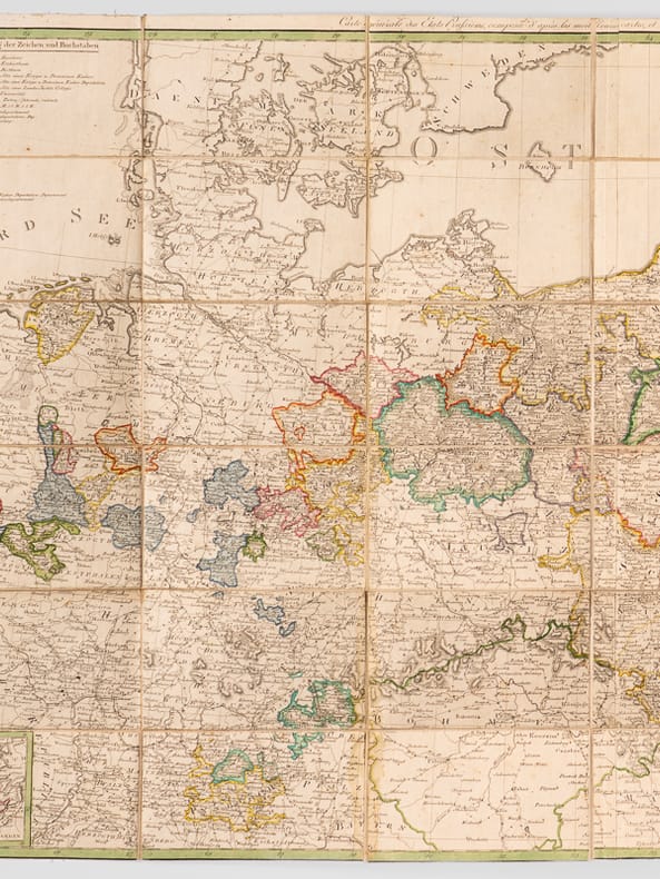
180262067General Karte von den Konig: Preussischen Staaten, nach den neuestenund zuverläfsigsten Hülfsmitteln auf das genauste entworfen, une herausgegeben im Jahre 1799 - Carte générale des Etats Prussiens composée d'après les meilleurs cartes, et les pièces les plus authentiques ; publiée l'an 1799, 1 grande carte dépliante format 102,3 cm x 64,8 cm, frontières rehaussées à l'aquarelle, Gestochen von Jäck in Berlin, s.d. [ 1802 ]