Geographie, La Societe deBiblio.com
1 748 résultats
0282101039.Gpaperback. Good. Access codes and supplements are not guaranteed with used items. May be an ex-library book. paperback
0483488321.Gpaperback. Good. Access codes and supplements are not guaranteed with used items. May be an ex-library book. paperback
1606182261606. Persici Vel Sopho Rum Regni Typus 1606 presents an early seventeenth century European cartographic rendering of Safavid Iran documenting how Persia was geographically understood and visually represented during the height of Safavid political authority. The map identifies the region within a broader network of imperial borders extending toward Russia and India and includes Kabul within the Persian sphere reflecting contemporary geopolitical conceptions rather than modern national boundaries. The Caspian Sea is depicted horizontally indicating an early stage in European geographic knowledge prior to the standardization of its vertical orientation. The Persian Gulf appears under the Latin designation "Sinus Arabicus" demonstrating period naming conventions and the fluidity of regional terminology in European mapmaking. Produced during the Age of Discovery the map participates in the circulation of geographic knowledge that accompanied expanding diplomatic commercial and intellectual engagement between Europe and the Islamic world.<br /> <br /> Hand colored engraved map dated 1606 measuring approximately 21.5 x 18 inches with text in Latin. The composition includes detailed delineation of mountain ranges waterways and settlements the latter indicated by small colored markers distributed across the landscape. Decorative cartouches frame descriptive text including a prominent circular panel reading "Persici Vel Sopho Rum Regni Typus." Verso contains French text referencing "le royaume des perses of l'empire des sophy" further situating the map within a European print context of translation and dissemination. The map is rendered in shades of pink gold and turquoise with coloring applied by hand at an undetermined date.<br /> <br /> Issued during the Safavid dynasty which maintained extensive political and dynastic connections across the Caucasus and surrounding regions the map reflects both European interest in Persia and the integration of Persian territories into broader early modern world mapping traditions. Its geographic features and naming conventions provide evidence of evolving European understanding of the Middle East and Central Asia during a period of intensified cross cultural contact. Central fold mark present with a few small tears along the lower edge not affecting image or text. One small ink mark at left margin also not affecting the image. Colors remain strong and impressions clear. Overall very good. unknown
1020328541.Ghardcover. Good. Access codes and supplements are not guaranteed with used items. May be an ex-library book. hardcover
1019523743.Ghardcover. Good. Access codes and supplements are not guaranteed with used items. May be an ex-library book. hardcover
B9781019523742Hardback. New. hardcover
0344066207.Gpaperback. Good. Access codes and supplements are not guaranteed with used items. May be an ex-library book. paperback
19172091502135307435Chiba shoten 1917. Soft Cover. Fine. Number of books: 1 Chiba shoten paperback
1931397309.Gmap. Good. Access codes and supplements are not guaranteed with used items. May be an ex-library book. unknown
190612199AB1906. Vol. XVIII no. 208. Tokyo Tokyo-Chigaku-Kyokwai 1906. 26 : 19 cm. With one coloured manyfolded map. Original wrappers. The map is a geological map of the southern Part of Shengking Province. With articles on: 'Manchuria during the military operation from 1904 to 1905' 'A sketch of eastern Taiwan' 'Hot springs of Korea' 'Freezing of Lake Suwa' etc. unknown
19842091202133202467Kashiwashobo 1984. Soft Cover. Fine. Number of books: 9 books in total Kashiwashobo paperback
18832110502150906360Masaaki Yuki Ironworks 1883. Soft Cover. Fine. Number of books: 1 Masaaki Yuki Ironworks paperback
19362090202123004950Kokinshoin 1936. Soft Cover. Fine. The book is in fine condition. Kokinshoin paperback
141901s-Gravenhage Nederlandsche Maatschappij voor Grond-Krediet-Gebr. J. & H. van Langenhuusen. 1868. Original publisher's ivory coloured paper-covered boardsblack title frontcover 4to: viij 274pp. iv 3 large folding maps & 1 table at the rear appendices references. Spine missing - frontcover loose - bookblock fine. s-Gravenhage, Nederlandsche Maatschappij voor Grond-Krediet-Gebr. J. & H. van Langenhuusen. 1868 hardcover
20002083002117500292Akashishoten 2000. Soft Cover. Fine. The book is in fine condition. Akashishoten paperback
19862090202120400783Yumanishobo 1986. Soft Cover. Fine. Number of books: 1 Yumanishobo paperback
19382082402113508916Chuko-kan 1938. Soft Cover. Fine. Volume: 1 Chuko-kan paperback
19412083002116202887Geography Research Society 1941. Soft Cover. Fine. Number of books: 3 Geography Research Society paperback
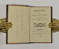
41226Huddersfield: Printed and Sold by Brook and Lancashire 1802. Fist and only edition 12mo 114 x 70 mm 4 13-124pp. with half-title endpapers renewed later quarter morocco marbled boards. Provenance: Contemporary ownership ink signature of Mary Mason. This collates as the only other known copy at The Bodleian Library Oxford. Huddersfield: Printed and Sold by Brook and Lancashire, 1802 hardcover
19942111902160306359Shimoina Magazine Editorial Board 1994. Soft Cover. Fine. Number of pages: 489 pages Size: B5 size Shimoina Magazine Editorial Board paperback
19342092902137405958Kokinshoin 1934. Soft Cover. Fine. Number of books: 1 book Kokinshoin paperback
19902083002115711103Jomoshinbunsha 1990. Soft Cover. Fine. Number of pages: 303p Size: 19cm Number of books: 1 Jomoshinbunsha paperback
20002091502133905461Kei Jin bunka-sha 2000. Soft Cover. Fine. Volume: 1 Kei Jin bunka-sha paperback
19752091502135308118Geirin-sha 1975. Soft Cover. Fine. Volume: 1 Geirin-sha paperback
19732081002108301669Masterpiece publication 1973. Soft Cover. Fine. Number of books: 1 Masterpiece publication paperback