1 748 résultats
18832110502150906360Masaaki Yuki Ironworks 1883. Soft Cover. Fine. Number of books: 1 Masaaki Yuki Ironworks paperback
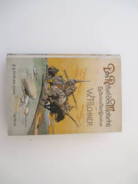
190812208AB1908. 2. edition. Berlin Mittler and Sohn 1908. 25 : 175 cm. XVII 438 pages 1 leaf With 3 portraits 64 plates some sketches and illustrations in the text and 3 folded maps. Coloured illustrated original-cloth. "Report of a journay from the upercourse of the river Hwang-ho called Matchu to the head of the 'Yellow River'. Important work on north-east Tibet with description of the Ngolok-nomadic tribes. Filcher himself calls the contents of the book as 'a scientific exploration of north-east Tibet'. - In the original illustrated editors binding. hardcover
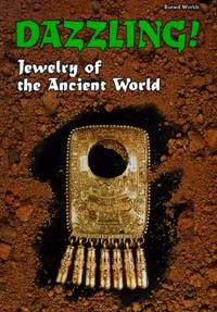
1995Q-0822532034Runestone Press 1995-12-01. Library Binding. New. In shrink wrap. Looks like an interesting title! Runestone Press unknown
0259551287.Gpaperback. Good. Access codes and supplements are not guaranteed with used items. May be an ex-library book. paperback
0365996505.Gpaperback. Good. Access codes and supplements are not guaranteed with used items. May be an ex-library book. paperback
048389527X.Gpaperback. Good. Access codes and supplements are not guaranteed with used items. May be an ex-library book. paperback
0364970588.Ghardcover. Good. Access codes and supplements are not guaranteed with used items. May be an ex-library book. hardcover
0366008994.Gpaperback. Good. Access codes and supplements are not guaranteed with used items. May be an ex-library book. paperback
0428413048.Ghardcover. Good. Access codes and supplements are not guaranteed with used items. May be an ex-library book. hardcover
065658789X.Gpaperback. Good. Access codes and supplements are not guaranteed with used items. May be an ex-library book. paperback
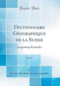
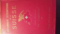
69051Neuchâtel Attinger Frères Éditeurs 1902-1910 Auflage: 1. Halbleder gebunden; rotes goldgeprägtes illustriertes Überzugspapier rote goldgeprägte Rücken blau marmorierter Schnitt / 6 Bände / Anz. Seiten: 704 768 771 768 768 1136 / 20 x 275 cm / mit zahlreichen Schwarzweissabbildungen Schemata und Karten davon einige ausfaltbar und in Farbe / Zustand: gut leichte Gebrauchsspuren; Buchblock angeplatzt Bde. 3 5 untere Ecken etwas beschabt Bde. 1 2 2 Ecken leicht bestossen Bd. 6 Gelenke gelockert Bde. 3 4 einzelne Seiten etwas bestossen oder leicht eingerissen Sous la direction de Charles Knapp professeur à l'académie de Neuchâtel Maurice Borel Cartographe et V. Attinger éditeur; tome 1: AA-Engadine tome 2: Engadine - Langenberg tome 3: Langenberg - Pyramides tome 4: Quader - Sovrana tome 5: Soyhières - Tofa tome 6: Toffen - Zybachsplatte et Supplément Neuchâtel, Attinger Frères, Éditeurs, 1902-1910, Auflage: 1. unknown
56827Neuchâtel Attinger Frères Éditeurs 1902-1910 Auflage: 1. Halbleder gebunden; grün marmoriertes Überzugspapier brauner goldgeprägter Rücken / 6 Bände / Anz. Seiten: 704 768 771 768 768 1136 / 205 x 28 cm / mit zahlreichen Schwarzweissabbildungen Schemata und Karten davon einige ausfaltbar sowie 1 Farbkarte / Zustand: gut mässige Gebrauchsspuren; Einbände berieben und etwas fleckig Kopfschnitt bestaubt Papier leicht gebräunt und teilweise leicht fleckig Schnitt fleckig Vorsatz knickspurig Bd. 1 Vortitel knickspurig Bd. 3 u. 4 Sous la direction de Charles Knapp professeur à l'académie de Neuchâtel Maurice Borel Cartographe et V. Attinger éditeur; tome 1: AA-Engadine tome 2: Engadine - Langenberg tome 3: Langenberg - Pyramides tome 4: Quader - Sovrana tome 5: Soyhières - Tofa tome 6: Toffen - Zybachsplatte Neuchâtel, Attinger Frères, Éditeurs, 1902-1910, Auflage: 1. unknown
0366394568.Gpaperback. Good. Access codes and supplements are not guaranteed with used items. May be an ex-library book. paperback
0366394584.Ghardcover. Good. Access codes and supplements are not guaranteed with used items. May be an ex-library book. hardcover
1902170016Complete set of six volumes in original bindings. Abundantly illustrated with photos maps and line drawings. Marbled page edges and bound-in errata.<br />1902 edition still a must for anyone interested in Swiss geography.<br />1st volume: 704 pages Aa-Engadine dated 1902<br />2nd volume: 768 pages Enga-Lange dated 1903<br />3rd volume: 771 pages Lange-Pyra dated 1905<br />4th volume: 768 pages Quad-Sovr dated 1906<br />5th volume: 768 pages Soyh-Tofa dated 1908<br />6th volume: 1136 pages Toffen-Zybachsplatte et Supplément dated 1910<br />REASONABLE OFFERS CONSIDERED.<br />All bindings in perfect condition except the first volume which shows a small split. Attinger frères hardcover
19362090202123004950Kokinshoin 1936. Soft Cover. Fine. The book is in fine condition. Kokinshoin paperback
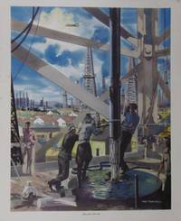
#[37841]London Macmillan ca. 1950. A vibrant designed poster by Mac Tatchell in bright colours. Ca. 43 x 535 cm. A set of industrial pictures was produced by educational publishers Macmillan designed to engage children in British history drawn by a range of artists used in classrooms across the UK in the 50s. unknown
3385009448.Gpaperback. Good. Access codes and supplements are not guaranteed with used items. May be an ex-library book. paperback
3386633358.Ghardcover. Good. Access codes and supplements are not guaranteed with used items. May be an ex-library book. hardcover
3386630871.Gpaperback. Good. Access codes and supplements are not guaranteed with used items. May be an ex-library book. paperback
48673797like new. unknown
141901s-Gravenhage Nederlandsche Maatschappij voor Grond-Krediet-Gebr. J. & H. van Langenhuusen. 1868. Original publisher's ivory coloured paper-covered boardsblack title frontcover 4to: viij 274pp. iv 3 large folding maps & 1 table at the rear appendices references. Spine missing - frontcover loose - bookblock fine. s-Gravenhage, Nederlandsche Maatschappij voor Grond-Krediet-Gebr. J. & H. van Langenhuusen. 1868 hardcover
1606182261606. Persici Vel Sopho Rum Regni Typus 1606 presents an early seventeenth century European cartographic rendering of Safavid Iran documenting how Persia was geographically understood and visually represented during the height of Safavid political authority. The map identifies the region within a broader network of imperial borders extending toward Russia and India and includes Kabul within the Persian sphere reflecting contemporary geopolitical conceptions rather than modern national boundaries. The Caspian Sea is depicted horizontally indicating an early stage in European geographic knowledge prior to the standardization of its vertical orientation. The Persian Gulf appears under the Latin designation "Sinus Arabicus" demonstrating period naming conventions and the fluidity of regional terminology in European mapmaking. Produced during the Age of Discovery the map participates in the circulation of geographic knowledge that accompanied expanding diplomatic commercial and intellectual engagement between Europe and the Islamic world.<br /> <br /> Hand colored engraved map dated 1606 measuring approximately 21.5 x 18 inches with text in Latin. The composition includes detailed delineation of mountain ranges waterways and settlements the latter indicated by small colored markers distributed across the landscape. Decorative cartouches frame descriptive text including a prominent circular panel reading "Persici Vel Sopho Rum Regni Typus." Verso contains French text referencing "le royaume des perses of l'empire des sophy" further situating the map within a European print context of translation and dissemination. The map is rendered in shades of pink gold and turquoise with coloring applied by hand at an undetermined date.<br /> <br /> Issued during the Safavid dynasty which maintained extensive political and dynastic connections across the Caucasus and surrounding regions the map reflects both European interest in Persia and the integration of Persian territories into broader early modern world mapping traditions. Its geographic features and naming conventions provide evidence of evolving European understanding of the Middle East and Central Asia during a period of intensified cross cultural contact. Central fold mark present with a few small tears along the lower edge not affecting image or text. One small ink mark at left margin also not affecting the image. Colors remain strong and impressions clear. Overall very good. unknown
2004x-073910764XLexington Books 2004. Hardcover. New. 200 pages. 9.00x6.00x0.75 inches. Lexington Books hardcover
152782165X.Gpaperback. Good. Access codes and supplements are not guaranteed with used items. May be an ex-library book. paperback