Petermann, A[ugust]Biblio.com
313 résultats
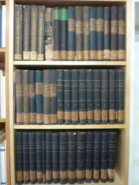
185832039AB1858. alle Bände in Originalausgabe Gotha J. Perthes 1858-1906 4° jeder Band zwischen ca. 300 und 500 S. mit zahlr. oftmals farbigen Ausklapp-Tafeln und Falt-Karten die ersten 4 Bände 1858-1863 als schwarze original Leineneinbände mit goldener Deckel- und Rückenbeschriftung sowie reicher Deckelbildprägung der Band 1868 als schlicher schwarzer Pappband der Zeit dann 1870-1906 Halbleinen-Einbände der Zeit mit Rückenschildern bzw. goldener Rückenbeschriftung und Musterpapierbezügen alle Bände unten mit Rückensignaturschildchen die Rückenkanten der ganz frühen Bände stellenw. angeplatzt wenige Bände oben am Rücken etwas angerändert beim schlichten Pappband von 1868 der Rücken beschädigt und mit Fehlstellen innen aber bindungsstabil die Vorsatz- und/oder Titelseiten aller Bände mit schönem alten Rundstempel und handschriftlicher Signaturnummer der Lehrerbibliothek eines alteingesessenen Frankfurter Gymnasiums sonst gute saubere und augenscheinlich auch vollständige sowie offenbar kaum je benutze Exemplare augenscheinlich vollständig aber nicht eingehend kollationaliert. Vorhanden die Bände 1858 4. Jahrgang 1861 1862 1863 und 1868 bis 1906 51. Jahrgang sowie 3 separat gebundene Inhaltsverzeichnisse 1865-1874 / 1875-1884 / 1885-1894. Der komplette Titel der fühen Bände lautete: 'Mittheilungen aus Justus Perthes' Geographischer Anstalt über wichtige neue Erforschungen auf dem Gesammtgebiete der Geographie'. Ohne die separat erschienen 'Ergänzungshefte'. Abholung im Ladengeschäft in Frankfurt am Main Nordend ggü. Musterschule möglich. Das spart die Portokosten. Pickup at the store in Frankfurt am Main Nordend close to Musterschule is possible. It saves the shipping costs. unknown
1823biblio8xx 208 8 pp 4 plates folded. very fine. very rare. Pictures on demand. Please contact me ramrozzi@yahoo.fr<br />
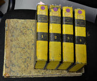
1801biblio23<p>Paris. Louis 1801. Hardcover. In five parts 8vo four text parts ; oblong 4to Atlas. 2456 pp. I: lvi 495; II: 619; III: 589; IV: 593; Title page iv two tables x pp. half title 86 engraved plates. Uniform near contemporary half calf over marbled boards with pines painted yellow edges yellow text volumes and near contemporary quarter calf over marbled boards gilt title on the spine atlas.Rare first edition of a fine illustrated work by the father of modern crystallography.</p><p>Lacks first title page the atlas boards much rubbed front board fly-leaf and title detached limited spotting throughout the plates good. See DSB VI pp. 178-182; Hoover Catalogue 391; Ward & Carozzi 1027; Wilson II pp. 54-56. Please contact me ramrozzi@yahoo.fr</p><p><br /><br /></p> Louis hardcover
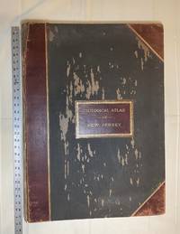
1889028277New York: Julius Bien & Co 1889. Condition of the binding is only Fair with pest damage. Leather over the spine has perished. Front and rear outer hinges cracks have been neatly reinforced with high quality clear flexible glue. Inner hinges are OK having been reinforced by the publisher/bookbinder with sturdy maroon cloth. SEE PHOTOS. Condition of all maps is NEAR FINE - FINE. NO foxing or toning. Pages are clean and unmarked. SEE PHOTOS. Includes a title page map of New Jersey Key to the System of Mapping and 19 linen-backed double page maps. Collated and complete per table of contents -- SEE PHOTOS. The maps are lithographically printed in blue red yellow and black. The double page maps open to an impressive 26.50" across by 36.50" tall. No year of publication is stated but Phillips 2149 in A LIST OF GEOGRAPHIC ATLASES Vol. 1 says 1889. The maps themselves are variously dated up to 1888. Titles of Sheets: No. 0. New Jersey State Map Geographic; No. 1. Kittatinny Valley and Mountain No. 2. Southwestern Highlands; No. 3. Central Highlands; No. 4. Northeastern Highlands; No. 5.Vicinity of Flemington; No. 6. Valley of the Passaic; No. 7. The Counties of Bergen Hudson Essex No. 8. Vicinity of Trenton; No. 9. Monmouth Shore; No. 10. Vicinity of Salem No. 11. Vicinity of Camden; No. 12. Vicinity of Mount Holly; No. 13. Vicinity of Barnegat Bay; No. 14. Vicinity of Bridgeton; No. 15. Southern Interior; No. 16. Egg Harbor and Vicinity; No. 17. Peninsula of Cape May; Unnumbered map. "New Jersey from Original Surveys based on the Triangulation of the U.S. Coast and Geodetic Survey Relief Map." Scale of first and last doublepage maps: 5 miles to an Inch. Scale of maps No. 1 to No. 17: 1 mile to an Inch. Bound in black pebble-grain cloth with gilt-stamped brown leather title label leather spine and corners leather backstrip has perished. SEE PHOTOS. The textblock could be easily rebacked or recased with no re-sewing required since all pages/maps are still securely bound together. Oversize Hardcover. 19.50" wide by 27" tall. This massive extremely heavy book will require SUBSTANTIAL extra postage at our cost based on your location. LeGear ATLASES OF THE UNITED STATES L5609. See also Schwartz and Ehrenerg's THE MAPPING OF AMERICA pp. 310-311. Phillips 2149. This massive extremely heavy book will require SUBSTANTIAL extra postage at our cost based on your location. Second Edition. Oversize Hardcover. Fair - FINE condition. Illus. by NOT a library discard. Atlas folio. Great Packaging Fast Shipping. Julius Bien & Co Hardcover
1880054418Venetiis: Typis Antonellianis. 1880-1881 1880. 2nd Edition . Leather. Very Good. Folio - over 12 - 15" tall. Extremely rare second edition of Quaresmus' work including four parts in two volumes which is a a contribution to history geography archaeology biblical and moral science of the East and Holy Land. First Edition is 1639 printed in Antwerp. This edition was edited by Father Cypriano da Treviso. First volume has one two-page map titled 'Chorographia Terræ Sanctæ Sev Terræ Promissionis Nova Descriptio' depicting a very attractive view of the Holy Lands which is decorated ships heading to the Holy Land. Second volume has two maps one plate and two plans All is folded and huge sizes. First map is one of the most attractive views of Extremely rare second edition of Quaresmus' work including four parts in two volumes which is a contribution to history geography archaeology biblical and moral science of the East and Holy Land. First Edition is 1639 printed in Antwerp. This edition was edited by Father Cypriano da Treviso. The first volume has one two-page map titled 'Chorographia Terræ Sanctæ Sev Terræ Promissionis Nova Descriptio' depicting a very attractive view of the Holy Lands which is decorated ships heading to the Holy Land. The second volume has two maps one plate and two plans All are folded and huge sizes. The first map is one of the most attractive views of Jerusalem titled 'Novæ Ierosolymæ et Locorvm Circvmiacentivm Accvrata Imago'. Other is depicting attractively 'Montis Calvariæ' i.e. Calvary or Golgotha which was according to the canonical Gospels a site immediately outside Jerusalem's walls where Jesus was crucified as well as Bethlehem and Resurrection Temple's plans. Quaresmio was a writer and Orientalist of the seventeenth century. His father was the noble Alberto Quaresmi and his mother Laura Papa. At an early age he was enrolled among the Franciscan Observantines at Mantua. For many years he held the chairs of philosophy theology and canon law and became successively guardian custos and minister of his province. His long apostolate in the East and the magnificent works he has left us have secured Quaresmius worldwide fame especially among earlier historians Biblical scholars and Orientalists. On 3 March 1616 he went to Jerusalem where he became Guardian and Vice-Commissary Apostolic of Aleppo in Syria 1616-8 and Superior and Commissary Apostolic of the East 1618-9. During this period he was twice imprisoned by the Turks. In 1620 he returned to Europe but in 1625 was back in Jerusalem whence the following year he addressed from the Holy Sepulchre an appeal to Philip IV of Spain inviting him to reconquer the Holy Land and at the same time dedicating to him his work "Hierosolymæ afflictæ". Between 1616 and 1626 he wrote his classical work "Elucidatio terræ Sanctæ" adjudged by the learned a monumental contribution to history geography archæology Biblical and moral science. During 1627-9 he was at Aleppo as papal commissary and as vicar-patriarch for the Chaldeans and Maronites of Syria and Mesopotamia. In 1629 he went to Italy to render an account to the Holy See of the state of the Eastern Churches; he then returned to the East but how long he remained is not known. Meanwhile he journeyed through Egypt and Sinai the Holy Land Syria Mesopotamia Cyprus Rodi Constantinople and a large part of Asia Minor; he also visited Germany France Belgium and Holland. In 1637 he was a guardian of S. Angelo Milan wherein 1643 he completed his other great work on the Passion of Christ. Original 1/3 black leather bdg. Six raised bands to spine. Marbled endpapers. Gilt title on spine and volume numbers. Folio. 38 x 28 cm. In Latin. 2 volumes set: xxviii 8 761 p.; 893 p. 6 engraved maps and plans 5 folded. <br/> <br/> Typis Antonellianis., (1880-1881) hardcover
18637098132Deighton Bell and Co 1863. 1st edition Pp. viii 86. This is an ex-library book and may have the usual library/used-book markings inside.This book has hardback covers. In good all round condition. No dust jacket. Re-bound by library in tan cloth. 8vo gilt lettering on backstrip. Some light shelf wear slightly bumped corners. Binding firm pages agetoned. Please note the Image in this listing is a stock photo and may not match the covers of the actual item400grams ISBN: Deighton, Bell and Co hardcover
1823018730London Dublin Edinburgh & New York: Printed for Sir Richard Phillips 1823. Six volumes small octavo pp 588; 600 15; 584 10 uncut a few pages unopened a little age-toning and marking one gathering 347-350 in Volume IV detached and gatherings towards the rear of the volume becoming a bit weak and loose Volume VI has extra bis pages 343 - 354; very well illustrated with 197 engraved or wood engraved plates of which 31 are folding and 50 coloured plates of which 2 are folding and 1 folding table; bound in the original pink boards a bit worn chipped and marked original printed paper labels on the spines the upper cover of Volume V detached otherwise firm and tight a neat signature on each front endpaper. Apparently lacking one plate in Volume 1 Relative Sizes of the Planets though there is no sign of this ever having been bound in. There are several extra plates to those listed and our copy would seem to agree with the set at auction at Christie's in 2006 which contained 246 of 248 plates. A work of considerable charm and interest and despite some faults as mentioned a remarkable set in original unsophisticated state. Simeon Ackroyd Shaw 1785 - 1859 was a 19th-century English scientific writer industrial historian and teacher. He spent his working life in the Staffordshire Potteries now the city of Stoke-on-Trent England. Shaw originated in Lancashire and as a young man he arrived in the Potteries to work on the Potteries Gazette and Newcastle-under-Lyme Advertiser newspaper. After some 20 years of newspaper and printing work living in Wolstanton he then went into teaching. He ran several teaching academies in the district. His first book was this 6-volume work which was based on his obviously very comprehensive series of popular short lectures on everything from natural species to meteorites. First Edition. Boards. Good. Printed for Sir Richard Phillips Hardcover
186716491London: Cassell Petter & Glapin 1867. First edition. Hardcover. Very Good . Schedule of Ores Contributed by Sundry Persons to the Paris Universal Exposition of 1867. With some information about the region and its resources." Book is Signed inscribed to Colorado territorial governor John Evans by the author commissioner from the territory. Two fold-out black white & red maps and fold-out photograph of displayed ores at front of book. Booklets in three languages were published for the exposition. This book was apparently specially bound and contains the text in English 61 pgs French and German each 71 pgs. Full leather embossed and with raised bands all edges gilt marbled endpapers. Boards are rubbed at corners and folds. Cracks in the front endpapers at the gutter. Straight and tight. <br/><br/> Cassell, Petter, & Glapin hardcover
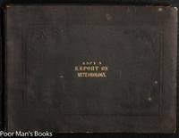
185034546Washington Dc:: Government Printing Office. Very Good with no dust jacket. 1850. First Edition. Flexible cloth. B/w/red; Oblong folio; 65 pages; 14.5" x 11". Front end paper with creases first three leaves with quite light and minor foxing. 100 partly color numerals maps 11 folding maps/charts all collated. These folding plates are quite large- often 20 x 30" or even larger and have occasional folds but seem free of tears. Bound in publisher's brown cloth with impressed design and gilt title. Sabin 22917. The author of this work James Pollard Espy nicknamed "The Storm King" for his classic book The Philosophy of Storms was the first Meteorologist of the US Government pioneering in the use of the telegraph to assemble weather observation data. Espy designed the first American weather map for a private scientific institute in 1838 before he moved to Washington. His first official meteorological report was published in 1843 but apparently included no maps. So the 100 "Charts" in this second report represent the first weather maps published by the US Government. . Government Printing Office hardcover
1891035628London / New York: Macmillan & Co. Ltd. 1889 1891. Second Edition With Appendix . Blue Cloth. Near Fine. 360 Pp Title Page Indicates Second Edition Dated 1889; This The Enlarged 1891 Issue With 60 Pp Appendix At End New Title Page Dated 1891. Second And Best Edition With The 1891 Appendix As Issued 1891. Fisher Described The Mechanism Of Plate Tectonics In 1881 Ascribing It To Convection Currents In The Earth's Molten Interior. This Work On Continental Drift Went Unnoticed Or Ridiculed But Was More Consistent With Modern Science Than The Criticisms Of His Work. An Unopened Copy Pages Still Attached Along Top Edge. Black Endpapers Immaculate Binding Firm No Names Or Marks. Very Scarce. <br/> <br/> Macmillan & Co. Ltd. (1889) hardcover
18993712616W. Holmes 1899. This is an ex-library book and may have the usual library/used-book markings inside.This book has hardback covers. In fair condition suitable as a study copy. No dust jacket. 4to 187 pages. Original blue cloth binding with silver title and crest to front cover. Exterior is heavily soiled and worn but there is minimal damage apart from some minor chipping to extremities. Binding is secure though there are some exposed gutters and pages are clean throughout though toned. 151 illustrations some in colour. Please note the Image in this listing is a stock photo and may not match the covers of the actual item1400grams ISBN: W. Holmes hardcover
18475784726S. Lewis and Co 1847. Volumes 1-2 and Supplement . This is an ex-library book and may have the usual library/used-book markings inside.This book has hardback covers. In good all round condition. Large black cloth 8vo with decorative blind borders on boards and gilt lettering and gilt borders on backstrip. Bumped corners and light general wear. Interior is secure clean and clear. Hinges in vol 1and 2 split. Supplementary Atlas volume is complete containing several large fold out maps. Interiors are secure clean and clear save for some foxing. Trimmed. Please note the Image in this listing is a stock photo and may not match the covers of the actual item4350grams ISBN: S. Lewis and Co hardcover
186442260London Taylor and Francis 1864. 4to. No wrappers as extracted from "Philosophical Transactions" Vol. 154 - Part II pp. 413-435 a. pp. 437-444 and 2 lithographed plates.1 plate showing the spectroscope which could be attached to his eight-innch telescope invented by Huggin's and Miller the start of stellar spectroscopi the other plate showing the obtained spectra of the nebulæ Aldebaran and Orionis. <br/><br/><em>First printing of a historical paper in spectroscopy and cosmology in which the authors shows by analysing the spectrae of nebulae of stars of planets of comets and of the sun that they are all built of the same elements as the earth. Thus was "laid to rest the twenty-one-century notion of Aristotle's that the heavens were composed of a unique substance not found on the earth."Asimov. They also shows that there is a considerable diversity of chemical composition among the stars.In this paper Huggins also describes his discovery by spectroscopy that a number of nebulae are luminous gas clouds."William Huggins 1824-1910 English astronomer a pioneer in spectroscopy and photography. He examined spectroscopically the chemical constitution of stars and comets and the gaseous nature of planetary and diffuse nebulae; he applied the Doppler Principle to the measurement of the radial velocities of stars and published an atlas of representative stellar spectra" Ripley: Source Book in Astronomy. </em> unknown
188342216London Harrison and Sons 1883. 4to. No wrappers as extracted from "Philosophical Transactions" Year 1882 Volume 173 - 1883. - Pp. 863-883 and 1 plate. Margin of plate with small tears.Otherwise clean and fine. <br/><br/><em>First appearance of the first paper describing the invention of the seismograph to record earthquakes."Milne studied at the Royal School of Mines and became mining engineer. He joined an Expedition to Arabia as a geologist. His real chance came in 1875 however when he accepted an appointment as a professor of geology and mining in the Imperial College of Engineering at Tokyo. He remained in Japan for twenty years and there had a marvelous opportunity to study earthquakes for no land is more riven with them than Japan. In 1880 he invented the seismograph.and established a chain of seismographs in Japan and elsewhere marking the beginning of modern seismology."Asimow.The paper describes 8 sets of experiments set up at different stations in Japan.On Milne's initiative the Seismological Society of Japan was founded and the emperor of Japan conferred upon him the Order of the Rising Sun. </em> unknown
189549284London arrison and Sons 1895. - Paris Gauthier-Villars 1895. 8vo. and 4to. Later full cloth gilt lettering to spine Ramsay and without wrappers Cleve. In "Proceedings of the Royal Society" Ramsay Vol. 58. Entire vol. offered. And in "Comptes Rendus Hebdomadaires des Séances de L'Academie des Sciences" Cleve Tome 120 No 15. Pp. 797- 850. Entire issue offered. Ramsay's papers: pp. 65-67 and pp. 81-89. - Cleve's paper: p. 834. Stamps tp edges and a few corners a bit bumped on vol. 58 otherwise clean and fine. <br/><br/><em>First printing of both papers in which Ramsay and Cleve - independently - announced their discovery of Helium on the Earth. Although Ramsay announced the discovery of Helium before Cleve had completed his research the Swedish chemist was independent discoverer of the element.Helium was discovered in the sun already in 1868 by Jules Janssen and independently by Lockyer the same year. Janssen discovered helium in the sun when he observed a total eclipse in India by studying the spectra of the suns chromosphere and Lockyer also by spectroscopy found that the new line in the spectrum did not belong to any element then known and he named it Helium for the sun.In the same volume as Ramsays paper there are 5 papers by NORMAN LOCKYER dealing with the discovery of Helium on the earth examining Ramsay's and Cleve's findings.Parkinson "Breakthroughs" 1895. </em> hardcover
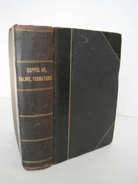
1900016807San Francisco and Sacramento: California State Mining Bureau 1900. 3 volumes bound as one. All three are First Editions published 1902/1901/1902 respectively -- not cheaply-made modern reprints. Bound together in black cloth with black leather spine and corners stamped in shiny gold on the spine. The leather joints have a hairline crack. SEE PHOTOS. The original colored wraps for all three books are bound-in. The binding is in Near Very Good condition. Internal condition is Very Good. The ink stamp of Harry M. Roche is on the front endpaper. All three books are profusely illustrated with photos and maps. Many of the maps are fold-out and printed in color. COPPER RESOURCES has 69 illustrations mostly photos and 8 maps of which 3 are folding. The largest: Map of California Copper Deposits unfolds to 29.5" wide by 36" tall. Another fold-out is: Geological Map of the Western Portion of the Shasta County Copper Belt. OIL AND GAS YIELDING FORMATIONS has 35 photos and 13 fold-out maps including Geological Map of Territory between Los Angeles and Santa Ana River; Los Angeles Oil Fields 1898-1900; Geological Sketch Map of the Peninsula of San Pedro; Geological Sketch Map of SE Portion of Orange Co.; Devils Gate Oil District; Sketch Map of Summerland Oil Wells; Coalinga Oil District Fresno Co. 1900; etc. SALINE DEPOSITS has 98 photos and 5 maps. Three of the maps are folding. Two of them are quite large and in color: Map of California Saline Deposits 1902 unfolds to 29" wide by 36" tall; Saline Deposits of the Southern Portion of California unfolds to 30.5" wide by 30.5" tall. First Editions. Hardcover. Near Very Good condition. 8vo. 282pp. 236pp. 215pp. Great Packaging Fast Shipping. California State Mining Bureau Hardcover
1886016429Washington: Department of the Interior Census Office / Government Printing Office GPO 1886. This is a solid reading/reference copy that was formerly in the Library of Congress/Smithsonian Institution. Good condition. See photos. New endpapers. Inner hinges are perfect. There is a small red ink stamp on the title page that reads: "Library of Congress February 25 1887 Smithsonian Deposit." Stamped over it in blue ink is: "Transferred Jan 7 1911." Otherwise all pages are unmarked. NO underlining. NO highlighting. NO margin notes. Bound in the original brown cloth moderately rubbed at the spine ends/edges. See photos. 76 tables. Profusely illustrated with 242 figures in the text and 102 full-page inserted maps and diagrams -- many folding and/or PRINTED IN BEAUTIFUL FULL COLOR. See photos. The List of Plates lists a total of 102 maps sections and diagrams. Of these 96 are bound-in as called for and all 96 are present. Of the remaining 6 plates that are supposed to be in a pocket at the rear only one plate LI is present. The 5 plates missing from the pocket are numbers XXIV Map of a group of iron mines in the town of Moriah Essex county New York and L LII-LIV Geological maps of the Cretaceous bituminous coal region of central Montana. Full title: "Report on the Mining Industries of the United States exclusive of the precious metals with Special Investigations into the Iron Resources of the Republic and into the Cretaceous Coals of the Northwest." Spine title: "Tenth Census of the United States 1880 Vol. XV Mining Industries." Oversize Hardcover. 9.5" wide by 12" tall by 3" thick. This large heavy book will require extra postage for Priority and International shipments but only the standard charge for media mail. First Edition. Oversize Hardcover. Good condition. xxxviii 1025pp. Department of the Interior, Census Office / Government Printing Office (GPO) Hardcover
18247053657Im Verlag der Carl Ferd. Beck'schen Buchhandlung Wien 1824. This is an ex-library book and may have the usual library/used-book markings inside.This book has hardback covers. Clean from markings. In fair condition suitable as a study copy. This is the table section only. Verzeichnung der Namen der in dieser Tabelle benutzten mineralogischen Schriftsteler plus 72 unnumbered pages of the table. Rebound in red cloth scuffed with gilt text on front cover. Some foxing otherwise clean pages. Gothic script. Please note the Image in this listing is a stock photo and may not match the covers of the actual item500grams ISBN: Im Verlag der Carl Ferd. Beck'schen Buchhandlung, Wien hardcover
18398361466Lewis & Co. 1839. This is an ex-library book and may have the usual library/used-book markings inside.This book has hardback covers. In good all round condition. No dust jacket. Quarto leather spine cloth boards. Spine rubbed. Title and library mark in gold on spine. Nottingham Public Libraries mark embossed on cover. The binding is a 20th century binding. Maps are all present 32 in total - and generally clean with only occasional light spotting. The general map of Ireland has been rebacked with cloth. Each map has a Nottingham Free Public Lbraries small purple stamp on it. These stamps are all in blank space within the map area. Engraved title with vignette drawn by George Cruikshank & engraved by Joseph Goodyear. The key for the maps shows Railroads. Please note the Image in this listing is a stock photo and may not match the covers of the actual item900grams ISBN: Lewis & Co. hardcover
18873958220Sampson Low Marston & Co. 1887. This is an ex-library book and may have the usual library/used-book markings inside.This book has hardback covers. In good all round condition. Re-bound by library. 8vo. Rebound. Foxing. Internally clean. Tightly bound. Please note the Image in this listing is a stock photo and may not match the covers of the actual item1350grams ISBN: Sampson Low, Marston & Co. hardcover
183123774London: James Ridgway & Sons 1831-37. 1st edition. V.g./No Jacket. Quarter leather binding with bubble-texture maroon boards gilt titles on spines Recently rebacked with red leather title labels. Maroon bubble cloth quarter-leather binding. Edges untrimmed. Occasional print-transference from plates to facing text. Folded plates intact. A handsome set of this seminal work in the history of palaeontology. London: James Ridgway & Sons hardcover
1896biblio18<p>Chr. Herm. Tauchnitz Leipzig Germany 1896. First edition. 711pp incl index illus 8x11.25 thick super 8vo. HB marbled grey board with half morocco leather gilt on spine. Marbeled ends pages. 20 half tone charts 8 color plates 94 illus. Color plates all have India paper. FP color plate on diamonds rubies sapphires. For mineralogist s geologists jewelers. Incredible book in great condition. Marks of previous owner. Very good/excellent copy. Please contact me ramrozzi@yahoo.fr</p><br /><br /> Chr. Herm. Tauchnitz hardcover
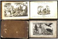
182129777Paris: Alexis Eymery. Good with no dust jacket. 1821. First Edition. Hardcover. French Language; Textbook; Juvenile; Engravings; Oblong 8vo 8" to 9"; 194 2 pages; Geographie vivante ou tableaux raisonnés et comparatifs des principaux habitans du globe avec leur costumes ses anuimaux divers qui s'y trouvent et une exacte description de leurs moeurs de leurs usages et habitudes. 60 plates on 30 pages showing people of the principal nations of the world. Beautiful engravings. Foxing. Designed for the juvenile. Probably original boards with leather spine over paper covered boards. Lacking leather spine strip covers attached by binding cords. Contents complete. French language text. Inkstain 3/4" x 1/2" to pp79-80 lightly affecting 1 plate pp1-4 reattached. 2 illustrations on each plate of Africa Asia the New World. . Alexis Eymery, hardcover
1819biblio16<p>Strasbourg F.G. Levrault. 2 volumes. 8vo. Contemporary half calf. With 2 folding engraved. The first geological textbook in France based on the teachings of Werner. It won wide popularity on account of its clearness and elegance in the mode of treatment. D'Aubuisson held closely to the methodical arrangement of the subject introduced by Werner and took his illustrative examples chiefly from French geology. His deviation of Werner's teaching was the insertion of Tertiary formations between the Secundary deposits and diluvial clays and gravels. He was together with Leopold von Buch and Alexander von Humboldt one of the three great pupils of Werner Zittel pp. 143-144. Stamps and marks of previous owner. A very good copy. BMC NH p. 70; Ward & Carozzi 88. Please contact me ramrozzi@yahoo.fr</p><br /><br /><br /><br /> F.G. Levrault hardcover
18548665918John Murray 1854. This is an ex-library book and may have the usual library/used-book markings inside.This book has hardback covers. Clean from markings. In good all round condition. Re-bound by library. Large grubby green cloth 8vo with gilt lettering on backstrip. Small strip of black paint has been applied to backstrip. Grubby edges. Brown end papers. Large fold out coloured map in place of frontispiece in good condition. Interior is secure clean and clear except for a fair amount of foxing. Volume is illustrated and contains multiple plates a few of which fold out. Please note the Image in this listing is a stock photo and may not match the covers of the actual item1350grams ISBN: John Murray hardcover