11 017 résultats
18664949023William Blackwood and Sons 1866. This is an ex-library book and may have the usual library/used-book markings inside.This book has hardback covers. In poor condition suitable as a reading copy. Large folio. Original binding. Green cloth half leather. Gilt lettering borders and motif on front board. Raised bands gilt lettering borders and motifs on backstrip. Backstrip semi detached with large sections missing. Detached boards. Gilt edges. Pages are secure clean and bright apart from flyleaf which are a little grubby. Contains numerous map plates. Please note the Image in this listing is a stock photo and may not match the covers of the actual item6350grams ISBN: William Blackwood and Sons hardcover
20083991408Ashgate 2008. This is an ex-library book and may have the usual library/used-book markings inside.This book has hardback covers. In good all round condition. No dust jacket. Please note the Image in this listing is a stock photo and may not match the covers of the actual item1550grams ISBN:9780754628149 Ashgate hardcover
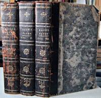
015665London: James Ridgway & Sons Picadilly 1831 - 1837. Three volumes octavo with 230 plates pp lixi; 218 6; xxviii x 208; 205 2 a little age-toning and marking throughout in each volume there is one internal hinge cracking; probably contemporary half calf rubbed and fraying upper joints weak particularly so in the third volume. A duplicate from Worthing Reference Library with their attractive bookplate in each volume; a neat small circular stamp in the corner of each plate on the title pages and the occasional text page a shelf number on the spines. A cornerstone of fossil flora literature. The work served to catalogue many of the fossil plants recognized by the 1830s from Britain ranging in age from Carboniferous to Pleistocene. Together with contributions from Henslow Murray and Williamson Lindley and Hutton described illustrated and in some cases emended almost 300 species with many of their type and figured specimens having survived. By giving the first illustrated account of the microscopic structure of a fossil cuticle together with discussions about the origin of coal prehistoric climates experimental taphonomy and plant evolution "The Fossil Flora" was much more than a catalogue of fossil plants. Lindley must surely rank amongst his palaeobotanical contemporaries for having pioneered aspects of the science that remain topics of active research into the third millennium. First Edition. Half-Leather. Good. James Ridgway & Sons, Picadilly Hardcover
19285792409American Geographical Society 1928. This is an ex-library book and may have the usual library/used-book markings inside.This book has hardback covers. In fair condition suitable as a study copy. Exterior worn. Interior good. Please note the Image in this listing is a stock photo and may not match the covers of the actual item1250grams ISBN: American Geographical Society hardcover
19285792410American Geographical Society 1928. This is an ex-library book and may have the usual library/used-book markings inside.This book has hardback covers. Book contains pencil markings. In fair condition suitable as a study copy. No dust jacket. Please note the Image in this listing is a stock photo and may not match the covers of the actual item1100grams ISBN: American Geographical Society hardcover
19275792411American Geographical Society 1927. This is an ex-library book and may have the usual library/used-book markings inside.This book has hardback covers. In fair condition suitable as a study copy. No dust jacket. Please note the Image in this listing is a stock photo and may not match the covers of the actual item1400grams ISBN: American Geographical Society hardcover
14491Journal de route du Capitaine SCOTT au Pôle Sud. Adaptation de Ch. RABOT. In 4 reliure éditeur pleine toile verte avec portrait en pied de SCOTT et titre doré. 265x205mm, (poids 1,8kg). Faux titre, portrait de SCOTT en frontispice, titre, X- 381 pages, 91 gravures hors texte y compris le frontispice. Tête dorée, Hachette & Cie 1914.Petit raccommodage au dos, une déchirure réparée en marge intérieure du frontispice sinon bon exemplaire.
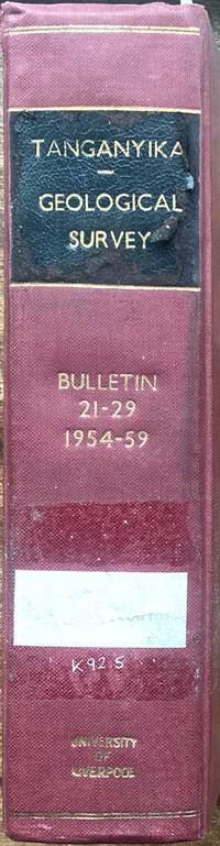
195443715Government Printer Dar Es Salaam 1954-1959. V.g./No Jacket. Modern maroon cloth Memoirs include pockets containing coloured maps. Ex-library copy with bookplate. Government Printer, Dar Es Salaam hardcover
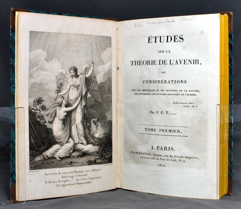
181010433A Paris, chez Maradan, 1810. 2 volumes petit in-8 de [4]-XXXII-416 et [4]-448 pages, demi-toile brune à petits coins, étiquettes oranges avec titre, tomaison, filets et roulettes dorés, tranches jaunes. Reliures très légèrement frottées.
8vo., First Edition, with frontispiece (original tissue guard present), 17 [of 18] plates (missing plate supplied in photofacsimile) and double-page map; original burgundy ribbed cloth, upper board letterd in white, gilt back, expertly rebacked with old backstrip laid down, hand-made endpapers, a very good, bright, clean copy. Wanting the plate 'Mount Buckland' at p.190 (missing plate supplied in photofacsimile). With 8pp publisher's catalogue bound in at end. SCARCE. Neate 180.
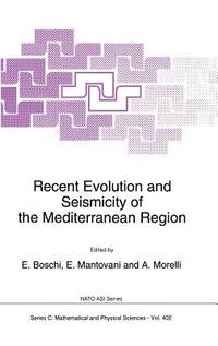
1993GE-190DordrechtHolland: Kluwer Academic 1993. Comprehensive text contains detailed technical papers presented by leading international scientists and field experts on a variety of topics covering seismotectonics and geodynamics of the Mediterranean region. Topics include: regional stresses in the Mediterranean regionderived from focal mechanisms of earthquakes; source process of large earthquakes in Greece and its tectonic implication; paleomagnetism in the Mediterranean from Spain to the Agean; P-wave teleseismic tomography contribution to the delineation of the upper mantle structure in Italy; tectonic evolution of the Northern Arabian plate in western Syria; Africa-Eurasia kinematics in the Mediterranean; etc. 422 pgs. Illustrated. Prior owner's nameplate pastedown on front endpaper; clean pocket on rear endpaper. Very minimal shelfwear. First Edition. Hard Cover. Near Fine. 8vo - over 7¾" - 9¾" tall. Ex- Professional Library. Kluwer Academic Hardcover
1975BI-89Princeton N.J.: Princeton University Press 1975. Comprehensive monumental work presents a systematic account of each of the 62 species of Ocypodidae genus Uca including a morphological description and information on social behavior and ecology. Includes additional detailed sections on biogeography ecology morphology and behavior. By linking intricate structural specializations with the motion patterns of social behavior the author achieves a unique synthesis of morphology and ethology. Text includes the only taxonomic review of the entire genus since 1880. 736 pgs. Illustrated. Dustjacket has a few closed edge tears; in mylar. Minor tiny mark on outer edge. Minimal rubbing to edges. Heavy item. First Edition. Hard Cover. Very Good/Very Good. 4to - over 9¾" - 12" tall. Princeton University Press Hardcover
1992GE-164Montreal Quebec: Canadian Institute of Mining Metallurgy and Petroleum 1992. Comprehensive text reviews various steps and components of the evaluation of gold deposits and the classification of reserves including detailed information on evaluation methods in the successive stages of mineral development; geological appraisal work and assaying methods; mineral and ore-dressing aspects; regulatory requirements; economic feasibility and profitability; classification of reserves and resources; etc. 299 pp. Illustrated. Minimal shelfwear. First Edition. Soft Cover. Very Good. 4to - over 9¾" - 12" tall. Canadian Institute of Mining, Metallurgy and Petroleum Paperback
9837LE CLAIR DE TERRE. " Surréalisme - Critique sociale " Paris. Sans nom d'éditeur. Cahier agrafé 21 x 27 cm. 33 pages tapuscrites, tirées sur duplicateur à alcool. (Destribats, 460)
165925399Cezy 1659 une liasse de 24 pages, manuscrites à l'encre brune, sur parchemin velin de format : 25,2 x 17,8 cm, signature manuscrite : LEVERS, TABELLION DE LA CHATELLÉNIE DE CÉZY, fait à Cezy, le 2 JANVIER 1659,
Lyon, chez B. Michel Mauteville, [1682 circa], in-12, legatura coeva in piena pelle, dorso a 5 nervi con titolo e fregi in oro (mancanza alla cuffia inferiore del dorso), pp. [16], 481, [3]. Si tratta, in realtà, di un viaggio in Terra Santa. Lievi bruniture.
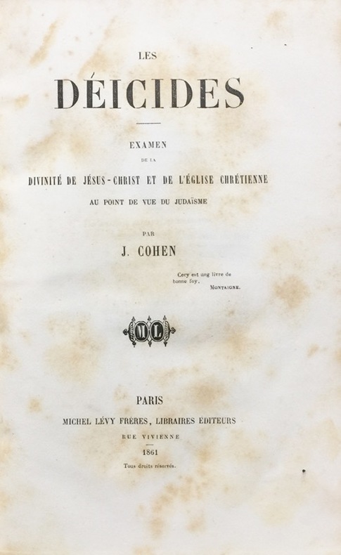
18615184Paris, Michel Lévy Frères, 1861 ; in-8 ; demi-chagrin vert sapin, dos à nerfs, caissons décorés et dorés, titre doré (reliure de l'époque) ; (4), 399 pp.
110033Paris, Amable Costes, Editeur, 1834-1836, 2 tomes reliés en 1 volume in-4 de 280x190x50 mm environ, 1f.blanc,faux-titre, frontispice, titre gravé, une carte dépliante, viij-56-48-24-16-48-28-128-8-80-64-64 pages, 1f.blanc, demi basane fauve et cartonnage marbré, dos lisse portant titres dorés sur pièce de titre rouille, orné de motifs dorés. Contient 134 figures sur acier et 2 grandes cartes. Des rousseurs et pages brunies, couverture très frottée sur le cuir et le cartonnage, début de fente sur un mors externe, mors internes en partie fendus mais la structure reste solide, déchirure restaurée sur la p. 5 de la Campagne de Rome, et p. 3 des Etats Vénitiens, les premières pages ont les bordures fendillées et sont partiellement détachées.
5357, Paris, audot, 1837., Relie, demi- veau, premier edition, frontispice, 18x26,5cm, 248pp, abime.
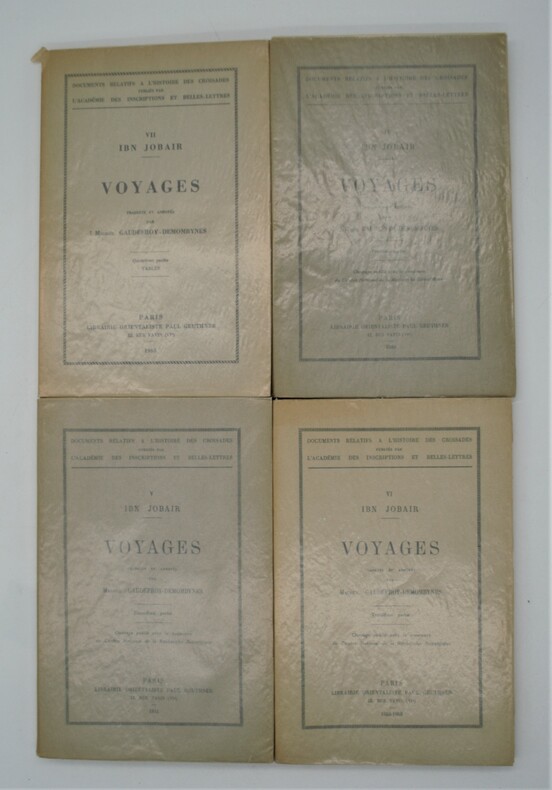
1949PHO-961Paris, Librairie orientaliste Geuthner 1949/1965.Documents relatifs à l'histoire des croisades publié par l’Académie des inscriptions et belles lettres . Quatre volumes in-8°(25x17cm). Brochage éditeur , non rogné , 106pp-158pp-142pp-180pp.
In-8 gr. (mm. 270x175), legatura in p. pelle coeva, decorazoni a secco ai piatti. tit. oro su tassello al dorso (con abrasioni), pp. (4),232, con antiporta litografata a colori, vignetta al frontesp., ornato da deliziosi grandi capilettera e finali, tutti inc. su legno. Il volume è molto ben illustrato da 58 tavole litografate in tinta (vedute e monumenti), tutte protette da velina, e da una carta topografica della regione, più volte ripieg. Storia della Palestina con dettagliata descrizione dei più importanti monumenti della Terra Santa. Fiorit. per lo più margin. a qualche tavola, pagine con lievi ingialliture ma certamente un buon esempl. con barbe.
Carta geografica tratta dall’ Atlante geografico. Corredato di notizie relative alla geografia fisica politica, ed in generale alla statistica delle varie regioni del Globo. Compilato ed eseguito in litografia per cura e sotto la direzione di Benedetto Marzolla edito a Napoli nel 1858. Marzolla, autore di importanti atlanti sulle provincie del Regno di Napoli, è anche autore di diverse carte sulle Circoscrizioni Ecclesiastiche nel Regno delle Due Sicilie, pubblicate postume, nello stesso anno della morte (1858) a Napoli nello Stabilimento Geografico diretto da Luigi Manzella. Benedetto Marzolla fu disegnatore topografo e litografo; geografo e cartografo; membro della Commissione di statistica presso il Ministero dell'Interno. Personaggio di grandissimo rilievo nella cartografia napoletana ed italiana del XIX secolo, Marzolla ottenne in vita pubblici riconoscimenti ed attestati per la produzione cartografica di altissima qualità. La sua notorietà si è lentamente dissolta dopo la morte; va tuttavia osservato che solo la mancanza di uno spiccato coinvolgimento politico in senso risorgimentale e di una valenza letteraria nella sua opera non lo hanno reso famoso come i contemporanei Francesco Costantino Marmocchi (1805-1858) e Attilio Zuccagni-Orlandini (1783-1872), con i quali può certamente confrontarsi. I progetti culturali didattici e editoriali di Marzolla furono e rimangono di straordinaria modernità; egli inventò, è il caso di dire, un nuovo modo di intendere e di disegnare la carta geografica, fornendo una visione assolutamente originale della comunicazione dei dati geografici attraverso la combinazione di testo e immagine. Con tale operazione, egli riuscì a fondere in un'unica opera, storia, geografia, economia, statistica e cartografia, raggiungendo un equilibrio grafico di rara efficacia (cfr. V. Valerio, Benedetto Marzolla Brindisino, Geografo e Cartografo dell'800 Europeo, Brindisi 2008). Bell’esemplare con coloritura coeva dei contorni, in ottimo stato di conservazione. Bibliografia V. Valerio, Benedetto Marzolla Brindisino, Geografo e Cartografo dell’800 Europeo (2008), n. 136. Map taken from the Atlante geografico. Corredato di notizie relative alla geografia fisica politica, ed in generale alla statistica delle varie regioni del Globo. Compilato ed eseguito in litografia per cura e sotto la direzione di Benedetto Marzolla published in Naples in 1858. Marzolla, author of important atlases on the provinces of the Kingdom of Naples, is also the author of several maps on the Ecclesiastical Circumscriptions in the Kingdom of the Two Sicilies, published posthumously in the same year of his death (1858) in Naples in the Stabilimento Geografico directed by Luigi Manzella. Benedetto Marzolla was draftsman topographer and lithographer, geographer and cartographer. Character of great importance in the Neapolitan and Italian cartography of the nineteenth century, Marzolla obtained during his life public recognition and certificates for the production of high quality cartography. His notoriety slowly faded after his death; it should be noted, however, that only the lack of a strong political involvement in the sense of the Risorgimento and of a literary value in his work did not make him as famous as his contemporaries Francesco Costantino Marmocchi (1805-1858) and Attilio Zuccagni-Orlandini (1783-1872), with whom he can certainly compare himself. Marzolla's cultural, didactic and editorial projects were, and remain, extraordinarily modern; he invented a new way of understanding and drawing maps, providing an absolutely original vision of the communication of geographical data through the combination of text and image. With this operation, he was able to merge in a single work, history, geography, economics, statistics and cartography, achieving a graphic balance of rare effectiveness. Benedetto Marzolla is famous for being among the most important cartographers of the XIX century, for being the one to print geographic maps using high quality lithographies. His Atlante Geografico, made of 58 maps, presents finely sketched works. Six maps depict North America, among them famous map of gold diggers in California, deriving from Hippolite Ferry. Extremely relevant are also the maps of Antarctic, South Africa with the plan of Cape Town and those about Australia. Though the maps are dated between 1843 and 1856, this 1858 edition, printed in Naples at the Stabilimento Geografico Strada San Carlo (founded by Marzolla himself), represents the final version of his atlas, the last one before his death. A posthumous edition will be published in 1865. The atlas is pretty rare, is not actually listed in Phillips, British Library e OCLC. Beautiful specimen with contemporary coloring of the contours, in excellent condition. Bibliografia V. Valerio, Benedetto Marzolla Brindisino, Geografo e Cartografo dell’800 Europeo (2008), n. 136.
Carta geografica tratta dall’ Atlante geografico. Corredato di notizie relative alla geografia fisica politica, ed in generale alla statistica delle varie regioni del Globo. Compilato ed eseguito in litografia per cura e sotto la direzione di Benedetto Marzolla edito a Napoli nel 1858. Marzolla, autore di importanti atlanti sulle provincie del Regno di Napoli, è anche autore di diverse carte sulle Circoscrizioni Ecclesiastiche nel Regno delle Due Sicilie, pubblicate postume, nello stesso anno della morte (1858) a Napoli nello Stabilimento Geografico diretto da Luigi Manzella. Benedetto Marzolla fu disegnatore topografo e litografo; geografo e cartografo; membro della Commissione di statistica presso il Ministero dell'Interno. Personaggio di grandissimo rilievo nella cartografia napoletana ed italiana del XIX secolo, Marzolla ottenne in vita pubblici riconoscimenti ed attestati per la produzione cartografica di altissima qualità. La sua notorietà si è lentamente dissolta dopo la morte; va tuttavia osservato che solo la mancanza di uno spiccato coinvolgimento politico in senso risorgimentale e di una valenza letteraria nella sua opera non lo hanno reso famoso come i contemporanei Francesco Costantino Marmocchi (1805-1858) e Attilio Zuccagni-Orlandini (1783-1872), con i quali può certamente confrontarsi. I progetti culturali didattici e editoriali di Marzolla furono e rimangono di straordinaria modernità; egli inventò, è il caso di dire, un nuovo modo di intendere e di disegnare la carta geografica, fornendo una visione assolutamente originale della comunicazione dei dati geografici attraverso la combinazione di testo e immagine. Con tale operazione, egli riuscì a fondere in un'unica opera, storia, geografia, economia, statistica e cartografia, raggiungendo un equilibrio grafico di rara efficacia (cfr. V. Valerio, Benedetto Marzolla Brindisino, Geografo e Cartografo dell'800 Europeo, Brindisi 2008). Bell’esemplare con coloritura coeva dei contorni, in ottimo stato di conservazione. Bibliografia V. Valerio, Benedetto Marzolla Brindisino, Geografo e Cartografo dell’800 Europeo (2008), n. 74. Benedetto Marzolla is famous for being among the most important cartographers of the XIX century, for being the one to print geographic maps using high quality lithographies. His Atlante Geografico, made of 58 maps, presents finely sketched works. Six maps depict North America, among them famous map of gold diggers in California, deriving from Hippolite Ferry. Extremely relevant are also the maps of Antarctic, South Africa with the plan of Cape Town and those about Australia. Though the maps are dated between 1843 and 1856, this 1858 edition, printed in Naples at the Stabilimento Geografico Strada San Carlo (founded by Marzolla himself), represents the final version of his atlas, the last one before his death. A posthumous edition will be published in 1865. Map taken from the Atlante geografico. Corredato di notizie relative alla geografia fisica politica, ed in generale alla statistica delle varie regioni del Globo. Compilato ed eseguito in litografia per cura e sotto la direzione di Benedetto Marzolla published in Naples in 1858. Marzolla, author of important atlases on the provinces of the Kingdom of Naples, is also the author of several maps on the Ecclesiastical Circumscriptions in the Kingdom of the Two Sicilies, published posthumously in the same year of his death (1858) in Naples in the Stabilimento Geografico directed by Luigi Manzella. Benedetto Marzolla was draftsman topographer and lithographer, geographer and cartographer. Character of great importance in the Neapolitan and Italian cartography of the nineteenth century, Marzolla obtained during his life public recognition and certificates for the production of high quality cartography. His notoriety slowly faded after his death; it should be noted, however, that only the lack of a strong political involvement in the sense of the Risorgimento and of a literary value in his work did not make him as famous as his contemporaries Francesco Costantino Marmocchi (1805-1858) and Attilio Zuccagni-Orlandini (1783-1872), with whom he can certainly compare himself. Marzolla's cultural, didactic and editorial projects were, and remain, extraordinarily modern; he invented a new way of understanding and drawing maps, providing an absolutely original vision of the communication of geographical data through the combination of text and image. With this operation, he was able to merge in a single work, history, geography, economics, statistics and cartography, achieving a graphic balance of rare effectiveness. Beautiful specimen with contemporary coloring of the contours, in excellent condition. The atlas is pretty rare, is not actually listed in Phillips, British Library e OCLC. Bibliografia Valerio, Benedetto Marzolla. Brindisino, Geografo e Cartografo dell’800 Europeo, p. 57, 3F. Tooley,s Dictionary, p. 216.

28 pages plus advertorial covers. Extensive WWII coverage including: Karsh cover photo of Churchill and Mackenzie King; Five photos of "Huge Military Convoy Reaching India Without Losing a Ship or Man - Disembarkation Scenes"; Two-page illustration of "The Relative Size, Velocity and Weight of Shell Used in the Latest North African Battles - General Grant Tanks, The Mark IV, and the German 88-m.m. anti-tank gun"; Ten Photos of devastation in Malta, "The Heroic Island, continuously battered from the air, unfailing courage of the most bombed place in the world"; Article on the Threat to Egypt; Eight photos of bomb damage to Canterbury and other historic sites; Photo-illustrated review of "Last Train From Berlin" by Howard K. Smith; One-page photo of 'starboard vista' view of British aircraft carrier; Six illustrations of the fighting in Africa by Captain McIntyre of New Zealand; Six aerial photos of Mersa Matruh, Libya, now in the hands of Rommel; Centerfold illustration of Senior army officers being trained to fix trucks; Photos of scorched earth in Sollum, Libya; Aerial photo of bomb damage to 'Gneisenau' at Brest; Photo of King Feisal II of Iraq on his 7th birthday; Photo of emblems of Yugoslavia's guerilla army - featuring skull and crossbones; Photo of U.S. sailor being trained to swim in a sea of buring oil!; Excellent photo illustrates the 56 personnel needed to maintain, service and fly a heavy bomber of the 'Sterling' type, including plane, fuel truck, bomb trailers, etc.; Photo of King George of the Hellenes addressing joint session in Washtington; Royal Visit to Ulster; Excellent one-page photos of dozens of 'General Grant' tanks, used in the Battle of Libya, under construction at the giant Chrysler tank arsenal in Detroit; Photo-illustrated article on Sir James Dewar and his pursuit of liquid air and liquid hydrogen; Five photos of the British Army training in troop-carrier gliders; Twelve excellent photos illustrating "Sebastapol's heroic defence against overwhelming odds in Crimea - scenes from the Russian battlefronts opposing Germany's gathering offensive; Photos of personalities of the week including Mervyn Haigh, Dwight Eisenhower, C.S. Staniland, Elinor Mordaunt, parents of Kenneth Campbell, V.C., Churchill with Attlee, Eden and Sinclair, Churchill with wife and daughter, Wife of able seaman Savage, V.C., Sir Edwin Cooper, V.A. Crutchley, V.C., Lord Glanely, Tom Driberg, and parents of Petty Officer Sephton, V.C. Unmarked with average wear. Spine taped. A sound vintage copy. Book
Pages 693-724. Features: Photo of Major John Bagot Glubb Pasha, reportedly killed in action in Iraq; Four photos of British evacuation from Greece; Informative two-page, seven-illustration feature describes the winged invaders of Crete - troop-carrying gliders - and the JU '52' sky tug; Excellent two-page illustrated feature entitled 'War in the Stratosphere' explains some problems presented by the enigma of flight miles above the earth; Six photos beneath the caption 'Eagle Wings of the Royal Navy - The Victorious Fleet Air Arm; H.M.S. Hood lost May 24 - photo of the ship and photo of part of her crew on deck during firing practice; Photo and illustration of the "Bismarck," sunk on May 27; The Battle for Crete - article; Three maps showing the strategic importance of Crete and Cyprus; Centrefold illustration depict Germany's air invasion of Crete - the first major attack by air-borne troops, across over 200 miles of sea; Photos of the "Beaufighter" night-fighter-bomber and the famous U.S.A. "Catalina"; Photos of thirteen personalities of the week include Igor I. Sikorsky setting record in Connecticut, Vice-Admiral L.E. Holland, Captain R. Kerr, Lord Austin of the well-known automaker, General Smuts, Sir Horace Rumbold, Flight-Officer F.H. Hanbury - first member of the W.A.A.F. to receive the M.B.E.; Two pages with twelve photos from Libya illustrate "Where Panzer Units Become Junk" - The Gallant Defenders of Tobruk; Five photos illustrate fighting in the western desert of North Africa where British patrols harass Nazis; Air photos of the cities of Rakki, Palmyra and Falluja; Photo of the King inspecting paratroops; Photo of truck carrying the wreckage of the ME. 110 fighter which Rudolf Hess flew to Glasgow; New discoveries in Iran exemplify the superb art of Persian goldsmiths over a period of seventeen centuries. Nice vintage ads. Unmarked with moderate wear. A quality copy of this informative wartime issue. Book