11 020 résultats
Milano,Mursia,1975. In 8°pp.192n. cartoncino editoriale illustrato a colori, Documenti fotografici in b.n. e 1 Carta geografica.
La mappa raffigura la costa nord-occidentale del Nord America, e quella nord-orientale dell'Asia utilizzando le scoperte dei Russi riportate da J. N. De L'isle. La cartografia non è prettamente scientifica, di qui una serie di errori come ad esempio, solo per citarne alcuni, la miitica colonia cinese Fou Sang, quale traccia di una colonizzazione cinese nella regione, e lo Stretto di Anian rappresentato al posto dell'attuale Vancouver. Questi errori saranno corretti negli anni successivi soprattutto grazie ai rapporti dei grandi navigatori, tra i quali l'inglese James Cook. Il cartiglio pittorico comprende una mitica isola deserta sulla quale vivono numerosi animali i più adatti a climi tropicali - un coccodrillo, un elefante, un rinoceronte e uno struzzo. La nave raffigurato nella vignetta è quasi certamente è la nave del capitano Cook, l'Endeavour. Carta geografica tratta dall’Atlante novissimo, illustrato ed accresciuto sulle osservazioni e scoperte fatte dai più celebri e più recenti geografi. Stampato in quattro volumi da Antonio Zatta tra il 1779 ed il 1785. Atlante fra i più belli e completi mai pubblicati in Italia nel XVIII secolo, l'opera più famosa dello Zatta.L’Atlante Novissimo, come si specifica anche nel titolo, è “accresciuto sulle osservazioni scoperte fatte dai più celebri e più recenti geografi”. Tra le novità più significative vi è la comparsa delle nuove isole scoperte nell'Oceano Pacifico da James Cook e la prima carta italiana della Nuova Zelanda. Le illustrazioni furono ideate e disegnate dai suoi collaboratori Giovanni Marco Pitteri, Anton Friedrich Busching, Pietro Antonio Novelli ed incise da Giuliano Zuliani. Il primo tomo dell’atlante è introdotto da un breve saggio di geografia generale dove l’autore definisce in modo sintetico e preciso gli elementi che compongono i reticoli eclittico ed equatoriale usati nelle tavole. Interessante la sezione dove si sofferma a descrivere il fenomeno della precessione degli equinozi e quello della variazione ciclica dell'obliquità dell'eclittica. Acquaforte, stampata su carta vergata coeva, coloritura coeva dei contorni, in buone condizioni. Striking example of Zatta's map of the northern Pacific Coastal regions and one of the best illustrations of a late rendition of the Northwest Passage, here illustrating two wide passages from the Pacific to Hudson's Bay, based upon the mythical voyages of Admirals Cluny and de Font. The map depicts the Northwest coast of North America and Northeast coast of Asia and utilizes the Russian discoveries reported by J.N. De L'Isle. The map is noteworthy for the odd archipelago of islands off NE Asia, the rivers extending from the Pacific Coast to the interior of North America and the odd projection of the western coast of North America. This conical projection shows the western coast of North America from the Baja Peninsula, along the coast of California to Alaska and thence to the Bering Strait and the Kamchatka Peninsula. The map is filled with hypothetical cartography based on misunderstood or mythical reports about the northern Pacific shores. Alaska is represented by a group of islands clustered off the coast of Russia, and the northwest coast of North America is filled with the fictitious system of rivers and lakes of the mythical Northwest Passage and discoveries of Admiral de Fonte. The map shows locations of ethnic groups and communities, and mentions the legendary Quivara (an alternative name for southwestern North America). Canada is broadly conceived, with waterways across the north related to the search for a Northwest Passage. The erroneous belief that that Chinese mariners colonized America in the late 5th Century led to the mythical "Fou-Sang" (colony of the Chinese) and the so-called Straits of Anian noted on the map in what is now Vancouver, British Columbia. Wagner declares the map to be "A Vaugondy mixture of old and new names as far south as the end of the peninsula." All of this unscientific mapmaking would change quickly in the ensuing decades, as cartography benefited from a large number of expeditions in Arctic latitudes, beginning with the great English circumnavigator James Cook. As with many maps by the famous mapmaker, the large decorative title vignette dominates. The pictorial cartouche includes a mythical desert island on which live several incongruent animals, all more suited to tropical climates - a crocodile, an elephant, a rhinoceros and an ostrich. The ship depicted in the vignette almost certainly is Captain Cook's ship, the Endeavour. Map from the Atlante novissimo, illustrato ed accresciuto sulle osservazioni e scoperte fatte dai più celebri e più recenti geografi. Printed in four volumes by Antonio Zatta between 1779 and 1785. Atlas among the most beautiful and complete ever published in Italy in the eighteenth century, the most famous work of Zatta. The Atlante Novissimo, as also specified in the title, is “increased on the observations made by the most famous and most recent geographers”. Among the most significant innovations there is the appearance of the new islands discovered in the Pacific Ocean by James Cook and the first Italian map of New Zealand. The illustrations were designed and drawn by his collaborators Giovanni Marco Pitteri, Anton Friedrich Busching, Pietro Antonio Novelli and engraved by Giuliano Zuliani. The first volume of the atlas is introduced by a brief essay of general geography where the author defines in a concise and precise way the elements that make up the ecliptic and equatorial grids used in the tables. Interesting is the section where he pauses to describe the phenomenon of precession of the equinoxes and the cyclical variation of the obliquity of the ecliptic. Etching, printed on contemporary laid paper, contemporary outline coloring, in good condition.
In-8 p. (mm. 235x155), brossura orig. (dorso spaccato), pp. 360. Bibliografia delle pubblicazioni di storia miliare esistenti presso la Biblioteca del Duca di Genova. Testo manoscritto. Tiratura di 150 esemplari. Ben conservato.
ill., br. Negli anni Cinquanta del secolo scorso, all'inizio della "grande accelerazione" (nell'uso dei combustibili fossili e nella crescita economica e demografica), nell'alta Val d'Astico si tentò di costruire una diga ma i lavori furono improvvisamente abbandonati. Poi fu la volta di un ardito progetto di attraversamento autostradale in galleria dello sbarramento montuoso fra Trentino e Vicentino. In anni recenti, il piano è stato rilanciato con un diverso tracciato e l'autore è stato chiamato ad analizzarlo, mettendo in luce una criticità trascurata, cioè un rilevante pericolo geologico. Il progetto definitivo ha forse in qualche modo rimediato alla carenza iniziale, senza tuttavia modificare le scelte operate in assenza di adeguate conoscenze. L'analisi del caso serve a inquadrare l'evoluzione fisica del territorio nel contesto più ampio delle attività che hanno fatto dell'uomo il principale agente geologico di modificazione del pianeta, tanto da posticipare l'inizio di una nuova fase glaciale e da rendere necessaria l'istituzione di una nuova epoca, definita Antropocene. Completano il volume alcune schede sui principali siti di interesse geologico della valle.
199513976Maisonneuve et Larose 1995 260 pages in8. 1995. Broché couverture rempliée. 260 pages. Cet ouvrage de Haïm Zafrani spécialiste du judaïsme en terre d'islam est dédié aux communautés juives du Sud marocain. Il présente et commente des extraits d'ouvrages hébraïques notamment le commentaire kabbalistique du 'Traité des Pères' de J. Bu-'Ifergan explorant l'éthique et la mystique juives dans le contexte de l'Occident musulman
198170616Salt Lake City Utah: John Zaelit 1981. Signed Limited Edition #4/24. Print. Very Good. Print 35cm x 24cm / 13.75" x 9.5". Black image printed on white stock. Signed and numbered by the artist in pencil at the bottom right. One in an edition limited to only twenty-four copies this is copy number four. Small ink smudge at the very top right corner near the edge. A few minor bumps or soft creases around the edges. The print depicts the bold crossed club and monkey wrench image that John Zaelit created for the environmental group Earth First!<br /> <br /> Ken Sanders on John Zaelit Earth First! and this logo/emblem: "Earth First! became infamous overnight back on March 24th 1981 when we unfurled a three-hundred-foot-long crack down the face of Glen Canyon Dam. Ed Abbey had introduced me to Dave Foreman and the other Earth First!’ers the night before at Lone Rock campground on the shores of Lake Powell. After we 'cracked' the dam Abbey spoke to the crowd from the back of my 1954 flat black Chevrolet pickup in the Glen Canyon Dam Visitor's Center parking lot. For the next five years my truck became the Earth First! Stage and I became Spurs Jackson the minister of information. Early on I introduced John Zaelit aka the Zealot to Earth First! He became an EF! artist and activist until his untimely drowning on the Jordan River in 1986. John designed the poster for the first and only EF! Festival which starred Gary Snyder and the Acoma poet Simon Ortiz. Zaelit created the crossed club/monkey wrench logo for EF! and these signed limited edition prints were made for and donated to Earth First! by Zaelit." –Ken Sanders. John Zaelit unknown
Galatina, Congedo, 1977. In 8°pp. da 177 a 223n. bross. edit.
Mm 110x170 Collana "Invito alla lettura. Sezione italiana". Brossura editoriale di 132 pagine. Esemplare in ottime condizioni. SPEDIZIONE IN 24 ORE DALLA CONFERMA DELL'ORDINE.
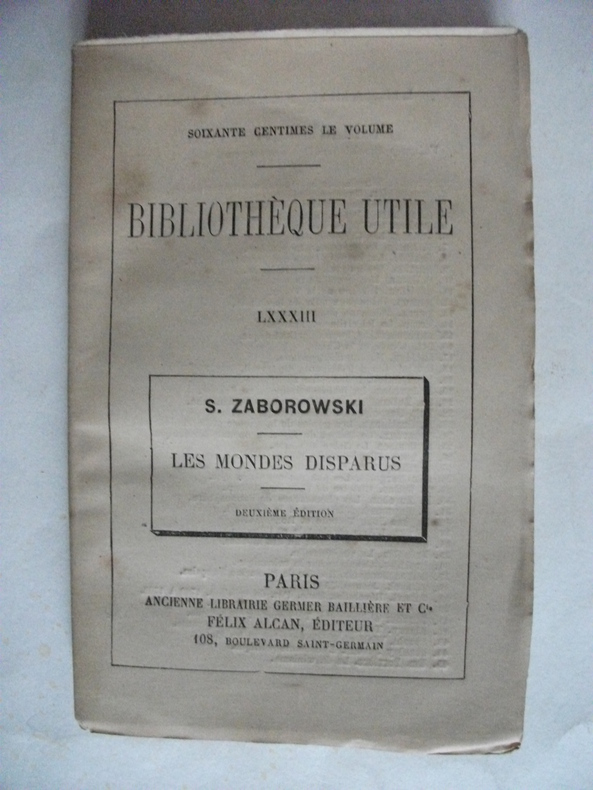
5327in 12 broché,titre,192 pages,figures dans le texte Germer Baillière Cie Félix Alcan. Mention de deuxième édition. Rousseurs éparses Bibliothèque utile LXXXIII
20114137384Routledge 2011. This is an ex-library book and may have the usual library/used-book markings inside.This book has soft covers. In good all round condition. Please note the Image in this listing is a stock photo and may not match the covers of the actual item550grams ISBN:9780415666718 Routledge paperback
1966w220931819Ch'eng-Wen Publishing Company 1966. 367pp. Green cloth hardback 359pp. Green cloth hardback no DJ's volume one has slight faded area on front cover fold out maps in each volume index footnotes volume one has books one and two volume two has books three and four Cathay and the Way Thither : Being a Collection of Medieval Notices of China . Hard Covers. Very Good. Ch'eng-Wen Publishing Company
19972080502106917508Not Available 1997. Soft Cover. Fine. The book is in fine condition. Not Available paperback
20118665007Springer 2011. This is an ex-library book and may have the usual library/used-book markings inside.This book has hardback covers. Clean from markings. In good all round condition. Please note the Image in this listing is a stock photo and may not match the covers of the actual item650grams ISBN:9789048198665 Springer hardcover
19964931229Pergamon 1996. This is an ex-library book and may have the usual library/used-book markings inside.This book has hardback covers. In fair condition suitable as a study copy. No dust jacket. Please note the Image in this listing is a stock photo and may not match the covers of the actual item1450grams ISBN:9780080425191 Pergamon hardcover
20134315232Ashgate 2013. This is an ex-library book and may have the usual library/used-book markings inside.This book has hardback covers. In good all round condition. Dust jacket in good condition. Please note the Image in this listing is a stock photo and may not match the covers of the actual item1250grams ISBN:9781409422242 Ashgate hardcover
Previous owner's name on the FEP, clean, bright and tight. Used
Geological Survey Professional Paper 993. Five large fold-out maps enclosed at rear, covering fault lines and failures along the California coast. Cover worn at edges, two small tears on rear cover; first page slightly foxed and last page slightly creased; contents otherwise clean and sound throughout. Used
Pages clean, bright and tight. Good Copy. Used
19755762904University Of Tokyo Press 1975. This is an ex-library book and may have the usual library/used-book markings inside.This book has hardback covers. In good all round condition. No dust jacket. Please note the Image in this listing is a stock photo and may not match the covers of the actual item1450grams ISBN:0860081443 University Of Tokyo Press hardcover
Large paperback, blue covers, showing some wear; contents clean and sound throughout, well-preserved. Pages in bottom-right corner slightly dogeared. Used
In-16°, pp. 197, (3), copertina editoriale con evidenti segni d'uso e del tempo (vedi foto), con alcune mende al dorso (in particolare, un fenditura riparata). Tracce di sottolineatura a matita cancellate. Leggerissimi segni d'umido all'occhietto. Volume numero 175 nella collana "Universale scientifica". Indice: Prefazione; 1. Le origini; 2. Sismologia e struttura della Terra; 3. La gravità e la forma della Terra; 4. L'età della Terra; 5. Il magnetismo e la Terra; 6. La deriva dei continenti e la tettonica a placche. Bibliografia. Indice analitico.
19762090502113714418Not Available 1976. Soft Cover. Fine. The book is in fine condition. Not Available paperback
20014323382Kluwer Academic 2001. Volume 67. This is an ex-library book and may have the usual library/used-book markings inside.This book has soft covers. In fair condition suitable as a study copy. Please note the Image in this listing is a stock photo and may not match the covers of the actual item500grams ISBN:9781402005343 Kluwer Academic paperback
20014323381Kluwer Academic 2001. Volume 67. This is an ex-library book and may have the usual library/used-book markings inside.This book has soft covers. In fair condition suitable as a study copy. Please note the Image in this listing is a stock photo and may not match the covers of the actual item500grams ISBN:9781402005343 Kluwer Academic paperback
20024323380Kluwer Academic 2002. Volume 67. This is an ex-library book and may have the usual library/used-book markings inside.This book has soft covers. In fair condition suitable as a study copy. Please note the Image in this listing is a stock photo and may not match the covers of the actual item500grams ISBN:9781402005343 Kluwer Academic paperback