11 022 résultats
1981R260185644THE COUSTEAU SOCIETY. 1981. In-4. Broché. Etat d'usage, Couv. convenable, Dos frotté, Intérieur frais. 587 pages augmentées de nombreuses illustrations en noir et blanc dans et hors texte, - EX LIBRIS en page de garde - Tranches legerement tachées. Coiffes abimées. Texte sur 2 colonnes.. . . . Classification Dewey : 550-Sciences de la Terre et des autres mondes
1981RO80143121LAFFONT Robert. 27 fév. 1981. In-4. Broché. Etat d'usage, Couv. légèrement passée, Dos satisfaisant, Intérieur acceptable. 587 pages. Nombreuses photos, illustrations et cartes en noir et blanc, dans le texte. . . . Classification Dewey : 550-Sciences de la Terre et des autres mondes
1993R260252581Hachette. 1993. In-4. Relié. Bon état, Couv. convenable, Dos satisfaisant, Intérieur frais. 263 pages augmentées de nombreuses photos en noir et blanc et en couleurs dans et hors texte.. . . . Classification Dewey : 550-Sciences de la Terre et des autres mondes
14489Paris, Librairie Agricole, 1894, 1 br., couverture illustrée. in-12 de 164-(28) pp., illustrations ;
1991R260252670Ramsay / Agence Jules Verne. 1991. In-4. Relié. Très bon état, Couv. convenable, Dos satisfaisant, Intérieur frais. 306 pages augmentées de nombreuses photos en noir et blanc et en couleurs dans et hors texte.. . . . Classification Dewey : 550-Sciences de la Terre et des autres mondes
181413167Paris, Chez Testu, 1814. Orig.-Broschur, 8°, 630 Seiten. Katalog der Ausstellung Prähistorische Staatssammlung München.
1992LFA00aa9N° 13 - Janvier-Février 1992 : une revue de 106 pages, format 270 x 210 mm, illustrée, brochée
ill., br. Piemonte, Valle d'Aosta e Alpini. Due regioni e un corpo militare. Tanta storia e tanti ricordi. Battaglie vinte, guerre perse. Simboli e linguaggio, luoghi e vette. Poi la piana russa, il caldo torrido africano e ancora la vita di caserma. Dal 1872 ad oggi sono cambiati loro, gli Alpini, e anche le due regioni. Un fatto. Per anni sono state costruite caserme e fortificazioni. Ora sono macerie o utilizzate per altro. Rimangono i ricordi e i segni, sono attivi i professionisti, vanto italiano nel mondo. Si faceva la naja, ora no. Si andava in guerra ora alcuni la studiano. C'erano divise colorate e poi grigio-verdi, infine mimetiche. Sono cambiate le armi, i muli sono sulle foto e nulla più. Le lapidi nei nostri paesi ci ricordano più generazioni che non hanno avuto un domani. Ricordiamo davvero la ritirata della Russia? Sappiamo di essere stati in Africa, in Grecia e in Francia a combattere? La storia è davvero come la ricordiamo o come a scuola l'hanno raccontata? Questo volume non è scolastico, non è enciclopedico e neppure nozionistico. Semplicemente, con "colore" dipinge una storia davvero a tinte grigie. È curioso scoprire che il primo alpino indossava i mocassini, aveva la giubba azzurra e sul capo aveva un cappello alla "calabrese".
br. Perché gli alpini sono diventati un mito così popolare nell'immaginario degli italiani, passando indenni attraverso due guerre mondiali, la dittatura, la guerra civile, la guerra fredda, mentre il resto della forze armate perdeva molto del proprio prestigio e della propria capacità di attirare consenso? Le origini di questa straordinaria fortuna, unica in Europa, deve forse essere ricercata in una complessa interazione tra testi letterari di successo, capaci di riutilizzare il preesistente mito delle Alpi di origine romantica, e una potente rete associativa, l'Associazione Nazionale Alpini, capace di farsi promotrice del mito, collettore di consenso, e di mobilitare negli ultimi cinquant'anni decine di migliaia di persone in grandi feste pubbliche e patriottiche.
19785578141Schweizerbartsche Verlagsbuchhandlung Stuttgart 1978. Volume 38. This is an ex-library book and may have the usual library/used-book markings inside.This book has hardback covers. In fair condition suitable as a study copy. No dust jacket. Re-bound by library. Library sticker on front cover. Please note the Image in this listing is a stock photo and may not match the covers of the actual item1500grams ISBN:3510650832 Schweizerbartsche Verlagsbuchhandlung Stuttgart, hardcover
1944CCC00229159. edition associaçao de cultura Franco-brasilieira Images françaises, 1944. Couverture souple. État : Très bon. In-8 (18 X 13 cm) imprimé en septembre 1944 sur les presses de Fabral Rio de Janeiro. Envoie de l'auteur à l'ambassadeur. Dédicacé par l'auteur
654489914National Academy Press pp. 422 . Hardback. New. National Academy Press hardcover
1892AC1961Park City UT: Russell Process Co. 1892. Three booklets bound together; Ex-library copy minimally marked. Rear two pages related to The Russell Process The Improved Method of Lixiviation are detached but laid in else clean and tight textblock with some edge chipping. 16p. The process of Lixiviation reprinted and extended from the Engineering & Mining Journal 1892-1893. Reprint. Stapled Wraps. Very Good. 8vo - Over 7 3/4" - 9 3/4 " Tall. Paper Back. Russell Process Co. Paperback
In-8 p. (mm.220x145), 2 volumi in 1, mz. pelle coeva (piatti con mancanze), fregi e tit. oro al dorso. L’opera, con testo su due colonne, molto ben illustrata da complessive 68 (su 74) tavole inc. in rame e numerate (poste alla fine del volume), è così composta: - "Chili, Paraguay, Uruguay, Buenos Aires" di Famin C., pp. (4),99;63; con 24 tavv, dedicate al Cile e 16 al Paraguay che raffigurano: usi e costumi, flora e fauna locali + 1 cartina geografica, ripieg., dedicata alle provincie unite del Rio della Plata (Paraguai, Uruguai e Chili). - "Patagonia, Terra del Fuoco ed isole Maluine" di La-Croix F., pp. 92 (incluso l’Indice), con 5 tavv. + la relativa cartina geografica, ripieg., numer. I. e II. - "Storia e descrizione delle isole dell’Oceano" di Bory di Saint-Vincent e Lacroix F. (con proprio frontesp., 1842), pp. 183 (Indice incluso). Questo secondo vol. è così suddiviso: Isole Orcadi - Shetland - Feroe - Normanne (Jersey, Guernesey, Serk e Aurigny) - Terranuova (San Pietro e Miquelon) - Bermude - Crozet - Galapagos - Revilla Gigedo. Fanno seguito le "Regioni circompolari" di Lacroix F., da p. 185 a 343 (incluso Indice), costituite da: Polo Artico - Islanda - Groenlandia, con 21 tavv. che raffigurano i nativi, loro abitazioni e vedute. Volume della Collana “L’Universo o Storia e descrizione di tutti i popoli, loro religioni, costumi, usanze, ecc. Con aloni, 8 tavv. ingiallite, ma complessivam. discreto esemplare.
Carta geografica tratta dall’ Atlante geografico. Corredato di notizie relative alla geografia fisica politica, ed in generale alla statistica delle varie regioni del Globo. Compilato ed eseguito in litografia per cura e sotto la direzione di Benedetto Marzolla edito a Napoli nel 1858. Marzolla, autore di importanti atlanti sulle provincie del Regno di Napoli, è anche autore di diverse carte sulle Circoscrizioni Ecclesiastiche nel Regno delle Due Sicilie, pubblicate postume, nello stesso anno della morte (1858) a Napoli nello Stabilimento Geografico diretto da Luigi Manzella. Benedetto Marzolla fu disegnatore topografo e litografo; geografo e cartografo; membro della Commissione di statistica presso il Ministero dell'Interno. Personaggio di grandissimo rilievo nella cartografia napoletana ed italiana del XIX secolo, Marzolla ottenne in vita pubblici riconoscimenti ed attestati per la produzione cartografica di altissima qualità. La sua notorietà si è lentamente dissolta dopo la morte; va tuttavia osservato che solo la mancanza di uno spiccato coinvolgimento politico in senso risorgimentale e di una valenza letteraria nella sua opera non lo hanno reso famoso come i contemporanei Francesco Costantino Marmocchi (1805-1858) e Attilio Zuccagni-Orlandini (1783-1872), con i quali può certamente confrontarsi. I progetti culturali didattici e editoriali di Marzolla furono e rimangono di straordinaria modernità; egli inventò, è il caso di dire, un nuovo modo di intendere e di disegnare la carta geografica, fornendo una visione assolutamente originale della comunicazione dei dati geografici attraverso la combinazione di testo e immagine. Con tale operazione, egli riuscì a fondere in un'unica opera, storia, geografia, economia, statistica e cartografia, raggiungendo un equilibrio grafico di rara efficacia (cfr. V. Valerio, Benedetto Marzolla Brindisino, Geografo e Cartografo dell'800 Europeo, Brindisi 2008). Bell’esemplare con coloritura coeva dei contorni, in ottimo stato di conservazione. Bibliografia V. Valerio, Benedetto Marzolla Brindisino, Geografo e Cartografo dell’800 Europeo (2008), n. 136. Map taken from the Atlante geografico. Corredato di notizie relative alla geografia fisica politica, ed in generale alla statistica delle varie regioni del Globo. Compilato ed eseguito in litografia per cura e sotto la direzione di Benedetto Marzolla published in Naples in 1858. Marzolla, author of important atlases on the provinces of the Kingdom of Naples, is also the author of several maps on the Ecclesiastical Circumscriptions in the Kingdom of the Two Sicilies, published posthumously in the same year of his death (1858) in Naples in the Stabilimento Geografico directed by Luigi Manzella. Benedetto Marzolla was draftsman topographer and lithographer, geographer and cartographer. Character of great importance in the Neapolitan and Italian cartography of the nineteenth century, Marzolla obtained during his life public recognition and certificates for the production of high quality cartography. His notoriety slowly faded after his death; it should be noted, however, that only the lack of a strong political involvement in the sense of the Risorgimento and of a literary value in his work did not make him as famous as his contemporaries Francesco Costantino Marmocchi (1805-1858) and Attilio Zuccagni-Orlandini (1783-1872), with whom he can certainly compare himself. Marzolla's cultural, didactic and editorial projects were, and remain, extraordinarily modern; he invented a new way of understanding and drawing maps, providing an absolutely original vision of the communication of geographical data through the combination of text and image. With this operation, he was able to merge in a single work, history, geography, economics, statistics and cartography, achieving a graphic balance of rare effectiveness. Benedetto Marzolla is famous for being among the most important cartographers of the XIX century, for being the one to print geographic maps using high quality lithographies. His Atlante Geografico, made of 58 maps, presents finely sketched works. Six maps depict North America, among them famous map of gold diggers in California, deriving from Hippolite Ferry. Extremely relevant are also the maps of Antarctic, South Africa with the plan of Cape Town and those about Australia. Though the maps are dated between 1843 and 1856, this 1858 edition, printed in Naples at the Stabilimento Geografico Strada San Carlo (founded by Marzolla himself), represents the final version of his atlas, the last one before his death. A posthumous edition will be published in 1865. The atlas is pretty rare, is not actually listed in Phillips, British Library e OCLC. Beautiful specimen with contemporary coloring of the contours, in excellent condition. Bibliografia V. Valerio, Benedetto Marzolla Brindisino, Geografo e Cartografo dell’800 Europeo (2008), n. 136.
0883639467.Gpaperback. Good. Access codes and supplements are not guaranteed with used items. May be an ex-library book. paperback
1890028137Ann Arbor Michigan: Meteorological Journal Company 1890. This is the original Volume 6 1890; NOT print on demand. NOT a modern reprint. Full title: "American Meteorological Journal: A Monthly Review of Meteorology Medical Climatology and Geography Volume VI May 1889 - April 1990." Contains issues No. 1 - 12. Cover is Poor as it lacks the front board and the rear board is detached. Leather spine is very worn. It is brightly gilt-stamped over red and black leather labels. Internal condition is Very Good. NO owner's name or bookplate. NOT a library discard. Most pages are creamy white clean and unmarked. The last issue April 1890 #12 is a little age toned having been printed on paper different from the other 11 numbers. This book is suitable as a reading / reference copy. Or because all pages are present and still bound together including blanks at the beginning and end it is a good candidate to be inexpensively recased. First Edition. Hardcover. Poor - Very Good condition. Illus. by NOT a library discard. 12 issues. Great Packaging Fast Shipping. Meteorological Journal Company Hardcover
160 pages. Features: The Sickness of our American Cities - Baltimore; The Conspiracy Against America - Excerpts of an address by Revilo P. Oliver to the American Coalition of Patriotic Societies; New York - The Freeloader's Paradise - The Empire State Becomes The Welfare State; How America Muffed Space Supremacy - we did not heed the warnings of Robert H. Goddard; Spare Parts for Human Hearts; That Athletic Second Rater-Man; Stay Away, U.S.A.; Defense Against Communism - Living Christianity is the Best; Istanbul's Grand Bazaar; The Health of the American People; 15 Years of U.N. Deceit - Agency Directed its Funds to Promote Socialism; "An Unauthorized Telegram" - How Ike let the Soviets occupy Berlin, Prague, and Vienna; The "Colorful" White House; We Lose Our U.N. Majority; The Bustling Canadian Border; Earth Poetry; Mercury Warned You; Let Them Explode; Coro Foundation - Political Bootcamp; Civil Rights; Evergreen - climate changes have resulted from deforestation and soil-depletion; Conservation - For Whom?; Greenland Today; The South Has Lessons to Teach; Wandering Children of the Sea; Olympia's Immortal Athletes; Government Office with Federal Funds; Who is Fighting the Loyalty Oath; Wild Foxes, Hoot Owls and TV; Wisconsin's New Indian County; The Honorable Sweet Potato; The Sweetest Little War; I Found the Palace of Kublai Khan; The Custom Hat; Are Fish More Important than People? - A core of doctors and dentists scientifically oppose fluoridation; Ice Cream - Delicious Dessert or Poison Potion?; The "Hollow" Man - John Cleves Symmes had strange theories about the earth's interior; and more. Minimal markings. Bottom of pate 149 removed, apparently with no loss to text. Moderate wear. A worthy vintage copy. Book
75-4352Evanston Illinois: Terra Museum of American Art 1982. 4to. Stapled Wrap ca. 30 pp. Very Good B&W and Color Plates. Provenance: Richard A. Lorenz 1952-2001 author art conservator curator and artist Berkeley California. As a trustee of The Imogen Cunningham Trust Mr. Lorenz organized and curated exhibitions of Cunningham's photographs. Evanston, Illinois: Terra Museum of American Art, 1982 unknown
1981138941981. Softcover. VG. White wraps. 32 pp. 13 color 29 bw plates. Foreword by John Wilmerding essay by Ronald McKnight Melvin bibliography several excellent plates. unknown books
198981871989. Softcover. VG. Wraps. 16 pp. 5 color plates. Catalogue briefly lists 48 works by such artists as Breck Bruce Bunker Cassatt Curran Demuth Frieseke Glackens Hassam Homer MacMonnies Metcalf Miller Morse Prendergast Ritter Robinson Sargent Tanner Twachtman Vonnoh Walter Wendel and Whistler. Most works are from the Terra Collection. unknown books
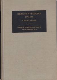
197138264American Geographical Society. Very Good with no dust jacket. 1971. Hardcover. Exlibrary with usual library markings. ; 554 pages . American Geographical Society hardcover
188032015AB1880. Erstausgabe Einsiedeln u.a. Benziger 1880 4° 316 S. mit 55 Holzstich-Illustrationen Goldschnitt roter original Leineneinband mit goldener Deckel- und Rückenbeschriftung sowie schwarzer Einbandverzierung Rücken mit altem und unauffälligem Signaturschildchen die Rückenkanten stellenw. sehr zart angeplatzt Vorsatz- und Titelseite mit altem Stempel der Lehrerbibliothek eines alteingesessenen Frankfurter Gymnasiums innen durchgäniger zarter Wasserrand unten die ersten Seiten stellenw. etwas fingerspurig sonst ein gutes textsauberes Exemplar li 01 Abholung im Ladengeschäft in Frankfurt am Main Nordend ggü. Musterschule möglich. Das spart die Portokosten. Pickup at the store in Frankfurt am Main Nordend close to Musterschule is possible. It saves the shipping costs. unknown
Peso di spedizione : 5.000 g (Opere geografiche di Reclus - Terre boreali) In 4°, bella legatura editoriale (firmata Magnier) con dorso in marocchino rosso, piatti in tela, tagli dorati. Ai piatti emisferi e rosa dei venti impressi in nero ed oro, al dorso strumenti scientifici, titolo e fregi dorati, pp. (4),721,(3) con 55 vedute (molte a piena pagina) nel testo, 165 carte n. t. e 4 carte geografiche a colori fuori testo. Collana "Nouvelle Gèographie Universelle". Volume ben conservato.