N[icolas] de FerBiblio.com
56 résultats
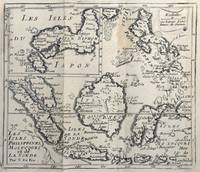
167862465<p>copper engraving. EXTREMELY RARE map from "Méthode pour apprendre facilemente la Géographie …par M. Robbe chez Henri van Bulderen…. 4th or earlier edition published in Paris; it is the basis for other later versions which do not show the name "N. de Fer" in the cartouche i.e. by Peeters and Afferden. Reference: Walter Japan OAG 51 - Quirino p. 87 knows only Peeters; Koeman: Pee 1 vol.III Peeters Koeman I AFF 1; Bonacker 27; Bagrow/Skelton 466 all Afferden. Condition: folds as issued slight offsetting stain on left margin not into plate; paper toning.</p> published in Paris.
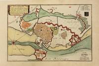
1700M10974Paris 1700. Very Good. Notes: Map of Copenhagen Capital of Denmark. Size : 227x337 mm 8.94x13.27 Inches Coloring: Hand Colored Category: Maps Europe Scandinavia Countries; Maps City Maps; unknown
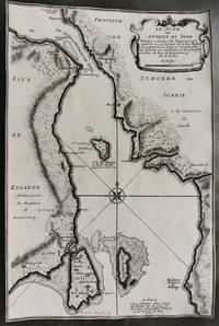
1700M10800Paris 1700. Very Good margins are trimmed. Notes: Map of Oresund strait between Denmark and Sweden. Size : 328x218 mm 12.91x8.58 Inches Coloring: Black & White Category: Maps Europe Scandinavia Countries; unknown
162450831624 broché - 16x24,5 - 79 pp - 1993 - imprimerie du château, Gy. nombreuses photographies hors texte.
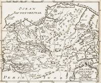
1700398AG1700. Paris c. 1700. Original copper engraved map. 16 cm wide x 13.2 cm high. Mounted on paper. Very good condition. From a wonderful collection of Maps from an old english library South Shields - with a tiny library stamp to the mounting paper The stamp is NOT on the Map. Nicolas de Fer 164625 October 1720 was a French cartographer and geographer. De Fer was the youngest of three sons of Antoine de Fer who was also a cartographer. When he was 12 he became the apprentice of Parisian engraver Louis Spirinx and made his first map of the Canal du Midi at the age of 23. After the death of his father in June 1673 his mother Geneviève initially took over the map making company which had begun to decline. She passed it and the atelier called Quai de L'Horloge on to Nicolas in 1687 because of her old age. De Fer was so successful at improving the firm that in 1690 he became the official geographer to Louis Dauphin of France. With support from the Spanish and French Royal Families de Fer also became official geographer for Philip V and Louis XIV the kings of Spain and France respectively. Because of this his maps became Bourbon propaganda endorsing French King Louis XIV. His business flourished producing town plans atlases wall maps and more than 600 sheet maps. He made maps of places in Europe and North America including New Spain places fortified by Vauban the Low Countries and the War of the Spanish Succession. In 1698 de Fer published a map of North America which included a depiction of beavers building dams near Niagara Falls. Seventeen years later Herman Moll published a map which plagiarized elements of de Fer's work particularly the beaver scene. It became known as the "Beaver map". De Fer became the official geographer for His Catholic Majesty in 1720. Two of his sons-in-law Guillaume Danet and Jaques-François Bénard continued the company after de Fer's death on 25 October of that year until around 1760. Wikipedia unknown
1671LBW-5776Paris, A. de Fer, 1671. 380 x 525 mm.