FER (Nicolas de).Livre Rare Book
56 résultats
1690LBW-4825Paris, de Fer, [1690-1695].
1690LBW-4820Paris, Sr. de Fer, [1690-1695]. 162 x 276 mm.
1695LBW-4835Paris, Sr. de Fer, 1695. 175 x 273 mm.
1690LBW-4823[1690-1695]. 170 x 288 mm.
1690LBW-4824Paris, Sr. de Fer, [1690-1695]. 169 x 294 mm.
1690LBW-4830Paris, Sr. de Fer, [1690-1695]. 190 x 253 mm.
1695LBW-4827Paris, Sr. de Fer, 1695. 171 x 272 mm.
1690LBW-4818Paris, Sr. de Fer, [1690-1695]. 169 x 288 mm.
1695LBW-4829Paris, Sr. de Fer, 1695. 185 x 245 mm.
1690LBW-5651Paris, Sr. de Fer, [1690]. 222 x 329 mm.
1690LBW-5661Paris, Sr. de Fer, [1690]. 221 x 329 mm.
1690LBW-4832Paris, Sr. de Fer, [1690-1695]. 159 x 259 mm.
1690LBW-4817Paris, Sr. de Fer, [1690-1695]. 185 x 229 mm.
1695LBW-4828Paris, Sr. de Fer, 1695. 255 x 162 mm.
1690LBW-4819[1690-1695]. 189 x 267 mm.
1692LBW-8595[1692]. 148 x 272 mm ; contrecollé sur carton.
170015901Paris 1700. Early original color large map of California showing it as an island and based on the explorations of missionary Father Kino. From De Fer's Atlas Curieux. In great detail with 314 locations in New Mexico identified by a numbered key at the upper right portion of the map. Engraved by Charles Inselin. mage size: 13 1/2 x 8 7/8". Paper size: 16 1/2 x 11 1/2". With a small chip at lower edge; very faint damp staining at upper left corner toning to edges; otherwise very good. Tooley R. V. Amer P 126-7. unknown
169315226Paris:: De Fer 1693. 19 x 20cm. Single leaf. Illustrated title page. Trimmed just outside borders clean. Mounted on larger plain leaf. Suitable for framing. De Fer, unknown
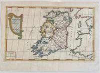
1689322292Paris: Nicolas De Fer 1689. unbound. Map. Engraving with original hand outline color. Sheet measures 13" x 9.5". Image measures 12.75" x 7.25".<br/> <br/> This is a lovely 1689 map of Ireland by Nicolas De Fer. Depicts the Emerald Isle in its entirety color coded and subdivided into its four provinces of Ulster Connacht Leinster and Munster. Parts of Scotland the Isle of Man and England and Wales are also visible. Major towns lakes rivers and islands are noted in Ireland and mountains beautifully rendered in profile. The title cartouche represents the Celtic Harp. The map is in good condition with minor toning along the original fold. Original platemark visible.<br> <br> Nicolas de Fer 1646-1720 was a prolific cartographer engraver and publisher who took over the family map business from his mother when she retired in 1687. The business flourished and he gained a great reputation in his lifetime and was appointed 'Geographer to the King' in 1690. This map demonstrates his skill and provides a curious yet alluring mixture of history and geography.<br/> <br/> Nicolas De Fer unknown
1700002589Paris 1700. Desencadernado / Disbound. Muito Bom/Very Good/Très Bien. 325 x 240 mm. A. Coquart Sculp. Fina gravura em chapa de cobre colorida a aguarela inserida no "Atlas Curieux ou le Monde Cca 1700. Representando três vistas de Lisboa em diferentes cartuxos: Uma vista razante do terreiro do Paço com a representação do antigo paço e do Convento de S. Domingos com uma vista do cais e do terreiro onde se desenrrolam cenas do quotidiano nomeadamente uma cena de equitação. Uma vista da Torre de Belém rodeada de barcos e navios e Uma planta das fortificações da cidade com identificação do castelo e do Palácio Real identificando um pântano "marais" ao norte da fortificação. Apresentada num passpartout de cartão pronta para encaixilhar. <br/> <br/> unknown
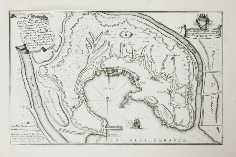
1693bp47Paris 1693. No Binding. Good. copper-plate print. uncoloured. fortification and Church jutting into mediterranean. cartouche with cherub like individuals and a sheep. Our orders are shipped using tracked courier delivery services. Paris unknown
17008374Paris 1700. Copper engraving 22.5 x 33.5 cms engraved by C. Inselin black and white slight soiling bottom right blank verso; the key lists 113 places of interest. This is the first version of the map before the date was amended. Howgego Printed Maps of London 44 1 unknown
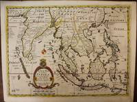
1700M6975London c. 1700. Very Good. Notes: A late 17th Century map of South East Asia by Edward Wells based upon the previous work by De Fer. <br><br>The cartouche has the dedication in the coat of arms to the Duke of Gloucester. Size : 367x487 mm 14.45x19.17 Inches Coloring: Original Outline Coloring Category: Maps Asia South East; Maps Asia Central India & Sri Lanka / Ceylon; unknown
165013241650 S.d., vers 1650, 30 x 39 cm, gravure sur cuivre émargée MAGNIFIQUE GRAVURE ORIGINALE photos sur demande