Journal d'Agriculture Pratique Vol. 2
1390440710.Gpaperback. Good. Access codes and supplements are not guaranteed with used items. May be an ex-library book. paperback
Bonita · États-Unis73,29 $US≈ 62,01 €
2 067 résultats
20161-3639603737Editorial Académica Española 2016. Paperback. New. 248 pages. Spanish language. 8.66x5.91x0.56 inches. Editorial Académica Española paperback
1390440710.Gpaperback. Good. Access codes and supplements are not guaranteed with used items. May be an ex-library book. paperback
19023172772Madrid.: J. Fortanet. 1902. Hardcover. Cubierta deslucida. Good. 23 cm. 371 p. lám. 1-16. Encuadernación en tapa dura de editorial. Por Ginés Moncada y Ferro . Cubierta deslucida. Minas [J. Fortanet]. hardcover
19023284822Cartagena.: José Requena. 1902. Hardcover. Cubierta deslucida. Contiene párrafos subrayados a lápiz. Good. 22 cm. IX 346 p. 1 h. con 16 lám. Encuadernación en tapa dura de editorial. Explicadas. por Ginés Moncada y Ferro Ingeniero . Cubierta deslucida. Contiene párrafos subrayados a lápiz. José Requena. hardcover
1023392364.Ghardcover. Good. Access codes and supplements are not guaranteed with used items. May be an ex-library book. hardcover
1023161389.Ghardcover. Good. Access codes and supplements are not guaranteed with used items. May be an ex-library book. hardcover
183753481N.p. n.d. 1837. 8vo pp. 36; large folding lithograph frontispiece of the Iron Mountains of Missouri one other full-page map; removed from binding; very good. American Imprints notes 3 editions in 1837: Hartford Philadelphia and Boston. The present edition is not located in American Imprints. Missouri Imprints 197. unknown
183730091St. Louis 1837. 36pp folding plate frontis full-page map. Institutional rubberstamps at base of title page verso. Original printed wrappers light rubberstamp discard stamp on front wrapper. Otherwise Very Good. <br /> <br /> "Missouri Imprints Inventory No. 197 cites only one copy. This tract is probably the first description of Iron mines west of the Mississippi. The Iron Mountains were located in St. Francis and Madison Counties. A proposal is made to make iron rails for a railroad from the mountains to the Mississippi" Decker. <br /> AII MO 197 1. 37 Decker 214. Not in Eberstadt Soliday Graff. OCLC indicates a number of institutional copies. unknown
30627256like new. unknown
30627256-nnew. unknown
A9789462987173Paperback / softback. New. This book critically reflects on the role and usefulness of big data challenging overly optimistic expectations about what such information can reveal. paperback
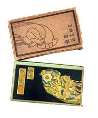
192485112Hakubunkan 1924. Fine. Hakubunkan 1924 19.50 x 11 cm broché Work published by the Japanese Ministry of Railways admirably illustrated with 130 double-page color illustrations by Hatsusaburo Yoshida: 2 decorating the pastedowns traditional Japanese animated scenes 26 views and 104 bird's-eye view landscape maps. Numerous black maps including a large one at the end of the Japanese railways which is detached. Pale green cloth covers. Smooth spine with title. Boards printed in black with a sample of Japanese fabric a cartouche for the title. Cardboard slipcase repeating the board motifs in black. Small lacks to slipcase rubbing and corners bumped. Fine condition of the collection with occasional light foxing. A paper lack to the pastedowns at the end of the volume. Some pages with fine manuscript notes in ink. Celebrated as the Hiroshige of the Taisho era Yoshida 1884-1955 was a painter and cartographer. His bird's-eye view maps and views are enhanced by multiple colors and changes of season and weather. A major retrospective of his works took place in Japan at the Sakai Museum in 1999. Hakubunkan hardcover
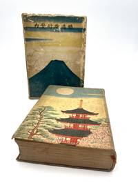
192686404Tky Tokyo: Hakubunkan 1926. Fine. Hakubunkan Tky Tokyo 1926 19.50 x 11 cm relié Work published by the Japanese Ministry of Railways admirably illustrated with 166 illustrations. This new edition was entirely revised and the illustration is completely new. The Ministry of Railways published this collection from 1923 to 1928; from 1923 to 1925 the collection contained numerous bird's-eye view maps by Yoshida which were replaced by photographs and now only adorn the pastedowns. This is the first collection to use photography with 126 black and white photographs and 18 hand-colored ones. 22 color prints by Hatsusaburo Yoshida. 7 folding color maps and several black and white maps in-text. Cloth binding and cardboard slipcase. Pale green cloth covers. Smooth spine with title. Boards printed with a Japanese temple with full moon and trees on the first board and on the second. Illustrated cardboard slipcase with Mount Fuji and birds. Rubbing and dulled edges to the slipcase. Small cut to the cloth on the spine. Fine condition of the collection with some foxing. Spine darkened boards spotted. Handsome copy rare with its original slipcase. A vast undertaking this guide was intended as a monument to the glory of Japan. For the first time modern Japan meets traditional Japan. Celebrated as the Hiroshige of the Taisho era Yoshida 1884-1955 was a painter and cartographer. A major retrospective of his works took place in Japan at the Sakai Museum in 1999. The prints created for this collection are particularly beautiful. Hakubunkan hardcover
2018TK253635Parasol Unit London 2018. 1st Edition. SOFTCOVER. No 473 of 500 numbered copies signed by Lisa Milroy at the rear colophon. Extra Large 4to. in colour printed stiff card covers 85pp on thick art paper colour photos etc __CONDITION : A well preserved AS NEW unmarked and unread copy. . To see more of our Art Monographs etc type DbbARTIST in the Keywords search box __We always ship in PROTECTIVE CARD PARCELS Parasol Unit, London paperback
0267515073.Ghardcover. Good. Access codes and supplements are not guaranteed with used items. May be an ex-library book. hardcover
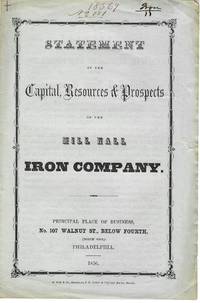
185611228Philadelphia 1856. 4pp folded sheet original printed self wrappers with wrapper title. Light edge wear Very Good. <br /> <br /> The Statement says the Company can "not be surpassed by any similar one in the state with its facilities for getting coal agricultural produce and the means of sending their productions to the best markets." Its property 2000 acres of land is located in "Clinton county on Fishing and Bald Eagle creeks three miles from Lock Haven." It will manufacture iron lime mineral paint water cement and fire-brick. 383 NUC 0580427 2 locs. records the 1854 Act of Incorporation and By-Laws. <br /> FIRST EDITION. Not in Sabin Eberstadt Decker NUC. unknown
W01OS-00438Centro Andaluz del Libro. Used - Very Good. Very Good condition. 4th edition. Spanish edition. Andalusia Spanish Cooking Cookbook Books in Spanish Centro Andaluz del Libro unknown
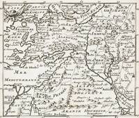
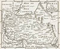
1700402AG1700. Paris c. 1700. Original copper engraved maps. 15.5 cm wide x 13 cm high. Mounted on paper. Very good condition. From a wonderful collection of Maps from an old english library South Shields - with a tiny library stamp to the mounting paper The stamp is NOT on the Map. Nicolas de Fer 164625 October 1720 was a French cartographer and geographer. De Fer was the youngest of three sons of Antoine de Fer who was also a cartographer. When he was 12 he became the apprentice of Parisian engraver Louis Spirinx and made his first map of the Canal du Midi at the age of 23. After the death of his father in June 1673 his mother Geneviève initially took over the map making company which had begun to decline. She passed it and the atelier called Quai de L'Horloge on to Nicolas in 1687 because of her old age. De Fer was so successful at improving the firm that in 1690 he became the official geographer to Louis Dauphin of France. With support from the Spanish and French Royal Families de Fer also became official geographer for Philip V and Louis XIV the kings of Spain and France respectively. Because of this his maps became Bourbon propaganda endorsing French King Louis XIV. His business flourished producing town plans atlases wall maps and more than 600 sheet maps. He made maps of places in Europe and North America including New Spain places fortified by Vauban the Low Countries and the War of the Spanish Succession. In 1698 de Fer published a map of North America which included a depiction of beavers building dams near Niagara Falls. Seventeen years later Herman Moll published a map which plagiarized elements of de Fer's work particularly the beaver scene. It became known as the "Beaver map". De Fer became the official geographer for His Catholic Majesty in 1720. Two of his sons-in-law Guillaume Danet and Jaques-François Bénard continued the company after de Fer's death on 25 October of that year until around 1760. Wikipedia unknown
1700403AG1700. Paris c. 1700. Original copper engraved maps. 15.5 cm wide x 13 cm high. Mounted on paper. Very good condition. From a wonderful collection of Maps from an old english library South Shields - with a tiny library stamp to the mounting paper The stamp is NOT on the Map. Nicolas de Fer 164625 October 1720 was a French cartographer and geographer. De Fer was the youngest of three sons of Antoine de Fer who was also a cartographer. When he was 12 he became the apprentice of Parisian engraver Louis Spirinx and made his first map of the Canal du Midi at the age of 23. After the death of his father in June 1673 his mother Geneviève initially took over the map making company which had begun to decline. She passed it and the atelier called Quai de L'Horloge on to Nicolas in 1687 because of her old age. De Fer was so successful at improving the firm that in 1690 he became the official geographer to Louis Dauphin of France. With support from the Spanish and French Royal Families de Fer also became official geographer for Philip V and Louis XIV the kings of Spain and France respectively. Because of this his maps became Bourbon propaganda endorsing French King Louis XIV. His business flourished producing town plans atlases wall maps and more than 600 sheet maps. He made maps of places in Europe and North America including New Spain places fortified by Vauban the Low Countries and the War of the Spanish Succession. In 1698 de Fer published a map of North America which included a depiction of beavers building dams near Niagara Falls. Seventeen years later Herman Moll published a map which plagiarized elements of de Fer's work particularly the beaver scene. It became known as the "Beaver map". De Fer became the official geographer for His Catholic Majesty in 1720. Two of his sons-in-law Guillaume Danet and Jaques-François Bénard continued the company after de Fer's death on 25 October of that year until around 1760. Wikipedia unknown
Magnus, Bente. PhotographIn near perfect condition. unknown
20192-6139790204Novas Edições Acadêmicas 2019. Paperback. New. 52 pages. 8.66x5.91x0.12 inches. Novas Edições Acadêmicas paperback
1986USD_9780808917557Saunder 1986. 1St. Hardcover. UsedLikeNew/UsedLikeNew. Saunder hardcover
3662483661.Gpaperback. Good. Access codes and supplements are not guaranteed with used items. May be an ex-library book. paperback
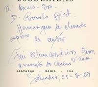
1968593627Salvador Bahia Brasil: Fondacao Goncalo Moniz for the Author 1968. Softcover. Very Good. First edition. Octavo. 131pp. Illustrated with a portrait of the author. Text in Portuguese. Oversized French-folded wrappers. Wrappers sunned at the spine and edges and with modest wear and a bit of soil very good or better. The text is fine. Nicely Inscribed to Knopf translator Pamela Bird in Bahia in the year of publication. Laid in is an advertisement for the Museum of Carmo the Carmelite museum Medeiros helped found at the Convent of Carmo where he lived most of his life. A book of religious poetry. The book appears to have been issued in at least three editions from 1968 to 1973 but all editions are very uncommon. OCLC locates three copies of a 1973 edition two of a 1971 edition and a single copy of this first edition at the University of Iowa. Fondac?a?o Goncalo Moniz for the Author unknown
2018Manohar-9781350063846Bloomsbury 2018. Paperback. New. Bloomsbury paperback