Nicolas De FerBiblio.com
56 résultats
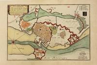
1700M10974Paris 1700. Very Good. Notes: Map of Copenhagen Capital of Denmark. Size : 227x337 mm 8.94x13.27 Inches Coloring: Hand Colored Category: Maps Europe Scandinavia Countries; Maps City Maps; unknown
169822511Paris Nicolas le Gras, Nicolas le Clerc et Barthelemy Girin 1698 -in-12 plein-veau 2 volumes, reliure plein veau havane moucheté in-douze (binding full calfskin in-12)(17,2 x 10,2 cm), dos à nerfs (spine with raised band), décoré or (gilt decoration), titre et tomaison frappés "or", pièce de titre sur fond rouge (label of title) avec filet "or" en encadrement, pièce de tomaison sur fond rouge (label of title) avec filet et roulette "or" en encadrement, roulette "or" en place des nerfs avec un filet à froid de part et d'autre, entre-nerfs à fleuron "or" dans un encadrement d'un filet "or" avec rinceaux "or" aux angles, restaurations anciennes aux coiffes mais fait proprement, plats ornés d'un filet à froid en encadrement, roulette "or" sur les coupes avec manques de dorures(fillets on the cuts), toutes tranches lisses jaspées rouges, orné d'un grand Plan dépliant de PARIS hors-texte gravé sur bois (engraving wood) en noir par DE FER, (VI + 402 pages + 33 Pages de tables) + ( 381 + 31 Pages de tables + 1ff. de privilège + 71 p. : "Le Nom de Toutes les Rues de Paris, par Ordre Alphabetique et les principaux quartiers ou elles se trouvent", 1698 à Paris Chez Nicolas le Gras, Nicolas le Clerc et Barthelemy Girin Editeurs,
162450831624 broché - 16x24,5 - 79 pp - 1993 - imprimerie du château, Gy. nombreuses photographies hors texte.
169532945Paris ca. 1695. 23x295 cm. Kobberstukket kort i fugleperspektiv over Göteborg og den nordlige del af sundet med byplan og fortifikationer. Med stor kartouche. Håndkoloreret. <br/><br/><em>Fra Nicholas de Fer: "Les Forces d l'Europe". </em> unknown
169532945(Paris, ca. 1695). 23x29,5 cm. Kobberstukket kort i fugleperspektiv over Göteborg og den nordlige del af sundet med byplan og fortifikationer. Med stor kartouche. Håndkoloreret.
1700398AG1700. Paris c. 1700. Original copper engraved map. 16 cm wide x 13.2 cm high. Mounted on paper. Very good condition. From a wonderful collection of Maps from an old english library South Shields - with a tiny library stamp to the mounting paper The stamp is NOT on the Map. Nicolas de Fer 164625 October 1720 was a French cartographer and geographer. De Fer was the youngest of three sons of Antoine de Fer who was also a cartographer. When he was 12 he became the apprentice of Parisian engraver Louis Spirinx and made his first map of the Canal du Midi at the age of 23. After the death of his father in June 1673 his mother Geneviève initially took over the map making company which had begun to decline. She passed it and the atelier called Quai de L'Horloge on to Nicolas in 1687 because of her old age. De Fer was so successful at improving the firm that in 1690 he became the official geographer to Louis Dauphin of France. With support from the Spanish and French Royal Families de Fer also became official geographer for Philip V and Louis XIV the kings of Spain and France respectively. Because of this his maps became Bourbon propaganda endorsing French King Louis XIV. His business flourished producing town plans atlases wall maps and more than 600 sheet maps. He made maps of places in Europe and North America including New Spain places fortified by Vauban the Low Countries and the War of the Spanish Succession. In 1698 de Fer published a map of North America which included a depiction of beavers building dams near Niagara Falls. Seventeen years later Herman Moll published a map which plagiarized elements of de Fer's work particularly the beaver scene. It became known as the "Beaver map". De Fer became the official geographer for His Catholic Majesty in 1720. Two of his sons-in-law Guillaume Danet and Jaques-François Bénard continued the company after de Fer's death on 25 October of that year until around 1760. Wikipedia unknown
16671606290099Venice: Presso Gio: Giacomo Hertz MDCLXVII 1667-01-01. Hardcover. Acceptable. Folio 33 cm. Handsome modern leather spine over marbled boards. Woodcut head- and tail-pieces initials and plant illustrations throughout.12 476 27 p. : ill. Title page dedication page and final 5 leaves of index supplied in facsimile. Margins of some of the prelims conserved. Custom book plate of Rev. Paul J. Barry on front paste down. Herbario Nuovo first published in 1585 is a description of medicinal plants from Europe and the Indies. It went through 11 editions and was actively used for over 130 years. "This was a popular Italian herbal that was reprinted in Italian and translated and published in several other languages for a number of years. The plant descriptions are written in the form of poems which Arber describes as 'pleasingly unscientific.' The Linnean genus Duranta formerly Castorea is named for the author" - Hunt 229. Nissen 569. NLM. Venice: Presso Gio: Giacomo Hertz, MDCLXVII hardcover
169315226Paris:: De Fer 1693. 19 x 20cm. Single leaf. Illustrated title page. Trimmed just outside borders clean. Mounted on larger plain leaf. Suitable for framing. De Fer, unknown
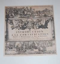
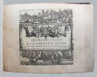
1695129558Paris: Chez l'auteur 1695. 188 engraved leaves printed on rectos only comprising the 167 plates 2 folding listed in the table of contents plus 5 plates not listed or numbered 9 plates numbered in French the pictorial title page naval and land battle scenes and 6 leaves of explanatory text for the first few plates plus a folding table of distances and a table of contents listing plates numbered 21-189 as issued; oblong 4to; early calf the spine with gilt lettered red leather title label and gilt decorated compartments between raised bands the boards rubbed with a few small surface grazes edges worn the leather lifting along fore-edge of upper board especially at bottom fore-corner small piece torn from head of spine the upper joint starting at extremities; inked ownership inscription near the bookplate of Alec Hill on the upper pastedown earlier small inked ownership inscription on upper free endpaper pencilled annotation at head of last leaf most plates neatly numbered in an early hand one plate Paris loose some damp stains occasionally large mostly to margins with a few encroaching onto plate surface several small edge chips and splits occasional slight creasing scattered light foxing and soiling; chez l'auteur Paris 1695. First edition. From the collection of Australian military historian and academic Alec Hill 1916-2008. Nicolas de Fer 1646-1720 inherited his father's cartography business which he developed into a flourishing enterprise producing town plans atlases and over 600 sheet maps and becoming one of the most prolific cartographic publishers of his era. In 1690 he was appointed official geographer to the Dauphin the heir to the French throne and when Louis XIV's grandson the Duke of Anjou acceded to the Spanish throne de Fer was proclaimed Geographer of the King of Spain as well. De Fer made maps of places throughout Europe and in North America including one in 1698 depicting beavers building dams near Niagara Falls. Introduction a la Fortification was issued in parts between 1690 and 1695 then re-issued in 1705 with the maps re-dated accordingly. Maps in this copy are dated from 1692 to 1695 with several undated. They depict fortified towns in France the Low Countries Germany Italy Spain and around the Mediterranean. The extra plates in this copy are Chartres Nouveau Canal Echelle Quebec and Batavia. The intricate folding Table Geografique enables the reader to calculate journey distances from Paris to all the principal towns in Europe. Chez l'auteur unknown
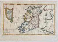
1689322292Paris: Nicolas De Fer 1689. unbound. Map. Engraving with original hand outline color. Sheet measures 13" x 9.5". Image measures 12.75" x 7.25".<br/> <br/> This is a lovely 1689 map of Ireland by Nicolas De Fer. Depicts the Emerald Isle in its entirety color coded and subdivided into its four provinces of Ulster Connacht Leinster and Munster. Parts of Scotland the Isle of Man and England and Wales are also visible. Major towns lakes rivers and islands are noted in Ireland and mountains beautifully rendered in profile. The title cartouche represents the Celtic Harp. The map is in good condition with minor toning along the original fold. Original platemark visible.<br> <br> Nicolas de Fer 1646-1720 was a prolific cartographer engraver and publisher who took over the family map business from his mother when she retired in 1687. The business flourished and he gained a great reputation in his lifetime and was appointed 'Geographer to the King' in 1690. This map demonstrates his skill and provides a curious yet alluring mixture of history and geography.<br/> <br/> Nicolas De Fer unknown
1700LBW0029bParis chez l'auteur 1700 220 x 328 mm.
1700M5178Paris 1700. Very Good. Size : 225x340 mm 8.875x13.375 Inches Coloring: Original Outline Coloring Category: Maps South America Countries; unknown
165013241650 S.d., vers 1650, 30 x 39 cm, gravure sur cuivre émargée MAGNIFIQUE GRAVURE ORIGINALE photos sur demande
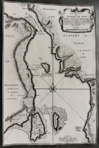
1700M10800Paris 1700. Very Good margins are trimmed. Notes: Map of Oresund strait between Denmark and Sweden. Size : 328x218 mm 12.91x8.58 Inches Coloring: Black & White Category: Maps Europe Scandinavia Countries; unknown
170015700Paris: N. de Fer 1700-05. Other. Full margins as published. In excellent condition. 233 by 343mm 9 by 13 inches. 233 by 343mm 9 by 13 inches. Original antique hand-colored copper engraving published 1700. Depicting Kingdom of Naples this map is a fine example of 0s European cartography. Image: 233 by 343mm 9 by 13 inches. An attractive and historically significant 18th-century map for the discerning collector. Nicolas de Fer 16461720 was a prominent French cartographer engraver and publisher based in Paris. After inheriting his father's mapmaking business de Fer built it into one of the most productive cartographic firms in France eventually becoming Geographer to King Louis XIV of France and King Philip V of Spain. His output was prolificmore than 600 sheet maps town plans and atlasescovering Europe the Americas and beyond. De Fer's maps are known for their decorative cartouches attractive hand coloring and commercial appeal though they were sometimes criticized for prioritizing artistry over accuracy. His maps are particularly associated with the campaigns of the War of the Spanish Succession and are sought by collectors for their decorative quality.This hand-colored copper engraving map of Kingdom of Naples published 1700 exemplifies the cartographic tradition of 1700s Europe. The map is engraved with careful attention to topographic detail depicting towns rivers mountain ranges and political boundaries with the precision expected of the finest cartographic productions of the period. The hand coloring highlights the geographic features and political divisions of Kingdom of Naples making this an attractive piece for both the collector and the scholar.A fine example from Introduction à la Géographie Paris sought after by collectors of antique maps of Italy antique maps of Kingdom of Naples and antique hand-colored copper engravings for sale. In very good condition. Light age-toning to the sheet as expected for a 18th-century map. N. de Fer unknown
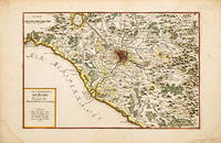
170070256Paris c.1700-05. Nicolas de Fer was the son of Antoine de Fer a Parisian map and print seller. This map from the Atlas Curieux shows the environs of Rome. At the time of publication de Fer was the official cartographer to the French Dauphin but he later became cartographer to both the French and Spanish kings. Size: 290 x 440 mm. Copperplate engraving with later hand colour. Good condition some slight toning and creasing. unknown
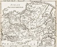
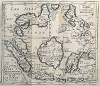
167862465<p>copper engraving. EXTREMELY RARE map from "Méthode pour apprendre facilemente la Géographie …par M. Robbe chez Henri van Bulderen…. 4th or earlier edition published in Paris; it is the basis for other later versions which do not show the name "N. de Fer" in the cartouche i.e. by Peeters and Afferden. Reference: Walter Japan OAG 51 - Quirino p. 87 knows only Peeters; Koeman: Pee 1 vol.III Peeters Koeman I AFF 1; Bonacker 27; Bagrow/Skelton 466 all Afferden. Condition: folds as issued slight offsetting stain on left margin not into plate; paper toning.</p> published in Paris.
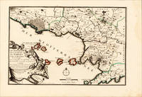
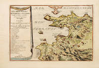
170070272Paris 1700-05. Pozzoli is a province of Naples and the main city of the Phlegrean Peninsula. It lies some two miles from the once fashionable resort of Baia. The map is well executed and detailed. Nicolas de Fer was the son of Antoine de Fer a Parisian map and print seller. This map from the Atlas Curieux. At the time of publication de Fer was the official cartographer to the French Dauphin but he later became cartographer to both the French and Spanish kings. Size: 270 x 405 mm. Copperplate engraving with later hand colour. Good condition. Slightly toned. unknown
1700002589Paris 1700. Desencadernado / Disbound. Muito Bom/Very Good/Très Bien. 325 x 240 mm. A. Coquart Sculp. Fina gravura em chapa de cobre colorida a aguarela inserida no "Atlas Curieux ou le Monde Cca 1700. Representando três vistas de Lisboa em diferentes cartuxos: Uma vista razante do terreiro do Paço com a representação do antigo paço e do Convento de S. Domingos com uma vista do cais e do terreiro onde se desenrrolam cenas do quotidiano nomeadamente uma cena de equitação. Uma vista da Torre de Belém rodeada de barcos e navios e Uma planta das fortificações da cidade com identificação do castelo e do Palácio Real identificando um pântano "marais" ao norte da fortificação. Apresentada num passpartout de cartão pronta para encaixilhar. <br/> <br/> unknown
1693bp47Paris 1693. No Binding. Good. copper-plate print. uncoloured. fortification and Church jutting into mediterranean. cartouche with cherub like individuals and a sheep. Our orders are shipped using tracked courier delivery services. Paris unknown
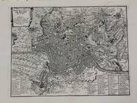
1700M5227Paris c.1700. Very Good. Size : 240x310 mm 9.5x12.20 Inches Coloring: Black & White Category: Maps City Maps; Maps Europe Italy Rome unknown
17008374Paris 1700. Copper engraving 22.5 x 33.5 cms engraved by C. Inselin black and white slight soiling bottom right blank verso; the key lists 113 places of interest. This is the first version of the map before the date was amended. Howgego Printed Maps of London 44 1 unknown