N De Fer; H Van LoonBiblio.com
56 résultats
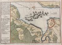
1694M7337Paris: N. de Fer c.1694. Very Good; . Notes: According to Kershaw this map was originally published in "Les Forces De L'Europe" "In August 1690 Sir William Phips left Boston to attack and capture Quebec. Previous military success at Port Royal had given the English an excess of confidence which Phips fully exploited in planning his expedition against Quebec but which quickly evaporated when the under-equipped force discovered the extent of the defenses at Quebec. The operation was disastrous and the English struggled back to Boston losing a number of ships on the way. The battle lines of the English fleet and the details of the French defences were recorded by Villenuve in manuscript form which were subsequently the source of a sequence of printed maps." Kershaw Size : 209x303 mm 8.23x11.93 Inches Coloring: Hand Colored Reference: Kershaw 279 Category: Maps Canada East Quebec Quebec City; Maps City Maps; N. de Fer unknown
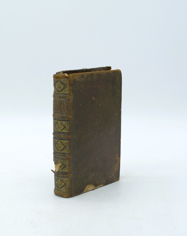
1698PHO-2187Paris, dans l'Isle du Palais, G. Saugrain, 1698.Grand in-12, 6ff.-219pp., veau époque, dos à nerfs orné, manque au dos et aux plats, coins usés, frottements, ex-libris sur la page de garde et manuscrit au titre. Exemplaire sans les planches.
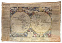
1695ABC_49413Paris: chez lauteur / van Loon 1695. Approximately 114 x 165 cm each. Copperplate engravings in original outline colour tissue-backed for stability laid down to modern cartographic linen. All with title banner dated 1698 with the Royal Privilege and text panels dated 1703. Each map printed on four joined sheets with title surmounted and engraved text panels at sides and bottom. A magnificent set of five Enlightenment wall maps of the continents & world all in early states: the only known set of all five unknown in any public or private collection. In the late 17th century mapmaking was emerging from an equal focus on the decorative and descriptive to a more analytic sensibility. Nicolas de Fer 1646-1720 successfully navigated the early Enlightenment era with these monumental wall maps created with the patronage of the Dauphin of France. The dramatic cartouches and vignettes in the maps are masterpieces of baroque imagery capturing the people wonders resources and cultures of faraway lands eagerly sought by Europeans during this dynamic period. A very limited number of large wall maps were produced by the major cartographic houses for the nobility and for wealthy merchants to satisfy curiosity about the world beyond Europe. Grand wall maps such as these were usually mounted for display and their exposure led to the great majority of examples from this period having been lost; the incidence of this type of map passing down to our era is astonishingly small. 1 America: LAmerique divisee selon letendue de ses principales parties et dont les points principaux sont placez sur les observations de messieurs de lAcademie Royale des Sciences 1698. Second state of 1698 first edition adding the dedication to the Dauphin within an ornamental cartouche. One of the most glorious cartographic expressions of the spirit of 17th century French expansionism in North America. The geography is of the type in fashion at Paris during the short interval between La Salles descent of the Mississippi in 1682 and the founding of Louisiana in 1699. De Fer properly aligned Hudson Bay above the Great Lakes which are portrayed with exceptional accuracy and the southern reaches to the Great Lakes are better aligned with the east coast. The map shows advanced knowledge of the Mississippi River drainage although still emptying in the Gulf of Mexico in Texas too far to the west following the school of Coronelli. Two of the most iconic 18th century images of America those of beavers at work and of a cod-fishery were introduced on this map before being made famous by the English cartographer Herman Moll. The beaver scene shows dozens of the industrious creatures against a backdrop of Niagara Falls which is most likely based on Hennepins first printed view of the falls published a year earlier in 1697. 2 Africa: LAfrique divisée selon letendue de ses principales parties et dont les points principaux sont placez sur les observations de messieurs de lAcadémie Royale des Sciences 1698. The African continent on a fantastic scale with extensive annotations and panelled legends throughout; dedicatory cartouche in the southern Indian Ocean. The side panels have extensive text entries for the division of the continent cities islands capes rivers mountains and a lengthy description of the source of the Nile. Richly decorated with more than 20 elaborate scenes showing art industry clothing customs farming hunting trade battle and landscapes. Numerous animals include ostrich monkey crocodile lion elephant and camel. With a plan of the Dutch fort at the Cape of Good Hope in a draped paneled inset. The Arabian Peninsula is shown in its entirety. Based in part on the work of de lIsle it shows an early conception of the Middle East: in particular it omits the Sinai Peninsula included in several of de Fers earlier efforts. Among the toponyms along the coast of the Gulf are Abadan Sur Ahsa Janama Bahr El Catif Bischa Borou Godo Vodana Calba Dadana and Pinder. Although the coastlines are well mapped there is a notable lack of understanding of the interior: the Niger delta is shown divulging on the west coast instead of the Gulf of Benin while the massive extent of the Congo rivers drainage basin is here only hinted at. The Nile is finally freed from the twin Ptolemaic lakes and begins to take on its more accurate course.3 Asia: LAsie divisée selon letendue de ses principales parties et dont les points principaux sont placez sur les observations de messieurs de lAcadémie Royale des Sciences 1696. The earliest known state dated 1696 in the dedication. Includes the rare letterpress historical text panels dated 1703. Much of the continent is well-charted based largely on Dutch for the Philippines Malaysia Southeast Asia and Jesuit sources for areas such as China. The coastlines north of Korea correctly shown as a peninsula curving west and northward begin and end in ambiguity. Inset map of Arctic Asia; two inset maps of Northeast China based on the writings of the Jesuits Martino Martini and Ferdinand Verbiest. The richly decorated borders depict the people art religion commerce and cultures of Asia. Vignettes show Chinese Japanese Turks Indians Tartars Philippines inhabitants of the Molucca and Sunda islands Ceylonese Arabs peoples from Goa and Mongolia Armenians Georgians people from Golconda Malaysia Siam Cochin and Tonkin. Among the images are those of the faithful during the Hajj visiting the Kaaba at Mecca. The rare letterpress panels provide extensive text references; rivers towns capes lakes and straights including more detailed descriptions of Turkey Arabia China Persia India Russia and Arabic islands in the Indian Ocean. 4 Europe: LEurope divisée selon letendue de ses principales parties et dont les points principaux sont placez sur les observations de messieurs de lAcadémie Royale des Sciences 1695. The earliest known state dated 1695 within the dedication. With 16 legends in elaborate Baroque vignettes describing the French Polish Germans Austrians English and other peoples the vignettes interspersed with views of cities hunting coats of arms pageantry and other fascinating glimpses of a dynamic continent with culture flowering everywhere. The side panels have extensive text entries for the division of the continent countries principalities nobility cities principal islands capes rivers mountains etc. Widely acknowledged as one of the foremost French cartographers of the late 17th century Nicolas de Fer published more than 600 maps and many atlases documenting French fortified towns strongholds and the explorations and discoveries of new territories. Unlike most Dutch cartographers who mainly made maps for navigational purposes he worked in the French decorative style creating a total of 26 large wall maps to adorn walls in the palaces and castles of European royalty clergy and wealthy merchants.A superb set previously unobtainable: no other set of the de Fer wall maps of the continents in their earliest incarnation with or without the side panels other than the present example are known to have survived. Examples of individual continental maps in the earliest states as here rarely appear on the market. Later states of the map often appear without the surmounted title and text panels. No comparable set traced in auction records; an example of the first-state America map alone sold by Cohen & Taliaferro in 2010 commanded $185000.Provenance: Long in an aristocratic collection based near Novara. Acquired in the U.S. trade. Absolutely untouched by facsimile only some reinstatement of paper in text panels and much less so to very minor loss in maps. Old outline colour retouched; cartouches and vignettes with recent colour. Stabilised cracks occasional scuffing overall age toning.l Burden P. The Mapping of North America II no. 744; Dahl E. The Original Beaver Map: De Fers 1698 Wall Map of America in: The Map Collector 29 Dec. 1984 pp. 22-26; Suarez T. Shedding the Veil Singapore 1992 no. 48; not in WorldCat. chez lauteur / van Loon, hardcover
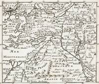
1700399AG1700. Paris c. 1700. Original copper engraved maps. 16 cm wide x 13.2 cm high. Mounted on paper. Very good condition. From a wonderful collection of Maps from an old english library South Shields - with a tiny library stamp to the mounting paper The stamp is NOT on the Map. Nicolas de Fer 164625 October 1720 was a French cartographer and geographer. De Fer was the youngest of three sons of Antoine de Fer who was also a cartographer. When he was 12 he became the apprentice of Parisian engraver Louis Spirinx and made his first map of the Canal du Midi at the age of 23. After the death of his father in June 1673 his mother Geneviève initially took over the map making company which had begun to decline. She passed it and the atelier called Quai de L'Horloge on to Nicolas in 1687 because of her old age. De Fer was so successful at improving the firm that in 1690 he became the official geographer to Louis Dauphin of France. With support from the Spanish and French Royal Families de Fer also became official geographer for Philip V and Louis XIV the kings of Spain and France respectively. Because of this his maps became Bourbon propaganda endorsing French King Louis XIV. His business flourished producing town plans atlases wall maps and more than 600 sheet maps. He made maps of places in Europe and North America including New Spain places fortified by Vauban the Low Countries and the War of the Spanish Succession. In 1698 de Fer published a map of North America which included a depiction of beavers building dams near Niagara Falls. Seventeen years later Herman Moll published a map which plagiarized elements of de Fer's work particularly the beaver scene. It became known as the "Beaver map". De Fer became the official geographer for His Catholic Majesty in 1720. Two of his sons-in-law Guillaume Danet and Jaques-François Bénard continued the company after de Fer's death on 25 October of that year until around 1760. Wikipedia unknown
1700402AG1700. Paris c. 1700. Original copper engraved maps. 15.5 cm wide x 13 cm high. Mounted on paper. Very good condition. From a wonderful collection of Maps from an old english library South Shields - with a tiny library stamp to the mounting paper The stamp is NOT on the Map. Nicolas de Fer 164625 October 1720 was a French cartographer and geographer. De Fer was the youngest of three sons of Antoine de Fer who was also a cartographer. When he was 12 he became the apprentice of Parisian engraver Louis Spirinx and made his first map of the Canal du Midi at the age of 23. After the death of his father in June 1673 his mother Geneviève initially took over the map making company which had begun to decline. She passed it and the atelier called Quai de L'Horloge on to Nicolas in 1687 because of her old age. De Fer was so successful at improving the firm that in 1690 he became the official geographer to Louis Dauphin of France. With support from the Spanish and French Royal Families de Fer also became official geographer for Philip V and Louis XIV the kings of Spain and France respectively. Because of this his maps became Bourbon propaganda endorsing French King Louis XIV. His business flourished producing town plans atlases wall maps and more than 600 sheet maps. He made maps of places in Europe and North America including New Spain places fortified by Vauban the Low Countries and the War of the Spanish Succession. In 1698 de Fer published a map of North America which included a depiction of beavers building dams near Niagara Falls. Seventeen years later Herman Moll published a map which plagiarized elements of de Fer's work particularly the beaver scene. It became known as the "Beaver map". De Fer became the official geographer for His Catholic Majesty in 1720. Two of his sons-in-law Guillaume Danet and Jaques-François Bénard continued the company after de Fer's death on 25 October of that year until around 1760. Wikipedia unknown
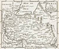
1700403AG1700. Paris c. 1700. Original copper engraved maps. 15.5 cm wide x 13 cm high. Mounted on paper. Very good condition. From a wonderful collection of Maps from an old english library South Shields - with a tiny library stamp to the mounting paper The stamp is NOT on the Map. Nicolas de Fer 164625 October 1720 was a French cartographer and geographer. De Fer was the youngest of three sons of Antoine de Fer who was also a cartographer. When he was 12 he became the apprentice of Parisian engraver Louis Spirinx and made his first map of the Canal du Midi at the age of 23. After the death of his father in June 1673 his mother Geneviève initially took over the map making company which had begun to decline. She passed it and the atelier called Quai de L'Horloge on to Nicolas in 1687 because of her old age. De Fer was so successful at improving the firm that in 1690 he became the official geographer to Louis Dauphin of France. With support from the Spanish and French Royal Families de Fer also became official geographer for Philip V and Louis XIV the kings of Spain and France respectively. Because of this his maps became Bourbon propaganda endorsing French King Louis XIV. His business flourished producing town plans atlases wall maps and more than 600 sheet maps. He made maps of places in Europe and North America including New Spain places fortified by Vauban the Low Countries and the War of the Spanish Succession. In 1698 de Fer published a map of North America which included a depiction of beavers building dams near Niagara Falls. Seventeen years later Herman Moll published a map which plagiarized elements of de Fer's work particularly the beaver scene. It became known as the "Beaver map". De Fer became the official geographer for His Catholic Majesty in 1720. Two of his sons-in-law Guillaume Danet and Jaques-François Bénard continued the company after de Fer's death on 25 October of that year until around 1760. Wikipedia unknown