2 067 résultats
1964327211964. unknown
0260890359.Ghardcover. Good. Access codes and supplements are not guaranteed with used items. May be an ex-library book. hardcover

0260313408.Gpaperback. Good. Access codes and supplements are not guaranteed with used items. May be an ex-library book. paperback
0266497292.Ghardcover. Good. Access codes and supplements are not guaranteed with used items. May be an ex-library book. hardcover
1334231621.Gpaperback. Good. Access codes and supplements are not guaranteed with used items. May be an ex-library book. paperback
aly2319Jersey City: The Snead & Company Iron Works Inc. 1915. First Edition. 4to. pp. 271. numerous b/w illus. index. cloth book labels & plates of the Liverpool Architectural Society library corners rubbed with minor fraying & few loose leaves Jersey City: The Snead & Company Iron Works, Inc., [1915] hardcover
1019426543.Ghardcover. Good. Access codes and supplements are not guaranteed with used items. May be an ex-library book. hardcover
46454647like new. unknown
1933362014.Gpaperback. Good. Access codes and supplements are not guaranteed with used items. May be an ex-library book. paperback
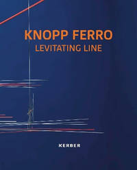
A9783735610393Paperback / softback. New. Marking Knopp Ferro’s 70th birthday this catalogue presents 45 years of his Fluxus-influenced work—sculptures installations drawings and performances—across eight global venues. Text in English German and Portuguese. paperback
19892090202118107312Mountain and Keikokusha Mountain and Keikokusha 1989. Soft Cover. Fine. The book is in fine condition. Mountain and Keikokusha (Mountain and Keikokusha) paperback
2003110850Zeitgeist Films 2003-09-02. DVD. Like New. 7x5x0. New in shrink wrap. Please email for photos. Zeitgeist Films unknown
51-6451Paris: chez l'auteur dans l'Isle du Palais sur le quay de l'orloge a la Sphére Royale avec privilége du Roy 1705-1717. 2 Engraved maps and coats of arms on two leaves.Each 27.3 x 38cm. Contemporary laid paper uniformly time aged.Published in "L'atlas curieux ou Le monde reÌpreseÌnteÌ dans des cartes geÌneÌrales et particulieres du ciel et de la terre : diviseÌ tant en ses quatre principales parties que par eÌtats et provinces et orneÌ par des plans et descriptions des villes capitales et principales et des plus superbes edifices qui les embelissent comme sont les eglises les palais les maisons de plaisance les iardins les fontaines &c. ". OCLC Number / Unique Identifier:79022119.LThe Atlas Curieux is geographic encyclopedia of images and maps of France with detailed views of the grand waterworks at Marly views of the great palaces and chateaux views and plans of the Paris Observatory and samples of military architecture. Issued in six annual parts from 1700-1705 the maps are based on the new observations of the Académie des Sciences and drawn up with the assistance of Philipe de La Hire.ibrary of Congress:The French cartographer and engraver Nicolas de Fer was a master at creating maps that were works of art. The maps that he published were printed during the Baroque period when the decorative arts were characterized by ornate detail. De Fer’s detailed maps and atlases were valued more for their decorative content than their geographical accuracy.Nicolas de Fer was born in 1646. His father Antoine de Fer owned a mapmaking firm. At the age of twelve Nicolas was apprenticed to a Parisian engraver named Louis Spirinx. The family business was starting to decline when his father died in 1673. Nicolas de Fer’s mother Genevieve took over the business after the death of her husband. In 1687 the business was passed on to Nicolas and the profits increased after he took over the firm. Nicolas de Fer was a prolific cartographer who produced atlases and hundreds of single maps. He eventually became the official geographer to King Louis XIV of France and King Philip V of Spain.One of de Fer’s major works is an atlas titled L’atlas curieux The curious atlas. Paris: chez l'auteur dans l'Isle du Palais sur le quay de l'orloge a la Sphére Royale avec privilége du Roy, 1705-1717 unknown
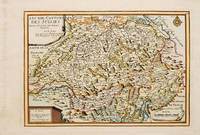
171753085Atlas Curieux ou le Monde. Paris 1717. Map of Switzerland with title at top left dedication and scales in lower corners Copper engraving. Fine condition Later colour. Size: 348 x 240 mm. 13½ x 9½ iinches unknown
2841111474.Gpaperback. Good. Access codes and supplements are not guaranteed with used items. May be an ex-library book. paperback
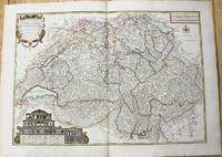
1764M10199Paris c. 1764. Very Good. Notes: An important and decorative map of Switzerland published in mid 18th century. The map originally was drawn by De Fer and later updated and improved by Desnos. Size : 485x670 mm 19.09x26.38 Inches Coloring: Hand Colored Category: Maps Europe Switzerland; unknown
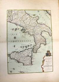
1708M10188Paris: chez Benard c.1708. Very Good. Notes: A detailed map of Southern Italy and Sicily also shows Malta. With wide margins and a pair of coats of arms is placed on top of the cartouche. Size : 560x402 mm 22.05x15.83 Inches Coloring: Original Hand Coloring Category: Maps Europe Italy; Maps Mediterranean Islands; chez Benard unknown
51-6453Paris: chez l'auteur dans l'Isle du Palais sur le quay de l'orloge a la Sphére Royale avec privilége du Roy 1705-1717. Engraved map. 27.3 x 38 cm. Contemporary laid paper uniformly time aged.Published in "L'atlas curieux ou Le monde reÌpreseÌnteÌ dans des cartes geÌneÌrales et particulieres du ciel et de la terre : diviseÌ tant en ses quatre principales parties que par eÌtats et provinces et orneÌ par des plans et descriptions des villes capitales et principales et des plus superbes edifices qui les embelissent comme sont les eglises les palais les maisons de plaisance les iardins les fontaines &c. ". OCLC Number / Unique Identifier:79022119.LThe Atlas Curieux is geographic encyclopedia of images and maps of France with detailed views of the grand waterworks at Marly views of the great palaces and chateaux views and plans of the Paris Observatory and samples of military architecture. Issued in six annual parts from 1700-1705 the maps are based on the new observations of the Académie des Sciences and drawn up with the assistance of Philipe de La Hire.ibrary of Congress:The French cartographer and engraver Nicolas de Fer was a master at creating maps that were works of art. The maps that he published were printed during the Baroque period when the decorative arts were characterized by ornate detail. De Fer’s detailed maps and atlases were valued more for their decorative content than their geographical accuracy.Nicolas de Fer was born in 1646. His father Antoine de Fer owned a mapmaking firm. At the age of twelve Nicolas was apprenticed to a Parisian engraver named Louis Spirinx. The family business was starting to decline when his father died in 1673. Nicolas de Fer’s mother Genevieve took over the business after the death of her husband. In 1687 the business was passed on to Nicolas and the profits increased after he took over the firm. Nicolas de Fer was a prolific cartographer who produced atlases and hundreds of single maps. He eventually became the official geographer to King Louis XIV of France and King Philip V of Spain.One of de Fer’s major works is an atlas titled L’atlas curieux The curious atlas. Paris: chez l'auteur dans l'Isle du Palais sur le quay de l'orloge a la Sphére Royale avec privilége du Roy, 1705-1717 unknown
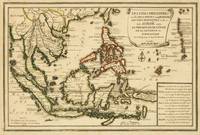
1702M5177Paris 1702. Excellent. Size : 235x340 mm 9.25x13.375 Inches Coloring: Original Outline Coloring Category: ; Maps Asia South East unknown
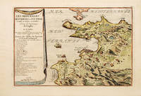
170070272Paris 1700-05. Pozzoli is a province of Naples and the main city of the Phlegrean Peninsula. It lies some two miles from the once fashionable resort of Baia. The map is well executed and detailed. Nicolas de Fer was the son of Antoine de Fer a Parisian map and print seller. This map from the Atlas Curieux. At the time of publication de Fer was the official cartographer to the French Dauphin but he later became cartographer to both the French and Spanish kings. Size: 270 x 405 mm. Copperplate engraving with later hand colour. Good condition. Slightly toned. unknown
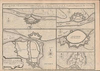
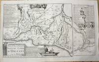
1705M10253Paris 1705. Very Good. Notes: Map showing the Canal de Briare and the Canal D'Orleans with indexes and descriptive notes on both canals. Size : 385x651 mm 15.16x25.63 Inches Coloring: Black & White Category: Maps Europe France; unknown
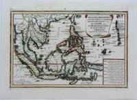
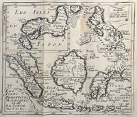
1702143641Paris: Nicolas de Fer 1702. Very Good. Paris Nicolas de Fer circa 1702. A hand-coloured engraved map printed surface 225 × 339 mm sheet size 250 × 361 mm. Engraved by Charles Inselin. Light tanning; a few unobtrusive spots and marks; crease to the border in the top right-hand corner with minimal loss to the marginal corner-tip; in very good condition. A map of the Philippines the Indonesian archipelago mainland Southeast Asia as far north as Taiwan and the Mariana Islands from de Fer's 'Atlas Curieux' 1700-1705. Nicolas de Fer unknown
151658422copper engraving. RARE map from 'El atlas abbreviado.' Spanish edition French text on map then part of the Spanish Netherlands by the author a Belgian Cartographer whose attractive pocket-atlas went through several editions with Jan Duren. Reference: Quirino p. 87 Peeters; Koeman: Pee 1 vol.III Peeters; Bonacker 27; Bgrow/Skelton 466. Condition: blank on verso paper toning cleaned. published in Antwerp.
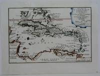
1702M5228Paris 1702. Very Good small tear in the upper left margin professionally repaired not affecting the image. Size : 225x335 mm 8.875x13.125 Inches Coloring: Hand Colored in Outline Category: ; Maps West Indies Whole unknown
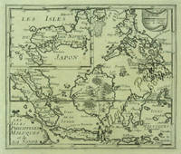
167862465<p>copper engraving. EXTREMELY RARE map from "Méthode pour apprendre facilemente la Géographie …par M. Robbe chez Henri van Bulderen…. 4th or earlier edition published in Paris; it is the basis for other later versions which do not show the name "N. de Fer" in the cartouche i.e. by Peeters and Afferden. Reference: Walter Japan OAG 51 - Quirino p. 87 knows only Peeters; Koeman: Pee 1 vol.III Peeters Koeman I AFF 1; Bonacker 27; Bagrow/Skelton 466 all Afferden. Condition: folds as issued slight offsetting stain on left margin not into plate; paper toning.</p> published in Paris.