88 résultats
18096214<p>This is an original linen-backed folding map game published in London in 1809 by William Darton.</p><p>Overall 25 1/2 x 21 inches. It is an early example of the "Cartographic Game" genre that became very popular in later Victorian England. The map folds and fits into the original slipcase with printed label. The rules are printed in columns at the sides. The object of the game is to move tokens originally in the shape of pyramids their landing place determined by use of a teetotum called a <em>totum </em>at that time and read about the region upon which one landed. It was both competitive and educational.</p><p>Early map games such as this have become very scarce. Most did not survive since they were children’s toys. This one is in remarkably good condition. There is a light stain in the lower left of the map part and general light age-toning but the colors are bright and crisp. The linen backing is sound and the folds are intact. The original slipcase has two printed paper labels.</p> Darton, William unknown books
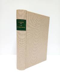
1895132391895 bradel demi-percale marron clair in-octavo (half hard-back brown percale in-octavo), dos long (spine without raised bands) - pièce de titre sur fond bleu-marine avec double filet or (label of title with gilt lines) - 1 fleuron au fer plein évidé (1 hollowed out blocking stamp) - double filet or au bas du dos (double gilt line in the bottom of the spine), papier peigné aux plats (cover with painting paper), tranches rognées (edges smooth), pages de garde blanches (white endpaper), illustrations : 1 portrait de l'auteur en frontispice (author's frontispiece portrait) et 32 figures explicatives in-texte (explanatory pictures in text), 414 pages, sans date (no date) (les années environ) - 1895 - à Paris H. Delarue et Compagnie Libraires-Editeurs,
189020151France 1890. 48 playing cards on thick stock. 86 x 56 mm. Wood engraved designed with stencil color versos alike with wood engraved grid fields. Excellent condition. A fine deck of cards for the game of Aluette a trick-taking game commonly played in France. Made up of four suits—batons coins swords and cups—the deck is dealt to players clockwise and played in “tricksâ€; the highest card wins and the player who threw it take the rest of the pile. <br /> Although it is a French game Aluette uses Spanish suits indicating that the game may be older than the creation of French playing cards. It is also called “La Vache†in some circles because one of the cups cards features a cow. B.P. Grimaud was the primary producer of Aluette decks but not that offered here. However the basic imagery on the cards closely follows Grimaud’s of the mid-late 19th century. unknown
189842191Cincinnati: The Cincinnati Game Co. n.d. 1898. 1898. YELLOWSTONE PLAYING CARDS. A deck of 52 playing cards each containing a scene of Yellowstone National Park. The game is designed to illustrate a trip through the park. The illustrations are divided into four sections: SERIES A: showing scenes from the park entrance up the Gardiner River past Mammoth Hot Springs as far as the first geyser basin; SERIES B: illustrates the geyser basin four in number; SERIES C: illustrates the region from the Upper Geyser Basin to Shoshone Lake along the Firehole River giving a glance at the famous Teton Mountains to the south around Yellowstone River to the Grand Canon; and SERIES D: illustrates the Yellowstone Falls the Grand Canon and thence down the Yellowstone River to the starting point at the park entrance. The original rules for the game are included. The playing cards are in fine condition and all are present. The original card box is lightly rubbed and intact. Overall a near fine set. The Cincinnati Game Co., n.d. [1898]. unknown
189941810Wynkoop Hallenback Crawford Co. State Printers 1899. First edition. Cloth with gilt titles stamped in blind string tied. Maps very good with small splits at corner folds colors bright in very good portfolio with small soiled spot on front and some sunning to spine. 1 colored map on 2 joined sheets 102 x 121 cm. Each map is 32 3/4 x 25 1/2 inches. Issued in portfolio 9 1/4 x 5 3/4 inches with cover title: Map of the Catskill Preserve. Engraved by J.Y. McClintock and W.L. Lawton. Over four feet if joined scale is 1 inch to 2 miles. Shows patents lots names of landowners and town boundaries subdivided into tracts. Shows street names and railroads. Compiled from "Official Maps and Field Notes on file in the State Departments at Albany N.Y. by Authority of the Fisheries Game and Forest Commission." The first meeting of the Forest Preserve Commission was held on September 23 1885 and a tabulation of the state ownership did not exist yet; in 1892 the State provided $250 the Forest Commission "for completing the public path leading to the summit of Slide mountain Ulster County included within the preserve." and in a 1893 budget bill Chapter 726 the State provided $1000 "For the expenses of examination of title and survey of lands owned by the state on Slide Mountain in Ulster County and other parts of the Catskills." which lead to the creation of this first map of the Catskill Forest Preserve. Quite detailed and in remarkably good condition. Wynkoop Hallenback Crawford Co. State Printers hardcover books
186019881Paris, Goin ; Bruxelles Vve Parent et Fils ; Leipzig, A. Schnée (Imp. Vve Parent et Fils, à Bruxelles), 1860 ; in 8, bradel demi maroquin à coins bordeaux, titre et date en queue dorés, non rogné (reliure de l’époque) ; 219 p., [1] bl., III pp. de Catalogue “Bibliothèque illustrée du Sportman” ; 5 planches hors-texte, dont 2 lithographiées sur chine contrecollé et 3 gravées sur bois par Félicien Rops ; quelques vignettes in texte.
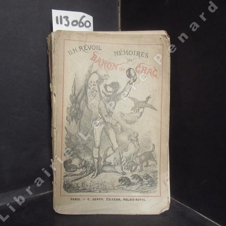
18751130601875 A Paris, E. Dentu, éditeur - 1875 - Petit in-8, broché, couverture illustrée - 354 p.
18852769Paris, Plon, 1885 ; in-12, broché ; (3) ff. (bl., faux-titre, titre), 189 pp., (1) f. (table) ; 10 figures en noir in-texte ; couverture grise imprimée en noir.
189146035Paris: Octave Doin 1891. Fine. Octave Doin Paris 1891 11.50 x 18.50 cm broché Third edition with some parts in first edition as revised and corrected. Work illustrated with figures in the text. Light tear with minimal lack at head of first board two slight marginal lacks on second board some foxing. Rare. Octave Doin unknown
189922877BUlletin Publ NY 1899. HB NODJ Stated Second edition 1899 Original Beige cloth titled in black at top Cover light Rub Wear SUN extremties spine Interior nice condition light Wear FoX PENCIL NOTES or Marks here & There & some inner Hinge tape Reinforcement VG-/VG NODJ 277 pgs Table Contents Back. Hard Cover. BUlletin Publ, NY hardcover
189146035Octave Doin | Paris 1891 | 11.50 x 18.50 cm | broché
1892JG073101892 483 p., 35 plates of fish and many more of mammals and birds, new hcloth.
18997146State of New York. Good. 1899. Hardcover. Light green stamped on dark green and black. Library marks on spine front rear endpapers and title page; library numbers we think at top corner of Mallard Duck male plate. First 14 pages including 3 plates almost completely pulled away from binding. 17 color plates present. Some listings mention a color fold-out map; I do not see one in illustrations list and there is no map with this copy. . State of New York hardcover
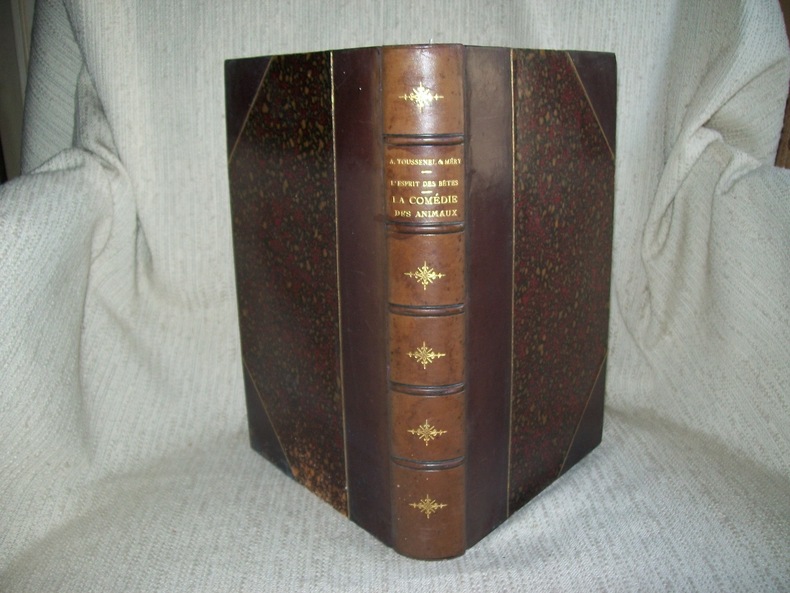
1886GITj991Paris Librairie Ch Delagrave 1886. Paris Hetzel sans date vers 1880. 2 ouvrages en 1 volume grand in-8 384pp et VIII 308pp. Demi basane acajou à coins signés, dos à nerfs orné de fleurons dorés, tête dorée, non rogné, reliure de l'époque. MERY: portrait de l'auteur en frontispice, abondante illustration dont 16 hors texte comprises dans la pagination par Morin, Speecht et Bombled, rousseurs. TOUSSENEL: Titre-frontispice et nombreuses illustrations dans le texte par Emile Bayard, quelques rousseurs par endroits. Les deux ouvrages sont complets. Dos uniformément passé au brun, reliure de l'époque solide et décorative malgré le défaut signalé.
1890GITj980Paris HAchette 1890. In-8 2 feuillets non chiffrés (faux-titre, titre) II-IV 6-415pp. Demi maroquin acajou à coins signés, dos à nerfs, tête dorée, non rogné, 1er plat de la belle couverture illustrée en couleurs conservé, reliure de l'époque. Orné de 2 plans de chenil à pleine page, 54 vignettes en tête de chapitre, cul de lampe et dans le texte d'après Bodmer et Krafty, 33 planches d'après Bodmer et de Penne (18 de races de chiens, 15 de gibiers). Rousseurs par endroits. Bel exemplaire complet du texte et des illustrations, reliure solide de bonne qualité. Thiébaud colonne 572. Edition plus complète que l'originale parue en 1858.
190025498Madrid: La Caza Ilustrada 1900.- Año IV: desde el nº 76 10 de enero de 1900 hasta el nº 110 20 de diciembre de 1900; 4º mayor 27 cm.- En total son 30 fascículos que abarcan el año completo a falta de 5. Se venden todos como colección conjunta al precio indicado. Como se indica faltan 5 números para completar el año. Su estado de conservación es muy bueno sobre todo dado el tiempo transcurrido y que los fascículos se hallan sueltos. CAZA Y PESCA Libro en español La Caza Ilustrada paperback
18760041461876 Paris, J. Rothschild, 1876. Petit in-folio (288 X 362) demi-chagrin vert lierre, dos cinq nerfs, fleuron doré dans les compartiments, auteur et titre dorés, nom de l'éditeur en queue, tranches dorées (reliure de l'époque); (1) f. blanc, (2) ff. de faux-titre et titre imprimé en rouge et noir, frontispice, 140 pages, 45 planches couleurs hors-texte sous serpente, (1) f. blanc. Quelques rares rousseurs, principalement aux serpentes, trois taches sur le cuir du plat supérieur, sans gravité.
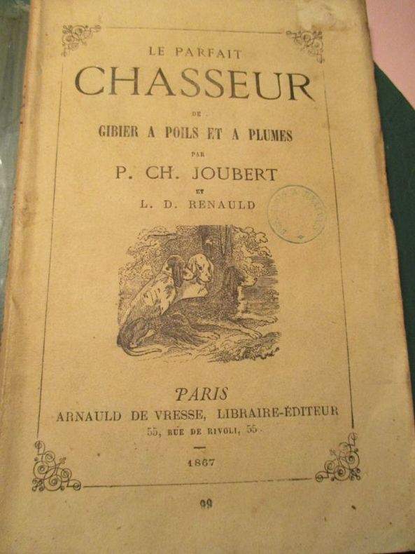
186755851867 Paris Arnauld de Vresse librairie-éditeur 1867 In12 broché 95 pages cachet de colportage sur la couverture
188738873London: Republished by Field & Tuer 1887. Small 8vo 18.5 cm 7.25". 4 iv 7-29 2 pp. 4 ads ff.; 1 plt. col. illus. <br><br>Riddles and counting-out rhymes all part of a fun game whose instructions serve as a preface. The text is printed on one side of a leaf only and => each printed page has a hand-colored illustration.<br>Â Â Â Â The work was first printed by Dean & Munday in 1823 and is here presented as vol. II in the Leadenhall Press "Series of Forgotten Picture Books for Children."<br>Â Â Â Â Provenance: From the children's book collection of Albert A. Howard small booklabel "AHA" at rear. Buff-color printed wrappers with hand-colored vignette on front wrapper; stitched head and foot of spine chipped rear wrapper detached and reattached with archival tissue. A good copy. Republished by Field & Tuer unknown books
1868G121025Roma, Tip. Tiberina 1868 [17] pp. + 3 folding engraved plates, 22cm., contemporary blind wrappers (some use), offprint from "Annali dell'Instituto di correspondenza archeologia" T.XL, small stamp on title page, [The Gioco del cottabo, or the game of cottabus, was a popular skill-based game played during ancient Greek and Etruscan banquets (symposia). Participants would attempt to flick the last dregs of wine from their drinking cup (kylix) at a specific target. The game often had a romantic or prophetic meaning : a player would dedicate their throw to a loved one, and hitting the target was seen as a favorable omen for their future in love], G121025
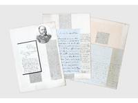
1837156409Kabul and elsewhere: 1837-41 & 1859. Correspondence chess A carefully assembled collection of material connected to players in the "great game" including Colonel Stoddart and Captain Arthur Conolly both famously beheaded at Bukhara Major Henry Rawlinson the political agent at Kandahar and Captain Sir Alexander "Bukhara" Burns. The material mounted on album leaves with accompanying newspaper clippings and other ephemera is tied together by Connolly and Stoddart's dramatic death. Sent on a mission to secure an agreement of friendship between Britain and the Emir of Bukhara in 1838 Stoddart was arrested by the emir on charges of spying and imprisoned. Conolly the intelligence agent credited with coining the term "great game" in an 1840 letter to Rawlinson arrived in Bukhara in late 1841 to negotiate his compatriot's release. Both men were killed in June 1842 and became household names back home. In the first two letters Burns writing about a year before he was killed by a mob in Kabul shares his views with Rawlinson on the latest moves in the "great game". He writes of Stoddart's short-lived release from prison and of the importance of Conolly's current intelligence-gathering in Central Asia. Shah Shuja "is surrounded by a parcel of harpies" and Burns advises caution about the use of British troops to prop up the Shah's rule: "Nothing contributes so much to lower the King's power as the employment of our troops against Afghans & I would avoid it if possible." As for Lord Auckland the governor-general "does not have great faith in the sincerity of Russia in abandoning her Khiva designs but it gives us time." The third letter from Conolly to Rawlinson discusses local news and offers a lighter-hearted window onto the life of a political agent far from home. He has swapped the diplomatic chessboard for the card table: "We miss you very much - especially at whist" the previous night's rubber being "stale and flat but not unprofitable for I won 9 rupees." This letter is mounted with a page of Stoddart's notes on taking navigational bearings which Stoddart gave to Rawlinson before departing for Central Asia in 1837. The final piece touches on the wider appeal of the Stoddart-Conolly story. Writing to the Cornish baronet Sir Hugh Molesworth almost two decades later Dr Joseph Wolff mentions his second expedition to Bokhara mounted to ascertain the fate of the two men and how the profits from the two editions of his best-selling Narrative of a mission to Bokhara 1845 were sufficient to finance a parsonage and schoolhouse in his living. a Sir Alexander Burns to Major Henry Rawlinson 21 December 1840 Kabul. ALS bifolium written across all sides. b Sir Alexander Burns to Major Henry Rawlinson 20 January 1841 Kabul. ALS bifolium written across all sides. c Captain Arthur Conolly to Major Henry Rawlinson 1840 Kabul. ALS bifolium and single sheet written across 5 sides addressed on final side remains of wax seal. d Colonel Stoddart's autograph notes on taking navigational bearings single sheet written one side. Endorsed on verso by Rawlinson "Given to me by Col. Stoddart on his departure for Bokhara in 1837. H. Rawlinson"; later note to the same effect but in a different hand below. e Revd Dr Joseph Wolff to Revd Sir Hugh H. Molesworth 31 August 1859 Taunton Somerset. ALS bifolium written across 3 sides. 4 autograph letters and single sheet of notes totalling 17 sides of manuscript tipped to or mounted on stubs to card album leaves 370 x 265 mm with laid-down material 11 newspaper clippings 2 printed illustrations sheet of manuscript later brief captions in manuscript. Letters and sheet of notes generally well preserved staining and creasing as expected stubs occasionally just touching text but no loss to sense: a very good collection. unknown
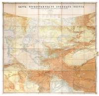
1881149774St Petersburg: Cartographic Institute of the Military-Topographic Department of the General Staff 1881. The cartographic climax of the "great game" Second edition significantly improved from the first edition 1877 to incorporate the latest military intelligence from field surveys. This magisterial work of "great game" cartography was presented at Russia's Tashkent military headquarters to the daring French explorer Stanislas Benoist-Méchin during his epic 1881-3 overland journey from Beijing to Europe. We have traced no other copies. A presentation inscription on the verso of the map reads in French "To Mr Baron Benoist-Méchin from Generals Kouropatkine and Levaschew October 1882 Tashkent." Benoist-Méchin 1854-1923 began travelling the world as a young man and then served as the French cultural attaché in Tokyo 1880-1. In 1881 he decided to return to Europe via the daring route through Central Asia. Leaving Beijing on 15 September with his regular travelling companion Comte Humbert Adrien de Mailly-Chalon 1853-1921 he journeyed through Manchuria and across Russian Siberia. In 1882 having reached Kashgar they received permission to cross Russian Turkestan spending six weeks in Tashkent as the honoured guests of General Mikhail Tchernayev the architect of Russian's expansion across Central Asia General Aleksey Nikolayevich Kuropatkin 1848-1925 and the aforementioned General Levaschov likely the artillery officer Vladimir Levaschov 1834-1898. After reaching Samarkand they travelled in extreme cold through Bukhara and via Khiva to Tehran reaching Moscow in October 1883 where they were accorded a hero's welcome. Their descriptions of this feat of exploration were published in 1885 in the Bulletin de la Société de géographie. This map was made for the use of the Russian military high command in St Petersburg and in the Turkestan Military District which had been established in the 1860s amid the occupation of Tashkent and Bokhara and dates from a period following the Second Anglo-Afghan War and the Battle of Geok Tepe when tensions were at their height. It encompasses almost the entire playing surface of the "great game" extending east-west from Xinjiang and Tibet to the Caspian Sea and Afghanistan and north-south from Siberia to northern India. Unparalleled in terms of accuracy and detail it names every city town and village and the legend has entries for such features as fortifications railways mail and caravan roads and mines. Spot heights are given in feet and deserts are marked with a light red pattern. It is much improved on the first edition which had only 48 panels and did not extend as far south. Chromolithograph map 195 x 200 cm dissected onto 64 sections and mounted on linen as issued laid-down printed slip stating "corrected up to 1881" small folding tab at right edge. Folding away to 28.5 x 28 cm. Housed in green quarter morocco solander box with chemise by the Chelsea Bindery. Map surface generally clean and brighta few stains toning and soiling at edges small repair at top-left edge verso foxed and with couple of areas of linen reinforcement: very good. unknown
1891335233eme. Ed. revue et corrigée.- Paris: Octave Doin Ed. 1891.- XXXII-398 p. en numeración continua: Ilustraciones; 8º 189 x 125 cm.; Texto en francés; Fina encuadernación a la alemana en Tela Nueva tejuelo. La portadilla con una falta de papel pequeña en su base. El papel algo grisáceo. Por lo demás en buen estado. ESOTERIA TEOSOFÃA PARAPSICOLOGÃA ALQUIMIA CARTOMANCIA SECTAS Y CIENCIAS OCULTAS EN GENERAL Livre en français Octave Doin hardcover
1886R320077328DOIN OCTAVE. 1886. In-12. Broché. Etat passable, Plats abîmés, Dos abîmé, Mouillures. XXXII + 398 + 16 pages - Quelques illustrations en noir et blanc dans et hors texte - Des traces de mouillure en tranches (gouttiere) sans conséquence réelle sur la Lecture - 1er plat et page de titre manquants - VENDU EN L'ETAT.. . . . Classification Dewey : 140-Les divers systèmes philosophiques
1889Q81482Philadelphie/ Paris/ Madrid, Lippincott/ Dentu/ Fuentes y Capdeville s.d. [+/- 1889] 270pp., 19cm., br.orig. (restauré, dos renforcé), texte et intérieur en bon état, cfr. Caillet no.4517, Q81482