62 résultats
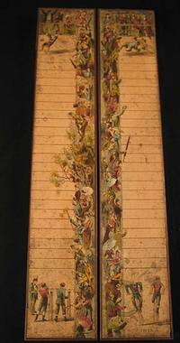
18096214<p>This is an original linen-backed folding map game published in London in 1809 by William Darton.</p><p>Overall 25 1/2 x 21 inches. It is an early example of the "Cartographic Game" genre that became very popular in later Victorian England. The map folds and fits into the original slipcase with printed label. The rules are printed in columns at the sides. The object of the game is to move tokens originally in the shape of pyramids their landing place determined by use of a teetotum called a <em>totum </em>at that time and read about the region upon which one landed. It was both competitive and educational.</p><p>Early map games such as this have become very scarce. Most did not survive since they were children’s toys. This one is in remarkably good condition. There is a light stain in the lower left of the map part and general light age-toning but the colors are bright and crisp. The linen backing is sound and the folds are intact. The original slipcase has two printed paper labels.</p> Darton, William unknown books
189020151France 1890. 48 playing cards on thick stock. 86 x 56 mm. Wood engraved designed with stencil color versos alike with wood engraved grid fields. Excellent condition. A fine deck of cards for the game of Aluette a trick-taking game commonly played in France. Made up of four suits—batons coins swords and cups—the deck is dealt to players clockwise and played in “tricksâ€; the highest card wins and the player who threw it take the rest of the pile. <br /> Although it is a French game Aluette uses Spanish suits indicating that the game may be older than the creation of French playing cards. It is also called “La Vache†in some circles because one of the cups cards features a cow. B.P. Grimaud was the primary producer of Aluette decks but not that offered here. However the basic imagery on the cards closely follows Grimaud’s of the mid-late 19th century. unknown
189842191Cincinnati: The Cincinnati Game Co. n.d. 1898. 1898. YELLOWSTONE PLAYING CARDS. A deck of 52 playing cards each containing a scene of Yellowstone National Park. The game is designed to illustrate a trip through the park. The illustrations are divided into four sections: SERIES A: showing scenes from the park entrance up the Gardiner River past Mammoth Hot Springs as far as the first geyser basin; SERIES B: illustrates the geyser basin four in number; SERIES C: illustrates the region from the Upper Geyser Basin to Shoshone Lake along the Firehole River giving a glance at the famous Teton Mountains to the south around Yellowstone River to the Grand Canon; and SERIES D: illustrates the Yellowstone Falls the Grand Canon and thence down the Yellowstone River to the starting point at the park entrance. The original rules for the game are included. The playing cards are in fine condition and all are present. The original card box is lightly rubbed and intact. Overall a near fine set. The Cincinnati Game Co., n.d. [1898]. unknown
189941810Wynkoop Hallenback Crawford Co. State Printers 1899. First edition. Cloth with gilt titles stamped in blind string tied. Maps very good with small splits at corner folds colors bright in very good portfolio with small soiled spot on front and some sunning to spine. 1 colored map on 2 joined sheets 102 x 121 cm. Each map is 32 3/4 x 25 1/2 inches. Issued in portfolio 9 1/4 x 5 3/4 inches with cover title: Map of the Catskill Preserve. Engraved by J.Y. McClintock and W.L. Lawton. Over four feet if joined scale is 1 inch to 2 miles. Shows patents lots names of landowners and town boundaries subdivided into tracts. Shows street names and railroads. Compiled from "Official Maps and Field Notes on file in the State Departments at Albany N.Y. by Authority of the Fisheries Game and Forest Commission." The first meeting of the Forest Preserve Commission was held on September 23 1885 and a tabulation of the state ownership did not exist yet; in 1892 the State provided $250 the Forest Commission "for completing the public path leading to the summit of Slide mountain Ulster County included within the preserve." and in a 1893 budget bill Chapter 726 the State provided $1000 "For the expenses of examination of title and survey of lands owned by the state on Slide Mountain in Ulster County and other parts of the Catskills." which lead to the creation of this first map of the Catskill Forest Preserve. Quite detailed and in remarkably good condition. Wynkoop Hallenback Crawford Co. State Printers hardcover books
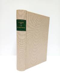
189146035Paris: Octave Doin 1891. Fine. Octave Doin Paris 1891 11.50 x 18.50 cm broché Third edition with some parts in first edition as revised and corrected. Work illustrated with figures in the text. Light tear with minimal lack at head of first board two slight marginal lacks on second board some foxing. Rare. Octave Doin unknown
189922877BUlletin Publ NY 1899. HB NODJ Stated Second edition 1899 Original Beige cloth titled in black at top Cover light Rub Wear SUN extremties spine Interior nice condition light Wear FoX PENCIL NOTES or Marks here & There & some inner Hinge tape Reinforcement VG-/VG NODJ 277 pgs Table Contents Back. Hard Cover. BUlletin Publ, NY hardcover
18997146State of New York. Good. 1899. Hardcover. Light green stamped on dark green and black. Library marks on spine front rear endpapers and title page; library numbers we think at top corner of Mallard Duck male plate. First 14 pages including 3 plates almost completely pulled away from binding. 17 color plates present. Some listings mention a color fold-out map; I do not see one in illustrations list and there is no map with this copy. . State of New York hardcover
190025498Madrid: La Caza Ilustrada 1900.- Año IV: desde el nº 76 10 de enero de 1900 hasta el nº 110 20 de diciembre de 1900; 4º mayor 27 cm.- En total son 30 fascículos que abarcan el año completo a falta de 5. Se venden todos como colección conjunta al precio indicado. Como se indica faltan 5 números para completar el año. Su estado de conservación es muy bueno sobre todo dado el tiempo transcurrido y que los fascículos se hallan sueltos. CAZA Y PESCA Libro en español La Caza Ilustrada paperback
188738873London: Republished by Field & Tuer 1887. Small 8vo 18.5 cm 7.25". 4 iv 7-29 2 pp. 4 ads ff.; 1 plt. col. illus. <br><br>Riddles and counting-out rhymes all part of a fun game whose instructions serve as a preface. The text is printed on one side of a leaf only and => each printed page has a hand-colored illustration.<br>Â Â Â Â The work was first printed by Dean & Munday in 1823 and is here presented as vol. II in the Leadenhall Press "Series of Forgotten Picture Books for Children."<br>Â Â Â Â Provenance: From the children's book collection of Albert A. Howard small booklabel "AHA" at rear. Buff-color printed wrappers with hand-colored vignette on front wrapper; stitched head and foot of spine chipped rear wrapper detached and reattached with archival tissue. A good copy. Republished by Field & Tuer unknown books
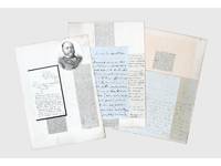
1837156409Kabul and elsewhere: 1837-41 & 1859. Correspondence chess A carefully assembled collection of material connected to players in the "great game" including Colonel Stoddart and Captain Arthur Conolly both famously beheaded at Bukhara Major Henry Rawlinson the political agent at Kandahar and Captain Sir Alexander "Bukhara" Burns. The material mounted on album leaves with accompanying newspaper clippings and other ephemera is tied together by Connolly and Stoddart's dramatic death. Sent on a mission to secure an agreement of friendship between Britain and the Emir of Bukhara in 1838 Stoddart was arrested by the emir on charges of spying and imprisoned. Conolly the intelligence agent credited with coining the term "great game" in an 1840 letter to Rawlinson arrived in Bukhara in late 1841 to negotiate his compatriot's release. Both men were killed in June 1842 and became household names back home. In the first two letters Burns writing about a year before he was killed by a mob in Kabul shares his views with Rawlinson on the latest moves in the "great game". He writes of Stoddart's short-lived release from prison and of the importance of Conolly's current intelligence-gathering in Central Asia. Shah Shuja "is surrounded by a parcel of harpies" and Burns advises caution about the use of British troops to prop up the Shah's rule: "Nothing contributes so much to lower the King's power as the employment of our troops against Afghans & I would avoid it if possible." As for Lord Auckland the governor-general "does not have great faith in the sincerity of Russia in abandoning her Khiva designs but it gives us time." The third letter from Conolly to Rawlinson discusses local news and offers a lighter-hearted window onto the life of a political agent far from home. He has swapped the diplomatic chessboard for the card table: "We miss you very much - especially at whist" the previous night's rubber being "stale and flat but not unprofitable for I won 9 rupees." This letter is mounted with a page of Stoddart's notes on taking navigational bearings which Stoddart gave to Rawlinson before departing for Central Asia in 1837. The final piece touches on the wider appeal of the Stoddart-Conolly story. Writing to the Cornish baronet Sir Hugh Molesworth almost two decades later Dr Joseph Wolff mentions his second expedition to Bokhara mounted to ascertain the fate of the two men and how the profits from the two editions of his best-selling Narrative of a mission to Bokhara 1845 were sufficient to finance a parsonage and schoolhouse in his living. a Sir Alexander Burns to Major Henry Rawlinson 21 December 1840 Kabul. ALS bifolium written across all sides. b Sir Alexander Burns to Major Henry Rawlinson 20 January 1841 Kabul. ALS bifolium written across all sides. c Captain Arthur Conolly to Major Henry Rawlinson 1840 Kabul. ALS bifolium and single sheet written across 5 sides addressed on final side remains of wax seal. d Colonel Stoddart's autograph notes on taking navigational bearings single sheet written one side. Endorsed on verso by Rawlinson "Given to me by Col. Stoddart on his departure for Bokhara in 1837. H. Rawlinson"; later note to the same effect but in a different hand below. e Revd Dr Joseph Wolff to Revd Sir Hugh H. Molesworth 31 August 1859 Taunton Somerset. ALS bifolium written across 3 sides. 4 autograph letters and single sheet of notes totalling 17 sides of manuscript tipped to or mounted on stubs to card album leaves 370 x 265 mm with laid-down material 11 newspaper clippings 2 printed illustrations sheet of manuscript later brief captions in manuscript. Letters and sheet of notes generally well preserved staining and creasing as expected stubs occasionally just touching text but no loss to sense: a very good collection. unknown
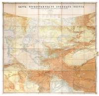
1881149774St Petersburg: Cartographic Institute of the Military-Topographic Department of the General Staff 1881. The cartographic climax of the "great game" Second edition significantly improved from the first edition 1877 to incorporate the latest military intelligence from field surveys. This magisterial work of "great game" cartography was presented at Russia's Tashkent military headquarters to the daring French explorer Stanislas Benoist-Méchin during his epic 1881-3 overland journey from Beijing to Europe. We have traced no other copies. A presentation inscription on the verso of the map reads in French "To Mr Baron Benoist-Méchin from Generals Kouropatkine and Levaschew October 1882 Tashkent." Benoist-Méchin 1854-1923 began travelling the world as a young man and then served as the French cultural attaché in Tokyo 1880-1. In 1881 he decided to return to Europe via the daring route through Central Asia. Leaving Beijing on 15 September with his regular travelling companion Comte Humbert Adrien de Mailly-Chalon 1853-1921 he journeyed through Manchuria and across Russian Siberia. In 1882 having reached Kashgar they received permission to cross Russian Turkestan spending six weeks in Tashkent as the honoured guests of General Mikhail Tchernayev the architect of Russian's expansion across Central Asia General Aleksey Nikolayevich Kuropatkin 1848-1925 and the aforementioned General Levaschov likely the artillery officer Vladimir Levaschov 1834-1898. After reaching Samarkand they travelled in extreme cold through Bukhara and via Khiva to Tehran reaching Moscow in October 1883 where they were accorded a hero's welcome. Their descriptions of this feat of exploration were published in 1885 in the Bulletin de la Société de géographie. This map was made for the use of the Russian military high command in St Petersburg and in the Turkestan Military District which had been established in the 1860s amid the occupation of Tashkent and Bokhara and dates from a period following the Second Anglo-Afghan War and the Battle of Geok Tepe when tensions were at their height. It encompasses almost the entire playing surface of the "great game" extending east-west from Xinjiang and Tibet to the Caspian Sea and Afghanistan and north-south from Siberia to northern India. Unparalleled in terms of accuracy and detail it names every city town and village and the legend has entries for such features as fortifications railways mail and caravan roads and mines. Spot heights are given in feet and deserts are marked with a light red pattern. It is much improved on the first edition which had only 48 panels and did not extend as far south. Chromolithograph map 195 x 200 cm dissected onto 64 sections and mounted on linen as issued laid-down printed slip stating "corrected up to 1881" small folding tab at right edge. Folding away to 28.5 x 28 cm. Housed in green quarter morocco solander box with chemise by the Chelsea Bindery. Map surface generally clean and brighta few stains toning and soiling at edges small repair at top-left edge verso foxed and with couple of areas of linen reinforcement: very good. unknown
1891335233eme. Ed. revue et corrigée.- Paris: Octave Doin Ed. 1891.- XXXII-398 p. en numeración continua: Ilustraciones; 8º 189 x 125 cm.; Texto en francés; Fina encuadernación a la alemana en Tela Nueva tejuelo. La portadilla con una falta de papel pequeña en su base. El papel algo grisáceo. Por lo demás en buen estado. ESOTERIA TEOSOFÃA PARAPSICOLOGÃA ALQUIMIA CARTOMANCIA SECTAS Y CIENCIAS OCULTAS EN GENERAL Livre en français Octave Doin hardcover
1858146689Weimar, Druck und Verlag von Bernard Friedrich Vogt 1858. XXX, 426 Seiten. Halbleinwand-Einband der Zeit. (Geringe Gebrauchsspuren). 17x11 cn
188639050New York: F. M. Lupton 1886. Early printing. Printed self-wrappers. Age toning to paper. Two stab holes in margin along spine. A VG copy. 16 pp text triple column. Ornamental masthead. Folio. 11-5/8" x 8-3/8" <br/><br/> F. M. Lupton unknown books
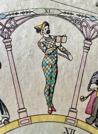
18405201<p>GAME. Arlequin und Columbine oder Arlequins Hochzeit. Nach der bekannten Pantomime gleichen Namens stellen bei diesem Spiele sämtliche Mitspieler Freier um Pantolons Tochter Columbine vor. n.p. n.p. ca 1830. </p><p> VAT in EU & UK</p><p>Lithograph broadside mounted on board 365 x 325 mm hand-coloured; board showing some staining and edges a little frayed; numbered 222 at bottom.</p><p>A well preserved board game played with two dice relating to the marriage of Harlequin and Columbine. Based on the well-known pantomime of the same name in this game all the players introduce suitors for Pantolon's daughter Columbine etc. The central circular field depicts the wedding couple surrounded by a number of acrobats. The surrounding twelve numbered arches show twelve stock male courtship figures all vying for Columbine's attention. The four corners show Commedia dell'arte figures.</p><p>Clockwise from the top the arches are numbered 2 7 5 4 10 2 8 3 6 9 2 11 while the central circle is numbered 12. The numbers thus represent all chances upon double dice with double 1 appearing three times. The rules give pay or take instructions for the various throws. The rules of the game are printed below. One participant is the 'banker' who organises the game and takes the pawns from all participants and arranges for the money to be distributed. The players throw dice andmove along according to their results.</p><p>This board game is number 222 from the fund of an unknown German publisher printed about 1840.</p><p>See Plock Phillippa and Adrian Seville "The Rothschild Collection of printed board games at Waddesdon Manor" in XIIIth Board Game Studies Colloquium Paris 14-17 April 2010; Buijnsters P.J. Papertoys. Speelprenten en papieren speelgoed in Nederland 1640-1920. Waanders Uitgevers-Zwolle 2005.</p> n.p.
187537921Paris: M.J. & Cie 1875. 10 1/4 x 10 1/4 x 5 inches. Some minor wear. 10 1/4 x 10 1/4 x 5 inches. M.J. & Cie unknown books
189037920np 1890. Box 7 3/4/ x 5 x 2 1/4 inches. Lid is split at joint else a fine set. Box 7 3/4/ x 5 x 2 1/4 inches. unknown books
1890379561890. 24 x 9 1/2 inches. 1 vols. Wooden frame with chromolithographic panels on front lid and lower panel. Printed on inside as well with skating rink. 24 x 9 1/2 inches. 1 vols. unknown books
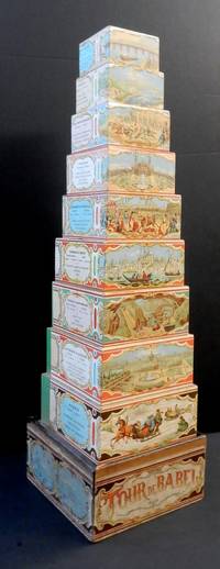
18823220299<i>A nest of nine wooden blocks ranging in size from 78 x78 x 46 mm to 182 x 182 x 60 mm each with a chromolithograph wrap-around illustration depicting European countries with statistical information; contained in the original box with a wrap around title label including four cartouche scenes printed in blue; with a sliding lid replaced.</i><br /><br />Each of the blocks is illustrated with a typical scene from European countries Russia the largest block showing a number of troikas in a winter landscape Germany & Austria with a view of Vienna Sweden and Denmark with mining for iron Turkey & Greece with a view of Istanbul etc. Also included are cartouches with basic information on the population and chief products of each country. <br /><br />The now ubiquitous graduated nested set of blocks for children was quite a late development in toy design with the earliest known patent being applied for in the US in 1881. Watilliaux's Tour of Babel was first marketed as interlocking jigsaw like pieces that could be joined together as hexagons and then stacked to form a tower that was issued at the time of the 1878 Paris Exposition here depicted as the illustration representing France. However when first American nested blocks began to appear Watilliaux evidently adapted the printed design and applied it to his own set of graduated blocks. Unfortunately this reworking did not quite fit the increased surface area of the blocks and a blank section has perforce had to be filled by a section of green glazed paper. It also necessitated the dropping the country of Switzerland and in that case the original pattern was too large to be adapted without their being some lose to the design.<br /><br />No doubt the original design had some educational value although this is somewhat lessened as there is no dexterity needed to correctly interlock the jigsaw pieces and instead only to stack and knock down the Tour de Babel.<br /><br />In 1874 Charles Watelliaux took over the publisher and manufacturer of many board games and toys Bernard Coudert and became a major producer until its sale in 1908 to Revenaz & Tabernat. Watilliaux, Editeur, Lith. J. Marie, Faub St Denis, 61.
1900050958James B. Lyon. Very Good- with no dust jacket. 1900. Hardcover. Hardcover. Green color illustrated cloth boards show edge wear and soil. Sun darkened spine. Text pages lightly tanned. Includes 8 Denton color chromolithographic fish plates and 5 Ridgway animal plates 3 Joutel insect plates plus many black and white photos and illustrations. Always carefully wrapped and shipped in cardboard boxes to protect your purchase. ; 4to 11" - 13" tall . James B. Lyon hardcover
189653762Albany Wynkoop Hallenbeck Crawford Co. for the Commissioners of Fisheries Game and Forests 1896. Hardcover. Gilt pictorial decorations on front cover. Extremities frayed; a few faint stains on covers with several smaller light discolorations; cloth lightly bubbled on rear cover; small stains on front endpaper with paper layer beginning to crack at hinge; pages faintly toned with outside margin frayed on a few; tissue guards a bit browned; otherwise very good condition. Includes 31 plates 15 of them in color and nearly all of game fish. All plates are present and in very good condition except that the "Pike" plate opposite p. 122 has a folded corner. The color plates are by Sherman F. Denton. . 376p. Illus. Includes 31 plates 15 of them in color and nearly all of game fish. The color plates are by Sherman F. Denton. Quarto. Albany, Wynkoop Hallenbeck Crawford Co. for the Commissioners of Fisheries, Game and Forests, [ hardcover
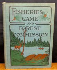
18979211Albany New York U.S.A.: Wynkoop Hallenbeck Crawford Co 1897. First edition. Hardcover. Good/No Dust Jacket. Various. The blue blind stamped boards have an illustration trees shore lake and mountains on front board done in black . The spine and one-quarter of the front board are sun faded. The top of spine has a 1 cm tear as does the lower corner of the front board. The front hinge shows three short tears to 1 cm with the cloth backing still intact. The title page has two creases on it from top to bottom. The front free page has been signed 'Compliments of Edward Thompson' who was one of the commissioners and authors. The previous owner has sign the front free page as well. Pages 521.Printer Wynkoop Hallenbeck Crawford Co. <br/><br/> Wynkoop Hallenbeck Crawford Co hardcover
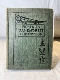
18989212Albany New York U.S.A.: Wynkoop Hallenbeck Crawford Co 1898. First edition. Hardcover. Very Good Minus/No Dust Jacket. Various. The green blind stamped boards have an illustration of a wrought iron work displaying a sign 'Fisheries Game & Forest Commission' with a fish deer antlers and three axes. They are illustrated in black. The previous owner has signed the front free page and there is a signature stamp from the State Superintendent of Public Instruction - 'Charles R. Skinner'. There is one tipped in illustration missing on page 318 entitled 'Wake Robin' Sugar Bush. The book contains a fold out map on page 372. The book is in very good condition other than the missing illustration. The book contains 455 pages.Printer Wynkoop Hallenbeck Crawford Co. <br/><br/> Wynkoop Hallenbeck Crawford Co hardcover
1898050957Wynkoop Hallenbeck Crawford Co. Good with no dust jacket. 1898. Hardcover. Hardcover. The front free endpaper has been SIGNED 'Compliments of Edward Thompson' who was one of the commissioners and authors. Red cloth boards show edge wear and soil. Sun darkened spine ends frayed. Text pages lightly tanned occasional finger soil rough edges. Includes 9 Denton color chromolithographic fish plates and 5 Ridgeway animal plates 1 Catchment Basins map which has a few closed tears plus many black and white photos and illustrations. Always carefully wrapped and shipped in cardboard boxes to protect your purchase. ; 4to 11" - 13" tall . Wynkoop Hallenbeck Crawford Co. hardcover
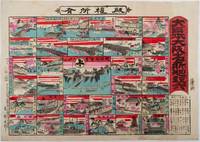
1898218612大阪. Osaka.: 東新太郎. Azuma Shintarō. Meiji 31 1898. Colour woodblock sugoroku 37.8 x 53cm a little light staining and soiling in margins very good. This vividly printed colour woodblock sugoroku game was published in 1898 and features major sites in Osaka. The game highlights entertainment districts such as Dōtonbori Shinsaibashi and the city’s red-light areas. It also includes the headquarters of Osaka Shōsen Kaisha OSK.<br><br>Known as the city of rivers canals and bridges Osaka is well represented in the game through depictions of several famous bridges. The goal of the game is the Osaka Army Headquarters located near Osaka Castle. Distances from Kōrai Bridge to various destinations are listed in the lower right corner. . 東新太郎. [Azuma Shintarō]. unknown