4 134 résultats
Small folio (280 x 212 mm). 5 issues. Original illustrated wrappers. Five issues of Aramco World. In November 1949 the Arabian American Oil Company launched "Aramco World" as an interoffice newsletter that linked the company's U.S. offices with "the field" - primarily Dhahran, in the Eastern Province of Saudi Arabia. The journal quickly grew into a monthly (later bi-monthly) educational magazine featuring historical, geographical and cultural articles that helped the American employees and their families appreciate an unfamiliar land. - The present collection comprises vol. 3, nos. 2, 4, and 11; vol. 5, no, 10, and vol. 6, no. 7. - Heads of spine somewhat worn. Interior in excellent condition.
Calling card format. 2 pp. Visiting card of the Almana Eye Hospital in Alkhobar, Saudi Arabia. With handwritten notes, likely by Mrs. Thomas, the wife of an Aramco employee, on verso, regarding the GIA Gemological Institue in New York, as well as a tailor. - Slightly creased and spotted.
75 original Kodachrome red border colour slides (35 mm film). Private collection compiled by an Aramco engineer active in Saudi Arabia, particularly remarkable due to the exceptionally well retained rich colours of the images - a signature feature of Kodachrome red border slides, which were only produced between the years 1941 and 1959. - Providing a rare insight into the demanding work environment of Aramco personnel, the slides document the cohabitation and collaboration of American and Saudi Arabian staff. They show the exploration for oil and the installment of drilling compounds, as well as large Aramco trucks, frequently carrying explosives. Other images depict groups of workers enjoying a meal in a tent, resting in the shade of a truck, having tea, or playing cards. In addition, the set includes pictures of a small Aramco plane, traditional markets and flocks of sheep, as well as two slides showing scenes from Hadramaut (the only captioned slides). - Extraordinarily well preserved.
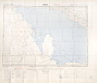
Lithographed map, ca. 99 x 137 cm. Scale 1:1,000,000, Conformal Conic Projection. Rare U.S. Air Force aeronautical chart of the Arabian Gulf detailing Saudi Arabia with Al Hasa Oasis, the Qatar Peninsula, Bahrein, parts of Kuwait, Iraq and Iran, as well as the Saudi-Kuwaiti and Saudi-Iraqi neutral zones. Other details include Tapline road, Kuwait road, geological features like the Dibdiba gravel plains, and the Rub al-Khali desert. The most prominent labelled cities include Riyadh, Doha, Kuwait, Bushire and Shiraz. - The map was prepared by the USAF Aeronautical Chart Service with the 1950 copyright belonging to Standard Oil Company. SOC subsequently licensed their copyright to Aramco. - With a single fold. Somewhat toned. Several larger tears to lower margin; a tear in right margin repaired with old adhesive tape.
8vo. 2 United States passports. Passports of the Aramco employee Joseph John de Roule, packed with entrance visa stamps from his trips to Aramco facilities in the Middle East, including Lebanon, Saudi Arabia, Egypt, and Turkey, but also Hong Kong, Cyprus, and Denmark. - De Roule had been with Aramco since 1951, his first assignment being that of a craft specialist in Abqaiq. He was transferred to Dhahran in 1956, where he later retired with his wife. His 1964 passport includes a set of spare original black-and-white passport photographs in a rear pocket. - In very good condition.
50 x 90 mm. Charming sew-on patch of the Ras Tanura Golf Association. Woven with gold, blue and black thread, it shows two camels wandering the Saudi Arabian desert surrounded by a set of golf clubs, an oil rig, and a palmtree. - Apparently never sewn on. A unique survival.
Oblong 12mo (74 x 114 mm). 1 page. Membership card of the Ras Tanura Golf Association issued to Aramco employee Orlin Orace Thomas. - Somewhat worn.
Oblong 12mo (63 x 100 mm). 2 pp. Membership card of the Ras Tanura Golf Association issued to Velma Thomas, the wife of Aramco employee Orlin Orace Thomas. - Slightly spotted. Well-preserved.
4to. 77 original photographs, comprising 48 colour and 29 black-and-white photos. Ca. 85 x 110 mm. With one Aramco press photograph. Captioned in English. Contemporary half calf with giltstamped spine in a full calf case with metal clasp. Private photo album of the petroleum engineer and Aramco employee Herschel Edmund Zirger (1926-2015). After joining Aramco in 1955, Zirger was involved in the construction of the ADMP-2 platform - a gigantic off-shore oil rig showcased here in impressive photographs which make up the bulk of the collection. Built in the fall of 1965 and spring of 1966 in Vicksburg, it was towed down the Mississippi river, across the Atlantic and through the Suez Canal, to arrive in Saudi Arabia in September 1966. The set includes spectacular images of the rig being launched into the river, passing under the Natchez-Vidalia Bridge, the largest bridge on the Mississippi, and travelling past New Orleans. A pioneering project, the ADMP-2 platform was constructed "to operate in 200-ft water depths compared to the 77-ft maximum of the earlier rig [ADMP-1]. The design of the No. 2 also anticipates Aramco moving out into deeper Gulf waters" (World Petroleum). - Another set of images displays the arduous transport of an oil rig derrick through the desert near Abqaiq. Zirger is seen posing in front of enormous trucks and following the convoi. Sadly, the endeavour ended in a severe accident: after weeks of hard work, the derrick was destroyed in a desert storm. - Finally, several images depict an oil platform in the Arabian Sea, including detailed views of a drill head. - Nearly every picture is captioned in white ink in Zirger's handwriting. Zirger's label of ownership to front cover. - In 1971 Zirger established a Saudi-Registered Limited Liability Partnership which provided consulting services and consultants to Aramco for the supervision, inspection and maintenance of oil wells, water wells and drilling operations. - Full calf case slightly rubbed. An extraordinary collection.
A total of 10 separately catalogued items: a personal collection of 5 membership cards of golf clubs, country clubs and women's groups, one golf score card and the Aramco Golf Banquet programme, a set of 7 programmes of the Protestant Fellowship, 2 programmes of a choir and theatre group, 2 membership cards of the Ras Tanura Golf Association, 2 autograph Christmas and birthday cards, a calling card, 2 identification cards, and a sew-on patch. Private material collected by the Aramco employees Orlin Orace and Velma Thomas during their years in Ras Tanura. The collection portrays the couple as avid golf enthusiasts, including their membership cards for several clubs of the Ras Tanura Golf Association as well as Velma's score card. Perhaps the most uncommon item is a sew-on patch of the Golf Association: woven with gold, blue and black thread, it shows two camels wandering the Saudi Arabian desert surrounded by a set of golf clubs, an oil rig, and a palmtree. - The Thomas family were active members not only of the golf scene, but also of the Protestant Fellowship; their archive further comprises several programmes for Sunday School, Vacation Bible School, and Christmas service. - 2 autograph Christmas and birthday cards addressed to Mrs. Honeycutt in Tulsa, Oklahoma, signed by the Thomas family, document the expats cultivating their relationship to their native home. - The remaining items include an insurance ID verifying Thomas's claim to have medical expenses covered under the Aramco medical payment plan, a permit to use retail services in the Ras Tanura Camp, as well as the programmes of a choir and theatre performance in Ras Tanura. - An intriguing set documenting the diverse activities of Aramco expats in Saudi Arabia. Detailed list available on request.
4to. 106, 22 ff. (as numbered; some leaves numbered with 'a' numbers according to preceding leaf, per standard industry practice). Published as a mimeographed typescript with inset illustrations, many folding. Bound in original wrappers with metal split pin fasteners. Second revised edition. A very extensive report supplied to Aramco regarding the Convair CV-340, a passenger jet designed largely for airlines like United, but quite popular in Saudi Arabia during the first decades of Saudi passenger air service. - The early 1950s saw the dawn of what would become Saudi Arabian Airlines, precipitated in part by the gift of a Douglas DC-3 passenger jet from U.S. President Roosevelt to King Ibn Saud in 1945. It would be the DC-3 and the CV-340 which would comprise the first fleets of passenger planes in Saudi Arabia. That Aramco, a large regional employer, might be interested in the CV-340 is thus understandable; in fact, both planes are remembered by Aramco employees from the 1950s and 1960s - and especially by their children, who were often sent to prep schools in cities like Rome, but flew home on DC-3s and CV-340s to Aramco installations like Dhahran with their peers for holidays. - The CV-340 was developed by Consolidated Vultee (later Convair) from the earlier CV-240, but was newer and larger; the first flight test took place on 5 October 1951. The CV-340 seated at total of 44 passengers. In all, 209 aircraft of this type were sold to airlines but 37 went to private operators, potentially including those interested in purchase at Aramco and more generally in Saudi Arabia and along the Gulf. In extensive text and diagrams, every aspect of the engineering and design of the plane is presented, from the new layout of the tailfin to the shocks in the landing gear to the fire extinguishing system. - A touch of wear, otherwise a well-preserved example of a rare publication produced in a very limited number of copies for promotional and reference use only.
3 typed letters signed and 1 autograph letter, a passport, and an air freight manifest. Compelling archive of the Aramco employee Paul Schwarzenau (1916-92), who joined the Aramco "family" at Dhahran around April 1952. The archive comprises three letters to his mother describing his life in the Middle East, praising his new job with Aramco: "How lucky can i get? All this and a salary too! Ah yes, this is real living although i still can't understand why it should happen to a bum like me!". The remaining correspondence is written in a slightly more critical tone, speaking of an invasion of locusts and the difficulties raised by the language barrier, as well as working obligations during the month of Ramadan, suggesting "the company should abolish all daytime work during this month but of course it is all a big question of $$$$$$'s and the oil has to be kept moving regardless of any attempts, man-made or god-made, to interrupt the flow". - The passport is packed with entrance visa stamps of his trips to Aramco facilities in the Middle East. It also documents a change of name from "Schwarzenau" to "Stiehl". - In addition, the set includes an air freight manifest for a box of personal effects Schwarzenau had shipped from Dhahran to New York. The document includes a customs clearance authorization as well as a specification of the contents of the box, which contained 4 prayer rugs, 12 towels, and 5 bed sheets. - A unique ensemble. Detailed list available on request.
Colour printed map, 1015 x 710 mm. Rare map of oil concessions in the Middle East. With an inset map of the Southern Arabian Peninsula. - Rich in detail, the chart depicts the concessions of various oil companies active in the Arabian Peninsula, the largest by far being that held by Aramco since the 1933 royal concession. However, the map also shows smaller concessions, including those held by Sirip (Société Irano-Italienne des Pétroles), Kuwait Oil, and Japan Petroleum. In addition, it shows oil fields, oil and gas pipelines, pump stations, and refineries, as well as important towns and international borders. - Published as a supplement to the international outlook issue of World Oil. - Slightly duststained, otherwise very well preserved. OCLC 137384087.
Oblong folio (ca. 425 x 300 mm). Photo album with 31 original black-and-white photographs, including 4 loosely inserted photographs. 205 x 255 mm. Contemporary full calf decorated with Arabian-themed scenery to front cover. Cord-bound. Compelling images of the fleet of vehicles operated by Aramco in Saudi Arabia. Uncommon in its extent, the collection was presumably prepared by an Aramco employee and motor enthusiast. It features large trucks mainly manufactured by Blumhardt, Kenworth and Fruehauf, which served in the transportation and installment of oil drilling facilities, as well as some close-ups of enormous tires and cargo areas. Some pictures feature oil derricks, refineries, tanks, cars, and office buildings in the background. - Very well preserved. A rare glimpse of the immense engine power required to produce oil in the Saudi Arabian desert.
Steel-engraved map by J. Rapkin (27 x 35 cm), with engraved illustrations by J.B. Allen after designs by J. Marchant, outlined in colour. Decorative map with Asia including the Arabian Peninsula, with vignettes of ‘Tartars’, ‘Russian peasants’, ‘The walrus’, ‘Sun birds’ and ‘Petra’. Also published in ‘Tallis’s illustrated atlas and modern history of the world’ (London, New York, R.M. Martin, 1851). - Some minor fraying at the top of the map, some browning. In good condition. Not in Al Ankary; Al-Qasimi.
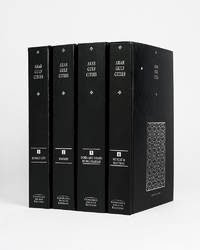
121943Cambridge Cambridge Archive Editions 2020. . 4 vols 8vo 25.5. x 16.5 cm; publisher's original black cloth lettered in silver a fine set.<br /> A valuable collection of records detailing the development and growth of the cities of Kuwait Manama Doha Abu Dhabi Dubai Sharjah Muscat and Mattrah from as early as 1818 right the way through until the mid-1960s before the Gulf War. Chapters are divided into: topography municipality water electricity health education communication lines urban development port development and social history with many royal decrees reproduced.<br /> Cambridge, Cambridge Archive Editions, 2020. hardcover
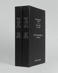
121999Minneapolis East View 2026. . 2 vols 8vo 25.5 x 16.5 cm; includes maps charts & tables; publisher's black cloth lettered white to boards and spines a fine copy.<br /> The complete collection of planning documents for Abu Dhabi from 1962 to 1979 the development plan review for Dubai of 1971 and the Federal Economic and Social Development Plan 1975 to 1980.<br /> Minneapolis, East View, 2026. hardcover
112628London War Office printed for D. Survey WO and AM by Balding and Mansell Ltd. 1957. . Coloured double-sided map of the Arabian Gulf on 1 sheet printed on silk; edition I-GSGS; sheet size: 64 x 72.5 cm; scale 1:1000000 text in English slight fading to creases otherwise near fine.<br /> An excellent example of a double-sided coloured escape map of the Arabian Gulf showing the UAE and Oman to recto and Qatar to verso. With a key to topographical features railways main roads and important settlements including the tribal and official names of provinces and a useful Arabic-English glossary translating key terms such as 'Bir' for 'Well' 'Ain' for Spring' 'Qasr' for 'Fort/Castle'.<br /><br />The recto extends from Kumzat in the North to Hafit in the South and Abu Dhabi in the West to al-Qasbiyat in the East showing the six remaining emirates of Dibai Dubai Sharja Ajman Umm al-Qaiwan Ras al-Khaima and Fujaira. The verso runs South from Ras es Safaniya to Ei Abd and from Awania in the West to Rudaim in the East including the principal settlements of Jubail Bahrein Hofuf showing Doha Wakra and Lusail on the Qatar Peninsular.Arabian Gulf Fabric Map of Hofuf and Bandar Abbas 1957<br /> [London], War Office, printed for D. Survey (WO and AM) by Balding and Mansell Ltd., 1957. unknown
112618London War Office printed for D. Survey WO and AM by Balding and Mansell Ltd. 1957. . Coloured double-sided map of the Arabian Gulf on 1 sheet printed on silk; edition I-GSGS; sheet size: 64 x 72.5 cm; scale 1:1000000 text in English very slight fading to outer margin otherwise near fine.<br /> An excellent example of a double-sided coloured escape map of the Arabian Gulf showing the UAE and Oman to recto and Qatar to verso. With a key to topographical features railways main roads and important settlements including the tribal and official names of provinces and a useful Arabic-English glossary translating key terms such as 'Bir' for 'Well' 'Ain' for Spring' 'Qasr' for 'Fort/Castle'.<br /><br />The recto extends from Kumzat in the North to Hafit in the South and Abu Dhabi in the West to al-Qasbiyat in the East showing the six remaining emirates of Dibai Dubai Sharja Ajman Umm al-Qaiwan Ras al-Khaima and Fujaira. The verso runs South from Ras es Safaniya to Ei Abd and from Awania in the West to Rudaim in the East including the principal settlements of Jubail Bahrein Hofuf showing Doha Wakra and Lusail on the Qatar Peninsular.<br /> [London], War Office, printed for D. Survey (WO and AM) by Balding and Mansell Ltd., 1957. unknown
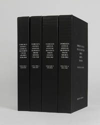
122002Minneapolis East View 2026. . 4 vols 8vo 25.5 x 16.5; publisher's black cloth lettered white to boards and spines a fine copy.<br /> A comprehensive collection of annual reports produced by the British Foreign Office concerning the major regions of Arabia often intended as internal circulars and never for direct publication.<br /> Minneapolis, East View, 2026. hardcover
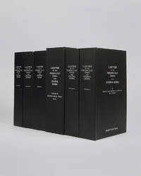
122010London Archive Editions 2003. . 6 vols 8vo 25.5 x 16.5 cm; includes maps & genealogical tables; publisher's original black cloth white lettering to upper board and spine a fine set.<br /> Lorimer's Gazetteer of the Persian Gulf was compiled by officials of the British Government in India during the decade after Lord Curzon's Vice-Regal tour of the Gulf in 1903. When first issued in 1915 it was classified as Secret and for Official Use Only and just a few dozen copies were printed for circulation to British Government departments and agencies.<br /><br />The work was planned in two parts; the first comprising a history of the Gulf region the second being a geographical dictionary but grew to encompass all aspects of Gulf life culture cities towns tribes and topography.<br /><br />Lorimer was an official of the India Civil Service who had spent most of his career on the North West Frontier. He was placed on 'special duty' to compile the Gulf handbook which was intended to be completed in six months but due to Lorimer's dedication and extensive field trips the work took some ten years to complete.<br /><br />The present edition printed from the India Office Records makes available one of the most important primary sources for the study of the Gulf region from the seventeenth to the early twentieth century.<br /> London, Archive Editions, 2003. hardcover
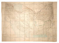
108381Calcutta Survey of India Office 1912-1923. . Heliozincographed colour map four sheets dissected and mounted on linen as one folding out to 108 x 152 cm in size scale 1:2000000 1.014 inches to 32 miles original paper covers with manuscript title label faint crayon lines confined to the area around Quetta a couple minor marginal tears repaired linen a little fragile in a few places but still a sturdy and attractive copy.<br /> Four sheets of the Survey of India Southern Asia Series 1912-1945 covering the Gulf Persia Afghanistan Boluchistan and western India stretching from Riyadh in the south-west to Bukhara in the north-east. The sheet covering the Arabian Gulf titled 'Southern Persia' is dated 1912 and shows the main travel routes along the Gulf and into the interior as far as Riyadh with none of the roads being depicted as suitable for wheeled vehicles and totally absent of railways or telegraph lines. Kuwait Bahrain Qatar Abu Dhabi and Dubai are all identified.<br /><br />Sir Sidney Gerald Burrard 1860-1943 initially served in the Survey offices at Dehra Dun before being made Surveyor General in 1908. In 1912 it was his decision to produce a new set of maps which would correct trigonometric errors in previous surveys and give a totally accurate mapping of Arabia and Central Asia centred on the oil reserves in Persia which Britain had a controlling interest in.<br /> Calcutta, Survey of India Office, 1912-1923. unknown
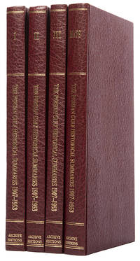
113476London Archive Editions 1987. . First edition; 4 vols 8vo includes a volume of maps and genealogical tables original brown cloth gilt a fine set.<br /> An historical summary of events in the Arabian Gulf concerning British interests from 1907. also includes oil agreements and concessions in the region particularly Muscat and Oman.<br /> London, Archive Editions, 1987. hardcover
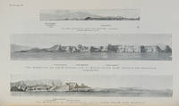
112658London Hydrographic Department Admiralty 1955. . Tenth edition with the second supplement dated 1959; 8vo 24.5 x 16 cm; supplement loosely inserted at rear 4 coloured plates of diagrams two maps acting as an index for admiralty charts 16 double-sided plates showing numerous coastal views further in-text weather diagrams notice of supplement tipped in to face title; publisher's blue cloth lettered in yellow spine a little sunned joints professionally restored very good copy; l 312 1 pp.<br /> A scarce pilot guide of the Persian gulf describing Bahrain Kuwait Qatar Dubai and Abu Dhabi and numerous other villages and towns along the Arabian coast. Includes coastal views of Ras Al Hadd Sur Qalhat As Suwaiq Sohar Fujairah Khasab the Tunb Islands Abu Musa Sirri Island Al Jazirah Al Hamra Al Shebeakah Rams Ajman Qasr Al Hosn in Abu Dhabi Sir Bani Yas the Doha Fort Bahrain Harbour and Tarut Island amongst others.<br /><br />The guide was published to give accurate sailing directions to the ports towns and safe anchorages along the Arabian coast from Ras al Hadd on the eastern peninsular of Oman to Shatt al Arab in the North and back along the coast of Iran to Bandar Abbas and beyond. With much early information on the principal settlements of the United Arab Emirates Qatar Bahrain Kuwait and Oman and an interesting glossary of Arabic-English key terms.<br /><br />By 1955 it was clear how the oil boom had changed the economy of the region. The first chapter gives an overview and includes the character of the sea and ports description of major towns and cities and their respective populations for example 18000 in Qatar the main economic imports and exports of each locale and considerable weather information.<br /><br />Dubai is described as well as Daira: 'Daira is a large suburb consisting of mat huts amongst which stand a number of well-built houses.' 'Dibai Dubai contains the residence of the Shaikh. There are several tall towers in Dibai; the fort is a conspicuous square building with a round tower. from which the Shaikh's flag is displayed. There is a hospital.'<br /><br />Abu Dhabi is similarly described: 'This town consists for the most part of huts and extends along the coast for nearly two miles. In the town there is a small fort partially surrounded by trees with five towers close together. The coast in the vicinity of Abu Dhabi is very low and the beach is of white sand'. The fort is given it's own view on one of the plates. The great pearl bank is also given attention: 'this extensive bank. fills the great bight in the southern part of the Persian Gulf.' 'Many islands both close to the coast and far offshore lie on the bank. With the exception of Dalma none has permanent inhabitants though they are frequented by the pearl boats during the summer and by fisherman from Abu Dhabi in the winter.' 'The best pilots for the coast are to be obtained at Abu Dhabi.'<br /><br />Much detail is also given to Qatar and Doha: 'This town situated on the southern side of the harbour is the capital of Al Qatar peninsula and had a population in 1947 of about 12000.' ' The Shaik's palace. is a large building with many colonnades and an open balustrade round its roof.' ' The chief exports are gutch fish and pearls; imports are food timber and manufactured goods.'<br /><br />Bahrain is also described with Manama being called the 'principal town and port' and as well as the trade being described there is also note of the health of the region: 'Manama is more liable to epidemics than the smaller ports; since 1920 however there have been no more epidemics in Bahrain than in any other of the larger Gulf ports.' It is interesting also that one of the major changes of the supplement is changing the name 'Bahrein' to 'Bahrain'.<br /><br />Kuwait is described as greatly altered by the oil wealth: ' Wealth derived from oil revenues is being spent on completely replanning and rebuilding the town. Government offices schools hospitals electric generating and water distillation stations private houses and blocks of flats are all being built in the most modern style'. 'Pearl fishing is now practically extinct. There are to all intents and purposes no exports. The chief imports are food of all kinds machinery motor vehicles and building materials.'<br /> London, Hydrographic Department, Admiralty, 1955. hardcover
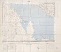
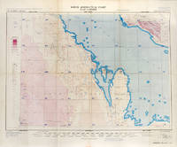
113506London War Office Geographical section 1951. . First edition GSGS 4622 Sheet 2547; Coloured printed map of Bahrain and Qatar on single sheet with extensive legend printed on reverse size: 62.5 x 77 cm; scale 1:1000000 text in English a little faded along folds a very good copy.<br /> First edition of the 1951 issue of the R.A.F. Aeronautical map of Bahrain and Qatar. The War office issued the R.A.F. series alongside a separate US Airforce Series: the R.A.F. series only covers Europe Africa Arabia and up to the end of 1951 had only covered Britain the east coast of Africa and this sheet of Arabia.<br /><br />The odd selection of this region aside from east Africa is made clearer by looking at the content of the map. The map does not show the 'delineation of international boundaries' or 'danger zones' but the topography largely the elevation and depression of the terrain with indications of marshy areas. The only indicated features other than towns and roads are of oil fields and pipelines. <br /><br />In 1941 Britain had gained control of much of Iraq's oil after the Anglo-Iraqi War and sought to expand its influence. The allies had seen the strategical benefits of Bahrain and after the discovery of oil in the region in 1932 it became even more pertinent to grow relations with the entire Middle Eastern command moving from Bushehr in Iran to Bahrain in 1935. But after the war relations had soured with the 1947 anti-Jewish riots in Manama Bahrain largely in reaction to Britain's disastrous orchestration of the Partition of Palestine. At the same time Iran had sought to break free of British control of their oil and in March 1951 voted to nationalise their oil production: in response Britain boycotted Iranian exports. It was in that same month that this map was finalised and published in July in the midst of the tense negotiations Iran was conducting with both Britain and the USA. In 1951 Britain was clearly searching for new regions to extract oil from and this map is captivating evidence of the fractious relationship Britain had fostered with the state of the Arabian Gulf.<br /> [London], War Office, Geographical section, 1951. unknown