VANDERMAELEN, Philippe MarieBiblio.com
943 résultats
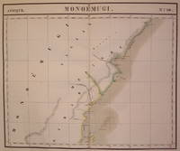
1827202229Brussels: Phillippe Marie Vandermaelen 1827. unbound. very good. Map. Large format lithograph of East Africa with original hand coloring. Image measures 18.5" x 22.25".<br/> <br/> Includes Kenya Mombasa Tanzania and Lamme Lamu. Double page with centerfold. From Vandermaelen's 6 volume "Atlas universel de geographie physique politique statistique et mineralogique sur l'echelle de 1/16411836". Can be combined as gores to form an immense globe. The atlas was the first to map the world on a uniform scale.<br/> <br/> Phillippe Marie Vandermaelen unknown
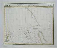
1825M4496Brussels 1825. Very Good minor woming on upper portion of map not affecting the map proficiently repaired. Notes: The first atlas of the world on a uniform scale. If assembled as a globe gores forms a very large globe. Size : 475x575 mm 18.75x22.625 Inches Coloring: Original Outline Coloring Category: Maps Canada West British Columbia; Maps Canada West Alberta unknown
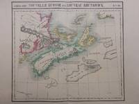
1827288092Brussels: Phillippe Marie Vandermaelen 1827. unbound. Map. Large format lithograph with original hand color wash. Image measures 18.25 x 20.75". Sheet measures 21.25 x 27.5".<br/> <br/> This scarce 1827 map of Nova Scotia and New Brunswick is one of the most detailed maps of the region published in the first half of the 19th century. It extends to Prince Edward Island St. John Cape Breton the Madelaine Islands and the Sable Islands. Topographical features of landforms water bodies and fishing banks are labeled in addition to geographical features such as ports counties towns and cities. As was typical of his cartographic style Vandermaelen has included notations throughout the map that describe the region. The map appeared in Vandermaelen's "Atlas Universal." The map is in excellent condition a dark impression on bright clean paper. Deluxe margins with no chips or tears minor wear to corners not affecting the image. Phillippe Marie Vandermaelen 1795-1869 was a Belgian cartographer and publisher. His Atlas universal was both the first lithograph atlas and the first atlas to map the world on a uniform scale. The maps were meant to join together to form a huge globe. This map is a fine example of his work.<br/> <br/> Phillippe Marie Vandermaelen unknown
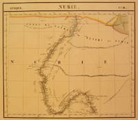
1827202375Brussels: Phillippe Marie Vandermaelen 1827. unbound. very good. Map. Large format lithograph with original hand coloring. Image measures 18.5" x 22.25".<br/> <br/> Includes Nubia Sudan and cities along the Nile River. Double page with centerfold. From Vandermaelen's 6 volume "Atlas universel de geographie physique politique statistique et mineralogique sur l'echelle de 1/16411836". Can be combined as gores to form an immense globe. The atlas was the first to map the world on a uniform scale.<br/> <br/> Phillippe Marie Vandermaelen unknown
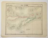
1827325002Brussels: Philippe Marie Vandermaelen 1827. Map. Hand colored engraving. Image measures 18 1/2" x 22"<br/> <br/> Beautiful and simple map of the island of Timor and surrounding islands. From Vandermaelen's 6 volume "Atlas universel de geographie physique politique statistique et mineralogique sur l'echelle.". Can be combined as gores to form an immense globe. <br> <br> Phillippe Marie Vandermaelen 1795-1869 was a Belgian cartographer and publisher. His Atlas universal was both the first lithograph atlas and the first atlas to map the world on a uniform scale. The maps were meant to join together to form a huge globe.<br/> <br/> Philippe Marie Vandermaelen unknown
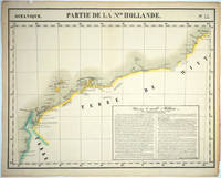
182725576Brussels: P. Vandermaelen 1827. An early map of the Exmouth Western Australia area from the North West Cape to Roebuck Bay. Lithograph with original outline color 15 3/4 x 21". Scale ca. 1:1 650 000. Plate no. 44 Partie de La Nlle. Hollande in vol. 6 Oceanique of Atlas Universal de Geographie Physique Politique Statistique et Mineralogique" by P. Vandermaelen 1827. Tooley 1286; Phillips 749; Bib ID 1553060. P. Vandermaelen unknown
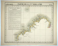
182725575Brussels: P. Vandermaelen 1827. Maps. Very good condition. An early map of the Broome & the Kimberly Western Australia area from P. Cantheaume to Cambridge Gulf including the Lacepede Islands. Broome is at the bottom of the Dampier Peninsula called "C. Boileau." Lithograph with original outline color 25 x 21.5". Plate no. 35 Partie de La Nlle. Hollande in vol. 6 Oceanique of Atlas Universal de Geographie Physique Politique Statistique et Mineralogique" by P. Vandermaelen 1827. Tooley 1282; Phillips 749; Bib ID 30855. P. Vandermaelen unknown
1827M1433Lithograph with hand colouring. An interesting chart showing Tonga or "The Friendly Islands" with extensive description of he flora and fauna of the region. Vandermaelen's Atlas Universel was the first Atlas to use the lithographic process throughout. <br /><br />Phillips 749; Koeman Vdm 1; National Maritime Museum 179<br /><br /> From "Atlas Universel"
1827798Brussels: Vandermaelen Philippe 1827. 18 1/2 x 20 1/2 inches. Very good. An antique map of epic proportions for the Texas collector. This map shows Arkansas and portions of eastern Texas in 1827. It has place names and locations of Native American tribes. Multiple rivers are shown and details of topography well labeled. Overall this is a fine cartographic presentation in the for of a rare map. Vandermaelen, Philippe unknown
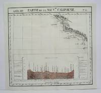
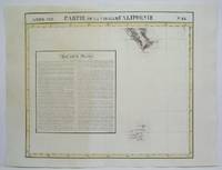
1827801Brussels: Vandermaelen Phillipe 1827. 19 3/4 x 18 1/2 inches. Very good condition. Vandermaelens map sheet on California and the coast. It shows the Westcoast line of Southern California A very nice map and the earliest us of lithography in a cartographic enterprise. Senefelder published his volume on lithography in 1819 in French. Vandermaelen, Phillipe unknown
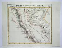
1827802Brussels: Vandermaelen Phillipe 1827. 20 1/2 x 18 1/2 inches. Very good condition. This map shows the West Coast inward into the Tonto Apache territories. Also shown is the land of the Papagos which also includes western Arizona and southern Arizona. Located on the east side of the map is Tumacacori site of a cluster of mission buildings indicating the long arm of religious colonialism. On the west coast is Cape Loma and San Diego. Above this is San Juan Capistrano located in present day Orange County California. This antique map rare map is an original artifact of a period oof little direct knowledge of the area. Vandermaelen, Phillipe unknown
1825M4512Brussels 1825. Very Good minor worming on upper and lower portion of the map along the central fold proficiently repaired. Notes: The first atlas of the world on a uniform scale. If assembled as a globe gores forms a very large globe. Size : 460x500 mm 18.125x19.625 Inches Coloring: Original Outline Coloring Category: ; Maps United States West California unknown
1825M4513Brussels 1825. Very Good minor worming on upper and lower portion of the map along the central fold proficiently repaired. Notes: The first atlas of the world on a uniform scale. If assembled as a globe gores forms a very large globe. Size : 464x515 mm 18.25x20.25 Inches Coloring: Original Outline Coloring Category: ; Maps United States West California unknown
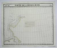
1825M4493Brussels 1825. Excellent. Notes: The first atlas of the world on a uniform scale. If assembled as a globe gores forms a very large globe. Size : 483x579 mm 19x22.75 Inches Coloring: Original Outline Coloring Category: Maps Polar Arctic Regions Alaska Greenland Iceland; unknown
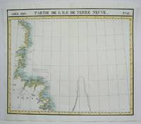
1825M4479Brussels 1825. Excellent. Notes: The first atlas of the world on a uniform scale. If assembled as a globe gores forms a very large globe. Size : 475x570 mm 18.75x22.375 Inches Coloring: Original Outline Coloring Category: Maps Canada East Newfoundland unknown
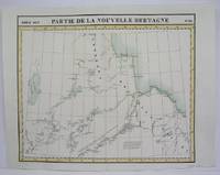
1825M4524Brusseld 1825. Very Good minor worming on upper portion of the map along the central fold proficiently repaired. Notes: The first atlas of the world on a uniform scale. If assembled as a globe gores forms a very large globe.<br><br>This map shows the western shore of Hudson Bay. Nothern Ontario Size : Coloring: Original Outline Coloring Category: Maps Canada Ontario North unknown
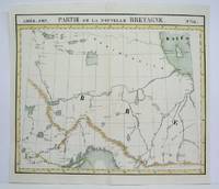
1825M4478Brussels 1825. Excellent. Notes: The first atlas of the world on a uniform scale. If assembled as a globe gores forms a very large globe.<br><br>This map shows the area from Hudson Bay to Lake Abbitibbe and notes the location of various Native tribes and trade houses. Size : 470x565 mm 18.5x22.25 Inches Coloring: Original Outline Coloring Category: Maps Canada East Quebec unknown
1825M4473Brussels 1825. Excellent. Notes: The first atlas of the world on a uniform scale. If assembled as a globe gores forms a very large globe. Size : 475x552 mm 18.75x21.75 Inches Coloring: Original Hand Coloring Category: Maps Polar Arctic Regions Alaska Greenland Iceland; unknown
1825M4518Brussels 1825. Very Good minor worming on upper and lower portion of the map along the central fold proficiently repaired. Notes: The first atlas of the world on a uniform scale. If assembled as a globe gores forms a very large globe. Size : 465x540 mm 18.25x21.25 Inches Coloring: Original Outline Coloring Category: Maps Central America Mexico unknown
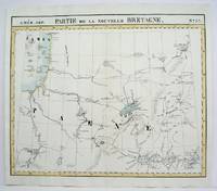
1825M4480Brussels 1825. Excellent. Notes: The first atlas of the world on a uniform scale. If assembled as a globe gores forms a very large globe.<br><br>This map show the region from Hudson Bay to Lake Superior. Noted in the map are the locations of different French forts and Native tribes. Northwest of Ontario Size : 470x563 mm 18.5x22.125 Inches Coloring: Original Outline Coloring Category: Maps Canada Ontario North; unknown
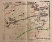
1827302381Brussels: Phillippe Marie Vandermaelen 1827. unbound. Map. Lithograph with original hand outline. Image measures 19" x 22.5".<br/> <br/> Exquisite map of the Amazon region at the borders of Colombia Venezuela and Brazil. Shows important rivers - Orinoco Guaviare Inirida and Rio Negro. Many native indigenous groups are labeled. Notations on the map describe the terrain the native peoples and colonial activities in the region. Double page with centerfold. From Vandermaelen's 6 volume "Atlas universel de geographie physique politique statistique et mineralogique". Can be combined as gores to form an immense globe. The atlas was the first to map the world on a uniform scale.<br/> <br/> Phillippe Marie Vandermaelen unknown
1827278526Brussels: Phillippe Marie Vandermaelen 1827. unbound. Map. Lithograph with original hand outline. Image measures 18.5" x 22.25".<br/> <br/> Minimal yet beautiful map of east-central portion of the Argentine coast just south of Buenos Aires. Includes notes in French on the capital city. Double page with centerfold. From Vandermaelen's 6 volume "Atlas universel de geographie physique politique statistique et mineralogique sur l'echelle de 1/16411836". Phillippe Marie Vandermaelen 1795-1869 was a Belgian cartographer and publisher. His Atlas universal was both the first lithograph atlas and the first atlas to map the world on a uniform scale. The maps were meant to join together to form a huge globe. This map is a fine example of his work.<br/> <br/> Phillippe Marie Vandermaelen unknown
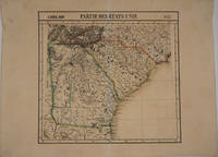
182716375Brussels 1827. Scarce original hand colored lithographed map of Georgia South Carolina North Carolina & Northern Florida. From the six volume atlas by Vandermaelen 'Atlas Universel de Geographie.'. This atlas was the first lithographed world atlas and the first of the entire world with all the maps on the same scale. Image size: 21 5/8 x 18 3/4". Paper size: 29 1/2 x 22". Very good condition. unknown
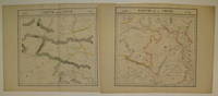
1827220293Brussels: Phillippe Marie Vandermaelen 1827. unbound. very good. Map diptych. Large format lithograph with original hand outline color. Each image measures 18 3/8" x 19 1/8".<br/> <br/> Beautifully detailed set of two maps of eastern central China including part of Hubei Henan Anhui Jiangsu Shanxi Shandong Gansu Sichuan and Shaanxi provinces. Mountains are delicately treated with hachure marks and major rivers and waterways are also shown. Minor overall toning and a few tears to edges. From Vandermaelen's 6 volume "Atlas universel de geographie physique politique statistique et mineralogique sur l'echelle de 1/16411836". Can be combined as gores to form an immense globe. The atlas was the first to map the world on a uniform scale.<br/> <br/> Phillippe Marie Vandermaelen unknown
1827220303Brussels: Phillippe Marie Vandermaelen 1827. unbound. very good. Map set of 4. Large format lithograph with original hand outline color. Each image measures 18.75" x 20 5/8" 18 5/8" x 20 5/8" 18.5" x 20 3/8"<br/> <br/> Beautifully detailed set of four regional maps of northern China and southern Mongolia. Mountains are delicately treated with hachure marks and major rivers waterways and cities are also shown. Notable inclusions from the west to the east: Plate 44 shows the very northwestern tip of China Xinjiang province and part of south central Mongolia with Lac Nor and Hami. Plate 45 shows the eastern portion of Xinjiang province and western Mongolia with Karakorum called here Karakum the medieval capital of Ghengis Khan and the Mongol Empire. Plate 46 demarcates the tribal regions of Khalkha and Tzakhares Mongolians. Plate 47 shows the western portion of the Wall of China delineating the border between Tartary and China. Some minor offsetting several tears and chips to edges. From Vandermaelen's 6 volume "Atlas universel de geographie physique politique statistique et mineralogique sur l'echelle de 1/16411836". Can be combined as gores to form an immense globe. The atlas was the first to map the world on a uniform scale.<br/> <br/> Phillippe Marie Vandermaelen unknown