948 résultats
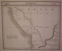
182736276Brussels Belgium: Lithographed By H. Ode. Very Good. 1827. Map. Map # 52 A Very Good primitive and early map showing the central California coast with Santa Barbara and others. Map has wonderful color and many small text descriptions of the coast lines. Latitude of the map is 30 degrees to 36 degrees and longitude is 120 degrees to 128 degrees. Of course almost all localities shown are French or Indian names. The atlas from which this is extracted is extremely rare and originally composed 6 volumes this map being from the North America volume. Lithographer Ode and Cartographer Vandermaelen produced the first lithographed atlas ever done. Condition is overall Very Good. Browning to the centerfold crease caused by glue used in attaching the tab to the original volume the two page spread measures 21" x 26 1/2" when opened out. Topigraphical features are accentuated see image. Shipping will require extra care and cost due to insurance. Photo available upon request. ; 21" x 26 1/2"; 1 pages . Lithographed By H. Ode unknown
182736275Brussels Belgium: Lithographed By H. Ode. Very Good. 1827. Map. Map # 53 A Very Good primitive and early map showing the southern California coast with San Diego and others. Map has wonderful color and many small text descriptions of the coast lines. Latitude of the map is 30 degrees to 36 degrees and longitude is 112 degrees to 120 degrees. Of course almost all localities shown are French or Indian names. The atlas from which this is extracted is extremely rare and originally composed 6 volumes this map being from the North America volume. Lithographer Ode and Cartographer Vandermaelen produced the first lithographed atlas ever done. Condition is overall Very Good. Browning to the centerfold crease caused by glue used in attaching the tab to the original volume the two page spread measures 21" x 26 1/2" when opened out. Topigraphical features are accentuated see image. Shipping will require extra care and cost due to insurance. Photo available upon request. ; 21" x 26 1/2"; 1 pages . Lithographed By H. Ode unknown
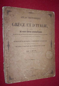
184545592Paris: Chez P. Dumenil Editeur. 1845. Hardcover. Good. Travel and Exploration Classical Studies Most Recent Listing; 13" x 10"; Paris: Good. 1845. Avec une notice sur tous les faits importants et l'indication des lieux ou ils se sont passes; destine a faciliter la Lecture et l'Intelligence de tous les ouvrages relatifs a l'histoire de la Grece et de l'Italie et redige d'apres les meilleures sources par A. Houze. Contents clean and complete; maps in very nice condition original boards detached and quite worn. Title page dated 1845 front board dated 1844. Maps measure 13 inches by 10 inches. Later printing of OCLC 66119840 . . Chez P. Dumenil, Editeur hardcover
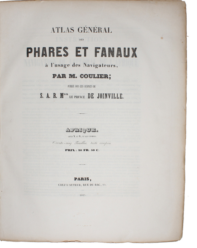
184458482Paris, Chez l'Auteur - Saint-Petersburg, Issakoff, 1844-48. Small folio. (35 x 27 cm.). In a worn contemp. hcalf. Spine cracked and broken. Boards detached. All parts stitched, a few loose. All parts uncut and unopened. All parts clean and fine. Each part separately paginated and with own title-page. Text to each part (from 8-12 pp.). Each part having a large folded engraved general map and from 11 to 27 engraved folio-maps. In all 292 textpages and 441 engraved maps.
184458482Paris Chez l'Auteur - Saint-Petersburg Issakoff 1844-48. Small folio. 35 x 27 cm. In a worn contemp. hcalf. Spine cracked and broken. Boards detached. All parts stitched a few loose. All parts uncut and unopened. All parts clean and fine. Each part separately paginated and with own title-page. Text to each part from 8-12 pp. Each part having a large folded engraved general map and from 11 to 27 engraved folio-maps. In all 292 textpages and 441 engraved maps. <br/><br/><em>The parts volumes comprises: 1. Turquie. 2. Afrique. 3. Grèce et Iles Ioniennes. 4. Portugal. 5. Mer des Indes 1ere Division. 6. Autriche Mer Adriatique. 7. Espagne Cotes N. Mer de Biscaye. 8. Espagne Mer Méditerranée. 9. Sardaigne. 10. Brésil. 11. Amérique Équatoriale Colonies européennes 1re Section. 12. Amérique Équatoriale et Continentale. 13. Prusse. 14. Russie Mer Blanche. 15. Russie Mer Baltique. 16. Russie Mer Noire. 17. Norvège. 18. Suéde. 19. Deux Siciles 1re Section. 20. Deux Siciles 2e Section. 21. Danemarck. 22. Hanovre. 23. Pays-Bas. </em> hardcover
1846B121426Bruxelles, Etablissement Géographique 1846 Page de titre + 1p. + 1 carte en double-page d'assemblage à l'échelle 1:10.000 + 9 plans de détails en double-page (plans parcellaires) à l'échelle 1:2500 ou 1:1250, Grand in-folio (59x38cm.), reliure d'époque en cuir brun (titre doré au premier plat, dos et bords frottés, plats usés, qqs. manque au dos), texte et intérieur sont frais, [Atlas cadastral historique d'une grande rareté, documentant le village de Bogaarden situé dans le Pajottenland. Dans les années 1840 il y avait le besoin de données géographiques précises à des fins fiscales et d'aménagement du territoire. Sur les plans de détail chaque parcelle de Bogaarden est numérotée et précisée (maisons, terres agricoles, vergers, chemins, cours d'eau). Chaque feuille comprend une échelle graphique en mètres, l'indication de la section spécifique et les numéros de parcelles individuelles et les noms des propriétaires], poids: 1.9kg., B121426
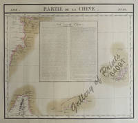
182564091<p>RARE original hand-colour lithograph text vignette on China shows Northern Taiwan Ryukyu Islands Okinawa and Southern part of coast of province of Quangdong and part of Fujian. Map from 'Atlas Universel de Geographie.' Asie no. 88. This 6 vol. Atlas contains 382 lithographed mapsheets and 40 plates of statistical data by Henri Ode mostly hand-coloured in outline. The maps in the atlas constitute not only the first atlas of the world on a uniform scale but also the first lithograph atlas. Constructed on a modified conical projection if assembled they form a 775 m diameter globe although only one such was known to have been assembled by the author himself and requiring a specially designed room. Reference: atlas: Koeman III Vdm 1; Phillips Atlases 749. Condition: very good condition.</p> published in Brussels.
1827283421Brussels: Vandermaelen Phillipe Marie 1827. unbound. very good. Map. Large format lithograph with original hand outline color. Image measures 18.75" x 19 1/8". Sheet measures 21" x 27". Shows some foxing and a few tears to edges.<br/> <br/> Beautifully detailed map that shows Bejing "Pekin" and surrounding provinces. Mountains are delicately treated with hachure marks and major rivers and waterways are also shown. From Vandermaelen's 6 volume "Atlas universel de geographie physique politique statistique et mineralogique sur l'echelle de 1/16411836". The atlas was the first to map the world on a uniform scale; maps were meant to join together to form a huge globe.Phillippe Marie Vandermaelen 1795-1869 was a Belgian cartographer and publisher. This map is a fine example of his work.<br/> <br/> Vandermaelen, Phillipe Marie unknown
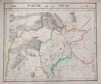
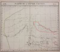
1827283424Brussels: Phillippe Marie Vandermaelen 1827. unbound. very good. Map diptych. Two double-page lithographs with original hand outline color. Each image measures 18.75" x 19 1/8". Sheets measure 21" x 27". Both show some foxing and some chips and tears to edges.<br/> <br/> Beautifully detailed map that shows northwest China including parts of the Silk Road. Mountains are delicately treated with hachure marks and major rivers and waterways are also shown. From Vandermaelen's 6 volume "Atlas universel de geographie physique politique statistique et mineralogique sur l'echelle de 1/16411836". The atlas was the first to map the world on a uniform scale; maps were meant to join together to form a huge globe.<br> <br> Phillippe Marie Vandermaelen 1795-1869 was a Belgian cartographer and publisher. This map is a fine example of his work.<br/> <br/> Phillippe Marie Vandermaelen unknown
1896RO10029324Bureau de la revue. 14 juin 1896. In-12. Broché. Bon état, Couv. convenable, Dos satisfaisant, Intérieur frais. 16 pages illustrées d'une gravure portrait en première page.. . . . Classification Dewey : 920-Biographie générale et généalogie
189360459Neuch‰tel : Attinger 1893. 205x135mm. XV- illustrÂŽ demi-parchemin ˆ coins piÂce de titre au dos plats papier marbrÂŽ quelques rousseurs au dÂŽbut du livre. 433 Attinger unknown
1888E2362Paris - Saintes, A. Picard - Mme Z. Mortreuil, 1888 ; in-8, 500 pp., broché (à faire relier). État moyen.
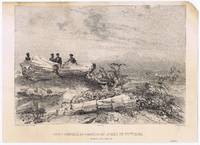
18379563<p>lithograph laid on India paper. EXTREMELY RARE view by Arthus Bertrand Paris. Baron de Bougainville 1781-1846 was a French naval officer the son of famous voyager Louis-Antoine de Bougainville. He became Rear-Admiral in 1838. The unachieved main intention of the voyage was: to extend French influence in Indochina but Manila Sydney and Rio de la Plata areas were also visited and documented with these superbly executed artworks published nine years before the official account of the voyage. <br />Condition: with tight top margin with slight smudges and water stains small paper and image loss on upper right.</p> Arthus Bertrand, Paris.
1827202217Brussels: Vandermaelen Philippe Marie 1827. unbound. very good. Map. Large format lithograph of West Africa with original hand coloring. Image measures 18.5" x 22.25".<br/> <br/> Includes the Congo Congo River and Gabon. Double page with centerfold. From Vandermaelen's 6 volume "Atlas universel de geographie physique politique statistique et mineralogique sur l'echelle de 1/16411836". Can be combined as gores to form an immense globe. The atlas was the first to map the world on a uniform scale.<br/> <br/> Vandermaelen, Philippe Marie unknown
182830319Mulhouse et Paris Engelmann & Cie 1828 2 Volumes In-folio volume du Haut-Rhin : 1 portrait de Benjamin constant XI -126 - 40 planches lithographiées (24 pp - 1 ff - - puis pour les monumens Romains et huit planches, vues plan et carte ) Volume du Bas -Rhin : 180 pp ( 1 ff ) et 40 planches Lithographiées par Engelmann , très nombreuses rousseurs mais principalement en marges des lithographies - les dos et les bords des plats sont très usagés avec manques en coiffes et mors partiellement fendus . L'ouvrage non dérelié est complet mais vendu tel que décrit e
184622742Paris Typographie Lacrampe et Cie 1846 In-8 500 pp et 12 planches non numérotées de gravures sur bois représentant des théatres parisiens , léger manque au dos partiellement non coupé
182028811paris 1820-1831 1- Copie d'une lettre adressée à Mr le Maire de Saint CLOUD, par le Chevalier DUFOUR , Médecin et Commissaire du Bureau de Bienfaisance du deuxième arrondissement de Paris, faisant l'Eloge des préparations anti-dartreuses de KÜNCKEL, avec cachet de la Mairie de St Cloud en noir in-fine : avec couronne et 3 fleurs de lys, lettre de 4 pages manuscrite à l'encre brune sur papier vergé crème, ligné et filigrané "P. MOREL", format : 30 x 19 cm, Paris, le 11 juin 1821, 2- Lettre Originale de Mr Guillaume CAPELLE, Conseiller d'Etat chargé de l'Administration Générale des Hospices et Etablissements de Bienfaisance adressée à Mr KÜNCKEL, Avenue du Chateau à St Cloud, N°11, à propos des Remèdes Secrets dont Mr KÜNCKEL est propriétaire, signature manuscrite à l'encre brune du Conseiller D'Etat Guillaume CAPELLE, Paris, le 4 Juillet 1820, lettre Originale de 2 pages manuscrite à l'encre brune sur papier vergé crème, ligné , format : 31 x 20 cm, 3- Lettre Originale de Mr Guillaume CAPELLE, Conseiller d'Etat chargé de l'Administration Générale des Hospices et Etablissements de Bienfaisance adressée à Mr KÜNCKEL, Avenue du Chateau à St Cloud, N°11, en réponse à sa demande d'examiner ses remedes Secrets par l'academie royale de Medecine, signature manuscrite à l'encre brune du Conseiller D'Etat Guillaume CAPELLE, Paris, le 27 Octobre 1821, ettre Originale de 2 pages manuscrite à l'encre brune sur papier vergé crème, ligné , format : 31 x 20 cm , 4- Lettre Originale du comte Antoine Maurice Apollinaire d'Argout : Ministre du Commerce et des Travaux publics adressée à Mr KÜNCKEL, rue Bellefond Nos 14 et 16, Paris, en reponse à sa réclamation, il a invité le Prefet de Police à faire lever les scellés mis sur les poudres, anti-Dartreuses en attendant le rapport de l'acdemie Royale de Medecine; signature manuscrite du Comte d'ARGOUT, lettre Originale de 2 pages manuscrites à l'encre brune sur papier vergé crème, ligné et filigrané : "LP ne", format : 30 x 20 cm, Paris, le 2 Novembre 1831, 5- Lettre Originale du Ministere des travaux Publics, de l'Agriculture et du Commerce, Bureau Sanitaire, section remedes secrets adressée à Mr KÜNCKEL, rue de la victoire N°11, Paris, signature manuscrite illisible pour le conseiller d'etat Directeur, Paris, le 27 Avril 1831, lettre Originale de 4 pages manuscrites à l'encre brune sur papier crème, format : 31 x 20,5 cm, Lettre : "accusant réception des recettes cachetées et leurs échantillons de préparations anti-dartreuses dont vous avez fait le depot au Bureau Sanitaire, que nous venons de transmettre à l'Academie Royale de Médecine....",
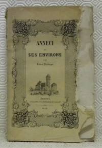
185267602Anneci : Typographie et lithographie de F. Saillet 1852. 215x140mm. frontispice: Ã’Vue dÕAnneciÓ brochÂŽ. Les pemiÂres pages sont tachÂŽes. Les bors latÂŽrales de la couverture supÂŽrieure de la page de garde et de la page de faux titre sont rongÂŽs. Coiffe supÂŽireure usÂŽe. Les coins supÂŽrieure des pages sont aussi tachÂŽs. 180 Typographie et lithographie de F. Saillet unknown
184087251840 demi-chagrin. 2 vol. in-8, VIII-496 et (2ff.), 744pp., 33 cartes h.t., P. Didot 1840,
1864120091864 Nancy, Cayon-Liébaut, 1864; pièce in-8° de VIII ( dont le titre- frontispice) - 24pp. Plein cartonnage souple beige imprimé en noir . Cette rare seconde édition est tiré à 120 exemplaires (la 1ère est de 1850).
183638556HB1836. Paris J.-B. Baillière 1836. 234 S. Späterer Pappband mit goldgeprägtem Rückentitel unbeschnittene Original-Broschur 1 gefaltete Tafel mit 12 lithogr. Abbildungen. Titelblatt mit hinterlegter Fehlstelle. Altersbedingt etwas gebräunt sonst schönes Exemplar. unknown
183719200Bruxelles: Delfosse 1837. SECOND EDITION. Folding lithographed plate. Contemporary gilt sheep-backed marbled boards edges sprinkled red. A nice complete copy. Second edition an anatomical guide to human and animal teeth. The first chapters cover tooth formation parts of the tooth tooth loss functions of individual teeth and differences in teeth between men and women and among different races of people. The second part of the book focuses on animal teeth across four orders: mammals birds reptiles and fish. The plate features 8 figures and is accompanied by explanatory text. <br /> <br /> Blandin 1798-1849 was a French surgeon and anatomist. He was a pioneer in the field of plastic surgery and is credited with coining the term autoplasty. Delfosse unknown
1833028210UK 1833. First Edition . Paper. Good. 48mo - over 3 - 4" tall. An Original Letter Handwritten and Signed by French Artist Louis Nicolas Philippe Auguste Comte de Forbin. Dated March 1833. A letter in French from the Louvre. Louis Nicolas Philippe Auguste Comte de Forbin 1777-1841 was the French painter and antiquary who succeeded Vivant Denon as curator of the Musée du Louvre and the other museums of France. Size is 132m x 105mm. Condition is good. Light folding creasing. More images can be taken upon request. Ref18068 <br/> <br/> unknown
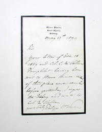
1890028753UK 1890. First Edition . Paper. Very Good. 8vo - over 7¾" - 9¾" tall. An Original Hand Written and Signed Letter by Writer Prince Philippe of Orléans Count of Paris. The letter discusses a pamphlet by George Brinton McClellan who was an American Civil War Military Officer politician engineer businessman and writer who served as the 24th governor of New Jersey. The prince did not receive the pamphlet at Stowe House but was sent to Sheen House instead. Dated 1890.Prince Philippe of Orléans Count of Paris Louis Philippe Albert; 1838-1894 was disputedly King of the French from 24 to 26 February 1848 as Louis Philippe II although he was never officially proclaimed as such. He was the grandson of Louis Philippe I King of the French. He was the Count of Paris as Orléanist claimant to the French throne from 1848 until his death. From 1883 when his cousin Henri Count of Chambord died he was often referred to by Orléanists as Philippe VII.Philippe volunteered to serve as a Union Army officer in the American Civil War along with his younger brother Prince Robert Duke of Chartres. He was appointed as an assistant adjutant general with the rank of captain on 24 September 1861 and served under the name of Philippe d'Orléans the Count of Paris. He served on the staff of the commander of the Army of the Potomac Major General George B. McClellan for nearly a year. He distinguished himself during the unsuccessful Peninsular Campaign. He resigned from the Union Army along with his brother on 15 July 1862. Philippe's History of the Civil War in America is considered a standard reference work on the subject. From a autograph book kept by A. P. Watt 1834-1914 founder of A. P. Watt & Son in 1875 the world's first literary agents. Size of letter is 150mm x 100mm. Good condition. Folding centre crease. More images can be taken upon request. Ref18423 <br/> <br/> unknown
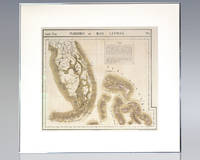
1825137108Brussels: Lithographed by H. Ode 1825. Rare hand-colored lithograph map of South Florida the Keys and the Bahamas from renowned 19th century Belgian cartographer Philippe Vandermaelen's Atlas Universel. One page the map displays South Florida and the Bahamas including major cities as of 1825 with numerous Native American trails and roads recorded and an inset text regarding the flora and fauna of the Everglades. Matted and framed. The entire piece measures 29 inches by 27 inches. Published in 1827 and consisting of approximately 380 conically projected sheets of maps in six volumes Belgian geographer's Vandermaelen's Atlas Universel was the first atlas produced using the method of lithography and the first to use the same large uniform scale for all of the maps included in its pages. Regarded as one of the most important and remarkable innovations in the private enterprise of cartography the maps were uniquely designed to be joined into a three-dimensional terrestrial globe with a diameter of approximately 25 feet. Lithographed by H. Ode unknown