1 490 résultats
1882101041Philadelphia 1882. Unbound colored engraved map decorative boarder 14"x 11". Slight toning and aging minor soiling and acople of small nicks ta side edge; still bright and clear and in otherwise very good shape. Maps are wrapped with acid free board or in rigid sleeves. The Mitchell family started to produce atlases in 1846 and continued into the early 1890s. Around 1860 S. Augustus Mitchell Jr. took over and the atlas would be called Mitchell's New General Atlas. This is an attractive colorful single page map of Maine from the 1869 installment of that atlas. Good detail and Portland is featured in an inset. Ristow 311-313 unknown books
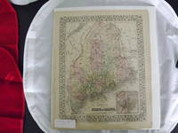
1869101040Philadelphia 1869. Unbound colored engraved map decorative boarder 14"x 11". Slight toning and aging; bright and clear and in otherwise very good shape. Maps are wrapped with acid free board or in rigid sleeves. The Mitchell family started to produce atlases in 1846 and continued into the early 1890s. Around 1860 S. Augustus Mitchell Jr. took over and the atlas would be called Mitchell's New General Atlas. This is an attractive colorful single page map of Maine from the 1869 installment of that atlas. Good detail and Portland is featured in an inset. Ristow 311-313 unknown books
1861101019Philadelphia 1861. Unbound colored engraved map decorative border 14"x 11". Slight toning and aging a little staining and soiling in margins a few small chips at left edge; overall bright and clear and in very good shape. Maps are wrapped with acid free board or in rigid sleeves. The Mitchell family started to produce atlases in 1846 and continued into the early 1890s. Around 1860 S. Augustus Mitchell Jr. took over and the atlas would be called Mitchell's New General Atlas. This is an attractive colored map of England and Wales from the 1861 installment of that atlas. Ristow 311-313 unknown books
1861101202Philadelphia 1861. Unbound colored engraved map decorative boarder 14 1/2"x 11". Slight toning and aging; overall bright and clear and in very good shape. Maps are wrapped with acid free board or in rigid sleeves. The Mitchell family started to produce atlases in 1846 and continued into the early 1890s. Around 1860 S. Augustus Mitchell Jr. took over and the atlas would be called Mitchell's New General Atlas. This is an attractive single page map of Michigan and Wisconsin from the 1861 installment of that atlas. Map has nice detail and good color. Ristow 311-313 unknown books
1864101046Philadelphia 1864. Unbound colored engraved map decorative boarder 14"x 11". Slight toning and aging; otherwise bright and clean. Maps are wrapped with acid free board or in rigid sleeves. The Mitchell family started to produce atlases in 1846 and continued into the early 1890s. Around 1860 S. Augustus Mitchell Jr. took over and the atlas would be called Mitchell's New General Atlas. This is a very colorful and attractive map of Minnesota from the 1882 installment of that atlas. While the upper part of the state shows more of the "wide open spaces" there is plenty of detail in the lower portion of this rather colorful map. Ristow 311-313 unknown books
1882101047Philadelphia 1882. Unbound colored engraved map decorative boarder 14"x 11". Slight toning and aging very minor small stains in bottom margin; otherwise bright and clean. Maps are wrapped with acid free board or in rigid sleeves. The Mitchell family started to produce atlases in 1846 and continued into the early 1890s. Around 1860 S. Augustus Mitchell Jr. took over and the atlas would be called Mitchell's New General Atlas. This is a very colorful and attractive map of Minnesota from the 1882 installment of that atlas. While the upper part of the state shows more of the "wide open spaces" there is plenty of detail in the lower portion of this rather colorful map. Ristow 311-313 unknown books
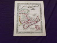
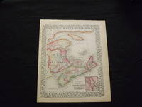
1869103218<p>Unbound colored engraved map decorative boarder 14"x 11". Slight toning browning and aging; overall very bright and clear and in very good shape. Maps are wrapped with acid free board or in rigid sleeves. The Mitchell family started to produce atlases in 1846 and continued into the early 1890s. Around 1860 S. Augustus Mitchell Jr. took over and the atlas would be called Mitchell's New General Atlas. This is a colorful map of a portion of eastern Canada from the 1869 installment of that atlas. The map is bright and crisp and includes a small inset map of Halifax. Extra postage may be required. Ristow 311-313.</p> books
1861101133<p>Philadelphia 1861. Unbound colored engraved map decorative boarder 14"x 11". Slight toning and aging; overall very bright and clear and in very good shape. Maps are wrapped with acid free board or in rigid sleeves. The Mitchell family started to produce atlases in 1846 and continued into the early 1890s. Around 1860 S. Augustus Mitchell Jr. took over and the atlas would be called Mitchell's New General Atlas. This is a colorful map of a portion of eastern Canada from the 1861 installment of that atlas. The map is bright and crisp and includes a small inset map of Halifax. Extra postage may be required. Ristow 311-313</p> books
1865101132Philadelphia 1865. Unbound colored engraved map decorative boarder 14"x 11". Slight toning and aging; overall very bright and clear and in very good shape. Maps are wrapped with acid free board or in rigid sleeves. The Mitchell family started to produce atlases in 1846 and continued into the early 1890s. Around 1860 S. Augustus Mitchell Jr. took over and the atlas would be called Mitchell's New General Atlas. This is a colorful map of Pennsylvania but includes New Jersey Maryland and Delaware from the 1865 installment of that atlas. The map is bright and crisp and includes inset maps of Philadelphia and Baltimore. Ristow 311-313 unknown books
1870106176<p>Unbound colored engraved map decorative border 22 1/2"x 14 1/2". Slight toning and aging top margin a little rough with a couple of minor chips and tears but margin is ample; overall bright and clear and in very good shape. Maps are wrapped with acid free board or in rigid sleeves. The Mitchell family started to produce atlases in 1846 and continued into the early 1890s. Around 1860 S. Augustus Mitchell Jr. took over and the atlas would be called Mitchell's New General Atlas. This is a very colorful and bright single page map of Georgia and Alabama from the 1870 installment of that atlas. Ristow 311-313.</p> books
1864101033<p>Philadelphia: 1864. Unbound colored engraved map decorative border 14"x 11 1/2". Slight toning and aging a little browing and staining in the margins; otherwise very good and overall bright and clear. Maps are wrapped with acid free board or in rigid sleeves. The Mitchell family started to produce atlases in 1846 and continued into the early 1890s. Around 1860 S. Augustus Mitchell Jr. took over and the atlas would be called Mitchell's New General Atlas. This is very colorful version of the Iowa and Missouri map from an early installment of this atlas. Ristow 311-313</p> books
1861106188<p>Unbound colored engraved map decorative boarder 14" x 11". Slight toning darkening and aging a little soiling and staining in margins a few minor chips and tears at the edge of the upper margin; overall bright and clean and in very good condition. Maps are wrapped with acid free board or in rigid sleeves. The Mitchell family started to produce atlases in 1846 and continued into the early 1890s. Around 1860 S. Augustus Mitchell Jr. took over and the atlas would be called Mitchell's New General Atlas. This is an attractive single page map of Virginia and North Carolina which is somewhat scarce Mitchell combination from the 1861 installment of that atlas. Extra postage may be required. Ristow 311-313.</p> books
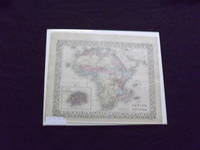
1882101003<p>Philadelphia: Bradley 1882. Unbound colored engraved map decorative border 14"x 11". Slight toning and aging a couple a minor chips to edges; overall bright and clear and in very good shape. Maps are wrapped with acid free board or in rigid sleeves. The Mitchell family started to produce atlases in 1846 and continued into the early 1890s. Around 1860 S. Augustus Mitchell Jr. took over and the atlas would be called Mitchell's New General Atlas. This is an attractive colored map of Africa from the 1882 installment of that atlas. The map shows a sizeable unknown territory and not surprisingly the map presents some very different political boundaries from more modern times. A small map of the Island of St. Helena is featured in an inset. May require extra postage. Ristow 311-313 Phillips 907</p> Bradley books
1864106096<p>Unbound colored engraved map decorative border 14" x 11". Slight toning and aging; otherwise bright and clear and very good. Maps are wrapped with acid free board or in rigid sleeves. The Mitchell family started to produce atlases in 1846 and continued into the early 1890s. Around 1860 S. Augustus Mitchell Jr. took over and the atlas would be called Mitchell's New General Atlas. This is a detailed single page map of Brazil Chilli and Bolivia from the 1864 installment of this atlas. Uncludes inset showing the harbor of Rio Janeiro. Colorful and attractive. Ristow 311-313.</p> books
1869101014Philadelphia 1869. Unbound colored engraved map decorative border 14"x 11". Slight toning and aging; overall bright and clean. Maps are wrapped with acid free board or in rigid sleeves. The Mitchell family started to produce atlases in 1846 and continued into the early 1890s. Around 1860 S. Augustus Mitchell Jr. took over and the atlas would be called Mitchell's New General Atlas. This is a nice map of Chicago from the 1869 installment of this atlas. A very good street map. Ristow 311-313 unknown books
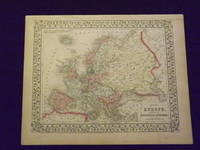
1861101203<p>Philadelphia 1861. Unbound colored engraved map decorative border 14"x 11". Slight toning and aging; overall bright and clear and in very good shape. Maps are wrapped with acid free board or in rigid sleeves. The Mitchell family started to produce atlases in 1846 and continued into the early 1890s. Around 1860 S. Augustus Mitchell Jr. took over and the atlas would be called Mitchell's New General Atlas. This is a nice map of Europe from the 1861 installment of that atlas. Despite the large area the map covers there is still a decent amount of detail. Ristow 311-313</p> books
1869103234<p>Unbound colored engraved map decorative border 14"x 11". Slight toning and aging; overall bright and clear and in very good shape. Maps are wrapped with acid free board or in rigid sleeves. The Mitchell family started to produce atlases in 1846 and continued into the early 1890s. Around 1860 S. Augustus Mitchell Jr. took over and the atlas would be called Mitchell's New General Atlas. This is a nice map of Europe from the 1869 installment of that atlas. Despite the large area the map covers there is still a decent amount of detail. Extra postage may be required. Ristow 311-313. # 103234</p> books
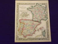
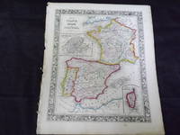
1864103237<p>Unbound colored engraved map decorative border 14" x 11". Slight toning and aging; overall bright and clean and in very good condition. Maps are wrapped with acid free board or in rigid sleeves. The Mitchell family started to produce atlases in 1846 and continued into the early 1890s. Around 1860 S. Augustus Mitchell Jr. took over and the atlas would be called Mitchell's New General Atlas. This is a very colorful map of France Spain and Portugal from the 1864 installment of that atlas. An inset illustrates Switzerland and the Island of Corsica. Extra postage may be required. Ristow 311-313.</p> books
1861103243<p>Map of France Spain and Portugal. Philadelphia: 1861. Unbound colored engraved map decorative border 14" x 11". Slight browning and aging some chips and nicks at the left edge; overall bright and clean and in very good condition. Maps are wrapped with acid free board or in rigid sleeves. The Mitchell family started to produce atlases in 1846 and continued into the early 1890s. Around 1860 S. Augustus Mitchell Jr. took over and the atlas would be called Mitchell's New General Atlas. This is a very colorful map of France Spain and Portugal from the 1864 installment of that atlas. An inset illustrates Switzerland and the Island of Corsica. Extra postage may be required. Ristow 311-313.</p> books
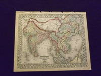
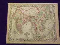
1870103247<p>Unbound colored engraved map decorative border 14"x 11". Slight toning and aging a little browning at edges some finger soiling in margins some chips and tears along top edge; otherwise bright and clean. Maps are wrapped with acid free board or in rigid sleeves. The Mitchell family started to produce atlases in 1846 and continued into the early 1890s. Around 1860 S. Augustus Mitchell Jr. took over and the atlas would be called Mitchell's New General Atlas. This is a nice colorful map of India and parts of the far east from the 1870 installment of that atlas. The coloring is more dramatic than other editions of this map. While this is not a large map there is still a considerable amount of detail. Extra postage may be required. Ristow 311-313. # 103247</p> books
1861101027<p>Philadelphia 1861. Unbound colored engraved map decorative border 14"x 11". Slight toning and aging a little browning at edges; overall bright and clear and in very good shape. Maps are wrapped with acid free board or in rigid sleeves. The Mitchell family started to produce atlases in 1846 and continued into the early 1890s. Around 1860 S. Augustus Mitchell Jr. took over and the atlas would be called Mitchell's New General Atlas. This is a nice colorful map of India and parts of the far east from the 1861 installment of that atlas. While this is not a large map there is still a considerable amount of detail. Ristow 311-313</p> books
1869103250<p>Unbound colored engraved map decorative border 14" x 11". Slight browning and aging; otherwise bright and clean. Maps are wrapped with acid free board or in rigid sleeves. The Mitchell family started to produce atlases in 1846 and continued into the early 1890s. Around 1860 S. Augustus Mitchell Jr. took over and the atlas would be called Mitchell's New General Atlas. This is a nice colorful map of India and parts of the Far East from the 1869 installment of that atlas. While this is not a large map there is still a considerable amount of detail. Extra postage may be required. Ristow 311-313.</p> books
1882101042Philadelphia: Bradley 1882. Unbound colored engraved map 22 1/2"x 14 1/2". Some toning and aging a little darkening at fold; otherwise very good. Maps are wrapped with acid free board or in rigid sleeves. The Mitchell family started to produce atlases in 1846 and continued into the early 1890s. Around 1860 S. Augustus Mitchell Jr. took over and the atlas would be called Mitchell's New General Atlas. This is an attractive double page map of Central America from the 1882 installment of that atlas. Bermuda Jamaica a map of the Panama Railroad and a map of the proposed Panama Canal route are highlighted within insets. Ristow 311-313 Phillips 907 Bradley unknown books
1870101214Philadelphia 1870. Unbound colored engraved map decorative border double page 22" x 14". Slight toning and aging; overall bright and clear and in very good shape. Maps are wrapped with acid free board or in rigid sleeves. The Mitchell family started to produce atlases in 1846 and continued into the early 1890s. Around 1860 S. Augustus Mitchell Jr. took over and the atlas would be called Mitchell's New General Atlas. This is an attractive double page map of Central America from the 1870 installment of that atlas. Bermuda Jamaica a map of the Panama Railroad and a map of Cuba are highlighted within insets. Ristow 311-313 Phillips 907 unknown books
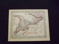
1869103217<p>Unbound colored engraved map decorative border 14" x 11". Slight toning browning and aging; otherwise bright and clean. Maps are wrapped with acid free board or in rigid sleeves. The Mitchell family started to produce atlases in 1846 and continued into the early 1890s. Around 1860 S. Augustus Mitchell Jr. took over and the atlas would be called Mitchell's New General Atlas. This is an attractive colorful map of Ontario from the 1869 installment of that atlas. The map provides good county detail and part of Quebec New York and Pennsylvania are visible. Extra postage may be required. Ristow 311-313. </p> books