1 490 résultats
1882101069<p>Philadelphia 1882. Unbound colored engraved map decorative boarder 14"x 11". Slight toning and aging; overall bright and clear and in very good shape. Maps are wrapped with acid free board or in rigid sleeves. The Mitchell family started to produce atlases in 1846 and continued into the early 1890s. Around 1860 S. Augustus Mitchell Jr. took over and the atlas would be called Mitchell's New General Atlas. This is a colorful map of part of the Middle East from the 1882 installment of that atlas. Ristow 311-313</p> books
1861101068<p>Philadelphia 1861. Unbound colored engraved map decorative boarder 14"x 11". Slight toning and aging and a little staining or soiling along bottom edge; overall bright and clear and in very good shape. Maps are wrapped with acid free board or in rigid sleeves. The Mitchell family started to produce atlases in 1846 and continued into the early 1890s. Around 1860 S. Augustus Mitchell Jr. took over and the atlas would be called Mitchell's New General Atlas. This is a colorful map of part of the Middle East from the 1861 installment of that atlas. The map includes an inset showing Palestine and the Holy Land. May require extra postage. Ristow 311-313</p> books
1869101074<p>Philadelphia 1869. Unbound colored engraved map decorative border 14"x 11". Slight toning and aging; overall bright and clear and in very good shape. Maps are wrapped with acid free board or in rigid sleeves. The Mitchell family started to produce atlases in 1846 and continued into the early 1890s. Around 1860 S. Augustus Mitchell Jr. took over and the atlas would be called Mitchell's New General Atlas. This is an fairly colorful map of Quebec from the 1869 installment of that atlas. The map includes an inset featuring Montreal. Ristow 311-313. Phillips 907</p> books
1865101078<p>Philadelphia 1865. Unbound colored engraved map decorative border 14"x 11". Slight toning and aging a few small chips at the left edge; overall bright and clear and in very good shape. Maps are wrapped with acid free board or in rigid sleeves. The Mitchell family started to produce atlases in 1846 and continued into the early 1890s. Around 1860 S. Augustus Mitchell Jr. took over and the atlas would be called Mitchell's New General Atlas. This is an attractive colored map of South America from the 1865 installment of that atlas. The map shows a "New Granada" in an inset. Extra postage may be required. Ristow 311-313</p> books
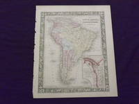
1882101079<p>Philadelphia: Bradley 1882. Unbound colored engraved map decorative border 14 1/2"x 11 1/2". Slight toning and aging; overall bright and clear and in very good shape. Maps are wrapped with acid free board or in rigid sleeves. The Mitchell family started to produce atlases in 1846 and continued into the early 1890s. Around 1860 S. Augustus Mitchell Jr. took over and the atlas would be called Mitchell's New General Atlas. This is an attractive colored map of South America from the 1882 installment of that atlas. The map shows a "New Granada" in an inset. Extra postage may be required. Ristow 311-313 Phillips 907</p> Bradley books
1882101092Philadelphia: Bradley 1882. Unbound colored engraved map decorative boarder 22 1/2"x 14 1/2". Some toning and aging a couple of small chips in margins no impact on image or boarder; otherwise very good. Maps are wrapped with acid free board or in rigid sleeves. The Mitchell family started to produce atlases in 1846 and continued into the early 1890s. Around 1860 S. Augustus Mitchell Jr. took over and the atlas would be called Mitchell's New General Atlas. This is an attractive double page map of the world from the 1882 installment that atlas. Ristow 311-313 Phillips 907 Bradley unknown books
1870101131Philadelphia 1870. Unbound colored engraved map decorative boarder 22 1/2"x 14 1/2". Some toning and aging a little staining in margins; otherwise very good. Maps are wrapped with acid free board or in rigid sleeves. The Mitchell family started to produce atlases in 1846 and continued into the early 1890s. Around 1860 S. Augustus Mitchell Jr. took over and the atlas would be called Mitchell's New General Atlas. This is an attractive double page map of the world from the 1870 installment that atlas. Ristow 311-313 Phillips 907 unknown books
1865101176Philadelphia 1865. Unbound colored engraved map decorative boarder 22 1/2"x 14 1/2". Some toning and aging; otherwise very good. Maps are wrapped with acid free board or in rigid sleeves. The Mitchell family started to produce atlases in 1846 and continued into the early 1890s. Around 1860 S. Augustus Mitchell Jr. took over and the atlas would be called Mitchell's New General Atlas. This is an attractive double page map of the world from the 1865 installment that atlas. Ristow 311-313 Phillips 907 unknown books
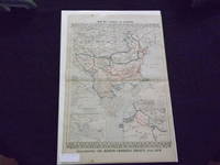
1882101083<p>Philadelphia: Bradley 1882. Unbound colored engraved map decorative boarder 22 1/2"x 14 1/2". Some toning and aging a little foxing in margins; otherwise very good. Maps are wrapped with acid free board or in rigid sleeves. The Mitchell family started to produce atlases in 1846 and continued into the early 1890s. Around 1860 S. Augustus Mitchell Jr. took over and the atlas would be called Mitchell's New General Atlas. This is an very interesting double page map of Turkey from the 1882 installment of that atlas. The map shows parts of Austria Russia and Armenia and illustrates the Berlin Congress Treaty of 1878. Map shows some territory annexed by Russia near the Black Sea. Extra postage may be required. Ristow 311-313 Phillips 907</p> Bradley books
1864101008Philadelphia 1864. Unbound colored engraved map decorative border 13" x 10 1/2". Slight toning and aging; otherwise very good. Maps are wrapped with acid free board or in rigid sleeves. The Mitchell family started to produce atlases in 1846 and continued into the early 1890s. Around 1860 S. Augustus Mitchell Jr. took over and the atlas would be called Mitchell's New General Atlas. This is a detailed single page map of Boston from the 1864 installment of this atlas. The map ishows a lot of street detail. Ristow 311-313 unknown books
1870101072Philadelphia 1870. Unbound colored engraved map decorative boarder 14"x 11". Slight toning and aging; overall bright and clear and in very good shape. Maps are wrapped with acid free board or in rigid sleeves. The Mitchell family started to produce atlases in 1846 and continued into the early 1890s. Around 1860 S. Augustus Mitchell Jr. took over and the atlas would be called Mitchell's New General Atlas. This is a colorful map of the city of Philadelphia from the 1870 installment of that atlas. Ristow 311-313 unknown books
1870101091Philadelphia 1870. Unbound colored engraved map decorative boarder 14 1/2"x 11". Slight toning and aging overall bright and clear and in very good shape. Maps are wrapped with acid free board or in rigid sleeves. The Mitchell family started to produce atlases in 1846 and continued into the early 1890s. Around 1860 S. Augustus Mitchell Jr. took over and the atlas would be called Mitchell's New General Atlas. This is an attractive single page map of Washington from the 1870 installment of that atlas. Ristow 311-313 unknown books
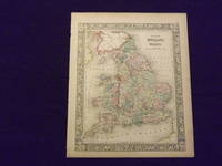
1882104501<p>Unbound colored engraved map decorative border 14" x 11". Slight browning and aging; overall bright and clear and in very good shape. Maps are wrapped with acid free board or in rigid sleeves. The Mitchell family started to produce atlases in 1846 and continued into the early 1890s. Around 1860 S. Augustus Mitchell Jr. took over and the atlas would be called Mitchell's New General Atlas. This is an attractive colored map of England and Wales from the 1864 installment of that atlas. Extra postage may be required. Ristow 311-313. </p> books
1864103235<p>Unbound colored engraved map decorative border 14" x 11". Slight browning and aging a couple of nicks at the left edge; overall bright and clear and in very good shape. Maps are wrapped with acid free board or in rigid sleeves. The Mitchell family started to produce atlases in 1846 and continued into the early 1890s. Around 1860 S. Augustus Mitchell Jr. took over and the atlas would be called Mitchell's New General Atlas. This is an attractive colored map of England and Wales from the 1864 installment of that atlas. Extra postage may be required. Ristow 311-313. </p> books
1861106159Unbound colored engraved map decorative boarder 14" x 11". Slight toning and aging a couple of small chips at upper margin edge; otherwise bright and clean and in very good condition. Maps are wrapped with acid free board or in rigid sleeves. The Mitchell family started to produce atlases in 1846 and continued into the early 1890s. Around 1860 S. Augustus Mitchell Jr. took over and the atlas would be called Mitchell's New General Atlas. This is an attractive and colorful map of Kentucky and Tennessee from the 1861 installment of that atlas. Ristow 311-313. books
1872102233Unbound colored engraved map decorative boarder 12 1/2"x 15". Somewhat narrow margins slight toning and aging; overall bright and clear and in very good shape. Maps are wrapped with acid free board or in rigid sleeves. The Mitchell family started to produce atlases in 1846 and continued into the early 1890s. Around 1860 S. Augustus Mitchell Jr. took over and the atlas would be called Mitchell's New General Atlas. This is a colorful map of New Jersey and Maryland and Delaware from the 1872 installment of that atlas. The map includes is divided into two panels with New Jersey in one and Maryland and Delaware in the other. books
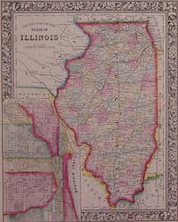
1864202985Philadelphia: Mitchell Samuel Augustus Jr. 1864. unbound. very good. Map. Engraving with original hand coloring. Image measures 13.5" x 10.75".<br/><br/> Great map of Illinois divided into counties showing towns major routes railroads and waterways. Includes a detailed town plan inset Chicago. Available in 1865 and 1866 editions. In excellent condition with a few very small chips to left edge and a narrow stain along right edge. S. Augustus Mitchell Jr. continued his father's successful mapmaking and publishing business and was one of the most prolific and renowned 19th century American publishers.<br/><br/> Mitchell, Samuel Augustus Jr. unknown books
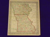
1869106177Unbound colored engraved map decorative border 14"x 11 1/2". Slight toning and aging margins a litle narrow; otherwise very good and overall bright and clear. Maps are wrapped with acid free board or in rigid sleeves. The Mitchell family started to produce atlases in 1846 and continued into the early 1890s. Around 1860 S. Augustus Mitchell Jr. took over and the atlas would be called Mitchell's New General Atlas. This is very colorful version of the Iowa and Missouri map from the 1869 installment of this atlas. Ristow 311-313. books
1869106162Unbound colored engraved map decorative boarder 14" x 11". Slight toning darkening and aging margins somewhat narrow slight tear in lower margin; overall bright and clean and in very good condition. Maps are wrapped with acid free board or in rigid sleeves. The Mitchell family started to produce atlases in 1846 and continued into the early 1890s. Around 1860 S. Augustus Mitchell Jr. took over and the atlas would be called Mitchell's New General Atlas. This is an attractive single page map of Virginia and West Virginia from the 1869 installment of that atlas. Extra postage may be required. Ristow 311-313. books
1861101199<p>Philadelphia 1861. Unbound colored engraved map decorative border 14"x 11". Slight toning and aging; overall bright and clear and in very good shape. Maps are wrapped with acid free board or in rigid sleeves. The Mitchell family started to produce atlases in 1846 and continued into the early 1890s. Around 1860 S. Augustus Mitchell Jr. took over and the atlas would be called Mitchell's New General Atlas. This is a very attractive single page colored map of Asia from the 1861 installment of that atlas. A very brightly colored version of this map. The map features China Hindostan Turkestan Persia and Siberia. Extra postage may be required. Ristow 311-313</p> books
1870106133Unbound colored engraved map decorative border 14" x 11". Slight toning and aging. A few margin creases and chips; overall generally bright and clean and in very good shape. Maps are wrapped with acid free board or in rigid sleeves. The Mitchell family started to produce atlases in 1846 and continued into the early 1890s. Around 1860 S. Augustus Mitchell Jr. took over and the atlas would be called Mitchell's New General Atlas. This is an attractive two panel map of Ireland and Scotland from the 1870 installment of that atlas.  While the map presents two countries it does provide a fair amount of county level detail. This is a very sharp and colorful impression. Extra psotage may be required. Ristow 311-313. books
1870106161Unbound colored engraved map decorative boarder 14" X 11". Slight darkening and aging some some chipping in top margin edge; overall bright and clear and in very good shape. Maps are wrapped with acid free board or in rigid sleeves. The Mitchell family started to produce atlases in 1846 and continued into the early 1890s. Around 1860 S. Augustus Mitchell Jr. took over and the atlas would be called Mitchell's New General Atlas. This is an attractive and colorful map of North and South Carolina from the 1870 installment. The map has a fair amount of detail and an inset of Charleston Harbor and another of Charleston. Ristow 311-313. books
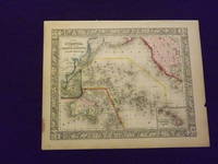
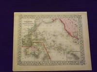
1864103248<p>Unbound colored engraved map decorative boarder 14" x 11". Slight browning and aging a little staining in margins a couple of edge chips; overall bright and clean and in very good condition. Maps are wrapped with acid free board or in rigid sleeves. The Mitchell family started to produce atlases in 1846 and continued into the early 1890s. Around 1860 S. Augustus Mitchell Jr. took over and the atlas would be called Mitchell's New General Atlas. This is a very colorful map of Oceanica South Pacific from the 1864 installment of that atlas. The map includes the Polynesian Islands Australia part of the Chinese coast; part of the western portion of North America and the Sandwich Islands is shown in a small inset. Extra postage may be required. Ristow 311-313. </p> books
1869103249<p>Unbound colored engraved map decorative boarder 14" x 11". Slight browning and aging; overall generally bright and clean and in very good condition. Maps are wrapped with acid free board or in rigid sleeves. The Mitchell family started to produce atlases in 1846 and continued into the early 1890s. Around 1860 S. Augustus Mitchell Jr. took over and the atlas would be called Mitchell's New General Atlas. This is a very colorful map of Oceanica South Pacific from the 1864 installment of that atlas. The map includes the Polynesian Islands Australia part of the Chinese coast; part of the western portion of North America and the Sandwich Islands is shown in a small inset. Extra postage may be required. Â Ristow 311-313. </p> books
1864103231<p>Unbound colored engraved map decorative boarder 14"x 11". Slight browning and aging; overall bright and clean and in very good shape. Maps are wrapped with acid free board or in rigid sleeves. The Mitchell family started to produce atlases in 1846 and continued into the early 1890s. Around 1860 S. Augustus Mitchell Jr. took over and the atlas would be called Mitchell's New General Atlas. This is a very colorful map of part of the Middle East from the 1864 installment of that atlas. The map includes an inset showing Palestine and the Holy Land. Extra postage may be required. Ristow 311-313. </p> books