MITCHELL, Margaret (her copy).Biblio.com
1 361 résultats
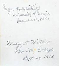
1882176004Boston: Ginn Heath & Co. 1882. A glimpse into Mitchell's family life and thwarted education A resonant literary artefact from a formative period of Mitchell's life: her family's copy of a dictionary used in her early days at Smith College and inscribed by her upon enrolment. A gift from her father a prominent Atlanta lawyer and historian it is inscribed by both generations on the front pastedown: "Margaret Mitchell Smith College Sept. 24 1918" and above her father's inscription from his own university days: "Eugene Muse Mitchell University of Georgia December 15 1882". Both father and daughter have practised their signatures elsewhere in the volume. It was Mitchell's suffragist mother May Belle Stephens Mitchell who encouraged her to attend Smith the prestigious female liberal arts school; she wanted her daughter to be educated as preparation for life's vagaries. May Belle loomed large as a figure of admiration and influence in Mitchell's early years but she did not live to witness the fruits of her daughter's schooling and the literary success of Gone with the Wind. In 1919 she died of influenza. This and the death of Mitchell's fiancé in action during the First World War prompted Mitchell to abandon her studies after her freshman year. She left Massachusetts and returned to the South to assume a role in her family's household supporting her father and stepping into her mother's role of a society hostess. 2 works in 1 octavo 188 x 140 mm presumably issued thus. Early 20th-century black textured coated cloth cloth labels lettered in manuscript. Housed in a custom green half morocco slipcase. Annotations to rear blank and throughout in an unidentified hand. Spines ends worn repair to covers inner hinges strengthened with linen spine labels toned and lifting slightly couple of small damp stains to edges loss to lower outer corner of first title page small tear to pp. 246-7 in second work contents toned. hardcover
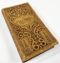
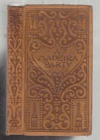
1895048505New York: The Century Co.; The Devinne Press 1895. Title page dated 1995. Petite volume in a lovely Arts & Crafts binding depicting bottles and glasses and is most likely by Blanche McManus who did later books in this series and signed the bindings with her initials BMM all edges gilt marbled endpapers monocolor frontis illustration of bottles title page in black and brown 165 pages 5 inches tall. Some rubbing to the extremities good hinges text block sound but binding stitches visible between two pages light foxing to endpapers no names or other markings. Hard Cover. Very Good. 24mo - 5" - 5¾" Tall. The Century Co.; The Devinne Press Hardcover
1895E10088New York: Century 1895. First edition. Leather_bound. Very Good. First edition. 24mo. in full suede tan leather with incised lettereing and design of botles glasses etc; marbled endpapers. Frontispiece rose- tinted photograph of wine bottles and decanters; title page printed in rose and plack. All edges gilt. 165 pp. Tight occasional staining to some of the first 20 or so leaves. some modest rubbing to the suede covers. Overall a very good quite acceptable example of a scarce title. Century unknown
18950176691895. Hardcover. Near Fine. New York: The Century Company 1895. Hardcover. Book Condition: Near Fine with minor edge wear. No Jacket. 1st Edition second or third printing unknown. Scarce first edition of this elusive Mitchell title. Original embossed leather with marbled endpapers and gilt edges and 1897 date on title and copyright pages with no addditional printings listed. <br/> <br/> hardcover
18950769964New York: Century Co. Good/No Jacket. 1895. First Edition. Full Leather. 16mo - over 5¾" - 6¾" Used Publisher's deluxe binding full brown suede heavily embossed in blind with designs of bottles glasses bowls and arabesque motifs all edges gilt marbled endpapers binding split spine separated and chipped boards rubbed some foxing to blanks. . Century Co. hardcover
1881013148Lombard IL: Longmans Green & Co 1881. xxxii 809 lvi 24pp. Or brown cloth. Spine reattached with green tape hinges starting moderate to heavy toning throughout prev owners name on 1/2 title page cloth rubbed and spotted. Not a pretty copy but complete and intact. Technical treatise and manual for assaying gold silver and other precious metals. Comprehensive classic work in the field. 24pp publishers ads at rear. Fifth Edition. Hard Cover. Good. 8vo. Longmans, Green & Co Hardcover
188730141Boston & New York: Houghton Mifflin 1887. First edition 8vo pp. 1 ads 6 63; title-page vignette original quarter cream cloth over cream boards printed paper spine label; binding is soiled a couple small chips to spine label endpapers discolored; overall a good sound copy with the signature of Shakespearean actor Edward Smith Willard on front pastedown. Houghton, Mifflin unknown
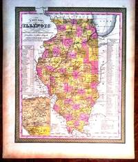
184996Philadelphia: Augustus Mitchell 1849. First Edition. Hand-colored Map. Very Good . Lithographed. Folio overall measures 13 3/4" x 17 1/4" with the printed area being 12" W x 15 1/4" H. Hand-colored. Published soon after Illinois became a state. Noteworthy depiction of booming lead mining region centered on Galena. Augustus Mitchell unknown
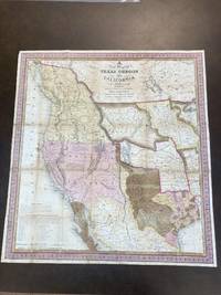
184687887Philadelphia PA: S. Augustus Mitchell 1846. Map. Good Plus. Folding lithographic map 22.75 in. x 21 in. with original color. Map is laid flat in archival plastic and will be securely protected and shipped in a mailing tube. Tanning to seams. Tape repairs and reinforcement on verso to all seams. Tiny losses of paper at six seam junctions. Storm 2841. Wagner-Camp 122b. <br /> <br /> This is Mitchell's third map of Oregon the first being "Oregon and California" published in Mitchell's ;School and Family Geography; and the second being "Mexico and Guatemala" which includes Upper or New California New Mexico and Texas." Wheat Mapping The Transmississippi West 520. Carl Wheat described it as: ".a work of real importance highly popular and.on it the influence of the War wioth Mexico is strikingly revealed.It was among the first by a commercial cartographer to utilize the recent explorations that had bounded and determined the nature of the Great Basin. The Texas claim to a western boundary up the Rio Grande is here shown with the northern panhandle extending all the way to the 42nd parallel.Because of its popularity this map of the West exerted great influence not only on the public but on other commercial cartographers." "The region covered by the map was of particular interest in 1846 because of two recent and related events. In 1845 Texas was admitted into the Union which prompted Mexico to invade Texas in 1846 thus precipitating the U.S.-Mexican war. General curiosity about the new State of Texas and interest in the war with Mexico led to Mitchell's timely map becoming quite popular. Mitchell used the latest and best sources for the map including Arrowsmith's 1841 map of Texas Fremont's and Emory's maps of their explorations in the region data from the Lewis & Clark expedition Nicollet's map of the region between the Mississippi River and the Missouri River Wilkes map of Oregon. <br /> <br /> Among other significant uses of the map Brigham Young ordered 6 copies of the map and an example in the BYU collection includes an annotation placing the Mormons in Utah pre-dating Fremont's map of 1848 which is the first printed map noting the presence of the Mormons in the Great Basin. <br /> <br /> The map shows Texas's claims to the Upper Rio Grande in present-day New Mexico -- eventually given up as part of the Great Compromise of 1850 in exchange for the U.S. Federal Government's assumption of Texas's public debt. One of the most influential maps in Western American History." from Stanford University Library. S. Augustus Mitchell unknown
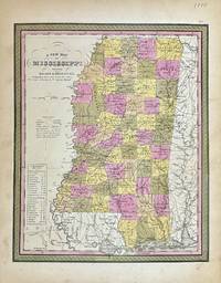
1848327877Philadelphia: S. Augustus Mitchell 1848. unbound. Map. Lithograph with original hand coloring. Image measures 11 1/2" x 14 1/4"<br/> <br/> Beautifully detailed first edition map of Mississippi divided into counties. The map delineates towns waterways railroads and major routes. Steamboat routes and distances are listed in a table. Canals and railroads are indicated. In very good condition with some toning to margins.<br> <br> Samuel Augustus Mitchell Sr. 1792-1868 published this map as part of the 1848 edition of his seminal New Universal Atlas. Mitchell is one of the pioneers in American cartography of the 19th century and led the conversion of engraved map plates to more affordable lithographic plates.<br/> <br/> S. Augustus Mitchell unknown
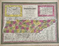
1847329553Philadelphia: S. Augustus Mitchell 1847. unbound. Map. Engraving with original hand coloring. Image measures 11 1/4" x 15 1/4".<br/> <br/> Nice map of Tennessee divided into counties. Features cities major routes canals railroads waterways and topographical elements. Insets include the environs of Knoxville and Nashville. A table lists steam boat routes. Minor overall toning.<br> <br> Samuel Augustus Mitchell Sr. 1792-1868 was one of the leaders in American cartography of the 19th century and pioneered the conversion of engraved map plates to more affordable lithographic plates. His son Samuel Augustus Mitchell Jr. continued his father's successful mapmaking and publishing business and was one of the most prolific and renowned 19th century American publishers.<br/> <br/> S. Augustus Mitchell unknown
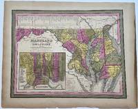
1848330432Philadelphia: S.A. Mitchell 1848. unbound. H.N. Burroughs. Map. Engraving with hand coloring. Image measures 11 1/8" x 14 1/4"<br/> <br/> Beautiful map of Maryland and Delaware divided into counties and townships. Shows towns waterways major routes and geographic features. Includes an inset showing the city plan of Baltimore with important buildings and points of interest listed and numbered. A table in the upper left shows steam boat routes from Baltimore to Norfolk Baltimore to Philadelphia and Baltimore to Washington.<br> <br> Samuel Augustus Mitchell Sr. 1792-1868 was one of the leaders in American cartography of the 19th century and pioneered the conversion of engraved map plates to more affordable lithographic plates. His son Samuel Augustus Mitchell Jr. continued his father's successful mapmaking and publishing business and was one of the most prolific and renowned 19th century American publishers.<br/> <br/> S.A. Mitchell unknown
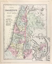
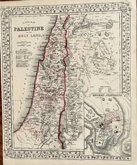
1884333035Philadelphia 1884. unbound. Map. Engraving with original hand coloring. 14 1/4 x 11 1/2 inches.<br/> <br/> Early map of Palestine or the Holy Land from the Dead Sea to Lebanon with part of Syria showing the biblical names of the tribes of Israel. Royal cities noted with towns waterways and geographical features also labeled. Turkish names noted as well as ruins. An inset of modern Jerusalem is included. In the index a color line should denote 'Land of the Philistines' but it was not colored in. In very excellent condition.<br> <br> Samuel Augustus Mitchell Sr. 1792-1868 was one of the leaders in American cartography of the 19th century and pioneered the conversion of engraved map plates to more affordable lithographic plates. His son Samuel Augustus Mitchell Jr. continued his father's successful mapmaking and publishing business and was one of the most prolific and renowned 19th century American publishers.<br/> <br/> unknown
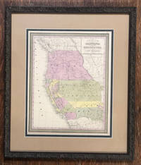
185057229Philadelphia: Thomas Cowperthwait & Co 1850. Hand-colored. 13" x 16 1/4" 20 1/2" x 23 1/2" in frame. Near fine. A slightly later 1850 edition with "Utah Territory" rather than "Deseret." Moffat 22. Wheat Transmississippi West 685. From Samuel Augustus Mitchell's "A New Universal Atlas."<br /> <br /> The Utah geography is taken from Fremont's 1845 map with a channel between Utah Lake and Great Salt Lake. Salt Lake City is the sole settlement depicted. The Great Basin is labeled "Fremont Basin" and "Tueson" is shown fifty miles east northeast of Tubac. Thomas Cowperthwait & Co unknown
188645701Philadelphia: W.M. Bradley 1886. Very good light soiling primarily to margins one edge tear not affecting contents. Hand colored map. Plate 117: New Map of Palestine or the Holy Land with inset Map of Modern Jerusalem drawn & engraved by W.H. Gamble Philadelphia. Copyright by S. Augustus Mitchell 1884. 11.5 x 14 inches.<br /> <br /> On verso Plate 118: Map of Hindoostan Farther India China and Tibet constructed & engraved by W. Williams Philadelphia. Copyright by S. Augustus Mitchell 1884. 13.75 x 11.25 inches.<br /> <br /> From: Mitchell's New General Atlas Containing Maps Of The Various Countries Of The World Plans Of Cities Etc. Embraced In Ninety-Three Quarto Maps Forming A Series Of One Hundred and Forty-seven Maps and Plans Together With Valuable Statistical Tables. Also A List Of Post-Offices Of The United States And Territories And Also Census Of 1880 For States Territories And Counties Also Of Cities Of Over 10000 Inhabitants. Philadelphia: Published By Wm. M. Bradley & Bro. No. 1026 Arch Street. 1886. [W.M. Bradley] unknown
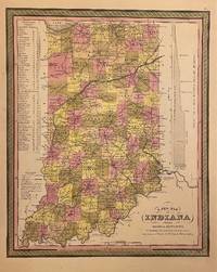
1846310093Philadelphia: H. N. Burroughs 1846. unbound. Map. Lithograph with original hand coloring. Image measures 14 3/8" x 11 7/16".<br/> <br/> Classic map of Indiana divided into counties. The map includes towns and roads in addition to canals drawn in blue and railroads drawn in red. A table in the upper left shows steamboat routes from Louisville to Pittsburgh and to New Orleans. An elevation view on the right shows a profile of the Wabash and Erie Canal. The map is in good condition with only minor chips and tears to edges not affecting the image.<br> <Br> Samuel Augustus Mitchell Sr. 1792-1868 published this map as part of the first edition of his seminal New Universal Atlas. Mitchell is one of the pioneers in American cartography of the 19th century and led the conversion of engraved map plates to more affordable lithographic plates.<br/> <br/> H. N. Burroughs unknown
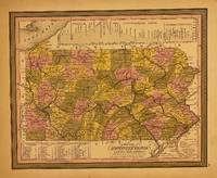
1848309999Philadelphia: S. Augustus Mitchell 1848. unbound. Map. Lithograph with original hand coloring. Image measures 11.5 x 14.5 inches.<br/> <br/> This map depicts the state of Pennsylvania divided into counties. The map includes towns and roads in addition to canals colored in blue and railroads colored in red. An elevation view near the top margin shows the profile of the Pennsylvania Canal and the Columbia Railroad. A table in the lower left lists steam boat routes from Pittsburgh to Louisville from Philadelphia to New York and Philadelphia to Baltimore. The map appeared in Mitchell's seminal New Universal Atlas. The map is in very good condition. One small closed tear to upper left margin not affecting the image. Archival tape repair. <Br> <br> Samuel Augustus Mitchell Sr. 1792-1868 is one of the pioneers in American cartography of the 19th century and led the conversion of engraved map plates to more affordable lithographic plates.<br/> <br/> S. Augustus Mitchell unknown
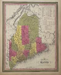
1847310373Philadelphia: S. A. Mitchell 1847. unbound. Map. Lithograph with original hand coloring. Image measures 14 7/8" x 12".<br/> <br/> Excellent map of Maine showing all counties railroads major routes and waterways. Two tables at the top of the page list population over time. Small chips to lower margin not affecting the image. From the 1847 edition of Mitchell's seminal New Universal Atlas. This is State XII of this map Thompson 84.<br> <br> Samuel Augustus Mitchell Sr. 1792-1868 was one of the leaders in American cartography of the 19th century and pioneered the conversion of engraved map plates to more affordable lithographic plates. His son Samuel Augustus Mitchell Jr. continued his father's successful mapmaking and publishing business and was one of the most prolific and renowned 19th century American publishers.<br/> <br/> S. A. Mitchell unknown
186718Philadelphia: Mitchell S. Augustus 1867. 1867 edition. 14 x 11 34 inches. Very good condition. Mitchell S. Augustus. Contemporary color highlights this lithograph from two years after the closing of the Civil War. The map shows the Holy Land with an inset of the town of Modern Jerusalem. Mitchell S. Augustus unknown
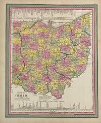
1846313477Philadelphia: S.A. Mitchell 1846. unbound. Map. Engraving with original hand coloring. Image measures 14" x 11 1/2"<br/> <br/> Classic map of Ohio divided into counties. Showing towns major routes railroads and waterways. Includes a profile of the Ohio Canal and a table listing steam boat routes from Cincinnati to Pittsburgh and to New Orleans and from Cleveland to Portsmouth Buffalo and Detroit. Canals are prominently delineated in blue and railroads in orange. In very good condition. Minor toning and chips to margin not affecting image. <Br> <br> Samuel Augustus Mitchell Sr. 1792-1868 was one of the leaders in American cartography of the 19th century and pioneered the conversion of engraved map plates to more affordable lithographic plates. His son Samuel Augustus Mitchell Jr. continued his father's successful mapmaking and publishing business and was one of the most prolific and renowned 19th century American publishers.<br/> <br/> S.A. Mitchell unknown
1870106777<p>Unbound colored engraved map decorative boarder 14" x 11". Slight toning and aging a couple of nicks or chips in left margin; otherwise bright and clear. Maps are wrapped with acid free board or in rigid sleeves. The Mitchell family started to produce atlases in 1846 and continued into the early 1890s. Around 1860 S. Augustus Mitchell Jr. took over and the atlas would be called Mitchell's New General Atlas. This is a very attractive single page map of Palestine and the Holy Land from the 1870 installment of that atlas. This map is probably one of the more attractive versions of this map from the Mitchell series. Modern Jerusalem is shown in an inset. Extra postage may be required. Ristow 311-313.</p>
1869106778<p> Unbound colored engraved map decorative boarder 14" x 11". Slight toning and aging margins a little narrow but still ample; otherwise bright and clear. Maps are wrapped with acid free board or in rigid sleeves. The Mitchell family started to produce atlases in 1846 and continued into the early 1890s. Around 1860 S. Augustus Mitchell Jr. took over and the atlas would be called Mitchell's New General Atlas. This is a very attractive single page map of Palestine and the Holy Land from the 1869 installment of that atlas. This map is probably one of the more attractive versions of this map from the Mitchell series. Modern Jerusalem is shown in an inset. Extra postage may be required. Ristow 311-313.</p>
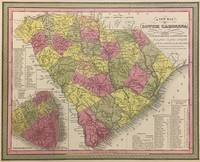
1848293169Philadelphia: S. Augustus Mitchell 1848. unbound. Map. Lithograph with original hand coloring. Image measures 11 1/4" x 14".<br/> <br/> Beautifully detailed first edition map of South Carolina divided into counties. The map delineates towns waterways railroads and major routes as explained in a small key at the bottom right. Canals and railroads are marked. Also included are insets of Charleston and a table of distances. The map is in good condition with minor toning. <br> <br> Samuel Augustus Mitchell Sr. 1792-1868 published this map as part of the 1848 edition of his seminal New Universal Atlas. Mitchell is one of the pioneers in American cartography of the 19th century and led the conversion of engraved map plates to more affordable lithographic plates.<br/> <br/> S. Augustus Mitchell unknown