1 372 résultats
189711776Philadelphia: n.p. 1897. Original printed wrappers. Volume XII of Mitchell’s case-study on Melancholy. BAL 6 14180. [n.p.] unknown
183122138Philadelphia 1831. No binding. Fine. Map of the United States. Entered according to Act of Congress in the Clerks Office of the Eastern District of Pennsylvania October 10th 1831. Philadelphia 1831. Folding map on four sheets joined. Folding into original covers 8vo binding size: 9 5/8 x 6 1/2 in. red half morocco over marbled paper boards upper cover with gilt-lettered title label corner and edges worn. The map and covers now apart and separately mounted for display. Historical BackgroundFirst edition and the first wall map issued by Mitchell. This edition does not have the counties delineated and numbered. Ristow mistakenly says all editions have the townships he means counties numbered but this one the first does not thereby eliminating the index of counties and thus showing more of the western territory. This map predates the Traveler's Guide by 1 year and thus is Mitchell's first ""original"" production as opposed to the Finley material he reissued as the American Atlas and Pocket Maps. Copyright date is October 10 1831. There is no other date on the map. Ristow thinks the map was issued in early 1832 but it is not in Phillips until 1834 edition which probably has the counties indicated by number and the 1831 copyright so Ristow may not have seen this edition but rather the 1834.ReferenceKarrow 1-1473; Ristow p309.ConditionOriginal full color the palette rich and bright. One 5-inch repaired tear at left into Arkansas some cracking and more minor tears at folds. Some overall browning of the sheet. In good condition. books
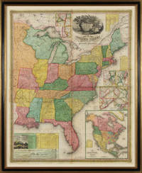
183122138Philadelphia 1831. No binding. Fine. Map of the United States. Entered according to Act of Congress in the Clerks Office of the Eastern District of Pennsylvania October 10th 1831. Philadelphia 1831. Folding map on four sheets joined. Folding into original covers 8vo binding size: 9 5/8 x 6 1/2 in. red half morocco over marbled paper boards upper cover with gilt-lettered title label corner and edges worn. The map and covers now apart and separately mounted for display. Historical BackgroundFirst edition and the first wall map issued by Mitchell. This edition does not have the counties delineated and numbered. Ristow mistakenly says all editions have the townships he means counties numbered but this one the first does not thereby eliminating the index of counties and thus showing more of the western territory. This map predates the Traveler's Guide by 1 year and thus is Mitchell's first ""original"" production as opposed to the Finley material he reissued as the American Atlas and Pocket Maps. Copyright date is October 10 1831. There is no other date on the map. Ristow thinks the map was issued in early 1832 but it is not in Phillips until 1834 edition which probably has the counties indicated by number and the 1831 copyright so Ristow may not have seen this edition but rather the 1834.ReferenceKarrow 1-1473; Ristow p309.ConditionOriginal full color the palette rich and bright. One 5-inch repaired tear at left into Arkansas some cracking and more minor tears at folds. Some overall browning of the sheet. In good condition.
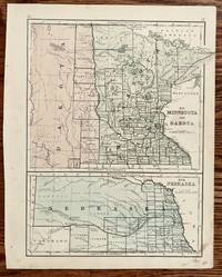
1865326Philadelphia: S. Augustus Mitchell 1865. 10 3/4 x 8 1/4 inches. Very good. Map created for Mitchell's New Reference Atlas 56 copperplate maps 1865. This is a very businesslike straight forward. rendering of the states of Minnesota and Nebraska with the Dakota Territory included. The political divisions were hand colored at the time of publication. Thes maps are identical to the ones found in Mitchell's New School Atlas. S. Augustus Mitchell unknown
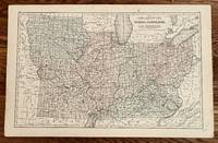
1865249Philadelphia: E. H. Butler & Co 1865. 17 1/4 x 10 3/4 inches. Very good with separation at lower centerfold expertly repaired with archival mending tape. This is a broad regional midwestern map from "Mitchell's New Reference Atlas for the Use of Colleges Libraries Families and Counting Houses." The states are delineated by color with firm linear county designations. Important to the overall presentation are the railroads that dominate the connections between urban places. The interstices draw their identity from a format that is light on places maps. Overall this is a Civil War look at part of the polarity of the north. This map should be in any serious Civil War or transportation collection. E. H. Butler & Co unknown
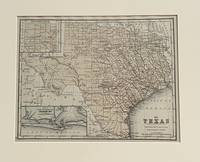
1870630Philadelphia: S. Augustus Mitchell 1870. 10 3/4 x 8 1/4 unches. Very good-. This is a very nice small format map of Texas. It has an inset of Galveston area and an inset of the Panhandle laid out in non-conforming sections. The single color includes all the counties. It would make a very nice addition to your collection. It is matted for framing. S. Augustus Mitchell unknown
1867770751867. MITCHELL S. Weir. The Wonderful Stories of Fuz-Buz the Fly and Mother Grabem the Spider. Large 8vo. Original cloth-backed boards. Illustrated. Philadelphia: J.B. Lippincott & Co. 1867. First edition. One of 170 large paper copies. BAL 14065. Peter Parley to Penrod 145. Some light wear to extremities but a very good or better copy of his rare First Book. The H. Bradley Martin copy. unknown
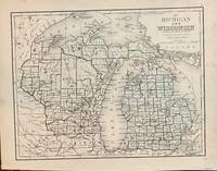
1865176Philadelphia: Mitchell 1865. 1865. 10 1/2 x 8 1/4 inches. Very good. This map has a more comprehensive county plan than the 1858 edition. The map is on heavy paper and was fro inclusion in Mitchell's school and family atlas productions.The stenciled color covers both states. Mitchell unknown
1894482251894. MITCHELL S. Weir. WHEN ALL THE WOODS ARE GREEN. New York: The Century Co. 1894. First edition. 8vo. green cloth spine in gilt t.e.g. A very good copy that shows only light rubbing at the spine ends and extremities binding slightly skewed. unknown books
1865WRCLIT54523New York: Charles Scribner 1865. 4vii1324pp. Green gilt cloth boards ruled in blind. Illustrated with engravings and maps. First edition a variant of BAL's binding C with brown rather than peach endpapers. Edges a little darkened bookplate on pastedown very faint early ownership signature spine ends and boards lightly rubbed last gathering darkened else very good. BAL 13942. Charles Scribner hardcover books
1865406584New York: Charles Scribner 1865. Spine mostly separated with losses at ends wear at extremities sheets lightly browned. 8vo 19 x 12.3 cm. vii 324 pages. Original purple cloth gilt-lettered on spine. FIRST EDITION BAL binding A. BAL 13942. <br/><br/> Charles Scribner hardcover books
1865RMITWET00TMScribner 1865. Very Good. Mitchell Donald Grant. Wet Days at Edgewood with Old Farmers Old Gardeners and Old Pastorals. New York: Scribner 1865. 324pp. 12mo. Pebbled purple cloth with gilt lettering. Book condition: Very good with light bumping and rubbing. Discoloration on spine that extends slightly to covers. Black streak on front cover. Contemporary green social club library bookplate on front pastedown. Postage sticker on rear endsheet. Brown coated endsheets lightly soiled and chipped. Lightly foxed. Scribner hardcover books
1865023239New York: Charles Scribner 1865. First Edition. Small Octavo. 342pp. The author writes about each of the nine days when it was cloudy or rainy. He retreats to his library with a large window that overlooks the land he lives on and finds comfort in visiting old friends within these books. From Theocritus Columella Virgil to Louden Burke Homer and more. He remarks about their sense of good husbandry. Many of these authors were gardeners or farmers or simply wrote on the subject in all its various branches. A very interesting work. Bound in 3/4 tan calf over marbled paper covered boards with matching endpapers all edge marbled rubbing to spine and joints just a bit of toning to page margins previous owner's name in pencil dated 1884. A very good copy. Charles Scribner unknown
1865006704New York: Charles Scribner 1865 First Edition. Brown cloth binding gilt titles top edge gilt. Antique ex-library with hand-numbered and hand-dated bookplate. 324 pp. Illustrated. Donald Grant Mitchell 1822-1908 was an essayist who was a Washington correspondent of the New York Morning Courier and Enquirer a connection in which he first employed his usual pseudonym of "Ik Marvel." He went to cover the revolution in Paris in 1848 and returned to New York in 1850 to edit a magazine satirizing society named the Lorgnette the twelve issues of which he published later as a book under the pseudonym of "John Timon." This is a book which contemplates country and farm writing throughout history in the works of the Greeks the Romans mediaeval writers in France and Germany and the British. Chipping to spine with small loss of material at top boards faded foxing to endpapers. Good condition. Charles Scribner hardcover
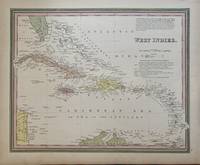
1846297531Philadelphia: H. N. Burroughs 1846. unbound. Map. Lithograph with original hand coloring. Image measures 15.75" x 12.5".<br/><br/> This map of the West Indies extends from the southern tip of Florida to the northern coast of South America and from the western tip of Cuba to Barbados in the east. The index includes capitals cities and towns labeled in a stylized manner that complements the region's scattered arrangement of islands. Above the title is a paragraph describing the region and its constituent islands. Below the title islands are attributed to the appropriate European colonial powers. The map appeared in Mitchell's first edition of his seminal New Universal Atlas. Samuel Augustus Mitchell Sr. 1792-1868 is one of the pioneers in American cartography of the 19th century and led the conversion of engraved map plates to more affordable lithographic plates. This map provides a clear overview of the West Indies.<br/><br/> H. N. Burroughs unknown books
1846297531Philadelphia: H. N. Burroughs 1846. unbound. Map. Lithograph with original hand coloring. Image measures 15.75" x 12.5".<br/> <br/> This map of the West Indies extends from the southern tip of Florida to the northern coast of South America and from the western tip of Cuba to Barbados in the east. The index includes capitals cities and towns labeled in a stylized manner that complements the region's scattered arrangement of islands. Above the title is a paragraph describing the region and its constituent islands. Below the title islands are attributed to the appropriate European colonial powers. The map appeared in Mitchell's first edition of his seminal New Universal Atlas. This map provides a clear overview of the West Indies.<Br> <br> Samuel Augustus Mitchell Sr. 1792-1868 was one of the leaders in American cartography of the 19th century and pioneered the conversion of engraved map plates to more affordable lithographic plates. His son Samuel Augustus Mitchell Jr. continued his father's successful mapmaking and publishing business and was one of the most prolific and renowned 19th century American publishers.<br/> <br/> H. N. Burroughs unknown
1871D17731Philadelphia: J.B. Lippincott & Co. 1871. Hardcover. Good. 8vo. 59 pp. Original brown cloth lettered in gilt. Dampstaining to boards chips to spine internally very good. <br/><br/> J.B. Lippincott & Co. hardcover books
1871D17731Philadelphia: J.B. Lippincott & Co. 1871. Hardcover. Fair. 8vo. 59 pp. Original brown cloth lettered in gilt. Dampstaining to boards bubbling to front chips to spine internally very good. Sold as is. <br/><br/> J.B. Lippincott & Co. hardcover
188706-2059Philadelphia: J. B. Lippincott Co. 1887. 76pp slight soiling & shelfwear to cover. Cloth. Very Good -/No Jacket. J. B. Lippincott Co. Hardcover
1844138555Prato: Giachetti 1844. In-8 p. mm. 235x150 2 opere in 1 volume mz. pelle coeva decoraz. a secco e titolo oro al dorso. - Volume XVI viaggi nell'interno dell'Australia: pp. 2822 con 9 su 13 tavole fuori testo - Volume XVII viaggi al Madagascar: pp. 295. Scompleto di tutte e 5 le tavole Firma di appartenenza al frontespizio della prima opera; qualche fioritura alle tavole e nel testo ma complessivamente esemplare in buono stato. Giachetti, unknown
184441322Prato: Tip. Giachetti 1844. Tip. Giachetti unknown
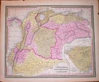
1846M1416detailed map of Venezuela Colombia and Equador. Inset map of proposed communication i.e. a railroad between the Atlantic and Pacific Ocean. <br /> In "A New Universal Atlas Containing Maps of the various Empires"
18367303H84013Munchen: Privately Printed. 36 pages. Signed to 'Pierce Butler Engle from the Author' inside front cover. Edgewear and chipping to wraps. . Acceptable. Soft cover. 1836. Privately Printed paperback
181969865Atlanta Georgia August 18 1936. attractively matted and framed with the envelope to an overall size of about 20 x 16 inches. . Light horizontal creases where folded to fit the envelope; otherwise very fine. 10-1/2 x 7 inches. Mitchell thanks her correspondent for her kind remarks about "Gone With the Wind" and the verisimilitude of her characters: "I know no higher compliment that can be paid to an author." Her second paragraph discusses the novel's ending and the future of Scarlett and Rhett and concludes "I do hate to write. Just now I feel that I will never write anything again." unknown
1894biblio37419<p>Boston and New York: Houghton Mifflin and Company; First Edition 1894. 278 pages. Fine Hardcover no dj. Very Well preserved book. 7.2"x5.0"x0.9". be26.</p> Houghton, Mifflin and Company hardcover