1 490 résultats
1882101054Philadelphia: Bradley 1882. Unbound colored engraved map decorative border 22 1/2"x 14 1/2". Slight toning and aging; otherwise bright and clean. Maps are wrapped with acid free board or in rigid sleeves. The Mitchell family started to produce atlases in 1846 and continued into the early 1890s. Around 1860 S. Augustus Mitchell Jr. took over and the atlas would be called Mitchell's New General Atlas. This is an attractive colorful double page map of the states of Ohio and Indiana from the 1882 installment. Two of the Great Lakes are present and part of Kentucky is visible. Ristow 311-313 Phillips 907 Bradley unknown books
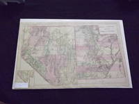
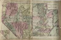
18814321Philadelphia: S. Augustus Mitchell 1881. Map 35 cm x 55 cm on a single sheet 38.5 cm x 59 cm. The territorial Utah and state Nevada boundaries and the counties within each have been hand tinted Colors are bright. Vertical centerfold as issued. Splitting at the foot of the centerfold. A few small chips and age toning to extremities. Detailed map that shows roads township lines and railroads to Eureka NV Austin Juab Stockton Alta Bingham and Frisco as well as showing the U.P and D&RG. Nephi is labeled 'Salt Creek.' Inset map of the southern tip of Nevada. From Mitchell's New General Atlas. Moffat 166. Phillips 895. S. Augustus Mitchell unknown books
1869101088Philadelphia 1869. Unbound colored engraved map decorative boarder 14"x11". Slight toning and aging; overall bright and clear and in very good shape. Maps are wrapped with acid free board or in rigid sleeves. The Mitchell family started to produce atlases in 1846 and continued into the early 1890s. Around 1860 S. Augustus Mitchell Jr. took over and the atlas would be called Mitchell's New General Atlas. This is an attractive map of the western part of the country from the 1869 installment of that atlas. Ristow 311-313 unknown books
1882101090Philadelphia: Bradley 1882. Unbound colored engraved map 22 1/2"x 14 1/2". Slight toning and aging; overall bright and clear and in very good shape. Maps are wrapped with acid free board or in rigid sleeves. The Mitchell family started to produce atlases in 1846 and continued into the early 1890s. Around 1860 S. Augustus Mitchell Jr. took over and the atlas would be called Mitchell's New General Atlas. This is an attractive double page map of the western part of the country from the 1882 installment. An Indian Reservation is highlighted and a small inset featuring southern Nevada is also present. Ristow 311-313 Phillips 907 Bradley unknown books
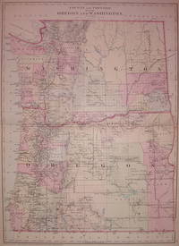
1881203536Philadelphia: Mitchell Samuel Augustus Jr. 1881. unbound. very good. Map. Engraving with original hand coloring. Image measures 20" x 14.5".<br/><br/> Great double page map of Washington and Oregon divided into counties and some townships. Shows towns waterways railroads topographical details and Indian reservations. In excellent condition. Also available in 1882 edition. S. Augustus Mitchell Jr. continued his father's successful mapmaking and publishing business and was one of the most prolific and renowned 19th century American publishers.<br/><br/> Mitchell, Samuel Augustus Jr. unknown books
1870106170Unbound colored engraved map decorative boarder 14"x 11". Slight toning and aging margins narrow; still bright and clear and in otherwise good condition. Maps are wrapped with acid free board or in rigid sleeves. The Mitchell family started to produce atlases in 1846 and continued into the early 1890s. Around 1860 S. Augustus Mitchell Jr. took over and the atlas would be called Mitchell's New General Atlas. This is an attractive colorful single page map of the states of Massachusetts Connecticut and Rhode Island from the 1870 installment of that atlas. Good detail and Portland is featured in an inset. Ristow 311-313. books
1869106168Unbound colored engraved map decorative boarder 14"x 11". Slight toning and aging some margin chips top margin narrow and with a coup;e of chips touching the neat line; still bright and clear and in otherwise good condition. Maps are wrapped with acid free board or in rigid sleeves. The Mitchell family started to produce atlases in 1846 and continued into the early 1890s. Around 1860 S. Augustus Mitchell Jr. took over and the atlas would be called Mitchell's New General Atlas. This is an attractive colorful single page map of the states of Massachusetts Connecticut and Rhode Island from the 1869 installment of that atlas. Good detail and Portland is featured in an inset. Ristow 311-313. books
1882101041Philadelphia 1882. Unbound colored engraved map decorative boarder 14"x 11". Slight toning and aging minor soiling and acople of small nicks ta side edge; still bright and clear and in otherwise very good shape. Maps are wrapped with acid free board or in rigid sleeves. The Mitchell family started to produce atlases in 1846 and continued into the early 1890s. Around 1860 S. Augustus Mitchell Jr. took over and the atlas would be called Mitchell's New General Atlas. This is an attractive colorful single page map of Maine from the 1869 installment of that atlas. Good detail and Portland is featured in an inset. Ristow 311-313 unknown books
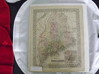
1869101040Philadelphia 1869. Unbound colored engraved map decorative boarder 14"x 11". Slight toning and aging; bright and clear and in otherwise very good shape. Maps are wrapped with acid free board or in rigid sleeves. The Mitchell family started to produce atlases in 1846 and continued into the early 1890s. Around 1860 S. Augustus Mitchell Jr. took over and the atlas would be called Mitchell's New General Atlas. This is an attractive colorful single page map of Maine from the 1869 installment of that atlas. Good detail and Portland is featured in an inset. Ristow 311-313 unknown books
1869101050<p>Philadelphia 1867. Unbound colored engraved map decorative boarder 14"x 11 1/2". Some toning and aging; otherwise bright and clear. Maps are wrapped with acid free board or in rigid sleeves. The Mitchell family started to produce atlases in 1846 and continued into the early 1890s. Around 1860 S. Augustus Mitchell Jr. took over and the atlas would be called Mitchell's New General Atlas. This is a colorful and attractive map of New Jersey and Maryland & Delaware from the 1867 installment of that atlas. This is a split map with New Jersey in one section and Maryland & Delaware in the other.</p> books
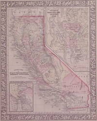
1860001305Philadelphia: S. A. Mitchell 1860. Softcover. First edition; 12 1/2 x 15 1/4; hand-colored map; ornate engraved border; chips with some loss of paper to lower corners; foxing to lower right quarter; good. Published as part of the first edition of "Mitchell's New General Atlas" the map featured not only the State of California with each county major cities bodies of water railroads etc. outlined but also two smaller inset maps of Great Salt Lake Country Utah and the San Francisco Bay Area. Philadelphia: S. A. Mitchell paperback books
1866202852Philadelphia: Mitchell Samuel Augustus Jr. 1866. unbound. very good. Map. Steel engraving with original hand coloring. Image measures 13.25" x 10.5".<br/><br/> Classic map of California divided into counties showing all major towns and cities geographical features and waterways. Includes insets of San Francisco Bay and the Great Salt Lake Country. S. Augustus Mitchell Jr. continued his father's successful mapmaking and publishing business and was one of the most prolific and renowned 19th century American publishers. In very good condition.<br/><br/> Mitchell, Samuel Augustus Jr. unknown books
1870101021Philadelphia 1870. Unbound colored engraved map decorative boarder 22"x 152". Slight toning and aging; overall bright and clear and in very good shape. Maps are wrapped with acid free board or in rigid sleeves. The Mitchell family started to produce atlases in 1846 and continued into the early 1890s. Around 1860 S. Augustus Mitchell Jr. took over and the atlas would be called Mitchell's New General Atlas. This is an attractive double page map of five western states from the 1870 installment of that atlas. This map covers a lot of territory but it is rather colorful. Ristow 311-313 unknown books
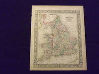
1861101019Philadelphia 1861. Unbound colored engraved map decorative border 14"x 11". Slight toning and aging a little staining and soiling in margins a few small chips at left edge; overall bright and clear and in very good shape. Maps are wrapped with acid free board or in rigid sleeves. The Mitchell family started to produce atlases in 1846 and continued into the early 1890s. Around 1860 S. Augustus Mitchell Jr. took over and the atlas would be called Mitchell's New General Atlas. This is an attractive colored map of England and Wales from the 1861 installment of that atlas. Ristow 311-313 unknown books
1882101020Philadelphia: Bradley 1882. Unbound colored engraved map decorative border 14"x 11". Slight toning and aging; overall bright and clear and in very good shape. Maps are wrapped with acid free board or in rigid sleeves. The Mitchell family started to produce atlases in 1846 and continued into the early 1890s. Around 1860 S. Augustus Mitchell Jr. took over and the atlas would be called Mitchell's New General Atlas. This is an attractive colored map of England and Wales from the 1882 installment of that atlas. Ristow 311-313 Phillips 907 Bradley unknown books
1882104501<p>Unbound colored engraved map decorative border 14" x 11". Slight browning and aging; overall bright and clear and in very good shape. Maps are wrapped with acid free board or in rigid sleeves. The Mitchell family started to produce atlases in 1846 and continued into the early 1890s. Around 1860 S. Augustus Mitchell Jr. took over and the atlas would be called Mitchell's New General Atlas. This is an attractive colored map of England and Wales from the 1864 installment of that atlas. Extra postage may be required. Ristow 311-313. </p> books
1864103235<p>Unbound colored engraved map decorative border 14" x 11". Slight browning and aging a couple of nicks at the left edge; overall bright and clear and in very good shape. Maps are wrapped with acid free board or in rigid sleeves. The Mitchell family started to produce atlases in 1846 and continued into the early 1890s. Around 1860 S. Augustus Mitchell Jr. took over and the atlas would be called Mitchell's New General Atlas. This is an attractive colored map of England and Wales from the 1864 installment of that atlas. Extra postage may be required. Ristow 311-313. </p> books
1861101024Philadelphia 1861. Unbound colored engraved map decorative border 14"x 11". Slight toning and aging a little browning at edges; overall bright and clear and in very good shape. Maps are wrapped with acid free board or in rigid sleeves. The Mitchell family started to produce atlases in 1846 and continued into the early 1890s. Around 1860 S. Augustus Mitchell Jr. took over and the atlas would be called Mitchell's New General Atlas. This is a colorful and attractive map of Florida from the 1861 installment of that atlas. An inset provides a smaller map of South Carolina. Ristow 311-313 unknown books
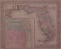
1870101025Philadelphia 1870. Unbound colored engraved map decorative border 14"x 11". Slight toning and aging; overall bright and clear and in very good shape. Maps are wrapped with acid free board or in rigid sleeves. The Mitchell family started to produce atlases in 1846 and continued into the early 1890s. Around 1860 S. Augustus Mitchell Jr. took over and the atlas would be called Mitchell's New General Atlas. This is an attractive map of Florida from the 1870 installment of that atlas. An inset provides a smaller map of Mobile. Ristow 311-313 unknown books
1869101213Philadelphia 1869. Unbound colored engraved map decorative border 14"x 11". Slight toning and aging; overall bright and clear and in very good shape. Maps are wrapped with acid free board or in rigid sleeves. The Mitchell family started to produce atlases in 1846 and continued into the early 1890s. Around 1860 S. Augustus Mitchell Jr. took over and the atlas would be called Mitchell's New General Atlas. This is a colorful and attractive map of Florida from the 1869 installment of that atlas. An inset provides a smaller map of Mobile. Ristow 311-313 unknown books
1867202924Philadelphia: Mitchell Samuel Augustus Jr. 1867. unbound. very good. Map. Steel engraving with original hand coloring. Image measures 11" x 13.25".<br/><br/> Nicely detailed map of Florida divided into counties showing towns major routes and geographical features. Includes a large inset town plan of Mobile Alabama. Minor chipping to corners. S. Augustus Mitchell Jr. continued his father's successful mapmaking and publishing business and was one of the most prolific and renowned 19th century American publishers.<br/><br/> Mitchell, Samuel Augustus Jr. unknown books
1882101037Philadelphia: Bradley 1882. Unbound colored engraved map decorative boarder 22 1/2"x 14 1/2". Slight toning and aging small repair at center fold; bright and clear and in otherwise very good shape. Maps are wrapped with acid free board or in rigid sleeves. The Mitchell family started to produce atlases in 1846 and continued into the early 1890s. Around 1860 S. Augustus Mitchell Jr. took over and the atlas would be called Mitchell's New General Atlas. This is an attractive colorful double page map of Kentucky and Tennessee from the 1882 installment of that atlas. Ristow 311-313 Phillips 907 Bradley unknown books
1861106159Unbound colored engraved map decorative boarder 14" x 11". Slight toning and aging a couple of small chips at upper margin edge; otherwise bright and clean and in very good condition. Maps are wrapped with acid free board or in rigid sleeves. The Mitchell family started to produce atlases in 1846 and continued into the early 1890s. Around 1860 S. Augustus Mitchell Jr. took over and the atlas would be called Mitchell's New General Atlas. This is an attractive and colorful map of Kentucky and Tennessee from the 1861 installment of that atlas. Ristow 311-313. books
1869101043Philadelphia 1869. Unbound colored engraved map decorative boarder 14 1/2"x 11". Slight toning and aging; overall bright and clear and in very good shape. Maps are wrapped with acid free board or in rigid sleeves. The Mitchell family started to produce atlases in 1846 and continued into the early 1890s. Around 1860 S. Augustus Mitchell Jr. took over and the atlas would be called Mitchell's New General Atlas. This is an attractive single page map of Michigan and Wisconsin from the 1869 installment of that atlas. Map has nice detail and good color. Ristow 311-313 unknown books
1861101202Philadelphia 1861. Unbound colored engraved map decorative boarder 14 1/2"x 11". Slight toning and aging; overall bright and clear and in very good shape. Maps are wrapped with acid free board or in rigid sleeves. The Mitchell family started to produce atlases in 1846 and continued into the early 1890s. Around 1860 S. Augustus Mitchell Jr. took over and the atlas would be called Mitchell's New General Atlas. This is an attractive single page map of Michigan and Wisconsin from the 1861 installment of that atlas. Map has nice detail and good color. Ristow 311-313 unknown books