1 490 résultats
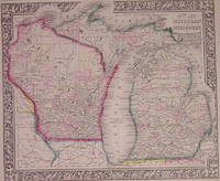
1864203205Philadelphia: Mitchell Samuel Augustus Jr. 1864. unbound. very good. Map. Engraving with original hand coloring. Image measures 11.75" x 13.75".<br/><br/> Nice map of Michigan and Wisconsin divided into counties. Shows cities major routes and waterways. Light scattered foxing. S. Augustus Mitchell Jr. continued his father's successful mapmaking and publishing business and was one of the most prolific and renowned 19th century American publishers.<br/><br/> Mitchell, Samuel Augustus Jr. unknown books
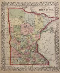
1864101046Philadelphia 1864. Unbound colored engraved map decorative boarder 14"x 11". Slight toning and aging; otherwise bright and clean. Maps are wrapped with acid free board or in rigid sleeves. The Mitchell family started to produce atlases in 1846 and continued into the early 1890s. Around 1860 S. Augustus Mitchell Jr. took over and the atlas would be called Mitchell's New General Atlas. This is a very colorful and attractive map of Minnesota from the 1882 installment of that atlas. While the upper part of the state shows more of the "wide open spaces" there is plenty of detail in the lower portion of this rather colorful map. Ristow 311-313 unknown books
1882101047Philadelphia 1882. Unbound colored engraved map decorative boarder 14"x 11". Slight toning and aging very minor small stains in bottom margin; otherwise bright and clean. Maps are wrapped with acid free board or in rigid sleeves. The Mitchell family started to produce atlases in 1846 and continued into the early 1890s. Around 1860 S. Augustus Mitchell Jr. took over and the atlas would be called Mitchell's New General Atlas. This is a very colorful and attractive map of Minnesota from the 1882 installment of that atlas. While the upper part of the state shows more of the "wide open spaces" there is plenty of detail in the lower portion of this rather colorful map. Ristow 311-313 unknown books
1866300140Philadelphia: Mitchell Samuel Augustus Jr. 1866. unbound. Map. Engraving with original hand coloring. Image measures 13.75" x 11.5".<br/><br/> Nice map of Minnesota divided into counties. Towns capitols roads rivers lakes railroads and proposed railroads are labeled. A wagon road from Fort Ridgely westward toward the Missouri River is indicated. <br><br> S. Augustus Mitchell Jr. continued his father's successful mapmaking and publishing business and was one of the most prolific and renowned 19th century American publishers.<br/><br/> Mitchell, Samuel Augustus Jr. unknown books
1872102233Unbound colored engraved map decorative boarder 12 1/2"x 15". Somewhat narrow margins slight toning and aging; overall bright and clear and in very good shape. Maps are wrapped with acid free board or in rigid sleeves. The Mitchell family started to produce atlases in 1846 and continued into the early 1890s. Around 1860 S. Augustus Mitchell Jr. took over and the atlas would be called Mitchell's New General Atlas. This is a colorful map of New Jersey and Maryland and Delaware from the 1872 installment of that atlas. The map includes is divided into two panels with New Jersey in one and Maryland and Delaware in the other. books
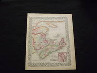
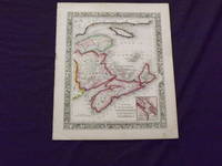
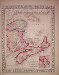
1869103218<p>Unbound colored engraved map decorative boarder 14"x 11". Slight toning browning and aging; overall very bright and clear and in very good shape. Maps are wrapped with acid free board or in rigid sleeves. The Mitchell family started to produce atlases in 1846 and continued into the early 1890s. Around 1860 S. Augustus Mitchell Jr. took over and the atlas would be called Mitchell's New General Atlas. This is a colorful map of a portion of eastern Canada from the 1869 installment of that atlas. The map is bright and crisp and includes a small inset map of Halifax. Extra postage may be required. Ristow 311-313.</p> books
1861101133<p>Philadelphia 1861. Unbound colored engraved map decorative boarder 14"x 11". Slight toning and aging; overall very bright and clear and in very good shape. Maps are wrapped with acid free board or in rigid sleeves. The Mitchell family started to produce atlases in 1846 and continued into the early 1890s. Around 1860 S. Augustus Mitchell Jr. took over and the atlas would be called Mitchell's New General Atlas. This is a colorful map of a portion of eastern Canada from the 1861 installment of that atlas. The map is bright and crisp and includes a small inset map of Halifax. Extra postage may be required. Ristow 311-313</p> books
1863204026Philadelphia: Mitchell Samuel Augustus Jr. 1863. unbound. very good. Map. Engraving with original hand coloring. Image measures 13" x 10.5".<br/><br/> Includes inset of Halifax Harbor and city. S. Augustus Mitchell Jr. continued his father's successful mapmaking and publishing business and was one of the most prolific and renowned 19th century American publishers.<br/><br/> Mitchell, Samuel Augustus Jr. unknown books
1861101058Philadelphia 1861. Unbound colored engraved map decorative boarder 14"x 11". Slight toning and aging; overall bright and clear and in very good shape. Maps are wrapped with acid free board or in rigid sleeves. The Mitchell family started to produce atlases in 1846 and continued into the early 1890s. Around 1860 S. Augustus Mitchell Jr. took over and the atlas would be called Mitchell's New General Atlas. This is a colorful map of Pennsylvania from the 1861 installment of that atlas. While the map includes three other states Pennsylvania is the most prominent part of the map. Insets highlight the cities of Philadelphia and Baltimore. Ristow 311-313 unknown books
1864101059Philadelphia 1864. Unbound colored engraved map decorative boarder 14"x 11". Slight toning and aging; overall bright and clear and in very good shape. Maps are wrapped with acid free board or in rigid sleeves. The Mitchell family started to produce atlases in 1846 and continued into the early 1890s. Around 1860 S. Augustus Mitchell Jr. took over and the atlas would be called Mitchell's New General Atlas. This is a colorful map of Pennsylvania from the 1861 installment of that atlas. While the map includes three other states Pennsylvania is the most prominent part of the map. Insets highlight the cities of Philadelphia and Baltimore. Ristow 311-313 unknown books
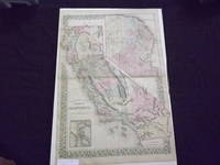
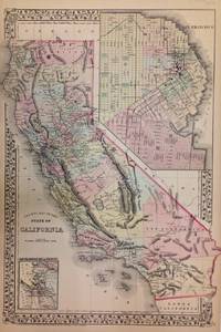
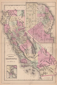
1882101013<p>Philadelphia: Bradley 1882. Unbound colored engraved map decorative boarder 22 1/2"x 14 1/2". Normal aging and toning crease at center fold; overall very good plus. Maps are wrapped with acid free board or in rigid sleeves. The Mitchell family started to produce atlases in 1846 and continued into the early 1890s. Around 1860 S. Augustus Mitchell Jr. took over and the atlas would be called Mitchell's New General Atlas. This is an attractive map of California from the 1882 installment. The city of San Francisco is shown in an inset. Will require extra postage. Ristow 311-313 Phillips 907</p> Bradley books
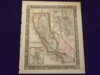
1869101011<p>Philadelphia 1869. Unbound colored engraved map decorative boarder 14"x 11". Normal aging and toning; overall bright and clean. Maps are wrapped with acid free board or in rigid sleeves. The Mitchell family started to produce atlases in 1846 and continued into the early 1890s. Around 1860 S. Augustus Mitchell Jr. took over and the atlas would be called Mitchell's New General Atlas. This is an attractive map of California from the 1869 installment of that atlas. The city of San Francisco is shown in an inset. Ristow 311-313</p> books
1865101010<p>Philadelphia 1865. Unbound colored engraved map decorative boarder 14"x 11". Slight toning and aging a few small chips at the edges; overall very bright and clean. Maps are wrapped with acid free board or in rigid sleeves. The Mitchell family started to produce atlases in 1846 and continued into the early 1890s. Around 1860 S. Augustus Mitchell Jr. took over and the atlas would be called Mitchell's New General Atlas. This is an extremely attractive map of California from the 1865 installment of that atlas. The city of San Francisco is shown in an inset. Ristow 311-313</p> books
1870101012<p>Philadelphia 1870. Unbound colored engraved map decorative boarder 14"x 11". Slight aging and toning; overall bright and clean. Maps are wrapped with acid free board or in rigid sleeves. The Mitchell family started to produce atlases in 1846 and continued into the early 1890s. Around 1860 S. Augustus Mitchell Jr. took over and the atlas would be called Mitchell's New General Atlas. This is an attractive double page map of California from the 1870 installment of that atlas. The city of San Francisco is shown in an inset. Ristow 311-313</p> books
1872271717Philadelphia: Mitchell Samuel Augustus Jr. 1872. unbound. Map. Steel engraving with original hand coloring. Image measures 21" x 15".<br/><br/> Beautifully detailed double page map of California divided into counties showing major towns and cities routes railroads and waterways. Includes two insets of San Francisco-one the bay and its vicinity and the other a city plan. Centerfold shows wear. Minor foxing and edge wear and foxing below center right.<br><br> Samuel Augustus Mitchell Sr. 1792-1868 was one of the leaders in American cartography of the 19th century and pioneered the conversion of engraved map plates to more affordable lithographic plates. His son Samuel Augustus Mitchell Jr. continued his father's successful mapmaking and publishing business and was one of the most prolific and renowned 19th century American publishers.<br/><br/> Mitchell, Samuel Augustus Jr. unknown books
188444576Philadelphia: W.M. Bradley 1884. Very good faint browning mostly to margins. 1 sheet. 55 x 39 cm image. Hand colored map. 21 x 14.5 inches. Plates 96-97. Hand colored map with two insets: San Francisco and San Francisco Bay and Vicinity. Shows settlements railroads rivers etc. City map of San Francisco shows wards major buildings aqueduct pay etc. Earlier versions often had a decorative border. W.M. Bradley unknown books
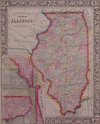
1864202985Philadelphia: Mitchell Samuel Augustus Jr. 1864. unbound. very good. Map. Engraving with original hand coloring. Image measures 13.5" x 10.75".<br/><br/> Great map of Illinois divided into counties showing towns major routes railroads and waterways. Includes a detailed town plan inset Chicago. Available in 1865 and 1866 editions. In excellent condition with a few very small chips to left edge and a narrow stain along right edge. S. Augustus Mitchell Jr. continued his father's successful mapmaking and publishing business and was one of the most prolific and renowned 19th century American publishers.<br/><br/> Mitchell, Samuel Augustus Jr. unknown books
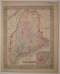
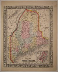
1869226734Philadelphia: Mitchell Samuel Augustus Jr. 1869. unbound. very good. Map. Steel engraving with original hand coloring. Image measures 13 3/8" x 10 5/8".<br/><br/> Classic map of Maine divided into counties. Shows major towns and cities routes railroads and waterways. Features an inset of Portland Harbor. In excellent condition with minor overall aging. Light crease to lower left corner. S. Augustus Mitchell Jr. continued his father's successful mapmaking and publishing business and was one of the most prolific and renowned 19th century American publishers.<br/><br/> Mitchell, Samuel Augustus Jr. unknown books
1864226732Philadelphia: Mitchell Samuel Augustus Jr. 1864. unbound. very good. Map. Steel engraving with original hand coloring. Image measures 13 3/8" x 10 5/8".<br/><br/> Beautifully printed map of Maine divided into counties. Shows major towns and cities routes railroads and waterways. Features an inset of Portland Harbor. In excellent condition with one very small dot of foxing to lower left margin. S. Augustus Mitchell Jr. continued his father's successful mapmaking and publishing business and was one of the most prolific and renowned 19th century American publishers.<br/><br/> Mitchell, Samuel Augustus Jr. unknown books
1882101051Philadelphia 1882. Unbound colored engraved map 15"x 11 1/2". Some toning and aging; otherwise bright and clear. Maps are wrapped with acid free board or in rigid sleeves. The Mitchell family started to produce atlases in 1846 and continued into the early 1890s. Around 1860 S. Augustus Mitchell Jr. took over and the atlas would be called Mitchell's New General Atlas. This is a colorful and attractive map of New Jersey from the 1882 installment of that atlas. On the reverse of this map is a double page map of Pennsylvania. Ristow 311-313 Phillips 907 unknown books
1869101063Philadelphia 1869. Unbound colored engraved map decorative boarder 22 1/2"x 14 1/2". Slight toning and aging; overall bright and clear and in very good shape. Maps are wrapped with acid free board or in rigid sleeves. The Mitchell family started to produce atlases in 1846 and continued into the early 1890s. Around 1860 S. Augustus Mitchell Jr. took over and the atlas would be called Mitchell's New General Atlas. This is an attractive double page map of New York State from the 1869 installment. Buffalo Rochester Albany and West Troy and New York Harbor are highlighted in five insets. Ristow 311-313 unknown books
1882101065Philadelphia: Bradley 1882. Unbound colored engraved map decorative boarder 22 1/2"x 14 1/2". Slight toning and aging; overall bright and clear and in very good shape. Maps are wrapped with acid free board or in rigid sleeves. The Mitchell family started to produce atlases in 1846 and continued into the early 1890s. Around 1860 S. Augustus Mitchell Jr. took over and the atlas would be called Mitchell's New General Atlas. This is an attractive double page map of New York State from the 1882 installment. Buffalo Rochester Albany and New York City are highlighted in four insets. Ristow 311-313 Phillips 907 Bradley unknown books
1870101064Philadelphia 1870. Unbound colored engraved map decorative boarder 22 1/2"x 14 1/2". Slight toning and aging; overall bright and clear and in very good shape. Maps are wrapped with acid free board or in rigid sleeves. The Mitchell family started to produce atlases in 1846 and continued into the early 1890s. Around 1860 S. Augustus Mitchell Jr. took over and the atlas would be called Mitchell's New General Atlas. This is an attractive double page map of New York State from the 1870 installment. Buffalo Rochester Albany and New York City are highlighted in four insets. Ristow 311-313 unknown books
1861101061Philadelphia 1861. Unbound colored engraved map decorative boarder 22 1/2"x 14 1/2". Slight toning and aging just a little soiling or staining in margins; overall bright and clear and in very good shape. Maps are wrapped with acid free board or in rigid sleeves. The Mitchell family started to produce atlases in 1846 and continued into the early 1890s. Around 1860 S. Augustus Mitchell Jr. took over and the atlas would be called Mitchell's New General Atlas. This is an very attractive and colorful double page map of New York State from the 1861 installment. Buffalo Rochester Albany and New York City are highlighted in four insets. Ristow 311-313 unknown books
1870101067Philadelphia 1870. Unbound colored engraved map decorative boarder 14"x 11". Slight toning and aging a few chips at the top edge; overall bright and clear and in very good shape. Maps are wrapped with acid free board or in rigid sleeves. The Mitchell family started to produce atlases in 1846 and continued into the early 1890s. Around 1860 S. Augustus Mitchell Jr. took over and the atlas would be called Mitchell's New General Atlas. This is a colorful map of Pennsylvania from the 1870 installment of that atlas. Ristow 311-313 unknown books