Mitchell Jr, S AugustusBiblio.com
1 361 résultats
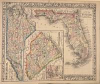
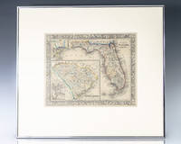
1860138429Clerk's Office of the District Court of the U.S. for the Eastern District of Pennsylvania 1860. First edition of Samuel Augustus Mitchell Jr.'s map of the states of Florida and South Carolina published in Mitchell's New General Atlas Containing Maps Of The Various Countries Of The World Plans Of Cities Etc. Embraced In Forty-Seven Quarto Maps Forming A Series Of Seventy-Six Maps And Plans Together With Valuable Statistical Tables. Philadelphia. One page hand-colored the maps shows the counties and major towns and cities of each state the Gulf of Mexico parts of Louisiana Mississippi Alabama North Carolina with an inset map of Charleston Harbor. In near fine condition. Mitchell worked as a teacher before turning to publishing geography textbooks and maps. He became involved in geography after teaching and realizing that there were so many poor quality geographical resources available to teachers. He moved to Philadelphia Pennsylvania in either 1829 or 1830. He was in Philadelphia when he founded his company. His son S. Augustus Mitchell became owner in 1860. Their publications covered all genres of geography: maps travel guides textbooks and sales of their 24 works reached an annual volume of over 400000 copies unknown
1864106796<p>Unbound colored engraved map decorative boarder 14"x 11". Slight toning browning and aging; overall very bright and clear and in very good shape. Maps are wrapped with acid free board or in rigid sleeves. The Mitchell family started to produce atlases in 1846 and continued into the early 1890s. Around 1860 S. Augustus Mitchell Jr. took over and the atlas would be called Mitchell's New General Atlas. This is a colorful map of a portion of eastern Canada from the 1864 installment of that atlas. The map is bright and crisp and includes a small inset map of Halifax. Extra postage may be required. Ristow 311-313. # 103218</p>
1870106797<p>Unbound colored engraved map decorative boarder 14"x 11". Slight toning browning and aging a few small chips and holes in left margin; overall very bright and clear and in very good shape. Maps are wrapped with acid free board or in rigid sleeves. The Mitchell family started to produce atlases in 1846 and continued into the early 1890s. Around 1860 S. Augustus Mitchell Jr. took over and the atlas would be called Mitchell's New General Atlas. This is a colorful map of a portion of eastern Canada from the 1870 installment of that atlas. The map is bright and crisp and includes a small inset map of Halifax. Extra postage may be required. Ristow 311-313.</p>
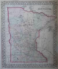
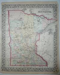
18727036S. Augustus Mitchell. Very Good. 1872. Map. A striking hand-colored map of Minnesota from Mitchell's 1872 Atlas. The state is outlined in red and the counties in green yellow and rose. Also included are railroads rivers lakes cities and towns and highest point on Mississippi River reached by steamboat in 1858 . Border is pretty interwoven vines and leaves. Single sheet; Hand-colored map; 11.5" x 13.75" . S. Augustus Mitchell unknown
18758358New York: S. Augustus Mitchell. Very Good. 1875. Map. Hand-colored map of Minnesota from Mitchell's New General Atlas. A pretty map with the state outlined in red the counties colored in pastel green yellow and rose all with a floral border and suitable for framing. The map shows cities counties lakes and rail lines ; Hand-colored Map; 11.50 x 14.0" . S. Augustus Mitchell unknown
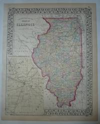
18748357New York: S. Augustus Mitchell. Very Good. 1874. Map. This hand-colored map with an inset of the city of Springfield and Sangamon County which is colored in light yellow. The state is outlined in red and the counties are colored in pastel green yellow and rose. The map shows cities towns and rail lines. From Mitchell's New General Atlas. Copyright date of 1874. A pretty map with floral border suitable for framing. ; Hand-colored Map; 10.75 x 13.25" . S. Augustus Mitchell unknown
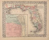
1869332073Philadelphia: Mitchell Samuel Augustus Jr. 1869. unbound. Map. Steel engraving with original hand coloring. Image measures 11" x 13.25".<br/> <br/> Nicely detailed map of Florida divided into counties showing towns major routes and geographical features. Includes a large inset town plan of Mobile Alabama. Minor chipping to corners. S. Augustus Mitchell Jr. continued his father's successful mapmaking and publishing business and was one of the most prolific and renowned 19th century American publishers.<br/> <br/> Mitchell, Samuel Augustus Jr. unknown
1866332076Philadelphia: Mitchell Samuel Augustus Jr. 1866. unbound. Map. Steel engraving with original hand coloring. Image measures 11.5" x 14".<br/> <br/> Nicely detailed map of Florida showing counties towns geographical features major routes. Features sideways maps of North Carolina and South Carolina with an inset of Charleston. Minor scattered foxing but otherwise in good condition. Samuel Augustus Mitchell Sr. 1792-1868 was one of the leaders in American cartography of the 19th century and pioneered the conversion of engraved map plates to more affordable lithographic plates. His son Samuel Augustus Mitchell Jr. continued his father's successful mapmaking and publishing business and was one of the most prolific and renowned 19th century American publishers.<br/> <br/> Mitchell, Samuel Augustus Jr. unknown
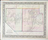
186570400Philadelphia: S. Augustus Mitchell Jr. 1865. Map. Very Good. Hand-colored map with decorative floral vine-patterned borders 13 6/8" x 11 3/8" and margins 15 1/4" x 12 1/8". Plate from "Mitchell's New General Atlas." With foam core backer board and shrink wrap. Moffat 79. Entered according to Act of Congress in the year 1865 by S. Augustus Mitchell Jr. in the Clerks Office in the District Court of the U.S. for the Eastern District of Pennsylvania.<br /> <br /> Samuel Augustus Mitchell Jr. was the son of Samuel Augustus Mitchell Sr. the most prominent American map publisher of his generation. Mitchell Sr. began publishing maps because he was frustrated with the low quality and inaccuracy of early 19th century maps. Samuel Augustus Mitchell Jr. carried on the Mitchell family business until the late 1880s. Information from National Museum of American History Behring Center Smithsonian Institution<br /> <br /> A bright hand colored map of the state of Nevada and the Territory of Utah.<br /> <br /> Fort Bridger in Utah. "No Kane Piute Sevier or Rich Counties shown. Shows Hastings Road Telegraph Route roads and mining districts in Nevada. Colored by counties. Utah's western border is at 115° W. Preuss Lake is in western Beaver County." - Moffat. S. Augustus Mitchell, Jr. unknown
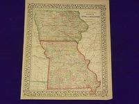
1861107225<p>Unbound colored engraved map decorative border 14"x 11". Slight toning and aging overall bright and clear and in really good condition. Maps are wrapped with acid free board or in rigid sleeves. The Mitchell family started to produce atlases in 1846 and continued into the early 1890s. Around 1860 S. Augustus Mitchell Jr. took over and the atlas would be called Mitchell's New General Atlas. This is an attractive map of Iowa and Missouri from the 1861 installment of that atlas made at the start of the Civil Waar. Ristow 311-313.</p>