Mitchell JoniABAA
1 490 résultats
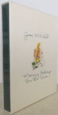
20192009200Houghton Mifflin Harcourt 2019. signed limited. as new. Signed Limited Edition. As new unread copy of Limited Slipcase Edition first printing. Signed by Joni Mitchell. Still in shrinkwrap. Small bump at one corner of slipcase. Includes reproductions of hand-written lyrics Joni's drawings and two prints suitable for framing. Houghton Mifflin Harcourt unknown books
198910007Brunswick: The Dog Ear Press 1989. 1st edition. Near fine in wraps. Goodman was Denise Levertov’s husband. Brunswick: The Dog Ear Press, paperback books
2004146382New York: Forge 2004. Octavo boards. First edition. Third book of the "Snowfall" series a loosely connected trilogy set in the near-future on a post-apocalyptic Earth gripped by a new Ice Age where remnants of civilization fight over territory and technology. "Boston's perverted technology used to conquer and oppress seems almost like magic to the North Americans who are slowly dragging themselves back up the ladder of civilization. Now the rulers of Boston eye the chaos in Middle Kingdom and find it ripe for conquest" publisher's blurb. Meanwhile rebellious genetically engineered "Persons" have turned on their makers and plot the destruction of Boston the frozen city that gave them life. "Beautiful compulsively readable . one of the finer post-apocalyptic tales of recent years. The blending of ancient and postmodern traits convinces us that we are indeed witnessing a futuristic milieu . Withstands comparison to Russell Hoban's RIDDLEY WALKER and John Crowley's ENGINE SUMMER." - Paul Di Filippo. A fine copy in fine dust jacket. #146382 Forge unknown books
1965247694New York: Macmillan 1965. First. hardcover. very good/very good. Illus. 400pp. 8vo blue cloth d.w. New York: Macmillan 1965. Very good<br/><br/> Macmillan unknown books
1850100371Engraved hand colored map 54.3x72.3cm 21 ½ x28 ½†with 128 pp of text folding into original gilt pictorial blindstamped leather covers 5 ¼ x3 ½ . Leather scuffed at joints and extremities a few short slits at folds bright very good or better. The United States from the Missouri River and the eastern Texas border. You can also see where the U.S. borders on the Indian Territory. There are five insets: Gold and Quicksilver District of California; North and South America showing the maritime and land routes to California; the copper mine regions around Lake Superior; region around Niagara Falls; and New England. Thomas, Cowperthwait & Co., hardcover books
1850100382Square 4to 11 ½ x 9 ½ publishers original quarter green calf and pictorial peach-colored boards. With 17 hand-colored copper engraved maps 5 double pages plus insets. Spine ends and corners bumped shelf wear a few small dampstains soiling; binding a bit loose short splits to some of the centerfolds U.S. map and light toning and foxing to contents. Overall about very good. Interesting double page map of the United States that shows large portions of the map as territories including a good sized section labeled as Indian Territory. The Missouri Territory stretches well into the Northwest portion of the U.S. and a portion of the Northwest is designated as Upper California. An inset at the lower left hand side of the map illustrates the Gold Region of California. Thomas Cowperthwait & Co., hardcover books
1833106021<p>Engraved Hand colored folding map 43.5 x 54.5 cm 17" x 21 1/2" folding into original gilt lettered and decorated morocco covers covers are 5 1/2" x 3 1/4" includes folding index sheet. Map is boxed in a cloth and marble board box with paper label on spine. Spine is worn covers a little bit rubbed some light and unobtrusive dampstaining 4" split and one fold in the ocean some darkening but generally bright; otherwise very good. Samuel Augustus Mitchell 1792-1868 founded one of the most influential map publishing companies in America which would last for over 60 years. After trying his hand at teaching Mitchell turned to map publishing and produces his first atlas in 1831. The following year he produced the first edition of the present work in 1832. This map was engraved by J.H. Young and provides a detailed view of what is now the eastern United States. The map comes with a folding index that includes information on steamboat and canal routes. This guide would be published for about 20 years. Ristow 303-204.</p> S. Augustus Mitchell, books
183325823Philadelphia: S. Augustus Mitchell 1833. Engraved folding map period hand-colouring in outline. Nine inset maps. Large folding Index sheet. Folds into publisher's dark green morocco covers covers bordered in gilt title stamped in gilt on the upper cover. Mitchell's Travellers Guide with the large map of the U.S.<br/> <br/>The map with the borders of the states brightly colored shows the Northeast west to Missouri Territory and part of Mexico including the Great Lakes region and south through part of Florida. Insets show the vicinities of Niagara New Orleans Cincinnati Albany New York Baltimore and Washington Philadelphia Charleston and Boston. The large folding Index sheet includes much information on steamboat and canal routes and various statistics. This copy very good condition for a guide generally found quite worn. This is the second edition preceded only by that of 1832.<br/> <br/>Rumsey 4374; Howes M690; Clark III:74; Graff 4790. S. Augustus Mitchell unknown books
183844262Philadelphia: Hinman & Dutton 1838. 16mo. 78 pp. Large folding map: Mitchell's Traveller's Guide through the United States: a Map of the Roads Distances Steam Boat and Canal Routes &c. Philadelphia: Mitchell 1838; engraved on steel by J.H. Young and D. Haines; 17 1/2 x 22 inches. Original gilt-stamped and embossed publisher's leather; map repaired on verso. Both the text and map are foxed but a very good copy. First issued under a different title in 1834. The map is hand-colored in outline and includes small inset maps of Cincinnati Albany New Orleans Boston New York Philadelphia Baltimore and Washington and Charleston; it extends from the Atlantic coast to Missouri and Arkansas labeled here "territory" although it gained statehood in 1836. Howes M-690. <br/><br/> Hinman & Dutton hardcover books
1851185142Philadelphia Penn: Thomas Cowperthwait & Co 1851. Hardcover. VG Cover and spine have general wear and fading corner and edge damage. Internal pages have staining water damage age toning foxing. Bookblock has age toning. Brown cloth boards black spine with gilt lettering. 336 pp. illus. Samuel Augustus Mitchell 1792-1868 was an American geographer who became known for publishing textbooks and maps. Thomas, Cowperthwait & Co hardcover books
1849135274Philadelphia Penn: Thomas Cowperthwait & Co 1849. 2d rev. ed. Hardcover. Fair Ex-library with usual library markings bookplate on front inside cover pocket remnant at back inside cover perforation stamp used on first pages boards have separated from block but are still present pages have some foxing but text and illus. are still easy to see flyleaves have darkened a child has colored one drawing near the back still a nifty schoolbook to browse through. Black paper-covered boards 336 pp. illus. Samuel Augustus Mitchell 1792-1868 was an American geographer who became known for publishing textbooks and maps. Thomas, Cowperthwait & Co hardcover books
1858027463Philadelphia: E.H. Butler & Company 1858. Quarto. 9 pages 23 unnumbered leaves. The maps are all from 1852 plates. OCLC shows copies are found at the Newberry and the Library of Congress. It has all 32 maps some of which are inset maps e.g. Galveston on the Texas map no. 13. Of particular interest is 1. no. 5 Map of the United States which shows New Mexico Territory which extends into what was later parts of Nevada and Colorado. The southern part of New Mexico was called Arizona but it was not until the Civil War that Arizona became a separate territory. This map was issued two years prior to the Gadsen Purchase. 2. no. 13 the State of Texas Besides showing Texas as it was after 1850 it also both in the insert and the full size map shows the range of the Comanche as well as the Apaches. This copy belonged to a Silas Wright of Greenwood. Bound in pictorial paper covered boards backed in black morocco some staining to boards small edge tears to spine toning or occasional spots of foxing to margins. A very good copy. E.H. Butler & Company unknown books
18599005506Philadelphia: E. H. Butler & Co. 1859. Hardcover. Very good condition. Bound in the publisher's original brown boards stamped in black with a black leather spine. Modest wear and soiling to the extremities. Some browning to the endpapers. Very clean internally. <br/><br/> E. H. Butler & Co. hardcover books
S2076E.H. Butler & Co. Collectible - Acceptable. Philadelphia: E. H. Butler 1860. 10x12" Black half cloth hardcover with salmon colored paper boards with black lettering on rear cover and black lettering and illustration on front. ~42 pp. Includes colored maps. No dust jacket. Cover soiled edges worn.Writing inside. Pages somewhat soiled. E.H. Butler & Co hardcover books
18396303Philadelphia: Thomas Cowperthwait & Co 1839. Hard Cover. Quarto. 18 hand-colored mapssome are insets with two maps; Map #3 North America and Map #4 of the United States and Texas each depicting Texas as a Republic with capitol as Austin. Bound in paper covered boards backed in calf rather worn maps are all very nice without foxing boards are darkened with some staining; small loss to rear endpaper; armorial bookplate on front pastedown. In all a very good atlas and quite scarce with all maps intact; housed in a custom leather backed clamshell case. <br/><br/> Thomas, Cowperthwait & Co hardcover books
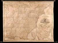
1845WRCAM32219Philadelphia: S. Augustus Mitchell 1845. Wall map 52 x 66 inches with full period hand-color. Expertly repaired backed with modern linen trimmed in green cloth on contemporary rollers. A few light creases and some marginal soiling but on the whole a bright map in very good condition. This impressive wall map of the United States was originally published in 1836 and again in 1841 supplemented by an occasional ACCOMPANIMENT. In this 1846 edition an important inset map is added entitled "A General Map of the United States with the Contiguous British & Mexican Possessions" 16 1/2 x 21 inches. This inset incorporates the discoveries of Fremont in the Great Basin and California shows all of Texas and stretches Oregon Territory well into Canada beyond the line of the Treaty of Guadalupe Hidalgo. In the large map some counties are added in Iowa Territory. There are also small inset maps of Boston New York Philadelphia Charleston Washington Albany Rochester and Niagara Falls. An important American map showing the country on the eve of its second great national expansion. RUMSEY 4223. PHILLIPS MAPS p.898. S. Augustus Mitchell hardcover books
18454885Philadelphia: S. Augustus Mitchell 1845. Copper-engraved wall map with full original colour expertly repaired backed with modern linen trimmed in green cloth on contemporary rollers with bright colour overall in very good condition. An impressive wall map of the United States from a crucial year in American history.<br/> <br/>In 1834 Mitchell republished his A New Map of the United States under the title of Reference and Distance Map. New updated editions appeared almost yearly. When compared to the 1833 edition of the former this 1845 edition of the Reference and Distance Map shows many new developments in the upper Midwest. The outline of Lake Michigan has undergone extensive corrections. An oversized Wisconsin Territory 1836 now appears. Two of the small insets of American towns have been removed from the upper left-hand corner so that the new oversized Territory of Iowa 1838 could be added. The large inset General Map of the United States now shows Texas in its last year as an independent Republic. An important American map showing the country on the eve of its second great national expansion.<br/> <br/>Rumsey 4223; Phillips Maps p. 898. S. Augustus Mitchell unknown books
185949436Philadelphia: S. Augustus Mitchell 1859. Large hand-colored wall map on rods approx. 64" square with 4 engraved vignettes 3 inset maps 2 of the world and 1 of the Sandwich Islands all within an elaborate floral border; some infill along the margins slight loss in the population tables at the bottom and several cracks in the paper the whole neatly and professionally backed with linen; overall appearance is certainly very good or better with the usual small defects. America as it was on the eve of the Civil War. OCLC records examples from 1856 1857 1858 1860 and 1861 but not this. Unusual features of this map include the Shoshone Territory what is now mostly Idaho Colona now part of Colorado the unusually large Nebraska the horizontal Utah and New Mexico and the unusually small Dakotas. <br/><br/> S. Augustus Mitchell unknown books
1874106572<p>Sold as a collection of maps. Folio original cloth with leather spine and corners about 48 colored maps. Joints cracked text block almost separated from coverts some spine and edge wear endpapers folded and creased some margin staining on maps of Ohio Cincinnati Illinois Chicago and Iowa. Pages 66 and 68 loose. Missing maps of Alaska Africa Central America Cuba Ireland Greece Connecticut Boston Norway New Jersey and Maltese Islands. However does contain attractive double page maps of the United States Texas California New York World and five other double page maps. Other maps appear to be present. Sold as collection of maps.</p> S. Augustus Mitchell, books
1868100377Folio original cloth with leather spine and corners gilt title on front cover 65 colored maps. Joints and extremities rubbed but binding is sturdy and in very good condition the U.S. map has a small split at lower end of center fold someminor foxing and stains but maps are generally bright and clean. Five of the 65 maps in this atlas are double page and 33 realte to the U.S. The maps of the United States New York Pennsylvania and Texas are particularly attractive. S. Augustus Mitchell, hardcover books
1864100375Folio original cloth with leather spine and corners embossed gilt title on front cover 49 colored maps. Rubbing and fading to binding gilt dull removed label from front coverwear to extremities small stain aaffecting preliminaries occassional margin soiling and a few margin tears; U.S. map has split at the bottom of fold some minor toning but contents generally bright and clean. This atlas contains 49 colored maps twenty-six relate to the U.S. Only for maps are double page. Maps of Texas California and South America are particularly attractive. S. Augustus Mitchell, hardcover books
1868100381Folio original cloth with leather spine and corners gilt title on front cover 65 colored maps. Joints and extremities rubbed but binding is sturdy and in very good condition the U.S. map is split at the middle fold someminor foxing and stains but maps are generally bright and clean. Five of the 65 maps in this atlas are double page and 33 realte to the U.S. The maps of the United States New York Pennsylvania and Texas are particularly attractive. S. Augustus Mitchell, hardcover books
186735085Philadelphia: S. Augustus Mitchell Jr. 1867. Folio. 15 3/8 x 12 1/4 inches. 54 hand-coloured lithographic maps and town plans the first map printed with an additional table of the world time zones on verso five double-page numbered 1-91 i.e. including numbering of the insets and with the plan of St. Louis unnumbered. Publisher's red half morocco and red cloth-covered boards the upper cover decoratively blocked in gilt the lower cover blocked in blind rear endpaper torn<br/> <br/>A fine complete copy of Mitchell's important New General Atlas.<br/> <br/>S. Augustus Mitchell retired in 1860 leaving the business to his son S. Augustus Mitchell Jr. In the same year Mitchell Jr. published the first edition of the present work issued to replace the New Universal Atlas. The work was evidently a success: a second edition followed in 1861 a third in 1862 and the atlas continued to be issued annually until 1887. As with its predecessor the General Atlas concentrates on the Americas this edition includes 35 maps of the area including a fine double-page east-to-west-coast of the United States the individual states are delineated on 21 maps and there are city plans of Boston New York Philadelphia Baltimore Washington New Orleans Cincinnati Chicago and St.Louis. The text also is also heavily weighted in the same direction as the maps: pp.1-23 'List of Post Offices in the United States' 24-25pp. 'Population of the United States' 26-27pp. 'List of Post Offices in the Canadas' 1p. 'Table of Population Governments &c.' 1p. 'Table of Distances'; 1p. 'Mountains of the World' 1p. 'Rivers of the World'.<br/> <br/>Phillips Atlases 3558; cf. Ristow p.313; Rumsey p.244. S. Augustus Mitchell, Jr. unknown books
186429101Philadelphia: S. Augustus Mitchell Jr. 1864. Square folio pp. 4 27 4; 84 hand-colored maps on 54 sheets; gilt on cover dull spine a little scuffed; internally very clean; aside from the dullness of the binding a very good sound copy in publisher's quarter brown morocco and brown cloth lettered in gilt on front. Includes full page city maps of Boston New York Baltimore Washington D.C. Cincinnati and New Orleans. <br/><br/> S. Augustus Mitchell, Jr. hardcover books
1888307523Philadelphia: Wm. M. Bradley & Bro 1888. Folio. Later blue cloth spine label. Very Good. Folio. Wm. M. Bradley & Bro unknown books