DUCLAUX Mary - BARRES MauriceLivre Rare Book
2 783 résultats
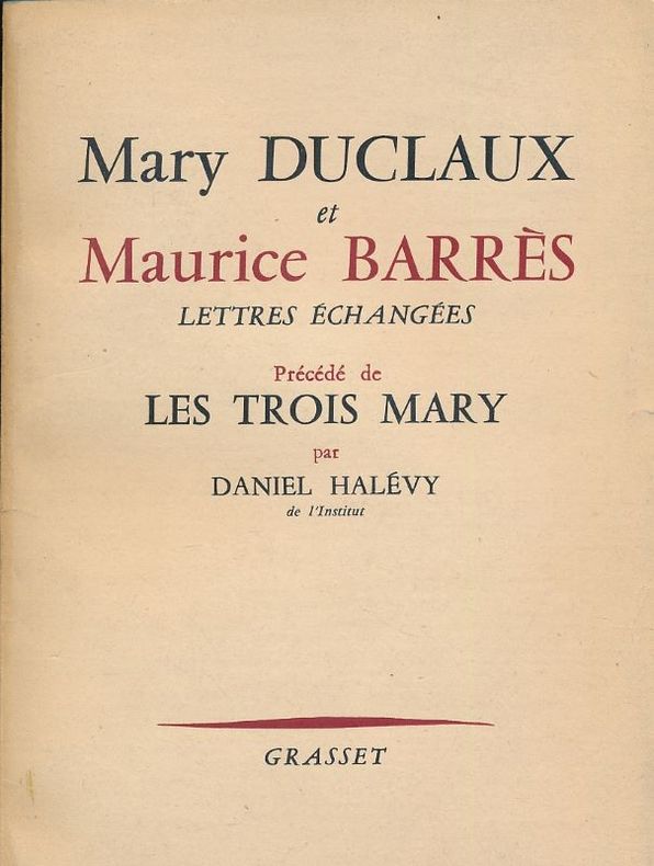
1959149150Grasset Grasset 1959, In-12 broché, portrait en frontispice et 86 pages non coupées. Bon état
17401Suivi de Les Trois Mary par Daniel Halévy . 1959 . Edit. Grasset , In 8° br. 86 pp.
1959928Paris, Grasset, 1959, in-12, 85pp, Broché, Très bel exemplaire non coupé de l'édition originale du service de presse. Portrait photographique de Mary Duclaux en frontispice. 85pp.
1160185921.Gpaperback. Good. Access codes and supplements are not guaranteed with used items. May be an ex-library book. paperback
1167678680.Gpaperback. Good. Access codes and supplements are not guaranteed with used items. May be an ex-library book. paperback
54606Paris, P.U.F., 1983, in-8, broché, 300 pp. Articles concernant Bernard Lazare, Lucien Herr, Péguy, Tchekhov, Valéry, Barrès, Maurras, etc. Ex-libris manuscrit sur le premier feuillet.
54606Paris, P.U.F., 1983, in-8, broché, 300 pp. Articles concernant Bernard Lazare, Lucien Herr, Péguy, Tchekhov, Valéry, Barrès, Maurras, etc. Ex-libris manuscrit sur le premier feuillet.
in-12 broche, IV-329 pages. - A. Dumas - E. Pailleron - V. Sardou - H. de Bornier - Fr. CoppEe - A. Parodi - J. Lemaitre - Richepin - G. Rodenbach - M. Barrès, etc. Bon exemplaire. [CL-4]
3848Paris, La Renaissance du Livre, 1927, 1 br. in-8 de 155 pages non coupées ;
1994100048140Editions Jacques Grancher 1994 in8. 1994. Broché.
65307Coll. "Musique", Monaco, Le Serpent à Plumes - Editions du Rocher, 2006, Première Edition, in-8, br., couv. photo en coul. éd., 398 pp., nb. photos en noir, Sommaire, Une jeune californienne qui devient une "groupie" des plus grandes stars du Rock des années 60 et 70 : les Stones, Led Zeppelin, les Byrds, les Kinks, les Who, les Doors, Jimi Hendricks, Frank Zappa, Alice Cooper, et bien d'autres. Un tumultueux parcours rempli de sex, drogues mais aussi d'humour et d'autodérision ! RARE. Très bon état
20061266232006 Editions Le Serpent à Plumes - 2006- In-8 broché, couverture illustrée - 389 pages
188046400846Paris, Baillière [Valence, Céas], vers 1880 ; in-8°, broché, couverture imprimée - 16 pages - Rare monographie du vin de Saint - Raphaël au quinquina. Orsi II, 507 - Chwartz I, 30
198715717NY:: William Morrow. Very Good in Very Good dust jacket. 1987. Hardcover. 068806602X . Black and white photographs. First printing. Very good in a very good minor edge wear at the spine ends and corners creasing to rear flap dust jacket.; 304 pages . William Morrow, hardcover books
198772440New York: William Morrow 1987. First Edition. Hardcover. Fine/Fine. First edition first printing. The stylish exuberant and remarkably sweet confession of one of the most famous groupies of the 1960s and '70s. 304 p. with textual photographs. Octavo. A fine unread copy in a fine dust jacket. William Morrow hardcover books
199243749NY:: William Morrow. Very Good in Very Good dust jacket. 1992. Hardcover. 0688091490 . Black and white photographs. First printing. Very good in a very good dust jacket. . William Morrow, hardcover books
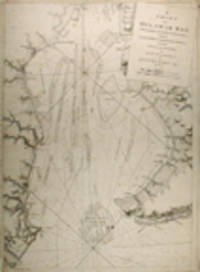
177633412London: J. F. W. Des Barres for The Atlantic Neptune 1776. Large engraved chart from Des Barres' Atlantic Neptune on two sheets of laid paper joined each bearing "J Bates" watermark. 43x31 inches sheet size nice margins; contemporary hand-color in outline; slightest offsetting a superior copy. State 4 of 7. Fine chart depicting the waters between New Bedford and Martha's Vineyard.<br/> <br/>Buzzards Bay and the Vineyard Sound including the Elizabeth Islands and the western half of Martha's Vineyard. Showing much more on-shore information than is typical for a Des Barres chart there are details of property boundaries structures even a road from Menemshaw Pond to Tisbury. Native names throughout remain largely unchanged today. Joseph Des Barres was born in Switzerland in 1721 and educated in Basel before emigrating to England and entering the Royal Military College where he learned engineering and the art of surveying. In 1756 Des Barres was commissioned a Lieutenant in the Royal American Regiment and dispatched to North America. He served in America during the Seven Years War under Colonel Bouquet Lord Howe and General Amherst and participated in the Quebec campaign as General Wolfe's engineer. Though Des Barres was responsible for the surveys done of Nova Scotia and the Isle of Sable the surveying of the coastline of what became the United States was undertaken by Major Samuel Holland a Dutchman who joined the British army during the French and Indian War as an engineer and became ultimately Surveyor General for North America. Holland was in charge of a rather large staff that included Charles Blaskowitz and George Gauld. They ultimately provided greatly improved charts for the entire coastline and the Gulf of Mexico. All this work was done prior to the Revolution which necessarily brought the surveys to an end. The publishing supervised by Des Barres continued throughout the war years. Des Barres compiled and edited the atlas maintaining a high standard throughout. His primary motive seems to have been the navigational usefulness of the charts. He clearly envisioned a navigator's needs in approaching a shoreline. The Atlantic Neptune was the first new survey of American coastlines in a century and the need was very great. The charts were plagiarized for the next thirty or forty years. Des Barres also had a flare for making charts aesthetically appealing so that they are invariably handsome as well as unfailingly interesting.<br/> <br/>Stevens 88D; John Carter Brown Library Charting the East Coast of North America The Atlantic Neptune Providence: 1972; Robert Lingel 'The Atlantic Neptune' in the Bulletin of the New York Public Library July 1936 pp.571-603; Augustus P. Loring 'The Atlantic Neptune' in American Maritime Prints New Bedford: 1985. J. F. W. Des Barres for The Atlantic Neptune unknown books
1776227653London 1776. First. unbound. very good. Sea chart. Engraving. Image measures 27.25" x 40.25".<br/><br/> Beautiful rare nautical chart of Port Campbell SE Nova Scotia. This is the first state and shows settlements and shoals in outline only. Includes the yet named Shelburne Harbour and Roseneath Island now McNutt Island. Includes description of the shoreline and tides. Map is dated 1776 just before the Loyalists came and settled the area. Published in "The Atlantic Neptune" the first British sea atlas of the eastern coast of North America hailed for both its accuracy and its aesthetics. J.F.W. Des Barres c. 1729-1827 was born in Basle Switzerland but went to military school in England. He became a colonial administrator in Nova Scotia and also served as governor of Quebec. Des Barres was commissioned for the surveying project in 1762 and dedicated ten years to the gathering of the charts and publication of the atlas. Small chips and tears to margin not affecting the image slight wear to original folds overall toning.<br/><br/> unknown books
288500London: J.F.W. Des Barres. unbound. very good. Map. Engraving. 32" x 82". Shows some wear to edges and toning of far left panel.<br/><br/> The Bay of Fundy lies between Canada's Nova Scotia and New Brunswick provinces and touches the U.S. state of Maine. It's known for extremely high tides. J.F.W. Des Barres c. 1729-1827 was born in Basle Switzerland but went to military school in England. He became a colonial administrator in Nova Scotia and also served as governor of Quebec. Des Barres was commissioned for the surveying project in 1762 and dedicated ten years to the gathering of the charts and publication of the atlas.<br/><br/> J.F.W. Des Barres unknown books
177920759London: Published by J. F. W. Des Barres in 'The Atlantic Neptune' 1779. Black and white copper engraving. Large repaired tear 12" from bottom edge parallel to centerfold. 4" repaired split from bottom in centerfold. Thin uneven margins. Plate size: 30 1/4 x 22 1/8 inches. This is a fantastic sea chart of the Delaware coast from the 'The Atlantic Neptune' which is universally recognized as one of the most magnificent atlases ever made.<br/> <br/>This superb sea chart constructed for the use of the British Navy shows the major part of the Delaware coast from Rehobeth to Bombay Hook as well as the opposing south New Jersey shore. 'The Atlantic Neptune' was the first great marine atlas and one of the great achievements of eighteenth century cartography. When publication in England began in 1774 it contained over 250 charts and views of the North American and Canadian coasts. The charts were intensely detailed and contained both hydrographical and topographical details. The Neptune was compiled and published for the Royal Navy by Joseph F. W. Des Barres a Swiss cartographer who joined the Royal American Regiment as a surveyor. Des Barres fought in the French and Indian wars and was enlisted to survey the Canadian coastline. While his fellow surveyor Samuel Holland charted the New England coast Des Barres mapped the shoreline of Nova Scotia Newfoundland and the St. Lawrence River regions. In 1774 Des Barres returned to England where he compiled and published his monumental atlas; his dedication to the project was so strong that he published an updated version of the work every year until 1784. Des Barres' work was so superior to any other contemporary atlas that the maps were used as the standard charts of the East coast for over 50 years. The Neptune remains one of the most important atlases ever printed its views and maps chart as aspect of the history of North America and now allow us to glimpse this land drastically changed by the passage of time.<br/> <br/>Snyder City of Independence p. 271; Stevens 158. Published by J. F. W. Des Barres in 'The Atlantic Neptune' unknown books
178134269London: Published by J.F.W. Des Barres in 'The Atlantic Neptune' 1781. Etching with aquatint. Sheet size: 33 x 24 1/4 inches. A portion of the upper left platemark expertly reinforced. 3rd state of 5 Corresponding to Stevens 51 c. A set of six navigational views of Halifax Harbour and nearby coastal area from one of the most important North American marine atlases.<br/> <br/>This group includes four views intended as aids to navigation. The profiles were intended for use by captains of vessels to identify exactly where they were in relation to distant shorelines; added to these is a charming roundel giving a picturesque view of a waterfall on the Hinchinbroke River and finally a tranquil view in Halifax harbour which is enlivened by the small scene in the lower right of the image where amid clouds of steam men work frantically to re-tar the hull of a man-of-war. This later state of the print incorporates all the improvements in detail and the addition of sailing ships of all kinds. 'The Atlantic Neptune' was the first great marine atlas and one of the greatest achievements of eighteenth century cartography. Published in England in 1774 it contained over 250 charts and views of the North American and Canadian coasts. The charts were intensely detailed and contained both hydrographical and topographical details. The Neptune was compiled and published for the Royal Navy by Joseph F. W. Des Barres a Swiss cartographer who joined the Royal American Regiment as a surveyor. Des Barres fought in the French and Indian wars and was enlisted to survey the Canadian coastline. While his fellow surveyor Samuel Holland charted the New England coast Des Barres mapped the shoreline of Nova Scotia Newfoundland and the St. Lawrence River regions. In 1774 Des Barres returned to England where he compiled and published his monumental atlas; his dedication to the project was so strong that he published an updated version of the work every year until 1784. Des Barres' work was so superior to any other contemporary atlas that the maps were used as the standard charts of the East coast for over 50 years. The Neptune remains one of the most important atlases ever printed its views and maps chart the history of North America and allow us to glimpse forgotten shores long changed with the passage of time.<br/> <br/>Spendlove The Face of Early Canada Chapter 4: "J.F.W. Des Barres and The Atlantic Neptune"; pp. 18-22; Debard "The Family Origins of Joseph Fredericks Wallet DesBarres: A Riddle Finally Solved" Nova Scotia Historical Review Vol 14 No. 2 1994 p.15; Catalogue of the Henry Newton Stevens Collection.51c. Published by J.F.W. Des Barres in 'The Atlantic Neptune' unknown books
177734270London: Published by J.F.W. Des Barres in 'The Atlantic Neptune' 1777. Hand-colored etching on Bates paper. No imprint. Sheet size: 32 1/4 x 23 3/4 inches with center fold as with all early issues. Expert restoration to center fold and marginal tears. A set of six navigational views of Halifax Harbour and nearby coastal area from one of the most important North American marine atlases.<br/> <br/>This group includes four profile views intended as aids to navigation. The profiles were intended for use by captains of vessels to identify exactly where they were in relation to distant shorelines; added to these is a charming roundel giving a picturesque view of a waterfall on the Hinchinbroke River and finally a tranquil view in Halifax harbour which is enlivened by the small scene in the lower right of the image where amid clouds of steam men work frantically to re-tar the hull of a man-of-war. This finely coloured example of the print corresponds to Stevens 51 first state without stamped plate number. 'The Atlantic Neptune' was the first great marine atlas and one of the greatest achievements of eighteenth century cartography. Published in England in 1774 it contained over 250 charts and views of the North American and Canadian coasts. The charts were intensely detailed and contained both hydrographical and topographical details. The Neptune was compiled and published for the Royal Navy by Joseph F. W. Des Barres a Swiss cartographer who joined the Royal American Regiment as a surveyor. Des Barres fought in the French and Indian wars and was enlisted to survey the Canadian coastline. While his fellow surveyor Samuel Holland charted the New England coast Des Barres mapped the shoreline of Nova Scotia Newfoundland and the St. Lawrence River regions. In 1774 Des Barres returned to England where he compiled and published his monumental atlas; his dedication to the project was so strong that he published an updated version of the work every year until 1784. Des Barres' work was so superior to any other contemporary atlas that the maps were used as the standard charts of the East coast for over 50 years. The Neptune remains one of the most important atlases ever printed its views and maps chart the history of North America and allow us to glimpse forgotten shores long changed with the passage of time.<br/> <br/>Spendlove The Face of Early Canada Chapter 4: "J.F.W. Des Barres and The Atlantic Neptune"; pp. 18-22; Debard "The Family Origins of Joseph Fredericks Wallet DesBarres: A Riddle Finally Solved" Nova Scotia Historical Review Vol 14 No. 2 1994 p.15; Stevens 51A. Published by J.F.W. Des Barres in 'The Atlantic Neptune' unknown books
178013223London: Published by J.F.W. Des Barres in 'The Atlantic Neptune' 1780. Etching with aquatint printed in sepia. On laid paper with 'J Bates' watermark and 'JB' countermark. Expertly repaired 1/2 inch hole to image. A very fine view of Quebec. This image is one of the most important of all the views included in Des Barres masterpiece: 'The Atlantic Neptune'.<br/> <br/>'The Atlantic Neptune' was the first great marine atlas and one of the greatest achievements of eighteenth century cartography. Published in England in 1774 it contained over 250 charts and views of the North American and Canadian coasts. The charts were intensely detailed and contained both hydrographical and topographical details. The Neptune was compiled and published for the Royal Navy by Joseph F. W. Des Barres a Swiss cartographer who joined the Royal American Regiment as a surveyor. Des Barres fought in the French and Indian wars and was enlisted to survey the Canadian coastline. While his fellow surveyor Samuel Holland charted the New England coast Des Barres mapped the shoreline of Nova Scotia Newfoundland and the St. Lawrence River regions. In 1774 Des Barres returned to England where he compiled and published his monumental atlas; his dedication to the project was so strong that he published an updated version of the work every year until 1784. Des Barres' work was so superior to any other contemporary atlas that the maps were used as the standard charts of the East coast for over 50 years. The Neptune remains one of the most important atlases ever printed its views and maps chart the history of Canada and the United states and allow us to glimpse a forgotten land long changed by the passage of time. Spendlove writes that the 'large prints from The Atlantic Neptune are among the finest and most beautiful pictures of Canada ever made. Des Barres was an artist of great ability. and his delineation of ships was particularly effective and one could hardly find anything finer' The Face of Early Canada pp. 18-19. The present view is apparently taken from on board a ship on the St. Lawrence River looking north west towards towards the citadel and burgeoning city of Quebec. In the foreground are two finely-observed merchantmen their flags and pennants streaming out in the stiff breeze blowing up the river valley. This is an historically important image of Quebec as it looked twenty years after its capture by Wolfe drawn by an artist of high merit who took part in the 1759 campaign. Second state of 2<br/> <br/>National Maritime Museum Greenwich Henry Newton Stevens Collection 125a; Cf. Spendlove The Face of Early Canada Chapter 4: "J.F.W. Des Barres and The Atlantic Neptune"; pp. 18-22; Debard "The Family Origins of Joseph Fredericks Wallet DesBarres: A Riddle Finally Solved" Nova Scotia Historical Review Vol 14 No. 2 1994 p.15; Stevens 125B. Published by J.F.W. Des Barres in 'The Atlantic Neptune' unknown books
178134986London: J. F. W. Des Barres 1781. Engraved with aquatint on single double-page sheet watermarked "J. Bates." Excellent condition with minor repairs along centerfold. Detailed depiction of the mouth of the Miramachi River in New Brunswick and Miramachi Bay in the Gulf of St. Larwence.<br/> <br/>Des Barres of Swiss-Huguenot extraction studied under the great mathematician Daniel Bernoulli at the University of Basel before continuing on to the Royal Military College at Woolwich. Upon the outbreak of hostilities with France in 1756 he joined the British Royal American Regiment as a military engineer. He came to the attention of General James Wolfe who appointed him to join his personal detail. During this period he also worked with the future legendary explorer James Cook on a monumental chart of the St. Lawrence River. From 1762 Des Barres was enlisted to survey the coastlines of Nova Scotia Newfoundland and the Gulf of St. Lawrence while his colleague Samuel Holland charted the New England coast. He also managed to gain access to some surveys of the American South Cuba and Jamaica. In 1774 Des Barres returned to England where he began work on The Neptune. His dedication to the project was so strong that often at his own expense he continually updated and added new charts and views up until 1784. That year he returned to Canada where he remained for a further forty years becoming a senior political figure and a wealthy land owner and living to the advanced age of 103. The Atlantic Neptune the most celebrated sea atlas contained the first systematic survey of the east coast of North America. Des Barres's synergy of great empirical accuracy with the peerless artistic virtue of his aquatint views created a work that "has been described as the most splendid collection of charts plates and views ever published" National Maritime Museum Catalogue. Upon the conclusion of the Seven Years War Britain's empire in North America was greatly expanded and this required the creation of a master atlas featuring new and accurate sea charts for use by the Royal Navy. Des Barres was charged with this Herculean task publishing the first volume in London in 1775 which was soon followed by three further volumes. Des Barres's monumental endeavor eventually featured over two-hundred charts and views many being found in several states. Des Barres's charts were immensely detailed featuring both hydrographical and topographical information and in many cases remained the most authoritative maps of the regions covered for several decades. The survey of the St. Lawrence River and Gulf was conducted by Samuel Holland who provided many charts to the immense hydrographic enterprise realized in the Atlantic Neptune. This is the fourth state of the map with the imprint date changed to 1781.<br/> <br/>HNS 131D; Spendlove The Face of Early Canada Chapter 4: "J.F.W. Des Barres and The Atlantic Neptune"; pp. 18-22; Debard "The Family Origins of Joseph Fredericks Wallet Des Barres: A Riddle Finally Solved" Nova Scotia Historical Review Vol 14 No. 2 1994 p.15. J. F. W. Des Barres unknown books
178019770London: J.F.W. Des Barres in the 'Atlantic Neptune' 1780. Engraved with aquatint period oxidized color. Good condition apart from expert restoration to center fold upper and lower margins. A very rare and highly important sea chart of Pensacola Harbor from the 'Atlantic Neptune' the finest marine atlas of North America's east coast produced during the Revolutionary War.<br/> <br/>This superbly drafted map features the magnificent natural harbor of Pensacola on the Florida panhandle. The town with its fort and carefully laid out streets is featured in the left-centre of the map. Another settlement "Campbell Town" is located further up the harbour toward where the entrance of the "Scambia" Escambia River. The borders of various land grants are demarcated and the countryside is elegantly detailed with aquatint features and coloured in a light brown-green wash. The chart precisely captures the features of the coast showing how the harbor is protected by two sandy bars of land the outer being Santa Rosa Island. The chart features a great deal of quantitative hydrographic information and instructions to mariners are written in the lower right of the map ensuring that it was by far the most accurate and comprehensive pilot for the harbor produced in the eighteenth-century. The present example is the first of two variants of this chart. It is important to note that the year this map was printed the region was caught up in the dramatic action of the Revolutionary War. The Spaniards who had just joined the war on the American side seized the British garrison at Fort Barrancas and West Florida remained in their possession for the duration of the war. Joseph Frederick Wallet Des Barres was born in Switzerland where his Huguenot ancestors had fled following the repeal of the Edict of Nantes. He studied under the great mathematician Daniel Bernoulli at the University of Basel before immigrating to Britain where he trained at the Royal Military College Woolwich. Upon the outbreak of hostilities with France in 1756 he joined the British Royal American Regiment as a military engineer. He came to the attention of General James Wolfe who appointed him to join his personal detail. During this period he also worked with the legendary future explorer James Cook on a monumental chart of the St. Lawrence River. Upon the conclusion of the Seven Years War Britain's empire in North America was greatly expanded and this required the creation of a master atlas featuring new and accurate sea charts for use by the Royal Navy. Des Barres was enlisted to survey the coastlines of Nova Scotia Newfoundland and the Gulf of St. Lawrence. With these extremely accurate surveys in hand Des Barres returned to London in 1774 where the Royal Navy charged him with the Herculean task of producing the atlas. Gradually he was forwarded the manuscripts of numerous advanced surveys conducted by British cartographers in the American Colonies Jamaica and Cuba. The result was The Atlantic Neptune which became the most celebrated sea atlas of its era containing the first systematic survey of the east coast of North America. Des Barres's synergy of great empirical accuracy with the peerless artistic virtue of his aquatint views created a work that "has been described as the most splendid collection of charts plates and views ever published" National Maritime Museum Catalogue. The Neptune eventually consisted of four volumes and Des Barres's dedication to the project was so strong that often at his own expense he continually updated and added new charts and views to various editions up until 1784 producing over 250 charts and views many appearing in several variations. All of these charts were immensely detailed featuring both hydrographical and topographical information such that in many cases they remained the most authoritative maps of the regions covered for several decades. Following the completion of the Neptune Des Barres returned to Canada where he remained for forty years becoming a senior political figure and a wealthy land owner living to the advanced age of 103.<br/> <br/>National Maritime Museum Henry Newton Stevens Collection HNS 173A & Catalogue III 144 p.384; Sellers & Van Ee Maps and Charts of North America and the West Indies 1663. J.F.W. Des Barres in the 'Atlantic Neptune' unknown books