2 783 résultats
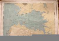
177633412London: J. F. W. Des Barres for The Atlantic Neptune 1776. Large engraved chart from Des Barres' Atlantic Neptune on two sheets of laid paper joined each bearing "J Bates" watermark. 43x31 inches sheet size nice margins; contemporary hand-color in outline; slightest offsetting a superior copy. State 4 of 7. Fine chart depicting the waters between New Bedford and Martha's Vineyard.<br/> <br/> Buzzards Bay and the Vineyard Sound including the Elizabeth Islands and the western half of Martha's Vineyard. Showing much more on-shore information than is typical for a Des Barres chart there are details of property boundaries structures even a road from Menemshaw Pond to Tisbury. Native names throughout remain largely unchanged today. Joseph Des Barres was born in Switzerland in 1721 and educated in Basel before emigrating to England and entering the Royal Military College where he learned engineering and the art of surveying. In 1756 Des Barres was commissioned a Lieutenant in the Royal American Regiment and dispatched to North America. He served in America during the Seven Years War under Colonel Bouquet Lord Howe and General Amherst and participated in the Quebec campaign as General Wolfe's engineer. Though Des Barres was responsible for the surveys done of Nova Scotia and the Isle of Sable the surveying of the coastline of what became the United States was undertaken by Major Samuel Holland a Dutchman who joined the British army during the French and Indian War as an engineer and became ultimately Surveyor General for North America. Holland was in charge of a rather large staff that included Charles Blaskowitz and George Gauld. They ultimately provided greatly improved charts for the entire coastline and the Gulf of Mexico. All this work was done prior to the Revolution which necessarily brought the surveys to an end. The publishing supervised by Des Barres continued throughout the war years. Des Barres compiled and edited the atlas maintaining a high standard throughout. His primary motive seems to have been the navigational usefulness of the charts. He clearly envisioned a navigator's needs in approaching a shoreline. The Atlantic Neptune was the first new survey of American coastlines in a century and the need was very great. The charts were plagiarized for the next thirty or forty years. Des Barres also had a flare for making charts aesthetically appealing so that they are invariably handsome as well as unfailingly interesting.<br/> <br/> Stevens 88D; John Carter Brown Library Charting the East Coast of North America The Atlantic Neptune Providence: 1972; Robert Lingel 'The Atlantic Neptune' in the Bulletin of the New York Public Library July 1936 pp.571-603; Augustus P. Loring 'The Atlantic Neptune' in American Maritime Prints New Bedford: 1985. J. F. W. Des Barres for The Atlantic Neptune unknown
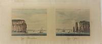
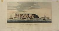
1779P2445London 1779. Very Good a short tear from upper left margin enters in the image for half an inch. Image Size : 145x423 mm 5.71x16.65 Inches Platemark Size : Paper Size : 232x564 mm 9.13x22.20 Inches Coloring: Hand Colored Medium: Aquatint Categories: Views Canada Nova Scotia; unknown
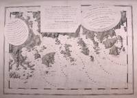
1776M4657London 1776. Very Good. Notes: A scarce and sought after map of Charlotte Bay in Greater Halifax. This area in present day contains numerous luxary cottages. Size : 680x975 mm 26.75x38.375 Inches Coloring: Hand Colored Category: Maps Canada East Nova Scotia; unknown
178120210London: J. F. W. Des Barres for 'The Atlantic Neptune' 1781. Etched with aquatint and stippling. Some outline color. Platemark: 29 1/4 x 21 3/8 inches; sheet: 32 3/4 x 24 3/4 inches. Laid paper watermarked "J. Bates" with counter mark "J.B." A meticulous survey of a portion of the eastern coast of New Brunswick on the Northumberland Straits with soundings and topographical detailing.<br/> <br/> This chart which appeared in Volume II of The Atlantic Neptune was part of the surveying work conducted by Des Barres himself in the late 1760s and early 1770s. The first state was issued in 1776; this enhanced second state appeared in 1779. Des Barres of Swiss-Huguenot extraction studied under the great mathematician Daniel Bernoulli at the University of Basel before continuing on to the Royal Military College at Woolwich. Upon the outbreak of hostilities with France in 1756 he joined the British Royal American Regiment as a military engineer. He came to the attention of General James Wolfe who appointed him to join his personal detail. During this period he also worked with the future legendary explorer James Cook on a monumental chart of the St. Lawrence River. From 1762 Des Barres was enlisted to survey the coastlines of Nova Scotia Newfoundland and the Gulf of St. Lawrence while his colleague Samuel Holland charted the New England coast. He also managed to gain access to some surveys of the American South Cuba and Jamaica. In 1774 Des Barres returned to England where he began work on The Neptune. His dedication to the project was so strong that often at his own expense he continually updated and added new charts and views up until 1784. That year he returned to Canada where he remained for a further forty years becoming a senior political figure and a wealthy land owner and living to the advanced age of 103. The Atlantic Neptune the most celebrated sea atlas contained the first systematic survey of the east coast of North America. Des Barres's synergy of great empirical accuracy with the peerless artistic virtue of his aquatint views created a work that "has been described as the most splendid collection of charts plates and views ever published" National Maritime Museum Catalogue. Upon the conclusion of the Seven Years War Britain's empire in North America was greatly expanded and this required the creation of a master atlas featuring new and accurate sea charts for use by the Royal Navy. Des Barres was charged with this Herculean task publishing the first volume in London in 1775 which was soon followed by three further volumes. Des Barres's monumental endeavor eventually featured over two-hundred charts and views many being found in several states. Des Barres's charts were immensely detailed featuring both hydrographical and topographical information and in many cases remained the most authoritative maps of the regions covered for several decades.<br/> <br/> Stevens 72h. J. F. W. Des Barres for 'The Atlantic Neptune' unknown
177510833London 5th August 1775. 705 by 1040mm 27.75 by 41 inches. Large aquatint and etched engraving on two sheets joined unfolded and uncut with the LVG watermark together with pamphlet quarto 280 by 230mm original blue wrappers typographic title pp. 5-12 there are no pages 3-4 which agrees with the John Carter Brown example. The first state of one of the most important Revolutionary War illustrations of Boston and its approaches accompanied by the very rare 12 page pamphlet by George Callender entitled 'Nautical remarks and observations for the chart of the harbour of Boston'. Callendar was the Master of HMS Romney. Commissioned in 1762 she served extensively in North America arriving in Boston in May 1768 to support the British during the enforcement of the Townshend Acts. Short of men it was the pressing of local men into service which increased tension in the town to a level which culminated in the Boston Massacre of 1770. This chart is part of a very large body of work known as the 'Atlantic Neptune' undertaken by Des Barres one of the greatest hydrographic achievements of the eighteenth century. The French and Indian War highlighted the lack of accurate mapping of the vast territories now under British control in North America. Samuel Holland was entrusted with the task of accurately mapping the northern portion of these territories. He proposed using the latest accurate methods which included astronomical readings and triangulation. In 1769 he was still working in Canadian waters but had instructed Callendar to undertake the survey of Boston. In England Des Barres was in charge of undertaking the detailed engraving. He set about providing the British government with more accurate mapping of the entire coastline of America and Canada. They proved to be of just as much use to the American rebel forces. This particular chart is notable for recording Boston as it was at the outbreak of hostilities. It illustrates the British defences before the siege. The second state in particular out of the four later ones would record the progress of the siege works constructed by the Americans around the city. As the title informs us it was surveyed in the year 1769 a troubled time in Boston. Extensive soundings are provided in the harbour. The road structure is accurately recorded as are the local towns. It even shows recorded field boundaries. An alphabetical key upper right identifies fourteen locations in the immediate area of Boston including batteries docks forts wharves and the all-important Charles-town Ferry. The accompanying pamphlet of sailing directions is rare. It was replaced soon after by a single sheet version entitled 'A Chart of the Harbour of Boston' which is sometimes found pasted to later states of the map. It is rarely found with the chart as here. Boston Engineering Department List of Maps of Boston pp. 70-71; Cumming British Maps of Colonial America pp.51-56; ESTC N12343 pamphlet; Guthorn 'British Maps of the American Revolution' 59/3 Holland's original manuscript; Krieger and Cobb Mapping Boston p. 106 plate 19; Nebenzahl Bibliography of printed battle plans 3; Sabin 10061 pamphlet; Sellers & Van Ee 945; Stevens Bibliography of the Atlantic Neptune unpublished pp. 211-216; Streeter II:706. unknown
178026675London 1780. Aquatint and line engraving period hand colouring. Very rare first state of Des Barres's chart of the coast of Georgia.<br/> <br/> This fine chart is from "The Atlantic Neptune" one of the finest large scale sea atlases of the United States and Canadian Atlantic coastline ever produced. The maps in the atlas were produce over a seven-year period 1775-82 and are well known for their accurate portrayal of various sounds bays bars harbors as well as navigational hazards. This atlas was used extensively by the Royal Navy during the American Revolution. This is a detailed chart of the Georgia and upper Florida coastlines covering an area between the mouth of the River May to John's Island. The towns of Savannah Beaufort Hardwick and Sunbury are shown and the coastal Parishes in Georgia are names. To the west is noted "Indian Boundary Line." This very rare first state is larger than the subsequent two states without any detail added to the South Carolina coast and without the inset in the lower right corner added in or after 1780.<br/> <br/> Stevens 168a. unknown
19871984New York: William Morrow. Very Good in Very Good dust jacket. 1987. First Edition. Hardcover. William Morrow hardcover
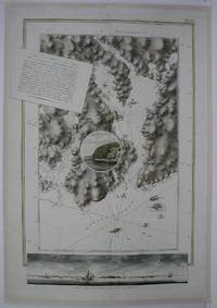
1775M5011London: The Atlantic Neptune 1775. Very Good laid on acid free canvas for long term preservation. A crease from the left extending in to the circle vignette in the map. Notes: Splendid chart of Egmont Harbor Nova Scotia - 30 miles east of Halifax. The beautifully engraved chart shows topography soundings anchorages and navigational notes. A circular vignette is superimposed on the chart with a view of what appears to be the only settlement there. At bottom is another engraved view of the coastline as seen from the sea. The title which includes detailed sailing instructions appears as a scrap of paper laid across the chart.<br>Aquatint and line engraving. This fine chart is from "The Atlantic Neptune" by Capt. Joseph Fredrick Wallet Des Barres 1721-1824. "The Atlantic Neptune" is one of the most important sea atlases of the USA and Canadian Atlantic coast that was ever been produced. The atlas was first published in England in 1774 and was updated regularly till 1784. The maps are known for the accurate portrayal of various sounds bays bars and harbours in addition to navigational challenges. The maps are very detailed and contain both hydrographical and topographical information. Des Barres a Swiss cartographer and landscape artist who immigrated to England and trained at the royal military academy became a colonial administrator in Halifax Nova Scotia where he died. He was a lieutenant in the royal American regiment c 1756; engineer under general wolf at Quebec c.1759; and governor of Prince Edward Island. He mapped the shore line of Nova Scotia Newfoundland and St. Lawrence River regions c.1764/1774 . This atlas was used by the Royal Navy during the American Revolution. <br>Reference Debard J. M. the family origins of J.f.W.Des Barres; Evens uncommon Obdurate: the several public careers of J.F.W. Des Barres Toronto 1989; De Vorsey map collector 1982 p.31 Size : 795x550 mm 31.25x21.625 Inches Coloring: Hand Colored Category: Maps Canada East Nova Scotia The Atlantic Neptune unknown
17795597London: Published by J.F.W. Des Barres in 'The Atlantic Neptune' 1779. Sea chart etched with roulette-work with original colour with aquatint view. Printed on laid paper with 'J Bates' watermark and 'JB' countermark. A very fine sea chart and view of Egmont now called Jeddore Harbour from 'The Atlantic Neptune' the first British sea atlas of her North American colonies<br/> <br/> This is a finely presented and highly detailed chart of what is now known as Jeddore Harbour near Halifax. The bay seven miles long and three miles wide is captured in a cartographic composition of great topographical and hydrographical detail and is further embellished by a roundel containing a mariner's view of the area. This chart is the fifth and final state produced and is identical to the Henry Stevens Collection variant 49G in the National Maritime Museum Greenwich. Des Barres studied under the great mathematician Daniel Bernoulli at the University of Basel before continuing on to the Royal Military College at Woolwich. On the outbreak of the Seven Years war in 1756 he joined the British Royal American Regiment as a military engineer. He came to the attention of General James Wolfe who appointed him to be his aide-de-camp. From 1762 Des Barres was enlisted to survey the coastlines of Nova Scotia Newfoundland and the Gulf of St.Lawrence while his colleague Samuel Holland charted the New England coast. In 1774 Des Barres returned to England where he began work on the Neptune. His dedication to the project was so strong that often at his own expense he continually updated and added new charts and views up until 1784. That year he returned to Canada where he remained for a further forty years becoming a senior political figure and a wealthy land owner and living to the advanced age of 103. The Atlantic Neptune was the first British sea atlas of her North American colonies and one of the most important achievements of eighteenth century cartography. With an official commission from the Royal Navy Des Barres published the first volume in London in 1775 which was soon followed by further volumes. Des Barres' monumental endeavor eventually featured over two-hundred charts and aquatint views many being found in several states. All of the charts were immensely detailed featuring both hydrographical and topographical information. Des Barres' plates were used to print further editions up into the first decade of the nineteenth-century. The Neptune met with the highest acclaim from the beginning and is today widely regarded as superior to all other atlases produced during its time.<br/> <br/> National Maritime Museum: Henry Stevens Collection: K0124 HNS 49G & Catalogue no.38 p.382; Cf. Spendlove The Face of Early Canada Chapter 4: "J.F.W. Des Barres and The Atlantic Neptune"; pp. 18-22; Debard "The Family Origins of Joseph Frederick Wallet Des Barres: A Riddle Finally Solved" Nova Scotia Historical Review Vol 14 No. 2 1994 p.15. Published by J.F.W. Des Barres in 'The Atlantic Neptune' unknown
198812012New York: Jove Editions 1988. First Jove Edition. Original Wraps. Very Good. First Jove Edition. Original Wraps. From the Collection of Jenny Lens. Inscribed by the author: "Love and kisses." Memoir from the most famous Hollywood groupie of all time! Shelfwear around edges creasing toning else tight bright and unmarred. 8vo 280pp. illus. b/w. Jove Editions unknown
1987B01040<p>New York: Beech Tree Books 1987. First Edition. 300pp. Hard Cover: NEAR FINE. Dust Wrapper: VERY GOOD. Small pencil writing on half title page. Minor chips on top left corner and bottom of dust wrapper spine. SIGNED by the author.</p><p>"Sexually intimate memoir of a queen of the groupies and of the life she lived to the hilt turning on with the kings of rock 'n' roll.a classic account of rampant narcissism among guitar egomaniacs". Kirkus Review.</p> Beech Tree Books hardcover
198782948New York: Beech Tree Books/William Morrow 1987. First Edition. Octavo. 22cm. Publisher's original off white cloth spine titled in gilt over cream paper covered boards. Dustjacket. 304pp. Light scuffing to extremities a little bumping to the spine ends internally clean in a bright strong pictorial dustjacket with some minor marginal creasing and wear. A very good copy indeed. <br /> <br /> Pamela Des Barres' autobiographical account of her career as the pre-eminent rock and roll groupie and her adventures amongst music aristocracy from Frank Zappa to the Stones. Beech Tree Books/William Morrow unknown
1987mon0003810680Beech Tree Books 1987-06-01. Hardcover. Good. 1.2000 8.1000 5.8000. Dust jacket has some wear and tear to the edges. General shelfwear to the cover and page edges. rn Beech Tree Books hardcover
0515097128New. Brand new and still unused unknown
19873115679New York: Beech Tree Books/William MORROW. Fine in Fine dust jacket. 1987. First Edition; First Printing. Hardcover. 068806602X . First edition. Fine in fine dust jacket. The definitive 'tell all' groupie memoir. Hard to locate in top condition. ; 8vo 8" - 9" tall; 304 pages . Beech Tree Books/William MORROW hardcover
068806602X.Ghardcover. Good. Access codes and supplements are not guaranteed with used items. May be an ex-library book. hardcover
0704IWP7FUK<p>Very Good. Signed by Pamela Des Barnes on FEP: "Rock & Roll!" ; 1stED/1st hardcover dust jacket not clipped tan boards with gray spine slightly creased gold gilt tilte well bound clean text without creases tears or marksmany photos. Email for photos.</p> hardcover
19879175Beech Tree Books. As New in Fine dust jacket. 1987. First Edition; First Printing. Hardcover photos. 068806602X . Book As New. No notes. No other names or ANY markings. DJ with gentle reader wear but NO tears. DJ not price clipped $16.95 ; Inscribed by author at 1st page "it's only rock n' roll love" and signed in full. ; 302 pages; Signed by Author . Beech Tree Books hardcover
1779P2444London 1779. Very Good. Image Size : 200x423 mm 7.87x16.65 Inches Platemark Size : Paper Size : 293x569 mm 11.54x22.40 Inches Coloring: Hand Colored Medium: Aquatint Categories: Views Canada Nova Scotia; unknown
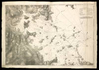
1779M8840London: Des Barres Joseph F.W. 1779. Very Good lower margin extended. Laid down on acid free paper for long term preservation. . Notes: This map of the Keppell Knowles Tangier Saunder's and Deane harbours found on Cape Breton Island in Nova Scotia appears in The Atlantic Neptune an important cartographic work published by De Barres. <br><br>Colonel Joseph Frederick Wallet DesBarres 1721 – 1824 was a hydrographer cartographer military engineer and landscape artist who served in the Seven Years War in part as the aide-de-camp to General James Wolfe. He also created the monumental four volume Atlantic Neptune which was the most important collection of maps charts and views of North America published in the eighteenth century. Finally he was the Governor of Cape Breton Island and Prince Edward Island. Size : 620x930 mm 24.41x36.61 Inches Coloring: Original faint Hand Coloring Category: Maps Canada East Nova Scotia; Des Barres, Joseph F.W. unknown
200711994Chicago IL: Chicago Review Press 2007. First Edition. Hardcover. Very Good in Very Good Unprice-Clipped DJ. First Edition. Hardcover. From the Collection of Jenny Lens. With photographs by Jenny Lens and inscribed by the author: "You're the coolest! Keep the images coming. Love." Memoir from the most famous Hollywood groupie of all time! Light shelfwear around edges and dj else tight bright and unmarred. Matte color DJ gray/black paper over boards. 8vo 384pp. illus b/w index. Chicago Review Press hardcover
20071-1556526687Chicago Review Pr 2007. Hardcover. New. 400 pages. 9.00x6.25x1.25 inches. Chicago Review Pr hardcover
2007DADAX1556526687Brand: Chicago Review Press 2007-07-01. hardcover. New. 6.25x1.25x9.00. Buy with confidence. Excellent Customer Service & Return policy. Brand: Chicago Review Press hardcover
elala5919Charlottetown: 1812. A distinguished military engineer DesBarres served in the British Army in North America during the Seven Years' War and participated in the capture of Louisbourg in 1758 and of Quebec in 1759. General James Wolfe used a chart which he prepared of the St. Lawrence River and approaches to Quebec in his assault on the city. From 1763 to 1773 DesBarres surveyed and charted the Atlantic coast from Newfoundland to New York which resulted in the publication in 1777 of the Atlantic Neptune a four-volume atlas “which stands as a landmark in Canadian cartographic achievement†R.J.Morgan DCB VI pp. 196 and is considered to be the most important atlas of North America published in the eighteenth century. He went on to become the first Lieutenant Governor of Cape Breton 1784-87 the founder of Sydney and the Lieutenant Governor of Prince Edward Island 1804-12. He faced considerable opposition to his administration in both colonies and with the home government and in each instance was recalled to England. The present document is dated just one month before his recall from Prince Edward Island in August of 1812. In it DesBarres reprimands the Grand Jury for overstepping the bounds of their authority although he says he is willing to attribute their statements to “good intentions in an infant colony language which under other circumstances might be very differently received.â€. one-page folio. horizontal folds several tears with no loss of text. matted & framed size of frame: 21.75 x 16 inches; 55.2 x 40.6 cm. elala5919 [Charlottetown]: 1812 unknown
178134986London: J. F. W. Des Barres 1781. Engraved with aquatint on single double-page sheet watermarked "J. Bates." Excellent condition with minor repairs along centerfold. Detailed depiction of the mouth of the Miramachi River in New Brunswick and Miramachi Bay in the Gulf of St. Larwence.<br/> <br/> Des Barres of Swiss-Huguenot extraction studied under the great mathematician Daniel Bernoulli at the University of Basel before continuing on to the Royal Military College at Woolwich. Upon the outbreak of hostilities with France in 1756 he joined the British Royal American Regiment as a military engineer. He came to the attention of General James Wolfe who appointed him to join his personal detail. During this period he also worked with the future legendary explorer James Cook on a monumental chart of the St. Lawrence River. From 1762 Des Barres was enlisted to survey the coastlines of Nova Scotia Newfoundland and the Gulf of St. Lawrence while his colleague Samuel Holland charted the New England coast. He also managed to gain access to some surveys of the American South Cuba and Jamaica. In 1774 Des Barres returned to England where he began work on The Neptune. His dedication to the project was so strong that often at his own expense he continually updated and added new charts and views up until 1784. That year he returned to Canada where he remained for a further forty years becoming a senior political figure and a wealthy land owner and living to the advanced age of 103. The Atlantic Neptune the most celebrated sea atlas contained the first systematic survey of the east coast of North America. Des Barres's synergy of great empirical accuracy with the peerless artistic virtue of his aquatint views created a work that "has been described as the most splendid collection of charts plates and views ever published" National Maritime Museum Catalogue. Upon the conclusion of the Seven Years War Britain's empire in North America was greatly expanded and this required the creation of a master atlas featuring new and accurate sea charts for use by the Royal Navy. Des Barres was charged with this Herculean task publishing the first volume in London in 1775 which was soon followed by three further volumes. Des Barres's monumental endeavor eventually featured over two-hundred charts and views many being found in several states. Des Barres's charts were immensely detailed featuring both hydrographical and topographical information and in many cases remained the most authoritative maps of the regions covered for several decades. The survey of the St. Lawrence River and Gulf was conducted by Samuel Holland who provided many charts to the immense hydrographic enterprise realized in the Atlantic Neptune. This is the fourth state of the map with the imprint date changed to 1781.<br/> <br/> HNS 131D; Spendlove The Face of Early Canada Chapter 4: "J.F.W. Des Barres and The Atlantic Neptune"; pp. 18-22; Debard "The Family Origins of Joseph Fredericks Wallet Des Barres: A Riddle Finally Solved" Nova Scotia Historical Review Vol 14 No. 2 1994 p.15. J. F. W. Des Barres unknown