DES BARRES, Joseph Frederick WalletBiblio.com
2 783 résultats
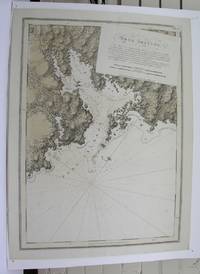
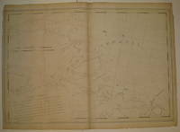
1776227653London 1776. First. unbound. very good. Sea chart. Engraving. Image measures 27.25" x 40.25".<br/> <br/> Beautiful rare nautical chart of Port Campbell SE Nova Scotia. This is the first state and shows settlements and shoals in outline only. Includes the yet named Shelburne Harbour and Roseneath Island now McNutt Island. Includes description of the shoreline and tides. Map is dated 1776 just before the Loyalists came and settled the area. Published in "The Atlantic Neptune" the first British sea atlas of the eastern coast of North America hailed for both its accuracy and its aesthetics. Small chips and tears to margin not affecting the image slight wear to original folds overall toning. J.F.W. Des Barres c. 1729-1827 was born in Basle Switzerland but went to military school in England. He became a colonial administrator in Nova Scotia and also served as governor of Quebec. Des Barres was commissioned for the surveying project in 1762 and dedicated ten years to the gathering of the charts and publication of the atlas.<br/> <br/> unknown
M3913London 1775. Very good. Notes: Aquatint and line engraving. This fine chart is from "The Atlantic Neptune" by Capt. Joseph Fredrick Wallet Des Barres 1721-1824. "The Atlantic Neptune" is one of the most important sea atlases of the USA and Canadian Atlantic coast that was ever been produced. The atlas was first published in England in 1774 and was updated regularly till 1784. The maps are known for the accurate portrayal of various sounds bays bars and harbours in addition to navigational challenges. The maps are very detailed and contain both hydrographical and topographical information. Des Barres a Swiss cartographer and landscape artist who immigrated to England and trained at the royal military academy became a colonial administrator in Halifax Nova Scotia where he died. He was a lieutenant in rhw royal American regiment c 1756; engineer under general wolf at Quebec c.1759; and governor of Prince Edward Island. He mapped the shore line of Nova Scotia Newfoundland and St. Lawrence River regions c.1764/1774 . This atlas was used by the Royal Navy during the American Revolution. <br>Reference Debard J. M. the family origins of J.f.W.Des Barres; Evens uncommon Obdurate: the several public careers of J.F.W. Des Barres Toronto 1989; De Vorsey map collector 1982 p.31 Size : 540x748 mm 21.25x29.375 Inches Coloring: Original Hand Coloring Category: Maps Canada East Nova Scotia unknown
0316882402.Gpaperback. Good. Access codes and supplements are not guaranteed with used items. May be an ex-library book. paperback
1996Q-0312148534St Martins Pr 1996-10-01. Hardcover. New. In shrink wrap. Looks like an interesting title! St Martins Pr hardcover
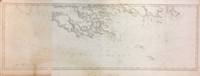
288500London: J.F.W. Des Barres. unbound. very good. Map. Engraving. 32" x 82". Shows some wear to edges and toning of far left panel.<br/> <br/> The Bay of Fundy lies between Canada's Nova Scotia and New Brunswick provinces and touches the U.S. state of Maine. It's known for extremely high tides. J.F.W. Des Barres c. 1729-1827 was born in Basle Switzerland but went to military school in England. He became a colonial administrator in Nova Scotia and also served as governor of Quebec. Des Barres was commissioned for the surveying project in 1762 and dedicated ten years to the gathering of the charts and publication of the atlas.<br/> <br/> J.F.W. Des Barres unknown
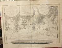
1779M10469London 1779. Very Good wide margins. Notes: With oval shaped Inset View showing Cape Spry N. NE… Beaver Isles… Westermost Ledge of Pegasus Wing East.<br><br>The Atlantic Neptune published for the Royal Navy of Great Britain in London 1774-1781. It included a comprehensive survey of the coasts of Nova Scotia the coasts and harbors of the Gulf and River of St. Lawrence and the Atlantic coast of North America including New York to Mexico and New England. Size : 723x1035 mm 28.46x40.75 Inches Coloring: Original Outline Coloring Category: Maps Canada East Nova Scotia; unknown
1992Q-0688091490William Morrow & Co 1992-11-01. Hardcover. New. New. In shrink wrap. Looks like an interesting title! William Morrow & Co hardcover
2008Q-1556528000Chicago Review Press 2008-09-01. Paperback. New. In shrink wrap. Looks like an interesting title! Chicago Review Press paperback
1993Q-042513945XBerkley 1993-10-01. Mass Market Paperback. New. In shrink wrap. Looks like an interesting title! Berkley paperback
0805QDCCOW2Near Fine. !st Edition full number line signed by author on half title page; HCDJ not price clipped light wear no tears; straight spine edgesslight bottom corner bump; no marks; ships in boxVery Good unknown
1992293916<p>First printing. Inscribed and signed on half-title page in purple ink "Dear Melanie. All you need is drawing of a heart Smooches - Pamela Des Barres". Miss Pamela's second volume of rock & roll reminiscences. 294 pages Index; 16 pages of black-and-white photos. Minor wear and soiling to edges. Unclipped dust jacket is protected in a clear sleeve.</p> Morrow hardcover
1779P2446London 1779. Very Good. Image Size : 200x424 mm 7.87x16.69 Inches Platemark Size : Paper Size : 265x555 mm 10.43x21.85 Inches Coloring: Hand Colored Medium: Aquatint Categories: Views Canada Nova Scotia; unknown
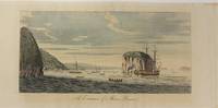
177913202London: Published by J.F.W. Des Barres in 'The Atlantic Neptune' 1779. Etching with aquatint printed in sepia coloured by hand. Printed on laid paper with `J Bates' watermark and `JB' countermark. Small tears to fold repaired tear to plate mark. A large-scale view of the entrance to the harbour at Louisbourg from one of the most important North American marine atlases.<br/> <br/> This very fine view is taken from the sea with the harbour mouth in the foreground and in the background the spires and roofs of the town and fort of Louisbourg the port of entry to Cape Breton county Nova Scotia. As usual Des Barres has added rowing boats and ships to give the viewer the correct sense of scale. Des Barres of Swiss-Huguenot extraction studied under the great mathematician Daniel Bernoulli at the University of Basel before continuing on to the Royal Military College at Woolwich. Upon the outbreak of hostilities with France in 1756 he joined the British Royal American Regiment as a military engineer. He came to the attention of General James Wolfe who appointed him to join his personal detail. During this period he also worked with the future legendary explorer James Cook on a monumental chart of the St. Lawrence River. From 1762 Des Barres was enlisted to survey the coastlines of Nova Scotia Newfoundland and the Gulf of St. Lawrence while his colleague Samuel Holland charted the New England coast. He also managed to gain access to some surveys of the American South Cuba and Jamaica. In 1774 Des Barres returned to England where he began work on The Neptune. His dedication to the project was so strong that often at his own expense he continually updated and added new charts and views up until 1784. That year he returned to Canada where he remained for a further forty years becoming a senior political figure and a wealthy land owner and living to the advanced age of 103. The Atlantic Neptune the most celebrated sea atlas contained the first systematic survey of the east coast of North America. Des Barres's synergy of great empirical accuracy with the peerless artistic virtue of his aquatint views created a work that "has been described as the most splendid collection of charts plates and views ever published" National Maritime Museum Catalogue. Upon the conclusion of the Seven Years War Britain's empire in North America was greatly expanded and this required the creation of a master atlas featuring new and accurate sea charts for use by the Royal Navy. Des Barres was charged with this Herculean task publishing the first volume in London in 1775 which was soon followed by three further volumes. Des Barres's monumental endeavor eventually featured over two-hundred charts and views many being found in several states. Des Barres's charts were immensely detailed featuring both hydrographical and topographical information and in many cases remained the most authoritative maps of the regions covered for several decades.<br/> <br/> Spendlove The Face of Early Canada Chapter 4: "J.F.W. Des Barres and The Atlantic Neptune"; pp. 18-22; National Maritime Museum Greenwich Henry Newton Stevens Collection: 65C; Debard "The Family Origins of Joseph Fredericks Wallet DesBarres: A Riddle Finally Solved" Nova Scotia Historical Review Vol 14 No. 2 1994 p.15. Published by J.F.W. Des Barres in 'The Atlantic Neptune' unknown
17793603London: Published by J.F.W. Des Barres in 'The Atlantic Neptune' 1779. Etching with aquatint printed in sepia. Printed on laid paper with `J Bates' watermark and `JB' countermark. A large-scale view of the entrance to the harbour at Louisbourg from 'The Atlantic Neptune' the first British sea atlas of her North American colonies<br/> <br/> A fine view of the harbour of Louisbourg the former "impregnable" fortress that was the gateway to French America and the scene of two great battles between France and Britain in 1748 and 1758. The scene depicted here features ships sailing into the excellent natural harbour surrounded by a ruggedly beautiful landscape. This is the third state of this view and is identical to the Henry Stevens Collection variant 65C in the National Maritime Museum Greenwich. Des Barres studied under the great mathematician Daniel Bernoulli at the University of Basel before continuing on to the Royal Military College at Woolwich. On the outbreak of the Seven Years war in 1756 he joined the British Royal American Regiment as a military engineer. He came the attention of General James Wolfe who appointed him to be his aide-de-camp. From 1762 Des Barres was enlisted to survey the coastlines of Nova Scotia Newfoundland and the Gulf of St.Lawrence while his colleague Samuel Holland charted the New England coast. In 1774 Des Barres returned to England where he began work on the Neptune. His dedication to the project was so strong that often at his own expense he continually updated and added new charts and views up until 1784. That year he returned to Canada where he remained for a further forty years becoming a senior political figure and a wealthy land owner and living to the advanced age of 103. The Atlantic Neptune was the first British sea atlas of her North American colonies and one of the most important achievements of eighteenth century cartography. With an official commission from the Royal Navy Des Barres published the first volume in London in 1775 which was soon followed by further volumes. Des Barres' monumental endeavor eventually featured over two-hundred charts and aquatint views many being found in several states. All of the charts were immensely detailed featuring both hydrographical and topographical information. Des Barres' plates were used to print further editions up into the first decade of the nineteenth-century. The Neptune met with the highest acclaim from the beginning and is today widely regarded as superior to all other atlases produced during its time.<br/> <br/> Spendlove The Face of Early Canada Chapter 4: "J.F.W. Des Barres and The Atlantic Neptune"; pp. 18-22; Debard "The Family Origins of Joseph Fredericks Wallet Des Barres: A Riddle Finally Solved" Nova Scotia Historical Review Vol 14 No. 2 1994 p.15; National Maritime Museum: Henry Stevens Collection: K0206 HNS 65C. Published by J.F.W. Des Barres in 'The Atlantic Neptune' unknown
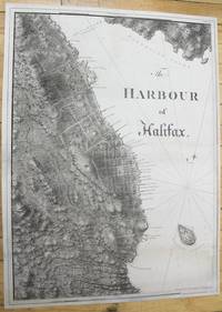
1781M10024London c.1781. Very good few marginal tears expertly repaired; backed on acid free tissue paper for long term preservation. Notes: scarce and superb sea chart constructed for the use of the British Navy shows The Harbour of Halifax Nova Scotia during the late 18th century. <br><br>Colonel Joseph Frederick Wallet DesBarres 1721 – 1824 was a hydrographer cartographer military engineer and landscape artist who served in the Seven Years War in part as the aide-de-camp to General James Wolfe. He also created the monumental four volume Atlantic Neptune which was the most important collection of maps charts and views of North America published in the eighteenth century. Finally he was the Governor of Cape Breton Island and Prince Edward Island. Size : 837x616 mm 32.95x24.25 Inches Coloring: Black & White Category: Maps City Maps; Maps Canada East Nova Scotia; unknown
177634405London: J. F. W. Des Barres 1776. Engraved with color wash and outline color. Sheet: 31 x 42 1/4 inches. Expert restoration primarily at the upper margin. Two sheets joined both watermarked "J.Bates" and countermarked "JB". Fourth state of five. Among the earliest charts published by Des Barres were those relevant to the crisis in New England as the War of Independence broke out.<br/> <br/> This chart depicts the coast of Massachusetts from Salem to Scituate Harbor and includes the complicated hydrography of Boston Harbor and the confluent rivers. A considerable amount of coastal topography is included obviously relevant to warships. Fundamentally a chart for navigators it includes soundings and shoals with particularly strong detail along the Charles and Mystic Rivers as well as in Salem and Marblehead. Samuel Holland was the lead surveyor. In 1764 he was named Surveyor General of both the Province of Quebec and the Northern District of North America. He had a considerable staff and the British Navy assisted in providing soundings. From 1770 to 1774 his squad worked exclusively on northeastern colonies that soon became part of the United States. The surveys that derived from the industry of their work were the most accurate ever made to that time. They were sent to London where Des Barres supervised the engraving and publication. The charts were very soon put to use. Des Barres of Swiss-Huguenot extraction studied under the great mathematician Daniel Bernoulli at the University of Basel before continuing on to the Royal Military College at Woolwich. Upon the outbreak of hostilities with France in 1756 he joined the British Royal American Regiment as a military engineer. He came to the attention of General James Wolfe who appointed him to join his personal detail. During this period he also worked with the future legendary explorer James Cook on a monumental chart of the St. Lawrence River. From 1762 Des Barres was enlisted to survey the coastlines of Nova Scotia Newfoundland and the Gulf of St. Lawrence while his colleague Samuel Holland charted the New England coast. He also managed to gain access to some surveys of the American South Cuba and Jamaica. In 1774 Des Barres returned to England where he began work on The Neptune. His dedication to the project was so strong that often at his own expense he continually updated and added new charts and views up until 1784. That year he returned to Canada where he remained for a further forty years becoming a senior political figure and a wealthy land owner and living to the advanced age of 103.<br/> <br/> Stevens Collection 94d ; cf. Hornsby Surveyors of Empire: Samuel Holland J.F.W. Des Barres and the Making of the Atlantic Neptune. 2011. J. F. W. Des Barres unknown
20061266232006 Editions Le Serpent à Plumes - 2006- In-8 broché, couverture illustrée - 389 pages
65307Coll. "Musique", Monaco, Le Serpent à Plumes - Editions du Rocher, 2006, Première Edition, in-8, br., couv. photo en coul. éd., 398 pp., nb. photos en noir, Sommaire, Une jeune californienne qui devient une "groupie" des plus grandes stars du Rock des années 60 et 70 : les Stones, Led Zeppelin, les Byrds, les Kinks, les Who, les Doors, Jimi Hendricks, Frank Zappa, Alice Cooper, et bien d'autres. Un tumultueux parcours rempli de sex, drogues mais aussi d'humour et d'autodérision ! RARE. Très bon état
188046400846Paris, Baillière [Valence, Céas], vers 1880 ; in-8°, broché, couverture imprimée - 16 pages - Rare monographie du vin de Saint - Raphaël au quinquina. Orsi II, 507 - Chwartz I, 30
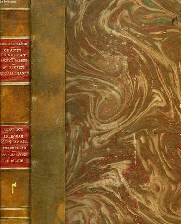
RO40119007Modern-Bibliothèque - Arthème Fayard. Non daté. In-8. Relié demi-cuir. Bon état, Couv. convenable, Dos satisfaisant, Intérieur frais. Env. 130 + 125 + 126 + 93 pages. 4 ouvrages en un volume. Premiers plats illustrés en couleur des ouvrages brochés conservés. Dessins en noir et blanc en frontispices. Illustrés de nombreux dessins en noir et blanc dans et hors texte. Pièces de titre rouges sur le dos. Auteur, titre, hache et filets dorés sur le dos. Ex-libris illustré en noir et blanc (Maud Harley) collé au dos du 1er plat.. . . . Classification Dewey : 840.091-XX ème siècle
196617AbParis Société D'édition D'enseignement Supérieur 1966 11x17,5 2 volumes: 1er vol 251 pages - couverture un peu fatiguée avec un pli marqué en 4ème page - nouvelle série V - 19ème siècle "des mémoires d'Outre tombe aux Contemplations" - 2ème vol 305 pages -nouvelle série VI -19ème siècle et début 20ème "de Baudelaire à Giraudoux"
196617AbParis Société D'édition D'enseignement Supérieur 1966 11x17,5 2 volumes: 1er vol 251 pages - couverture un peu fatiguée avec un pli marqué en 4ème page - nouvelle série V - 19ème siècle "des mémoires d'Outre tombe aux Contemplations" - 2ème vol 305 pages -nouvelle série VI -19ème siècle et début 20ème "de Baudelaire à Giraudoux"
193918481Paris Berger-Levrault 1939 In-12 79 pp, illustrations
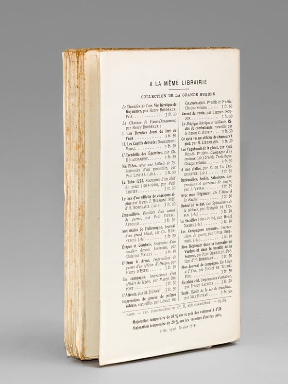
191868938Préface de Maurice Barrès, 1 vol. in-12 br., Librairie Plon, Paris, 1918, 310 pp.
1160190216.Gpaperback. Good. Access codes and supplements are not guaranteed with used items. May be an ex-library book. paperback