Barrès MauriceLivre Rare Book
2 778 résultats
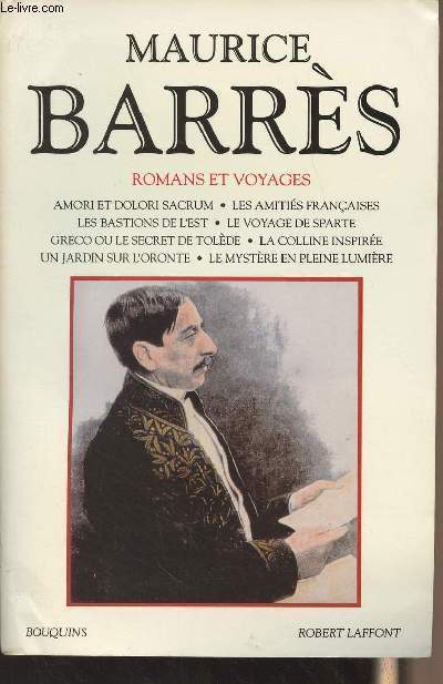
1994R300270041Robert Laffont. 1994. In-8. Broché. Bon état, Couv. convenable, Dos satisfaisant, Intérieur frais. 1160 pages. Papier bible.. . . . Classification Dewey : 840.091-XX ème siècle
ROD0117227ALEXIS RIEDER. NON DATE. In-8. Relié plein cuir. Bon état, Coins frottés, Dos à nerfs, Intérieur frais. 171 pages. Dos à 5 nerfs. Titre et auteur en dorés. Cuir plein maroquin. Contre-plats jaspés. Couverture d'origine conservée. Frontispice en noir et blanc sous serpente. Orné de 6 pointes-sèches en noir et blanc hors texte sous serpente de Hermine David. Tranche en tête dorée.. . . . Classification Dewey : 94.4-Editions numérotées
100.105Paris, Librairie Plon, 1923. 13 x 20, 2 volumes, 314 + 242 pages, quelques photos, reliure carton marbré, tome 2 partiellement coupé, tête mouchetée, non rogné, couverture conservée (3 pièces pour les 2 volumes) très bon état.
16516Vers et prose Paris, 1905, in-4 broché, 220pp.-6pp. Liste des abonnés à la revue Vers et Prose-1f. Paul Claudel : Les Muses, ode/ Viélé-Griffin : Tantale / Barrès : Autour de mon clocher (préface) / Francis Jammes : l'âne de Sancho Pança/ Paul Adam : Irène et Jean/ Abert Mockel : l'éternelle fiançée/ Stefan George / Stuart Merill / Jean Moréas / [Paul Fort / André Salmon] Saint-Pol-Roux / Tornouel / Omar Khayyam / Mécilas Golberg / Albert Saint-Paul / Valère Gille / Tancrède de Visan / Tristan Klingsor / Henri Delormel / Henri Ghéon / William Morris / Dowson / Robert de Souza / E. de Castro. Bon exemplaire.
19200292# AUTEUR: Maurice Barrès # ÉDITEUR: Plon # ANNÉE ÉDITION: 1920 – 1921 # ENVOI, BEAUX PAPIERS: vélin pur fil # COUVERTURE: imp. titre rouge grandes marges # DÉTAILS: 4 petits in 8° brochés T1 (1er fév-4déc 1914) III ff + 302 pp T3 ( 1 janv-11 mars 1915) + 366 pp T4 (12 mars-31 mai 1915) 384 pp T 5 (1 juin - 24 aout 1915) 370 pp 4 tomes des 50 ex non mis dans le commerce et comportant chacun un envoi autographe â Henri Bordeaux Sur le tome 1 envoi en rajout colé sur la page de titre. ”A vous qui avez raconté les faits que vous avez vus, j'offre ces annales de nos espérances quotidiennes”( Charmes oct. 1920) # PHOTOS visibles sur www.latourinfernal.com
19130580# AUTEUR: Barrès Maurice # ÉDITEUR: Emile-Paul frères # ANNÉE ÉDITION: 1913 # ENVOI, BEAUX PAPIERS: vélin # COUVERTURE: Impr. jaune et noir # DÉTAILS: In12° broché XIII + 248pp. Exemplaire tiré spécialement pour l'auteur n° 83. Envoi autographe à H. Bordeaux, 3eme édition. Trois stations de psychothérapie, toute licence sauf contre l'amour. Huit jours chez M. Renan, ont paru dans le ”Voltaire” au mois de mai 1886. # PHOTOS visibles sur www.latourinfernal.com
19302867# AUTEUR: Barrès Maurice # ILLUSTRATEUR: Denis Maurice # ÉDITEUR: Eos - Paris # ANNÉE ÉDITION: 1930 # ENVOI, BEAUX PAPIERS: Vélin pur fil BFK filigrané Maurice Barrès # COUVERTURE: Souple illustrée à rabats - sous chemise cartonnée rouge brique illustrée - à double lacets - titre manuscrit au dos # DÉTAILS: In 4° en feuilles sous chemise à lacets de soie 2ff.vierges+ 2ff. (faux titre, titre)+ 88pp.+ 4ff.(dont 2 vierges) 20 bois gravés en couleurs dont 10 hors-texte, 6 vignettes et culs de lampe. N° 185 des 225 exemplaires tirés par l'imprimerie nationale. Les illustrations de Maurice Denis ont été gravées sur bois par les frères Beltrand et tirées sur leurs presses par M. Lacou, Lainé et Vaganay. Cet exemplaire porte les initiales E.H. # PHOTOS visibles sur www.latourinfernal.com
GIT00e8fParis Paul Ollendorff sd v 1910. In-12 broché XI 264pp.
AMA-721 p. in 8°, 6 août 1917 (une note au crayon indique "erreur de date c'est du 6 septembre) – 17 mai 1918. 1/2 p. in 4°, sur papier à en-tête du 100 bd Maillot à Neuilly.
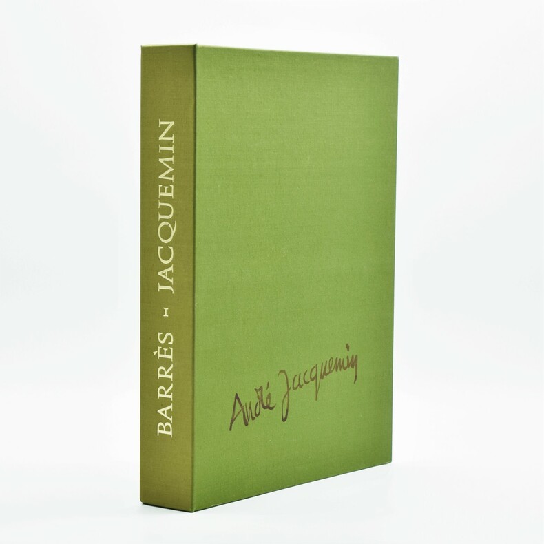
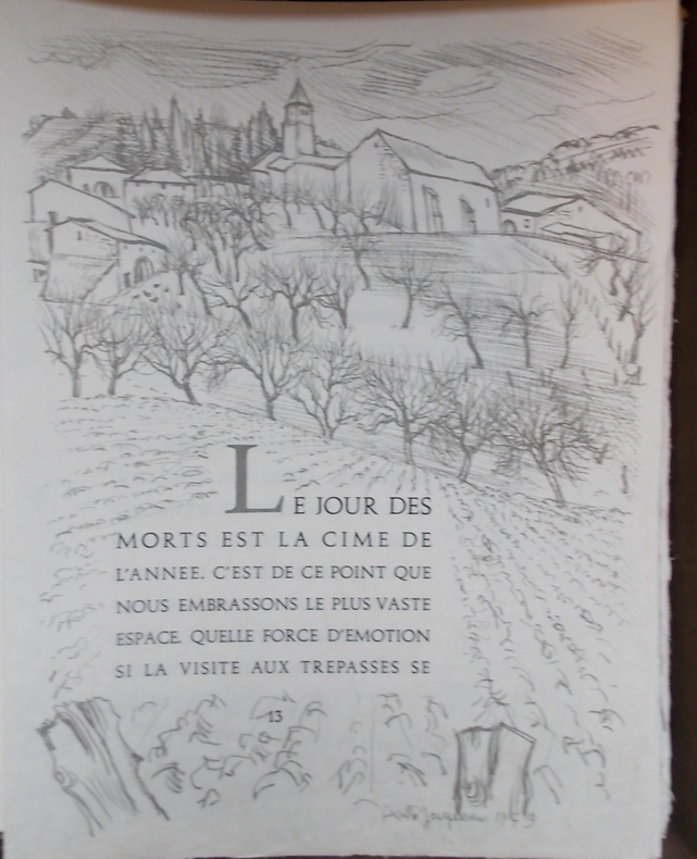
197956531Bièvres En Essonne, Pierre De Tartras 1979 In-folio, en ff. sous chemise gauffrée rempliée et emboîtage toilé, 92- 6 pp. Illustré de 8 eaux-fortes originales hors texte tirées sur grand vélin d'Arches et de lithographies entourant le texte par André Jacquemin.
1979Sal5Bièvres En Essonne Pierre De Tartras 1979 in folio - Bièvres en Essonne, Pierre de Tartras, 1979 - en feuilles, sous chemise ill. dans 1 emboîtage toilé vert - Superbe décor gaufré de chardons lorrains réalisé par Jacquemin sur la chemise - Tirage à 346 ex., le notre n° 309 sur grand Vélin d'Arches, comportant l'état définitif des illustrations, dont une eau-forte double planche signée par Jacquemin. Signature de l'illustrateur et de l'éditeur au justificatif. Un des plus beaux textes de Barrès sur la Lorraine, très bien servi par André Jacquemin.
1979Sal5Bièvres En Essonne Pierre De Tartras 1979 in folio - Bièvres en Essonne, Pierre de Tartras, 1979 - en feuilles, sous chemise ill. dans 1 emboîtage toilé vert - Superbe décor gaufré de chardons lorrains réalisé par Jacquemin sur la chemise - Tirage à 346 ex., le notre n° 309 sur grand Vélin d'Arches, comportant l'état définitif des illustrations, dont une eau-forte double planche signée par Jacquemin. Signature de l'illustrateur et de l'éditeur au justificatif. Un des plus beaux textes de Barrès sur la Lorraine, très bien servi par André Jacquemin.
5401Bièvres en Essonne,Pierre de Tartas,1979.Petit in folio, 92pages.En feuillets.Exemplaire numéroté 76 sur grand vélin d’Arches,avec sa rare suite des 8 eaux fortes sur vélin d'Arches,format 56x 37cm,dont deux contresignée au crayon par l’artiste,sous serpentes,dans son portefeuille cartonné vert fermoir à 3 rubans,avec son nom sur le premier plat.Exemplaire signé par l'artiste et par l'éditeur et visé par huissier de justiceIllustré de 8 eaux-fortes originales,signées et datées dans la plaque, sur double page hors texte,sous serpentes tirées sur grand vélin d'Arches et de 35 lithographies hors-texte ou dans le texte en ornement de pages typographiques par André Jacquemin,sous couverture jaquette gaufrée,chardon Lorrain,et emboitage de toile verte. Avec titre doré au dos et signature imprimée de l’artiste sur un plat; Tirage total 320 exemplaires.Les eaux-fortes ont été confiée aux ateliers Giraudon et tirées sur les presses de l'atelier I.M.A.G.E.Le texte composé à la main en Augusta de Corps 16,En très bon état.
1979UDG-16Bièvres, Pierre de Tartas, 1979. In-folio en feuilles sous couverture rempliée gaufrée de trois chardons et emboitage éditeur. Édition illustrée par André Jacquemin, chaque page de texte encadrée de lithographie et 8 eaux-fortes hors-texte à double-page. Tirage limité à 320 exemplaires numérotés signés par l'éditeur et l'illustrateur et visés par huissier, celui-ci n°246, un des 240 comportant l'état définitif des illustrations dont une double-planche signée par l'artiste.
30200Bièvres en Essonne, Pierre de Tartas, 1979. Gr. in-4°, 92p. en feuilles, sous couverture gaufrée et emboitage de toile verte.
1965A4447Paris, J.-J. Pauvert, 1965 ; in-12, 118 pp., broché. Maurice Barrès est né en 1862 à Charmes (Vosges) et mort le 4 décembre 1923 à Neuilly-sur-Seine (Seine), est un écrivain et homme politique français, figure de proue du nationalisme français. Le premier axe de sa pensée est « le culte du Moi ». Il affirme que notre premier devoir est de défendre notre moi contre les « Barbares », c'est-à-dire contre tout ce qui risque de l'affaiblir dans l'épanouissement de sa propre sensibilité. Le second axe est résumé par l'expression « la terre et les morts » qui témoignent de l'évolution de Maurice Barrès vers le nationalisme républicain et le traditionalisme, l'attachement aux racines, à la famille, à l'armée et à la terre natale. Il est resté l'un des maîtres à penser de la droite nationaliste durant l'entre-deux-guerres. Très bon état.
178134403London: J.F.W. Des Barres 1781. Hand-colored line engraving and aquatint. Two plates printed on two sheets joined with 8 views arranged in 5 rows. Sheet size: 32 x 43 3/4 inches. 8 navigational profile views from the greatest of all 18th century sea atlases.<br/> <br/> These eight views of sites in and around Nova Scotia were designed to give navigators additional information to the soundings on the charts of these same places. Several of the placenames have changed but Beaver Island Port Bickerton Chedabucto Bay and Canso remain. This is the 5th of 5 states with many ships and aquatinted features to the landscapes added to the original plates. Des Barres of Swiss-Huguenot extraction studied under the great mathematician Daniel Bernoulli at the University of Basel before continuing on to the Royal Military College at Woolwich. Upon the outbreak of hostilities with France in 1756 he joined the British Royal American Regiment as a military engineer. He came to the attention of General James Wolfe who appointed him to join his personal detail. During this period he also worked with the future legendary explorer James Cook on a monumental chart of the St. Lawrence River. From 1762 Des Barres was enlisted to survey the coastlines of Nova Scotia Newfoundland and the Gulf of St. Lawrence while his colleague Samuel Holland charted the New England coast. He also managed to gain access to some surveys of the American South Cuba and Jamaica. In 1774 Des Barres returned to England where he began work on The Neptune. His dedication to the project was so strong that often at his own expense he continually updated and added new charts and views up until 1784. That year he returned to Canada where he remained for a further forty years becoming a senior political figure and a wealthy land owner and living to the advanced age of 103.<br/> <br/> The American Revolution in drawings and prints; a checklist of 1765-1790 graphics in the Library of Congress / Compiled by Donald H. Cresswell with a foreword by Sinclair H. Hitchings. Washington : 1975 no. 397-404; #61e Henry Stevens Collection. J.F.W. Des Barres unknown
178134403London: J.F.W. Des Barres 1781. Hand-colored line engraving and aquatint. Two plates printed on two sheets joined with 8 views arranged in 5 rows. Sheet size: 32 x 43 3/4 inches. 8 navigational profile views from the greatest of all 18th century sea atlases.<br/> <br/>These eight views of sites in and around Nova Scotia were designed to give navigators additional information to the soundings on the charts of these same places. Several of the placenames have changed but Beaver Island Port Bickerton Chedabucto Bay and Canso remain. This is the 5th of 5 states with many ships and aquatinted features to the landscapes added to the original plates. Des Barres of Swiss-Huguenot extraction studied under the great mathematician Daniel Bernoulli at the University of Basel before continuing on to the Royal Military College at Woolwich. Upon the outbreak of hostilities with France in 1756 he joined the British Royal American Regiment as a military engineer. He came to the attention of General James Wolfe who appointed him to join his personal detail. During this period he also worked with the future legendary explorer James Cook on a monumental chart of the St. Lawrence River. From 1762 Des Barres was enlisted to survey the coastlines of Nova Scotia Newfoundland and the Gulf of St. Lawrence while his colleague Samuel Holland charted the New England coast. He also managed to gain access to some surveys of the American South Cuba and Jamaica. In 1774 Des Barres returned to England where he began work on The Neptune. His dedication to the project was so strong that often at his own expense he continually updated and added new charts and views up until 1784. That year he returned to Canada where he remained for a further forty years becoming a senior political figure and a wealthy land owner and living to the advanced age of 103.<br/> <br/>The American Revolution in drawings and prints; a checklist of 1765-1790 graphics in the Library of Congress / Compiled by Donald H. Cresswell with a foreword by Sinclair H. Hitchings. Washington : 1975 no. 397-404; #61e Henry Stevens Collection. J.F.W. Des Barres unknown books
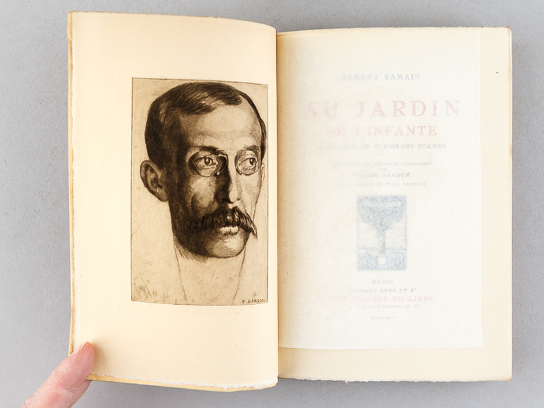
192156747Exemplaires sur papier de Rives numérotés, 21 vol. petit in-8 br. sous couv. rempliée, collection Les Maîtres du Livre, George Crès et Cie : Vies imaginaires, 1921 ; Le Roi au Masque d'Or, 1917 ; Le Chemin de Velours, 1923 ; L'Apprentie, 1920 ; Le Feu (2 Tomes - Complet), 1919 ; Au flanc du Vase, 1919 ; Au Jardin de l'Infante, 1924 ; Physiologie de l'Amour Moderne, 1917 ; Les autres vies et les autres mondes, 1924 ; Colette Baudoche, 1918 ; Le coeur solitaire, 1922 ; La porte étroite, 1920 ; Le Deuil des Primevères, 1920 ; Le Bon Plaisir, 1918 ; Les Jeux rustiques et divins, 1925 ; Le Sang des Races, 1921 ; Le Trésor des Humbles, 1921 ; Contes choisis, 1919 ; La Maison du Péché, 1913 ; Barnavaux, 1921
178119326London 1781. Engraved chart the town and border hand-coloured as issued. Minor repaired edge tears. Sheet Size: 22 5/8 x 32 1/2 inches. An important 18th century chart of Louisbourg harbour.<br/> <br/> Des Barres of Swiss-Huguenot extraction studied under the great mathematician Daniel Bernoulli at the University of Basel before continuing on to the Royal Military College at Woolwich. Upon the outbreak of hostilities with France in 1756 he joined the British Royal American Regiment as a military engineer. He came to the attention of General James Wolfe who appointed him to join his personal detail. During this period he also worked with the future legendary explorer James Cook on a monumental chart of the St. Lawrence River. From 1762 Des Barres was enlisted to survey the coastlines of Nova Scotia Newfoundland and the Gulf of St. Lawrence while his colleague Samuel Holland charted the New England coast. He also managed to gain access to some surveys of the American South Cuba and Jamaica. In 1774 Des Barres returned to England where he began work on The Neptune. His dedication to the project was so strong that often at his own expense he continually updated and added new charts and views up until 1784. That year he returned to Canada where he remained for a further forty years becoming a senior political figure and a wealthy land owner and living to the advanced age of 103. The Atlantic Neptune the most celebrated sea atlas contained the first systematic survey of the east coast of North America. Des Barres's synergy of great empirical accuracy with the peerless artistic virtue of his aquatint views created a work that "has been described as the most splendid collection of charts plates and views ever published" National Maritime Museum Catalogue. Upon the conclusion of the Seven Years War Britain's empire in North America was greatly expanded and this required the creation of a master atlas featuring new and accurate sea charts for use by the Royal Navy. Des Barres was charged with this Herculean task publishing the first volume in London in 1775 which was soon followed by three further volumes. Des Barres's monumental endeavor eventually featured over two-hundred charts and views many being found in several states. Des Barres's charts were immensely detailed featuring both hydrographical and topographical information and in many cases remained the most authoritative maps of the regions covered for several decades.<br/> <br/> Stevens 140. unknown
178019770London: J.F.W. Des Barres in the 'Atlantic Neptune' 1780. Engraved with aquatint period oxidized color. Good condition apart from expert restoration to center fold upper and lower margins. A very rare and highly important sea chart of Pensacola Harbor from the 'Atlantic Neptune' the finest marine atlas of North America's east coast produced during the Revolutionary War.<br/> <br/> This superbly drafted map features the magnificent natural harbor of Pensacola on the Florida panhandle. The town with its fort and carefully laid out streets is featured in the left-centre of the map. Another settlement "Campbell Town" is located further up the harbour toward where the entrance of the "Scambia" Escambia River. The borders of various land grants are demarcated and the countryside is elegantly detailed with aquatint features and coloured in a light brown-green wash. The chart precisely captures the features of the coast showing how the harbor is protected by two sandy bars of land the outer being Santa Rosa Island. The chart features a great deal of quantitative hydrographic information and instructions to mariners are written in the lower right of the map ensuring that it was by far the most accurate and comprehensive pilot for the harbor produced in the eighteenth-century. The present example is the first of two variants of this chart. It is important to note that the year this map was printed the region was caught up in the dramatic action of the Revolutionary War. The Spaniards who had just joined the war on the American side seized the British garrison at Fort Barrancas and West Florida remained in their possession for the duration of the war. Joseph Frederick Wallet Des Barres was born in Switzerland where his Huguenot ancestors had fled following the repeal of the Edict of Nantes. He studied under the great mathematician Daniel Bernoulli at the University of Basel before immigrating to Britain where he trained at the Royal Military College Woolwich. Upon the outbreak of hostilities with France in 1756 he joined the British Royal American Regiment as a military engineer. He came to the attention of General James Wolfe who appointed him to join his personal detail. During this period he also worked with the legendary future explorer James Cook on a monumental chart of the St. Lawrence River. Upon the conclusion of the Seven Years War Britain's empire in North America was greatly expanded and this required the creation of a master atlas featuring new and accurate sea charts for use by the Royal Navy. Des Barres was enlisted to survey the coastlines of Nova Scotia Newfoundland and the Gulf of St. Lawrence. With these extremely accurate surveys in hand Des Barres returned to London in 1774 where the Royal Navy charged him with the Herculean task of producing the atlas. Gradually he was forwarded the manuscripts of numerous advanced surveys conducted by British cartographers in the American Colonies Jamaica and Cuba. The result was The Atlantic Neptune which became the most celebrated sea atlas of its era containing the first systematic survey of the east coast of North America. Des Barres's synergy of great empirical accuracy with the peerless artistic virtue of his aquatint views created a work that "has been described as the most splendid collection of charts plates and views ever published" National Maritime Museum Catalogue. The Neptune eventually consisted of four volumes and Des Barres's dedication to the project was so strong that often at his own expense he continually updated and added new charts and views to various editions up until 1784 producing over 250 charts and views many appearing in several variations. All of these charts were immensely detailed featuring both hydrographical and topographical information such that in many cases they remained the most authoritative maps of the regions covered for several decades. Following the completion of the Neptune Des Barres returned to Canada where he remained for forty years becoming a senior political figure and a wealthy land owner living to the advanced age of 103.<br/> <br/> National Maritime Museum Henry Newton Stevens Collection HNS 173A & Catalogue III 144 p.384; Sellers & Van Ee Maps and Charts of North America and the West Indies 1663. J.F.W. Des Barres in the 'Atlantic Neptune' unknown
177920759London: Published by J. F. W. Des Barres in 'The Atlantic Neptune' 1779. Black and white copper engraving. Large repaired tear 12" from bottom edge parallel to centerfold. 4" repaired split from bottom in centerfold. Thin uneven margins. Plate size: 30 1/4 x 22 1/8 inches. This is a fantastic sea chart of the Delaware coast from the 'The Atlantic Neptune' which is universally recognized as one of the most magnificent atlases ever made.<br/> <br/>This superb sea chart constructed for the use of the British Navy shows the major part of the Delaware coast from Rehobeth to Bombay Hook as well as the opposing south New Jersey shore. 'The Atlantic Neptune' was the first great marine atlas and one of the great achievements of eighteenth century cartography. When publication in England began in 1774 it contained over 250 charts and views of the North American and Canadian coasts. The charts were intensely detailed and contained both hydrographical and topographical details. The Neptune was compiled and published for the Royal Navy by Joseph F. W. Des Barres a Swiss cartographer who joined the Royal American Regiment as a surveyor. Des Barres fought in the French and Indian wars and was enlisted to survey the Canadian coastline. While his fellow surveyor Samuel Holland charted the New England coast Des Barres mapped the shoreline of Nova Scotia Newfoundland and the St. Lawrence River regions. In 1774 Des Barres returned to England where he compiled and published his monumental atlas; his dedication to the project was so strong that he published an updated version of the work every year until 1784. Des Barres' work was so superior to any other contemporary atlas that the maps were used as the standard charts of the East coast for over 50 years. The Neptune remains one of the most important atlases ever printed its views and maps chart as aspect of the history of North America and now allow us to glimpse this land drastically changed by the passage of time.<br/> <br/>Snyder City of Independence p. 271; Stevens 158. Published by J. F. W. Des Barres in 'The Atlantic Neptune' unknown books
14035[London]: Publish'd ... by I. F. W. Des Barres [in 'The Atlantic Neptune', November 1st 1780. Etching, with engraving and roulette work, on three joined sheets. 33 1/4 x 64 1/4 inches overall. A large format sea chart: the greatest coastal map of Nova Scotia, originally issued in Des Barres' 'The Atlantic Neptune' ,exemplaire entoilé et roulé vus les dimensions 167 x 80 cm environ
178019770London: J.F.W. Des Barres in the 'Atlantic Neptune' 1780. Engraved with aquatint period oxidized color. Good condition apart from expert restoration to center fold upper and lower margins. A very rare and highly important sea chart of Pensacola Harbor from the 'Atlantic Neptune' the finest marine atlas of North America's east coast produced during the Revolutionary War.<br/> <br/>This superbly drafted map features the magnificent natural harbor of Pensacola on the Florida panhandle. The town with its fort and carefully laid out streets is featured in the left-centre of the map. Another settlement "Campbell Town" is located further up the harbour toward where the entrance of the "Scambia" Escambia River. The borders of various land grants are demarcated and the countryside is elegantly detailed with aquatint features and coloured in a light brown-green wash. The chart precisely captures the features of the coast showing how the harbor is protected by two sandy bars of land the outer being Santa Rosa Island. The chart features a great deal of quantitative hydrographic information and instructions to mariners are written in the lower right of the map ensuring that it was by far the most accurate and comprehensive pilot for the harbor produced in the eighteenth-century. The present example is the first of two variants of this chart. It is important to note that the year this map was printed the region was caught up in the dramatic action of the Revolutionary War. The Spaniards who had just joined the war on the American side seized the British garrison at Fort Barrancas and West Florida remained in their possession for the duration of the war. Joseph Frederick Wallet Des Barres was born in Switzerland where his Huguenot ancestors had fled following the repeal of the Edict of Nantes. He studied under the great mathematician Daniel Bernoulli at the University of Basel before immigrating to Britain where he trained at the Royal Military College Woolwich. Upon the outbreak of hostilities with France in 1756 he joined the British Royal American Regiment as a military engineer. He came to the attention of General James Wolfe who appointed him to join his personal detail. During this period he also worked with the legendary future explorer James Cook on a monumental chart of the St. Lawrence River. Upon the conclusion of the Seven Years War Britain's empire in North America was greatly expanded and this required the creation of a master atlas featuring new and accurate sea charts for use by the Royal Navy. Des Barres was enlisted to survey the coastlines of Nova Scotia Newfoundland and the Gulf of St. Lawrence. With these extremely accurate surveys in hand Des Barres returned to London in 1774 where the Royal Navy charged him with the Herculean task of producing the atlas. Gradually he was forwarded the manuscripts of numerous advanced surveys conducted by British cartographers in the American Colonies Jamaica and Cuba. The result was The Atlantic Neptune which became the most celebrated sea atlas of its era containing the first systematic survey of the east coast of North America. Des Barres's synergy of great empirical accuracy with the peerless artistic virtue of his aquatint views created a work that "has been described as the most splendid collection of charts plates and views ever published" National Maritime Museum Catalogue. The Neptune eventually consisted of four volumes and Des Barres's dedication to the project was so strong that often at his own expense he continually updated and added new charts and views to various editions up until 1784 producing over 250 charts and views many appearing in several variations. All of these charts were immensely detailed featuring both hydrographical and topographical information such that in many cases they remained the most authoritative maps of the regions covered for several decades. Following the completion of the Neptune Des Barres returned to Canada where he remained for forty years becoming a senior political figure and a wealthy land owner living to the advanced age of 103.<br/> <br/>National Maritime Museum Henry Newton Stevens Collection HNS 173A & Catalogue III 144 p.384; Sellers & Van Ee Maps and Charts of North America and the West Indies 1663. J.F.W. Des Barres in the 'Atlantic Neptune' unknown books
177517671London: Published by J.F.W. Des Barres in 'The Atlantic Neptune' 1775. Copper-engraved and etched map with aquatint on two joined sheets. Printed on laid paper with `J Bates' watermark and `JB' countermark in excellent condition. Sheet size: 30 1/4 x 42 5/8 inches. With: The explanatory text leaf titled as above. 1p. folio 25 1/2 x 19 inches. The finest and most celebrated sea chart of Boston Harbor ever produced and a highly important Revolutionary War map depicting details relating to the Siege of Boston: with the very rare explanatory text leaf.<br/> <br/>This is one the most important maps contained in Des Barres' The Atlantic Neptune and one of the most significant large-scale maps of the Revolutionary War. It provides an invaluable record of Boston at the beginning of the war covering the area from the environs of the city out into the open waters of Massachusetts Bay. A particularly striking feature is the use of boldly etched and subtly aquatinted details to capture the diverse topography of the region including the numerous hills islands and river estuaries. It is important to remember that this was issued as a working sea-chart and as such the cartographer has naturally concentrated on features such as depth soundings indicated by detailed lines and based on surveys by Samuel Holland and George Callendar and the navigable channels between the harbor's numerous shoals which are delicately outlined in stipple-engraving. Holland's original manuscript map is today preserved in the British Hydrographic Library at Taunton Somerset. The present map shows the city of Boston with its streets carefully outlined occupying a pear-shaped peninsula a position that would soon prove precarious to its British defenders in the escalating conflict. This is the second state of five of Des Barres' chart and is identical to the Henry Stevens Collection variant 96D in the National Maritime Museum Greenwich. This state shows a number of notable changes when compared with the original and was evidently altered to take particular account of the Siege of Boston April 19 1775 to March 17 1776. Henry Stevens noted that this state depicted the addition of "Numerous Forts Batteries Redoubts &c. which have been inserted in many places notably on the Charles Town peninsula and on the mainland between 'Willis Creek' and 'Mystic River' also on the east and north side of 'Charles River' below 'Cambridge'.also to the south of 'Boston Neck' and 'Dorchester Neck'.This state is almost as rare as the first state. It is found in some copies of the earliest edition of the Neptune." The accuracy scope and artistic virtue of Des Barres's Chart of the Harbour of Boston was apparent to his contemporaries and it became the main source map of the area for decades to come. Joseph Frederick Wallet Des Barres was born in Switzerland where his Huguenot ancestors had fled following the repeal of the Edict of Nantes. He studied under the great mathematician Daniel Bernoulli at the University of Basel before immigrating to Britain where he trained at the Royal Military College Woolwich. Upon the outbreak of hostilities with France in 1756 he joined the British Royal American Regiment as a military engineer. He came to the attention of General James Wolfe who appointed him to join his personal detail. During this period he also worked with the legendary future explorer James Cook on a monumental chart of the St. Lawrence River. Upon the conclusion of the Seven Years War Britain's empire in North America was greatly expanded and this required the creation of a master atlas featuring new and accurate sea charts for use by the Royal Navy. Des Barres was enlisted to survey the coastlines of Nova Scotia Newfoundland and the Gulf of St. Lawrence. With these extremely accurate surveys in hand Des Barres returned to London in 1774 where the Royal Navy charged him with the Herculean task of producing the atlas. He was gradually forwarded the manuscripts of numerous advanced surveys conducted by British cartographers in the American Colonies Jamaica and Cuba of which the present map is based on the work of Samuel Holland conducted in the 1760s. The result was The Atlantic Neptune which became the most celebrated sea atlas of its era containing the first systematic survey of the east coast of North America. Des Barres's synergy of great empirical accuracy with the peerless artistic virtue of his aquatint views created a work that "has been described as the most splendid collection of charts plates and views ever published" National Maritime Museum Catalogue. The Neptune eventually consisted of four volumes and Des Barres's dedication to the project was so strong that often at his own expense he continually updated and added new charts and views to various editions up until 1784 producing over 250 charts and views many appearing in several variations. All of these charts were immensely detailed featuring both hydrographical and topographical information such that in many cases they remained the most authoritative maps of the regions covered for several decades. Following the completion of The Neptune Des Barres returned to Canada where he remained for a further forty years becoming a senior political figure and a wealthy land owner living to the advanced age of 103.<br/> <br/>Cf. GuthornBritish Maps of the American Revolution referring to Holland's original manuscript 59/3; Krieger & Cobb p.107 1781 issue; Lingel Atlantic Neptune N91.2; National Maritime Museum Henry Stevens Collection K0713 HNS 96D; National Maritime Museum Catalogue 78-83; Nebenzahl Bibliography 3; Stevens Bibliography of the Atlantic Neptune unpublished pp.211-216; Sellers & Van Ee 945. Published by J.F.W. Des Barres in 'The Atlantic Neptune' unknown books