Jaillot, Alexis-Hubert & Sanson, NBiblio.com
3 880 résultats
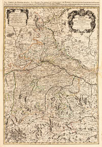
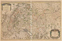
167533301Paris: Hubert Jaillot 1675. Blatt gebräunt Mittelfalz mit nicht säurebeständigem Tape hinterlegt heller Streifen. . 803 by 560mm 31 by 22 inches. Hand-Colored Original Copperplate Engraving by Alexis-Hubert Jaillot & N. Sanson depicting Le Cercle de Souabe subdivisé en tous les Estats qui le Composent Tire ´sur les Memoires les plus noueaux Par le S. Sanson Geographe Ordinaire du Roy. A Paris Ches H. Laillot joingnant les Augustins aux deux Globes Auec Priuilege du Roy pour Vingt Ans. Published Paris Hubert Jaillot 1675. Sheet: 803 by 560mm 31 by 22 inches. A fine and original hand-colored example of Jaillot's celebrated cartographic work documenting this region of Germany with the precision and decorative artistry characteristic of the 16700s. Alexis-Hubert Jaillot c.1632-1712 was one of the foremost French cartographers of the late 17th and early 18th centuries. Working in Paris he produced magnificent large-format maps of European territories often in collaboration with Nicolas Sanson -- considered the father of French cartography. Jaillot's maps are known for their striking decorative cartouches generous size and fine hand coloring representing the pinnacle of French Baroque cartography.This original copperplate engraving with original hand coloring depicts the region of Le Cercle de Souabe subdivisé en tous les Estats qui le Composent Tire ´sur les Memoires les plus noueaux Par le S. Sanson Geographe Ordinaire du Roy. A Paris Ches H. Laillot joingnant les Augustins aux deux Globes Auec Priuilege du Roy pour Vingt Ans. published in Paris Hubert Jaillot 1675. The map records the political and geographic boundaries of the region as understood in 1675 offering a fascinating window into the history of German territorial organization. Sheet measures 803 by 560mm 31 by 22 inches. In good condition overall with minor signs of age appropriate for a 17th-century engraving. Ready to frame. Hubert Jaillot unknown
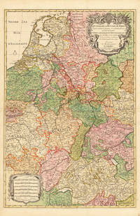
169233626Paris 1692. Schönes tadelloses Exemplar. . 803 by 560mm 31 by 22 inches. Hand-Colored Original Copperplate Engraving by Alexis-Hubert Jaillot & N. Sanson depicting Le Cours de la Riviere du Rhein depuis sa Source jusques a son Emboucheure ou sont distingues Tout les Estats et Souverainetes qui sont dessus et aux enuirons. Tire de tous les Memoires les plus Nouveaux Parle Sr. Sanson Geopgraphe Ordinaire du Roy. Published Paris 1692. Sheet: 803 by 560mm 31 by 22 inches. A fine and original hand-colored example of Jaillot's celebrated cartographic work documenting this region of Germany with the precision and decorative artistry characteristic of the 16900s. Alexis-Hubert Jaillot c.1632-1712 was one of the foremost French cartographers of the late 17th and early 18th centuries. Working in Paris he produced magnificent large-format maps of European territories often in collaboration with Nicolas Sanson -- considered the father of French cartography. Jaillot's maps are known for their striking decorative cartouches generous size and fine hand coloring representing the pinnacle of French Baroque cartography.This original copperplate engraving with original hand coloring depicts the region of Le Cours de la Riviere du Rhein depuis sa Source jusques a son Emboucheure ou sont distingues Tout les Estats et Souverainetes qui sont dessus et aux enuirons. Tire de tous les Memoires les plus Nouveaux Parle Sr. Sanson Geopgraphe Ordinaire du Roy published in Paris 1692. The map records the political and geographic boundaries of the region as understood in 1692 offering a fascinating window into the history of German territorial organization. Sheet measures 803 by 560mm 31 by 22 inches. In good condition overall with minor signs of age appropriate for a 17th-century engraving. Ready to frame. unknown
169228137Paris 1692. Other. Schönes tadelloses Exemplar. . 803 by 560mm 31 by 22 inches. Hand-Colored Original Copperplate Engraving by Alexis-Hubert Jaillot & N. Sanson depicting Le Cours de la Riviere du Rhein depuis sa Source jusques a son Emboucheure ou sont distingues Tout les Estats et Souverainetes qui sont dessus et aux enuirons. Tire de tous les Memoires les plus Nouveaux Parle Sr. Sanson Geopgraphe Ordinaire du Roy. Published Paris 1692. Sheet: 803 by 560mm 31 by 22 inches. A fine and original hand-colored example of Jaillot's celebrated cartographic work documenting this region of Germany with the precision and decorative artistry characteristic of the 16900s. Alexis-Hubert Jaillot c.1632-1712 was one of the foremost French cartographers of the late 17th and early 18th centuries. Working in Paris he produced magnificent large-format maps of European territories often in collaboration with Nicolas Sanson -- considered the father of French cartography. Jaillot's maps are known for their striking decorative cartouches generous size and fine hand coloring representing the pinnacle of French Baroque cartography.This original copperplate engraving with original hand coloring depicts the region of Le Cours de la Riviere du Rhein depuis sa Source jusques a son Emboucheure ou sont distingues Tout les Estats et Souverainetes qui sont dessus et aux enuirons. Tire de tous les Memoires les plus Nouveaux Parle Sr. Sanson Geopgraphe Ordinaire du Roy published in Paris 1692. The map records the political and geographic boundaries of the region as understood in 1692 offering a fascinating window into the history of German territorial organization. Sheet measures 803 by 560mm 31 by 22 inches. In good condition consistent with its age of over 330 years. Ready to frame. unknown
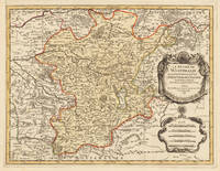
169633637Paris 1696. Schönes tadelloses Exemplar. . 803 by 560mm 31 by 22 inches. Hand-Colored Original Copperplate Engraving by Alexis-Hubert Jaillot & N. Sanson depicting Le Duché De Westphalie ainsi qu`il est presentement possedé par L`Eslecteur De Cologne. Tiré des Memoires les pl. recents Par le Sr. Sanson Geographe Ordinaire du Roy A Paris. Published Paris 1696. Sheet: 803 by 560mm 31 by 22 inches. A fine and original hand-colored example of Jaillot's celebrated cartographic work documenting this region of Germany with the precision and decorative artistry characteristic of the 16900s. Alexis-Hubert Jaillot c.1632-1712 was one of the foremost French cartographers of the late 17th and early 18th centuries. Working in Paris he produced magnificent large-format maps of European territories often in collaboration with Nicolas Sanson -- considered the father of French cartography. Jaillot's maps are known for their striking decorative cartouches generous size and fine hand coloring representing the pinnacle of French Baroque cartography.This original copperplate engraving with original hand coloring depicts the region of Le Duché De Westphalie ainsi qu`il est presentement possedé par L`Eslecteur De Cologne. Tiré des Memoires les pl. recents Par le Sr. Sanson Geographe Ordinaire du Roy A Paris. published in Paris 1696. The map records the political and geographic boundaries of the region as understood in 1696 offering a fascinating window into the history of German territorial organization. Sheet measures 803 by 560mm 31 by 22 inches. In good condition consistent with its age of over 320 years. Ready to frame. unknown
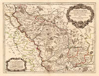
170024651Paris: H. Jaillot. 1700. Other. In excellent condition. 428 by 570mm 16 by 22 inches. 428 by 570mm 16 by 22 inches. Hand-Colored Original Copperplate Engraving by Alexis-Hubert Jaillot & N. Sanson depicting Le Duché de Berg le Comté de Homberg les Seigneuries de Hardenberg et de Wildenborg. Dressé surles Memoires les plus recents. Parle Sr. Sanson Geographe ordinaire du Roy. A Paris. Chez H. Iaillot joignant les grands Augustins aux deux Globes Aure Privilege du Roy. 1700. Published Paris H. Jaillot. 1700. Sheet: 428 by 570mm 16 by 22 inches. A fine and original hand-colored example of Jaillot's celebrated cartographic work documenting this region of Germany with the precision and decorative artistry characteristic of the 17000s. Alexis-Hubert Jaillot c.1632-1712 was one of the foremost French cartographers of the late 17th and early 18th centuries. Working in Paris he produced magnificent large-format maps of European territories often in collaboration with Nicolas Sanson -- considered the father of French cartography. Jaillot's maps are known for their striking decorative cartouches generous size and fine hand coloring representing the pinnacle of French Baroque cartography.This original copperplate engraving with original hand coloring depicts the region of Le Duché de Berg le Comté de Homberg les Seigneuries de Hardenberg et de Wildenborg. Dressé surles Memoires les plus recents. Parle Sr. Sanson Geographe ordinaire du Roy. A Paris. Chez H. Iaillot joignant les grands Augustins aux deux Globes Aure Privilege du Roy. 1700. published in Paris H. Jaillot. 1700. The map records the political and geographic boundaries of the region as understood in 1700 offering a fascinating window into the history of German territorial organization. Sheet measures 428 by 570mm 16 by 22 inches. In good condition overall with minor signs of age appropriate for a 18th-century engraving. Ready to frame. H. Jaillot. unknown
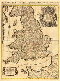
169317484Paris: H. Jaillot 1693. Other. In very good condition. 757 by 582mm 29¾ by 23 inches. 757 by 582mm 29¾ by 23 inches. Copper-engraving handcolored in outline when published. Minor offsetting of the old outline colors to the paper. Printed around 1693 by Hubert Jaillot in Paris printed from two plates and published in his great atlas the Atlas Noveau.. Large and decorative map of England by the French cartographer Nicolaus Sanson and Hubert Jaillot. Published in the 'Atlas Noveau.' this atlas was a masterpiece in the French cartography in the 17th century. The atlas was specially designed for Louis XIV and due of the very large size of the plates most maps were printed from two plates it took Hubert Jaillot over 12 years to complete the 'Atlas Noveau.'. England is very detailled shown on the map as well the various counties are shown in engraved territory borders. The maps are rich in detail with many cities and place names rivers mountains castles etc. The map is ornated with a very large fine allegoric title cartouche with coat of arms in the upper right corner as well a decorative cartouche with a milage scale in the lower left corner. H. Jaillot unknown
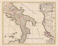
169617229Paris: Hubert Jaillot 1696. Other. In excellent condition. 445 by 550mm 17 by 21 inches. 445 by 550mm 17 by 21 inches. Original antique hand-colored copper engraving from the 'Atlas Nouveau' published in Paris 1696. Depicting Kingdom of Naples this map is a fine example of 1690s European cartography. Image: 445 by 550mm 17 by 21 inches. An attractive and historically significant 17th-century map for the discerning collector. Alexis-Hubert Jaillot c. 16321712 was a French sculptor turned cartographer who became one of the most important map publishers of late 17th-century France. After marrying into the family of mapmaker Nicolas Berey he negotiated access to the plates of the great French cartographer Nicolas Sanson 16001667 and used them to publish his monumental 'Atlas Nouveau' from the 1690s onward. Appointed 'Géographe du Roi' Royal Geographer to Louis XIV in 1686 Jaillot produced large-format maps celebrated for their elaborate allegorical cartouches and decorative ambition. His maps of Italy were among the finest large-format representations of the peninsula produced in the 17th century frequently bearing dedications to members of the French royal family.Large and decorative map of England by the French cartographer Nicolaus Sanson and Hubert Jaillot. Published in the 'Atlas Noveau.' this atlas was a masterpiece in the French cartography in the 17th century. The atlas was specially designed for Louis XIV and due of the very large size of the plates most maps were printed from two plates it took Hubert Jaillot over 12 years to complete the 'Atlas Noveau.'. The kingdom of Naples is very detailled shown on the map as well the various principalities are shown in engraved territory borders. The map is rich in detail with many cities and place names rivers mountains castles etc. The map is ornated with a large fine allegoric title cartouche with coat of arms in the upper right corner as well a decorative cartouche with a milage scale.A fine example from Atlas Nouveau Paris sought after by collectors of antique maps of Italy antique maps of Kingdom of Naples and antique hand-colored copper engravings for sale. In good condition consistent with age. The map is ornated with a large fine allegoric title cartouche with coat of arms in the upper right corner as well a decorative cartouche with a milage scale. Hubert Jaillot unknown
169616269Paris: Alexis Hubert Jaillot 1696. Copper-engraved map with full original colour and gold embellishment in excellent condition. A stunning map of Normandy by Alexis Jaillot an exceptional example with gilt embellishments.<br/> <br/> One of the most important figures in French cartography Nicolas Sanson initiated the great school of French geographers. Born in Abbeville in 1600 Sanson established his first printing house in Paris in 1638. He soon became geographer to the king establishing himself as one of the most influential cartographers on the Continent. He was succeeded by his sons Adrien and Guillaume and by his son-in-law Pierre Duval who continued to publish a wealth of maps using Sanson's name. At the close of the seventeenth century Sanson's plates were purchased by the influential cartographer Alexis Hubert Jaillot who continued to publish his maps and atlases under Sanson's title. This stunning map of Normandy is based on Sanson's map published in 1650 but was redrawn and enlarged by Jaillot. It shows the provinces of Normandy as well as the northern tip of Brittany and part of the English Channel. Both Jersey and Guernsey are included as is Mont St. Michel off the coast of St. Malo. In keeping with all of Sanson's and Jaillot's superb maps forests rivers and towns are meticulously identified and named. The map includes an ornate cartouche in the upper section as well as a scale and key.<br/> <br/> Tooley Maps & Map-Makers pp. 40-41. Alexis Hubert Jaillot unknown
169233439Paris: H. Jaillot 1692. In ausgezeichnetem Zustand. . 570 by 850mm 22 by 33 inches. Hand-Colored Original Copperplate Engraving by Charles Hubert Alexis Jaillot & Nicolaus Sanson depicting Le Cercle de Franconie subdivise entous les Estats qui le composent. Dressè sur les Memotres les plus Nouveaux Parle Sr. Sanson Geographe Ordinaire du Roy. A Paris Chez H. Iaillot joignant les grands Augustins aux dewe Globes. Avec Privilege du Roypour Vingt Ans. 1692. Published Paris H. Jaillot 1692. Sheet: 570 by 850mm 22 by 33 inches. A fine and original hand-colored example of Jaillot's celebrated cartographic work documenting this region of Germany with the precision and decorative artistry characteristic of the 16900s. Alexis-Hubert Jaillot c.1632-1712 was one of the foremost French cartographers of the late 17th and early 18th centuries. Working in Paris he produced magnificent large-format maps of European territories often in collaboration with Nicolas Sanson -- considered the father of French cartography. Jaillot's maps are known for their striking decorative cartouches generous size and fine hand coloring representing the pinnacle of French Baroque cartography.This original copperplate engraving with original hand coloring depicts the region of Le Cercle de Franconie subdivise entous les Estats qui le composent. Dressè sur les Memotres les plus Nouveaux Parle Sr. Sanson Geographe Ordinaire du Roy. A Paris Chez H. Iaillot joignant les grands Augustins aux dewe Globes. Avec Privilege du Roypour Vingt Ans. 1692. published in Paris H. Jaillot 1692. The map features a decorative Baroque cartouche containing the title inscription. A distance scale is incorporated within the cartouche or alongside it. The map records the political and geographic boundaries of the region as understood in 1692 offering a fascinating window into the history of German territorial organization. Sheet measures 570 by 850mm 22 by 33 inches. In good condition overall with minor signs of age appropriate for a 17th-century engraving. Ready to frame. H. Jaillot unknown
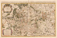
49665Paris: 1690. 54 x 87.5 cm. Double page copper engraved map of Lorraine. Original outline colour. Large decorative cartouche to upper right corner. Horizontal crease parallel and adjacent to centrefold otherwise good. [Paris:] 1690 unknown
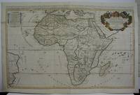
1719M5162Paris 1719. Excellent. Size : 580x890 mm 22.875x35 Inches Coloring: Original Outline Coloring Category: ; Maps Africa Continent unknown
1674ag662Jaillot H. Carte 1674 Carte de 43 x 57 cm en une partie : frontières colorées ; petites déchirures marginales sans gravité, bon exemplaire. Livraison a domicile (La Poste) ou en Mondial Relay sur simple demande.
1675bb3400Jaillot H. Carte 1675 Carte de 41 x 56 cm en une partie : frontières colorées ; petits défauts, très bon exemplaire. Livraison a domicile (La Poste) ou en Mondial Relay sur simple demande.
1675ag657Jaillot H. Carte 1675 Carte de 41 x 56 cm en une partie : frontières colorées ; petits défauts, très bon exemplaire. Livraison a domicile (La Poste) ou en Mondial Relay sur simple demande.
1695bb3406Jaillot H. Carte 1695 Carte de 43 x 57 cm en une partie : frontières colorées ; petites déchirures marginales sans gravité, bon exemplaire. Livraison a domicile (La Poste) ou en Mondial Relay sur simple demande.
1695ag659Jaillot H. Carte 1695 Carte de 43 x 57 cm en une partie : frontières colorées ; petites déchirures marginales sans gravité, bon exemplaire. Livraison a domicile (La Poste) ou en Mondial Relay sur simple demande.
1676bb3407Jaillot H. Carte 1676 Cartes en deux parties, 53 par 90 cm ; frontières surlignées en couleur, très bel exemplaire. Livraison a domicile (La Poste) ou en Mondial Relay sur simple demande.
1676ag661Jaillot H. Carte 1676 Cartes en deux parties, 53 par 90 cm ; frontières surlignées en couleur, petites déchirures marginales, bel exemplaire. Livraison a domicile (La Poste) ou en Mondial Relay sur simple demande.
1674ag658Jaillot H. Carte 1674 Cartes en une partie, 42 par 56 cm ; frontières surlignées en couleur, mouillures marginales, n'atteignant pas la carte, bel exemplaire. Livraison a domicile (La Poste) ou en Mondial Relay sur simple demande.
1674bb3404Jaillot H. Carte 1674 Carte de 43 x 57 cm en une partie : frontières colorées ; mouillure marginale sans gravité, bon exemplaire. Livraison a domicile (La Poste) ou en Mondial Relay sur simple demande.
1674ag660Jaillot H. Carte 1674 Carte de 43 x 57 cm en une partie : frontières colorées ; mouillure marginale sans gravité, bon exemplaire. Livraison a domicile (La Poste) ou en Mondial Relay sur simple demande.
1674bb3401Jaillot H. Carte 1674 Carte de 42 x 55 cm en une partie : frontières colorées ; très bon exemplaire. Livraison a domicile (La Poste) ou en Mondial Relay sur simple demande.
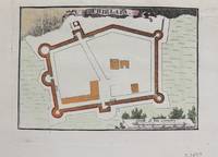
1690M9479Paris c.1690. Very Good. Notes: Map of Chielafa Greece during the late 17th century. Size : 105x152 mm 4.13x5.98 Inches Coloring: Hand Colored Category: Maps Europe Greece Macedonia; unknown
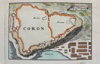
1690M9480Paris c.1690. Very Good. Notes: Map of Coron Greece during the late 17th century. Size : 103x153 mm 4.06x6.02 Inches Coloring: Hand Colored Category: Maps Europe Greece Macedonia; unknown
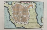
1690M9473Paris c.1690. Very Good. Notes: A charming map of Fort D'Asso Greece during the late 17th century. Size : 104x153 mm 4.09x6.02 Inches Coloring: Hand Colored Category: Maps Europe Greece Macedonia; unknown