DesnosBiblio.com

587 résultats
1984258724Presses du monteil 1984. Etat Correct bords frottés couverture jaunie livres percé de 4 trous à chaque coins intérieur frais. in8. 1984. Broché. traduction de Erna Liebscher Presses du monteil unknown
1789138456Paris: Desnos 1789. hardcover. very good. Miniature atlas. 32 double-page hand-colored maps throughout engraved title 2pp. catalogue of contents and 1789 calendar at end of book 24mo full contemporary red levant gilt-decorated spine with black leather label; corners lightly bumped some light foxing in margins. Paris: Desnos 1789. Very good .<br/><br/> Desnos unknown books
1767297404Paris: Louis Charles Desnos 1767. unbound. Engraving with original hand color. Image measures 8 3/4" x 11 1/4"<br/><br/> Interesting and highly detailed map of Paris with prominent buildings roads and gardens labeled. Published by Louis Charles Desnos after a 1748 map by Jean-Baptiste Crepy. This later printing includes an inset at lower left corner showing the 'Gouvernement de Paris' or the broader metropolitan area surrounding the city attribued to Brion engineer geographer of Roy 1765. Some staining. <br><br>Louis Charles Desnos 1725 - 1805 was a cartographer and globe maker from Paris France. He was the Royal Globe Maker for the King of Denmark Christian VII and published a large number of maps during his time.<br/><br/> Louis Charles Desnos unknown books
1761269935Paris: Louis Charles Desnos 1761. unbound. Copper plate engraving with original hand color. Image measure 15" x 21.5".<br/><br/> This impressive chart by Desnos and Brion de la Tour depicts the astronomical model developed by Nicolaus Copernicus. The Copernican Heliocentrism shows a stationary Sun at the center of the Universe with all the planets rotating around it. The Copernicus model is believed to have given birth to modern astronomy as it departed from the prevailing Ptolemaic system which for centuries placed the Earth at the center. The whole is surrounded by text with remarks and descriptions of the map and enclosed in a decorative border which was only added to the deluxe editions of his atlas.<br><br>The map is in good condition with minor wear and creasing along the centerfold. Centerfold split at bottom not affecting printed image. Original plate mark is visible. <br><br>Louis Charles Desnos 1725 - 1805 was a cartographer and globe maker from Paris France. He was the Royal Globe Maker for the Kind of Denmark Christian VII and published a large number of maps during his time. Louis Brion de la Tour 1756-1823 is best known for his 'Atlas General' published in collaboration with Louis Charles Desnos. He held the title of Royal Cartographer to the King of France. This is an uncommon example of their collaborative work.<br/><br/> Louis Charles Desnos unknown books
1761273345Paris: Louis Charles Desnos 1761. unbound. Copper plate engraving with original hand color. Image measure 14.25" x 20.75".<br/><br/> This lovely 1761 map by Claude Buy de Mornas depicts the Nile Delta in northern Egypt. The map presents the science arts and monuments of Egypt and as such does not identify cities towns or other locations. Includes illustrations of pyramids pharaohs and a labyrinth. The city of Memphis is labeled and mountains are rendered in profile. Along the left and right is French text and the whole is surrounded by a beautiful floral border.<br><br>The notable feature of this map is the mapping of the large Lake Moeris. Today a small lake named 'Birket Qarun' near modern day Hawara appears at the location of Lake Moeris. Nearby is the legendry 'Labyrinth'. The lost Labyrinth appears in many classical texts including those of Herodatus Strabo Diodorus and Pliny. Described to be megalithic complex designed by Imandes for the Pharaoh Amenemhet III the Labyrinth is believed to have contained thousands of rooms filled with hieroglyphs and ancient Egyptian sculptures. Herodotus wrote about it in the fifth century B.C.: <br><br>" Furthermore they resolved to leave a memorial of themselves in common and in pursuance of this resolve they made a labyrinth a little above Lake Moeris and situated near what is called the City of the Crocodiles. I saw it myself and it is indeed a wonder past words; for if one were to collect together all of the buildings of the Greeks and their most striking works of architecture they would all clearly be shown to have cost less labor and money than this labyrinth. Yet the temple at Ephesus and that in Samos are surely remarkable. The pyramids too were greater than words can tell and each of them is the equivalent of many of the great works of the Greeks; but the labyrinth surpasses the pyramids also. It has 12 roofed courts with doors facing one another 6 to the north and 6 to the south and in a continuous line. There are double sets of chambers in it some underground and some above and their number is 3000; there are 1500 of each. We ourselves saw the aboveground chambers for we went through them so we can talk of them but the underground chambers we can speak of only from hearsay. For the officials of the Egyptians entirely refused to show us these saying that there were in them the coffins of the kings who had built the labyrinth at the beginning and also those of the holy crocodiles. So we speak from hearsay of these underground places; but what we saw aboveground was certainly greater than all human works. The passages through the rooms and the winding goings-in and out through the courts in their extreme complication caused us countless marvelings as we went through from the court into the rooms and from the rooms into the pillared corridors and then from these corridors into other rooms again and from the rooms into other courts afterwards. The roof of the whole is stone as the walls are and the walls are full of engraved figures and each court is set round with pillars of white stone very exactly fitted. At the corner where the labyrinth ends there is nearby a pyramid 240 feet high and engraved with great animals. The road to this is made underground.<br><br> Such was the labyrinth; but an even greater marvel is what is called Lake Moeris beside which the labyrinth was built. The circuit of this lake is a distance of about 420 miles which is equal to the whole seaboard of Egypt. The length of the lake is north and south and its depth at the deepest is 50 fathoms 300 feet. That it is handmade and dug it itself is the best evidence. For in about the middle of the lake stand 2 pyramids that top the water each one by 50 fathoms 300 feet and each built as much again underwater; and on top of each there is a huge stone figure of a man sitting on a throne. So these pyramids are 100 fathoms 600 feet high and these 100 fathoms are the equivalent of a 600-foot furlong the fathom measuring 6 feet or four cubits the cubit being six spans. The water in the lake is not fed with natural springs for the country here is terribly waterless but it enters the lake from the Nile by a channel; and for 6 months it flows into the lake and then another 6 it flows again into the Nile. During the 6 months that it flows out it brings into the royal treasury each day a silver talent for the fish from it; and when the water flows in it brings 20 minas a day."<BR><BR>Despite many archelogical surveys being conducted at site no evidence of the Labyrinth has been confirmed till today. The French text along the sides also includes a brief description of the Labyrinth. <br><br>The map appears in the 1761 edition of "Atlas Methodique et Elementaire de Geographie et d'Histoire" published by Louis Charles Desnos. The map is in good condition with minor wear along the original centerfold and minor spotting. Some edge wear. Stain in lower margin not affecting printed image. Original plate mark is visible. <br><br>Louis Charles Desnos 1725 - 1805 was a cartographer and globe maker from Paris France. He was the Royal Globe Maker for the King of Denmark Christian VII and published a large number of maps during his time.<br/><br/> Louis Charles Desnos unknown books
1766101196Engraved map slight outline coloring decorative rococo boarder with landscape style cartouche 12" x 10.7". Decent margins but bottom margin a little narrow minor aging light pencil notation in right margin; overall in excellent condition with a very strong impression. While the interior of the map doesn't show a substantial amount of geographical detail this appears typical of the period. There are some large rivers and lakes that are identified. The Nile appears to rise from two small lakes in the Mts de la Lune above the Equator. In the south there aren't a lot of places named but there are still some tribal names present. books
1994131025Iowa City IA: Windhover Press The University of Iowa 1994. quarter cloth decorated paper-covered boards paper spine label top edge cut other edges uncut. Windhover Press. 8vo. quarter cloth decorated paper-covered boards paper spine label top edge cut other edges uncut. unpaginated. Text in English and French. Limited to 165 copies. Table of contents errata. Twenty five poems translated from the French by William Kulik. Windhover Press, The University of Iowa unknown books
195270973Paris:: Editions Cercle des Arts. Very Good. 1952. Paperback. Text is in French. Limited edition: this copy is number 492 of 1310 copies paperback. Very good in printed wraps.; 113 pages . Editions Cercle des Arts, paperback books
199176895NY:: Ecco Press. Near Fine in Near Fine dust jacket. 1991. Hardcover. 0880012617 . Translated from the French by Carolyn Forche and William Kulik. Edited with an introduction by William Kulik. Stated first edition. Near fine in a near fine dust jacket. . Ecco Press, hardcover books
1972UDESVOI00EMGrossman Publishers 1972. Very Good. Desnos Robert. The Voice : Selected Poems. New York: Grossman Publishers 1972. 1st edition. 80pp. Illustrated. 8vo. Yellow wraps. Book condition: Very good. Light rubbing to wraps corner of free front endsheet clipped. Grossman Publishers paperback books
19729009796New York: Grossman Publisher's 1972. 1st. Paperback. Fine Condition. Bound in publisher's original stiff yellow wrappers. <br/><br/> Grossman Publisher's paperback books
1995175094Ellsworth ME: Backwoods Broadsides 1995. First edition. Single sheet folded three times. Printed in an edition of 750 copies. Number 7 in this series. A fine copy. Uncommon as it wasn't well distributed. Backwoods Broadsides unknown books
197188350Santa Cruz:: Kayak Books. Very Good. 1971. Paperback. 0877110468 . Translated from the French and with an introduction by Michael Benedikt. Illustrated with color prints by Jacqueline Airame. First edition thus paperback - 1200 copies. Very good in illustrated wraps. . Kayak Books, paperback books
197280746NY:: Grossman Publishers. Near Fine. 1972. Paperback. 0670747491 . Illustrated by the author. Translated from the French by William Kulik with Carole Frankel. First edition thus paperback. Near fine in illustrated wraps. . Grossman Publishers, paperback books
197269974NY: Grossman/Mushinsha 1972. First US edition. xii 80 pp. Fine in very near fine dust jacket. Translations by William Kulik with Carole Frankel with Kulik’s introduction. Forty-three poems with Desnos’ illustrations. NY: Grossman/Mushinsha unknown books
197127779Santa Cruz: Kayak. 1971. First Edition; First Printing. Softcover. Wraps a fine copy of this collection of poems by a major participant in the early Surrealist group in Paris. 1200 copies were printed.; 8vo 8" - 9" tall; 39 pp . Kayak paperback books
176667669Paris: c.1766. A fine and handsome map of the British Isles with an inset of Orkneys and Shetland islands and a very ornate title cartouche. The map is flanked by informative text in French pertaining to the British Isles.The map is surrounded with a very pleasing "framed" effect border decoration. Published in the "Atlas Generale Civil et Ecclesiastique". Size: 390 x 575 mm. Copperplate engraving with later hand colour. Good condition. unknown
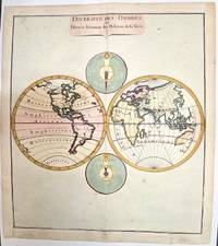
1780M1807Paris 1780. Very Good both right and left margins are extended. Notes: Louis Charles Desnos 1725-1805 was a French geographer of the 18th century. A Parisian map seller bookseller; and globe maker. He made globes for the King of Denmark Christian VII. Size : 262x305 mm 10.31x12.01 Inches Coloring: Hand Colored Category: Maps World unknown
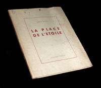
1945225011945. Rodez Collection Humour 1945. Un vol. au format pt in-4 242 x 192 mm de 91 pp. brochÂŽ sous couverture ˆ rabats rempliÂŽs. Edition originale pour laquelle il n'est pas fait mention d'un tirage en grands papiers. ''MÂŽconnue rarement jouÂŽe "La Place de l'ƒtoile" fut ÂŽcrite ˆ la fin des annÂŽes 1920 par Robert Desnos l'un de nos plus grands poÂtes surrÂŽalistes. Ce chef-d'Ãuvre de dr™lerie insolite se compose de neuf scÂnes o se croisent d'improbables personnages ˆ la fois proches et fuyants en une balade ÂŽtoilÂŽe aux multiples branches.'' Plats prÂŽsentant de discrÂtes rousseurs ainsi qu'un ÂŽclat lÂŽgÂrement altÂŽrÂŽ. Papier lÂŽgÂrement jauni. TrÂs rares rousseurs dans le texte. Nonobstant belle condition. b42961 unknown
1994021440Atlas 1994 168 pp. 4 surrealist novels. Covers have some light shelf wear. Atlas paperback
176620022Paris 1766. No Binding. Fine. Folio - over 12 - 15" tall. Artist: Desnos Louis Charles - 1805 Paris; issued in: Paris; dated: 1766 27x16 inches or 56x40cm plus matting and frame. <br/> <br/> unknown
19261689151926. MASSON André. C'est les bottes de 7 lieues Cette phrase "Je me vois". By Robert Desnos. 13 ff. Illustrated with 4 etchings by Masson. Folio bound in publisher's wrappers in a new cloth folding box. Paris: Galerie Simon Henri Kahnweiler 1926. A fine copy of the most beautiful of the books Kahnweiler published with Masson's illustrations and the first book by Robert Desnos with illustrations. One of 90 copies on Arches signed by Masson and Desnos from a total edition of 100. Cramer André Masson The Illustrated Books No. 3. hardcover books
2011758106.Gpaperback. Good. Access codes and supplements are not guaranteed with used items. May be an ex-library book. paperback
2329388659.Gpaperback. Good. Access codes and supplements are not guaranteed with used items. May be an ex-library book. paperback
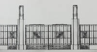
193039432Paris: Editions Charles Moreau 1930. First edition. Hardcover. g- to vg. Folio 17 2/8 x 12 6/8". 4pp Title and list of contents 36 loose leaves Plates as issued. Original quarter black cloth over illustrated paper covered boards. String ties. Illustrated title. This remarkable work is a pictorial survey of French Art Deco locksmith and ironworks in the late 1920s and early 1930s. The 36 striking photographic plates reproduced in heliotype depict numerous realized projects and projects of hand railings ironwork stairs gates doors and doorways executed by some of the most famous architects and craftsmen of the period such as: Raymond Subes Lucien Bechmann Henri Pacon Léon Gaudibert P. Jumelle R. Genuys Louis-Hippolyte Boileau Germain Debré Jean Dunand J. Rey Joseph Marrast Jean Walter Jean Prouvé Le Corbusier P. Jeanneret Dominique Chollet et Mathon Nics Frères Robert Mallet-Stevens Walter Gropius Henri Martin Michel Roux-Spitz G. Perzel Szetlak Pierre Patout Joseph Bassompierre Sirvin et de Rutte Joseph-Charles de Montarnal Bezault Frères Freynet et Deperthes P. et G. Bloch L. Praeger Molinie et Nicod Gilbert Poillerat Albert Laprade G. Vaudoyer Schenck E. Arrighi Henri Palausi Auguste Bluysen J. Lacoste Edgar Brandt Louis Plousey and Urbain Cassan. Moderate rubbing and age-toning along edges of portfolio. Head of spine slightly frayed. Lower margin of front cover and lower fore-edge of back board slightly water-stained. Water-staining to lower margin of text pages not affecting text slightly affecting the tip of the lower margin of plates throughout not affecting images. Text and captions in French. Portfolio in overall good- interior in good plates in good to very good images in very good condition. Editions Charles Moreau hardcover