CLAUDEL (Paul). PREVERT (Jacques). RIBEMONT-DESSAIGNES (Georges). DESNOS (Robert). KASSNER (Rudolf).Livre Rare Book
587 résultats
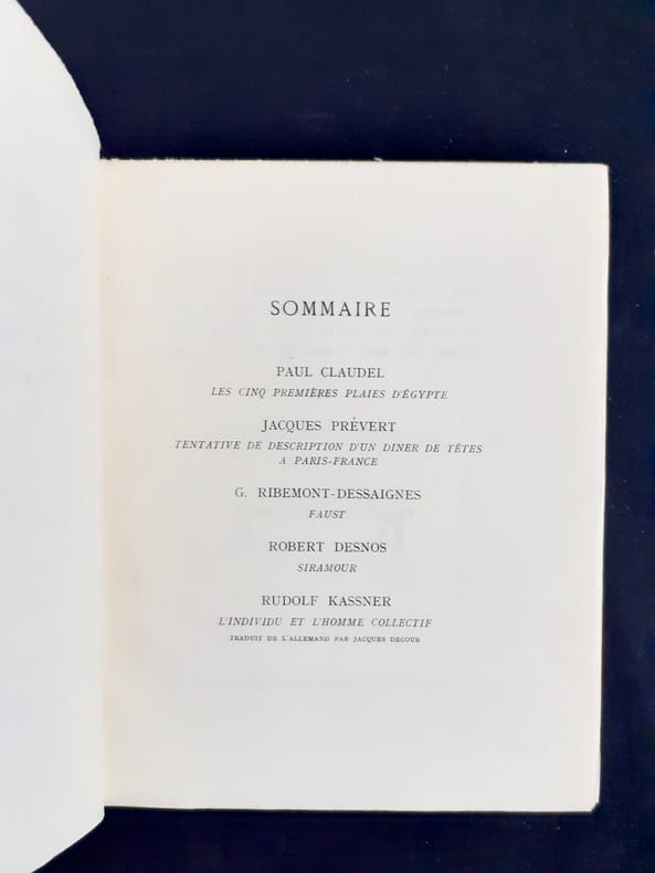
45990Paris, Cahiers trimestriels publiés par les soins de Paul Valéry, Léon-Paul Fargue et Valery Larbaud, 1931. Un volume 19x24cm broché de 232 pages. Exemplaire numéroté sur alfa. Couverture insolée sinon bon état.
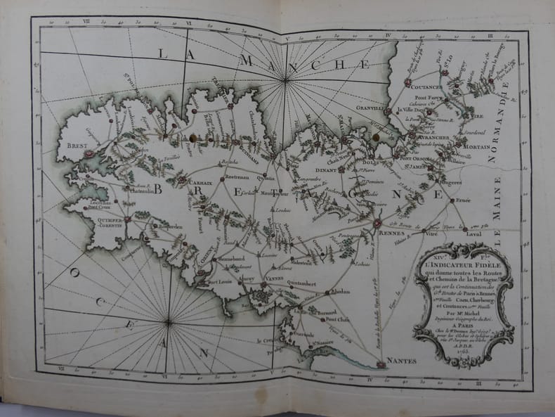
176581119Paris, Rue Saint-Jacques à L'Enseigne du Globe, 1765, in-4 (21x27,5cm), reliure tardive (19e s.) en demi-chagrin bleu nuit à dos long, titre et filets à l'or, plats papier marbré oeil de chat, Contient 19 cartes montées sur onglets, certaines dépliantes : une Carte Générale de France, IIe Feuille: Route de Paris à Rennes. IIIe F. Route de Paris à Bordeaux et Toulouse. IVe F. Route de la Diligence de Lion. Ve F. Le Carosse de Strasbourg. VIe F. Routes de Champagne, Lorraine, Franche-Comté, partie de la Bourgogne et de l'Alsace. VIIe F. Troisième Route de Paris à Strasbourg. VIIIe F. 3e Route de Paris à Strasbourg. IXe F. Grande Route des Prov. de Picardie, de Thiérache, d'Artois, de Hainaut, de la Flandre et des Pays-Bas. Xe F. Route des Provinces de Normandie, Boulonois, partie de la Flandres et Picardie, et Route de Paris à Londres. XIe F. Détail de la première Route d'Amsterdam à Marseille. XIIe F. suite Route Amst. à Mars. XIIIe F. Grande Route de Strasbourg à Wienne. XIVe F. Carte de Bretagne. XVe F. Routes et Chemins des Communications, compris entre les 4 grandes routes de Paris à Nantes et Rennes. XVIe F. Carte de Gacogne. XVIIe F. Qui donne les Routes et Chemins, tant Royaux que Particuliers, compris entre les deux grandes Routes de Paris à Toulouse. XVIIIe F. Qui donne les continuations des Routes Orientales et Méridionales des Grandes Routes de Paris à Marseille. Suit : un Prospectus du Guide des Voyageurs (1ff), un Catalogue Alphabétique des Routes Royales et Particulières (3ff), un Catalogue alphabétique du Supplément des 1380 Villes et Routes de France (4ff). MANQUE la Première Feuille, représentant Paris et les villages de la Banlieue.
1950002243Paris La Nef 1950 In-8 Broché, couv. illustrée Edition originale
10719Editions du Sagittaire, "La Nef" n°71-72, décembre 1950-janvier 1951 (numéro spécial). In-8 broché, 224 pages, couverture illustrée par Miro. Le dos de la couverture est consolidée avec du scotch, sans manque, intérieur en bon état.
66570Coll. "l'Icosathèque 20 th - Le siècle n° 2", Paris, éd. Lettres Modernes, 1978, EDITION ORIGINALE sur papier ordinaire, in-8, cartonnage souple, couv. texte en vert sur fond jaune éd. 200 pp., dessins en noir, notes, table des matières, Très belles études sur Artaud, Breton, Desnos, Duchamp, Eluard, Jarry, Roussel, Tzara et Van Doesburg. RARE Très bon état
1792005599Paris: Veuve Hérissant 1792. Half Calf. Very Good. Exceptionally richly hand-colored French atlas. Elephantine folio 56 by 44 cm. Following title page which contains table of contents as well six two paged hand-colored maps. The first map with its large allegorical cartouche is especially spectacular but all the maps are beautiful and noteworthy for the quality of their coloring. Scarce with copies held by BNF Bibliotheque Sainte-Genevieve Leiden and the National Library of Scotland according to OCLC and not clear whether all of these copies are hand-colored. Corner dampstains most pronounced on title then receding as progress. While unquestionably noticeable on the first map in our view it doesn't seriously detract from the beauty of the map. Other light scattered soiling which again we do not find disconcerting. Some scuffing of the binding. While half calf technically the calf coverage of the boards is minimal <br/><br/> Veuve Hérissant unknown books
1792005599Paris: Veuve Hérissant 1792. Half Calf. Very Good. Exceptionally richly hand-colored French atlas. Elephantine folio 56 by 44 cm. Following title page which contains table of contents as well six two paged hand-colored maps. The first map with its large allegorical cartouche is especially spectacular but all the maps are beautiful and noteworthy for the quality of their coloring. Scarce with copies held by BNF Bibliotheque Sainte-Genevieve Leiden and the National Library of Scotland according to OCLC and not clear whether all of these copies are hand-colored. Corner dampstains most pronounced on title then receding as progress. While unquestionably noticeable on the first map in our view it doesn't seriously detract from the beauty of the map. Other light scattered soiling which again we do not find disconcerting. Some scuffing of the binding. While half calf technically the calf coverage of the boards is minimal. Veuve Hérissant unknown
1987649ACR, Paris 1987-2001. Fort volume in-4 carré (280 X 260 mm), relié et cartonné, jaquette illustrée en couleurs, sous étui rigide illustré. 588 pp. Ouvrage abondamment illustré en noir et en couleurs : tableaux, aquarelles, encres, dessins, gravures, bois, lithographies, livres illustrés et de nombreux documents publiés ici pour la première fois. MONOGRAPHIE et "CATALOGUE RAISONNÉ" : de 1894 à 1967, plus de 1100 références décrites, datées et illustrées. Expositions, bibliographie et index. Remarquablement documenté, écrit avec clarté et précision, voici le premier volume (sur 3) de ce formidable travail de référence sur le plus célèbre peintre japonais du XXe siècle. 1987年 、パリ、ACR出版。280 X 260 mm、588ページ、厚い表紙、ジャケット、箱にカラーの絵。白黒、カラーの図版多数。油彩、水彩、インク、デッサン、木版、リトなど、初めて収録される資料も多い。1894年から1967年までの収録図版、写真は、1100点以上にのぼり、全て年数、解説付き。藤田に関する展覧会、本のリスト、インデックス。フランス語による解説は正確で明快。全三巻からなる、20世紀日本の最も有名な画家に関する優れた解説書の一巻目。新品同様。
1956176331956 Bruxelles, Palais des Académies,1956, In huit, 238 pp, broché,
1770910507CG[Um 1770]. Altkolorierter Kupferstich 35,5 x 51,5 cm, Blattgröße 39 x 56 cm.
1770910503CG[Um 1770]. Altkolorierter Kupferstich 28,5 x 31 cm, Blattgröße 29 x 39,5 cm.
176522130Paris 1765. 4to. Grangé Guillyn Desnos et al. Contemporary gold- and blind-tooled marbled calf sewn on 5 supports with the corresponding raised bands on the spine a red morocco title label on the spine lettered in gold a blind-tooled triple fillet border on both boards gold-tooled board edges red edges marbled end papers. With a double-page frontispiece by Le Charpentier after De Sève with a view of the Place de la Concorde in Paris 2 large folding engraved maps of France by Rizzi Zannoni 40 double-page engraved maps and charts of France 10 folding road maps 2 "Cartes odographiques" with the distances between French cities and 3 double-page engraved part-titles all but the frontispiece and titles in a contemporary hand colouring. 2 works in 1 volume the first in 3 parts. 15 1 blank 3 1 blank 8 10; 16 pp. 56 plates First edition of a rare atlas of France mapping out the country from all possible useful points of view. The work includes "analytical" maps which divide France in many ways showing not only the various geographical and political divisions of the country but also the military ecclesiastical juridical genealogical commercial and financial divisions and even hunting territories. The atlas also includes a small sea-atlas with 3 charts showing the French coasts as well as a French road atlas mapping out all the travelling routes of France. The maps were all made under the direction of Louis Charles Desnos 1725-1805 but they were drawn by various mapmakers. Several of the analytical maps and all sea charts were drawn by Rizzi Zannoni and all the road maps by Michel Royal geographer and engineer of the Paris Observatoire. This important geographical compendium drawn primarily from the cartographic collections of Desnos is structured around three series of maps: the Tableau analytique de la France Le petit Neptune and L'indicateur fidèle. All maps 52 in total were newly made and dated 1763-5. In the present composition published by Louis Brion de la Tour ca. 1745-1823 the atlas is in first edition and exactly as issued with all maps including the part-titles dated 1765. Most maps are set within broad ornamental borders and are attractively hand-coloured. After the maps three additional texts follow: the Prospectus du guide des voyageurs pour des routes royales & particulières de la France & autres a Catalogue alphabetique des routes royales et particulières and a Catalogue alphabetique du supplement des 1380 villes de France. Of particular interest is the added catalogue of the stock of Mr. Desnos who was a Paris publisher bookseller and engineer geographer of globes and spheres at Paris. All parts of the present atlas are offered for sale in the catalogue separately as well. With remnants of 2 bookplates mounted on the front pastedown an ownership annotation "Mailly" on the title page. The boards are somewhat scratched with some loss of material. Two maps are browned. Otherwise in very good condition.l Cf. Phillips 2990-2993 all three parts separate with the "Neptune" and "L'Indicateur" dated 1766; Quérard I 515. hardcover
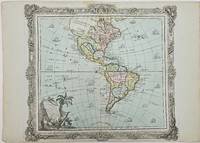
1786357069Brion. 1786. Short tear with no loss to centerfold marginal toning otherwise very good. 29x40.8x0.1 cm. Image size: 28x31.5 cm. Engraved map of the Americas with a decorative border. Old color. The details of the Pacific Northwest are speculative and poorly defined. Decorative title cartouche. Several ships sail the ocean. weight: 0.1 lb. Brion. unknown
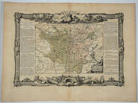
176818497Paris: Desnos 1768. Attractive map of this famed wine area of France. Includes Besancon Baumes Bourg Charillon Langres Tonnerre Dijon Auxonne. Long columns of descriptive text along the left and right of the map. Map measure 17 x 15.5" with large border. Attractive "military" motif border original color on the map. Very good condition. Desnos unknown
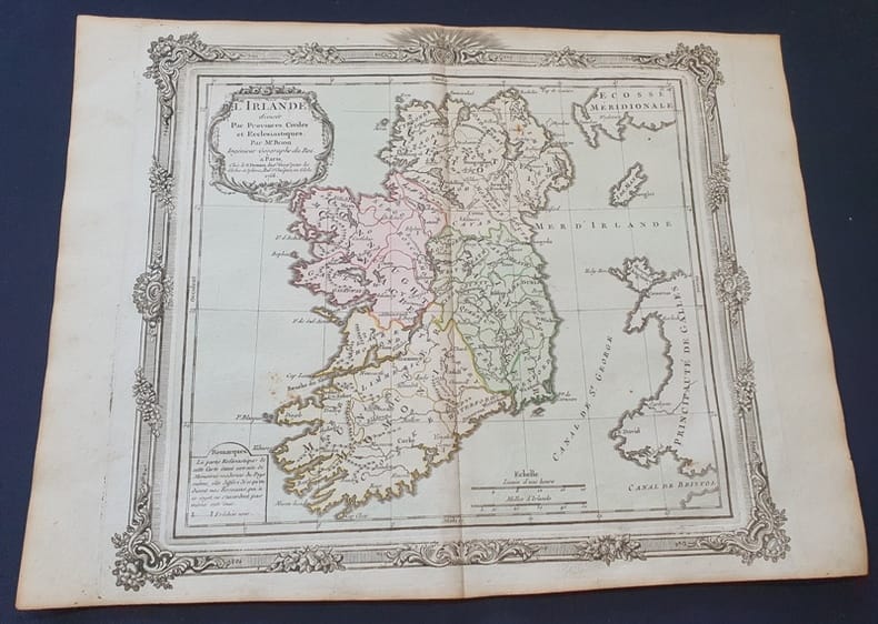
1772Tir401772 Planche seule - dimensions 38 x 29 cm - planche aquarellée - Échelle en lieux . Le pli du milieu existant déjà sera donc envoyée pliée en deux
1772Tir401772 Planche seule - dimensions 38 x 29 cm - planche aquarellée - Échelle en lieux . Le pli du milieu existant déjà sera donc envoyée pliée en deux
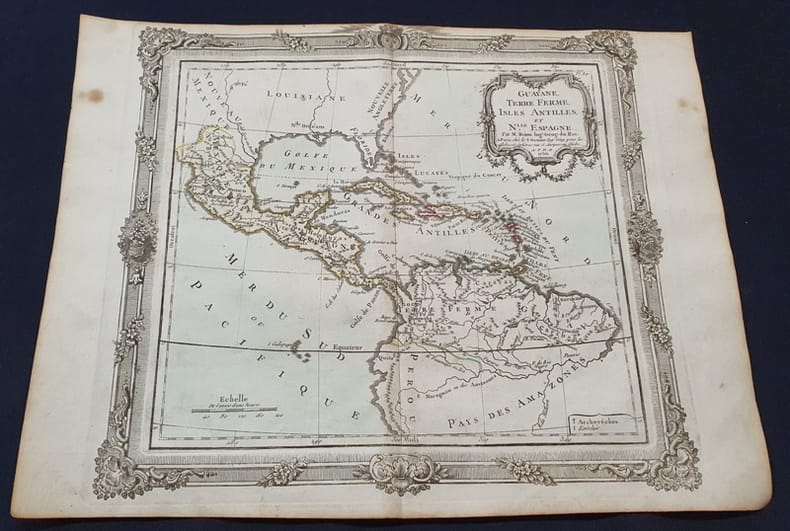
1772Tir411772 Planche seule - dimensions 38 x 29 cm - planche aquarellée - Échelle en lieux . Le pli du milieu existant déjà sera donc envoyée pliée en deux .La nouvelle Espagne correspond au Mexique , Nicaragua, Panama / la Terre ferme au Vénézuela .
1772Tir411772 Planche seule - dimensions 38 x 29 cm - planche aquarellée - Échelle en lieux . Le pli du milieu existant déjà sera donc envoyée pliée en deux .La nouvelle Espagne correspond au Mexique , Nicaragua, Panama / la Terre ferme au Vénézuela .
1772Tir431772 Planche seule - dimensions 38 x 29 cm - planche aquarellée - Échelle en lieux - Le pli du milieu existant déjà sera donc envoyée pliée en deux . Les deux siciles étant la Sicile et le Royaume de Naples .
1772Tir431772 Planche seule - dimensions 38 x 29 cm - planche aquarellée - Échelle en lieux - Le pli du milieu existant déjà sera donc envoyée pliée en deux . Les deux siciles étant la Sicile et le Royaume de Naples .
1772Tir441772 Planche seule - dimensions 38 x 29 cm - planche aquarellée - Échelle en lieux - petit manque de papier en bordure inférieure - Le pli du milieu existant déjà sera donc envoyée pliée en deux .
1772Tir441772 Planche seule - dimensions 38 x 29 cm - planche aquarellée - Échelle en lieux - petit manque de papier en bordure inférieure - Le pli du milieu existant déjà sera donc envoyée pliée en deux .
1772Tir751772 Planche seule - dimensions 38 x 29 cm - planche aquarellée - Échelle en lieux et en Milles d'Italie . Le pli du milieu existant déjà sera donc envoyée pliée en deux .
1772Tir751772 Planche seule - dimensions 38 x 29 cm - planche aquarellée - Échelle en lieux et en Milles d'Italie . Le pli du milieu existant déjà sera donc envoyée pliée en deux .
1772Tir801772 Planche seule - dimensions 38 x 29 cm - planche aquarellée - Le pli du milieu existant déjà sera donc envoyée pliée en deux .