McNicholl, David HBiblio.com
44 résultats
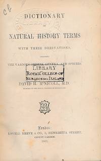
1863t0394London: Lovell Reeve & Co. G: in Good condition without dust jacket as issued. Spine darkened. Ex Royal College of Surgeons Ireland Library. 1863. First Edition. Green hardback cloth cover. 190mm x 130mm 7" x 5". vii 584pp ads. . Lovell Reeve & Co hardcover
184714960Cincinnati: J. A. & U. P. James. Poor. 1847. First Edition; First Printing. Hardcover. Incomplete. Useable for repairing another copy. The binding is very poor; worn with the bottom of the spine chipped away. Pages 50 to 62 are loose and pages 67 to 158 are missing. The title page is present as are the ads at the end. What can I say I got stung. Selling it for a loss if you can use it. Most certainly as-is. ; Small 8vo 7½" - 8" tall; 255 pages . J. A. & U. P. James hardcover
1836ZB349680Washington: Blair & Rives printers 1836. 3 pp issued as 25th Congress. 2d Session S137; chipping at spine but no loss now in self wrappers good; a plan for more equitable distribution particularly in favor of groups of families who would form townships; all the petitioners are from Litchfield Ohio. - If you are reading this this item is actually physically in our stock and ready for shipment once ordered. We are not bookjackers. Buyer is responsible for any additional duties taxes or fees required by recipient's country. Washington: Blair & Rives, printers, unknown
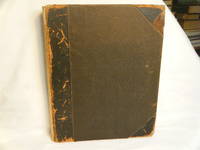
190039664Fair with no dust jacket. 1900. Hardcover. Holograph manuscripts by David Bauslin bound in one large book. Comprising "The Reformation" Oct. 1900 83pp plus syllabus; "Protestantism" Jan. 1901 48pp plus syllabus; "Puritanism" May 1903 62pp. Also "Pietism" Jan. 1903 45pp plus syllabus; "Rationalism" Jan. 1901 67pp plus syllabus. The half leather binding spine is perished and edges are exposed boards partially detached. The contents are VG. ; quarto . hardcover
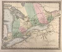
1835321534New York: Wm. Hall & Co 1835. unbound. Map. Engraving with original hand coloring. 12" x 15".<br/> <br/> Antique map of Upper Canada also known as Ontario divided into districts. Shows towns major routes waterways and topographical features. Based on Greenleaf's map of the area but does not include indigenous territories. Slight foxing in Lake Erie.<br> <br> David H. Burr 1803-1875 served as Topographer to the United States Post Office and Geographer to the House of Representatives and was widely known for his accuracy and attention to detail. Burr was one of the first cartographers to map each of the United States individually.<br/> <br/> Wm. Hall & Co unknown
185831172Cincinnati: Anderson Gates & Wright 1858. Later printing. Hardcover. Good. 12mo. xvi 17-255 pages. Brown cloth hardcover stamped in blind on the covers. Title in gilt on spine. Restored. Cloth spine rebacked on new dark brown leather. Front and rear hinges repaired. Faded pencil inscription regarding historical information written on the right front flyleaf. A thin typed printed description on the front paste down: "These "Trappers" were a portion of Lewis and Clark party." According to Howes "Thrilling narrative but not of unquestioned veracity."<br /> <br /> Howes C 836; Field 380; Sabin 17319; Rader 948; Wagner-Camp 130; Graff 897. Anderson, Gates & Wright hardcover
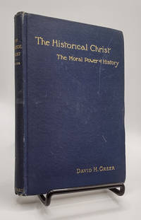
1890018390<p>New York: E. P. Dutton & Company 1890. First Edition. Hardcover. Good. 94pp; Navy blue cloth boards with gilt titling to front & spine slight forward slant minor staining to rear board slight wear to spine ends original brown endpapers gift inscr. to flyleaf text unmarked binding is sound Good condition. Scarce antique volume containing the text of the Bedell Lecture for 1889 by Rev. David H. Greer D.D 1844-1919 Rector of Bartholomew's Church New York. Greer later became the 8th Episcopal Bishop of New York.</p> E. P. Dutton & Company hardcover
186100105741861-1862. Quarto 1 page; 2 octavo letters: one letterhead shows the portrait of Maj. Gen. John C. Fremont; the other shows the Star Spangled Banner. each with the original mailing envelopes with postage and cancellations. Note: the larger letter is boldly written while the small letters a very faded. Two postmarks from December 4 & 27 1861 one from Feb 1 1862. <br/><br/>The boldly written letter was written by Pvt. David H. Grim at Benton Barracks at St. Louis MO 29 January 1862. David H. Grim enlisted to Company F Iowa 14th Infantry Regiment in November 1861. Per the records he was taken captive at Shiloh probably in the middle of the "Hornet's Nest". Missing in action and taken prisoner April 6 1862. Paroled. Died of fever July 7 1862 age 26 7. David was not a speller: "to rite/rite a Leter to you to Let yow now that I am well at this time . i am in the tens . think well stay here this winter. worth we hant had any supper here worth wile to menth here". " General Prentiss having already surrendered with a part of his command the Fourteenth was left in advance of all that remained but completely enclosed receiving the enemy's fire from three directions. The regiment still kept its ranks unbroken and held its position facing the enemy but the men were almost completely exhausted with a whole day of brave and steady fighting and many of them had spent their whole stock of ammunition. It was therefore useless to think of prolonging a resistance which could only have wasted their lives to no purpose and at about a quarter to six P. M. surrendered them and myself prisoners of war. I have only to add that I feel under the deepest obligation to both officers and men of my regiment for their admirable conduct through the day. This was so complete and free from exception that it would be impossible to mention individuals without doing injustice to the rest. Their steadiness and courage the accuracy of their fire and precision of all their movements entitle them to the highest credit and their general demeanor both upon the battle field and in the trying scenes through which we passed as prisoners of war will always be remembered by me with pride and gratification." - Col. W. T. Shaw. unknown
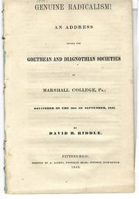
184318497Pittsburgh: A. Jaynes 1843. 23 1 blank. Disbound with small wrapper remnants last blank dustsoiled minor foxing else Very Good. Riddle bemoans contemporary identifications of Radicalism with Fanaticism. "Genuine radicalism goes to the roots of the evil it designs to rectify." The root of evil lies in the human heart and its only cure is Christianity. AI 43-4321 5. Not in Sabin Eberstadt or Decker. A. Jaynes unknown
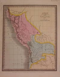
1835204780New York: Illman & Pilbrow 1835. unbound. very good. Map. Engraving with original hand coloring. Image measures 12.75" x 10.5".<br/> <br/> Shows Lake Titicaca as Bolivian whereas modern borders share it with Peru.<br/> <br/> Illman & Pilbrow unknown
1838021525Boston: John B. Hall. First Edition. Quarter leather and marbled boards. Cracked inside the front cover front free endpaper detached dampstaining on many pages some foxing Fair. . Fair. Hardcover. 1st Edition. 1838. John B. Hall hardcover
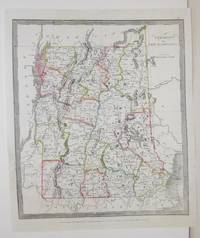
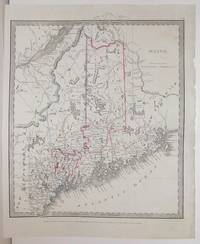
1836M2577New York: Illman Thomas 1836. Good; some restoration in the lower left corner. Notes: From David Burr's "A new Universal Atlas comprising Separate Maps of all the Principal Empires Kingdoms & States Throughought the World" 1836 New York. Size : 340x290 mm 13.375x11.375 Inches Coloring: Original Outline Coloring Category: Maps United States New England States; Illman, Thomas unknown
189020098Plano IL: Printed at the True Latter Day Saints' Herald Office 1890. 14pp. Caption title as issued. Folded partly uncut. Printed in double columns. Light edgewear. Tanned. bound with EPITOME OF THE FAITH AND DOCTRINES OF THE REORGANIZED CHURCH OF JESUS CHRIST OF LATTER DAY SAINTS. 4. Published by the Reorganized Church of Jesus Christ at Lamoni Decatur County Iowa. 1890. 1 1 blank pp. Caption title as issued. Printed in double columns. Light edgewear. Tanned rather brittle. Good to Good. <br /> <br /> OCLC suggests the first item was published in Plano Illinois. It argues that no religious or ethical foundation exists for polygamy. <br /> OCLC 11817939 12 first item. OCLC notes several variants of the second item. Printed at the True Latter Day Saints' Herald Office unknown
1836M2580New York: Illman Thomas 1836. Excellent. Notes: From David Burr's "A new Universal Atlas comprising Separate Maps of all the Principal Empires Kingdoms & States Throughought the World" 1836 New York. Size : 294x293 mm 11.625x11.5 Inches Coloring: Original Outline Coloring Category: Maps United States South States; Maps United States Midwest States; Illman, Thomas unknown
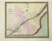
1834M10162New York: Illman & Pilbrow 1834. Very Good. Size : 293x350 mm 11.54x13.78 Inches Coloring: Hand Colored Category: Maps Canada East Quebec; Illman & Pilbrow unknown
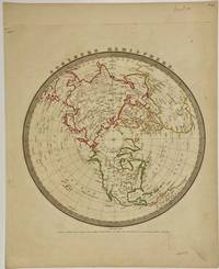
1836324310New York: Illman & Pilbrow 1836. unbound. Map. Engravings with original hand coloring. 15" x 12 1/8".<br/> <br/> This map features a polar projection of the Northern Hemisphere. Rivers major cities and islands are labeled. In very good condition with minor scuffs to outside margins not affecting the image. <Br> <Br> David H. Burr 1803-1875 served as Topographer to the United States Post Office and Geographer to the House of Representatives and was widely known for his accuracy and attention to detail. His "Universal Atlas" was the first to map each of the United States individually.<br/> <br/> Illman & Pilbrow unknown
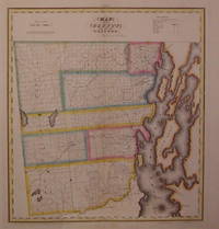
1829203497New York: DeWitt Simeon 1829. unbound. very good. Rawdon Clark & Co. Map. Copper plate engraving with original hand coloring. Image measures 18.5" x 17". Includes data text description.<br/> <br/> Fine antique map of Clinton County in northern New York State including part of Lake Champlain. Denotes townships major routes waterways and towns. In very good condition with some wear to corners. David H. Burr 1803-1875 served as Topographer to the United States Post Office and Geographer to the House of Representatives and was widely known for his accuracy and attention to detail. This atlas was among the first to map each of the United States individually. Included is a separate page with statistical information and a historical description of Clinton County. Please visit our Gallery for more Burr New York county maps.<br/> <br/> DeWitt, Simeon unknown
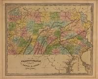
1834310002New York: Illman and Pilbrow 1834. unbound. Thomas Illman. Map. Engraving with original hand coloring. Image measures 10 1/2" x 12 5/8"<br/> <br/> Early map of Pennsylvania beautifully hand colored to show county divisions. Cities towns major routes topograhical features islands and waterways are labeled. In very good condition. Mat burn to margins.<br> <br> David H. Burr 1803-1875 served as Topographer to the United States Post Office and Geographer to the House of Representatives and was widely known for his accuracy and attention to detail. His "Universal Atlas" was the first to map each of the United States individually.<br/> <br/> Illman and Pilbrow unknown
1835324308New York: Illman & Pilbrow 1835. unbound. Map. Engravings with original hand coloring. 15" x 12 1/4".<br/> <br/> The first edition of this map features a polar projection of the Southern Hemisphere omitting the entirety of the Antarctic continent. Includes much of South America the southern half of Africa and Oceania - with Australia labeled as "New Holland." Dozens of islands are extensively labeled. The Pacific Ocean is mislabeled as Atlantic. In very good condition. <Br> <Br> David H. Burr 1803-1875 served as Topographer to the United States Post Office and Geographer to the House of Representatives and was widely known for his accuracy and attention to detail. His "Universal Atlas" was the first to map each of the United States individually.<br/> <br/> Illman & Pilbrow unknown
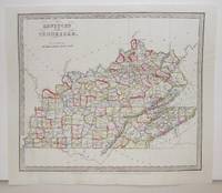
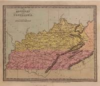
1834306029New York: Wm. Hall & Co 1834. unbound. Thomas Illman. Map. Engraving with original hand coloring. Image measures 10 3/8" x 12 5/8"<br/> <br/> Early map of Kentucky and Tennessee. Shows towns major routes waterways and topographical features. Published after the passage of the Indian Removal Act 1830 but before Cherokee Removal in 1838 this map does not label Cherokee Territory in the southeast territory as most maps from this time period do.<br> <br> David H. Burr 1803-1875 served as Topographer to the United States Post Office and Geographer to the House of Representatives and was widely known for his accuracy and attention to detail. His "Universal Atlas" was the first to map each of the United States individually.<br/> <br/> Wm. Hall & Co unknown
1863002489London: Lovell Reeve & Co. 1863. First . Hardcover. Good/No Jacket. 12mo - over 6¾" - 7¾. vii 584 with publisher's 16 pp list for 1863; publisher's green cloth gilt titles to spine chocolate eps. A little eadge wear ffep removed and title page foxed in consequence. Translations of Latin and Greek terms used in the Natural Sciences Botany Medicine etc. Owner signature on title margin 12mo - over 6¾" - 7¾ <br/> <br/> Lovell, Reeve & Co. hardcover
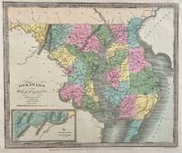
1833309705New York: Illman and Pilbrow 1833. unbound. Thomas Illman. Map. Engraving with original hand coloring. Image measures 10 1/2" x 12 5/8"<br/> <br/> Early map of Delaware and Maryland beautifully hand colored to show county divisions. Cities towns major routes topograhical features islands and waterways are labeled. An inset in the lower left shows the Western Part of Maryland. <br> <br> David H. Burr 1803-1875 served as Topographer to the United States Post Office and Geographer to the House of Representatives and was widely known for his accuracy and attention to detail. His "Universal Atlas" was the first to map each of the United States individually.<br/> <br/> Illman and Pilbrow unknown
1836M2563New York: Illman Thomas 1836. Excellent. Notes: From David Burr's "A new Universal Atlas comprising Separate Maps of all the Principal Empires Kingdoms & States Throughought the World" 1836 New York. Size : 304x268 mm 12x10.5 Inches Coloring: Original Outline Coloring Category: Maps United States New England States; Illman, Thomas unknown
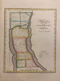
1829293671New York: David H. Burr 1829. unbound. Rawdon Clark & Co. Map. Copper plate engraving with original hand-coloring. Image measures 11 3/4 x 14 1/2 inches.<br/> <br/> This map depicts Seneca County in eastern New York divided into 9 towns outlined in vivid color. Seneca Falls is named as is the Cayuga%u2013Seneca Canal. The map denotes major routes waterways and topographical details and icons label villages flouring mills factories forges saw mills and churches. This first edition of Burr's county map appeared in his "Atlas of the State of New York" of the same year which was the second atlas of an individual state ever published.<br> <br> The map is in good condition with light foxing throughout. Full original margins.<br> <br> David H. Burr 1803-1875 served as Topographer to the United States Post Office and Geographer to the House of Representatives and was widely known for his accuracy and attention to detail. His "Universal Atlas" was the first to map each of the United States individually. This map is a lovely rendering of a hard-to-find county in New York State.<br/> <br/> David H. Burr unknown
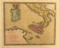
1835329965New York: Thomas Illman 1835. unbound. Map. Engraving with original hand coloring. Image measures 10 3/8" x 12 5/8"<br/> <br/> Unusual map of Italy depicting the Kingdom of Naples the islands of Sicily and Sardinia and parts of Corsica. The map extends from the northern coast of Africa to the Papal states. Major cities rivers roads and topographical features are labeled. Topography is depicted by hachure. In good condition with minor staining throughout. <br> <br> David H. Burr 1803-1875 served as Topographer to the United States Post Office and Geographer to the House of Representatives and was widely known for his accuracy and attention to detail. Burr was one of the first cartographers to map each of the United States individually.<br/> <br/> Thomas Illman unknown