44 résultats
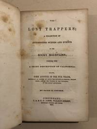
1850837831850. COYNER David H. The Lost Trappers; A Collection of Interesting Scenes and Events in the Rocky Mountains; Together with a Short Description Of California: Also Some Account of the Fur Trade. Cincinnati: E. D. Truman 1850. 1st ed. 255pp. Orig. cloth. Foxing former owner's signature on front pastedown and title page else very good. Howes C-836. Wagner-Camp 130:2. Rittenhouse 142 ref. Cowan p.149. Graff 897. Sabin 17319. First edition second printing of this famous and sometimes fictitious account of the beginnings of the American fur trade. The narrative is based on the journal of Ezekial Williams who recorded his explorations in the Rockies during 1809-13 and reported an overland journey to California by two of his associates in 1809-10. This was historian Alfred Creigh's copy Creigh was the author of History of Washington County PA 1870. unknown
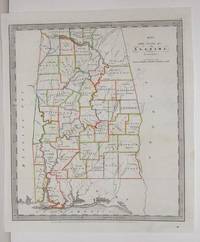
1836M2575New York: Illman Thomas & Pilbrow 1836. Excellent; Some scratching along the left side of the map. Notes: From David Burr's "A new Universal Atlas comprising Separate Maps of all the Principal Empires Kingdoms & States Throughought the World" 1836 New York. Size : 322x285 mm 12.625x11.25 Inches Coloring: Original Outline Coloring Category: Maps United States South States; Illman, Thomas & Pilbrow unknown
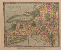
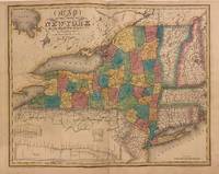
1836M2572New York: Burr David H. 1836. Very Good small tear 1" entering image in the upper left corner professionally repaired. Notes: From David Burr's "A new Universal Atlas comprising Separate Maps of all the Principal Empires Kingdoms & States Throughought the World" 1836 New York. Size : 261x298 mm 10.25x11.75 Inches Coloring: Original Outline Coloring Category: ; Maps United States East New York Burr, David H. unknown
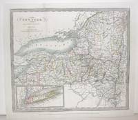
1835312196New York: David H. Burr 1835. unbound. Map. Engraving with original hand coloring. Image measures 10 3/8" x 12 1/4"<br/> <br/> Early map of New York beautifully hand colored to show county divisions. An inset in the lower left corner depicts Long Island and New York City. Cities towns major routes topographical features islands and waterways are labeled. In very good condition. Some wear and signs of aging at margins not affecting the image.<br> <br> David H. Burr 1803-1875 served as Topographer to the United States Post Office and Geographer to the House of Representatives and was widely known for his accuracy and attention to detail. His "Universal Atlas" was the first to map each of the United States individually.<br/> <br/> David H. Burr unknown
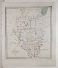
1836M2568New York: Illman Thomas & Pilbrow 1836. Excellent with tiny scratch in the middle left side of the map. Notes: From David Burr's "A new Universal Atlas comprising Separate Maps of all the Principal Empires Kingdoms & States Throughought the World" 1836 New York. Size : 332x296 mm 13x11.625 Inches Coloring: Original Outline Coloring Category: Maps United States Midwest States; Illman, Thomas & Pilbrow unknown
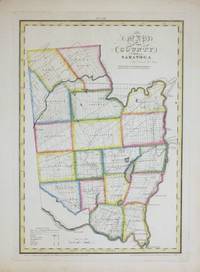
1829264493New York: David H. Burr 1829. unbound. Rawdon Clark & Co. Map. Copper plate engraving with original hand-coloring. Image measures 12 x 17 1/2".<br/> <br/> This map depicts Saratoga County in eastern New York divided into 18 towns outlined in vivid color. The county is bordered by the Hudson River in the east and the Mohawk River in the south. Saratoga Springs is identified. The map denotes major routes waterways and topographical details and icons label villages flouring mills factories forges saw mills and churches. This first edition of Burr's county map appeared in his "Atlas of the State of New York" of the same year which was the second atlas of an individual state ever published.<br> <br> The map is in good condition with light foxing throughout. Full original margins.<br> <br> David H. Burr 1803-1875 served as Topographer to the United States Post Office and Geographer to the House of Representatives and was widely known for his accuracy and attention to detail. His "Universal Atlas" was the first to map each of the United States individually. This map is a lovely rendering of a hard-to-find county in New York State.<br/> <br/> David H. Burr unknown
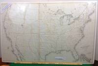
1855102New York: Ackerman Lith 1855. First edition thus. Map. Near Fine. A Near Fine map. 33 x 49 inches. Black and white engraving with hand-colored borders in yellow and red. Original folds present. A near fine example of a rare large size pre-civil war map. David H. Burr is listed as draftsman U.S. SENATE. Burr was 'Geographer and Draftsman to the Senate' between 1855-59 1855 Large map of the United States issued after the Gadsden Purchase and prior to the Pacific Railroad Survey. Shows Kansas and Nebraska possibly the first government map to do so. West Virginia is not separated from Virginia. . Ackerman Lith unknown
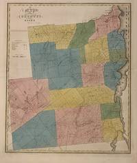
1829300575New York 1829. unbound. Rawdon Clark & Co. Map. Engraving with original hand outline color. Image measures 22 x 18 1/4 inches. Some chips to margins and repairs to left centerfold but otherwise in good condition.<br/> <br/> This 1829 map depicts Essex County in the high peaks region of the Adirondacks divided into 17 towns in full vivid color. Lake Champlain forms the right border of the region and Lake Placid yet unnamed appears in the upper left. The map denotes major routes waterways and topographical details and icons label villages flouring mills factories forges saw mills and churches. This first edition of Burr's county map appeared in his "Atlas of the State of New York" of the same year which was the second atlas of an individual state ever published. The map is in good condition with light foxing throughout and some ink stains in the lower right margin not affecting the image. Full original margins. <br> <br> David H. Burr 1803-1875 served as Topographer to the United States Post Office and Geographer to the House of Representatives and was widely known for his accuracy and attention to detail. His "Universal Atlas" was the first to map each of the United States individually. This map is a lovely rendering of a scenic area in New York State.<br/> <br/> unknown
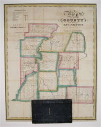
1829233726New York: David Burr 1829. First. unbound. Pocket map. Copper plate engraving with original hand-coloring. Map attached to blue leather binding as issued title stamped in gold. Image measures 15 1/2 x 12".<br/> <br/> This rare fold-out pocket map depicts Livingston County in the Finger Lakes region of New York divided into 12 towns outlined in vivid color. The map is centered around the town of Geneseo and denotes major routes waterways and topographical details. Icons label villages flouring mills factories forges saw mills and churches. The map is in excellent condition with no tears of any kind. Some scattered staining especially along original folds. It is attached to its original leather cover and the watermark of the paper is visible. David H. Burr 1803-1875 served as Topographer to the United States Post Office and Geographer to the House of Representatives and was widely known for his accuracy and attention to detail. Burr was one of the first cartographers to map each of the United States individually. Issued separately rather than included in his seminal "Universal Atlas" this pocket map is a scarce version of Burr's celebrated work.<br/> <br/> David Burr unknown
1856RBURMAP01abs1856. Good. Burr David H. Map Showing the Extent of Surveys in the Territory of Utah Wahsatch and Salt Lake. NP: NP 1856. 16.5"" x 35"". paper with matboard. Book condition: Good with bumped and torn edges. Slight yellowing soiling and creasing. ""Examined and approved this 30th Sept. 1856 Sur Gen David H. Burr of Utah"". Extends from Mt Nebo up to Cache and Hansel Spring Valleys. Includes eastern shore of the Great Salt Lake. unknown
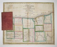
1829233728New York 1829. unbound. Rawdon Clark & Co. Map. Copper plate engraving with original hand outline color. Map attached to red leather binding as issued title stamped in gold. Image measures 12 1/2 x 15".<br/> <br/> This rare fold-out pocket map depicts Wayne County in northwest New York on Lake Ontario divided into 15 towns outlined in vivid color. The map denotes major routes waterways and topographical details. Icons label villages flouring mills factories forges saw mills and churches. The map was published in 1829 during the Second Great Awakening which brought attention to this region of the state as a major site of religious revival. In particular the village and town of Palmyra which appear on the map served as an important site of discovery for Joseph Smith later the founder of the Mormon Church. The map is in excellent condition with no tears of any kind. Some scattered staining especially along original folds. It is attached to its original leather cover and the watermark of the paper is visible. David H. Burr 1803-1875 served as Topographer to the United States Post Office and Geographer to the House of Representatives and was widely known for his accuracy and attention to detail. Burr was one of the first cartographers to map each of the United States individually. Issued separately rather than included in his seminal "Universal Atlas" this pocket map is a scarce version of Burr's celebrated work.<br/> <br/> unknown
1856RBURMAP00abs1856. Good. Burr David H. Map Showing the extent of Surveys in the Territory of Utah 1856 Wahsatch and Salt Lake. NP: NP 1856. 16.5"" x 35"". paper with matboard. Book condition: Good with slightly bumped edges. Slight soiling yellowing and creasing. Closed tears in center of map yet do not interrupt image. ""Examined and approved this 30th Sept. 1856 Sur Gen David H. Burr of Utah"". Extends from Mt Nebo up to Cache and Hansel Spring Valleys. Includes eastern shore of the Great Salt Lake. unknown
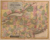
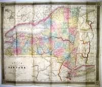
1829312199New York 1829. unbound. Rawdon Clark & Co. Map. Copper plate engraving with original hand coloring. Image measures 19 7/8" x 25.25".<br/> <br/> Stunning rare map of New York state divided into counties. Denotes towns major routes waterways and topographical features all in beautiful detail. Includes insets of three canal profiles Champlain Seneca and Erie. Part of Upper Canada and Lake Huron included. New England also included in outline color. In good condition with foxing and toning near center fold and surface dirt with a crease in the lower left portion. David H. Burr 1803-1875 served as Topographer to the United States Post Office and Geographer to the House of Representatives and was widely known for his accuracy and attention to detail. This atlas was among the first to map each of the United States individually.<br/> <br/> unknown
184753428Cincinnati: J. A. & U. P. James 1847. 1847. First edition. First Edition. 12mo. Original blind-stamped Cloth with title in gilt on spine. xv 16 - 255 pp. blank plus 7 pp. of Advertisements Introduction Appendix. Graff 897 says "Howes and Wagner-Camp suggest doubt about the veracity of the author the "lost trappers" were from the Lewis and Clark Expedition. Some statements in the work are demonstrably untrue but there are sections which may be proven authentic." Coyner a Presbyterian preacher sojourning in Missouri claims to have compiled this narrative on behalf of a Virginia newspaper seeking frontier material basing it on an old musty mutilated journal kept by Ezekial Williams a Kentucky-born trapper. The main incidents concern the wanderings and adventures and his colleagues in the Rocky Mountains from 1809 to 1813 and the overland journey of two of them - the "Lost Trappers" - to California in 1809-1810. One of the early pictures of California. Professionally rebacked with original cloth spine retained and a little touch-up to corners. Modest amount of foxing scattered throughout. In all a very good copy of a fur trade classic. Interesting small 1"x2" old label of merchant that sold this book affixed to upper front endpaper reads: A. D. Sproat Druggist Chillicothe O. J. A. & U. P. James, 1847. hardcover
1840312198New York: Stone and Clark 1840. Rawdon Clark & Co. Map. Copper plate engraving with original hand coloring. Image measures 19 3/4" x 25"<br/> <br/> Rare map of New York state and parts of Pennsylvania Connecticut Massachusetts New Jersey Vermont and New Hampshire divided into counties and vibrantly colored. Denotes cities towns major routes waterways and topographical features all in beautiful detail. A table in the upper left lists Congressional and Senatorial districts. On the map Senatorial districts are outlined and numbered. Updated from the 1829 map with changes to the counties and Railroad routes are featured. In very good condition with minor wear to margins. Lower left corner creased and flattened. <br> <br> David H. Burr 1803-1875 served as Topographer to the United States Post Office and Geographer to the House of Representatives and was widely known for his accuracy and attention to detail. His "Universal Atlas" was the first to map each of the United States individually.<br/> <br/> Stone and Clark unknown
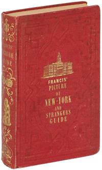
1850526223New York: C.S. Francis & Co 1850. Hardcover. Very Good. 12mo. xvi 172 4pp. with a folded engraved map: “Map of the City of New York†drawn by D.H. Burr. Illustrated with an engraved frontispiece plate an added engraved title page and several other engraved plates of public buildings. The 1850 edition includes a new introduction and the map by Burr is accompanied with a letterpress street directory. Publisher’s red decorative cloth stamped in blind and gold on front cover and spine and in blind only on back cover cream endpapers. Contemporary owner’s name in light pencil on front free endpaper. The boards are rubbed with light wear at the spine ends and corners the folded map has a few small light creases and one short closed tear very good or better with some light foxing. An attractive well-preserved copy of an early New York City Stranger’s guide uncommon in such very good condition. OCLC locates only six copies. C.S. Francis & Co hardcover
1856RBURMAP00fpGovernment Printing Office 1856. Very Good. Burr David H. Map Showing the Extent of Surveys in the Territory of Utah 1856. Washington D.C.: Government Printing Office 1856. one folded sheetpp. 17 "" x 34"". Framed folded sheet map. Book condition: Very good. Light toning along folds. Framed under glass in frame with a few nicks and scratches. A Nice copy of a map extracted from a General Land Office Report. Map shows land surveyed along the Wahsatch front from the Bear River Valley to just south of Utah Lake. Government Printing Office unknown
183821432New York: J.H. Colton 1838. 16mo cloth with title stamped in gilt on front board. Folding pocket map in full period color. 15.5" x 13." Near Fine pinsize closed split at a fold intersection with no loss. Insets of the Hudson River Valley and Niagara River are included. J.H. Colton unknown
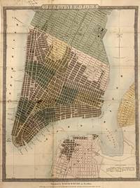
1832321720New York: David H Burr 1832. Map. Hand-colored engraving. 14 x 18.75 inches with original brown leather booklet.<br/> <br/> This important map of New York City was issued as a pocket map around 1832 by David Burr. It covers lower Manhattan from roughly 30th street south to include the northernmost parts of Brooklyn and Williamsburg which at the time were separate cities. Incredibly detailed it notes churches ferry lines government buildings parks squares and other important landmarks. Columbia College is noted on Murray Street. The old Fulton Fish Market St. Mark's Church in the East Village and the nation's first hospital at Bellevue are also identified. Burr's Map Store is noted near City Hall although we can't be sure if it was real or fictitious made up specifically for this map. The map is in good condition with some spotting and toning especially along the original fold lines. Some manuscript ink notations alone the top left margin. Backed with restoration paper for stability.<br> <br> David H. Burr 1803-1875 was a significant American cartographer and map publisher known best for his 1826 Atlas of the State of New York one of the most important state atlases in history. His rigorous research and surveying won him accolades particularly later in life when he was granted a number of civic offices in recognition of his high-quality work. He served as Topographer to the United States Post Office and Geographer to the House of Representatives and was widely known for his accuracy and attention to detail. This beautiful map is a fascinating piece of New York City history.<br/> <br/> David H Burr unknown