911 résultats
1790ST19326Amsterdam: H. Keyzer H. Gartman en W. Vermandel 1790. 555 x 345 mm. 21 7/8 x 13 3/4". 2 p.l. 62 folding plates. <br/> Attractive late 19th or early 20th century retrospective polished brown calf by L. Guétant stamp-signed in gilt on tail of spine double gilt-ruled border floral cornerpieces raised bands spine panels with scrolling floral borders and central flower ornament gilt titling. With title vignette and 62 ENGRAVED FOLDING PLATES ALL WITH BEAUTIFUL HAND COLORING AND HIGHLIGHTED WITH GOLD depicting Bible scenes from the Old and New Testament 61 of which are by Jan Luyken. A Large Paper Copy. For earlier editions: Graesse IV p. 308; Brunet III 1245-46; Klaversma & Hannema 159-164. Light rubbing to joints and edges boards just a little marked trivial foxing and faint spots here and there but A REMARKABLY FINE COPY the binding lustrous and showing little wear the paper extremely bright and fresh the margins immense and the paint and gold unusually vibrant.<br/> <br/> The marvelous illustrations of Dutch engraver and poet Jan Luyken comprise this collection of "remarkable stories" from the Bible each depicted with panoramic grandeur and enhanced with a wide range of finely applied colors and gold. Luyken 1649-1712 had written and illustrated erotic poetry as a young man but later became a devout Pietist after reading the works of German mystic Jakob Böhme. He became a member of the Baptist Church in 1673 and thereafter devoted his talents to producing religious works. The vast scenes here are notable in their scale detail and animation. There are a number of battle scenes from the Old Testament as well as dramatic depictions of the plagues and a fascinating episode from the histories of Josephus depicting Herod's soldiers being lowered down the side of a cliff in large boxes suspended from chains in order to attack the thieves hiding in caverns on the cliffside. There is a majestic portrayal of the Queen of Sheba arriving at the court of Solomon a peaceful scene of Adam naming the beasts in the Garden of Eden and a festive celebration of the Feast of Tabernacles. New Testament scenes include a terrifying final judgment a blinding conversion of St. Paul and scenes from that Apostle's travels. The engravings have one common trait: they are heavily populated whether by men or beasts and one of Luyken's special gifts is to render every person in the crowd as an individual with his own concerns and reactions to the events at hand. The engravings while already greatly pleasing in black and white are even more stirring and memorable when seen in the full color and gold used here. Expansive tableaus are given greater definition and clarity and events such as Noah’s flood and the destruction of Sodom and Gomorrah are rendered even more successful in expressing the awesome powers of the Almighty. The illustrations are quite definitely Protestant in point of view: there are no depictions of the Virgin Mary not even a Nativity scene. Except for engravings of the Annunciation to the Shepherds and the Massacre of the Holy Innocents the illustrations focus on Jesus as an adult and on the work of his Apostles spreading the gospel. There were earlier editions containing Luyken's 62 large plates which originally appeared without text as here in 1708 and they appeared again with a text in Dutch in 1729 and in French in 1732. Copies of these editions appear with some regularity in the marketplace but are usually not colored and are often found incomplete or with other major condition issues. We can trace no record in RBH or OCLC of a copy of our 1790 edition and we can find nothing that compares with the quality of coloring and grand height attained by the monumental margins seen here. H. Keyzer, H. Gartman en W. Vermandel unknown
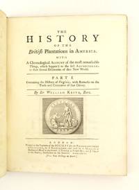
1738ST16322London: Printed for the Society for the Encouragement of Learning by S. Richardson 1738. FIRST EDITION. 240 x 186 mm. 9 1/2 x 7 1/4". 4 p.l. 187 1 pp. <br/> Contemporary sprinkled calf raised bands red morocco label. With engraved device of the Society on title page and final page engraved tailpiece and TWO FOLDING MAPS. Church 930; Howes K-36; Sabin 37240; ESTC T115083. Front joint cracked but the cover still firmly attached thin half-inch chip to spine at tail of front joint other minor signs of wear to the leather but the original unsophisticated binding sound and pleasing. Light scattered foxing mostly confined to margins one leaf with a tiny hole affecting a couple of words other trivial imperfections but A FINE COPY INTERNALLY the paper fresh and clean the maps remarkably free from any tears.<br/> <br/> Tracing the history of Virginia from the earliest English settlements through the first quarter of the 18th century with valuable notes on the colony's economy and trade this is a scarce and valuable work by a former colonial official with direct knowledge of the region. The history draws on earlier accounts most notably the 1705 work of Jamestown-born historian Robert Beverley ca. 1667-1722 but the more contemporary observations including those related to agriculture and economy come from the firsthand experiences of author William Keith 1680-1749 who went to Virginia in 1714 upon his appointment as surveyor-general of customs for the southern colonies in North America. According to ANB he toured Virginia the Carolinas Pennsylvania and Jamaica over the next two years charming all he met. In 1717 he became governor of Pennsylvania and ANB notes "for five years from 1717 to 1722 Keith was the most popular governor since the founding of the colony." During his service in the American colonies Keith wrote reports to the British government that ANB says "helped shape royal policy well into the 1760s." Knowledge gleaned in producing these reports is shared in the present work which features two fine maps: "A New and Correct Map of America" measuring 560 x 475 mm. showing North and South America with California as an island with inset views of Port Royal Boston Georgia North Pole and a Newfoundland cod fishery as well as "A New Map of Virginia" measuring 340 x 235 mm. by Thomas Fairfax dated 1738 showing the Tidewater region of the Mid-Atlantic states centering on Virginia with Maryland and New Jersey to the north and North Carolina to the south. Thomas Jefferson was familiar with this work remarking in "Notes on Virginia" that it is "agreeable enough in style and passes over events of little importance." Keith intended this to be the first in a series on the British colonies in North America--thus the "End of Vol. I" notation on the final page--but the project was abandoned for lack of funds. This work is rare in the marketplace: just two copies complete with maps one of these in a modern binding have appeared at auction since 1991. [Printed for] the Society for the Encouragement of Learning by S. Richardson unknown
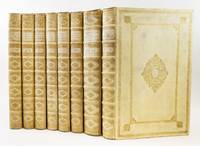
1735ST18632Amsterdam: Petrus Shenk 1735-38. First Edition in Dutch. 415 x 264 mm. 16 3/8 x 10 3/8". Entirely complete with continuous pagination but with a jump in page numbering from the end of book XIII to the beginning of XIV as usual. 15 parts in eight volumes. Translated by Florentius H. J. van Halen. <br/> HANDSOME CONTEMPORARY VELLUM covers with large gilt entrelac centerpiece framed with gilt floral rule with bouquet-like cornerpieces gilt floral border raised bands compartments richly gilt titles and volume numbers handwritten in ink on spines all edges gilt. With head- and tailpieces 15 engraved titles printed in red and black with engraved vignettes and complete with frontispiece two engraved portraits of the author and the engraver the latter with shorter margins probably tipped-in and 760 OFTEN STRIKING COPPER ENGRAVINGS on 758 plates one with partial hand coloring a few double-page. Front pastedown of first volume with handwritten note in French on lined paper; with additional black & white title to first work erroneously dated 1728. Nissen ZBI 3661; see also: Faber du Faur "German Baroque Literature" p. 472. Trivial soiling to the vellum the seventh volume with a faint marginal dampstain affecting a few quires but not touching engravings the odd negligible blemish but AN OUTSTANDING SET the very attractive original bindings showing only insignificant wear and THE CONTENTS ESPECIALLY FRESH AND CLEAN THROUGHOUT WITH VERY FINE IMPRESSIONS OF THE PLATES.<br/> <br/> This is the first Dutch translation of Scheuchzer's "Sacred Nature" one of the most splendid German illustrated books of the 18th century presenting what surely is the most impressive combination of biblical exegesis and scientific illustration to be found in any printed book. First published in 1731-35 as the "Physica Sacra" in Latin and as the "Kupfer-Bibel" in German so-named for the amazing array of copperplate engravings this work is arranged according to the progression of books in the Bible citing passages from those chapters where phenomena from the natural world are mentioned. The typical pattern here includes a textual citation followed by the author's often lengthy remarks on the passage and in many cases a dramatic engraving to illustrate what is said. The plates are identical to the earlier editions retaining the inscriptions in Latin and German and are the work of Johann-Melchior Fuseli of the well-known Zurich family of 18th and 19th century artists. The engraved scenes are always executed with great skill are generally very animated and are often fascinating. Of the 760 images meant to illustrate the text many are strictly or primarily depictions of biblical scenes; several are simply illustrations of specimens of nature; and a large number perhaps half offer a kind of combination. An example of this last type includes a wonderful scene showing the birth of Man as related in Genesis 1:26-27 depicting not only a startled Adam in his fecund paradise but also 10 images of fetuses placentas and the skeletons of children attached like mounted specimens to the architectural frame of the illustration. According to Faber du Faur it is in this work that "the Baroque attains philosophically as well as artistically its high point and its conclusion. It is the last of those elegant works which do not really contain illustrations to a text but which are in effect composed of splendid plates with a text to accompany them." Scheuchzer 1672-1733 was a prolific naturalist who promoted at every opportunity the most modern scientific ideas though without wanting to risk the accusation of being irreverent. He says that the present work represents an attempt at finding a harmony between reason and revelation though it can also be seen as an effort to promulgate progressive theories under the venerable cloak of biblical commentary. The bibliographies disagree about the number of plates that ought to be present in this work and in other editions but ours corresponds to copies previously sold at auction as complete. Copies of the "Physica Sacra" and its translations show up regularly for sale but almost never does one see the work both complete and as here with a clean and fresh text in remarkably well-preserved and attractive contemporary bindings. Petrus Shenk unknown
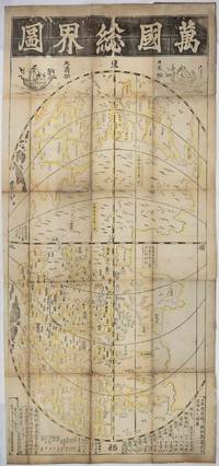
1708219243東京. Tokyo.: 須原屋茂兵衛. Suwaraya Mohei. Hoei 5 1708. Black and white woodblock map with yellow outlining in original hand colour 55.8 x 127cm map; 59.5 x 131cm sheet folding into the original Japanese wrappers chipped and rather worn 26.4 x 17.4cm the map with old repairs laid down on washi rather browned and wormed at the folds but with no serious loss the sheet age-toned and a little dusty but overall in remarkably good condition. Preserved in a modern blue linen Japanese case with toggle-closures. A famous woodblock-printed Japanese map of the world by renowned Edo Period map-maker Ishikawa Tomonobu who is also known as Ishikawa Ryūsen. This is a revised version of an earlier map produced by Ishikawa in 1688. <br> <br>The map appears to draw on Chinese and Portuguese geographical knowledge. The Chinese production of world maps had been transformed by the influence of the Italian Jesuit Matteo Ricci who collaborated with Chinese cartographers to produce a 1584 map of the world. In Japan the production of maps of "the myriad countries" or "the international countries" bankoku had been inspired by contact with Portuguese missionaries and with the Dutch in the 16th century. <br> <br>Ishikawa's map broadly resembles the Ricci map in being placed in an oval frame with the Pacific and thus also China and Japan at the centre. The content though is different. While Ricci's map is oriented to the north Ishikawa's is oriented to the east with America at the top of the page and the sketchy outlines of Europe including 'Ikiresu' England and a large and clearly marked Holland and Africa 'Kafuri' at the bottom. This orientation apparently influenced by the first world map in Japan "Bankoku Sōzu" 万国総図 which was published in 1645. Interestingly although Ishikawa had earlier produced a quite detailed and fairly accurate map of Japan the Japan shown on this world map is a rather loosely outlined collection of islands in which for example Ryūkyū the Ryukyu Kingdom now Okinawa and Hachijōjima appear much larger than they are in reality. Japan is also unusually oriented making it appear as though Ezo now Hokkaido is in the middle of the Pacific. It seems that the cartographer's interest here was less in outlining Japan in detail than in broadly setting out the country's place in relation to the land masses to the east and west. <br> <br>Like other Japanese world maps of the Edo period and like Ricci's map Ishikawa's image of the world includes imagined countries such as 'The Land of Giants". The continuing centrality of China in Japanese thought is indicated by the fact that Ishikawa's map contains a very clearly marked depiction of the Great Wall and that the map is decorated at the top with depictions of a Japanese and a Chinese sailing ship. The text at the bottom gives estimated distances between Hizen Province where the port of Nagasaki provided Japan's main official outlet to the world in this age of seclusion and various places in China and between Hizen and the Ryūkyū Kingdom. It also gives the estimated distance from Korea to Tsushima Island which served as Japan's gateway for diplomatic and trade relations with Korea. <br> <br>Engelbert Kaempfer a German physician and explorer brought back the 1688 edition of this map printing to Europe after his stay in Japan between 1690 and 1692. The map was introduced to European audiences in the 17th century and impacted on later European cartographic endeavours. <br> <br>Copies of this rare and historically significant map are held only in a handful of major collections: the British Library National Diet Library NDL of Japan the Staatsbibliothek of Berlin University of California Berkeley's Japanese Historic Maps Collection and the University of British Columbia. . 須原屋茂兵衛. [Suwaraya Mohei]. unknown
178025574Paris: D. Lothrop & Company. Very Good with No dust jacket as issued. 1780-1804. First Edition. Hardcover. Full leather is what appears to be contemporary bindings. The first 2 volumes have minor separations along the ends of the hinges. The Atlas volume is missing the title page and has numerous notations in the first maps in French. ; 8vo 8" - 9" tall . D. Lothrop & Company hardcover
1776M1486London: Charles Eyre and William Strahan 1776. Original Issue First Printing . paper wrappers. Fine. Folio. 'PROHIBITORY ACT' 215-244pp; Cap.V 1776. AN IMPORTANT ACT IN THE STORY OF AMERICA AND THE REVOLUTION. A fine example with clean fresh paper wide margins and a strong dark type impression. "It throws thirteen colonies out of the royal protection levels all distinctions and makes us independent in spite of our supplications and entreaties. It may be fortunate that the act of independency should come from the British Parliament rather than the American Congress" John Adams 'Regis Magnae Britanniae Franciae and Hiberniae Vicesimo. Decimo Secto. At the Parliament begun and holden at Westminster .Anno Dom. 1775 in the fifteenth year of the Reign of our Sovereign Lord George the Third by the Grace of God of Great Britain France and Ireland King Defender of the Faith & c. being the first session of this present parliament'. Attractive general title-page with the Royal Crest. Decorative initial to the black letter with a drop title to the head of the page. A fine crisp fresh and clean complete copy. . .from an incomplete nonce volume. The final acts to crush the American Revolution by acts of Parliament sanctions. <br/> <br/> Charles Eyre and William Strahan unknown
1705032822London : Thomas Bennet; John Nicholson; and Daniel Midwinter 1705 A good copy of the 1st edition in recent full panelled calf bindings with 9 maps 21 of 22 plates 2 frontispieces one with loss and 8 engravings in the text. John Harris 1633-1719 was an anglican priest and scientist specialising in mathematics. He was admitted as an FRS in 1696. His written works were well-regarded and popular and Navigantium was published in 2 further enlarged editions. The 1st edition is relatively scarce and is sought after particularly for the first printings of the Moll maps. The bindings are in near fine clean condition with gilt-lined raised bands to the spine with gilt decoration in the compartments and title and volume labels. There is light scuffing. Internally new endpapers and blanks have been added. This set has been matched against the reference copy held by the Hathi Trust and matches it apart from a misplaced plate a missing plate a small misbound section in the appendix and a misplaced map America. There are numerous mispaginations without loss and a number of small repaired edge tears. Overall the set is very clean with occasional light marking. There are small library stamps to the top corner of the title pages the verso of 2 maps one per volume and the top side margins of a couple of pages in each volume. Please enquire if you would like to see a full report of mispaginations and condition. Contents: Vol I: frontispiece laid down and missing circa 30%; title; dedication 2 pp; to the Reader 2pp; subscribers' list 2pp; contents 6pp with tipped in paper strip; introduction pp i-lxvii; text pp 1-862 finis with 10 plates 6 folding maps and 2 engravings in the text; index 1 - 6pp; index 2 - 8 pp finis. Vol II: frontispiece laid down - some loss in gutter; title with some expert repair; contents 4pp; folding map of the world; text pp 1-928 finis with 11 plates one folding 2 maps and 6 engravings in the text; appendix pp 1-56 with pp 41-48 bound after p 56 without loss; index 1 - 4pp; index 2 - 8pp; finis Thomas Bennet; John Nicholson; and Daniel Midwinter hardcover
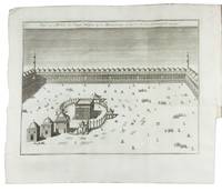
1760F6AGR64OFPE1Utrecht: Hermanus Besseling vols. 1-2 Leiden Amsterdam P. van der Eyk G. de Groot and son K. van Tongerloo and P. Schouten vol. 3 1760. Contemporary boards covered with sprinkled paper. 4to. With general title-page and 3 volume-titles in red and black 3 part-titles 3 engraved frontispieces engraved coat of arms and 6 folding plates. 6 parts in 3 volumes. First Dutch edition of the first 3 volumes of The modern part of an universal history devoted to the life of Muhammad and the history of Arabia under the first four Caliphs to the taking of Baghdad by the Mongols 1258 which put an end to the Abbasid Caliphate. The work based partly on George Sale's authoritative studies on the Quran and Arabian history includes fine views of Baalbek and the Ka'ba in Mecca. The Universal history met with great success and was admired by Edward Gibbon Joseph Priestly and Voltaire. If was translated into several European languages and formed an important source of information about Arabian history.Spines damaged otherwise in very good condition and wholly untrimmed vols. 2 and 3 unopened. Hermanus Besseling (vols. 1-2), Leiden, Amsterdam, P. van der Eyk, G. de Groot and son, K. van Tongerloo and P. Schouten (vol. 3 hardcover
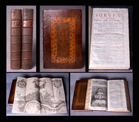
1720BB0673London: printed for A. Churchill J. Knapton R. Knaplock J. Walthoe E. Horne B. Tooke D. Midwinter B. Cowse R. Robinson and T. Ward 1720. First Edition thus. Full Calf. Fine. First Strype Edition best and most desirable edition of Stow's magisterial study—the "starting point of all inquiry into the subject of Elizabethan London." Complete in two folio volumes; each of the six 'books' introduced by a drop-head title with its own pagination: 4 xii xlii 2 308 208 285 1; 2 120 459 1 93 3 143 1 26 2pp with 70 plates plans and maps 31 double-page or folding including those of London Westminster and Southwark. Title pages in red and black. Superbly bound in handsome contemporary paneled calf sewn on six raised bands very skillfully rebacked with the original lettering pieces laid down. A crisp clean fresh copy with only occasional minor soiling the copper-engraved plates in deep rich impressions. Provenance: On the verso of the title pages the engraved armorial bookplate of Jacob Bouverie 1st Viscount Folkestone bapt. 14 October 1694 - 17 February 1761 English Politician and first elected president of the Royal Society for the encouragement of Arts Manufactures & Commerce whose members included Benjamin Franklin Karl Marx Adam Smith William Hogarth and Charles Dickens. Maslen & Lancaster. Bowyer ledgers 584. Lowndes V 2526. Gibson's Library p. 258. ESTC Citation No. T48975. This edition of Stow's Survey was the first to contain a series of ward maps: "Many of these maps are excellent. Their clarity and accuracy fulfill the requirements of the student of London history" Hyde. Fifth and Best Edition.Titlepage in red and black. Each of the 6 ’books’ has its own pagination and is introduced by a drop-head title. Adams London Illustrated 25; Lowndes III 2526; Upcott II pp 605-617; Darlington and Howgego 16 8 London maps. "Fifth and grandest edition. John Strype was already collecting materials for the text by 1703 and an ambitious reprint 'with very great Additions throughout and illustrated with about 100 large Copper Cutts . requiring much Time and Great expence' was advertised as early as 1708. The advertisement was on the title verso of Hatton's New View of London a smaller and cheaper book whose popularity actually caused the postponement of Strype's more monumental work. His two folio volumes cost six guineas and the print run was probably at least 500 copies. He included what he believed to be Stow's entire original text which had become conflated with the 1618 and 1633 editions of Anthony Munday clearly identifying his own additions in the margins. John Kip who had been responsible for the views of London buildings in volume I of Mortier's Nouveau theatre de la Grande Bertagne 1707 is credited with about half the 28 engraved views of 'eminent places'. In addition there are two folding general maps of London one showing the city as it was in Queen Elizabeth's time 17 ward maps bks. II-III and 20 parish maps bks. IV and VI. The only map to be signed is the Parish of St. Mary Rotherhithe revised by John Pullen and engraved by John Harris. 2" Christies. John Stow's Survey of London first published in 1598 brims with amusing descriptions and anecdotes as well as highly detailed accounts of the buildings social conditions and customs of the time based on a wide range of classical and medieval historical literature public and civic records and Stow's own intimate knowledge of the city where he spent his life. "The reader of A Survey travels with Stow through each of the city's wards and the adjoining city of Westminster learns about the wall bridges gates and parish churches . . . Stow also records the negative aspects of urban growth in the shape of unsightly sprawl filth the destruction of ancient monuments and above all poverty. His book approaches the thoroughness of an encyclopaedia . . . It is noteworthy that while Camden's Britannia was written in Latin for the educated élite Stow's Survey was composed in the language of his fellow countrymen." This edition of 1720 greatly expanded with interpolated amendments by John Strype is considered the best and most desirable. "Throughout his life at Low Leyton Strype crossed the River Lea into London each week to meet and converse with his antiquarian friends and to call on his contacts in the book trade. . . . The Survey had been repeatedly revised and enlarged in order to keep up with the changing aspect of the post-fire city now much expanded and altered in its religion and other ways. . . . Although Strype had arranged most of the work by 1707 and the engravings had been prepared it was set aside after the publication of Edward Hatton's New View of London in 1708 which seemed to cover much the same ground and was considerably smaller and cheaper. . . . Finally once the defects of Hatton's book were acknowledged another agreement in November 1716 led to the Survey's publication at the end of 1720. . . . The print run was probably more than 500 copies . . . To quote Merritt ‘By this stage the Survey has a multiple personality switching with little warning from nostalgic Elizabethan antiquary Stow . . . to diligent post-Restoration recorder of events Strype and back again’ Merritt 87." ODNB N. B. With few exceptions always identified we only stock books in exceptional condition with dust jackets carefully preserved in archival removable mylar sleeves. All orders are packaged with care and posted promptly. Satisfaction guaranteed. Fine Editions Ltd is a member of the Independent Online Booksellers Association and we subscribe to its codes of ethics. printed for A. Churchill, J. Knapton, R. Knaplock, J. Walthoe, E. Horne, B. Tooke, D. Midwinter, B. Cowse, R. Robinson, and T. W unknown
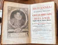
1722032088London : Mary Matthews for Awnnsham Churchill 1722 A very good copy of Camden's Britannia revised by Edmund Gibson and published in 2 volumes in contemporary full leather binding. Page edges pale yellow. With 51 maps 48 by Robert Morden and 3 by Andrew Johnstone 9 plates of coins 2 further full page plates and numerous illustrations in the text. The tree calf bindings have raised bands to spine and title and volume labels. There is some wear to edges and some scuffing to the boards - the back board of Vol I and the front board of Vol II. There is a small 2 cm approx split at the top of the front spine joint in Vol I. There is no corresponding split internally and the board is firmly attached. The contents are generally in very good clean condition with the very occasional mark. Vol I: frontispiece; title page in red and black inks; Dedication 4pp; Preface 2pp; Mr Camden's Preface 4pp; Poems 1p; Ad Lectorum 6pp; Books and Antiquities 13pp; Antoninus Itinerary 6pp; General Heads 3pp; text and maps double column pp ii-cclxvii with 3 maps and 9 coin plates; half title - the Counties of England and Wales; text and maps pp 1-696 double column counting with 33 maps. The map of Kent has 2 small repaired tears at the bottom of the folds and has turned-over edges; the map of Essex has a small 1 cm hole which looks like a paper flaw affecting one word; the maps of Nottinghamshire and Staffordshire have slight staining to corners; and there is a grubby mark in the margin of p299. Vol II: title page in red and black inks; text double column pp 697-1107 with 11 maps and one full page plate; half title - The Union of England and Scotland; text pp 1113-1138; half title Scotland; 2 maps and text to p 1292; half title Ireland; map and text to p1424; half title The Smaller Islands; text to p 1526 and map; half title Appendix; text 46 pp unpaginated; half title The Insertion made by Dr Holland 33pp; blank; Index 91pp; Errata 1p; Finis. There is some spotting to p 1442; a small hole in an index page; and some staining in the index. Mary Matthews, for Awnnsham Churchill hardcover
1736033335<p>LONDON: John Watts 1736 A very good copy of the scarce 1st English edition of Du Halde's General History of China translated in 4 volumes by Richard Brookes. Complete with 19 copper engraved plates of which 11 are folding; 4 folding maps; and numerous head and tailpiece decorations and decorative initial capitals. Du Halde 1674 - 1743 was a French Jesuit and used the letters and accounts written by other Jesuit missionaries to compile his work. it was first published in French in 1735. This English translation was made by Richard Brookes an English physician known for translating works of natural history geography medicine and surgery. All 4 volumes are in full leather: the contemporary boards have been retained and they have new matching spines with raised bands gilt tooling and gilt titles and volume numbers. The boards are in very good condition with occasional light scuffing. Corners have been rebuilt where necessary. All the volumes have the decorative stamp of Mr Thistlethwayte on the front pastedown and his signature at the top of the title page. Volume I has an engraved frontispiece of Confucius; title page in red and black inks; dedication to Frederick Prince of Wales by Richard Brookes; preface; contents listing; folding maps of China and the entrance into Canton; 2 folding plates and 3 one page plates. 509 pp. There is a half title part way through to head up a section on Chinese Monarchy.The map of China has professional repair to a tear around the attachment and the Canton map has a small repair. Vol II has a frontispiece of Father Matthew Ricci; red and black title page; dedication to the Rt Hon Arthur Onslow; contents listing; text with 9 plates of which 8 are folding. 438 pp. Vol III has a frontispiece of Father Adam Schael; dedication to Dr Mead; contents listing; text with 2 pages of musical notation one page plan of an instrument and a diagram of the 5 elements; and one folding plate.496 pp. Vol IV has a frontispiece of Father Ferdinando Verbiest; dedication to the Directors of the United Company of Merchants of England trading to the E Indies; and 2 folding maps - Tibet and Captain Beering's travels. The Tibet map has a small tear which has been professionally repaired.464 pp. All the contents are in very clean condition with the occasional mark or spot. The paper to some sections is quite brown toned. There some corner tip creases and a crease across the top edge of p69/70 in Vol II which has been caused by a binding fault. Please enquire if you would like to see additional images.</p> John Watts hardcover
1797035987London: G. Nicol 1797. 1st Edition 1st Printing. Hardcover. Very Good . 11 1/8" Tall. Frontispieces Plates And Illustrations. Ii Xxxiv518; Ii Xx 626. The Two Complete Text Volumes In Full Size Text Blocks 10 5/8" Tall; The Plates Were Issued 1796 In A Separate Volume Not Present Here; But The Plate Of The Camellia Sesanqua Is Present Between Pp 466 And 467. Original Quarter Morocco Binding Five Bands Morocco Spine Labels Over Boards Covered With Marbled Paper Original Off-White Endpapers Preliminary And Final Blank In Each Volume. Bindings With Old Wear But Nicely Furbished Morocco Labels Clean With Brilliant Gilt A Little Loss Of Leather At Tops Of Spines And At Top Right Front Spine Edge Paper Frayed Along All Edges Of Boards Hinges Tight Contents Clean Just A Few Tiny Foxing Spots. Small Very Old Booksellers' Label Of The China Times Bookseller 94 Consular Road Tientsin. And Another From Sydney. Former Owner's Signature Dated 1894 Erased In Volume 1 Of George Ernest Morrison And A Few Marginalia Which Appear To Be His; George Ernest "G. E." Morrison 1862 - 1920 Also Known As Morrison Of Peking Or Chinese Morrison Was An Australian Adventurer Appointed In February 1897 As The Times Correspondent In Peking Despite His Lack Of Knowledge In The Chinese Language. He Traveled To Vladivostok And Reported To The Times That Russian Engineers Were Making Preliminary Surveys From Kirin Towards Port Arthur Then Sent A Telegram To Say That Russia Had Presented A Five-Day Ultimatum To China Demanding The Right To Construct A Railway To Port Arthur. This Was A Triumph For The Times And Its Correspondent But He Had Also Shown Prophetic Insight In Another Phrase Of His Dispatch When He Stated That "The Importance Of Japan In Relation To The Future Of Manchuria Cannot Be Disregarded". After A Visit To Siam And England Then To Australia 1899-1900 He Returned To Peking. When The Boxer Uprising Broke Out And During The Siege Of The Legations From June To August Morrison As An Acting-Lieutenant Showed Great Courage Always Ready To Volunteer For Every Service Of Danger. After A Siege Of 55 Days The Legations Were Relieved By A Multinational Force Which Then Ransacked Much Of The Palaces In Peking With Morrison Taking Part In The Looting. There Was Great Uncertainty Regarding The Future Of China In The Following Months And Through The Times Morrison Managed To Depict A Skewed Picture Before The British Public. While Russia And Japan United In Opposing Any Dismemberment Of China The Country Was Nevertheless Punished By The Imposition Of A Heavy Indemnity. In 1904 Morrison Became A Correspondent With The Japanese Army. He Was Present At The Entry Of The Japanese Into Port Arthur Early In 1905 And Represented The Times At The Usa Peace Conference. In 1907 He Crossed China From Peking To The French Border Of Tonkin And In 1910 Rode From Honan Across Asia To Russian Turkestan. From Andijan He Took A Train To St Petersburg And Then Traveled To London Arriving On 29 July 1910. A Great Chinese Physician Dr. Wu Lien-Teh Succeeded In Staying The Spread Of This Mortal Sickness Which Seemed To Threaten The Whole World. Morrison Published A Series Of Articles Advocating The Launching Of A Modern Scientific Public Health Service In China. When The Chinese Revolution Began In 1911 Morrison Took The Side Of The Revolutionaries. In August Morrison Resigned His Position On The Times To Become Political Adviser To The Chinese Government And Immediately Went To London To Assist In Floating A Chinese Loan Of £10 Million. In China During The Following Years He Had An Anxious Time Advising And Endeavoring To Deal With The Political Intrigues That Were Continually Going On. He Visited Australia Again In December 1917 And Returned To Peking In February 1918. He Represented China During The Peace Discussions At Versailles In 1919 But His Health Began To Give Way And He Retired To England Well Aware That He Had Only A Short Time To Live. He Died On 30 May 1920 . A Nice Historical Association. Later Ownership Signatures Of G B Wilson. <br/> <br/> G. Nicol hardcover
1706032965London : W Freeman F Walthoe T Newborough F Nicholson and R Parker 1706 A very good copy of the 1st English edition of this work translated from the Dutch edition of 1704. In contemporary panelled calf binding which has been expertly rebacked with new spine with gilt lined raised bands and title label. Corners have been repaired. The binding is in very good clean condition. Contents are complete with large folding map and 30 plates of which 8 are folding. In detail: engraved title dated 1705; title 1706 - with old small signature to the top; epistle 6pp; contents list 4pp; folding map; text pp 1-110 with 29 plates; blank; half title; text pp 115-208 with one plate; Dutch translator's postscript pp 209-10; Finis. The contents are in good to very good condition. There are some toned sections and there is some marking and spotting which is mainly to margins particularly the side margin eg on the title page. There is some professional paper repair small worm hole circa pp 31-34; small edge tears; some side edge repair/reinforcement to plates. Please enquire if you would like to see additional images to further assess condition. Book size 25 cm x 18.5 cm. Eberhard Ysbrants Ides 1657-1708 settled in Moscow in 1687 and traveled as the Russian Envoy to Kangxi the Emperor of China in 1692 returning in 1694 after extensive travels across the region. He was one of the first Europeans to view and describe the Gobi Desert. W Freeman, F Walthoe, T Newborough, F Nicholson, and R Parker hardcover
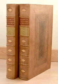
1734D4425Paris: Par La Compagnie des Libraires 1734. Hardcover. Very Good. Three volumes comprising Vol. III parts I to III of Memoires de lAcadémie Royale des Sciences depuis 1666 jusquà 1699. Paris: Par La Compagnie des Libraires 1733-1734. Part I: 231pp.; Part II: 294pp.; Part III: 215pp. 97 engraved folding plates depicting animals and skeletal diagrams. Engraved portrait frontispiece of Claude Perrault in first volume. Contemporary French calf spines gilt edges red; some occasional browning; repairs to joints some rubbing. Unidentified armorial bookplate to front pastedown beneath monogrammed bookplate D.P. with chipmunk and two mice. A later reduced format edition of Perraults Memoires of 1671-1676 Perraults study of this nature was first published in 1669 with the results of investigations of five animals and later expanded with studies of over forty animals. Prior to 1670 most descriptions of animals paid little attention to their internal structure and there were very few images in natural history encyclopedias that depicted skeletons or muscles. That changed with the establishment of the Académie des Sciences in Paris in 1666 by Jean-Baptiste Colbert with the approval of King Louis XIV. The Academy functioned with neither statutes nor regulations until 1699. At that time the Academy used the term mathématique to encompass the fields that are now called astronomy mathematics and physics and the term physique to encompass the fields that are now called anatomy botany zoology and chemistry. In January 1699 Louis reorganized the Academy giving it first regulations. The effect was to give the King more control over their activities in exchange for becoming an official institution under his protection with the new name Académie Royale des Sciences. One of the original academicians the physician Claude Perrault organized regular sessions at which participants could dissect deceased animals from Louis XIVs royal menagerie and record all they observed. Lions chameleons bears gazelles wolves ostriches crocodiles monkeys eagles tigers porcupines and salamanders among some were all laid open by the academics scalpels. These superb folding plates record in great detail the pioneering work at the Academy. These three volumes in three parts focus on the transformative and foundational years of the French Royal Academy of Sciences and Claude Perraults efforts which had made comparative anatomy a vital tool for the classifying naturalist. <br/><br/> Par La Compagnie des Libraires hardcover
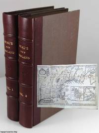
17201347Printed for J. Clark at the Bible & Crown in the Poultry R. Ford at the Angel in the Poultry and R. Cruttenden at the Bible and Three Crowns in Cheapside London 1720. First Edition. Hardcover Quarter Leather. Very Good Condition. Book Two vols. Pagination: 1 x 2 330; 4 331 - 712 xv 1 which lines up with Howe's listing for the first edition. Volume 1 includes the folded map of New England bound between the Table of Contents and the text between signatures A and B. The map is in excellent condition with no loss around the edges but there is a 2†split along the top horizontal fold through the “Bay of Funda†with a small piece of what appears to be acid-free paper tape just under the fold and a one-half inch split at the bottom of the vertical fold not affecting the map. The verso of the last leaf of Vol. 2 is a single advertisement page for “BOOKS printed for John Clark Richard Ford and Robert Cruttenden†which include three of Isaac Watts’ books and a notice of a planned collection of previously unpublished works by John Owen. Sabin 52140; Howe N-26; European Americana 720/178 Neal was an Independent or Dissenting minister educated at Thomas Rowe’s Dissenting Academy. He was friends with other prominent Dissenters of his time including Philip Doddridge and Isaac Watts. His “History†found an immediate audience in New England resulting in an honorary degree from Harvard just a year after the work’s publication Size: Small Octavo. 712 pages. 2-volume set complete. Item Type: Book. The books have been professionally re-bound quarter-bound with the five panel spines in dark brown leather and the boards in a dark brown cloth. The spines are stamped with the title “Neal’s New England†in the second panel a floral device in the third panel and the volume numbers in the fourth. The end papers have been replaced sympathetically with tan laid paper. The title page of Vol. 1 has been reattached with Japanese paper. Scattered foxing but text mostly clean. There are a few five by my count but I may have missed some pages with penciled notes in the margin or underlining. Note by an early owner in brown ink on the free front end paper of Vol. 2: "Horatio Aldin. purchased for him in London by his friend Geo. Oats Esqr. 1826". Quantity Available: 1. Category: Antiquarian & Rare; Britain/UK; 18th century; History. Main Picture: Neal 1700 The History of New England - Spines and front cover with inset of the fold-out map of New England. Picture 2: Neal 1700 The History of New England - Page edges and rear cover. Picture 3: Neal 1700 The History of New England - Title pages for both volumes. Picture 4: Neal 1700 The History of New England - Fold-out map of New England. Picture 5: Neal 1700 The History of New England - Partial view of the fold-out map of New England facing the beginning of the text in Volume 1. Picture 6: Neal 1700 The History of New England - Folded-up map of New England facing the beginning of the text in Volume 1. Picture 7: Neal 1700 The History of New England - End of Neal's Dedication and first page of the Preface. Picture 8: Neal 1700 The History of New England - End of the Table of Contents and beginning of the text of Volume 2. Picture 9: Neal 1700 The History of New England - Part of the appendices at the end of Volume 2. Pictures of this item not already displayed here available upon request. Inventory No: 1347. . Printed for J. Clark, at the Bible & Crown in the Poultry, R. Ford, at the Angel in the Poultry, and R. Cruttenden, at the Bible hardcover
1788013271London: J. Dodsley 1788 London: J. Dodsley 1788. Early printing of the United States Constitution with the Circular Letters transmitted to the Governors of the States Plan of the New Constitution signed in the plate by George Washington and the Constitution itself through Article VII followed by the resolution to lay the Constitution before Congress and a request by the Memorial Society for the Abolition of Slavery in Pennsylvania to Congress to abolish the slave trade as part of the constitution. Cloth binding leather spine labels minor pen marks inside front endpapers bow to boards. Very good. J. Dodsley hardcover
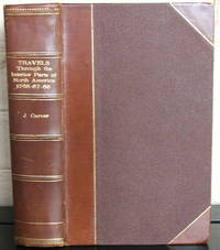
1778007643London: Printed for the Author. First edition. Bound in 3/4 calf with raised bands and gilt titles decorative endpapers. Published London: Printed for the author 1778. 8vo. 5 1/2" x 8 1/4" xvi 17-543 1 pp. errata page two folding engraved maps that are fully hand-colored plus four plates - Falls of St. Anthony on the Mississippi An Indian Pipe of Peace and two plates of native peoples. Includes a Chippewa vocabulary. Large bookplate of Otto Oren Fisher on front pastedown. Jonathan Carver 1710-1780 was an explorer mapmaker author and one of the first white men to explore and map areas of Minnesota and Wisconsin. Part of a small expedition to map uncharted territory west of the Mississippi he visited many of the Native American groups residing in the area. He "penetrated farther into the West than any other English explorer before the Revolution" Howes. While French explorers had been in the area earlier they did not leave behind detailed maps or journals as Carver did. He explored the headwaters of the Mississippi and wintered with a tribe of Dakota in the Great Lakes region recording their customs. A classic of American travel it is one of the earliest and best accounts of pre-Revolution exploration. A compelling narrative of travel and adventure it was highly inspirational to post-Independence explorers and has been published in more than 30 editions. In addition to his comments on the natural history and the Native Americans of the West this work contains the first published mention of the word "Oregon." Wear at the tips outer hinge starting small tape repair to the stub of first map and free endpaper some offsetting from plates and maps to facing page else near fine clean text bright unmarked. A very attractive example. . Very Good Plus. Hard. 1st. 1778. Printed for the Author unknown
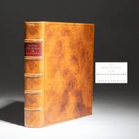
177318311London: W. Strahan and T. Becket and Co 1773. First Edition. Full calf. Near fine. The first edition of The History Of The British Dominions In North America published in 1773 with a large fold-out map of the American Colonies. Quarto 12 297pp 1 1-276pp 1. Contemporary polished calf raised bands title stamped in gilt over red morocco label. New marbled endpapers. Two archival paper repairs to title page. Faint transference from map to title page even toning to leaves throughout. Bookplate affixed to rear pastedown from printmaker Helen Hyde titled "The Mosquito." Includes the publisher's hand-colored fold-out map by Peter Bell dated 1772. Archival paper repair to verso at the hinge faint transference along bottom quarter an attractive example. Sabin 32161 Howes H527aa. This two-volume work bound as one details the history of North America from its discovery through 1763. Fourteen individual chapters detail the history of the British colonies of North America including Pennsylvania Nova Scotia Connecticut Rhode Island Florida etc. W. Strahan and T. Becket and Co unknown
1797042012-EBoston Mass. USA: W. Spotswood & J. Nancrede 1797. Book. Illus. by Various Map Makers. Very Good. Full-Leather. 1st. American Edition. 1st. Edition USA 1797 . 1st. Printing Walnut brown leather with gilded letters on the spine. Volume 1 536 page book with 11 fold out maps . Both volume have been rebound with new leather and blank end papers aging and light staining on some pages and maps. Volume 2 573 page book with 5 fold out maps and errata at back page with directions to the binder for placing the charts with a list of books by the publisher Joseph Nancrede. Condition : Very Good see Image . Note no international sale. Size: 8vo - over 7¾" - 9¾" tall Size: 8vo - over 7¾ - 9¾" tall. W. Spotswood & J. Nancrede Hardcover
17229900002372London: James and John Knapton et al. 1722. Hardcover. Maps engravings. Folio. Two large volumes in original full leather bindings. Title pages are printed in red and black with an elegant full-page copper engraving of Camden as the frontispiece of the first volume. There are 50 double-page maps of the English counties Ireland Scotland and 'the Islands'; six of the maps are folding. There are also twelve large full-page engravings and numerous smaller engravings in the text. There is a comprehensive index and the errata page is present. A previous owner has reinforced the hinges with linen-like binding tape. The boards are quite worn and rubbed but a competent bookbinder could restore both bindings. The contents are remarkable clean with only occasional foxing and a few stained pages. The maps by the cartographer Robert Morden and which are usually removed and sold individually are all in excellent condition. Overall a good set. William Camden 1551-1623 was an English antiquary and historian who during the reign of Queen Elizabeth travelled throughout England collecting material for 'Britannia' which was first published in 1586. Initially written in Latin it is a survey of the British islands; its archaeology geography institutions monetary system and inhabitants 'chiefly intended for the instruction of foreigners' or so Gibson states in his Preface to this edition. It was first translated into English in 1610 probably under Camden's direction see Ency. Brit. 11th vol. V p. 101. Gibson's revision was first published in 1695. Our set is the undated 'Second Edition' but by comparing particulars with available bibliographical resources we believe it was published in 1722. Printing and the Mind of Man 101. James and John Knapton et al. hardcover
1747BOOKS005853<p>24548 pages with three folding engraved maps present southern part of South America; part of the Pacific Ocean and the track of the Centurion round the world. Octavo 8 1/4" x 5 1/2" bound in full leather with five raised spine bands with red label to spine in gilt lettering with decorative blind-stamped ruled edges. Compiled from papers and other materials of the Right Honourable George Lord Anson and published under his direction by Richard Walter M.A. Chaplain of his Majesty's Ship the Centurion in that expedition. Hill I pp 317-138. Third edition.<br /><br />"This is the official account of Anson's voyage. England at war with Spain in 1739 equipped eight ships under the command of George Anson to harass the Spaniards on the western coast of South America for the purpose of cutting off Spanish supplies of wealth from the Pacific area. Lord Anson who was a friend and patron of Benjamin Robins after returning from the voyage around the world in the Centurion appears to have entrusted to Robins for revision the account of the voyage which had been compiled from the journals by his chaplain Richard Walter. It is probable that Robins revised and edited the work wrote an introduction and added dissertations." Hill. Perhaps the most popular account of maritime adventure of the eighteenth century. Anson's account of harrying the Spanish of South America and the taking of the Manilla galleon with treasure with a contemporary value of $800000 and his circumnavigation has long enjoyed a distinguished place as a masterpiece in descriptive travel.<br /><br /><strong>Condition:</strong><br /><br />Some small closed tears at the edges of the maps. Rebound in tooled leather with raised bands. Over all a very good to fine copy.</p> John and Paul Knapton and Office of the Lord High Admiral hardcover
178025530Paris. Very Good. 1780-1801. First Edition. Hardcover. A beautiful 32 volume set of La Harpe's Voyages although without the atlas volume. In the original full leather. Text is in French. ; 8vo 8" - 9" tall . hardcover
1728BOOKS00671225144 contents and errata2 pages with 2 folding maps lacks frontispiece. Small Quarto 10" x 7 3/4". Rebacked in the 19th century leather retaining the original spine with raised bands and gilt decorative stamping and lettering to spine. Translated from the original Portuguese manuscripts by Jackim le Grande. First edition.<br /><br />Born in Lisbon he entered the Order of Jesus at the age of sixteen. In 1621 he was ordered as a missionary to India and in 1622 he arrived at Goa. With the intention of proceeding to Abyssinia whose Negus emperor Segued had been converted to Roman Catholicism by Pedro Páez he left India in 1624. He disembarked on the coast of Mombasa and attempted to reach his destination through the Galla country but was forced to return. In 1625 he set out again accompanied by Mendez the patriarch of Ethiopia and eight missionaries. The party landed on the coast of the Red Sea and Lobo settled in Abyssinia as superintendent of the missions in Tigre. He remained there until death deprived the Catholics of their protector the emperor Segued. Forced by persecution to leave the kingdom in 1634 Lobo and his companions fell into the hands of the Turks at Massawa who sent him to India to procure a ransom for his imprisoned fellow-missionaries. In this he was successful but could not induce the Portuguese viceroy to send an armament against Abyssinia. Intent upon accomplishing this cherished project he embarked for Portugal and after he had been shipwrecked on the coast of Natal and captured by pirates arrived at Lisbon. Neither at this city however nor at Madrid and Rome was any countenance given to Lobo's plan. He accordingly returned to India in 1640 and was elected rector and afterwards provincial of the Jesuits at Goa. After some years he returned to his native city and died there January 29 1678.<br /><br />Lobo wrote an account of his travels in Portuguese which appears never to have been printed but is deposited in the monastery of St. Roque Lisbon. Balthazar Telles made large use of the information therein in his Historia geral da Ethiopia a Alta Coimbra 1660 often erroneously attributed to Lobo see Machado's Bibliotheca Lusitana. Lobo's own narrative was translated from a manuscript copy into French in 1728 by the Abbe Joachim le Grand under the title of Voyage historique d'Abissinie. In 1669 a translation by Sir Peter Wyche of several passages from a manuscript account of Lobo's travels was published by the Royal Society translated in Melchisédech Thévenot<i>Relation des voyages</i> in 1673. An English abridgment of Le Grand's edition by Dr. Johnson was published in 1735 reprinted 1789. In a <i>Mémoire justificatif en réhabilitation des pères. Pierre Paëz et Jérôme Lobo</i> Dr. C. T. Beke maintains against Bruce the accuracy of Lobo's statements as to the source of the Abai branch of the Nile. See A. de Backer <i>Bibliothèque de la Compagnie de Jésus</i> edited by C. Sommervogel iv. 1893.<br /><br /><b>Condition:</b><br /><br />Old stamp and inscription on title page first folding map conspicuously restored second map tear restored else a very good copy notes to front end paper in period pen else about very good. La Veuve d'Antoine-Urbain Co hardcover
1748GT719London: M. Coooper 1748. 1st Edition . Hardback. Vg. 12mo. 316pp pp 253-316 contains The Journal of George Jams i His Pilgrimage amongst the Inland Natives of the Countires Adjoyning to South Carolina Field No 1618 Indian Bibliography. Original full calf with the original red morocco label. Original owners name George Basson to the inside front endpapercrossed out. Title-page dated MDCCXLVII .The spine calf has a lengthways crack affecting the original label. All original state. A RARE ITEM. No copy appears to have been at auction since 1955. Sabin 100991 27x10cms <br/> <br/> M. Coooper hardcover
1795E0029<b>Samuel Hearne was the first European to make an overland excursion across northern Canada to the Arctic Ocean</b><br /><br />xliv458 pages with two of four engraved plates after drawings by the author both folding and four of five folding engraved maps. Quarto 11 3/4" x 9 3/4" bound in full leather with raised spine bands and gilt lettering to spine. HillI page 141. Sabin 31181 First edition.<br /><br />Manuscript journal was found by La Pérouse when he captured Fort Albany; later one of his conditions of surrender was that it be published. Samuel Hearne 1745 – November 1792 was an explorer fur-trader author and naturalist. He was the first European to make an overland excursion across northern Canada to the Arctic Ocean In 1774 Hearne built Cumberland House for the Hudson's Bay Company its first interior trading post and the first permanent settlement in present Saskatchewan. From 1769 to 1772 Hearne was employed in north-western discovery searching especially for certain copper mines described by Indians as "Far-Away-Metal River". These copper mines were found in the Barren Lands where the ground is permanently frozen to within a few inches of the surface creating in many areas vast stretches of mosquito- and fly-infested swamp during the summer thaw. For this reason it was decided that travel in winter was preferable. His first attempt began on 6 November 1769. The large size of the expedition and too much European equipment being carried led to the desertion of his Indian guides and the failure of the expedition. His second commencing 23 February 1770 failed because his quadrant was broken and much of his equipment was stolen. Learning from the mistakes of the first two expeditions Hearne contrived to travel as the only European with a group of Indians led by the great chief Matonabbee. The group also included eight of Matonabbee's wives to act as beasts of burden in the sledge traces camp servants and cooks. This third expedition set out in December 1770 in order to reach the Coppermine River in summer by which he could descend to the Arctic in canoes. Matonabbee kept a fast pace so fast they reached the great caribou traverse before provisions dwindled and in time for the spring hunt. Here all the Indian hunters of the north gathered to hunt the vast herds of caribou migrating north for summer. A store of meat was laid up for Hearne's voyage and a band of warriors joined the expedition. Matonabbee ordered the women to wait for his return in the Athabasca country to the west. The Chipewyans were generally a mild and peaceful people however they were in a state of conflict with the Inuit. A great number of Indians joined Hearne's party to accompany them to the Coppermine River with intent to murder Inuit who were understood to frequent that river in considerable numbers.2 On July 14 1771 they reached the Coppermine River a small stream flowing over a rocky bed in the "Barren Lands of the Little Sticks". A few miles down the river just above a cataract were the domed wigwams of an Eskimo camp. At 1am on July 17 1771 Matonabbee and the other Indians fell upon the sleeping Eskimo in a ruthless massacre. Approximately twenty men women and children were killed; this would be known as the Massacre at Bloody Falls. A few days later Hearne was the first European to reach the shore of the Arctic Ocean by an overland route. By tracing the Coppermine River to the Arctic Ocean he had established there was no northwest passage through the continent at lower latitudes. This expedition also proved successful in its primary goal by discovering copper in the Coppermine River basin. However an intensive search of the area yielded only one four-pound lump of copper and commercial mining was not considered viable. Matonabbee led Hearne back to Churchill by a wide westward circle past Bear Lake in Athabasca Country. In midwinter he became the first European to see and cross Great Slave Lake. Hearne returned to Fort Prince of Wales on 30 June 1772 having walked some 5000 miles and explored more than 250000 square miles.<br /><br />Condition:<br /><br />Rebound in attractive leather with raised spine bands. Lacks frontispiece map and two plates. Plate I A North West View of Prince of Wales's Fort and Plate IV A Winter view of the Athapuscow Lake. Some internal spotting. Small repair to title page and verso and front free end paper edge else a better than very good copy. Printed for A Strahan and T Cadell hardcover