9 442 résultats
190646279Washington: G.P.O. 1906. 8vo. 112 pp. Tables diagrams. Embossed emerald-green cloth gilt lettering on front cover & spine embossed ruling on covers ex-lib spine label & stamps on front endpapers slight shelfwear very minor bumping to couple corners still G ex-lib copy w/ bookplate on front pastedown. First edition of this very scarce service manual for directing the operations of the U.S. Army Signal Corps at the beginning of the 20th century published just prior to the San Francisco earthquake & fire. This manual details the equipment and specifications for setting up and maintaining telegraph & telephone lines telegraph codes types of property all of the tools required for their systems and includes sections on wireless telegraphy balloons submarine-cable instruments fieldglasses and more. The Signal Corps was commanded by the famed polar explorer Adolphus Greely 1844-1935 who had been appointed to the post by President Grover Cleveland. Under his command the Signal Corps was vastly expanded and constructed operated and maintained telegraph lines during the Spanish-American War the Philippine Insurrection constructed a line of 4000 miles to Alaska and proved to be a vital lifeline during the aftermath of the San Francisco earthquake & fire in April 1906. In the burned out city the Signal Corps set up 42 telegraph offices and 79 telephone offices connecting all the military districts federal buildings railroad offices & depots city offices and other vital locations. G.P.O., hardcover
181252868Washington City:: Printed by R. C. Weightman 1812. First edition. original marbled boards rear board lacking. The rear board is lacking. Small dime-sized hole to the lower right corner of the title page;binding worn; one relevant tiny ink annotation. . 12mo. Printed by R. C. Weightman, hardcover
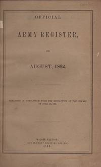
186230103Washington DC: Government Printing Office 1862. First Edition. Hardcover. Fair. Octavo. 118 pages. Contents include three folding charts opposite page 88 and an alphabetical index in back. Former institutional copy rebound in red cloth covered boards with red leather spine and corners. Original wraps preserved and in very good condition. Commandery of the State of Illinois illustrated label on the front paste down. The label is signed by Roswell H. Mason and dated Sept. 1909. The front board is detached. Leather is rubbed on the spine. Library paper label on spine. Interior contents in good condition. This is the first Army Register printed with Major General Geo. B. McClellan listed at top General on page 3. Other officers include John Fremont and Henry Halleck. U.S. Grant is listed on page 63. George Custer is listed on page 21 as Second Lieutenant Fifth Regiment of Cavalry. Government Printing Office hardcover
195162701Chicago: Univ. of Chicago Press 1951. Tall thick 8vo. xxix 1 947 1 pp. With many maps numerous photo plates. Dark blue publisher’s cloth gilt badge lozenge on front cover gilt lettering on spine map-illustrated endpapers minor shelfwear dustsoiling slight bumping to couple corners w/ d.j. wraparound map cover art edgewear small closed tears minor chipping & tear head of spine fore-edge front cover still VG/G copy w/ former ownership stamp on half-title. First edition of this expansive and surprisingly scarce 3rd Volume in the series devoted to the the carrying out of air operations and bombing campaigns in Europe and the Mediterranean in 1944 to the end of the War including supports of the D-Day invasion Italy landings and attacks upon German V-weapon rocket installations. Very scarce in original dustjacket. Univ. of Chicago Press, hardcover
1939051562Ankara: T.C. Nafia Vekâleti 1939. No Binding. Very Good. 8vo - over 7¾ - 9¾" tall. Original typescript letter signed TLS 'A. F. Cebesoy' sent to Salih Sener. 23x15 cm. In Turkish. Dated 'November 1 1939'. Response to greetings of Salih Keçeci. Text: "Sayin Bay Salih Tebrikinize tesekkür ederim. Bayraminizi kutlular sihhat ve saadetler dilrim. Hürmetler. Naia Vekili Ali Fuad Cebesoy.". Ali Fuat was born in September 1882 to father Ismail Fazil Pasha and mother Zekiye Hanim. Ali Fuat was the grandson on his mother's side of Mushir Mehmet Ali Pasha. Ludwig Karl Friedrich Detroit who was the commander of the Danube Army Tuna Sark Ordusu during the Russo-Turkish war participated in the Congress of Berlin as one of three representatives of the Ottoman Empire and was killed on September 7 1878. in Dakovica Kosovo by Albanian insurgents who were dissatisfied with the results of the Berlin Congress. Ali Fuat attended the War School in 1902 and graduated from the Ottoman War College in 1905 as a Staff Captain. He was assigned to the 3rd Rifle Battalion Üçüncü Nisanci Taburu the 28th Cavalry Regiment Yirmi Sekizinci Süvari Alayi based in Beirut under the command of Fifth Army based in Damascus and later to 15th Artillery Regiment On Besinci Topçu Alayi based in Thessalonica under the command of Third Army as an intern. He joined the Committee of Union and Progress membership number was 191. On June 28 he was assigned to the staff officer of the Third Army. And then he was promoted to the rank of Senior Captain and appointed to the area commander of Karaferye present day: Veria. On January 9 1909 he was appointed to the military attaché in Rome Italy. On October 1 1911 he was appointed to the chief of the 1st department chief of operations of the Western Army On February 20 he was temporarily appointed to the chief of staff of the VII Corps</a>. And then he was appointed to the commander of a detachment that was formed to liberate Ipek present day: Pec and Yakova Dakovica from insurgents. On January 15 1914 he was appointed to the chief of staff of the VIII Corps. After Kress von Kressenstein was appointed the chief of staff of this corps replacing Ali Fuat he was promoted to the rank of Lieutenant Colonel Kaymakam and on September 19 he was appointed to the commander of the 25th Division. In January 1915 he participated in the First Suez Offensive. On January 7 he and his division left Birüssebi present day: Beersheba for the desert and arrived at the front of the Suez Canal but the Ottoman forces couldn't pass the canal and retreated. He and his division went back to Gaza on January 20 1915. After the Gallipoli Campaign was launched the 25th Division was dispatched to the Gallipoli Front on May 24 1915 and started to arrive there on June 2 1916. His division entered to the order of the XVII Corps of the First Army and deployed in the Bulair-Saros area. On January 20 1916 he was appointed to the commander of the 14th Division. At first his division was intended for use in the Second Suez Offensive and sent to Maallaha but because of the Russian offensive his division instead came under the command of the Second Army under Ahmet Izzet Pasha and on June 27 were sent back from the Rayak station to Aleppo and dispatched to Diyârbekir. On September 30 he was promoted to commander of the 5th Division and in January he became the chief of staff of the Second Army. On January 12 1917 he returned to the Sina-Palestine Front and in April he became the deputy commander of the Sina-Palestine Front. On June 30 1917 he became the commander of the XX Corps. After the Armistice of Mudros was signed he concurrently became the deputy commander of Seventh Army replacing Mustafa Kemal. After the Seventh Army was abolished he transferred the headquarters of the XX Corps from Syria to Eregli then to Konya and to Ankara. Ali Fuat Pasha organized the resistance in Western Turkey against the Greek invasion and thus actually started the National Independence War. <br/> <br/> T.C. Nafia Vekâleti unknown
194518311Randolph Field TX: Army Air Forces Training Command. Very Good. 1945. First Edition. Metal post in flexible covers. The covers are soiled with names and notes in various places. Well illustrated including photo of the cockpit. ; 4to 11" - 13" tall; 120 pages . Army Air Forces Training Command unknown
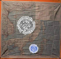
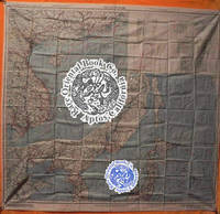
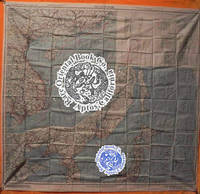
38000905Washington D.C. 1945 Army Map Service U.S. Army. Silk map folds down to ca. 12.5 x 14.5 cm. opens up to 85.5 x 81.5 cm. printed in color on two sides bright one tiny margin tear else cleantwo maps in all. O B S C U R E . . . ORIGINAL WORLD WAR 2 SURVIVAL & EVASION MAP . .SHOWING A VERY LONG EAST COAST OF RUSSIA GULF OF SAKHALIN . . TARTARY STRAIGHT SOUTH DOWN THE COAST AMUR RIVER . . VLADIVOSTOK ALL OF MANCHURIA KOREA MUKDEN HSINKING . . DAIREN GULF OF CHILI BEIJING SHANGHAI WEIHAIWEI . . TSINGTAU NORTH HOKKAIDO & HONSHU KURIL ISLANDS AMOY . . SWATOW HONG KONG MACAO CANTON KWANGCHOW HAINAN . . YUNNAN KUNMING GUILIN LIUZHOU NANNING HANOI DOWN . . THE COAST TO VIETNAM LAOS CAMBODIA S. HONSHU KYUSHU . . TAIWAN PHILIPPINES HANGZHOU SUCHOW NANKING NINGBO . . FOOCHOW AMOY OKINAWA & TOO MANY OTHERS TO LIST . . SHOWING GREAT DETAILS: ROADS RAILROADS AND RIVERS . U.S.A.A.F. United States Army Air Force issue one on each side one sheet = 2 maps. in all printed in full color. . No. C-52: JAPAN AND SOUTH CHINA SEAS. Shows Yunnan Fu Kunming City in the uppermost left corner at about 24.5 degrees by 103 degrees; then Kweilin Guilin at 110 degrees and Amoy Xiamen Shanghai Nanking Nanjing Foochow and the edge of the Pescadores on the Tropic of Cancer at the north end of the map. . Includes the large operational area of the "FLYING TIGERS" "A.V.G." & the FOURTEENTH AIR FORCE in China. Including important airbase cities: Nanning Liuzhou Kweilin & Kunming. . Below these areas from the left or extreme west Laos Cambodia Phnom Penh Saigon Hanoi all of Indo-China Vietnam down to Paulau Condor sic Paolo Condor Island and the tip of Vietnam at 8 degrees. Hainan Island Macao Hong Kong up the coast to Shantou. . No. C-53: EAST CHINA SEAS: Shows Yenchowfu and Changtse upper left Part of Korea at 35 degrees Japan from Sendai down to Okinawa all of Formosa to the Philippines Baguio Manila all of that area down to Albay. Including Shanghai Nanjing Qingdao Hangzhou most of the east coast of China Taiwan & Korea. . The large inset to the right shows Sakhalin the Kuril Islands Hokkaido Northern tip of Honshu Aomori down to Kanazawa Choshi at about 36 degrees. The Amur River and much of extreme eastern Russia Vladivostok down the Pacific coast Manchuria Mukden Korea Port Arthur Dairen Gulf of Chili Beijing Paotingfu down to Suzhou at 34 degrees. Up the coast of the Yellow Sea Qingdao and that area. . The back side shows the balance of the map are from the front side. From the left Tsinan Yenchowfu Weihaiwei down the Yellow Sea along the Pacific coast to Nanjing Shanghai Hangzhou Ningbo Taichofu Wenchow Funing fu Lienkong Fuzhou Xiamen down to Yunsiaoh across the Formosa Straits to all of Taiwan Formosa South to the Philippines Bataan the main island of Luzon Manila down to almost 13 degrees south ending at Sorsogon Gubat. The rest of the right east portion shows the Marianas Islands Guam at the extreme lower right the Ogasawara Kanzan groups with Korea at the upper middle from about 37 degrees showing all from Shunsen Keijo Seoul down to Kanra San the southern island. Showing much of Japan from where the other map left off: Sakata on Honshu all of Japan Shikoku Kyushu Tokara Group the island chains Amami Okinawa groups Naha Ryukyu Islands/Okinawa down to Taiwan. . INSET MAPS: No. C-52: has one very large inset of N. Russia & N. Sakhalin south down to Korea Tsingtau and Chowfu. And Hokkaido Honshu down to Urawa 36 degrees south. . A second inset shows the key & legend to lines on the map currents winds scale 1/4000000 or 1/4m. heights in meters with 'Location Index" which is a key and guide to other adjacent maps in this series and this geographical area. . All part of the basic combat operation region for the U.S. A.A.F. U.S. Navy war against Japan. With ocean currents noted for possible air crew survival back to land. . USED BY THE "FLYING TIGERS:" This map and many similar to it were part of the "E & E" survival items issued to "FLYING TIGER" and "A.V.G." "AMERICAN VOLUNTEER GROUP" pilots. They were often tied around the neck by pilots and air crew while flying combat missions. . The map also has an Annual Magnetic Change compass miles scale kilometers nautical miles 1:1000 000 altitudes of land mass legend or key to symbols roads towns cities rivers mountains and an index to boundaries. . This map was part of the U.S. Army Air Force & Naval flyers "E & E" Escape and Evasion survival kit printed on thick silk parachute cloth. These maps were often worn by fighter and other air crew members as scarves to insure they would be with the downed airman if/when his plane or he had to parachute out into the sea or over land. Each air crew member carried among other survival supplies a .38 caliber pistol survival knife a signal mirror stainless steel or glass compass and some basic food rations fishing kit water purification tablets along with minor medical supplies; the whole kit was tucked into the pants pocket of the flight suit. . The majority of these perishable maps have been lost during World War II and very few survived the attrition of war time and humid climates. This map was considered the "LAST HOPE" for safe return to Allied lines. Given to fliers in the Pacific war against Japan. . Color photos are posted to our website. . . unknown
38000904Washington D.C. 1945 Army Map Service U.S. Army. Silk map folds down to ca. 12.5 x 14.5 cm. opens up to 83.5 x 83.5 cm. color printed 2 sides brightextra clean feint small margin stain at top minor impact two maps in all. OBSCURE . . . ORIGINAL WORLD WAR 2 SURVIVAL & EVASION MAP . .SHOWING A VERY LONG EAST COAST OF RUSSIA GULF OF SAKHALIN . . TARTARY STRAIGHT SOUTH DOWN THE COAST AMUR RIVER . . VLADIVOSTOK ALL OF MANCHURIA KOREA MUKDEN HSINKING . . DAIREN GULF OF CHILI BEIJING SHANGHAI WEIHAIWEI . . TSINGTAU NORTH HOKKAIDO & HONSHU KURIL ISLANDS AMOY . . SWATOW HONG KONG MACAO CANTON KWANGCHOW HAINAN . . YUNNAN KUNMING GUILIN LIUZHOU NANNING HANOI DOWN . . THE COAST TO VIETNAM LAOS CAMBODIA S. HONSHU KYUSHU . . TAIWAN PHILIPPINES HANGZHOU SUCHOW NANKING NINGBO . . FOOCHOW AMOY OKINAWA & TOO MANY OTHERS TO LIST . . SHOWING GREAT DETAILS: ROADS RAILROADS AND RIVERS . U.S.A.A.F. United States Army Air Force issue one on each side one sheet = 2 maps. in all printed in full color. . No. C-52: JAPAN AND SOUTH CHINA SEAS. Shows Yunnan Fu Kunming City in the uppermost left corner at about 24.5 degrees by 103 degrees; then Kweilin Guilin at 110 degrees and Amoy Xiamen Shanghai Nanking Nanjing Foochow and the edge of the Pescadores on the Tropic of Cancer at the north end of the map. . Includes the large operational area of the "FLYING TIGERS" "A.V.G." & the FOURTEENTH AIR FORCE in China. Including important airbase cities: Nanning Liuzhou Kweilin & Kunming. . Below these areas from the left or extreme west Laos Cambodia Phnom Penh Saigon Hanoi all of Indo-China Vietnam down to Paulau Condor sic Paolo Condor Island and the tip of Vietnam at 8 degrees. Hainan Island Macao Hong Kong up the coast to Shantou. . No. C-53: EAST CHINA SEAS: Shows Yenchowfu and Changtse upper left Part of Korea at 35 degrees Japan from Sendai down to Okinawa all of Formosa to the Philippines Baguio Manila all of that area down to Albay. Including Shanghai Nanjing Qingdao Hangzhou most of the east coast of China Taiwan & Korea. . The large inset to the right shows Sakhalin the Kuril Islands Hokkaido Northern tip of Honshu Aomori down to Kanazawa Choshi at about 36 degrees. The Amur River and much of extreme eastern Russia Vladivostok down the Pacific coast Manchuria Mukden Korea Port Arthur Dairen Gulf of Chili Beijing Paotingfu down to Suzhou at 34 degrees. Up the coast of the Yellow Sea Qingdao and that area. . The back side shows the balance of the map are from the front side. From the left Tsinan Yenchowfu Weihaiwei down the Yellow Sea along the Pacific coast to Nanjing Shanghai Hangzhou Ningbo Taichofu Wenchow Funing fu Lienkong Fuzhou Xiamen down to Yunsiaoh across the Formosa Straits to all of Taiwan Formosa South to the Philippines Bataan the main island of Luzon Manila down to almost 13 degrees south ending at Sorsogon Gubat. The rest of the right east portion shows the Marianas Islands Guam at the extreme lower right the Ogasawara Kanzan groups with Korea at the upper middle from about 37 degrees showing all from Shunsen Keijo Seoul down to Kanra San the southern island. Showing much of Japan from where the other map left off: Sakata on Honshu all of Japan Shikoku Kyushu Tokara Group the island chains Amami Okinawa groups Naha Ryukyu Islands/Okinawa down to Taiwan. . INSET MAPS: No. C-52: has one very large inset of N. Russia & N. Sakhalin south down to Korea Tsingtau and Chowfu. And Hokkaido Honshu down to Urawa 36 degrees south. . A second inset shows the key & legend to lines on the map currents winds scale 1/4000000 or 1/4m. heights in meters with 'Location Index" which is a key and guide to other adjacent maps in this series and this geographical area. . All part of the basic combat operation region for the U.S. A.A.F. U.S. Navy war against Japan. With ocean currents noted for possible air crew survival back to land. . USED BY THE "FLYING TIGERS:" This map and many similar to it were part of the "E & E" survival items issued to "FLYING TIGER" and "A.V.G." "AMERICAN VOLUNTEER GROUP" pilots. They were often tied around the neck by pilots and air crew while flying combat missions. . The map also has an Annual Magnetic Change compass miles scale kilometers nautical miles 1:1000 000 altitudes of land mass legend or key to symbols roads towns cities rivers mountains and an index to boundaries. . This map was part of the U.S. Army Air Force & Naval flyers "E & E" Escape and Evasion survival kit printed on thick silk parachute cloth. These maps were often worn by fighter and other air crew members as scarves to insure they would be with the downed airman if/when his plane or he had to parachute out into the sea or over land. Each air crew member carried among other survival supplies a .38 caliber pistol survival knife a signal mirror stainless steel or glass compass and some basic food rations fishing kit water purification tablets along with minor medical supplies; the whole kit was tucked into the pants pocket of the flight suit. . The majority of these perishable maps have been lost during World War II and very few survived the attrition of war time and humid climates. This map was considered the "LAST HOPE" for safe return to Allied lines. Given to fliers in the Pacific war against Japan. . Color photos are posted to our website. . . unknown
38000902Washington D.C. 1945 Army Map Service U.S. Army. Silk map folds down to ca. 12.5 x 14.5 cm. opens up to 83.5 x 83.5 cm. color printed 2 sides bright superbly clean unused copy as issued two maps in all like "NEW'. O B S C U R E . . . ORIGINAL WORLD WAR 2 SURVIVAL & EVASION MAP . .SHOWING A VERY LONG EAST COAST OF RUSSIA GULF OF SAKHALIN . . TARTARY STRAIGHT SOUTH DOWN THE COAST AMUR RIVER . . VLADIVOSTOK ALL OF MANCHURIA KOREA MUKDEN HSINKING . . DAIREN GULF OF CHILI BEIJING SHANGHAI WEIHAIWEI . . TSINGTAU NORTH HOKKAIDO & HONSHU KURIL ISLANDS AMOY . . SWATOW HONG KONG MACAO CANTON KWANGCHOW HAINAN . . YUNNAN KUNMING GUILIN LIUZHOU NANNING HANOI DOWN . . THE COAST TO VIETNAM LAOS CAMBODIA S. HONSHU KYUSHU . . TAIWAN PHILIPPINES HANGZHOU SUCHOW NANKING NINGBO . . FOOCHOW AMOY OKINAWA & TOO MANY OTHERS TO LIST . . SHOWING GREAT DETAILS: ROADS RAILROADS AND RIVERS . U.S.A.A.F. United States Army Air Force issue one on each side one sheet = 2 maps. in all printed in full color. . No. C-52: JAPAN AND SOUTH CHINA SEAS. Shows Yunnan Fu Kunming City in the uppermost left corner at about 24.5 degrees by 103 degrees; then Kweilin Guilin at 110 degrees and Amoy Xiamen Shanghai Nanking Nanjing Foochow and the edge of the Pescadores on the Tropic of Cancer at the north end of the map. . Includes the large operational area of the "FLYING TIGERS" "A.V.G." & the FOURTEENTH AIR FORCE in China. Including important airbase cities: Nanning Liuzhou Kweilin & Kunming. . Below these areas from the left or extreme west Laos Cambodia Phnom Penh Saigon Hanoi all of Indo-China Vietnam down to Paulau Condor sic Paolo Condor Island and the tip of Vietnam at 8 degrees. Hainan Island Macao Hong Kong up the coast to Shantou. . No. C-53: EAST CHINA SEAS: Shows Yenchowfu and Changtse upper left Part of Korea at 35 degrees Japan from Sendai down to Okinawa all of Formosa to the Philippines Baguio Manila all of that area down to Albay. Including Shanghai Nanjing Qingdao Hangzhou most of the east coast of China Taiwan & Korea. . The large inset to the right shows Sakhalin the Kuril Islands Hokkaido Northern tip of Honshu Aomori down to Kanazawa Choshi at about 36 degrees. The Amur River and much of extreme eastern Russia Vladivostok down the Pacific coast Manchuria Mukden Korea Port Arthur Dairen Gulf of Chili Beijing Paotingfu down to Suzhou at 34 degrees. Up the coast of the Yellow Sea Qingdao and that area. . The back side shows the balance of the map are from the front side. From the left Tsinan Yenchowfu Weihaiwei down the Yellow Sea along the Pacific coast to Nanjing Shanghai Hangzhou Ningbo Taichofu Wenchow Funing fu Lienkong Fuzhou Xiamen down to Yunsiaoh across the Formosa Straits to all of Taiwan Formosa South to the Philippines Bataan the main island of Luzon Manila down to almost 13 degrees south ending at Sorsogon Gubat. The rest of the right east portion shows the Marianas Islands Guam at the extreme lower right the Ogasawara Kanzan groups with Korea at the upper middle from about 37 degrees showing all from Shunsen Keijo Seoul down to Kanra San the southern island. Showing much of Japan from where the other map left off: Sakata on Honshu all of Japan Shikoku Kyushu Tokara Group the island chains Amami Okinawa groups Naha Ryukyu Islands/Okinawa down to Taiwan. . INSET MAPS: No. C-52: has one very large inset of N. Russia & N. Sakhalin south down to Korea Tsingtau and Chowfu. And Hokkaido Honshu down to Urawa 36 degrees south. . A second inset shows the key & legend to lines on the map currents winds scale 1/4000000 or 1/4m. heights in meters with 'Location Index" which is a key and guide to other adjacent maps in this series and this geographical area. . All part of the basic combat operation region for the U.S. A.A.F. U.S. Navy war against Japan. With ocean currents noted for possible air crew survival back to land. . USED BY THE "FLYING TIGERS:" This map and many similar to it were part of the "E & E" survival items issued to "FLYING TIGER" and "A.V.G." "AMERICAN VOLUNTEER GROUP" pilots. They were often tied around the neck by pilots and air crew while flying combat missions. . The map also has an Annual Magnetic Change compass miles scale kilometers nautical miles 1:1000 000 altitudes of land mass legend or key to symbols roads towns cities rivers mountains and an index to boundaries. . This map was part of the U.S. Army Air Force & Naval flyers "E & E" Escape and Evasion survival kit printed on thick silk parachute cloth. These maps were often worn by fighter and other air crew members as scarves to insure they would be with the downed airman if/when his plane or he had to parachute out into the sea or over land. Each air crew member carried among other survival supplies a .38 caliber pistol survival knife a signal mirror stainless steel or glass compass and some basic food rations fishing kit water purification tablets along with minor medical supplies; the whole kit was tucked into the pants pocket of the flight suit. . The majority of these perishable maps have been lost during World War II and very few survived the attrition of war time and humid climates. This map was considered the "LAST HOPE" for safe return to Allied lines. Given to fliers in the Pacific war against Japan. . Color photos are posted to our website. . . unknown
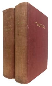
191157369Fort Leavenworth KS: U. S. Cavalry Association. VG. 1911. 4th Edition. Hardcover. 8vo 8" - 9" tall. Fourth completely revised edition. With numberous plates in the text. Translated by Walter Krueger. Two volume set. Spines faded; ownership signature to front endpapers; front hinges weak but still intact; light rubbing to edges . U. S. Cavalry Association hardcover
199484973Washington DC: Department of the Army Headquarters and US Marine Corps 1994. Presumed First Edition First Printing thus. Wraps. Good/No Dust Jacket issued. Three hole-punched and staplebound. Format is approximately 8.5 inches by 11 inches. Distribution was authorized to US government agencies only to protect technical or operational information as well as unclassified controlled nuclear information UCNI material from automatic dissemination under the International Exchange Program or by other means. This determination was made 29 November 1991. It is understood that due to the passage of time and increase in publicly available information this restriction no longer applies. This publication supercedes the nuclear/radiological portions of FM 3-3 dated 30 September 1986. Various paginations approximately 300 pages. Figures. Tables/Tabular Data Appendices. References. Glossary. Reproducible Forms. This we understand was the Army's last and most comprehensive word on how troops would confront the effects of nuclear weapons on the battlefield. IT was also jointly issued with the Marine Corps since their troops could also be expected to be on the ground in a 'post-detonation' operational environment. Much of the emphasis is on establishing and communicating the spatial extent of fallout from adversarial nuclear weapons explosions and understanding its impact on battlefield operations. This really is the definitive work on the subject at the end of the Twentieth Century. Included also is AREA PREDICTOR RADIOLOGICAL FALLOUT ABC-M5A2 a 24"X39" flexible translucent overlay sheet with stenciled templates for first-order fallout area delineation on US Army maps; its use is fully described in the FM 3-3-1 manual. The mission of the Chemical Corps is to prepare the Army to survive and win in a nuclear environment by developing doctrine organizations training products and equipment for nuclear defense and nuclear retaliation. Minimizing the impact of nuclear weapons through contamination avoidance protection and decontamination. Employing smoke and flame are part of the operational options. This manual FM 3-3-1 defines and clarified the entire process of nuclear contamination avoidance. It details the NBC Warning and Reporting System NBCWRS how to locate and identify nuclear contamination and how to operate in and around nuclear contamination. This manual is designed and intended to be an easy-to-read step-by-step manual depicting the manual method of calculating nuclear contamination avoidance procedures for chemical officers and NCOs at brigade level and high organizations. The manual addresses vulnerability analysis nuclear operations Fallout prediction Radiation Monitoring Reconnaissance Nuclear Defense Neutron-Induced Radiation Civilian Radiation Hazards Operational Exposure Guidance Shielding Nuclear Burst Effects Nuclear Effects on Electronics Wind Vector Planning Nomograms and Nuclear Operations Checklists. Department of the Army, Headquarters and US Marine Corps paperback
1982055027Washington DC: Headquarters Department of the Army 1982. 1st . Paper Back. Near Fine/No Jacket. 4to - over 9¾" - 12" tall. 10pp.distribution pg.; SC gray&blue w/blk.-pic.cover; slight rub w/Army address labelbk.cover; cleantight pgs. "This field manual provides a basic reference for training and employing Special Forces personnel in waterborne operations. It supports the water infiltration and exfiltration tasks identified in the Army Training and Evaluation Program ARTEP 31-101 for the Airborne Special Forces Group." illus. <br/> <br/> Headquarters, Department of the Army unknown
1917003717np: si 1917. First Edition First Printing. Hardcover. About Fine/Lacking. Unpaged. vii 1-70 leaves printed recto only. 27 cm. Oblong 4to. Hardcover. Paper over boards front cover with elaborate decorations in brown ink and prominent gilt title. Preliminary pages half title title copyright listing of plates etc. adorned with complex line drawings text in calligraphic gothic lettering in mauve and gilt in German and Bulgarian. Book Condition: About Fine. Dust Jacket Condition: Lacking. The called for dust jacket is a plain manilla shapeless paper with no decoration or text. An extraordinary photobook of 75 sepia toned photogravures printed on heavy cream colored stock. An understated book about the great war that features very few soldiers and then almost always from a distance. A military blimp is pictured in one image half deflated and defeated looking. Seventy five per cent of the images are uninhabited there is almost no activity and not a hint of armies battle assembled troops or the like. Apparently issued in a very small printing Worldcat shows two institutional holdings only both in Germany. <br/><br/> si hardcover
1896240926002Libraire des Bibliophiles 1896. Second edition. Paperback. Acceptable. please read THIS VOLUME II ONLY - Well worn covers with bumps nicks chips soiling/foxing and cover is separated but not detached at the front trough and spine - foxing on edges of text pages at least - text block is intact with trough at back binding - pencil note on front flyleaf - no marks on text - 266 pages - inside a mylar sleeve - my shelf location - 29-c-48 Libraire des Bibliophiles paperback
193127762New York: Jonathan Cape & Harrison Smith 1931. Hardcover. Very good condition. Previous owner's armorial book plate on the front paste down - Arcadi Gluckman. Gluckman was a Colonel in the U.S. Army awarded a Silver Star during World War I and was an author of gun books. 8vo 1 xxiii 363pp b&w illustrations. Recased. Custom binding with Asian bookbinder block stamp on the title page. Red cloth covered boards with red leather corners and spine. Raised bands gilt title and previous owners name in gilt on the spine. Gold and purple decorative end papers. Toning to the end sheets. Title page foredge and a few pages in the text are lightly foxed. Jonathan Cape & Harrison Smith hardcover
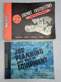
1943h44400Longview TX: LeTourneau Company; U. S. Army 1943. Wraps. Very good. Airport Construction" is oblong quarto 11 x 8 inches softcover with steel band fastener very good light wear and toning. About 150 pp. total with 65 charts many pictorial printed in red and black with an "earthmoving calculator" in sealed envelope inside rear cover we haven't opened it to take a look. With short introduction by S. C. Godfrey Brigadier General Air Engineer. This manual was produced to assist officer personnel of the Air Force engineers in visualizing the correct and efficient use of heavy equipment in the construction of landing strips airfields and other earth moving projects. It was meant to be used in conjunction with Aviation Engineer Technical manual 5-255 and "Principles of modern excavation and equipment" TM5-9500. Includes material on how to employ the LeTourneau Super C model Tournapull earth mover. This was published in either 1943 or 1944 but no dates are given; this was deduced from when those technical manuals were published and the use of the Super C model Tournapull. Very RARE with NO copies located by Worldcat-OCLC. During World War II the LeTourneau company provided nearly 75% of the Allies' earthmoving equipment. "JOB PLANNING" was published for use at the 463rd AAF Base Unit AAF Aviation Engineering School. Oblong quarto 11 x 8 inches softcover with steel fastener band very good 126 pp with lots of plates and illustrations of various construction equipment intended as a supplement to "Airport Construction with Heavy Equipment." During WWII the 463rd operated out of Geiger Field in Spokane WA. OCLC locates two holdings Columbia University NYC and Georgia Inst. of Technology. LeTourneau Company; U. S. Army unknown
191917034Providence: Press of E. L. Freeman Company 1919. 1919. 8vo. 152 pp. Illustrated with B & W photographs of members and locations. Includes a state by state roster of the entire membership. Rebound in modern grey gilt-stamped buckram. Light wear near fine. Scarce. 1st Edition. Hardcover. Near Fine. Providence: Press of E. L. Freeman Company, 1919. hardcover
1958010688Washington D. C.: Departments of the Army and the Air Force 1958. Paper Back. Near Fine/No Jacket. 8vo - over 7¾" - 9¾" tall. 82pp.; SC staple-bound tan w/blk.no title on spine; slight rub w/cleantight pgs. ". limited to a consideration of those toxic chemicals and weapon systems which are available to the field commander at the time of publication ." TM 3-200 / TO 42C-1-7. original 1958 manual. <br/> <br/> Departments of the Army and the Air Force unknown
DA02C-03092Telegraph Press. Collectible - Acceptable. Harrisburg PA: Telegraph Press 1946. 1st edition. 4to hardcover. 269pp. Illustrations. Fair book. Tears to joints foot of spine and rear hinge. World War 2 Regimental Histories Inquire if you need further information. NOT AVAILABLE FOR SHIPMENT OUTSIDE OF THE UNITED STATES. Telegraph Press hardcover
2001737652001. Staplebound. Good. Various paginations approximately 100 pages. Illustrations. Figures. Checklists. References. Glossary. Abbreviations and Acronyms. Terms and Definitions. Cover has some wear and soiling. Three-hole punched with staples between the holes at the left side. Marked For Official Use Only. Distribution Restriction: Distribution authorized to U.S. Government agencies only to protect technical or operational information from automatic dissemination under the International Exchange Program or by other means. Destruction Notice also on front cover. It is understood that this restriction is no longer applicable due to the passage of time and availability of copies on-line. Issued in September 2001 it represents the state-of-knowledge the state-of-practice the state-of-doctrine and the tactical state-of-the-art at the time the United States experienced the 9/11 attacks and began anti-Taliban anti-Al Qaeda and anti-terrorism in the Middle East and elsewhere. This publication provides tactics techniques and procedures TTP for the planning and execution of special operations forces SOF nuclear biological and chemical NBC defense operations. It provides a basis for understanding the requirements of individual SOF personnel operating in NBC environments as well as the requirements for joint force staff planners. TTPs support planning to meet the requirements of difference scenarios. Across the range of military operations it also provides guidance for commanders who determine force structure equipment material and operational requirements necessary to conduct the missions and collateral activities herein described. This publication has been prepared by direction of the Commander in Chief United States Special Operations Command USCICSOC who has recognized the need to share the skills developed by individual components within the SOF community. Each SOF element brings unique capabilities to an operation that can be improved upon from the knowledge of other elements. This publication compiles existing joint doctrine principles and known multi-Service/component TTP for NBC defense preparedness. It established a single 'how to' guide for use by individual SOF personnel and SOF components supporting Joint Task Force/Joint Special Operations Task Force JTF/JSOTF operations. It is a guided intended to enhance SOF force protection survivability and readiness in NBC environments. unknown
1856019070Washington: A. O. P. Nicholson Public Printer 1856. Book. Good. Hardcover. First Edition. 117 1. 35p. one leaf. Including illustrations tables 2 folding plates. Cloth. A good copy with wear 1/4" lacking at the top of the spine and wear 1/8" lacking at the bottom of the spine the forecorners of the covers are slightly bumped and slightly worn and there is minor soil on the covers. The insignia of the Ordnance Dept. is brightly printed in gold on the front cover and short title and date are printed on a moderately faded spine. A good copy in the original binding well bound with clean pages. Size: 8vo - over 7¾" - 9¾" tall. A. O. P. Nicholson, Public Printer Hardcover
18630009041Philadelphia: George W. Childs 1863. New edition. Hardcover. Very Good. 8vo 594 pages original blue embossed cloth rebacked with original extra-gilt spine laid down. <br/><br/>Ex libris " Alfred Read / Lt. Col. 12th Ind. Cav." signed on front free endpaper; signed again on the title-page. amd possibly in the Preface. The 12th Indiana Cavalry later became the 127th Indiana Cavalry. The 12th was mustered in 1863 and saw a lot of action in Tennessee Alabama Louisiana and Georgia. His third inked name is clearly "Reed". He sometimes appears in the roster as "Read". According to the roster he was mustered out Mar. 31 1864; however the Lt. Col. lead a raid on the town of Vienna p now New Hope Alabama on May 29 1864. Col Reed was from Monticello White County IN. Obviously a man of mystery. George W. Childs hardcover
1918A38678Washington D. C.: United States Army. Near Fine. 1918. Paperback. B&W Illustrations; This is a trade sized paperback book with flexible cloth covers and a glued spine. The book is in Near Fine condition and was issued without a dust jacket. There is some beginning edge wear and rubbing to the spine ends and corners of the book covers. There is an inked number on the top edge of the front cover. The text pages are clean and bright. There are two folded plates at the rear of the book. "By this time sophisticated aerial photography from kites balloons and even pigeons had already developed significantly thanks to a century of experiments by scientists and militaries. In The Balloon Prospect Caren Kaplan writes that balloons were used for military reconnaissance as early as June 26th 1794 when the French Revolutionary Army floated balloons over their engagement with the Austrian-Dutch coalition in Fleurus Belgium. Aerial reconnaissance from balloons also saw use in the American Civil War the Spanish-American War the Franco-Prussian War of 1870 and in the Boer War. Balloons and other methods of aerial photography began to give way to airplanes in the Italo-Turkish War in which aircraft were used for the first time for military reconnaissance directing naval gunfire. At the 1913 Paris Aero Salon French engineers revealed the first airplane to be equipped with a specially configured aerial camera. By 1914 each of Europes major powers had developed dedicated aircraft corps for aerial intelligence. The single use in war for which the machines of the Military Wing of the Royal Flying Corps were designed and the men trained was let it be repeated reconnaissance It was designed to operate with an expeditionary force and to furnish that force with eyes wrote Walter Raleigh in The War in the Air: In Being the Story of the Part Played in the Great War by the Royal Air Force 1922. "Bard College . United States Army paperback
199685229Washington DC: U.S. Army Headquarters 1996. Presumed First Edition First printing thus. Wraps. Good/No dust jacket issued. Three-hole punched and staplebound. Distribution Restriction--authorized to U.S. Government agencies only. Various paginations approx. 100 pages. Figures. Glossary. References. Index. Cover creased and has some wear and soiling. This manual establishes Army doctrine for operations in a nuclear environment and details the doctrine for integrating nuclear consideration into all other aspects of the battlefield. It also describes the Army's role in nominating tragets at corps and above levels and protecting the force from the effects of a nuclear weapons detonation. Nuclear employment in a theater of operations has theater strategic operational and tactical results; execution has national strategic implications. The corps' role is to function at either the tactical or operational levels of war. At the tactical level the corps accomplishes missions as Field Manual FM 199-15 describes. At the operational level when directed and augmented the corps functions as either the Army force ARFOR the joint force land component command JFLCC or a joint task force JTF. By viewing the corps in its many possible roles the reader can also discern nuclear procedures for echelons above corps EAC and joint missions. This manual can help educate and train commanders and staff at corps and operations levels in nuclear operations and educate and train divisions in nuclear force protection. It is used with Joint Publications JP 3-12.1 3-12.2 SRD or 3-12.3 and serves as the bridge between joint and Army doctrine. It is also uses with FM 25-50 which contains training doctrine for nuclear survivability. Among the topics addressed are: Nuclear Weapons; Joint Nuclear Doctrine; Deterrence Proliferation Weapons Effects Survivability Countermeasures Nuclear Operations Targeting Battlefield Operating Systems Nuclear Support Nuclear Tactics; Tactical Operations; Military Training; Nuclear Combat; Theater Nuclear; Nuclear Environment FM-100-30 Mobile Defense Command and Control Decision-Making Collateral-Damage and Troop Safety. A tactical nuclear weapon TNW or non-strategic nuclear weapon NSNW is a nuclear weapon that is designed to be used on a battlefield in military situations mostly with friendly forces in proximity and perhaps even on contested friendly territory. Generally smaller in explosive power they are defined in contrast to strategic nuclear weapons which are designed mostly to be targeted at the enemy interior far away from the war front against military bases cities towns arms industries and other hardened or larger-area targets to damage the enemy's ability to wage war. No tactical nuclear weapon has ever been used in a combat situation. Tactical nuclear weapons include gravity bombs short-range missiles artillery shells land mines depth charges and torpedoes which are equipped with nuclear warheads. Also in this category are nuclear armed ground-based or shipborne surface-to-air missiles SAMs and air-to-air missiles. Small two-man portable or truck-portable tactical weapons such as the Special Atomic Demolition Munition and the Davy Crockett recoilless rifle have been developed but the difficulty of combining sufficient yield with portability could limit their military utility. In wartime such explosives could be used for demolishing "chokepoints" to enemy offensives such as at tunnels narrow mountain passes and long viaducts. There is no exact definition of the "tactical" category in terms of range or yield of the nuclear weapon. The yield of tactical nuclear weapons is generally lower than that of strategic nuclear weapons but larger ones are still very powerful and some variable-yield warheads serve in both roles. Some tactical nuclear weapons have specific features meant to enhance their battlefield characteristics such as variable yield which allow their explosive power to be varied over a wide range for different situations or enhanced radiation weapons which are meant to maximize ionizing radiation exposure and to minimize blast effects. Tactical nuclear weapons were a large part of the peak nuclear weapons stockpile levels during the Cold War. U.S. Army Headquarters paperback
191749320n.p.: U.S. Army c. 1917. fair to good. 8" x 13" 34 wraps sheets held together with two paperclips at top edge tables a few pencil notes some soiling & small stains to text. U.S. Army paperback