9 442 résultats
191854407Belgium: Australian Corps 1918. 1st edition. Very Good. small quarto. stiff wrappers 9pp. fldg. map Libraries Australia ID 2241991. Wrappers rather spotted o/w VG copy of a scarce pamphlet printed in the field Australian Corps unknown
1942C206102Washington DC: War and Navy Departments 1942. Paperback . Very Good. Twelvemo. 44pp. Original printed paperback. Rubbing foxing and creasing otherwise very good. No date c.1942. War and Navy Departments, paperback
1951709382PN. New. 1951. Soft Cover. Date is original print. This is a reprint edition. . PN paperback
1957266279Cardiff : Western Mail and Echo 1957. First Edition. Softcover. Very good paperback copy; edges somewhat slightly dust-dulled and nicked. Remains particularly well-preserved overall; tight bright clean and strong. Physical description; 112 pages. Subjects; Great Britain. Army. South Wales Borderers 24th. Zulu War 1879 -- Regimental histories -- Great Britain. South African War 1899-1902 -- Regimental histories -- Great Britain. Cardiff : Western Mail and Echo paperback
0266833071.Ghardcover. Good. Access codes and supplements are not guaranteed with used items. May be an ex-library book. hardcover
11241Letter on Government of India letterhead dated from the 'Baghelkhund Bagelkhand; Baghelkhand Agency Sutua; 31 July 1883. 3 pp folio. Text clear and complete. Good on lightly-aged paper. Supporting the application of 'Surgeon Charles Lowdell Officiating Agency Surgeon Baghelkhund sic applying for the Acting Appointment of Medical Officer in Charge Bhopal Battalion in the event of a vacancy occurring in October next'. Lowdell is holding his current post while Surgeon Goldsmith is on furlough and on his return will be without an appointment. 'His duties in connection with the special charge of the young Maharaja have been difficult and have required the exercise of tact and patience. Doctor Lowdell has been most successful and has gained the confidence of those who are most jealous of the supervision of the Maharajas health. . the Dispensaries in the Rewah State as well as other Dispensaries of the Agency have been well supervised by him and the vaccination returns for the year which gives the large number of 52000 children operated on testifies to Dr. Lowdell's care and attention int his important matter.' Barr 'cannot speak too highly' of Lowdell whose 'services in this Agency . give him a claim for further employment in Central India.' Attested a 'True Copy' with Barr's genuine signature. Letter, on Government of India letterhead, dated from the 'Baghelkhund [Bagelkhand; Baghelkhand] Agency, Sutua; 31 July 1883. unknown
1992260049PN. New. 1992. Soft Cover. Date is original print. This is a reprint edition . PN paperback
1161762574.Ghardcover. Good. Access codes and supplements are not guaranteed with used items. May be an ex-library book. hardcover
1985774581PN. New. 1985. Soft Cover. Date is original print. This is a reprint edition. . PN paperback
1985774580PN. New. 1985. Soft Cover. Date is original print. This is a reprint edition. . PN paperback
1968733670PN. New. 1968. Soft Cover. Date is original print. This is a reprint edition. . PN paperback
1021076430.Ghardcover. Good. Access codes and supplements are not guaranteed with used items. May be an ex-library book. hardcover
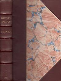
179332480London: Printed for J. Debrett 1793. The Second Edition with Considerable Additions. Three-quarter leather. Good. Octavo. 1 xvi 433 pages 1 page blank 19 page index 1 page errata 2 pages advertisements 1. Recased binding with three-quarter brown leather and marbled paper covered boards. Gilt title and five raised bands on the spine. Newer front and rear end papers and one front blank end sheet inserted. The original rear end sheet is present. The folding frontispiece map is toned on the verso with an old repair made also on the verso. Some light edge wear to the map. The folding view of the Rapids of the Ohio and the State Map of Kentucky are in very good condition with light toning. <br /> <br /> Pages 417-433 includes a "Report of the Secretary of State to the President of the United States of the Quantity and Situation of the Lands not Claimed by the Indians Nor Granted to Nor Claimed by Any Citizens Within the Territory of the United States. Read in the House of Representatives Nov. 10 1791" by Thomas Jefferson. <br /> <br /> Howes I 12; Howes Reference Filson - F 129; Sabin 34355; Streeter III 1523; Clark II 41 "An early account of the western country.which was produced by a man who left Kentucky without settling his obligations who seems to have been involved in efforts to organize a French expedition to take the lower Mississippi Valley and who treated Mary Wollstonecraft Shamelessly. This book was written in the form of letters from Kentucky to a friend in England. In all probability they were written in Europe. Printed for J. Debrett unknown
1476689083.Gpaperback. Good. Access codes and supplements are not guaranteed with used items. May be an ex-library book. paperback
AQ28162s.i.: s.n. s.d. c. 1875 Manuscript on paper. 98 leaves. Paper watermarked 1875. Contemporary red half-morocco red buckram boards ruled and lettered in gilt. Rubbed and marked. Marbled endpapers hinges exposed typed bookseller's description pasted to verso of FFEP first leaf detached. A Victorian manuscript copy in at least two unidentified hands of the general military order for several British Regiments during the campaign in Scotland 1745-46 including according to a later manuscript note to verso of FFEP those of Lieutenant Archibald Campbell of the 3rd Regiment of Dragoons who was aide-de-camp to General Bland and served under 'Butcher' Cumberland at the Battle of Culloden. Campbell's military order books have seemingly never been published; the originals are preserved at the National Army Museum NAM 1968-07-228. . Oblong 8vo. [s.n.], [s.d., c. 1875] hardcover
1919142221London: H.K. Lewis & Co. Ltd 1919. First Edition. Hardcover. Very Good. London H.K. Lewis & Co. Ltd. 1919. Octavo xx 182 pages with numerous tables plus a plate 2 folding maps and an errata slip tipped onto the contents page. Cloth lightly rubbed and flecked with a very small mark to the rear cover; spine lightly sunned; edges and endpapers foxed with slight foxing to the preliminaries; a very good copy. H.K. Lewis & Co. Ltd hardcover
1333502893.Gpaperback. Good. Access codes and supplements are not guaranteed with used items. May be an ex-library book. paperback
1929Alibris.0042782THE PENN PUB CO 1929. signed by author. Hard cover. Good. No dust jacket. Ex-library. Signed by previous owner. A WEST POINT CADET BY MAJ GEN PAUL MALONE U S ARMY 1929--SIGNED AUTHOR-HARDCOVER CONDITION GOOD EX-LIBRARY BOOK; WALTER REED U S ARMY GENERAL HOSPITAL LIBRARY; SIGNED TO DAUGHTERS OF THE U S. 419 p. A WEST POINT CADET BY MAJ GEN PAUL MALONE U S ARMY 1929--SIGNED AUTHOR-HARDCOVER CONDITION GOOD EX-LIBRARY BOOK; WALTER REED U S ARMY GENERAL HOSPITAL LIBRARY; SIGNED TO DAUGHTERS OF THE U S ARMY LIBRARY WITH MY COMPLIMENTS; MAJ GEN PAUL MALONE U S A WEST POINT CADET BY MAJ GEN PAUL MALONE U S ARMY 1929--SIGNED AUTHOR-HARDCOVER CONDITION GOOD EX-LIBRARY BOOK; WALTER REED U S ARMY GENERAL HOSPITAL LIBRARY; SIGNED TO DAUGHTERS OF THE U S ARMY LIBRARY WITH MY COMPLIMENTS; MAJ GEN PAUL MALONE U S ARMY-PUBLISHED BY THE PENN PUB CO-BOOK SIZE 7 1/4 X 5-419 PAGES Paul Bernard Malone May 8 1872 October 16 1960 was a highly decorated officer in the United States Army with the rank of major general. Following his graduation from the United States Military Academy USMA he participated in the Spanish American and Philippine American Wars and commanded an infantry brigade in the last year of the World War I. Malone reached the rank of brigadier general during that conflict and distinguished himself during the Battle of Soissons. 1 He received the Distinguished Service Cross and the Distinguished Service Medal and several foreign decorations. Malone remained in the Army following the war and completed his service as commanding general Fourth United States Army in 1936. Paul B. Malone was born in Middletown New York on May 8 1872 the son of Irish immigrants John and Hannah Malone. His parents ran a dairy and young Paul received his early education at Saint James Parochial School and the De La Salle Institute. He received an appointment to the United States Military Academy at West Point New York on June 17 1890 and graduated in 1894. 14 Among his classmates who also became general officers were Butler Ames John W. Barker Oliver Edwards George H. Estes Hamilton S. Hawkins III Samuel Hof Ora E. Hunt Frank Parker Briant H. Wells and Clarence C. Williams. 1 He was commissioned second lieutenant in the Infantry branch on June 12 1894 and was ordered to Fort Jay on Governors Island New York where he joined 13th Infantry Regiment. Malone was promoted to first lieutenant on April 26 1898 and sailed with his regiment to Cuba in June that year. He distinguished himself during the Battle of San Juan Hill within Spanish American War and received Silver Star citation for bravery. 35 With the outbreak of Philippine American War Malone was transferred to the newly established 27th Infantry Regiment in the Philippines in mid-1901 and took part in the chasing of rebel leader Emilio Aguinaldo to the swamps and morasses of the Luzon. He was ordered back to the United States and following his promotion to captain on November 2 1901 he was appointed an instructor of chemistry at the United States Military Academy at West Point New York. While in this capacity Malone taught a future General of the Army and Medal of Honor recipient Douglas MacArthur. Malone remained in this capacity for five years and sailed back to Cuba for occupation duty as a member of his old 27th Infantry Regiment in late 1906. He was later appointed a judge advocate and provost marshal general of the Army of Cuban Pacification and remained in that capacity for two years before he was sent back to the United States. 1 Upon his return stateside Malone attended the Army School of the Line at Fort Leavenworth Kansas and graduated with honors in May 1909. He then completed the Army Staff College in Washington D.C. and was assigned to the War Department General Staff. While in this capacity Malone and two other captains John McAuley Palmer and George Van Horn Moseley were ordered to Germany in September 1912 and observed German Imperial Army maneuvers northeast of Dresden. In mid-1913 Malone was transferred to Honolulu Hawaiian Islands and served with 2nd Infantry Regiment until June 1916. He was promoted to major on July 12 1916 and appointed chief of staff Eagle Pass District Texas. Malone served in this capacity on the Mexican Border during the Pancho Villa Expedition until January 1917 when he was appointed Officer-in-charge of Training Camps in the Central Department. He also served for brief period at the Citizens' Military Training Camp the first businessmen's. THE PENN PUB CO hardcover
1839298234London: Richard Bentley 1839. Boards. Good-. 313 pp. Vol. 1. Lacks title on spine raised band leather spine is worn leather covers in good shape. Bookplate of the Duke of Roxburghe frontis piece plate has water stain on bottom corner slightly affecting the corner image.volume 2 287 pp leather covers smudged Richard Bentley hardcover
199271036Carlisle Barracks PA: Strategic Studies Institute U.S. Army War College: Supt. of Docs. U. 1992. Presumed first edition/first printing. Trade paperback. Very good. No dust jacket. Cover has slight wear and soiling. vi 125 p. 23 cm. Errata slip laid in. Tables. Endnotes. Bibliography. From an on-line posting: CHARLES W. TAYLOR a faculty member of the U.S. Army War College is a strategic futurist with the Strategic Studies Institute and occupies the General Douglas MacArthur Academic chair of Research. His futures research extends over 25 years and includes major contributions in the form of narrative long-range strategic forecasts as well as in methods and designs of forecasts for studies requested by the Deputy Chief of Staff for Operations and Plans Department of the Army. He is known internationally for his strategic forecasts and for his contributions of methods and techniques to the field of forecasting. He is the author of a number of future studies including The Technical Report to Forecast 90 A Concept of a Future Force The Relationship of Forecasting to Long-Range Planning The Pilot Delphi Project strategic issues to the year 2030 A World 2010: A Decline of Superpower Influence Alternative World Scenarios for Strategic Planning Creating Strategic Visions A World 2010: A New Order of Nations and others. Mr. Taylor is the originator of the Panel Consensus Technique an internationally recognized contribution to participative decisionmaking problem solving and forecasting. He is a member of the American Academy of Political and Social Sciences World Future Society Population Reference Bureau Association of Electronic Defense Fellow of the Inter-University Seminar on Armed Forces and Society Military Operations Research Society and The Planning forum. The above information may not be current. It was current at the time when the individual worked for SSI or was published by SSI." Strategic Studies Institute, U.S. Army War College: Supt. of Docs., U.. paperback
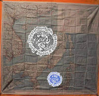
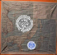
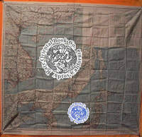
38000905Washington D.C. 1945 Army Map Service U.S. Army. Silk map folds down to ca. 12.5 x 14.5 cm. opens up to 85.5 x 81.5 cm. printed in color on two sides bright one tiny margin tear else cleantwo maps in all. O B S C U R E . . . ORIGINAL WORLD WAR 2 SURVIVAL & EVASION MAP . .SHOWING A VERY LONG EAST COAST OF RUSSIA GULF OF SAKHALIN . . TARTARY STRAIGHT SOUTH DOWN THE COAST AMUR RIVER . . VLADIVOSTOK ALL OF MANCHURIA KOREA MUKDEN HSINKING . . DAIREN GULF OF CHILI BEIJING SHANGHAI WEIHAIWEI . . TSINGTAU NORTH HOKKAIDO & HONSHU KURIL ISLANDS AMOY . . SWATOW HONG KONG MACAO CANTON KWANGCHOW HAINAN . . YUNNAN KUNMING GUILIN LIUZHOU NANNING HANOI DOWN . . THE COAST TO VIETNAM LAOS CAMBODIA S. HONSHU KYUSHU . . TAIWAN PHILIPPINES HANGZHOU SUCHOW NANKING NINGBO . . FOOCHOW AMOY OKINAWA & TOO MANY OTHERS TO LIST . . SHOWING GREAT DETAILS: ROADS RAILROADS AND RIVERS . U.S.A.A.F. United States Army Air Force issue one on each side one sheet = 2 maps. in all printed in full color. . No. C-52: JAPAN AND SOUTH CHINA SEAS. Shows Yunnan Fu Kunming City in the uppermost left corner at about 24.5 degrees by 103 degrees; then Kweilin Guilin at 110 degrees and Amoy Xiamen Shanghai Nanking Nanjing Foochow and the edge of the Pescadores on the Tropic of Cancer at the north end of the map. . Includes the large operational area of the "FLYING TIGERS" "A.V.G." & the FOURTEENTH AIR FORCE in China. Including important airbase cities: Nanning Liuzhou Kweilin & Kunming. . Below these areas from the left or extreme west Laos Cambodia Phnom Penh Saigon Hanoi all of Indo-China Vietnam down to Paulau Condor sic Paolo Condor Island and the tip of Vietnam at 8 degrees. Hainan Island Macao Hong Kong up the coast to Shantou. . No. C-53: EAST CHINA SEAS: Shows Yenchowfu and Changtse upper left Part of Korea at 35 degrees Japan from Sendai down to Okinawa all of Formosa to the Philippines Baguio Manila all of that area down to Albay. Including Shanghai Nanjing Qingdao Hangzhou most of the east coast of China Taiwan & Korea. . The large inset to the right shows Sakhalin the Kuril Islands Hokkaido Northern tip of Honshu Aomori down to Kanazawa Choshi at about 36 degrees. The Amur River and much of extreme eastern Russia Vladivostok down the Pacific coast Manchuria Mukden Korea Port Arthur Dairen Gulf of Chili Beijing Paotingfu down to Suzhou at 34 degrees. Up the coast of the Yellow Sea Qingdao and that area. . The back side shows the balance of the map are from the front side. From the left Tsinan Yenchowfu Weihaiwei down the Yellow Sea along the Pacific coast to Nanjing Shanghai Hangzhou Ningbo Taichofu Wenchow Funing fu Lienkong Fuzhou Xiamen down to Yunsiaoh across the Formosa Straits to all of Taiwan Formosa South to the Philippines Bataan the main island of Luzon Manila down to almost 13 degrees south ending at Sorsogon Gubat. The rest of the right east portion shows the Marianas Islands Guam at the extreme lower right the Ogasawara Kanzan groups with Korea at the upper middle from about 37 degrees showing all from Shunsen Keijo Seoul down to Kanra San the southern island. Showing much of Japan from where the other map left off: Sakata on Honshu all of Japan Shikoku Kyushu Tokara Group the island chains Amami Okinawa groups Naha Ryukyu Islands/Okinawa down to Taiwan. . INSET MAPS: No. C-52: has one very large inset of N. Russia & N. Sakhalin south down to Korea Tsingtau and Chowfu. And Hokkaido Honshu down to Urawa 36 degrees south. . A second inset shows the key & legend to lines on the map currents winds scale 1/4000000 or 1/4m. heights in meters with 'Location Index" which is a key and guide to other adjacent maps in this series and this geographical area. . All part of the basic combat operation region for the U.S. A.A.F. U.S. Navy war against Japan. With ocean currents noted for possible air crew survival back to land. . USED BY THE "FLYING TIGERS:" This map and many similar to it were part of the "E & E" survival items issued to "FLYING TIGER" and "A.V.G." "AMERICAN VOLUNTEER GROUP" pilots. They were often tied around the neck by pilots and air crew while flying combat missions. . The map also has an Annual Magnetic Change compass miles scale kilometers nautical miles 1:1000 000 altitudes of land mass legend or key to symbols roads towns cities rivers mountains and an index to boundaries. . This map was part of the U.S. Army Air Force & Naval flyers "E & E" Escape and Evasion survival kit printed on thick silk parachute cloth. These maps were often worn by fighter and other air crew members as scarves to insure they would be with the downed airman if/when his plane or he had to parachute out into the sea or over land. Each air crew member carried among other survival supplies a .38 caliber pistol survival knife a signal mirror stainless steel or glass compass and some basic food rations fishing kit water purification tablets along with minor medical supplies; the whole kit was tucked into the pants pocket of the flight suit. . The majority of these perishable maps have been lost during World War II and very few survived the attrition of war time and humid climates. This map was considered the "LAST HOPE" for safe return to Allied lines. Given to fliers in the Pacific war against Japan. . Color photos are posted to our website. . . unknown
38000904Washington D.C. 1945 Army Map Service U.S. Army. Silk map folds down to ca. 12.5 x 14.5 cm. opens up to 83.5 x 83.5 cm. color printed 2 sides brightextra clean feint small margin stain at top minor impact two maps in all. OBSCURE . . . ORIGINAL WORLD WAR 2 SURVIVAL & EVASION MAP . .SHOWING A VERY LONG EAST COAST OF RUSSIA GULF OF SAKHALIN . . TARTARY STRAIGHT SOUTH DOWN THE COAST AMUR RIVER . . VLADIVOSTOK ALL OF MANCHURIA KOREA MUKDEN HSINKING . . DAIREN GULF OF CHILI BEIJING SHANGHAI WEIHAIWEI . . TSINGTAU NORTH HOKKAIDO & HONSHU KURIL ISLANDS AMOY . . SWATOW HONG KONG MACAO CANTON KWANGCHOW HAINAN . . YUNNAN KUNMING GUILIN LIUZHOU NANNING HANOI DOWN . . THE COAST TO VIETNAM LAOS CAMBODIA S. HONSHU KYUSHU . . TAIWAN PHILIPPINES HANGZHOU SUCHOW NANKING NINGBO . . FOOCHOW AMOY OKINAWA & TOO MANY OTHERS TO LIST . . SHOWING GREAT DETAILS: ROADS RAILROADS AND RIVERS . U.S.A.A.F. United States Army Air Force issue one on each side one sheet = 2 maps. in all printed in full color. . No. C-52: JAPAN AND SOUTH CHINA SEAS. Shows Yunnan Fu Kunming City in the uppermost left corner at about 24.5 degrees by 103 degrees; then Kweilin Guilin at 110 degrees and Amoy Xiamen Shanghai Nanking Nanjing Foochow and the edge of the Pescadores on the Tropic of Cancer at the north end of the map. . Includes the large operational area of the "FLYING TIGERS" "A.V.G." & the FOURTEENTH AIR FORCE in China. Including important airbase cities: Nanning Liuzhou Kweilin & Kunming. . Below these areas from the left or extreme west Laos Cambodia Phnom Penh Saigon Hanoi all of Indo-China Vietnam down to Paulau Condor sic Paolo Condor Island and the tip of Vietnam at 8 degrees. Hainan Island Macao Hong Kong up the coast to Shantou. . No. C-53: EAST CHINA SEAS: Shows Yenchowfu and Changtse upper left Part of Korea at 35 degrees Japan from Sendai down to Okinawa all of Formosa to the Philippines Baguio Manila all of that area down to Albay. Including Shanghai Nanjing Qingdao Hangzhou most of the east coast of China Taiwan & Korea. . The large inset to the right shows Sakhalin the Kuril Islands Hokkaido Northern tip of Honshu Aomori down to Kanazawa Choshi at about 36 degrees. The Amur River and much of extreme eastern Russia Vladivostok down the Pacific coast Manchuria Mukden Korea Port Arthur Dairen Gulf of Chili Beijing Paotingfu down to Suzhou at 34 degrees. Up the coast of the Yellow Sea Qingdao and that area. . The back side shows the balance of the map are from the front side. From the left Tsinan Yenchowfu Weihaiwei down the Yellow Sea along the Pacific coast to Nanjing Shanghai Hangzhou Ningbo Taichofu Wenchow Funing fu Lienkong Fuzhou Xiamen down to Yunsiaoh across the Formosa Straits to all of Taiwan Formosa South to the Philippines Bataan the main island of Luzon Manila down to almost 13 degrees south ending at Sorsogon Gubat. The rest of the right east portion shows the Marianas Islands Guam at the extreme lower right the Ogasawara Kanzan groups with Korea at the upper middle from about 37 degrees showing all from Shunsen Keijo Seoul down to Kanra San the southern island. Showing much of Japan from where the other map left off: Sakata on Honshu all of Japan Shikoku Kyushu Tokara Group the island chains Amami Okinawa groups Naha Ryukyu Islands/Okinawa down to Taiwan. . INSET MAPS: No. C-52: has one very large inset of N. Russia & N. Sakhalin south down to Korea Tsingtau and Chowfu. And Hokkaido Honshu down to Urawa 36 degrees south. . A second inset shows the key & legend to lines on the map currents winds scale 1/4000000 or 1/4m. heights in meters with 'Location Index" which is a key and guide to other adjacent maps in this series and this geographical area. . All part of the basic combat operation region for the U.S. A.A.F. U.S. Navy war against Japan. With ocean currents noted for possible air crew survival back to land. . USED BY THE "FLYING TIGERS:" This map and many similar to it were part of the "E & E" survival items issued to "FLYING TIGER" and "A.V.G." "AMERICAN VOLUNTEER GROUP" pilots. They were often tied around the neck by pilots and air crew while flying combat missions. . The map also has an Annual Magnetic Change compass miles scale kilometers nautical miles 1:1000 000 altitudes of land mass legend or key to symbols roads towns cities rivers mountains and an index to boundaries. . This map was part of the U.S. Army Air Force & Naval flyers "E & E" Escape and Evasion survival kit printed on thick silk parachute cloth. These maps were often worn by fighter and other air crew members as scarves to insure they would be with the downed airman if/when his plane or he had to parachute out into the sea or over land. Each air crew member carried among other survival supplies a .38 caliber pistol survival knife a signal mirror stainless steel or glass compass and some basic food rations fishing kit water purification tablets along with minor medical supplies; the whole kit was tucked into the pants pocket of the flight suit. . The majority of these perishable maps have been lost during World War II and very few survived the attrition of war time and humid climates. This map was considered the "LAST HOPE" for safe return to Allied lines. Given to fliers in the Pacific war against Japan. . Color photos are posted to our website. . . unknown
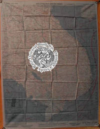
38026201Washington D.C. 1943-44 Army Map Service.Silk color maps 2 sides = 2 maps circa 63 x 63.5 c m. NJ 50: FIRST EDITION 1943; NJ 51: Second edition 1944 both AMS 2 type maps fine condition exceptionally clean & bright folded as issued. . . . . MAP OF MANCHURIA NORTH EAST CHINA & KOREAN AREAS . . . ORIGINAL WORLD WAR 2 "E & E" "ESCAPE & EVASION" . . . SURVIVAL MAP . . . USED BY "U.S. ARMY AIR FORCES A.A.F. "FLYING TIGERS" . . . PILOTS & AIR CREW OF THE 14TH & 23 AIR FORCES . . . THROUGHOUT CHINA 1942-1945 . . . A.A.F.Army Air Force issue shows: NORTH EAST CHINA MANCHURIA & KOREA . Maps: NJ 50: PEKING AND SURROUNDING AREAS. TIENTSIN GULF OF CHILI MOUTH OF THE HUANG HO Yangtse RIVER LAI CHOU BAY & TSINAN. With two magnetic compasses. . NL 51: NORTH EAST CHINA MANCHURIA KOREA LIAONING PENINSULA JAPANESE KWANTUNG LEASED TERRITORY DAIREN RYOJUN PORT ARTHUR PECHILI STRAIT SHANTUNG THE NORTH-EAST CHINA COAST & THE WEST COAST OF KOREA. With four magnetic compasses. . This map shows a good portion of the areas held by the Japanese during the Sino-Japanese war beginning in 1937 through August 1945. . Both sides of the maps show from left 120 degrees to 126 degrees east; from 40 degrees north south to 36 degrees. . With legend key index to adjoining sheets inset "index to boundaries" in Manchuria Korea China and the Yellow sea. With glossary of Chinese & Korean words. Key to altitude tints chart from sea level to over 2500 meter in height by colors. Scale: 1:1000000 with miles kilometers & nautical miles. Legend to various features found on the map roads railroads provincial boundaries telegraph lines radio stations &c. . With an "Index to Boundaries:" on each map: . NJ 50: Hopeh Gulf of Chili Shantung Chahar Shansi & Honan. . NJ 51: Manchuria Korea China & Yellow Sea Huang Hai . CONDITION: The maps are in excellent unused condition there are no stains or other flaws. . This map was part of the U.S. Army Air Force & Naval flyers "E & E" Escape and Evasion survival kit printed on thick silk parachute cloth. . These maps were often worn as neck scarves by fighter pilots and other air crew members as scarves for warmth and to insure if they went down the map would be available to escape and evade the enemy. . Each air crew member carried among other survival supplies a .38 or .45 caliber pistol survival knife a signal mirror stainless steel or glass compass and basic food rations fishing kit water purification tablets minor medical supplies; the whole kit was tucked into the pant pocket of the flight suit. . The majority of these perishable maps have been lost during World War II. Few survived the attrition rate of war time and bad climate. This map was given to American fliers in the Pacific war against Japan. It was the "last hope" to insure downed fliers had a chance to navigate their way back to friendly forces. . NJ 50: Hopeh Gulf of Chili Shantung Chahar Shansi & Honan. . NJ 51: Manchuria Korea China & Yellow Sea Huang Hai . CONDITION: The maps are in excellent unused condition there are no stains or other flaws. . SURVIVAL MAP: . This map was part of the U.S. Army Air Force A.A.F. & Naval flyers "E & E" Escape and Evasion survival kit printed on thick silk parachute cloth. . These maps were often worn as neck scarves by fighter pilots and other air crew members as scarves for warmth and to insure if they went down the map would be available as their "Last Hope" to evade and escape the Japanese enemy. . Each air crew member carried among other survival supplies a .38 or .45 caliber pistol survival knife a signal mirror stainless steel or glass compass and basic food rations fishing kit water purification tablets minor medical supplies; the whole kit was tucked into the pant pocket of the flight suit. . The majority of these perishable maps have been lost during World War 2. Few survived the attrition rate of war time and sultry Asian climates. This map was given to American fliers in the Pacific war against Japan. It was the "last hope" & chance for downed fliers to navigate their way back to friendly forces. . REFERENCES: . BALDWIN R.E. et al.:LAST HOPE THE BLOOD CHIT STORY. DOLL John G.: CLOTH MAPS CHARTS AND BLOOD CHITS OF WORLD WAR 2. www.escape-maps.com/escape_maps/history_of_wwii_us_cloth_esc ape_maps.htm#3.___Asiatic_Series . . unknown
38000902Washington D.C. 1945 Army Map Service U.S. Army. Silk map folds down to ca. 12.5 x 14.5 cm. opens up to 83.5 x 83.5 cm. color printed 2 sides bright superbly clean unused copy as issued two maps in all like "NEW'. O B S C U R E . . . ORIGINAL WORLD WAR 2 SURVIVAL & EVASION MAP . .SHOWING A VERY LONG EAST COAST OF RUSSIA GULF OF SAKHALIN . . TARTARY STRAIGHT SOUTH DOWN THE COAST AMUR RIVER . . VLADIVOSTOK ALL OF MANCHURIA KOREA MUKDEN HSINKING . . DAIREN GULF OF CHILI BEIJING SHANGHAI WEIHAIWEI . . TSINGTAU NORTH HOKKAIDO & HONSHU KURIL ISLANDS AMOY . . SWATOW HONG KONG MACAO CANTON KWANGCHOW HAINAN . . YUNNAN KUNMING GUILIN LIUZHOU NANNING HANOI DOWN . . THE COAST TO VIETNAM LAOS CAMBODIA S. HONSHU KYUSHU . . TAIWAN PHILIPPINES HANGZHOU SUCHOW NANKING NINGBO . . FOOCHOW AMOY OKINAWA & TOO MANY OTHERS TO LIST . . SHOWING GREAT DETAILS: ROADS RAILROADS AND RIVERS . U.S.A.A.F. United States Army Air Force issue one on each side one sheet = 2 maps. in all printed in full color. . No. C-52: JAPAN AND SOUTH CHINA SEAS. Shows Yunnan Fu Kunming City in the uppermost left corner at about 24.5 degrees by 103 degrees; then Kweilin Guilin at 110 degrees and Amoy Xiamen Shanghai Nanking Nanjing Foochow and the edge of the Pescadores on the Tropic of Cancer at the north end of the map. . Includes the large operational area of the "FLYING TIGERS" "A.V.G." & the FOURTEENTH AIR FORCE in China. Including important airbase cities: Nanning Liuzhou Kweilin & Kunming. . Below these areas from the left or extreme west Laos Cambodia Phnom Penh Saigon Hanoi all of Indo-China Vietnam down to Paulau Condor sic Paolo Condor Island and the tip of Vietnam at 8 degrees. Hainan Island Macao Hong Kong up the coast to Shantou. . No. C-53: EAST CHINA SEAS: Shows Yenchowfu and Changtse upper left Part of Korea at 35 degrees Japan from Sendai down to Okinawa all of Formosa to the Philippines Baguio Manila all of that area down to Albay. Including Shanghai Nanjing Qingdao Hangzhou most of the east coast of China Taiwan & Korea. . The large inset to the right shows Sakhalin the Kuril Islands Hokkaido Northern tip of Honshu Aomori down to Kanazawa Choshi at about 36 degrees. The Amur River and much of extreme eastern Russia Vladivostok down the Pacific coast Manchuria Mukden Korea Port Arthur Dairen Gulf of Chili Beijing Paotingfu down to Suzhou at 34 degrees. Up the coast of the Yellow Sea Qingdao and that area. . The back side shows the balance of the map are from the front side. From the left Tsinan Yenchowfu Weihaiwei down the Yellow Sea along the Pacific coast to Nanjing Shanghai Hangzhou Ningbo Taichofu Wenchow Funing fu Lienkong Fuzhou Xiamen down to Yunsiaoh across the Formosa Straits to all of Taiwan Formosa South to the Philippines Bataan the main island of Luzon Manila down to almost 13 degrees south ending at Sorsogon Gubat. The rest of the right east portion shows the Marianas Islands Guam at the extreme lower right the Ogasawara Kanzan groups with Korea at the upper middle from about 37 degrees showing all from Shunsen Keijo Seoul down to Kanra San the southern island. Showing much of Japan from where the other map left off: Sakata on Honshu all of Japan Shikoku Kyushu Tokara Group the island chains Amami Okinawa groups Naha Ryukyu Islands/Okinawa down to Taiwan. . INSET MAPS: No. C-52: has one very large inset of N. Russia & N. Sakhalin south down to Korea Tsingtau and Chowfu. And Hokkaido Honshu down to Urawa 36 degrees south. . A second inset shows the key & legend to lines on the map currents winds scale 1/4000000 or 1/4m. heights in meters with 'Location Index" which is a key and guide to other adjacent maps in this series and this geographical area. . All part of the basic combat operation region for the U.S. A.A.F. U.S. Navy war against Japan. With ocean currents noted for possible air crew survival back to land. . USED BY THE "FLYING TIGERS:" This map and many similar to it were part of the "E & E" survival items issued to "FLYING TIGER" and "A.V.G." "AMERICAN VOLUNTEER GROUP" pilots. They were often tied around the neck by pilots and air crew while flying combat missions. . The map also has an Annual Magnetic Change compass miles scale kilometers nautical miles 1:1000 000 altitudes of land mass legend or key to symbols roads towns cities rivers mountains and an index to boundaries. . This map was part of the U.S. Army Air Force & Naval flyers "E & E" Escape and Evasion survival kit printed on thick silk parachute cloth. These maps were often worn by fighter and other air crew members as scarves to insure they would be with the downed airman if/when his plane or he had to parachute out into the sea or over land. Each air crew member carried among other survival supplies a .38 caliber pistol survival knife a signal mirror stainless steel or glass compass and some basic food rations fishing kit water purification tablets along with minor medical supplies; the whole kit was tucked into the pants pocket of the flight suit. . The majority of these perishable maps have been lost during World War II and very few survived the attrition of war time and humid climates. This map was considered the "LAST HOPE" for safe return to Allied lines. Given to fliers in the Pacific war against Japan. . Color photos are posted to our website. . . unknown
38006901Washington D.C. 1943-44 U. S. Army Map Service. Silk map folds circa 10.3 x 7 cm.opens to ca. 51 x 65 cm.very good clean excellent copy2 color maps2 sides glossarylegend magnetic compass & current flows. FIRST EDITION FIRST ISSUE . . . ISSUED BY U.S. A.A.F. ARMY AIR FORCE . . "A.V.G." AMERICAN VOLUNTEER GROUP" & "FLYING TIGERS" . . & THE FOURTEENTH AIR FORCE IN CHINA & BURMA "CBI" . . . . AN ORIGINAL WORLD WAR2 SURVIVAL & EVASION MAP . . FOR "E. & E." & "FLYING TIGER" PILOTS FIGHTING JAPAN . . A SUPERB MAP OF SOUTHERN CHINA FROM KUNMING TO KWANGCHOW . . BAY JUST ABOVE HAINAN . . GUANGXI NANNING LIUZHOU GUILIN FROM CHONGQIN . . FRENCH INDO-CHINA HANOI . . FROM NORTH VIETNAM SOUTH & DOWN TO SAIGON . . INCLUDING THAILAND CAMBODIA & LAOS . This excellent and detailed cloth map was used by the "A.V.G." "AMERICAN VOLUNTEER GROUP" known as the "FLYING TIGERS" in the "I.E." "CHINA-BURMA-INDIA" theater throughout World War 2 in China Burma & Indo China. . This "E & E" "Escape & Evasion" cloth map was carried by pilots & air crew on combat missions and attacks on Japanese assets. This map was valuable to downed pilots and crew behind hostile and enemy lines. . It was first carried by the "A.V.G." fighter pilots in early 1942 when they first attacked the Japanese Air Force over Burma: air combat over Rangoon Touongoo and Southwest China Kunming Chiang Mai Thailand Hanoi and the strike against Japanese air planes parked at Noi Bai airfield. . The famous "Battle of Toungoo" Burma March 19-March 29 1942 was one of the key battles in the Battle of Yunnan-Burma Road in the Burma Campaign of World War II and Second Sino-Japanese War. The failure to hold the city of Toungoo opened up the route for the Japanese to make their lunge to Lashio around the allied flank and into the Chinese rear. The "A.V.G." fighter pilots performed brilliantly downing a substantial number of Japanese planes with minor losses to themselves. . This map and others like it for the adjacent areas were commonly worn on fighter pilot's neck or put in the pocket of the flight jacket survival vest or in the flight suit pant leg pocket. . MAP NO. 32 FRENCH INDO CHINA: A.A.F. Army Air Force issue. A pair of maps one on each side in color. Shows most of old Vietnam from just above 19 degrees north down to just below 9 degrees South and from 101 degrees at the West to 110 degrees to the West about half of Hainan Island the whole coast line from North to South down to Nga Ba Hoc Nang including Poulo Condore Saigon Nha Trang Tourane part of Thailand the West Cambodia and Laos Vientiane. . MAP NO. 33 CENTRAL CHINA: Shows: Ch'ung Ch'ching Chungqing down to Yunnan province and Kunming. Guangxi province: Guilin Liuzhou Nanning and points south to French Indo China. . Hanoi Kwangchow and the South China Sea with the North tip of Hainan Island the Gulf of Tonkin and the border between China & North Vietnam. . This area was all part of the basic combat region for the "A.V.G." & "FLYING TIGERS" later for the FOURTEENTH AIR FORCE. The Americans prosecuted the war against Japanese forces throughout this area. . With ocean currents noted for survival back to land. The map also has other important information for downed pilots such as an Annual Magnetic Change compass miles & kilometer scale nautical miles 1:1000 000 altitudes of land mass legend & key to symbols roads towns cities rivers mountains and an index to international boundaries. . This map was part of the U.S. Army Air Force & Naval flyers "E & E" Escape and Evasion survival kit printed on thick silk parachute or other indelible cloth. Each air crew member carried among other survival supplies a .38 caliber pistol survival knife a signal mirror stainless steel or glass compass and some survival food rations fishing kit water purification tablets along with minor medical supplies; the whole kit was tucked into flight suit pocket survival vest or flyers sheepskin jacket or trouser pockets. . The majority of these perishable maps have been lost during WW2 and very few survived. This map was a fliers "Last Hope" to get back to friendly forces once they parachuted our of their plane or after an unexpected landing behind Japanese lines. . CONDITION: In excellent clean condition folded as usual no soil or other issues. . Color photos are posted to our website. . REFERENCE: . BALDWIN R.E. et al.: LAST HOPE THE BLOOD CHIT STORY. DOLL John G.: CLOTH MAPS CHARTS AND BLOOD CHITS OF WORLD WAR 2. wikipedia-org/wiki/Battle_of_Toungoo . . unknown