ARMY MAP SERVICE [USA] U S ABiblio.com
9 442 résultats
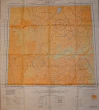
25041301Washington D.C. 1944 Army Map Service U.S. Army. Silk map folds down to be ca. 8.5 x 13.5 cm. opens up to ca. 95 x 52 cm. color printed flawless bright and superb copy as new condition directional magnetic compass 12 maps in all. . . . . ORIGINAL WORLD WAR 2 SURVIVAL & EVASION MAP . A.A.F.= Army Air Force. This silk cloth has two maps one per side. The first map shows Mindanao Basilan Island at the top the lower tip of Negros Siquijor as well as the Camigiun Islands & at the bottom or South end Jolo Island with an index inset showing a larger area map with this map located in the big picture. There is also an inset of a close-up of Mindanao Siargao and Panaon Islands. . The back side shows at the top the Southern part of Balbac Island and a good part of North Borneo down to Sibuko Bay the Tawitawi Group & the Jolo Island group to the extreme East. The Sulu Archipelago is at the lower right corner with an inset index to the larger area of the South China Sea. With an Annual Magnetic Change compass scale in miles kilometers nautical miles 1:1000000 legend or key to symbols roads towns cities rivers mountains and an index to the boundaries. . USED BY THE FLYING TIGERS: This map and many similar to it were part of the items issued to FLYING TIGER pilots and A.V.G. AMERICAN VOLUNTEER GROUP pilots. They were often tied around the neck to keep them warm while flying. . This map was part of the U.S. Army Air Force and Naval flyers "E & E" survival kit Escape & Evasion printed on silk parachute cloth. These maps were often worn by fighter and other air crew members as scarves to insure they would be with the downed airman if/when his plane or he had to parachute out into the sea or over land. . Each air crew member carried among other survival supplies a .38 caliber pistol survival knife a signal mirror stainless steel or glass compass & some basic food rations fishing kit water purification tablets along with minor medical supplies; the whole kit was tucked into the pant pocket of the flight suit. The mass majority of these maps have perished during World War II & few if any others survived the attrition rate of war time & climate prevented many from ever being brought back home. This map and others like it were issued to all fight crews in the Pacific war against Japan to insure that downed fliers had some chance to navigate their way back to friendly forces. . . unknown
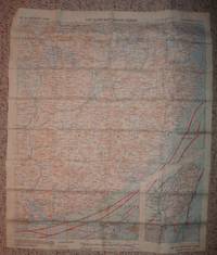
27066501Washington D.C. 1943-1944 Army Map Service.Silk maps color printed two sides exceptionally clean bright copy opens to 55 x 63 cm. folds to 14.5 x 17 cm. NL 50: 1944; NL 51: 1943 type AMS 2 both maps are the OBSCURE FIRST EDITIONS. . . . . MAP OF EASTERN ASIA . . . ORIGINAL WORLD WAR 2 "E & E" "ESCAPE & EVASION" . . . SURVIVAL MAP . . . USED BY "U.S. ARMY AIR FORCES A.A.F. "FLYING TIGERS" . . . PILOTS & AIR CREW OF THE 14TH & 23 AIR FORCES . . . THROUGHOUT CHINA 1942-1945 . This is one of the more obscure maps on An obscure map of North China Mongolia Manchuria the Great Wall & Heilongjiang formerly Lung-Chiang . This silk cloth map is color printed on both sides. . No.NL 50: BUIR NOR: shows from 48 degrees North to 44 South; 114 West to 120. From the North or top it shows Manchuria Buir Nor lake North Hsingan South down to Inner Mongolia Chahar West Hsingan. Three magnetic compasses. FIRST EDITION 1944 AMS 2. . No. NL 51 TSITSIHAR Lung-Chiang as in Heilongjiang: from 48 degrees North to 44 South; 120 West to 126 East. Shows the Great Wall from the great city of Lung-Chiang Black Dragon River down to Nung-an and much of the Sungari River. With three magnetic compasses. FIRST EDITION 1943 AMS 2. . INDEX OF COVERAGE: . NL 50: Manchuria Outer Mongolia Khalkha Mongols Silingol League Inner Mongolia Chahar Jo-odo League & West Hsingan. . NL 51: Hsing-an-tung Sheng Hsing-an-nan Sheng Pei-an Sheng Lung-Chiang Sheng Pin-Chiang Sheng Manchuria Hsing-an-Hsi Sheng Chi-lin Sheng & China. . With legend keys to map symbols. . INDEX TO ADJOINING SHEETS glossary scale: 1:1000000 with distance scale in miles kilometers and nautical miles altitude tints: key to heights by colors. . This map shows a good portion of the areas held by the Japanese during the Sino-Japanese war 1937-August 1945. . CONDITION: The maps are in excellent unused condition there are no stains or other flaws. Like "NEW" in collector's fine condition. . SURVIVAL MAP: . This map was part of the U.S. Army Air Force A.A.F. & Naval flyers "E & E" Escape and Evasion survival kit printed on thick silk parachute cloth. . These maps were often worn as neck scarves by fighter pilots and other air crew members as scarves for warmth and to insure if they went down the map would be available as their "Last Hope" to evade and escape the Japanese enemy. . Each air crew member carried among other survival supplies a .38 or .45 caliber pistol survival knife a signal mirror stainless steel or glass compass and basic food rations fishing kit water purification tablets minor medical supplies; the whole kit was tucked into the pant pocket of the flight suit. . The majority of these perishable maps have been lost during World War 2. Few survived the attrition rate of war time and sultry Asian climates. This map was given to American fliers in the Pacific war against Japan. It was the "last hope" & chance for downed fliers to navigate their way back to friendly forces. . REFERENCES: . BALDWIN R.E. et al.:LAST HOPE THE BLOOD CHIT STORY. DOLL John G.: CLOTH MAPS CHARTS AND BLOOD CHITS OF WORLD WAR 2. oth_escape_maps.htm#3.___Asiatic_Series . . unknown
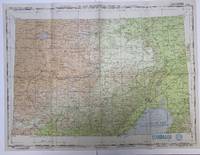
25041203Washington D.C. 1944 Army Map Service U.S. Army. Silk map folds down: 8.5 x 13.5 cm. opens up to 64.5 x 52 cm.clean flawless bright & excellent copy color 2 maps folded as issued. EXCELLENT EXAMPLE . . . . ORIGINAL WORLD WAR 2 "E & E" "ESCAPE & EVASION" . . . SURVIVAL CLOTH MAP USED BY :"FLYING TIGERS" & "A.V.G." . . . "AMERICAN VOLUNTEER GROUP" THROUGHOUT CHINA: . . . NANJING SHANGHAI HONG KONG MACAO CANTON XIAMEN . . FORMOSA TAIWAN FOOCHOW HANGCHOW HANKOW CHAOCHOU . . SWATOW NANKING NANJING KAI-FENG . . AND OTHER POINTS NORTH & SOUTH . A.A.F.= Army Air Force issue this pair of maps shows all the major parts of China from a bit above 38 degrees at the North and 109 degrees from the West to 123 degrees at the East and South down to just below 22 degrees including the South China sea the last island is one more degree South below Canton Hong Kong and Macao with a nice inset of all of Taiwan. This was the basic combat region for the Pacific war against Japan. . USED BY THE "A.V.G." & FLYING TIGERS THROUGHOUT CHINA: . This map and many similar to it were part of the items issued to FLYING TIGER pilots and A.V.G. AMERICAN VOLUNTEER GROUP pilots. They were often tied around the neck to keep them warm while flying. . A CLOTH MAP COLOR PRINTED ON TWO SIDES: . Number 34 SOUTHEAST CHINA: Sshows from Nan-Ching Nanking or Nanjing this city is also shown on both sides of this maps to North down to Tao-chuang-fou St. John Island with Macau Hong Kong Canton. To the right is an inset map showing all of Formosa Taiwan. The whole Eastern coast of China from Tao-chuang-fou up to just above Shanghai. . Number 35 NORTHEAST CHINA: From Miao Lieh-tao island Lai-chou Wan at the far East and Li-ch-eng city to the Great Wall at extreme West at the Yellow River. Down South to Hankow Hang-chow area. K'ai-feng is about in the center of this map. With an inset of and index to the other maps in this area and series sea currents key guide to symbols. . A detailed map showing a substantial number of small towns big cities lakes rivers train routes roads major highways &c. With seasonal ocean currents noted for possible survival back to land. The map also has an index inset to related other area silk maps. Miles scale kilometers nautical miles legend or key to symbols roads towns cities rivers & mountains. This map was part of the U. S. Army Air Force & Naval flyers "E & E" survival kit "Escape and Evasion" printed on thick silk parachute cloth. . These maps were often worn by fighter pilots and other air crew members as scarves to insure they would be with the downed airman if/when his plane or he had to parachute out into the sea or over land. Each air crew member carried among other survival supplies a .38 or .45 caliber pistol survival knife a signal mirror stainless steel or glass compass and some basic food rations fishing kit water purification tablets along with minor medical supplies; the whole kit was tucked into the pant pocket of the flight suit. . The majority of these perishable maps have been lost during World War 2 and few if any others survived the attrition rate of war time and climate prevented many from ever being brought back home. This map was given to fliers in the Pacific war against Japan to insure downed fliers had some chance to navigate their way back to friendly forces. These maps are truly RARE and seldom found on the market. . Color photos are posted to our website. . . unknown
19448061C1944. Washington. AMS. 1944/47. ca. 91 x 88 cm. 1 map English Language. Original map folded with title to front cover. Low signs of use a bit browning at the back. Appropriate to its age in good condition. Die vorliegende Karte beinhaltet den geographischen Stand bis 1945. Sie zeigt Europa Asien Afrika und den Großteil Ozeaniens. Sie trägt oben den Hinweis: "For use by War and Navy Department Agencies only". / The military map shows Europe Asia Africa and wide parts of Australia. The map contains the geographic status up to 1945 and contains the note "For use by War and Navy Department Agencies only". unknown
1945015941Detroit: U.S. Army Map Service 1945 Book. Very Good. No Binding. 1st Edition. 1945 Good Condition Army Air Forces U.S.A. Aeronautical Chart Dimensions: 74 x 56 cm 29 x 22 inches - Reverse Blanco Detailed Navigational Chart showing the Gulf of Liaotung in Japanese occupied Manchuria Present day China. The map was printed in June 1945 and is marked RESTRICTED. The Chart is prepared for use at night under white ultra-violet red and amber light. This chart was printed just a few months before the Soviet invasion of Manchuria on the 9th of August 1945. . U.S. Army Map Service unknown
1944870171Washington DC: Army Map Service. Very Good with no dust jacket. 1944. Map. This is a survival map issued to airman on missions which might result in going down in or near China. It contains information on wind and currents along with the usual feature of a physical map. It is printed on 26.5" x 20" silk-like fabric two maps back to back and folded to a 3"x5" size. The maps were compiled in 1943 and are dated 1944. This map shows no signs of use and is in very good condition. . Army Map Service unknown
1938108443Adelaide: AAMC Reunion Committee 1938. First Edition. Paperback. Very Good. Adelaide AAMC Reunion Committee 1938. Oblong octavo ii title page verso blank 201 pages plus 19a and its printed verso numbered 21a with some illustrations all produced in brown ink from processed typescript plus 47 pages of plates and 8 unnumbered sectional title leaves all versos blank; all but 6 of the first 30 and 2 later pages are printed rectos only. Flush-cut pictorial wrappers with light wear to the extremities and a few trifling surface blemishes; occasional light foxing and mild signs of handling; a very good copy of a rare and unusual item. 'Ever since the cessation of hostilities of the Great War 1914-1918 it has been the wish of Australian Army Medical Corps AIF ex-servicemen in South Australia that we should have some permanent record of our Fallen Comrades and to those who have "Passed On" since returning to Australia. The following pages are the expression of that wish' foreword. The Honor Rolls run to 18 pages. Other contents include the reunion programme with a list of guests Digger songs 'War and Other Verses' and a lengthy section of war statistics and related items of interest. We have previously handled a copy in which was loosely inserted a 'Critique of the book by the Editor "Rising Sun"' dated Adelaide 31 March 1938. The information contained in our catalogue note at the time is worth repeating: 'Presumably the reference is to "The Rising Sun. A Journal of the AIF in France. With which is incorporated 'The Honk'"; nineteen numbers were issued between 25 December 1916 and 24 March 1917 see Fielding and O'Neill page 264. The anonymous critic is not only onside; his intimate remarks about the compilation and production of the book suggest he was very much inside as well. He writes the following about the AAMC Orderly Room in Adelaide where the work was done: "the well remembered atmosphere of a dug-out was warmly recaptured. On the walls were Leyshon White pictures crisp of technique and so faithfully capturing the spirit that existed 'over there'. War-time quips were bandied freely; each chic female helper may well have been the ghost of Mam'selle herself; each flurry of sound from passing traffic may well have been the whine of more sinister objects"'. <p>Dornbusch addenda 535; Fielding and O'Neill page 233 supplying the name of the editor; Trigellis-Smith 316. [AAMC Reunion Committee] paperback
20021339258PN. New. 2002. Soft Cover. Date is original print. This is a reprint edition . PN paperback
1983769569PN. New. 1983. Soft Cover. Date is original print. This is a reprint edition. . PN paperback
0484637231.Ghardcover. Good. Access codes and supplements are not guaranteed with used items. May be an ex-library book. hardcover
19197835Albany NY: J. B. Lyon Company Printers 1919. 324pp. Red cloth covers w/ gilt title on spine. Binding lightly soiled and rubbed. Spine a bit sunned; ends bumped. Light foxing to edges of text block and endpapers. "Received April 7th 1920" written in pencil at top edge of front paste-down. Faint dampstain to bottom corner of first few leaves. Illust. w/ a b/w frontispiece of Lewis S. Pilcher Department Commander. Hard Cover. Good/No Dust Jacket. 8vo - over 7¾" - 9¾" tall. Scarce. J. B. Lyon Company, Printers Hardcover
1332948340.Gpaperback. Good. Access codes and supplements are not guaranteed with used items. May be an ex-library book. paperback
1980761054PN. New. 1980. Soft Cover. Date is original print. This is a reprint edition. . PN paperback
1983768487PN. New. 1983. Soft Cover. Date is original print. This is a reprint edition. . PN paperback
1983768489PN. New. 1983. Soft Cover. Date is original print. This is a reprint edition. . PN paperback
1980761916PN. New. 1980. Soft Cover. Date is original print. This is a reprint edition. . PN paperback
1983768488PN. New. 1983. Soft Cover. Date is original print. This is a reprint edition. . PN paperback
1979759793PN. New. 1979. Soft Cover. Date is original print. This is a reprint edition. . PN paperback
1979759630PN. New. 1979. Soft Cover. Date is original print. This is a reprint edition. . PN paperback
1983769925PN. New. 1983. Soft Cover. Date is original print. This is a reprint edition. . PN paperback
1980760587PN. New. 1980. Soft Cover. Date is original print. This is a reprint edition. . PN paperback
1980761596PN. New. 1980. Soft Cover. Date is original print. This is a reprint edition. . PN paperback
1993267751PN. New. 1993. Soft Cover. Date is original print. This is a reprint edition . PN paperback
1980761333PN. New. 1980. Soft Cover. Date is original print. This is a reprint edition. . PN paperback
1991247740PN. New. 1991. Soft Cover. Date is original print. This is a reprint edition . PN paperback