Kneeland, SamuelBiblio.com
2 037 résultats
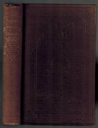
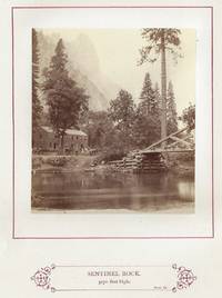
187224393Boston and New York: Alexander Moore and Lee Shepard & Dillingham 1872. Hardcover. Very good. Third edition revised and enlarged; second printing. Small quarto pp. v-x xi-xii 13-98 with two maps and 20 original mounted albumen photographs credited to Boston photographer John Soule. In publisher's green cloth with beveled edges; front board decorated in gilt black and rose; all edges gilt; each text page and each photograph bordered in red. A very good copy with rubbing and fraying to corners and spine ends bookplate of Canadian bookseller and collector G. Ducharme on front pastedown handwritten date of December 15 1872 on front free endpaper evidence of an erased ink stamp on title page. Lacks tissue guard over plate facing p. 35 all others present. Contents sound and clean. This is the rarest and most desirable edition of this work as it is the only one to contain 20 rather than 10 mounted photographs. Kneeland 1821-1888 was a physician naturalist and Professor of Zoology and Physiology at MIT. This book is based on his first visit to the Yosemite Valley in 1870 and includes a narrative of his trip from and return to Boston. "Kneeland made every effort to obtain current and accurate information and each of the later editions of the guide incorporates new material.Weston J. Naef in his book Era of Exploration the Rise of Landscape Photography in the American West 1860-1885.comments that the photographs 'are curious because there is no evidence that Soule a talented landscape photographer was ever in California.which suggests that he might have purchased the negatives from a California photographer not an uncommon transaction'" Currey & Kruska 225. Eadweard Muybridge and Martin Hazeltine are both considered strong candidates to have been the actual photographer. Farqhuar #10; Cowan p. 333. Only two copies of this edition have appeared at auction in the past 30 years and there are no others on the market as of September 2025. Alexander Moore [and] Lee, Shepard & Dillingham hardcover
181052825Philadelphia: C. & A. Conrad & Co. Somerville & Conrad Petersburgh. Bonsal Conrad & Co. Norfolk and Fielding Lucas Jr. Baltimore 1810. First edition 8vo pp. 5 3 105 10 41-65 1 53 1 107-277 5 40 87 1; the appendices for parts 1 and 2 are bound out of order but the book is complete; engraved frontispiece portrait 6 maps 5 folding 3 folding tables; contemporary marbled boards neatly rebacked in quarter calf gilt-lettered direct on gilt-paneled spine; good and sound the maps generally in a nice state of preservation. With an 1892 ownership signature of Louis G. Carpenter at the top of the title page. Carpenter 1861-1935 was a college Professor and later the Dean of Engineering & Physics at Colorado State University formerly known as the Colorado Agricultural College. He was also a mathematician and an irrigation and consulting engineer. See Wikipedia for an account of his life. Pike's personal journal of the earliest U.S. government expedition to the southwest. Even before Lewis and Clark had returned in 1806 Lieutenant Zebulon Pike was sent to explore the southern reaches of the Louisiana Territory. Pike traveled to Colorado and down the Front Range looking for the Red River. His party failed to find it and instead wandered into New Mexico where the Spanish caught him and escorted him home. His expedition returned with valuable information about the northern provinces of colonial Mexico. He explored the headwaters of the Arkansas and Red Rivers and reported on the Spanish settlements in New Mexico as well as his account of his expedition to the upper Mississippi in Minnesota. The maps "were the first of this entire region to display knowledge derived from actual exploration and are of outstanding historic interest" Wheat Trans-Mississippi West Maps II pp. 20-21. Field 1218; Graff 3290; Howes P-373; Sabin 62836; Shaw & Shoemaker 21089; Streeter 3125; Streeter Texas 1047; Wagner-Camp 9. <br/><br/> C. & A. Conrad, & Co. Somerville & Conrad, Petersburgh. Bonsal, Conrad & Co. Norfolk, and Fielding Lucas, Jr. Baltimore hardcover books
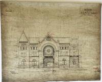
1886010275Pittsburgh PA: Thomas Rodd 1886. Paper. Very Good. Unbound. A set of four original architect's plans on translucent white architectural paper for the construction of the Indianapolis Union Railway Station. The plans are 1. Front Elevation North 24 2/8" w x 30 1/4" w. 2. Design A. 1st Floor Plan22" h x 33 5/8" w 3. Design A. 2nd Floor Plan 22" h x 33 1/2" h. and 4. Showing Elevation of Interior Pier 1/2 Elevation 1/2 Section and Plans of A.A. B.B. C.C. D.D. F.F.29 3/4" h x 25" w. The Front Elevation and the 4th plan with "Tho's. Rodd Engr. & Arch.t Pittsburgh PA" lower left the 1st and 2nd Floor Plans unsigned. Overall a Very Good set general soiling and wrinkling small chips at edges. Front Elevation North plan with red ink "Note: The Red Lines Show Corrected Grades Oct. 20th 1886". All four plans with red ink additions the 2nd Floor plan with blue ink additions as well. The Indianapolis Union Railway Station was built in 1888 to replace the 1853 station which was the first "union" station ever built and its red brick and granite Grand Hall is renowned as one of the finest Romanesque Revival-styled structures in America. It was restored beginning in 1983 and today houses the Crowne Plaza Hotel which features thirteen 1920's Pullman cars converted into hotel suites. London-born Pittsburgh architect and engineer Thomas Rodd 1849-1929 later became a Chief Engineer for the Pennsylvania Railroad West of Pittsburgh. He was responsible for the design and construction of many buildings in western Pennsylvania and the Midwest. A wonderful set of plans encompassing American architectural railroad and Indiana history. . Thomas Rodd unknown
1851008968Philadelphia: Lippincott Grambo & Company 1851. "Collected and prepared under the direction of the Bureau of Indian Affairs per Act of Congress of March 3d 1847." Presentation Copies of Parts I III and IV only each part a First Edition 1851 1853 and 1854 published by Lippincott Grambo & Company Philadelphia . Part I SIGNED AND INSCRIBED "Prof. George Howe with respect of H.R. Schoolcraft" at front paste down in tidy secretatial hand. Parts III and IV SIGNED AND INSCRIBED alike "Rev. George Howe with respects of H.R. Schoolcraft". George Howe 1802-1883 was an ordained minister and professor at Presbyterian Theological Seminary in Columbia S.C. and the author of History of the Presbyterian Church in South Carolina published 1870-1883. Provenance: Part I additionally SIGNED AND INSCRIBED at front paste down "Presented to Joseph Hyde Pratt by Prof. George Howe University of North Carolina". Prof. George Howe 1876-1936 was the grandson of George Howe and was a longtime professor of Latin and the Classics at UNC. He was also the nephew of President Woodrow Wilson. Joseph Hyde Pratt 1870-1942 was State Mineralogist and State Geologist of North Carolina a longtime professor at UNC and a WWI hero. Parts III and IV with Pratt's ownership signature at front end page. The three volumes are complete with all plates. Part I xviii 13-568 p. 76 plates; Part III xviii 19-635 p. 45 plates 3 of which are listed as appearing in Vol. IV; Part IV xxvi 19-668 p. 41 plates. A good set in unsophisticated original decorative cloth bindings Part I with damping at fore edge margins worn at corners cloth at spine torn and separating from front joint cloth chipped at head of spine. Part III cloth torn and peeling from top and bottom of spine corners worn; Part IV rear hinge starting corners worn holes in cloth along top half of front joint 1/4" loss of cloth at head of spine. Scattered toning and end papers soiled throughout the set Presentation Copy with distinguished provenance. of three of the first four volumes of Schoolcraft's six volume massive contribution to the history of Native Americans. SIGNED. First Edition. Decorative Cloth. Good. Folio - over 12" - 15" tall. Presentation Copy. Lippincott, Grambo & Company Hardcover books
1851008968Philadelphia: Lippincott Grambo & Company 1851. Book. Good. Decorative Cloth. Signed by Authors. First Edition. Folio - over 12" - 15" tall. "Collected and prepared under the direction of the Bureau of Indian Affairs per Act of Congress of March 3d 1847." Presentation Copies of Parts I III and IV only each part a First Edition 1851 1853 and 1854 published by Lippincott Grambo & Company Philadelphia . Part I SIGNED AND INSCRIBED "Prof. George Howe with respect of H.R. Schoolcraft" at front paste down in tidy secretatial hand. Parts III and IV SIGNED AND INSCRIBED alike "Rev. George Howe with respects of H.R. Schoolcraft". George Howe 1802-1883 was an ordained minister and professor at Presbyterian Theological Seminary in Columbia S.C. and the author of History of the Presbyterian Church in South Carolina published 1870-1883. Provenance: Part I additionally SIGNED AND INSCRIBED at front paste down "Presented to Joseph Hyde Pratt by Prof. George Howe University of North Carolina". Prof. George Howe 1876-1936 was the grandson of George Howe and was a longtime professor of Latin and the Classics at UNC. He was also the nephew of President Woodrow Wilson. Joseph Hyde Pratt 1870-1942 was State Mineralogist and State Geologist of North Carolina a longtime professor at UNC and a WWI hero. Parts III and IV with Pratt's ownership signature at front end page. The three volumes are complete with all plates. Part I xviii 13-568 p. 76 plates; Part III xviii 19-635 p. 45 plates 3 of which are listed as appearing in Vol. IV; Part IV xxvi 19-668 p. 41 plates. A good set in unsophisticated original decorative cloth bindings Part I with damping at fore edge margins worn at corners cloth at spine torn and separating from front joint cloth chipped at head of spine. Part III cloth torn and peeling from top and bottom of spine corners worn; Part IV rear hinge starting corners worn holes in cloth along top half of front joint 1/4" loss of cloth at head of spine. Scattered toning and end papers soiled throughout the set Presentation Copy with distinguished provenance. of three of the first four volumes of Schoolcraft's six volume massive contribution to the history of Native Americans. Lippincott, Grambo & Company Hardcover
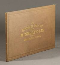
188257546New York: Charles Hart lithographer 1882. Large folding color lithograph panorama of the east and west prospects of Washington Avenue in Minneapolis from 8th Avenue South to Fourth Avenue North the whole in an oblong quarto binding original brown cloth gilt lettering on upper cover. The panorama extends to a total length of 30 feet 15 feet for each side of the avenue; each building is identified in the margins and the bustle of everyday city life is captured in the many people horses carriages etc. depicted throughout. Neat professional repair and strengthening of several folds on verso one small hole in a cloudy sky but on the whole very good and attractive. <br/><br/> Charles Hart, lithographer hardcover books
186952169N.p. Saint Paul 1869. Large plate albumen photograph approx. 12" x 21" mounted on a printed card approx. 16" x 21"; slight toning; very good. A large and unusual photograph by an unnamed photographer showing the steamer Buckeye towing what was at the time the largest raft ever run on the Mississippi River from Read's Landing in Minnesota to St. Louis Missouri. <br/><br/> unknown books
188610165Huron Dakota: Huronite publishing house 1886. Second Edition. Very good. 12mo 88 1 pages. original pictorial wrappers portrait and plates. -- Light wear to tips of the spine corners bumped bottom lightly top corner has a diagonal crease corners of pages themselves top lightly bumped bottom hardly at all. Internally clean and tight. A few pages with small foxed spots to the extremities. --- Overall condition for this fragile & rare book. "Not in Allen's Dakota Imprints. Wilkins had an adventurous time after leaving Fort Snelling. He gives some interesting anecdotes of the Sioux Uprising and the mass hanging of the thirty-eight Sioux at Mankato".-rarebookhub: Rare Book Transaction History one listing found in a dealers catalog @$125.00; source year 1953. Huronite publishing house unknown
186952169N.p. Saint Paul 1869. Large plate albumen photograph approx. 12" x 21" mounted on a printed card approx. 16" x 21"; slight toning; very good. A large and unusual photograph by an unnamed photographer showing the steamer Buckeye towing what was at the time the largest raft ever run on the Mississippi River from Read's Landing in Minnesota to St. Louis Missouri. unknown
185723389.07<p><strong>Rare New York Senate Print of Proposed State Law to Combat the <em>Dred Scott</em> Decision</strong></p><p>"<em>Every slave … who shall come or be brought or be involuntarily in this state shall be free.</em>"</p><p>SLAVERY AND ABOLITION—NEW YORK STATE.</p><p>New York Senate. "An Act To secure Freedom to all persons within this State" Edward M. Madden April 9 1857 Passed the Assembly on April 17; failed in the Senate. Printed with numbered lines for the use of the Senate. 1 p. 6.5 x 11.5 in. </p><p><strong>Excerpts</strong></p><p>"<em>Neither descent near or remote from an African…nor color of skin shall disqualify any person for being or prevent any person from becoming a citizen of this state; nor deprive such person of the rights and privileges of a citizen thereof.</em>"</p><p>"<em>Every person who shall hold or attempt to hold in this state in slavery…under any pretence or for any time however short shall be deemed guilty of felony and on conviction thereof shall be confined in the state prison at hard labor for a term not less than two nor more than ten years.</em>"</p><p><strong>Historical Background</strong></p><p>In 1799 the New York legislature passed "An Act for the gradual abolition of slavery" that indentured and would eventually free slave children born after July 4 1799. In 1817 it passed a law freeing those slaves in 1827. But non-residents and part-time residents could still bring their slaves into the state temporarily.</p><p>On March 14 1857 New York Assemblyman Samuel A. Foot introduced resolutions declaring that the U.S. Supreme Court through its decision in <em>Dred Scott v. Sanford</em> "has in effect declared slavery to be national" and calling for the creation of a joint committee of three senators and five assemblymen to "consider and report what measures if any the Legislature of this State ought to adopt to protect the constitutional rights of her citizens." The resolution passed by a vote of 49-24 and the Senate concurred on April 2.</p><p>On April 9 Edward M. Madden introduced this bill in the Senate. Simultaneously Foot introduced this bill #24129 and three resolutions #23389.08 in the Assembly. Eight days later the Assembly with 81 Republicans 38 Democrats and 8 American Party members passed the bill 72 to 38. In the Senate with 17 Republicans 9 American Party members Know Nothings and 4 Democrats attempts to move the bill to the Committee of the Whole were evenly divided. Lacking the two-thirds majority required for this procedure the bill died.</p><p>Very similar language appeared in an 1859 bill which also failed; New York passed no new Personal Liberty Law during the decade before the Civil War.</p><p>The New York Senate had thirty-two members in 1857 so it is likely no more than fifty copies of this bill were printed for Senate consideration. We can find no evidence that any other copies have survived.</p><p><strong>Edward M. Madden</strong> 1818-1885 was born in Orange County New York and began work at a cotton factory at age nine. He worked as a merchant and then opened a saw factory in Middletown. He entered politics as a Democrat and was a delegate to the 1852 Democratic state convention. He joined the new Republican Party and served as a member of the New York Senate in 1856-1857 1872-1873 1875 and 1880-1881. He also served as a delegate to the 1864 and 1876 Republican National Conventions.</p>
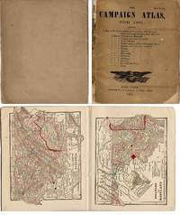
186117755New York: S. N. Gaston. Good. 1861. First Edition. Soft Covers. Rare pocket-sized atlas focusing on the secessionist or slave-holding states at the outset of the American Civil War. Bound in tan publisher's printed wrappers. Front wrap is identical to the title page & with American eagle emblem. Saddle-stitched binding is tight. 14 hand-colored cerograph maps 1 double-page. Blank on verso of each map. Cover has small areas of chipping but generally good; interior has only minor pencil marginalia & light age toning. The initial double-page map of the United States and Territories is indicated with "great cantonments and strategic points" marked with a hand-colored red dot. These points include New York Philadelphia Pittsburgh Baltimore Washington DC Norfolk Pensacola Cairo St. Louis Santa Fe Salt Lake City and San Francisco. Individual maps of the Confederate and Border States follow: Delaware/Maryland Virginia North Carolina South Carolina Georgia Florida Mississippi Alabama Louisiana Arkansas Missouri Kentucky/Tennessee and Texas. OCLC locates 5 copies. Military; 12mo 7" - 7½" tall . S. N. Gaston paperback
18452221815<p>On verso of title: S. W. Benedict Stereotyper and Printer. First edition. Octavo. Frontispiece folding map with wear at fold. Original black cloth with title "Prairiedom" and ornamentation stamped in gilt on spine; cover stamped in blind. No dust jacket. Very good tight copy slight wear to corners. 166 pages 18 pages of ads. No signatures or bookplates.</p><p>Streeter Texas #1604 his copy in wrappers but also recording copies issued in green and black cloth.</p><p>Howe. P-9.</p><p>Rader 2568.</p><p>Graff 3159.</p> Paine & Burgess hardcover books
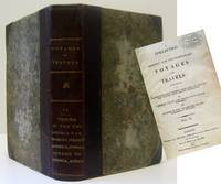
180716527London: Richard Phillips. Good with no dust jacket. 1807. First English Edition; First Printing. Hardcover. Contemporary 3/4 leather over scuffed marbled boards. Bright gilt lettering on spine. Text tight. Early owner's ink stamp on title page. Condition of individual books as noted after each title. Each book was issued separately throughout the year. Binding Instruction including insertion of plates is at the end of the volume although they were sometimes bound individually. These books were of considerable interest because at the time they were one of the only sources of information as to current conditions in foreign countries. Most travel & exploration books were of a more historical nature. There were 10 or more volumes published in this series. Full Titles: 1 "TRAVELS THROUGH THE TWO LOUISIANAS AND AMONG THE SAVAGE NATIONS OF THE MISSOURI; ALSO IN THE UNITED STATES ALONG THE OHIO AND THE ADJACENT PROVINCES IN 1801 1802 & 1803" by M. Perrin Du Lac translated from the French. Title page 106pp. 2pp index. Light waterstain on approx 1/3 of lower quarter of pages. 2 "VOYAGE OF DISCOVERY TO THE NORTH-EAST OF SIBERIA THE FROZEN OCEAN." by Gawrila Sarytschew Russian Imperial Major General translated from the Russian. Title page 80pp index at rear lacks plate of man & woman in Unilaschka. 3 "TRAVELS FROM ST. PETERSBURGH THROUGH MOSCOW GRODNO WARSAW BRESLAW.TO GERMANY IN.1805" by G. Reinbeck translated from the German. Title page 160pp fold out plate "Palace of the Czars" lower corners dampstained index at rear. 4 "TRAVELS IN THE INTERIOR PARTS OF AMERICA COMMUNICATING DISCOVERIES MADE IN EXPLORING THE MISSOURI RED RIVER AND WASHITA BY CAPTAINS LEWIS AND CLARK DR SIBLEY AND MR DUNBAR; WITH A STATISTICAL ACCOUNT OF THE COUNTRIES ADJACENT" As Laid Before the Senate by the President of the United States and Never Before Published in Great Britain an edition of 1000 copies was published inWashington in 1806. Title page 116pp index at rear. Illustrated with charts & a folding table. Information on Indian tribes flora fauna geography & first account of Texas in book form. Nice condition: quite rare. 5 "ACCOUNT OF A VOYAGE TO THE WESTERN COAST OF AFRICA; PERFORMED BY HIS MAJESTY'S SLOOP FAVOURITE IN THE YEAR 1805" by F. B. Spilsbury surgeon to the Favourite. Title page 2pp ad 43pp index 2 fold-out & 5 full page plates dealing mainly with slavery lacks 2 plates. Light scattered foxing. Parts 6 & 7 Analyses of New Works of Voyages and Travels Lately Published in London are summaries of larger works & do not have title pages. 6 " ANALYSES A VOYAGE TO SHEERAZ BY THE ROUTE OF KAZROON AND FEEROZABAD; .MANNERS CUSTOMS LAWS LANGUAGE AND LITERATURE OF THE PERSIANS." by Edward Scott Waring. 64pp index in rear. 7 "TRAVELS IN THE YEAR 1806 FROM ITALY TO ENGLAND THROUGH THE TYROL STYRIA BOHEMIA GALLICIA POLAND AND LAVONIA" by Marquis De Salvo. 32pp. World Travel Americana Africa Russia Persia Native American Slavery ; B.W. Plates; 8vo; 600 pages . Richard Phillips hardcover
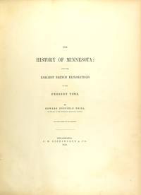
185825243Philadelphia: J. B. Lippincott 1858. First edition of the first history of Minnesota large paper issue limited to 100 copies this copy out-of-series but see below; large 4to pp. xlviii 49-628; frontispiece portrait of Alexander Ramsey Minnesota's first governor 7 other engraved portraits of prominent figures in Minnesota history one of Anna E. Ramsey the wife of Alexander and the dedicatee of this book is loose and laid in and bound in its place is an original albumen photograph portrait of her in a similar pose; 5 maps 1 folding 36 engraved plates mostly after Seth Eastman and mostly mounted proofs on India paper; original brown cloth stamped in gilt and blind cracked at spine ends and along hinges corners bumped and showing; a good copy or better. This copy enhanced by a presentation on the flyleaf in pencil: "Mrs. D. Blakely with compliments of Mrs. Anna E. Ramsey." Mrs. Blakeley is likely Mrs. David Blakeley wife of the Minnesota Secretary of State 1862-66. The Eastman plates were not included in the octavo trade edition of the same year. Not in Graff; Howes N-40; Sabin 52284. <br/><br/> J. B. Lippincott hardcover books
1823423251London: Printed by Ellerton and Henderson Gough Square 1823. Near Fine. Folio 21.5 x 33 cm / 8½" x 13â€. pp. 1 2-3 4 blank. Light vertical and horizontal center folds three short tears at the horizontal fold near fine with a contemporary drawing of a few survey lines and diagrams very lightly sketched in ink and pencil on the final blank page. The Society states its case against slavery in the Colonies of Great Britain where "there are at this moment upwards of 800000 human beings in a state of degrading personal slavery." It provides a brief but detailed description of "the immoral inhuman and unjust" nature of the slave trade and of the absolute power of slave owners. Printed by Ellerton and Henderson, Gough Square unknown
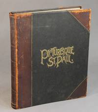
188851749St. Paul: Northwestern Photo Co. n.d. 1888. Only edition 4to 8 p.l. plus 60 leaves showing 105 photogravures of houses and scenery in and around St. Paul some printed in sepia some in blue; original black pebble-grain cloth lettered in gilt on upper cover brown morocco shelfback a.e.g. upper joint rubbed extremities worn; a good sound copy. Includes the hand-colored chromolithograph title page showing a vignette photogravure of an ice palace with 2 other vignetted views half-title printed in red 4 pages of introduction by Pyle who was the private secretary of the railroad tycoon James J. Hill and the first librarian at the James J. Hill Library and a 7-page description of the plates. This copy is from the J. J. Hill Library without the bookplate bought by us in 1994 and now recently found in a stray box. <br/><br/> Northwestern Photo Co., n.d. hardcover books
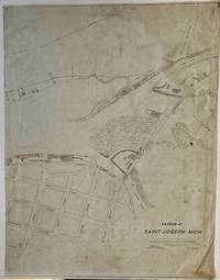
1891010274Saint Joseph Michigan 1891. Map. Very Good. Map. 1st Edition. A RARE late 19th century Michigan map apparently unrecorded dated by "Soundings taken December 11th - 18th 1891". A manuscript map by E.C. Dunbar Ass. Engr. on translucent vellum architectural paper 39" x 30" "Scale 1 inch = 100 feet Soundings reduced to zero of U.S. guage react - 20 ft." Drawn in black ink with State Street in pencil and red ink for the Vandalia Lines Depot Grounds area. Very Good light soiling and light wear at edges "24" in black ink at bottom right and top corners with the 24 top right inked out and replaced with "106-17" in black ink. Of particular interest is the small drawing about half way up the right edge of a shore bird with a frog in its mouth! Along with several streets the map shows The Morrison Channel St. Joseph River and the Pawpaw River. It also shows the lines of the West Michigan Railroad Cincinnati Wabash & Michigan Railroad and the Lake Michigan Railroad Vandalia Lines. 1891 was the year that Saint Joseph was incorporated as a city. An amazing piece of Southwestern Michigan history. . hardcover
189547674Philadelphia.: G. Wm. Baist. No date. Ca. 1895. Broadside map handcolored lithograph 39 1/4 x 27 1/4 inches on sheet 41 1/4 x 28 3/4 inches folded. A few extra creases loss to upper left margin just touching neatline couple of other chips and tears in margin one just entering the map area blank at left centre. Overall clean and crisp very good condition. A very attractive softly handcolored map showing the growing city of Everett shortly after its incorporation in 1893 and the completion of the Great Northern Railroad. Additions mapped include Riverside Addition at the south end of the map Bay View Addition and Church Loveland Lamoure's Addition at the west and Church & La Moure's Addition at the north end. The Hotel Monte Cristo and many industries are marked. The Great Northern Railroad enters Everett from the east and the railroad along the Puget Sound is the Seattle and Montana Railway. An inset map at the upper left shows Western Washington the inset map at upper right shows Everett and vicinity. A large and handsome map of great historical interest. . G. Wm. Baist. unknown books
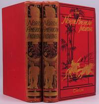
1841008954London: Published By the Author at the Egyptian Hall Piccadilly 1841. "Written During Eight Years Travel Amongst the Wildest Tribes of Indians in North America in 1832 33 34 35 36. 37 38 and 39. With 400 Illustrations carefully engraved from His Original Paintings." Two volumes in contemporary bright red cloth with decorations and lettering in gilt and black at front covers and spines. With decorative end papers. Very Good spines slightly sunned and with slight lean hinges starting with rear hinge Vol. I open all hinges holding well. At first blank end page both vols. an 1890s prior owner name and prior owner inscription detailing provenance. Fold-out map at frontis Vol. I and frontis map and map at p. 259 Vol. II are Fine. The First Edition of Catlin's self-published classic 2nd issue with error "Frederick" for "Zedekiah" on page 104 line 26 of Volume I corrected. Alll illustrations in black and white. No errata slip found. Interior pages clean and bright a quite pleasing set. . First Edition. Decorative Cloth. Very Good/No Jacket As Issued. Tall 8vo. Published By the Author, at the Egyptian Hall, Piccadilly Hardcover books
188110532Las Vegas N.M.: Imprenta Del Rio Grande 1881. First Edition. Good condition. 8vo. handcrafted leather binding self bound frontis portrait pp. 292 errata page. -- Author's name written in pencil on the title page; appears to be a crude attempt to copy the authors signature. I doubt it is authentic. Last blank leaf has writing in pencil in Spanish. Printed pastedown inside rear cover mostly complete; top part in Spanish and last paragraph in English. the English part commends the work of the author Estanislao N. Ronquilla. Imprenta Del Rio Grande unknown
1820105055<p>Archive contains more than 5o items including letters manifests printed and manuscript and pay vouchers etc. in a loose-leaf binder. Some light wear and creasing some minor chips and fold tears normal aging and toning; overall about fine.This is a fairly large archive of the career of Captain Paul Ambrose Oliver c1796-c1848 and his ships the "Louisiana" the "Tiber' and the "Trenton". The archive includes manifests for the shipment of sugar cigars and coffee from Havana to New Orleans St. Petersburg Hamburg and London. One key item is a partially printed Bill of Sale for the Ship "Tiber" dated January 13 1834 for $21500. There is also an estimate for repairs to the "Tiber' dated November 6 1836. The earliest document is dated September 14 1829 and while most of the other documents are between the late 1820s to the 1840s the archive includes some items that are later. There is a letter to his son Brigadier-General and Medal of Honor recipient Paul A. Oliver dated March 29 1869 there is also a copy of the Last Will and Testament of the younger Oliver done in 1911. General Oliver was actually born on his father’s ship the "Louisiana’". There are numerous pay vouchers and receipts from what appears to be a successful career. There is even a rare book list and the burial confirmation for Captain Oliver dated September 17 1849. Other interesting items include a family tree for the Olivers some family letters including a letter to his sons several receipts concerning coffee shipments and a number of ship manifests from various places. Over 50 documents in the collection.</p> books
1820105055<p>Archive contains more than 5o items including letters manifests printed and manuscript and pay vouchers etc. in a loose-leaf binder. Some light wear and creasing some minor chips and fold tears normal aging and toning; overall about fine.This is a fairly large archive of the career of Captain Paul Ambrose Oliver c1796-c1848 and his ships the "Louisiana" the "Tiber' and the "Trenton". The archive includes manifests for the shipment of sugar cigars and coffee from Havana to New Orleans St. Petersburg Hamburg and London. One key item is a partially printed Bill of Sale for the Ship "Tiber" dated January 13 1834 for $21500. There is also an estimate for repairs to the "Tiber' dated November 6 1836. The earliest document is dated September 14 1829 and while most of the other documents are between the late 1820s to the 1840s the archive includes some items that are later. There is a letter to his son Brigadier-General and Medal of Honor recipient Paul A. Oliver dated March 29 1869 there is also a copy of the Last Will and Testament of the younger Oliver done in 1911. General Oliver was actually born on his father’s ship the "Louisiana’". There are numerous pay vouchers and receipts from what appears to be a successful career. There is even a rare book list and the burial confirmation for Captain Oliver dated September 17 1849. Other interesting items include a family tree for the Olivers some family letters including a letter to his sons several receipts concerning coffee shipments and a number of ship manifests from various places. Over 50 documents in the collection.</p>
185640406Philadelphia 1856. Folio broadside 13" x 18-1/2." Printed in five columns beneath the caption title. Lightly toned with scattered spotting and several shallow chips at blank margins. Good. Signed in type at the end by "Charles Gibbons Chairman of Rep. State Ex. Committee Philadelphia Oct. 20 1856."<br /> <br /> This rare broadside prints the Address of Pennsylvania's Republican State Executive Committee "To the People of Pennsylvania." It reports Republicans' efforts to form an alliance with members of the American or Know-Nothing Party who are "opposed to the extension of slavery and to the election of Mr. Buchanan to the Presidency." <br /> The broadside demonstrates the chaotic rearrangements of Party affiliations in this crucial election year: the Whig Party was on the verge of extinction destroyed by the growing sectional conflict over slavery; and the Know Nothings under former President Fillmore sought to fill the void. The Committee warns that "Mr. Fremont and Mr. Fillmore are therefore rival candidates." The Committee urges "Friends of liberty" to vote the Fremont ticket "If you would check the extension of slavery and assert the worth and dignity of free labor." <br /> The Library of Congress is the only location recorded by OCLC. Its title Control No. 2021768425 reverses the placement of our second and third sentences. We have located no other copies.<br /> Not in Sabin Eberstadt Decker. Not at AAS. OCLC 1280407366 1- DLC as of December 2024. unknown
1866007591Boston: Ticknor & Fields 1866. First Edition in original plum cloth spine lettering and decoration in gilt wreath decoration stamped with borders in blind on boards dark brown end pages 286 pp. Very Good Plus spine lightened from sun gilt lettering a bit dulled yet quite legible small fray top edge of spine scattered light foxing. A tight square copy of this Thoreau classic uncommon in such lovely condition. Contains his important essay "Civil Disobedience" originally published in 1849 as "Resistance to Civil Government" which has served as a call to action and inspired generations ever since. . First Edition. Cloth. Very Good Plus/No Jacket As Issued. 8vo - over 7¾" - 9¾" tall. Ticknor & Fields Hardcover books
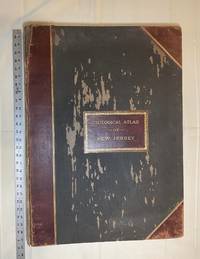
1889028277New York: Julius Bien & Co 1889. Condition of the binding is only Fair with pest damage. Leather over the spine has perished. Front and rear outer hinges cracks have been neatly reinforced with high quality clear flexible glue. Inner hinges are OK having been reinforced by the publisher/bookbinder with sturdy maroon cloth. SEE PHOTOS. Condition of all maps is NEAR FINE - FINE. NO foxing or toning. Pages are clean and unmarked. SEE PHOTOS. Includes a title page map of New Jersey Key to the System of Mapping and 19 linen-backed double page maps. Collated and complete per table of contents -- SEE PHOTOS. The maps are lithographically printed in blue red yellow and black. The double page maps open to an impressive 26.50" across by 36.50" tall. No year of publication is stated but Phillips 2149 in A LIST OF GEOGRAPHIC ATLASES Vol. 1 says 1889. The maps themselves are variously dated up to 1888. Titles of Sheets: No. 0. New Jersey State Map Geographic; No. 1. Kittatinny Valley and Mountain No. 2. Southwestern Highlands; No. 3. Central Highlands; No. 4. Northeastern Highlands; No. 5.Vicinity of Flemington; No. 6. Valley of the Passaic; No. 7. The Counties of Bergen Hudson Essex No. 8. Vicinity of Trenton; No. 9. Monmouth Shore; No. 10. Vicinity of Salem No. 11. Vicinity of Camden; No. 12. Vicinity of Mount Holly; No. 13. Vicinity of Barnegat Bay; No. 14. Vicinity of Bridgeton; No. 15. Southern Interior; No. 16. Egg Harbor and Vicinity; No. 17. Peninsula of Cape May; Unnumbered map. "New Jersey from Original Surveys based on the Triangulation of the U.S. Coast and Geodetic Survey Relief Map." Scale of first and last doublepage maps: 5 miles to an Inch. Scale of maps No. 1 to No. 17: 1 mile to an Inch. Bound in black pebble-grain cloth with gilt-stamped brown leather title label leather spine and corners leather backstrip has perished. SEE PHOTOS. The textblock could be easily rebacked or recased with no re-sewing required since all pages/maps are still securely bound together. Oversize Hardcover. 19.50" wide by 27" tall. This massive extremely heavy book will require SUBSTANTIAL extra postage at our cost based on your location. LeGear ATLASES OF THE UNITED STATES L5609. See also Schwartz and Ehrenerg's THE MAPPING OF AMERICA pp. 310-311. Phillips 2149. This massive extremely heavy book will require SUBSTANTIAL extra postage at our cost based on your location. Second Edition. Oversize Hardcover. Fair - FINE condition. Illus. by NOT a library discard. Atlas folio. Great Packaging Fast Shipping. Julius Bien & Co Hardcover